This site requires that JavaScripts be enabled in your browser. For instructions,
click here
+ Contact NASA
Directory Listing -- 2015
NASA LaRC Building 1196A CAPABLE Site : BSRN-PLUS Data Files
BSRN Site Managers:
Fred Denn
,
Bryan Fabbri
+ For additional info on this BSRN site click here
‹‹‹‹ Back One
- history -
Forward One ››››
+ Return to The NASA LaRC CRAVE/COVE Program Main Page
To download a file
right click
on its link and select save.
Files in this folder:
Size (bytes):
Modified:
+ BSRN-PLUS-lrc_2015-12.txt
5716072
2021-01-28 15:40pm
+ BSRN-PLUS-lrc_2015-11.txt
5531752
2021-01-28 15:40pm
+ BSRN-PLUS-lrc_2015-10.txt
5716072
2021-01-28 15:40pm
+ BSRN-PLUS-lrc_2015-09.txt
5531752
2021-01-28 15:40pm
+ BSRN-PLUS-lrc_2015-08.txt
5716072
2021-01-28 15:40pm
+ BSRN-PLUS-lrc_2015-07.txt
5716072
2021-01-28 15:40pm
+ BSRN-PLUS-lrc_2015-06.txt
5531752
2021-01-28 15:40pm
+ BSRN-PLUS-lrc_2015-05.txt
5716072
2021-01-28 15:40pm
+ BSRN-PLUS-lrc_2015-04.txt
5531752
2021-01-28 15:40pm
+ BSRN-PLUS-lrc_2015-03.txt
5716072
2021-01-28 15:40pm
+ BSRN-PLUS-lrc_2015-02.txt
5163112
2021-01-28 15:40pm
+ BSRN-PLUS-lrc_2015-01.txt
5716072
2021-01-28 15:40pm
Page Curator: Jay Madigan
NASA Official: Greg Schuster
Page Last Modified:
12/05/2017
+ NASA Communications Policy
+ Freedom of Information Act
+ Budgets, Strategic Plans and Accountability Reports
+ Inspector General Hotline
+ Equal Employment Opportunity Data Posted Pursuant to the No Fear Act
+ USA.gov
+ Open Government at NASA
+ Privacy Policy and Important Notices
+ Multimedia Browser Plug-ins
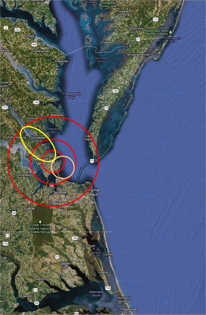
BSRN-LRC-49
Large area view.
Latitude: 37.1038
Longitude: -76.3872
Elevation: 3 m Above sea level
Scenes: urban, marsh, bay, river and farm.
Legend
The
inner red
circle is a 20km CERES foot print centered on the BSRN-LRC site.
The
pink
circle represents a possible tangential 20km foot print.
The
middle red
circle represents the area in which a 20km foot print could fall and still see the site.
Yellow
is a sample 40 deg off nadir foot print.
The
outer red
circle is the region which would be seen by a possible 40 deg off nadir foot print.
The BSRN-LRC sun tracker at the NASA Langley Research Center on a snowy day (02/20/2015)
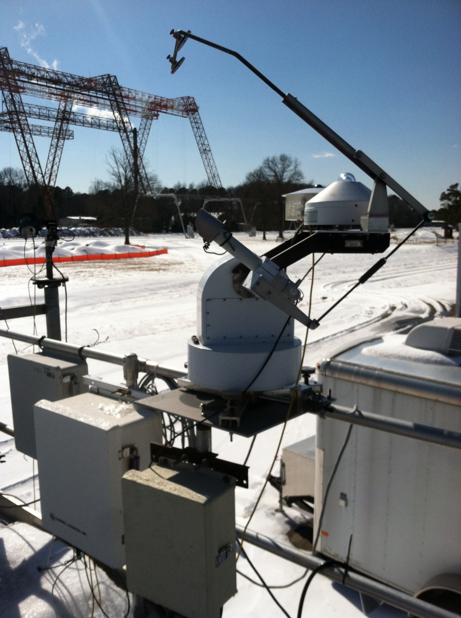 The BSRN-LRC sun tracker at the NASA Langley Research Center on a snowy day (02/20/2015)