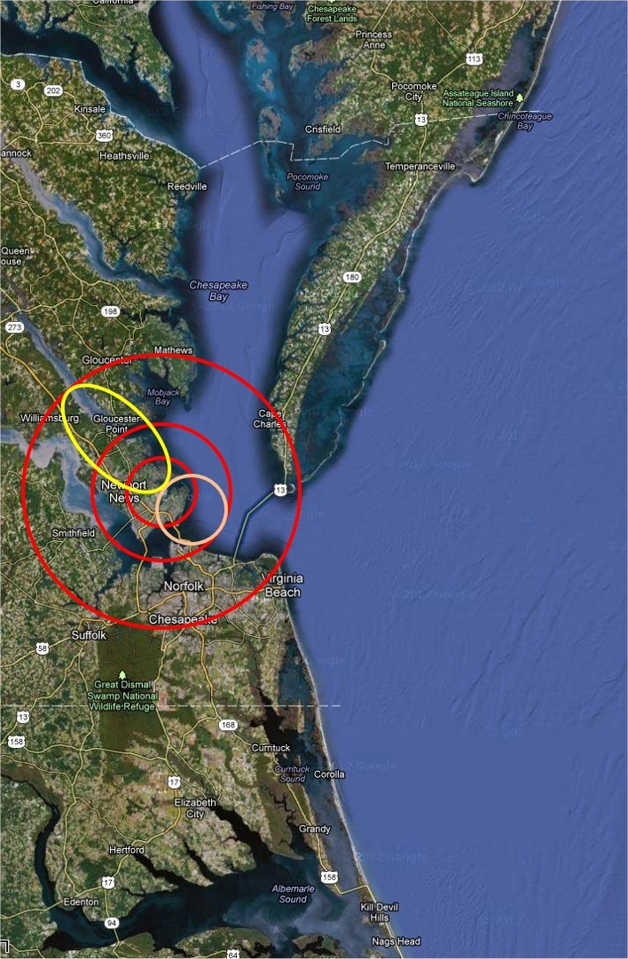
BSRN-LRC-49
Large area view.
Latitude: 37.1038
Longitude: -76.3872
Elevation: 3 m Above sea level
Scenes: urban, marsh, bay, river and farm.
Legend
- The inner red circle is a 20km CERES foot print centered on the BSRN-LRC site.
- The pink circle represents a possible tangential 20km foot print.
- The middle red circle represents the area in which a 20km foot print could fall and still see the site.
- Yellow is a sample 40 deg off nadir foot print.
- The outer red circle is the region which would be seen by a possible 40 deg off nadir foot print.
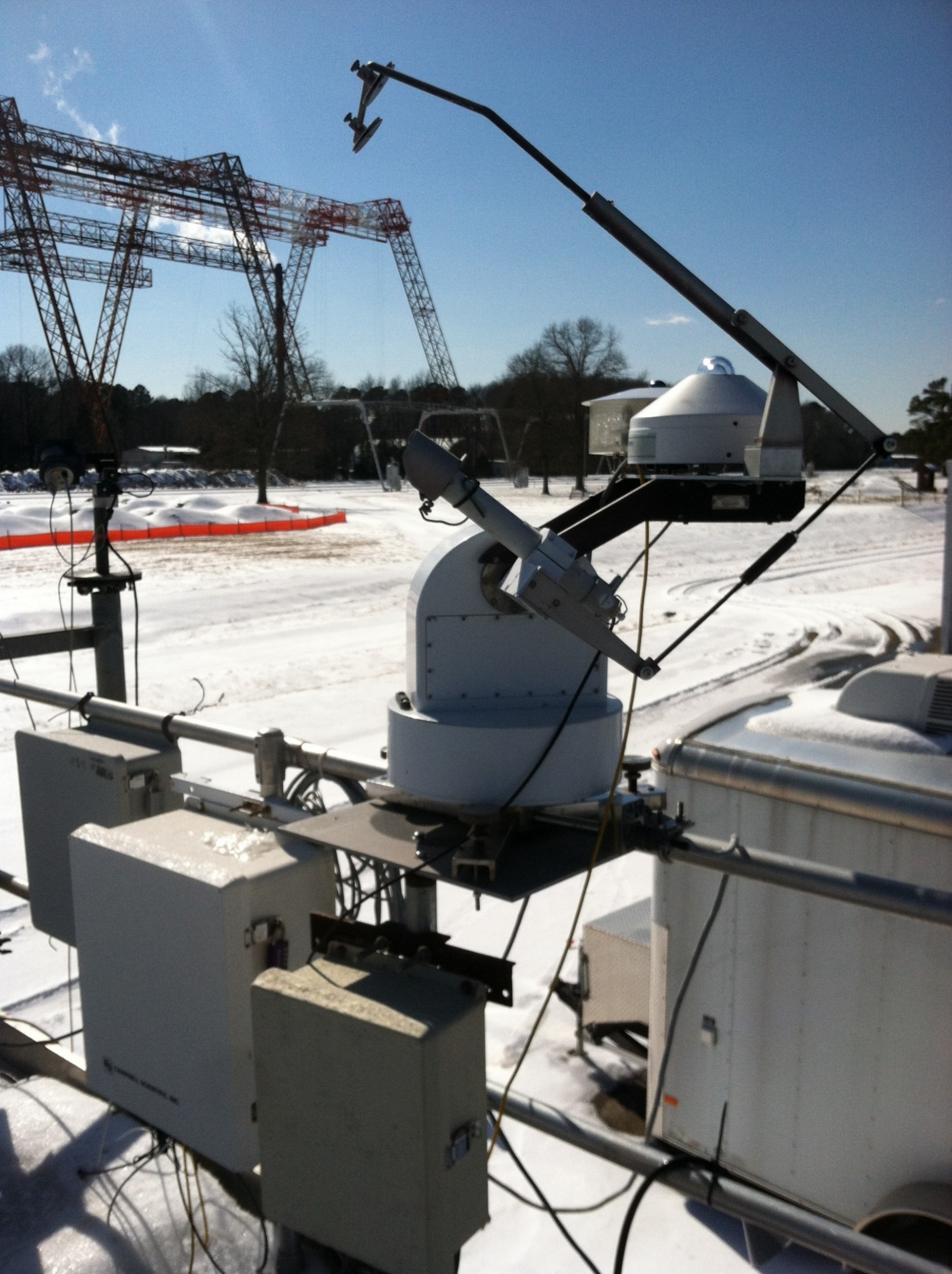 The BSRN-LRC sun tracker at the NASA Langley Research Center on a snowy day (02/20/2015)
|
|