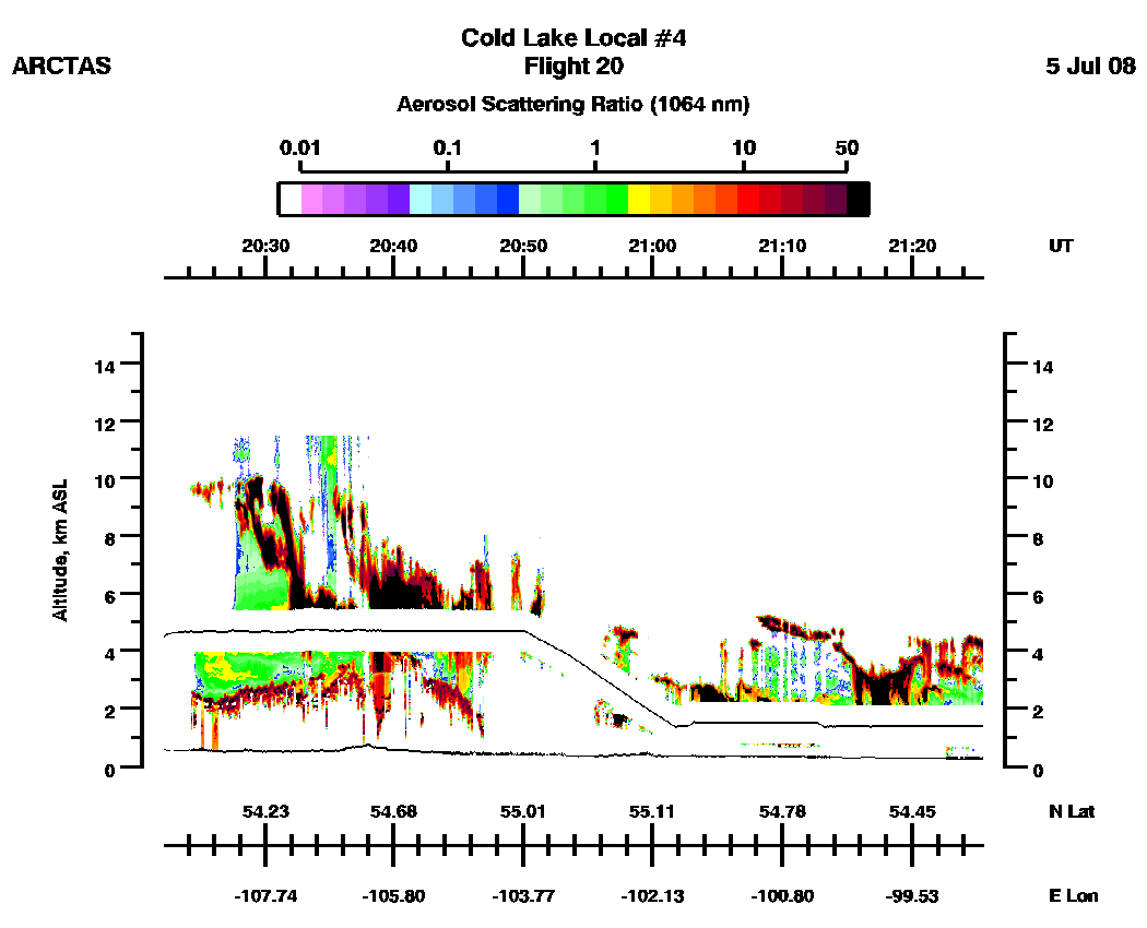
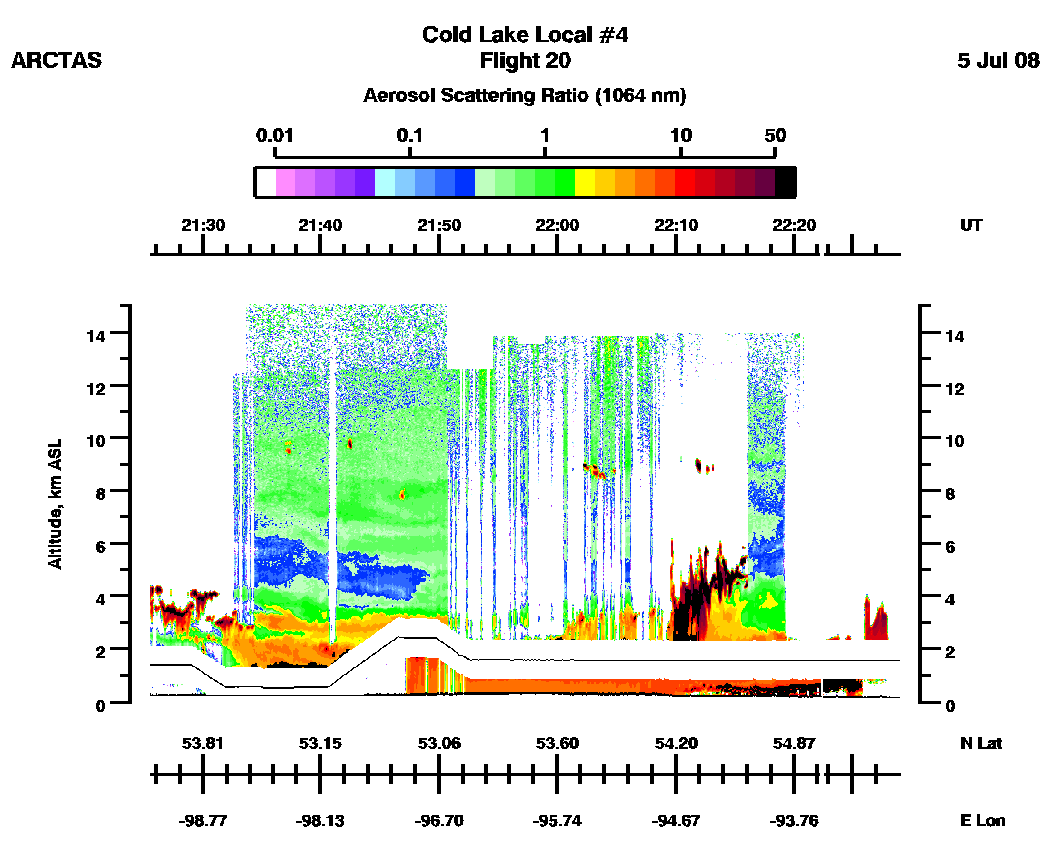
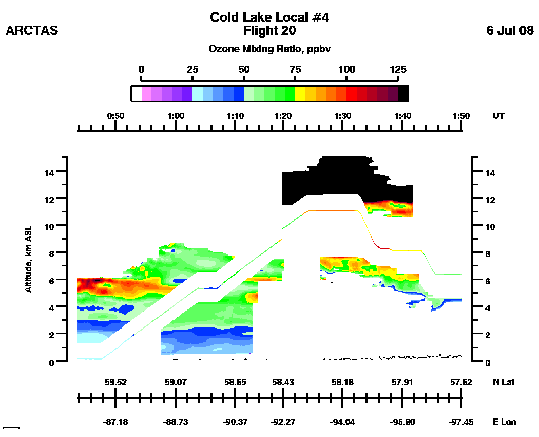
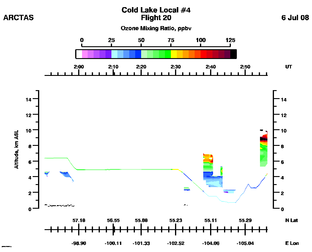
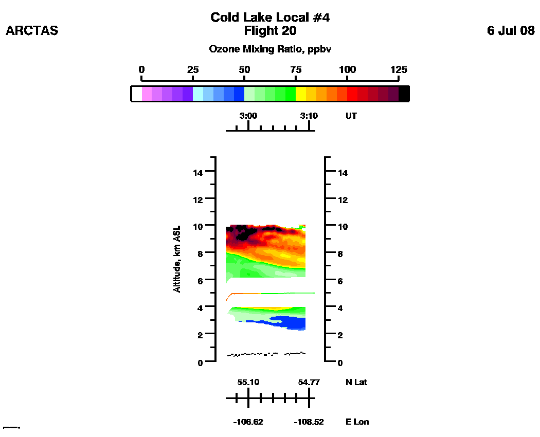
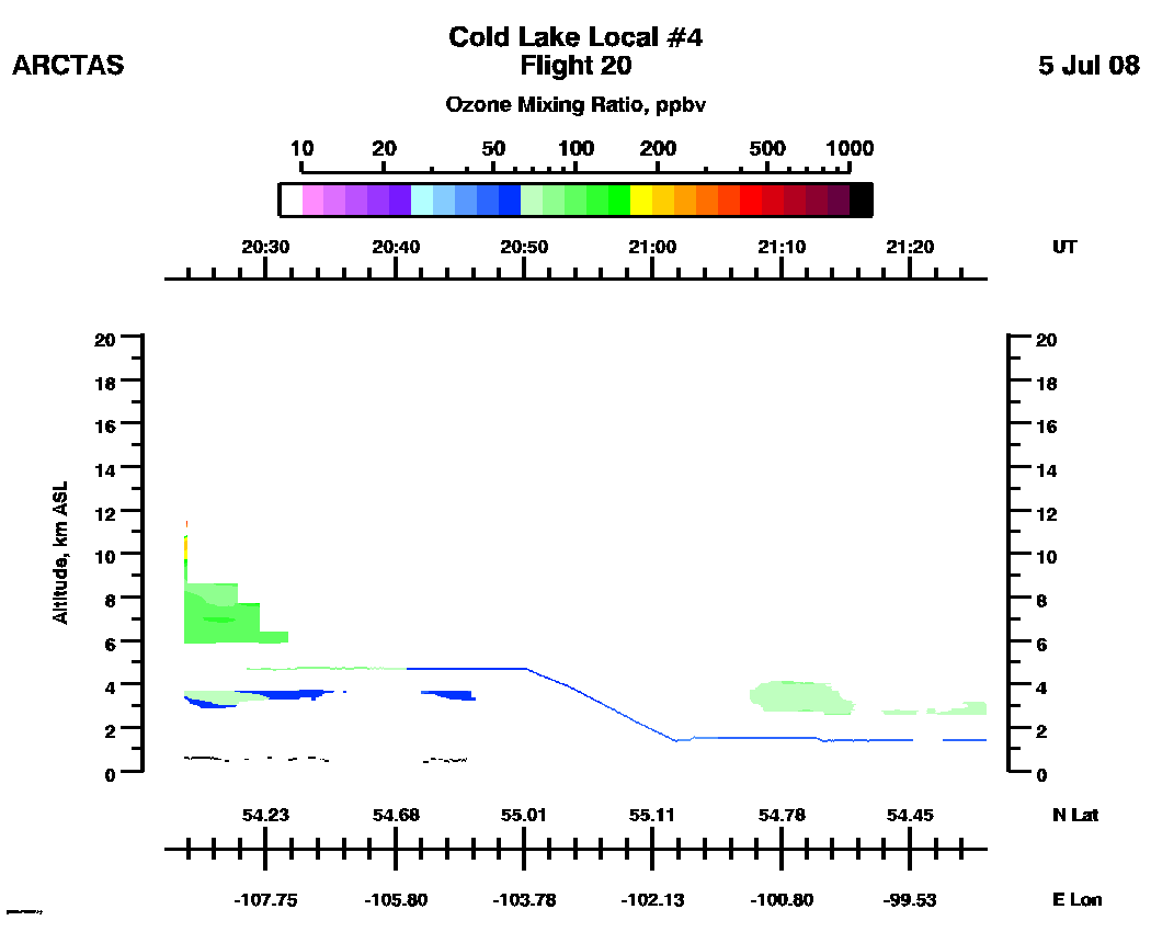
ARCTAS Flight 20
DIAL Aerosol and Ozone Distributions
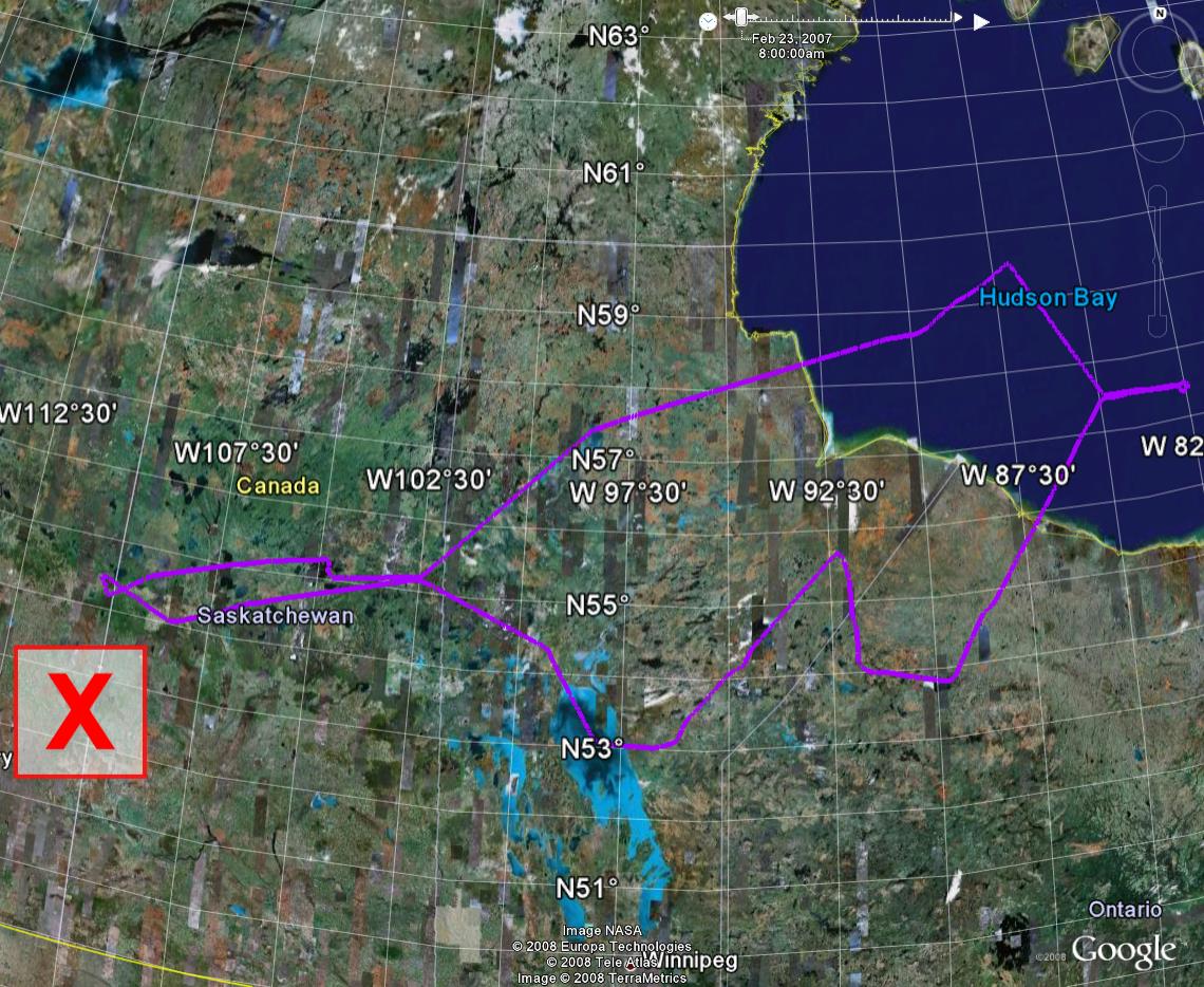
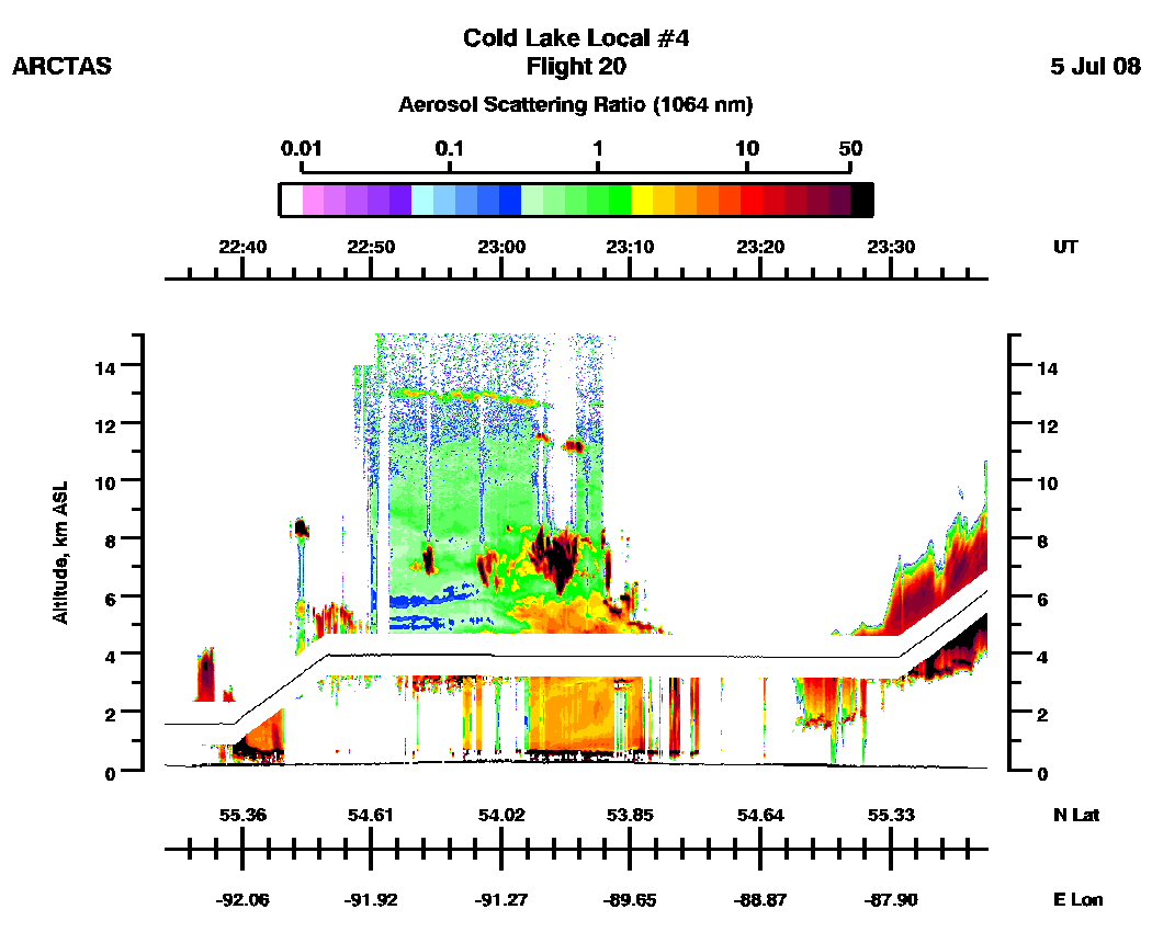
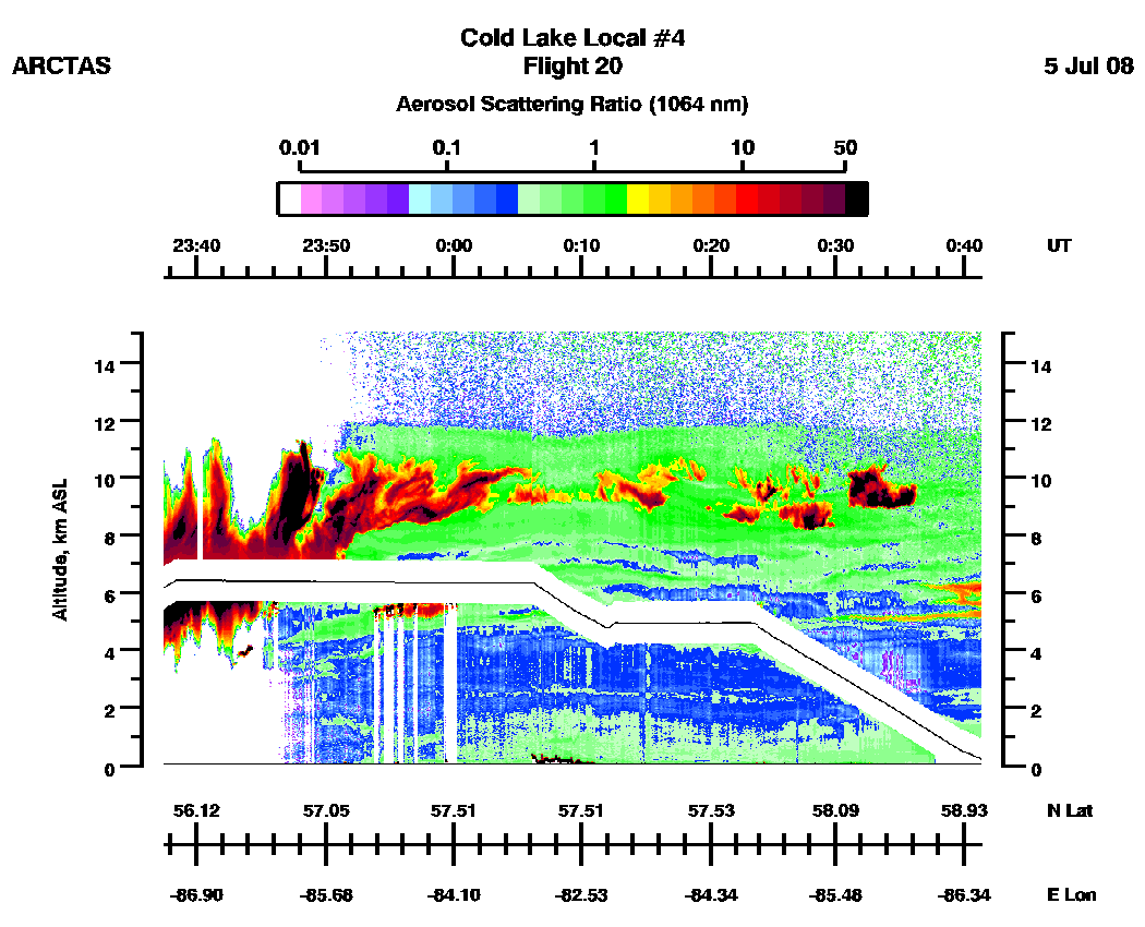
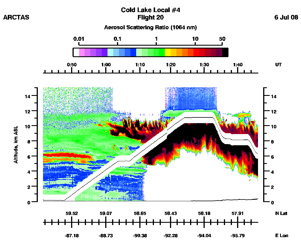
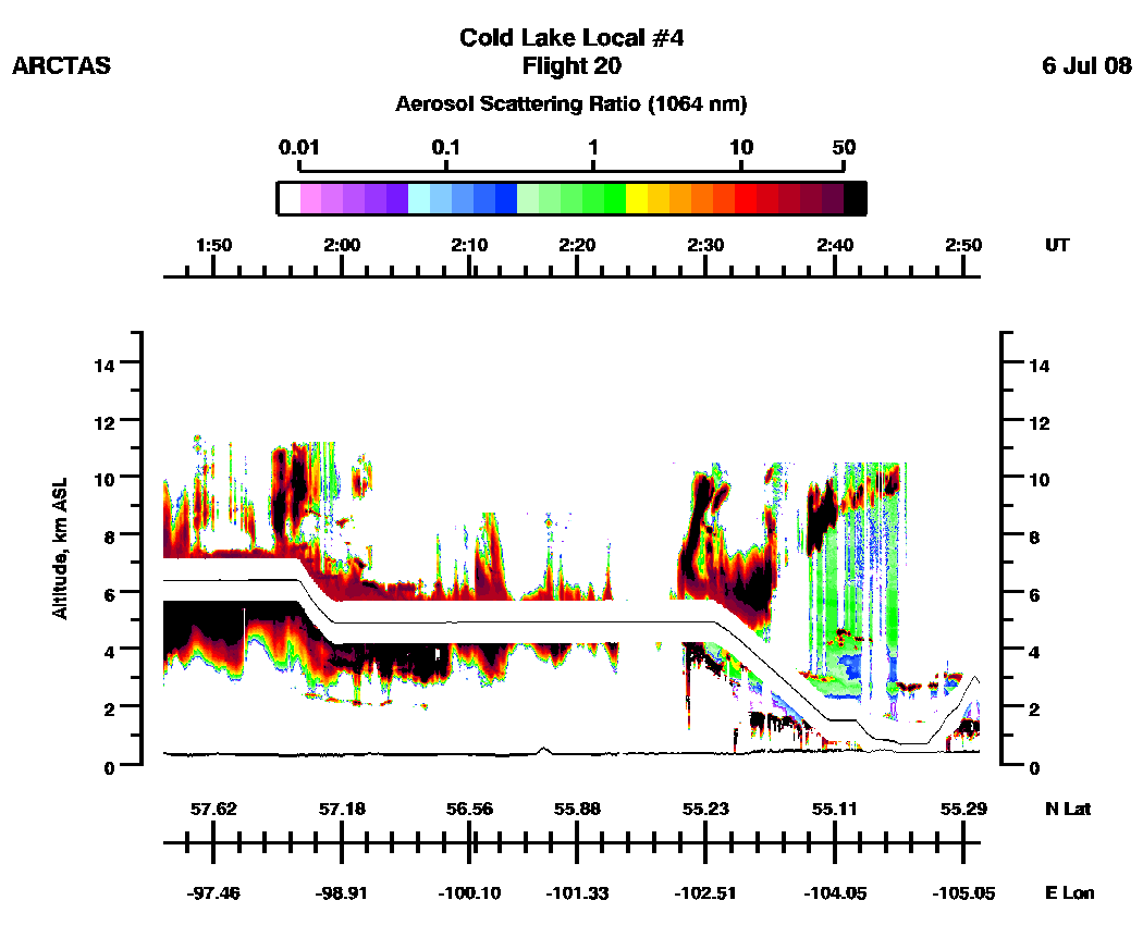
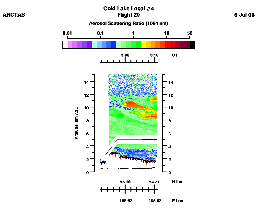
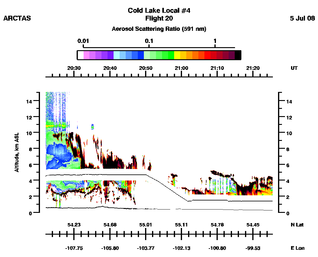
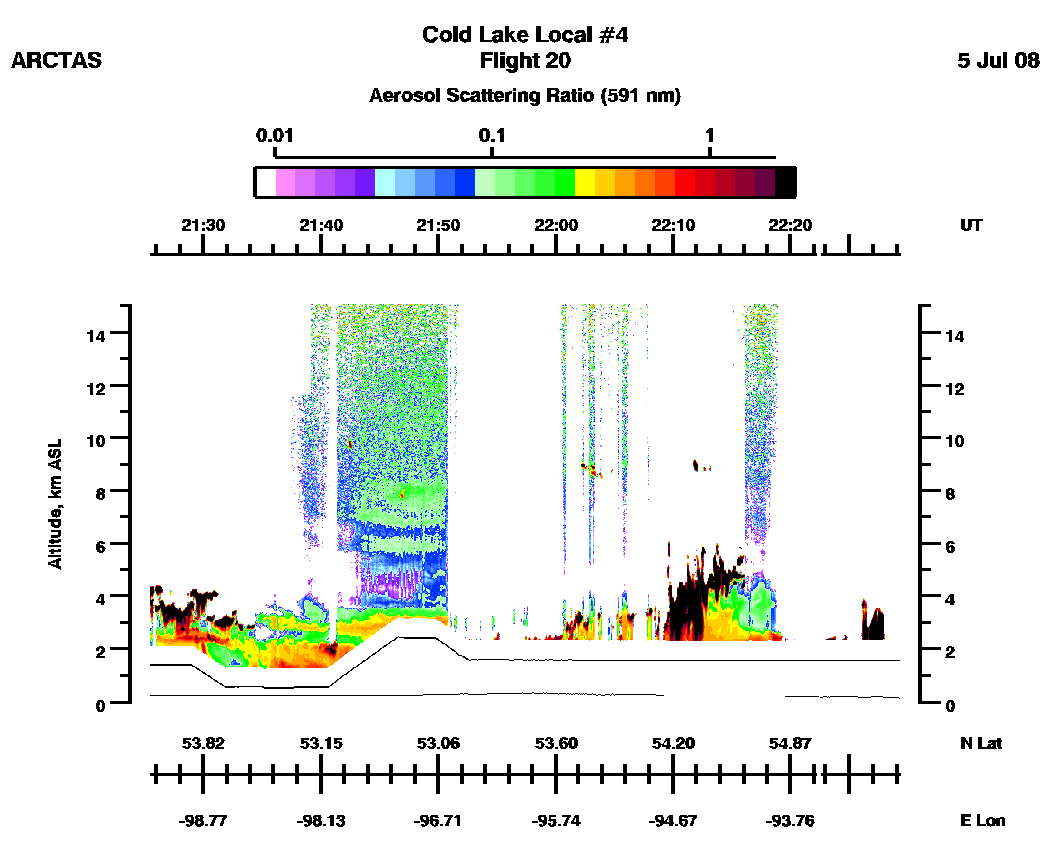
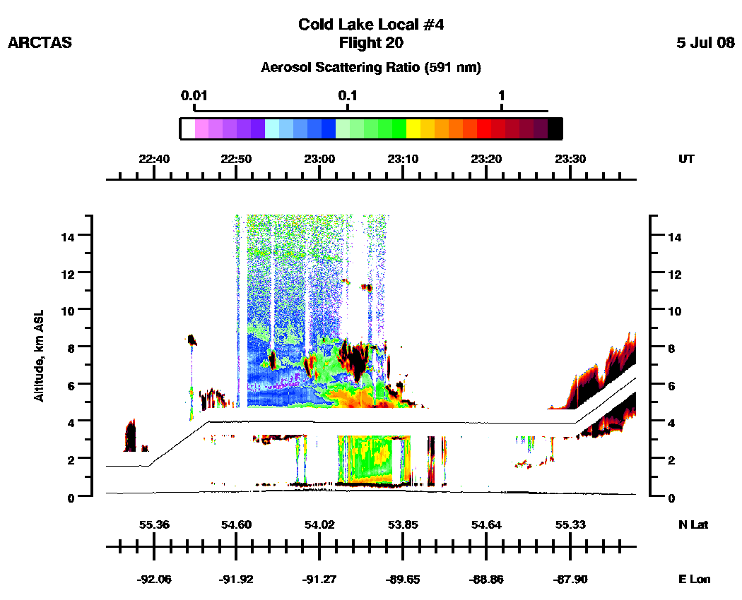
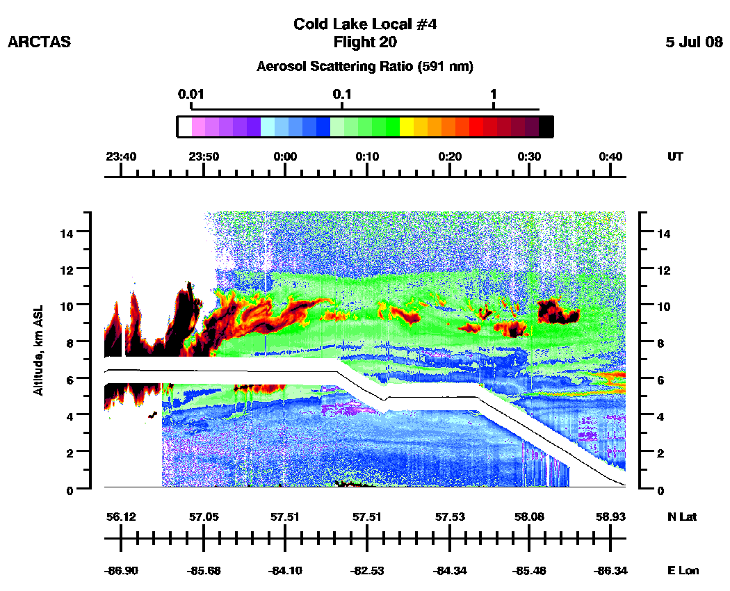
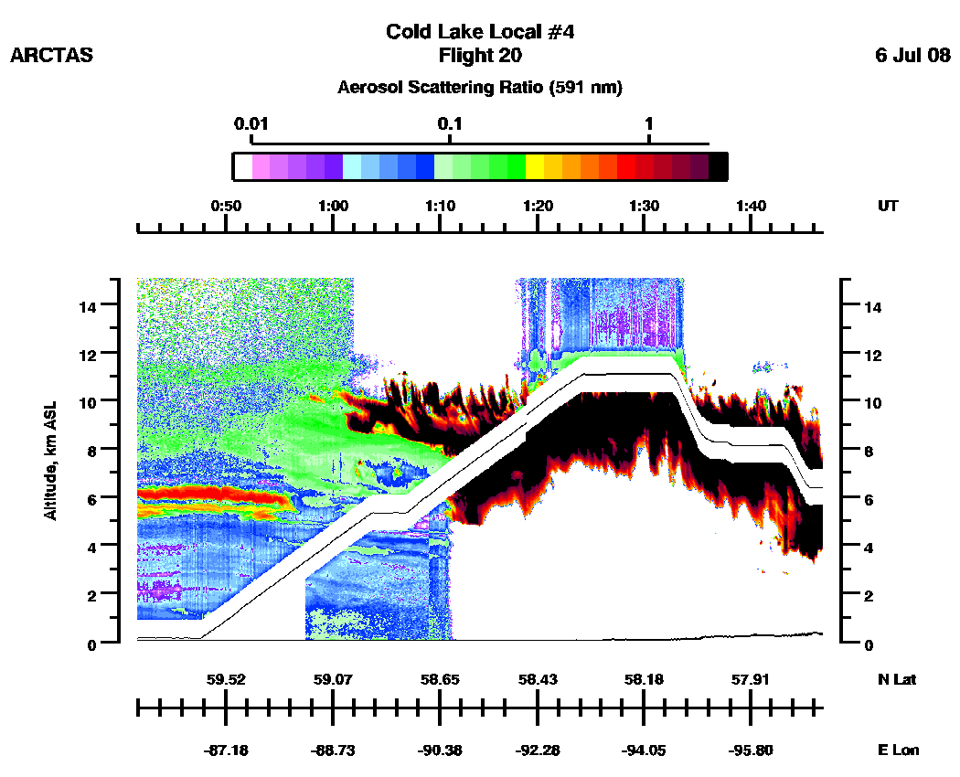
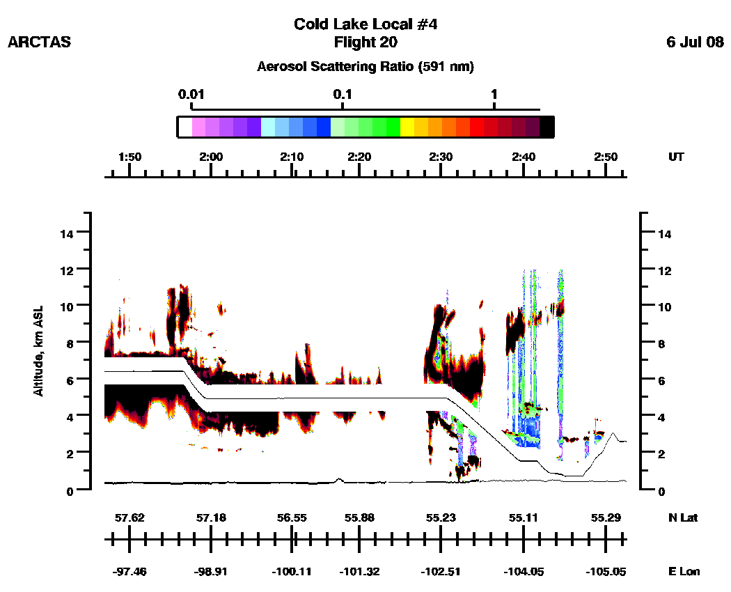
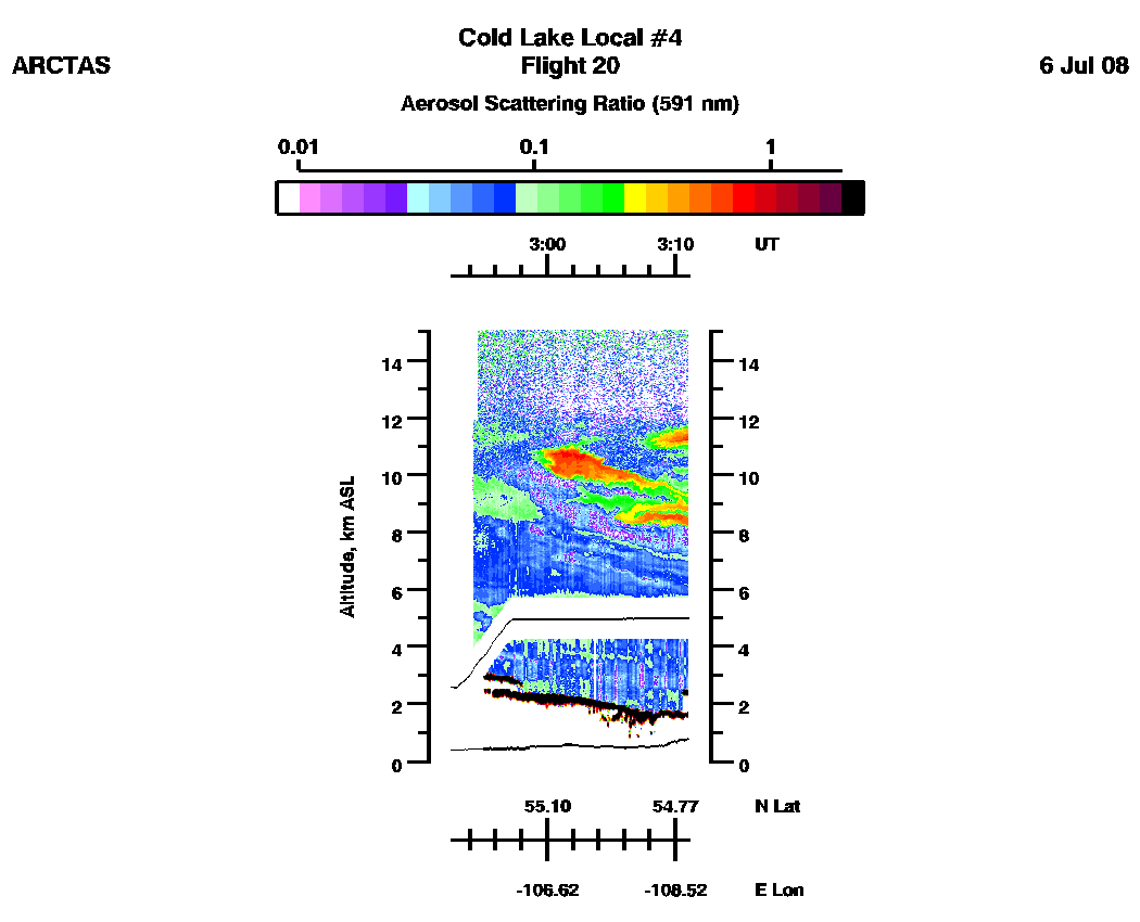
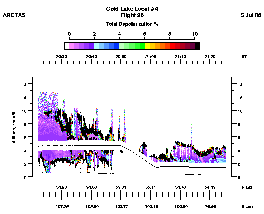
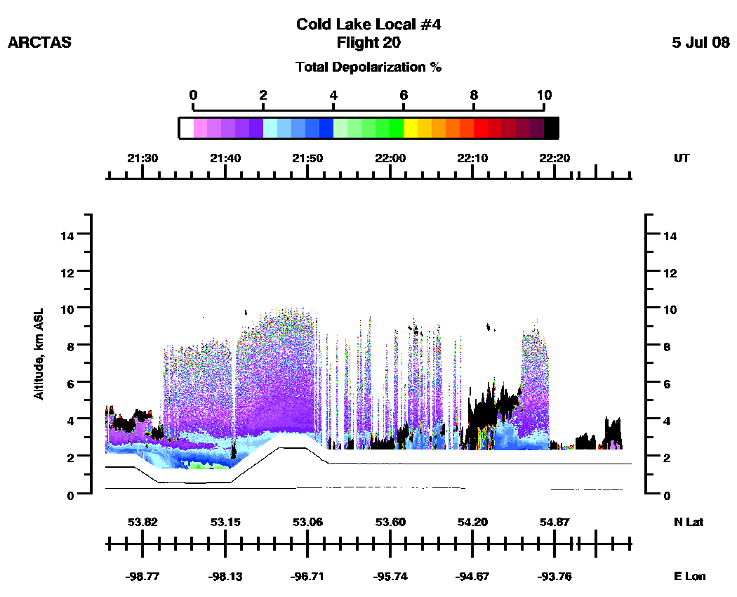
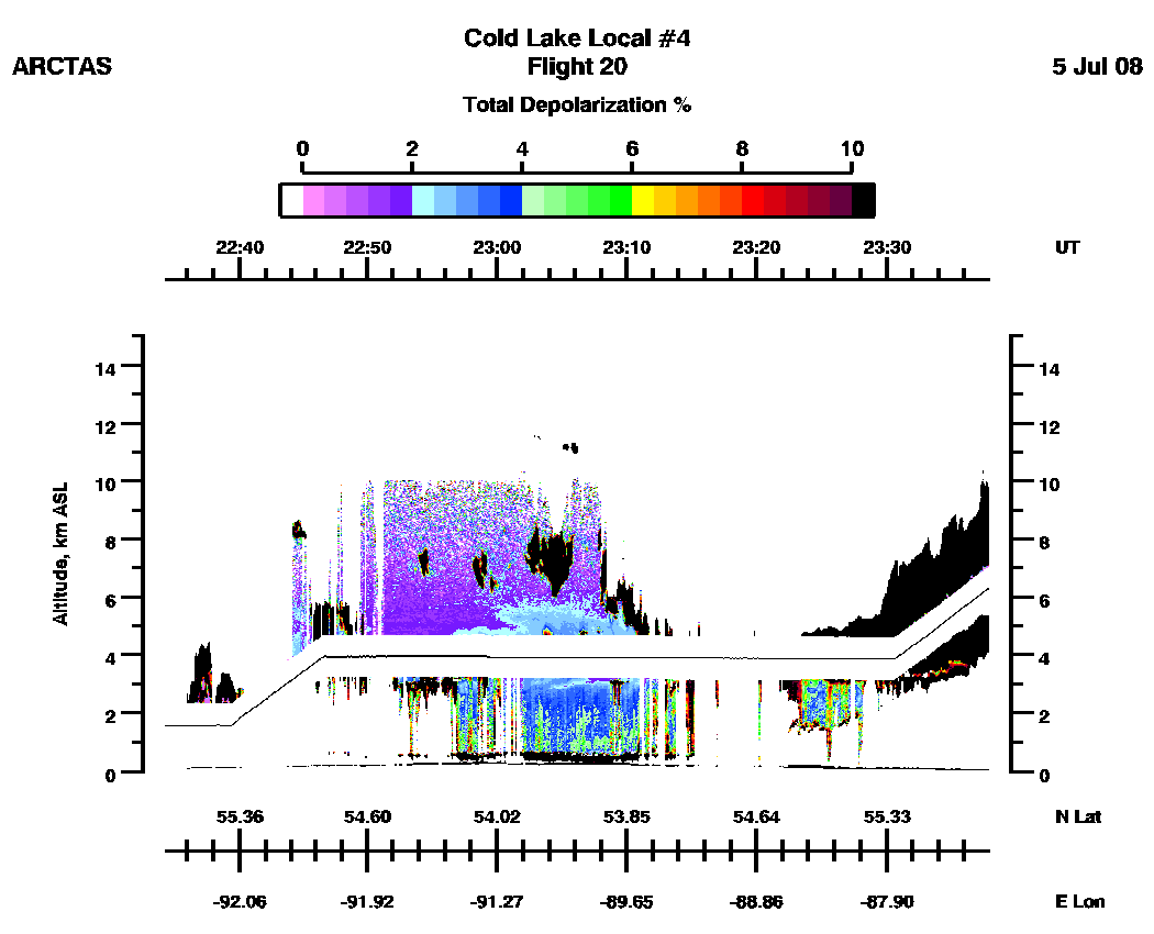
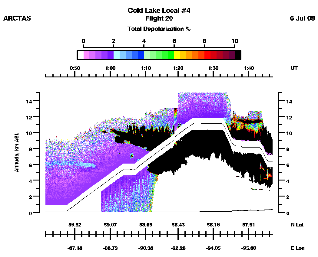
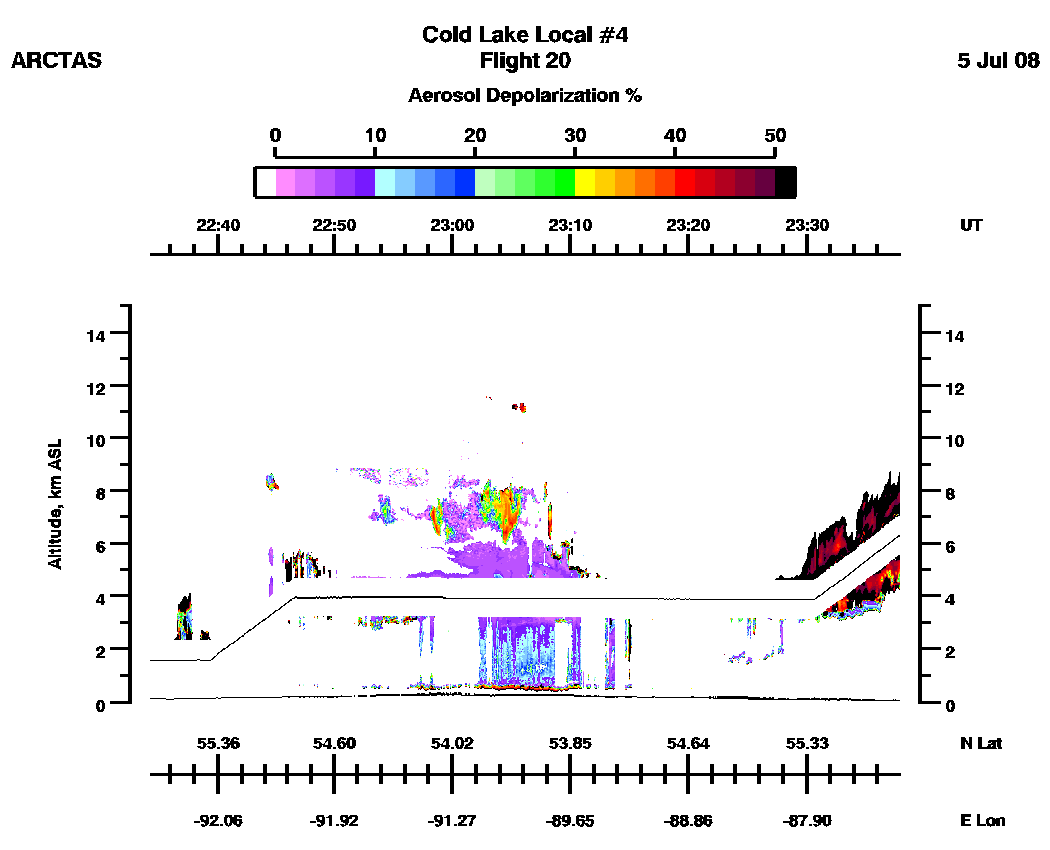
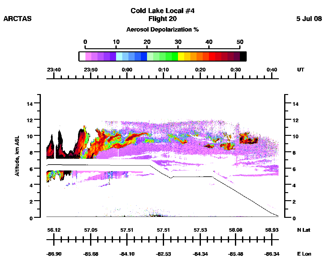
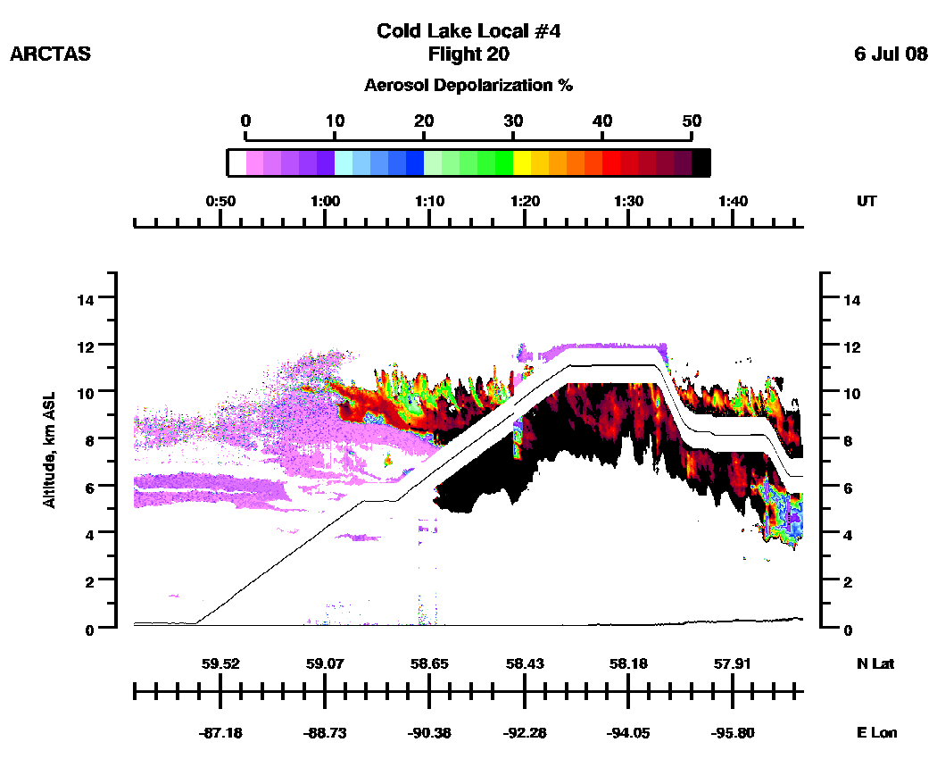
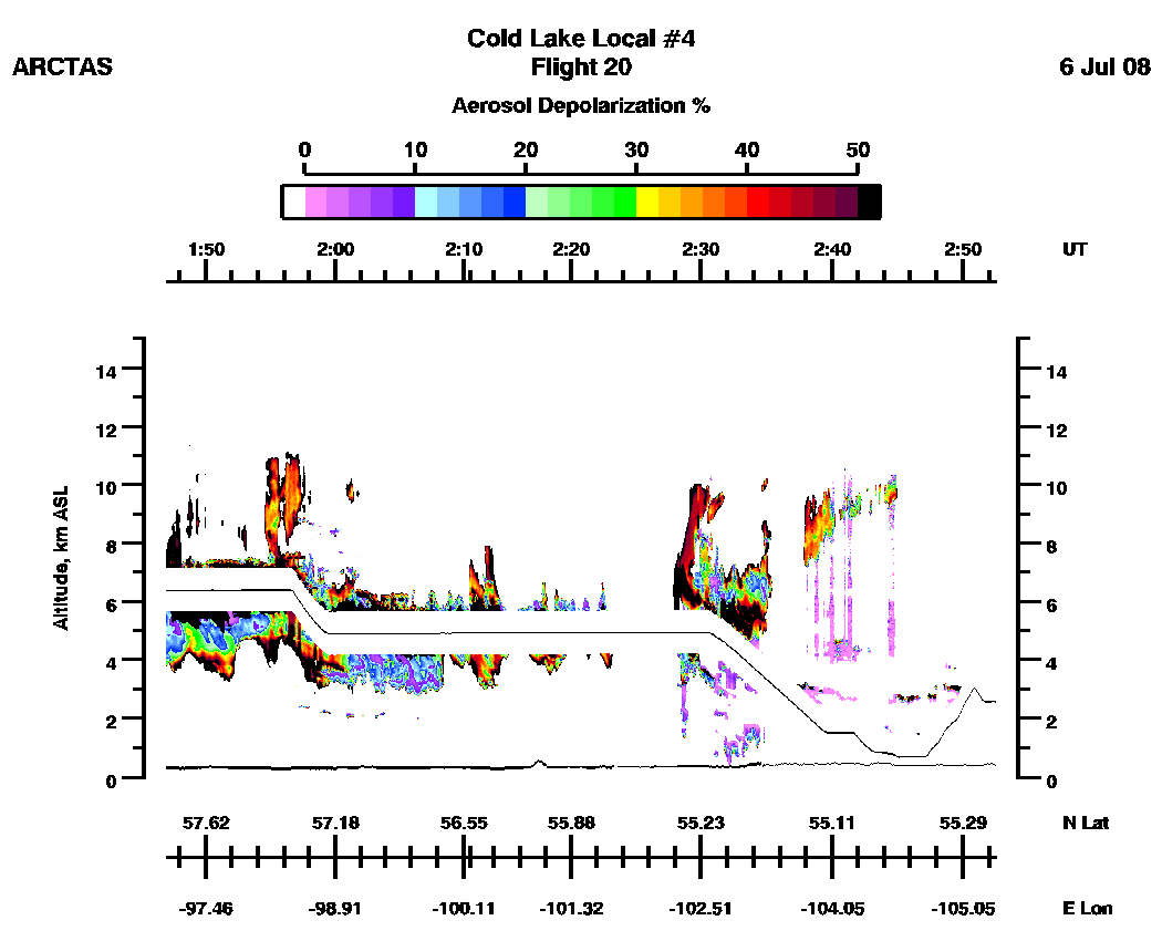
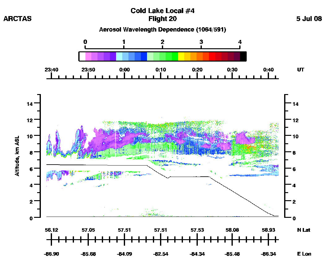
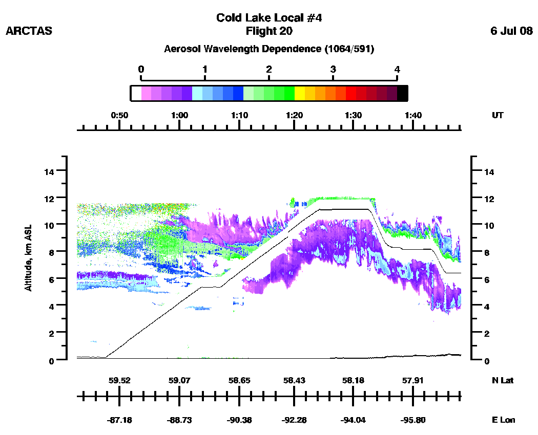
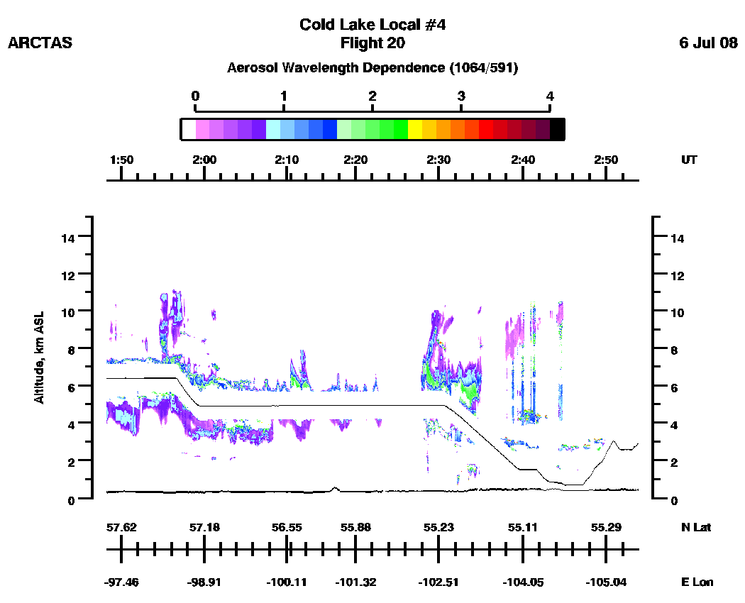
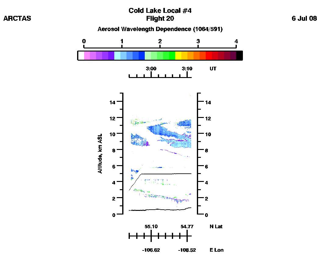
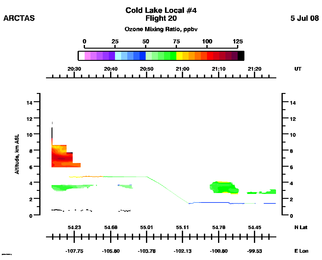
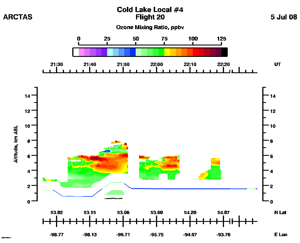
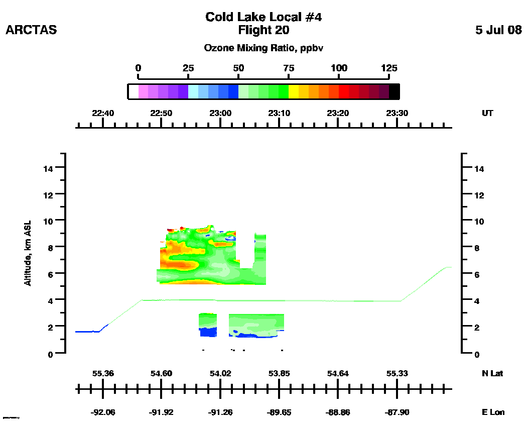
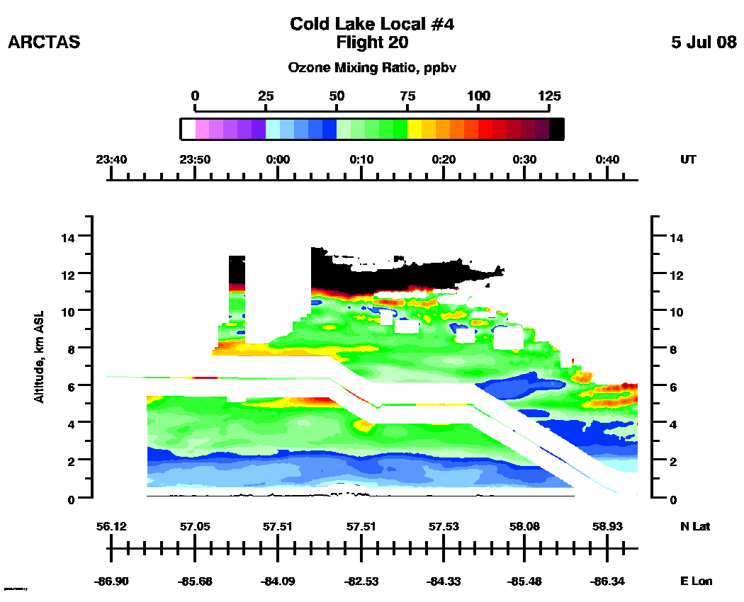
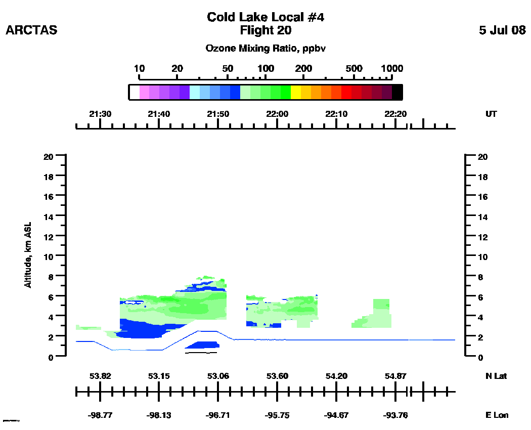
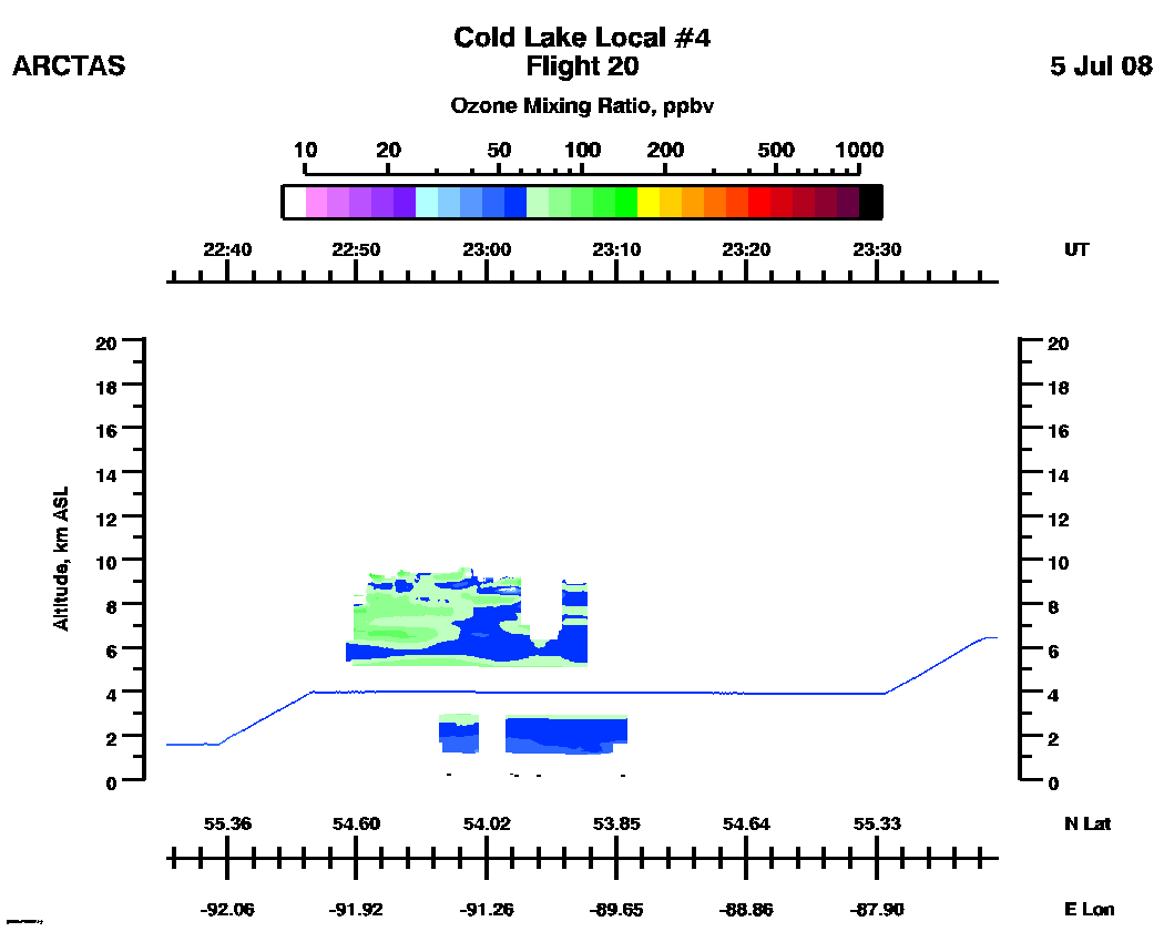
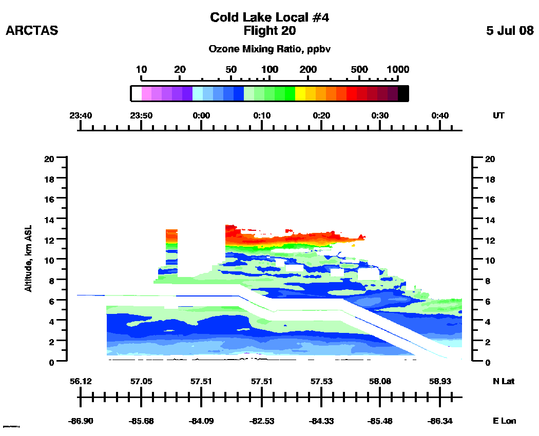
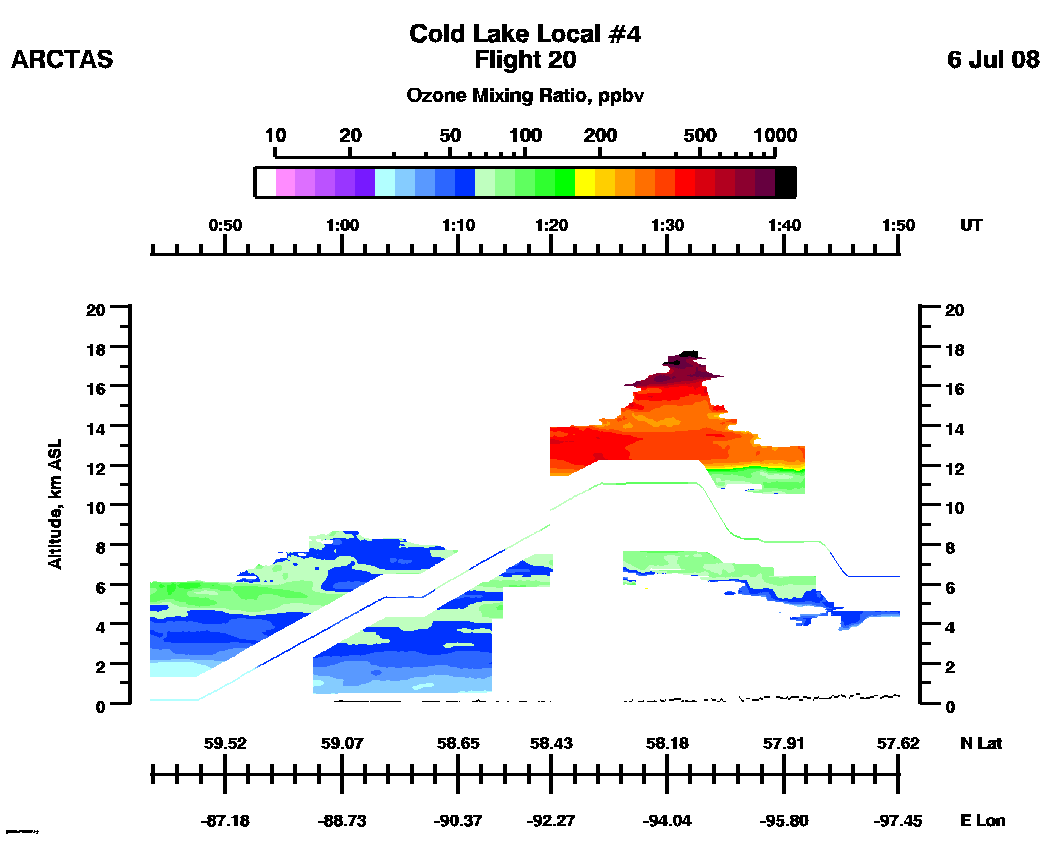
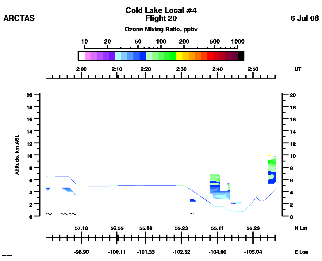
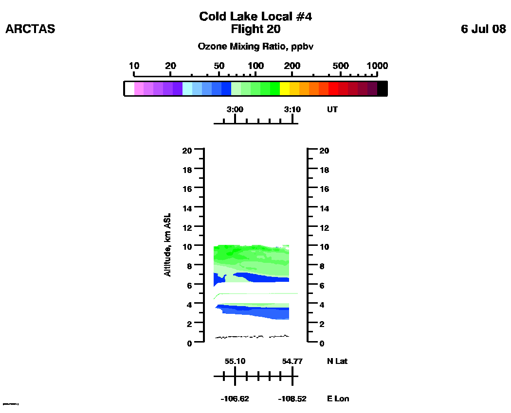
Flight 20 / Cold Lake Local #4 / July 5, 2008
DC8 flight track
(UT) | Entire Flight |
Note:
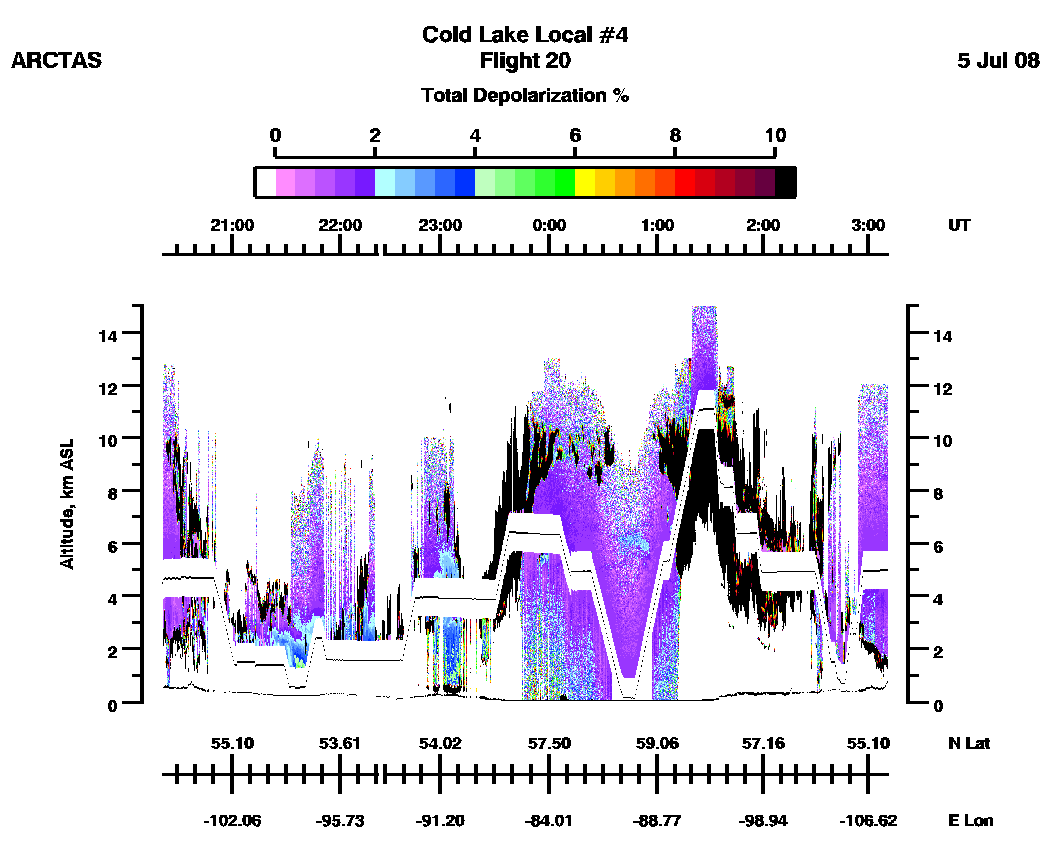
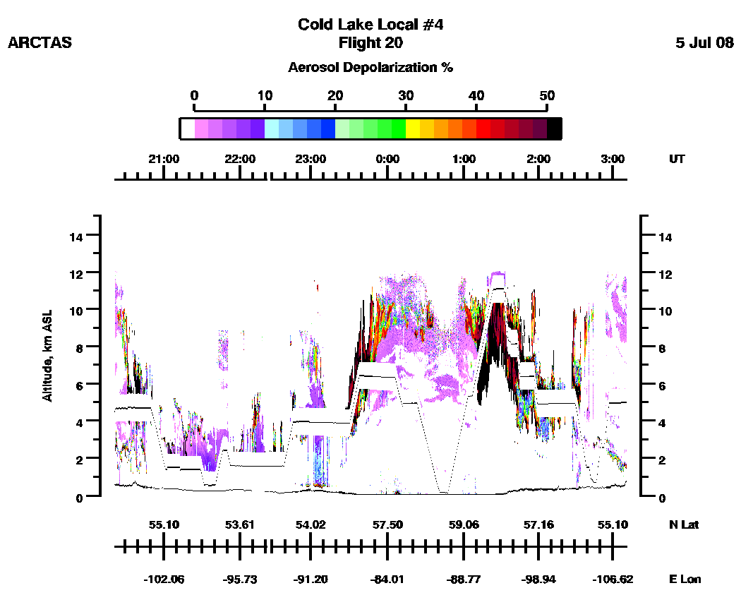
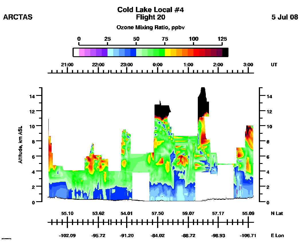
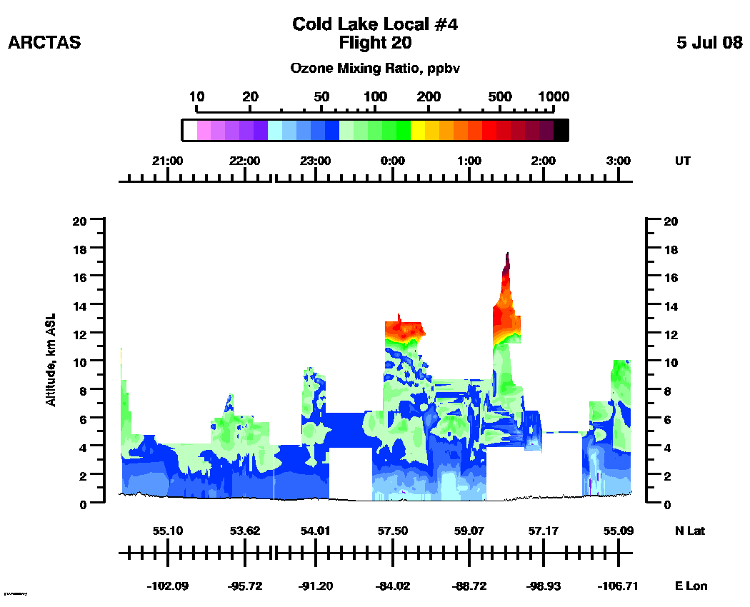
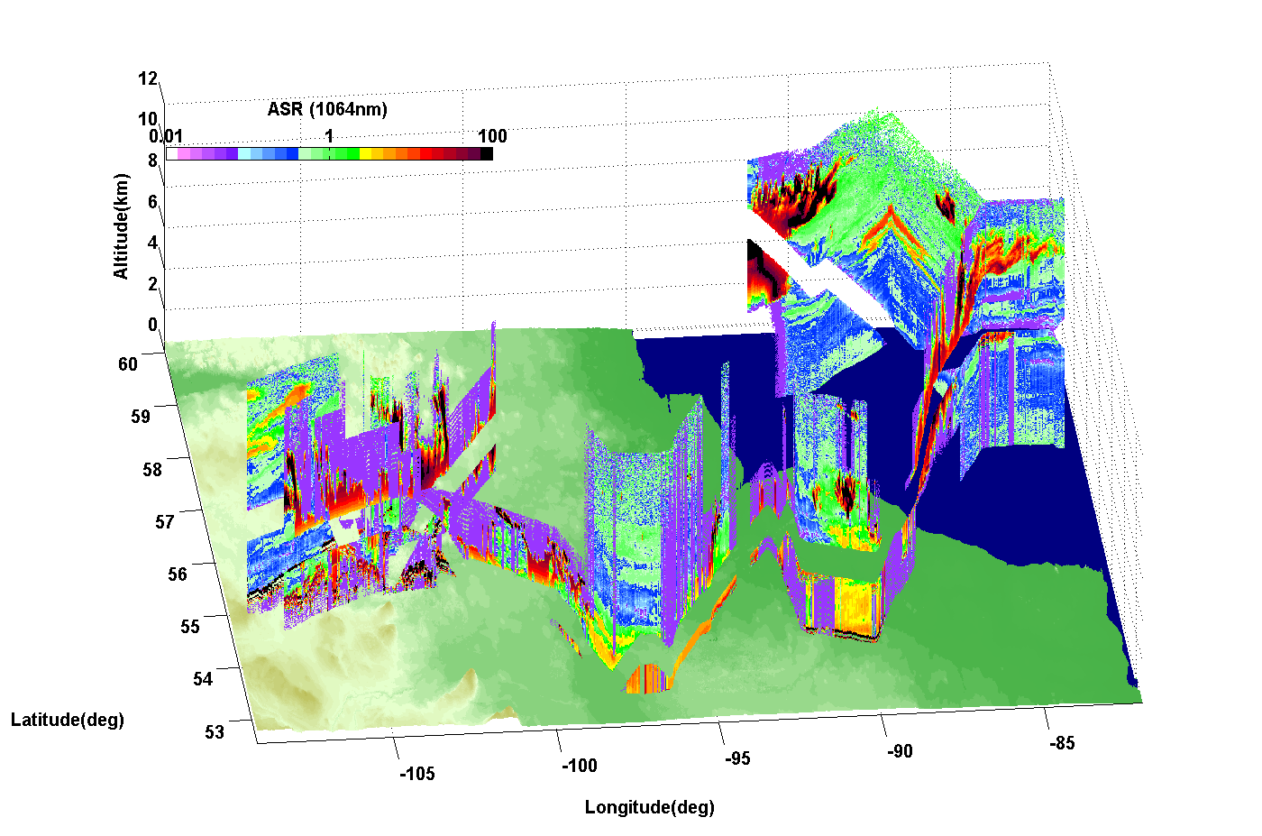
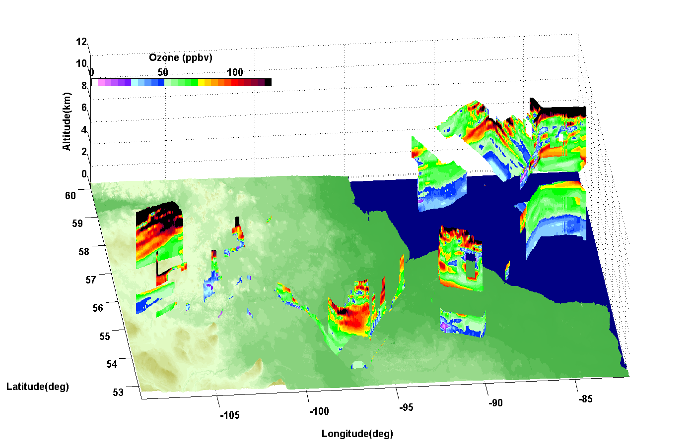
1. DIAL measures ozone densities, the molecular densities from the RAQMS model (kindly provided by B. Pierce of NOAA) have been used to calculate mixing ratios.
2. The DIAL ozone images contain insitu ozone from the NCAR NOxyO3 4-channel chemiluminescence instrument (PI: A. Weinheimer) at DC-8 flight altitudes.
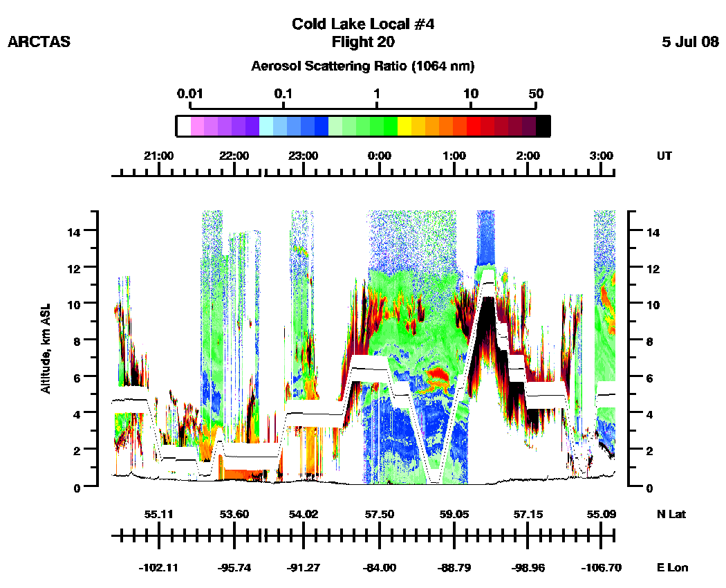
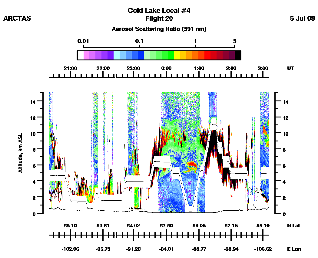
3. Scattering ratio normalizations have used molecular densities from the RAQMS model (provided by B. Pierce of NOAA).
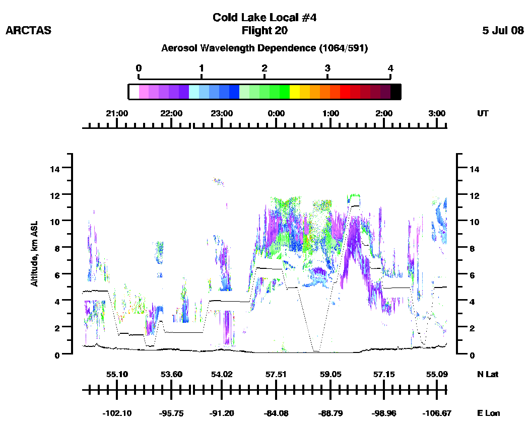
DIAL full flight images
(20:22 - 27:10 UT)
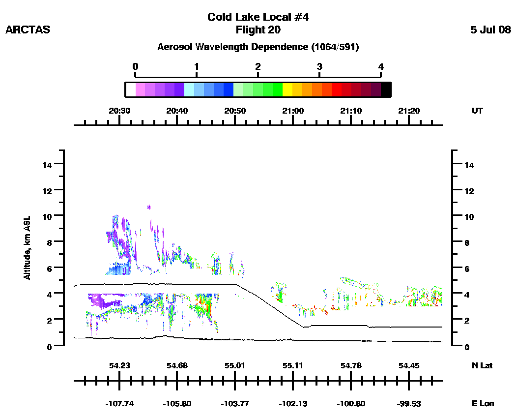
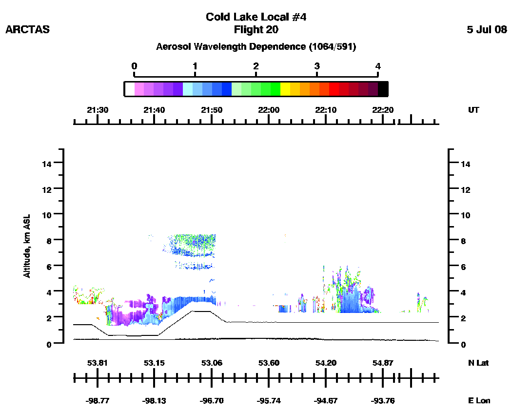
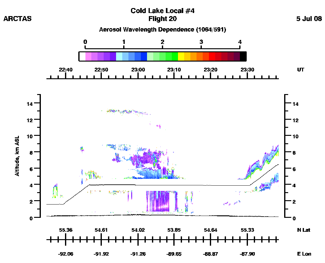
| Aerosol Scattering Ratio (1064 nm) | Aerosol ScatteringRatio (591 nm) | Aerosol Wavelength Dependence (1064/591 nm) |
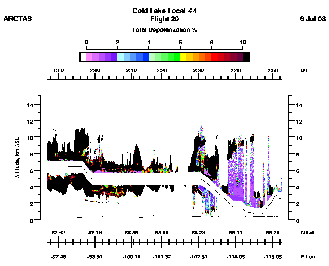
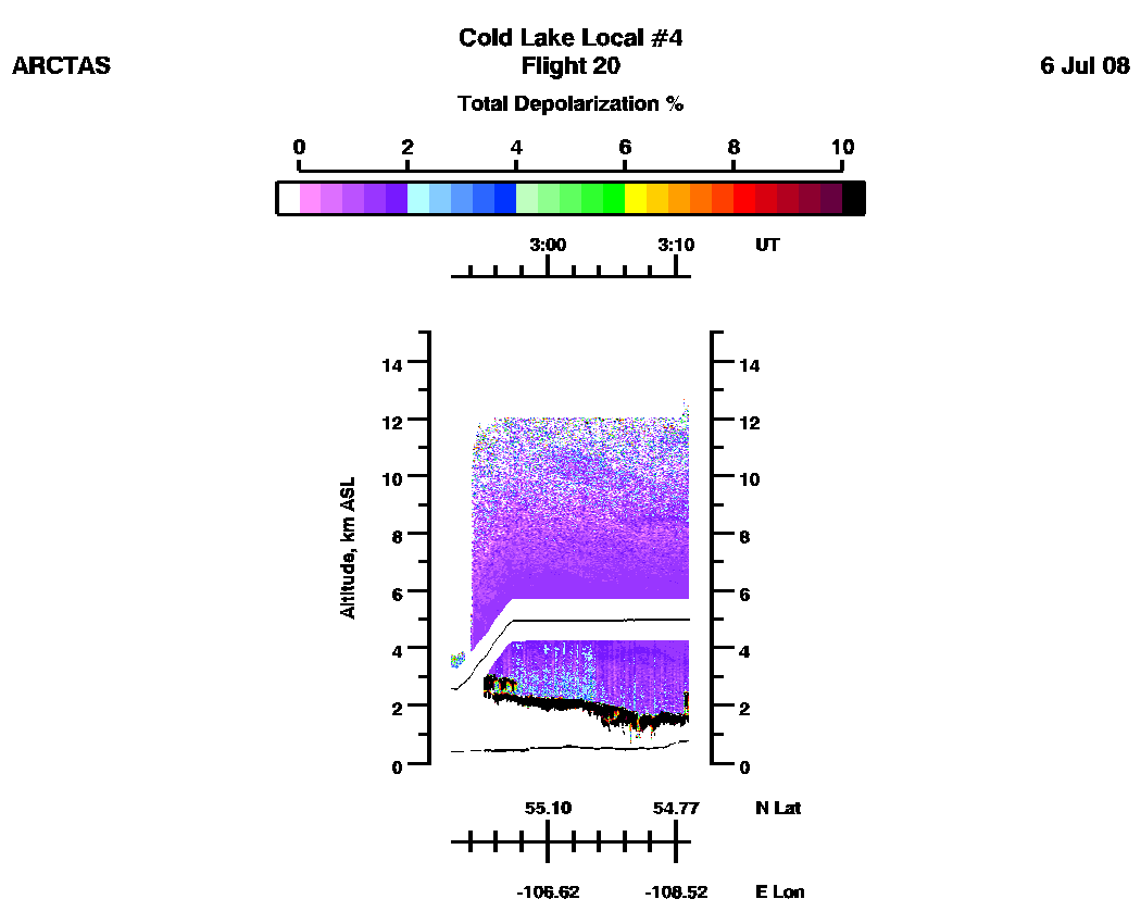
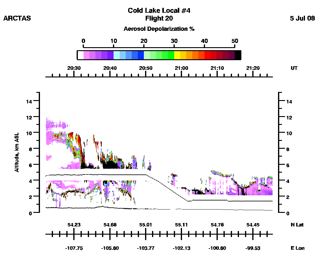
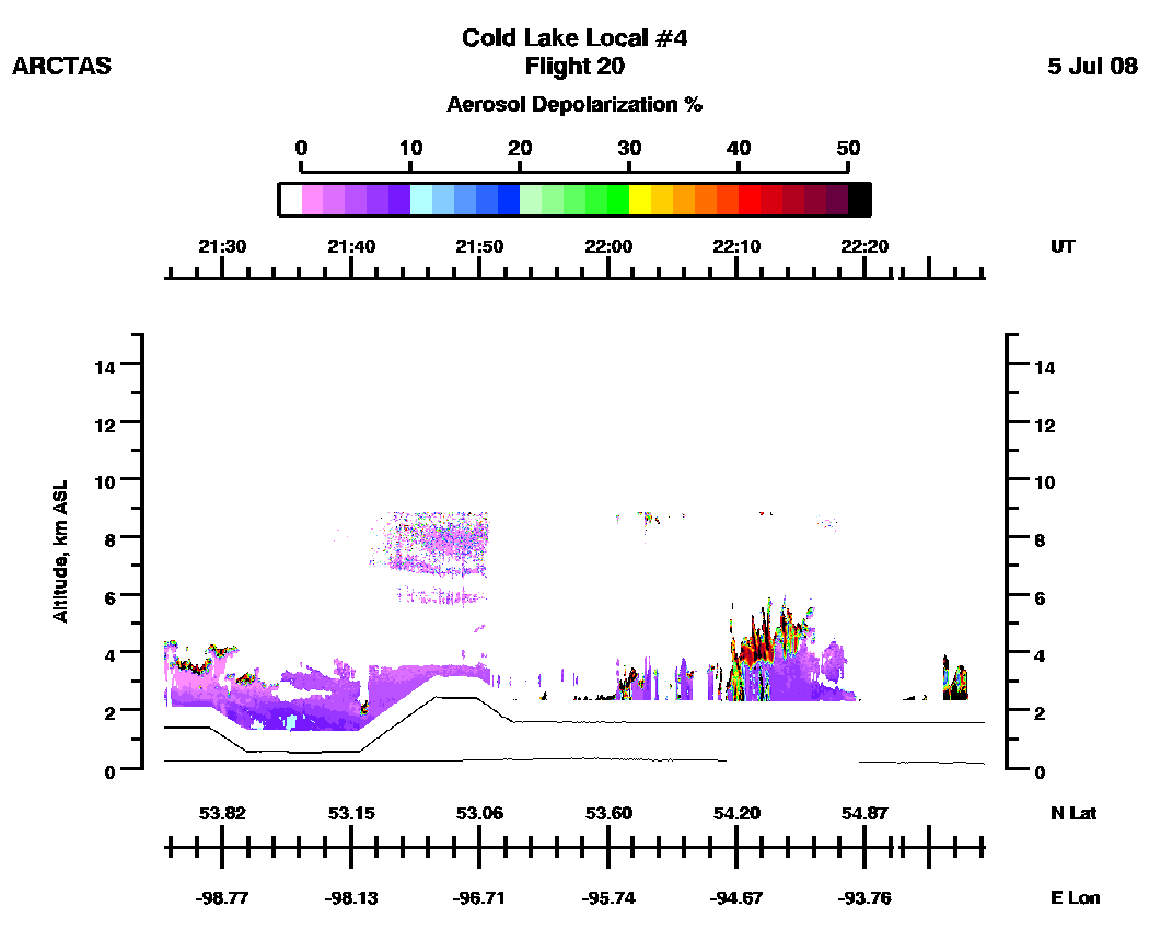
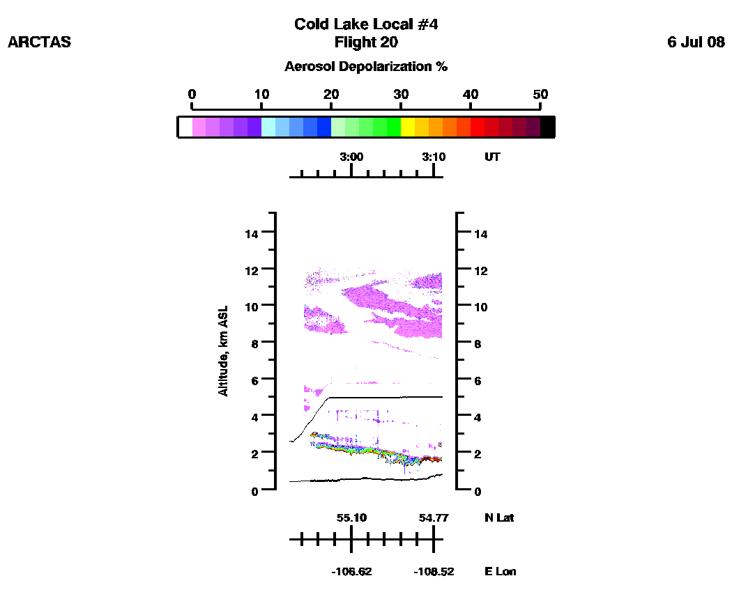
| Total Depolarization % (591 nm) | Aerosol Depolarization % (591 nm) |
| Ozone (linear scale) | Ozone (log scale) |
3D Images
| Aerosol Scattering Ratio (IR) | Ozone
(ppbv) |
Subset aerosol scattering
ratio images
IR(1064nm): | 20:22-21:25| 21:25-22:33| 22:34-23:37| 23:37-24:41| 24:41-25:46| 25:46-26:51| 26:51-27:11| loop |
VIS(591nm): | 20:22-21:25| 21:25-22:33| 22:34-23:37| 23:37-24:41| 24:41-25:46| 25:46-26:51| 26:51-27:11| loop |
Subset
depolarization images (%)
Total: | 20:22-21:25| 21:25-22:33| 22:34-23:37| 23:37-24:41| 24:41-25:46| 25:46-26:51| 26:51-27:11| loop |
Aerosol: | 20:22-21:25| 21:25-22:33| 22:34-23:37| 23:37-24:41| 24:41-25:46| 25:46-26:51| 26:51-27:11| loop |
Subset aerosol wavelength dependence
IR/VS(1064/591 nm): | 20:22-21:25| 21:25-22:33| 22:34-23:37| 23:37-24:41| 24:41-25:46| 25:46-26:51| 26:51-27:11|
Subset
ozone mixing ratio images (ppbv)
Linear scale: | 20:22-21:25| 21:25-22:35| 22:35-23:39| 23:39-24:43| 24:43-25:50| 25:50-26:56| 26:56-27:10| loop |
Log scale: | 20:22-21:25| 21:25-22:35| 22:35-23:39| 23:39-24:43| 24:43-25:50| 25:50-26:56| 26:56-27:10| loop|
