CAMEX3 Experiment/Mission Description
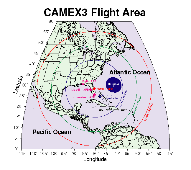
The third in the series of CAMEX field studies (CAMEX-3) is planned for August - September, 1998. This field campaign will be devoted to the study of hurricane tracking and intensification using NASA-funded aircraft remote sensing instrumentation. The NASA ER-2 and DC-8 are the primary aircraft platforms currently planned for the deployment; however, collaborations with the National Weather Service/Tropical Prediction Center/National Hurricane Center and National Oceanic and Atmospheric Administration/Hurricane Research Division are being developed so that actual mission sorties may involve as many as five to six aircraft.
The remote sensing instrumentation to be utilized by NASA during CAMEX-3 will yield high spatial and temporal information of hurricane structure, dynamics, and motion. These data, when analyzed within the context of more traditional aircraft, satellite, and ground-based radar observations, should provide additional insight to hurricane modelers and forecasters who continually strive to improve hurricane predictions. The ultimate goal of CAMEX-3 is to provide information which could someday assist in decreasing the size of coastal evacuation areas and increasing the warning time for those areas.
