GRIP Flight 17 -- Aerosol and Water Vapor Distributions
Information about LASE Aerosol and Water Vapor Images.
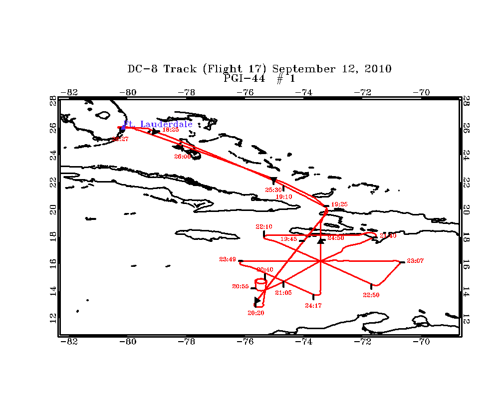
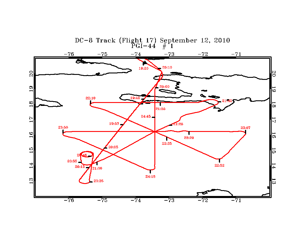
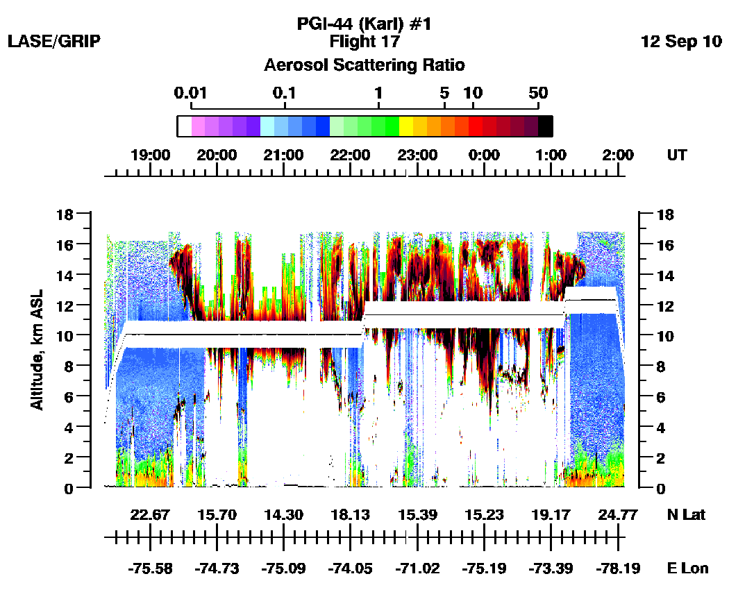
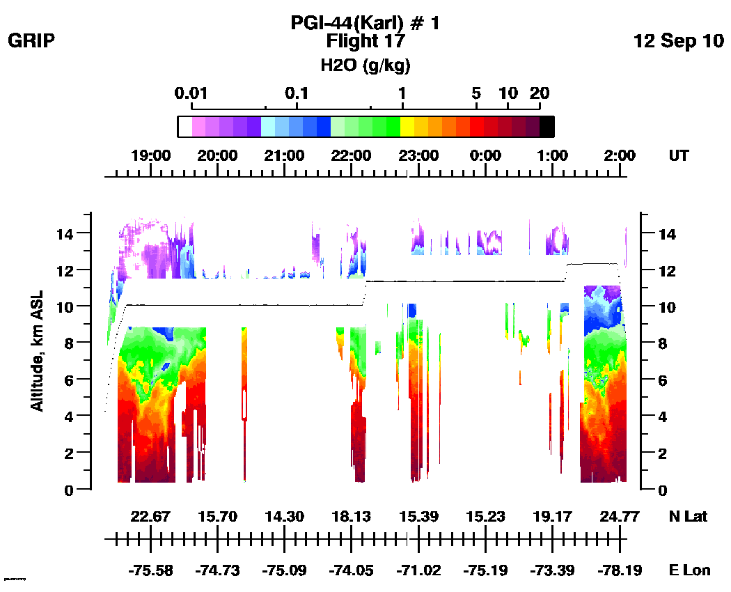
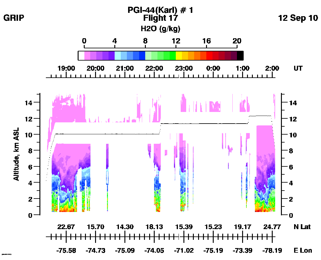
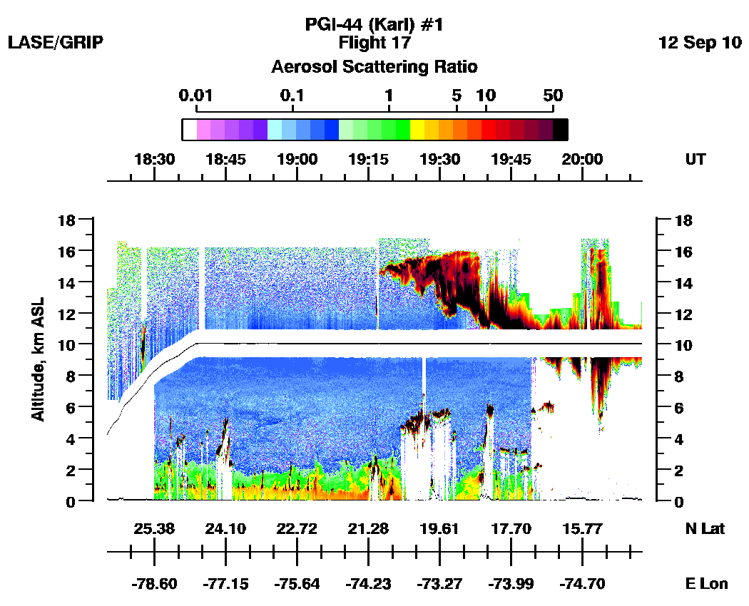
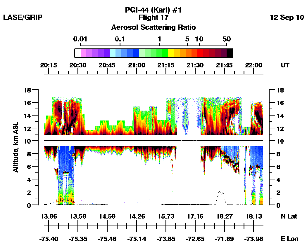
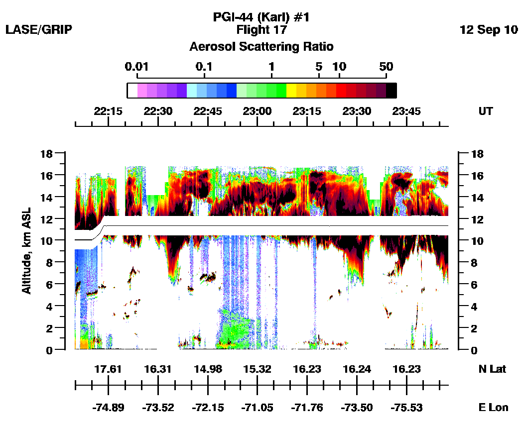
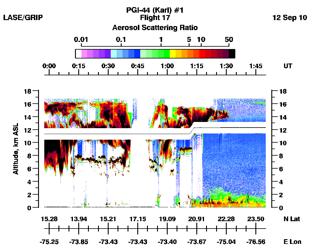
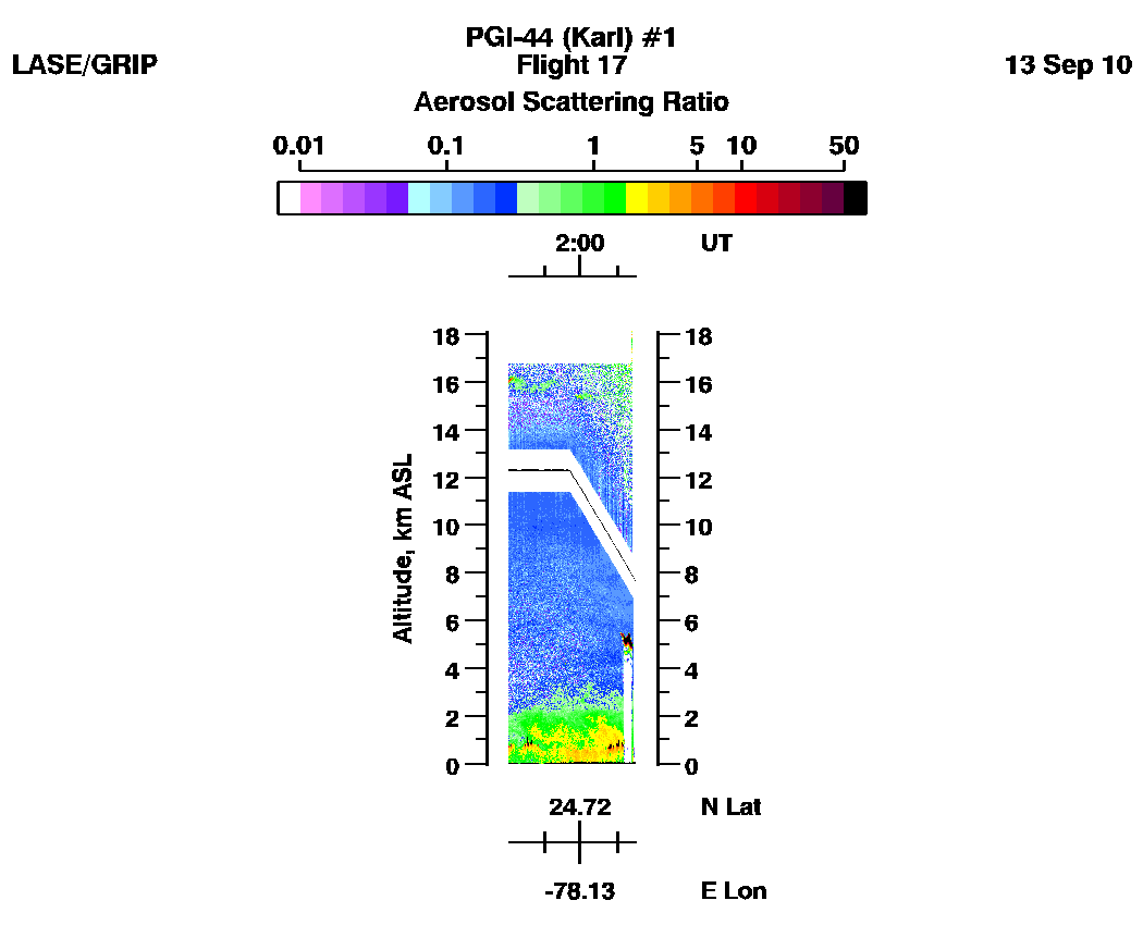
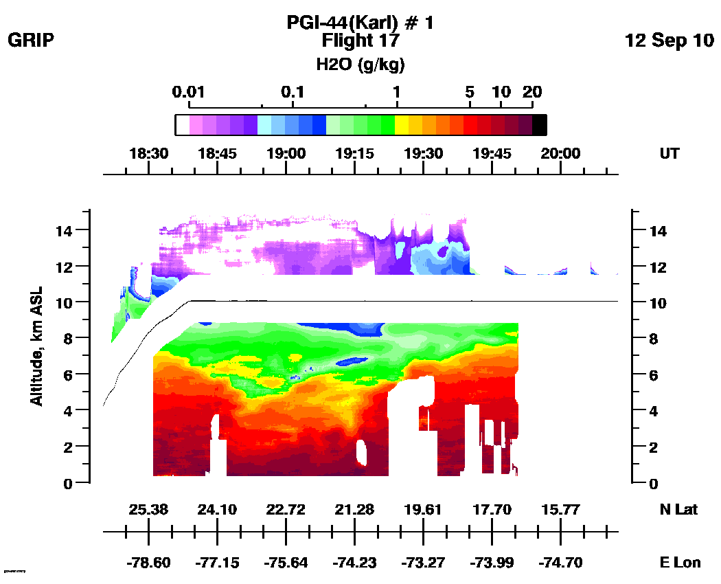
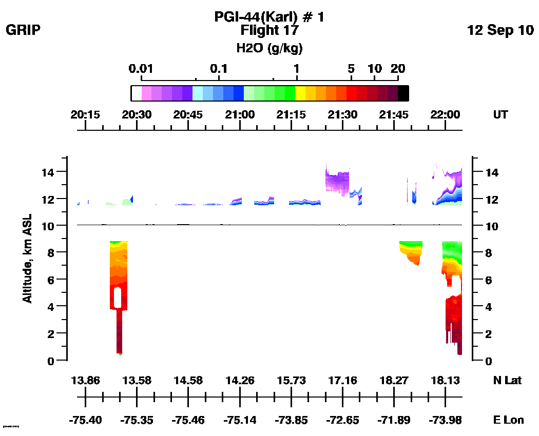
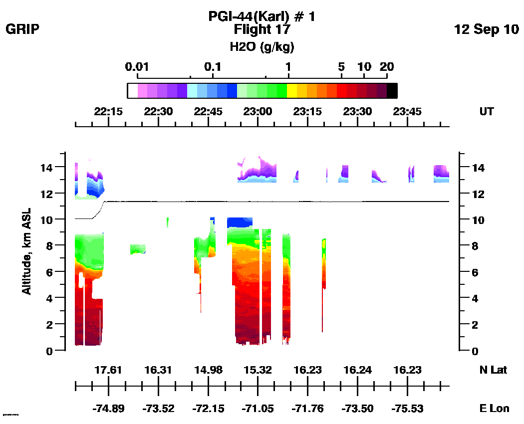
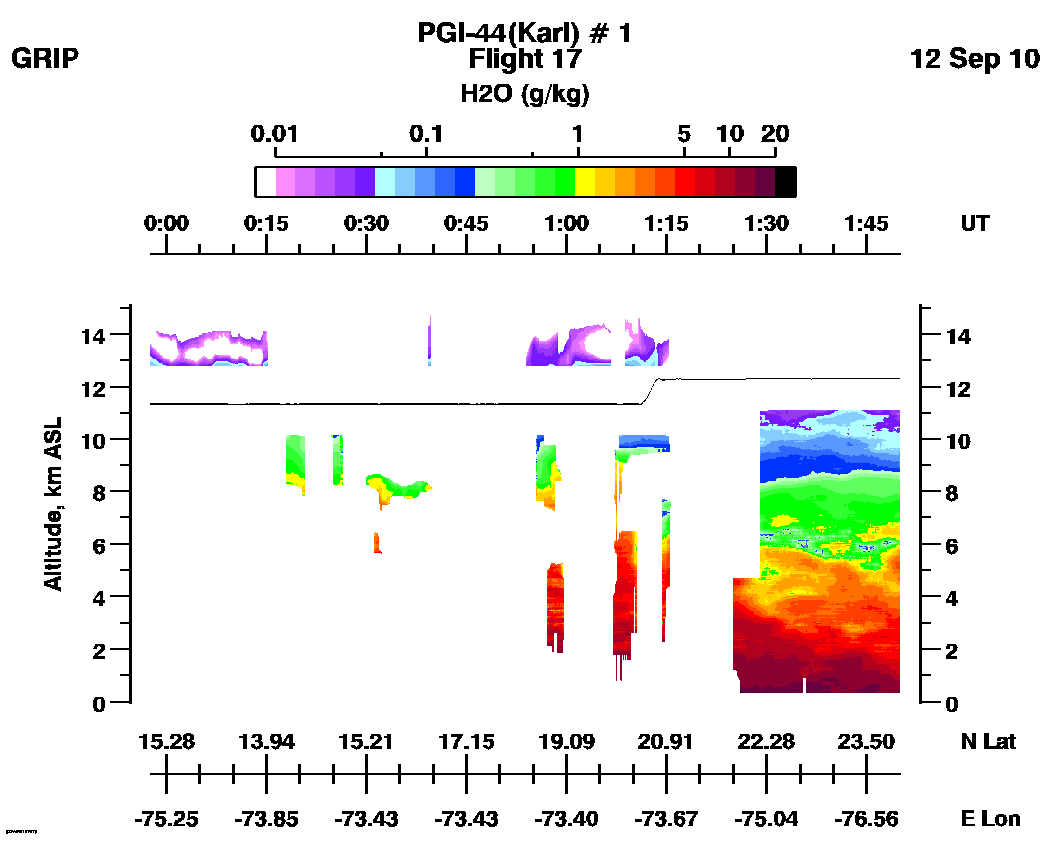
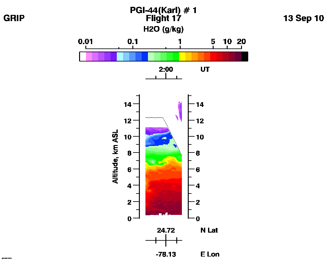
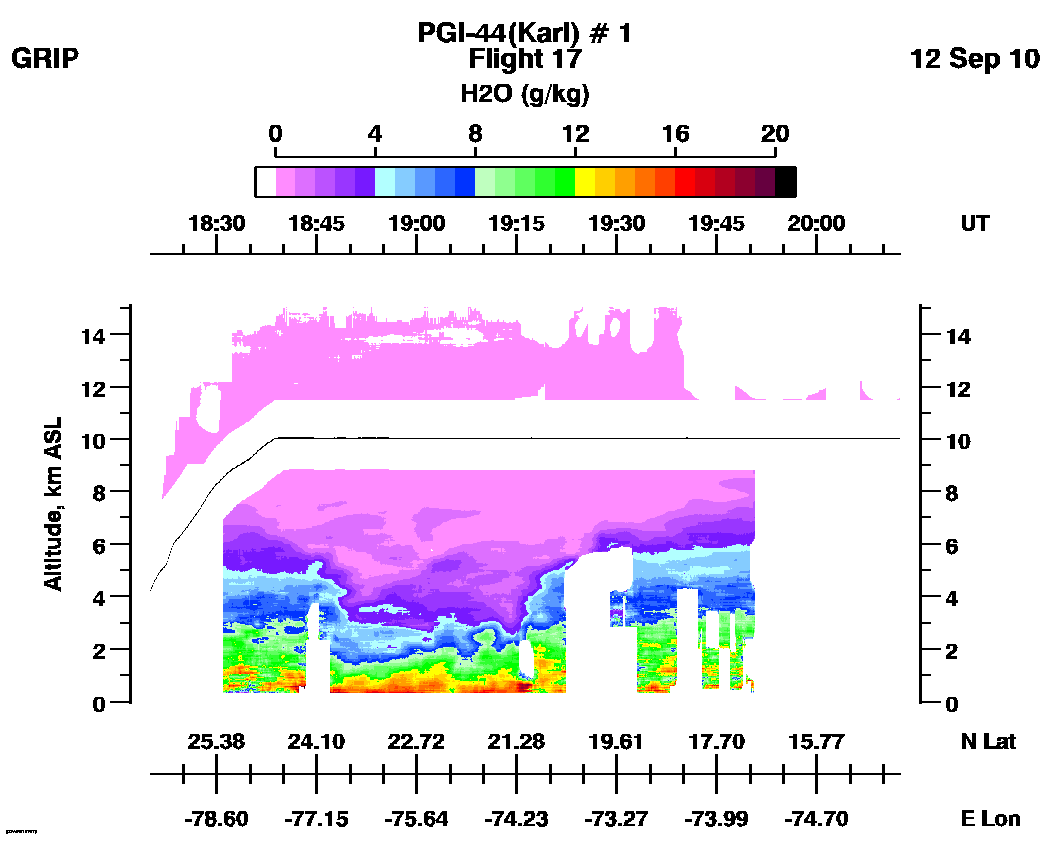
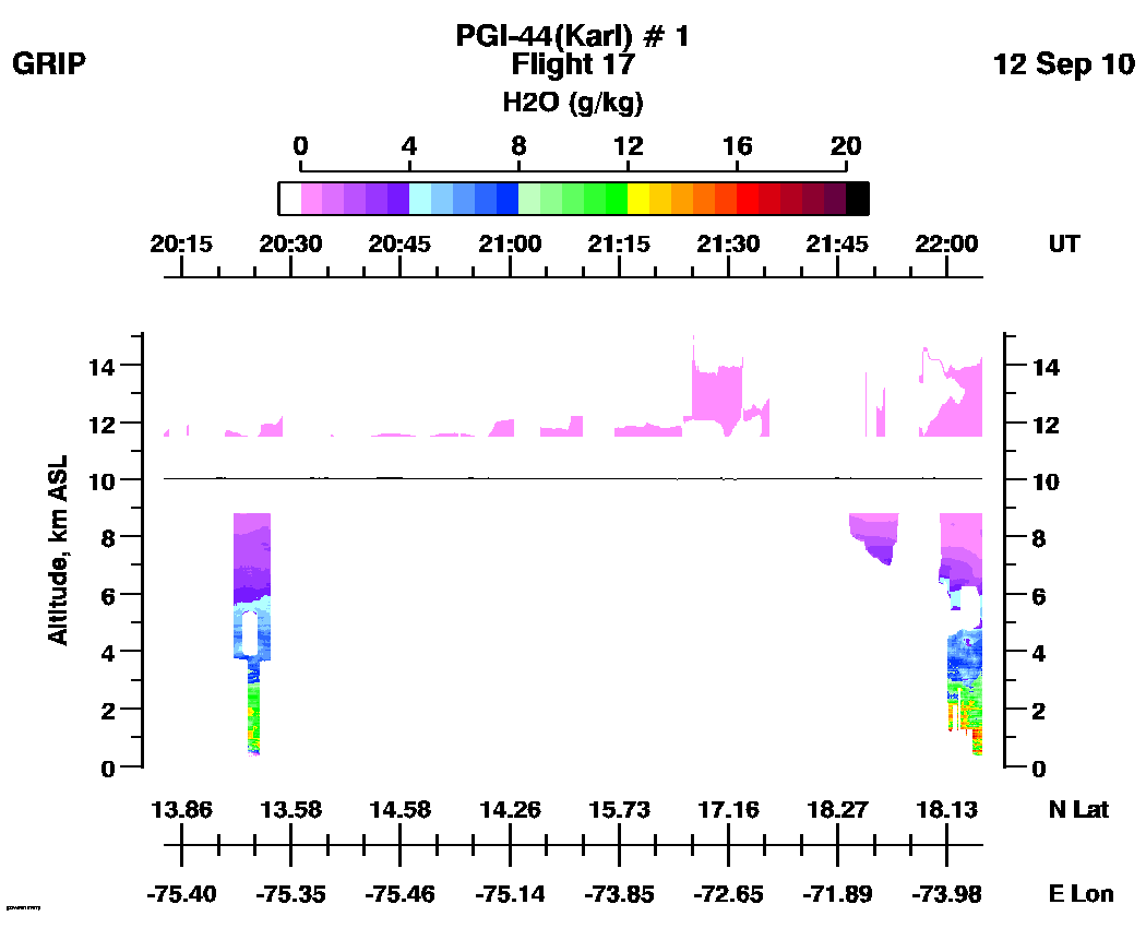
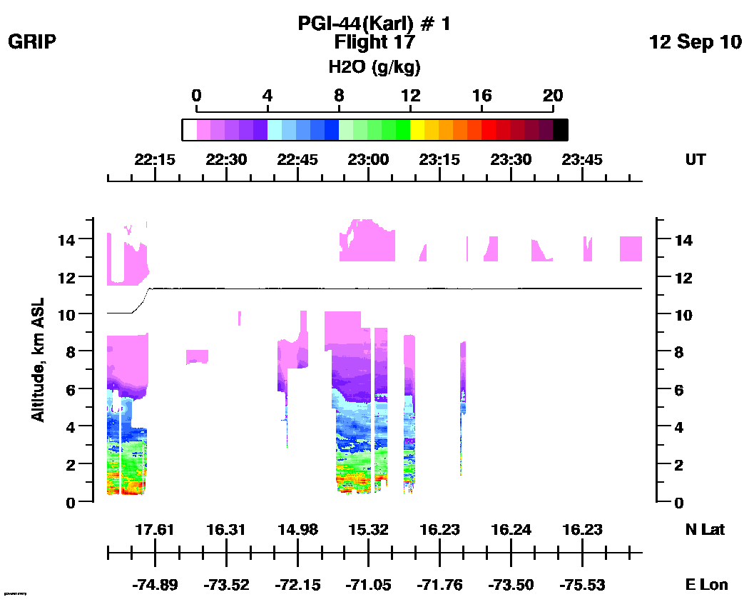
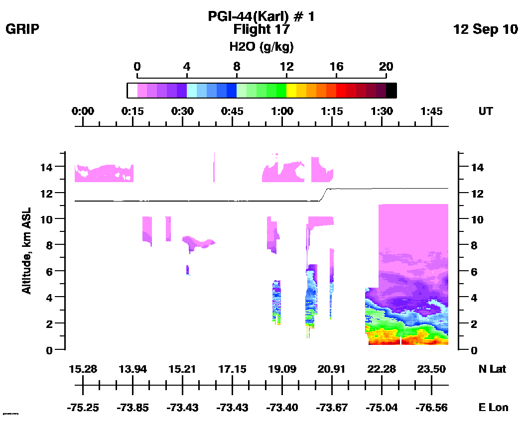
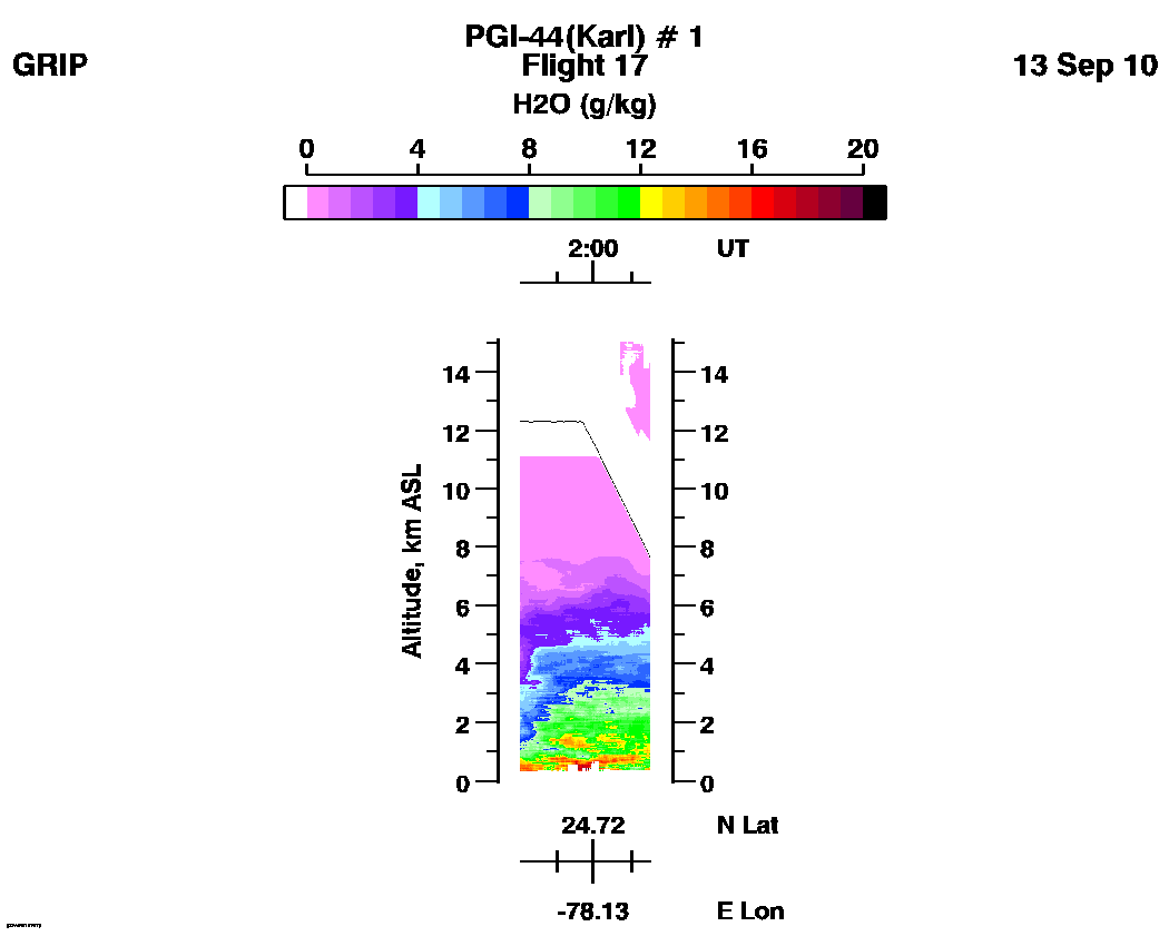
Flight 17 / PGI-44 (Karl) #1 / September 12, 2010
DC-8 flight track: | Track Plot | | PGI-44 Track Plot |
Full flight LASE images
| Aerosol Scattering Ratio | Water Vapor Mixing Ratio (log scale) | Water Vapor Mixing Ratio (linear scale) |
Subset Aerosol Scattering Ratio Images
| image01 | image02 | image03 | image04 | image05 | movie_loop_all |
Subset Water Vapor Mixing Ratio Images (g/kg)
(Log scale):| image01 | image02 | image03 | image04 | image05 | movie_loop_all |
(Linear scale):| image01 | image02 | image03 | image04 | image05 | movie_loop_all |
Go to GRIP Project Science Home Page  for
additional information.
for
additional information.
Return to LIDAR Applications
Group Home Page 