
Flight tracks of the ER-2 plane are drawn on GOES-8 and NOAA-14 AVHRR imagery. The tracks are divided into 40 min intervals centering at 15 & 45 min past the hour for the GOES data. There is a 10 minute overlap from one image to the next. On the AVHRR data the tracks are 2 hours long. If no data are available for a given time, the tracks are drawn on the nearest available hour image.These tracks are mostly drawn on the VIS data (channel 1) but for a few cases, the IR data (channel 4) are used. A brief description of the footer on each image is given below :
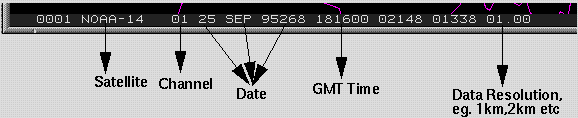
The file name is : SFF-DDD.HHM.gif, where S is the satellite G = GOES-8, A=AVHRR, FF is the LASE flight number, DDD is the day of the year, HH is the UTC hour, M is the minutes past the hour: a = 15, b=45.
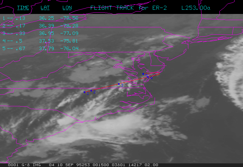
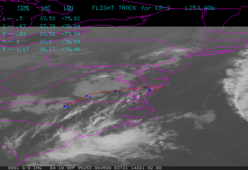
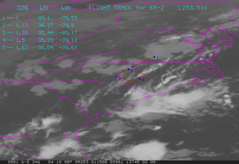
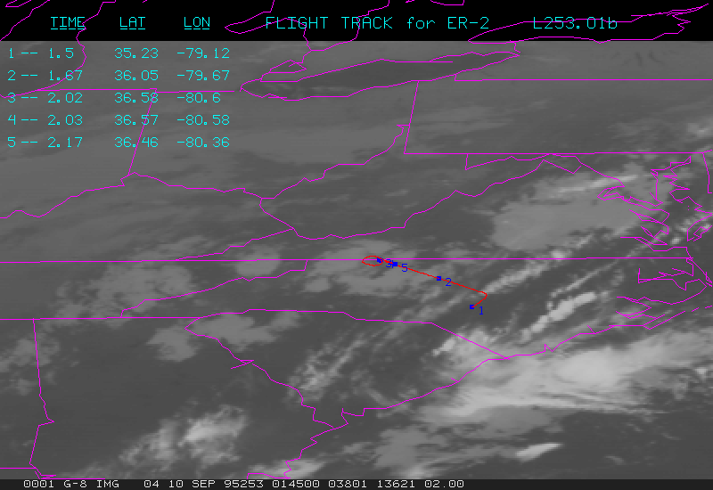
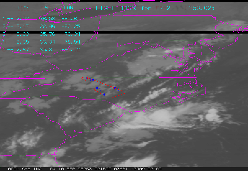
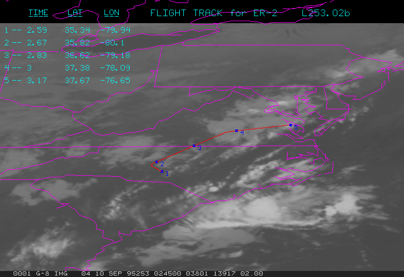
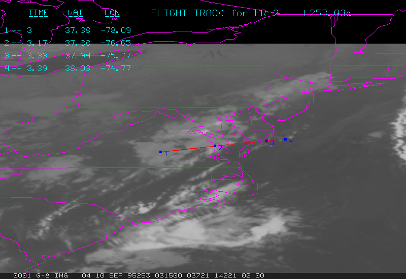
Flight 1
G01-253.00a.gif contains GOES data at 0015Z, and flight track from 0000Z to 0040Z.
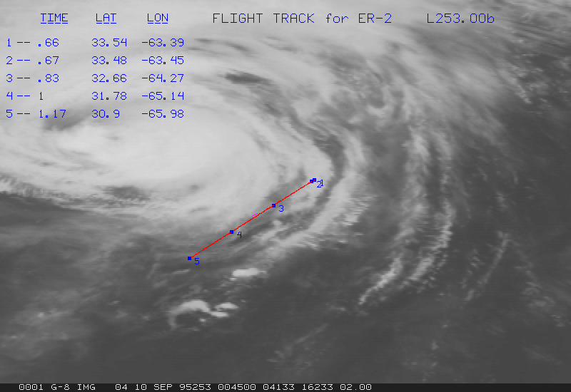
G01-253.00b.gif contains GOES data at 0045Z, and flight track from 0030Z to 0110Z.
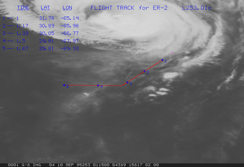
G01-253.01a.gif contains GOES data at 0115Z, and flight track from 0100Z to 0140Z.
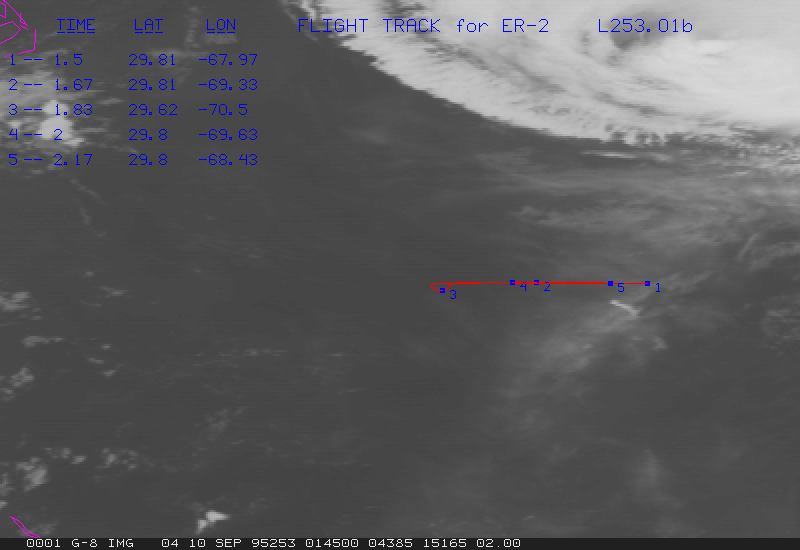
G01-253.01b.gif contains GOES data at 0145Z, and flight track from 0130Z to 0210Z.
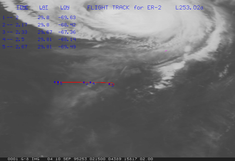
G01-253.02a.gif contains GOES data at 0215Z, and flight track from 0200Z to 0240Z.
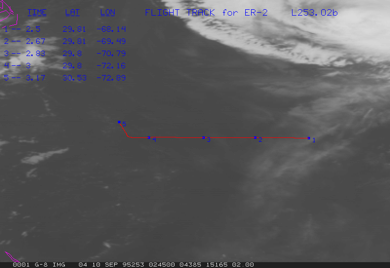
G01-253.02b.gif contains GOES data at 0245Z, and flight track from 0230Z to 0310Z.
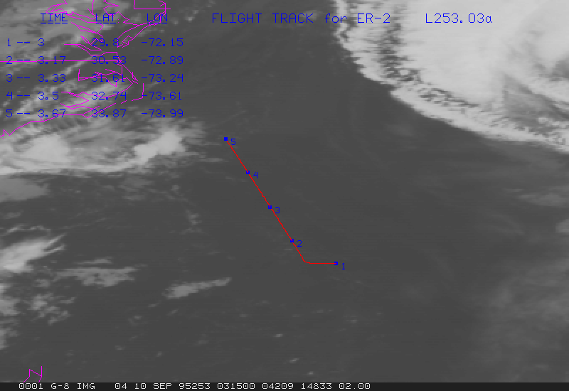
G01-253.03a.gif contains GOES data at 0315Z, and flight track from 0300Z to 0340Z.
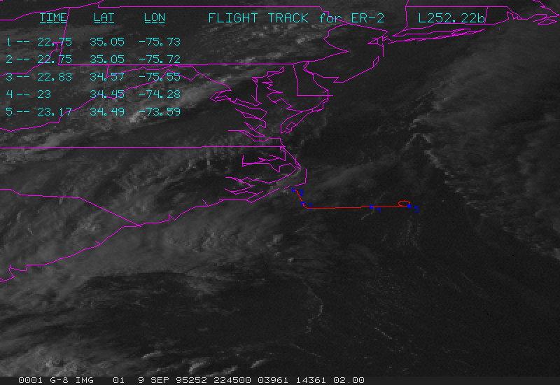
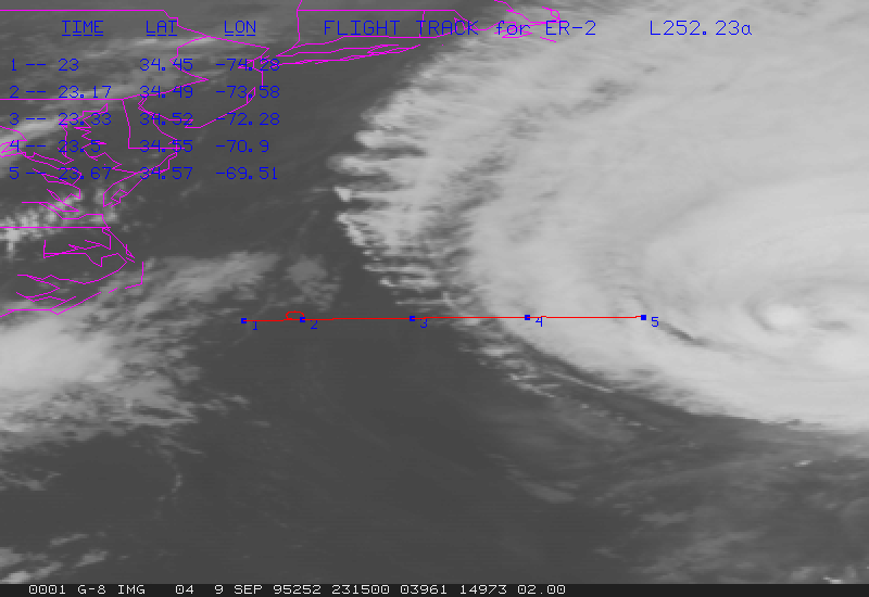
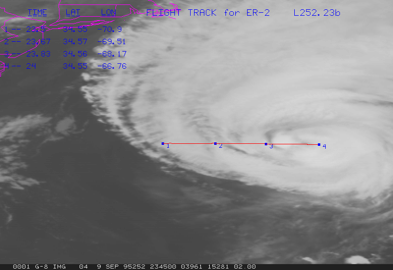
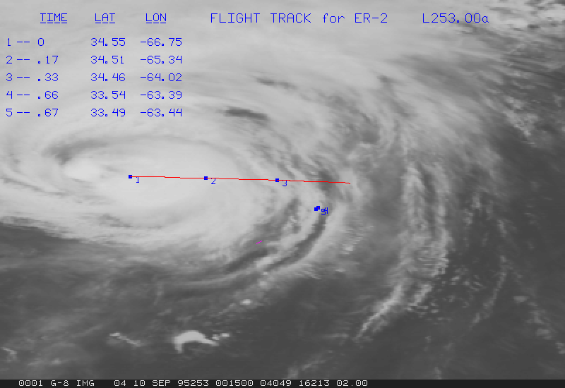
Flight 2
G02-252.22b.gif contains GOES data at 2245Z, and flight track from 2230Z to 2310Z.
G02-252.23a.gif contains GOES data at 2315Z, and flight track from 2300Z to 2340Z.
G02-252.23b.gif contains GOES data at 2345Z, and flight track from 2330Z to 0010Z.
G02-253.00a.gif contains GOES data at 0015Z, and flight track from 0000Z to 0040Z.
G02-253.00b.gif contains GOES data at 0045Z, and flight track from 0030Z to 0110Z.
G02-253.01a.gif contains GOES data at 0115Z, and flight track from 0100Z to 0140Z.
G02-253.01b.gif contains GOES data at 0145Z, and flight track from 0130Z to 0210Z.
G02-253.02a.gif contains GOES data at 0215Z, and flight track from 0200Z to 0240Z.
G02-253.02b.gif contains GOES data at 0245Z, and flight track from 0230Z to 0310Z.
G02-253.03a.gif contains GOES data at 0315Z, and flight track from 0300Z to 0340Z.
G02-253.03b.gif contains GOES data at 0345Z, and flight track from 0330Z to 0410Z.
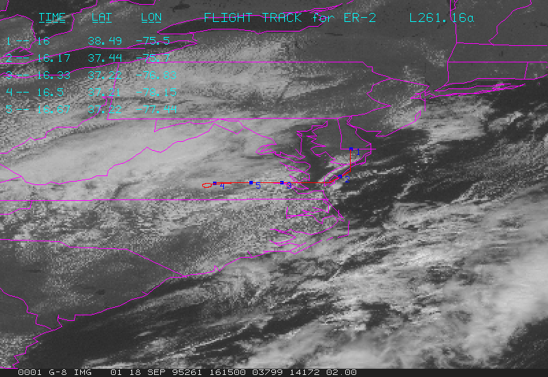
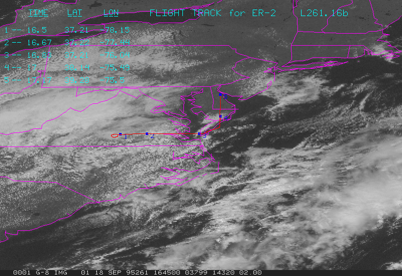
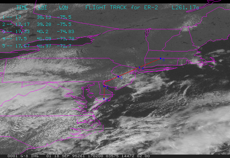
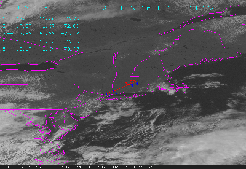
Flight 5
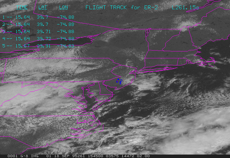
G05-261.15a.gif contains GOES data at 1515Z, and flight track from 1500Z to 1540Z.
G05-261.15b.gif contains GOES data at 1545Z, and flight track from 1530Z to 1610Z.
G05-261.16a.gif contains GOES data at 1615Z, and flight track from 1600Z to 1640Z.
G05-261.16b.gif contains GOES data at 1645Z, and flight track from 1630Z to 1710Z.
G05-261.17a.gif contains GOES data at 1715Z, and flight track from 1700Z to 1740Z.
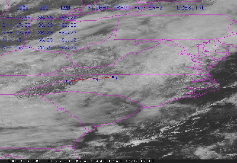
G05-261.17b.gif contains GOES data at 1745Z, and flight track from 1730Z to 1810Z.
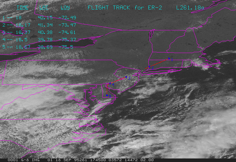
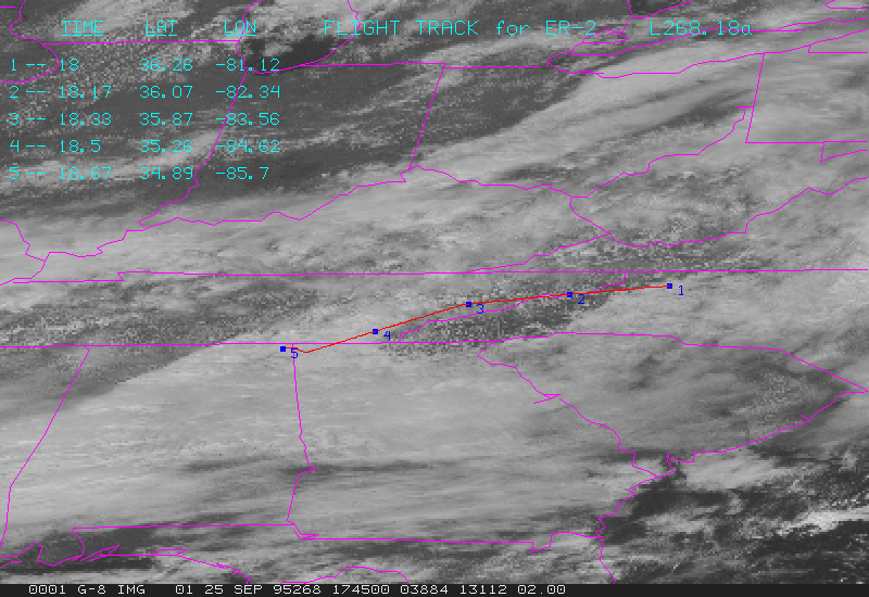
G05-261.18a.gif contains GOES data at 1815Z, and flight track from 1800Z to 1840Z.
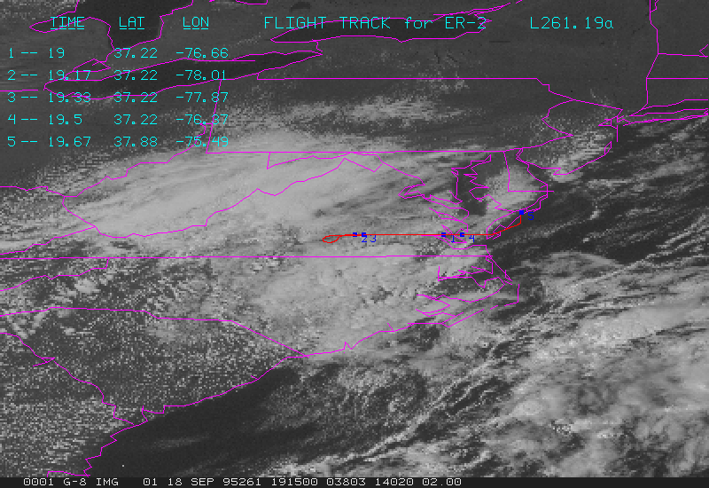
G05-261.19a.gif contains GOES data at 1915Z, and flight track from 1900Z to 1940Z.
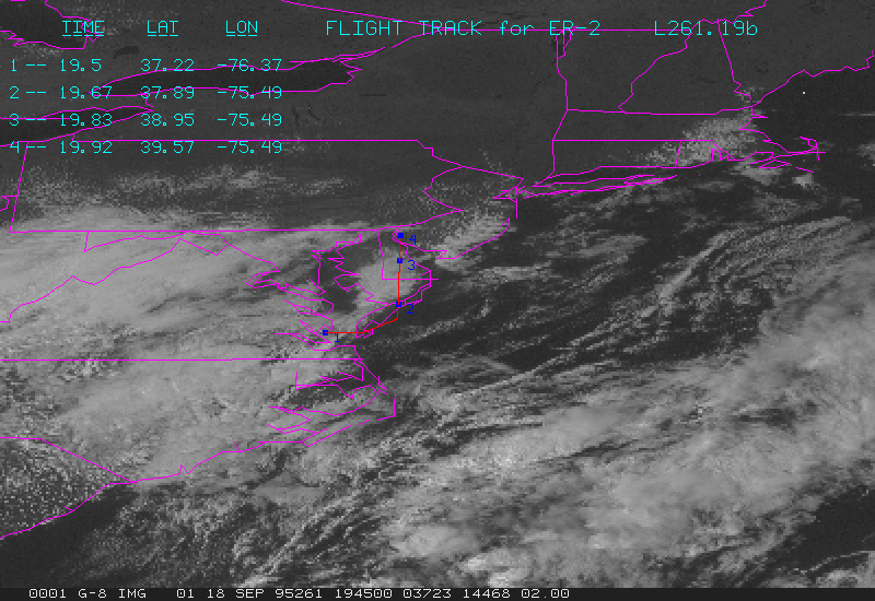
G05-261.19b.gif contains GOES data at 1945Z, and flight track from 1930Z to 2010Z.
Flight 6
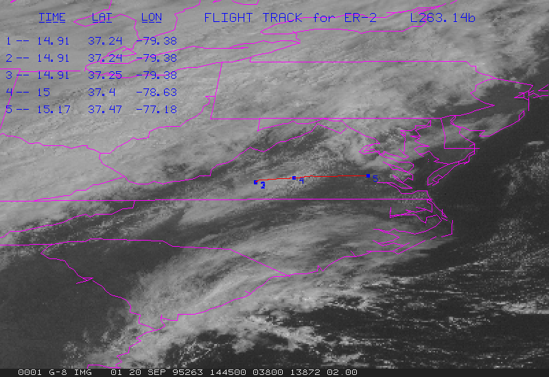
G06-263.14b.gif contains GOES data at 1445Z, and flight track from 1500Z to 1540Z.
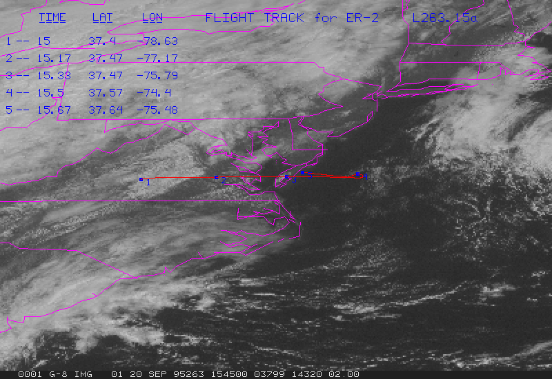
G06-263.15a.gif contains GOES data at 1515Z, and flight track from 1500Z to 1540Z.
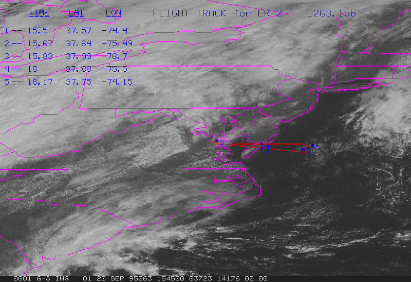
G06-263.15b.gif contains GOES data at 1545Z, and flight track from 1530Z to 1610Z.
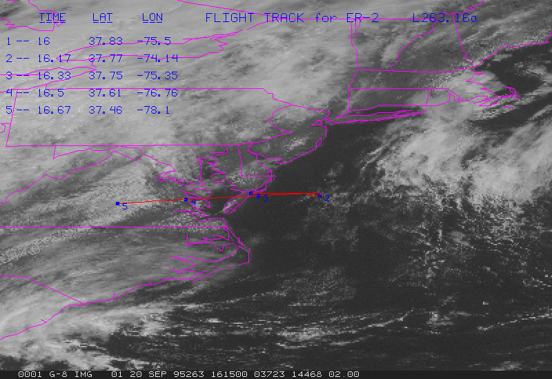
G06-263.16a.gif contains GOES data at 1615Z, and flight track from 1600Z to 1640Z.
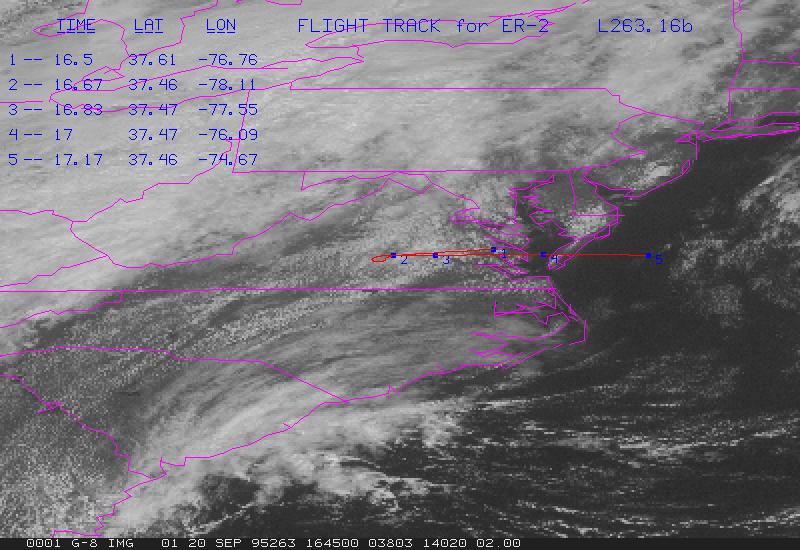
G06-263.16b.gif contains GOES data at 1645Z, and flight track from 1630Z to 1710Z.
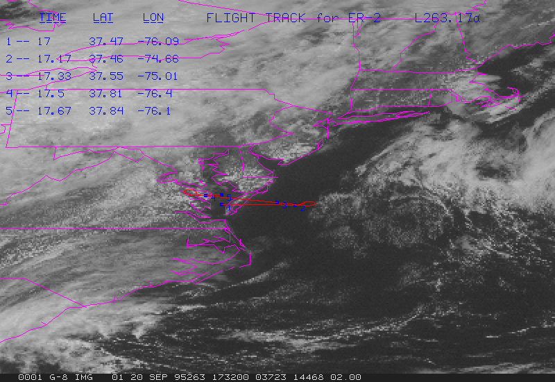
G06-263.17a.gif contains GOES data at 1715Z, and flight track from 1700Z to 1740Z.
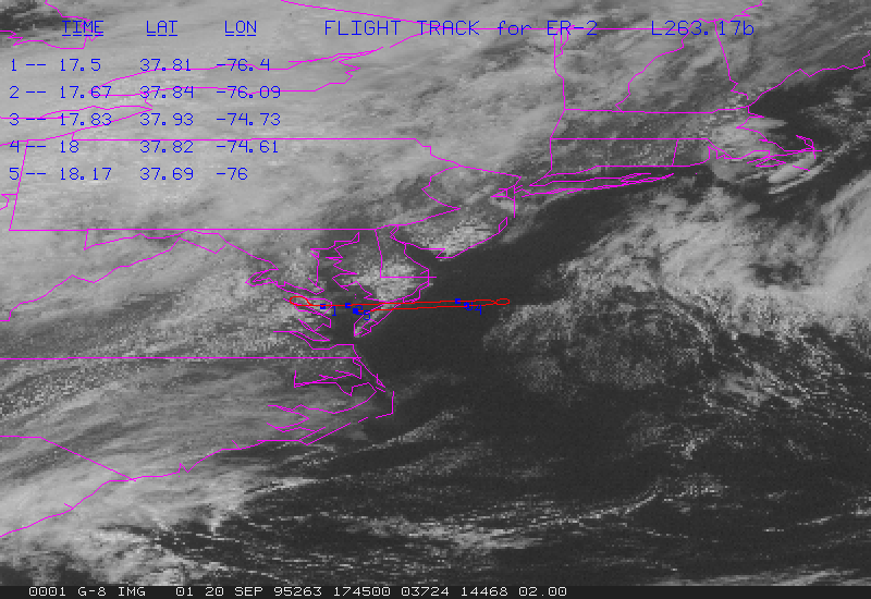
G06-263.17b.gif contains GOES data at 1745Z, and flight track from 1730Z to 1810Z.
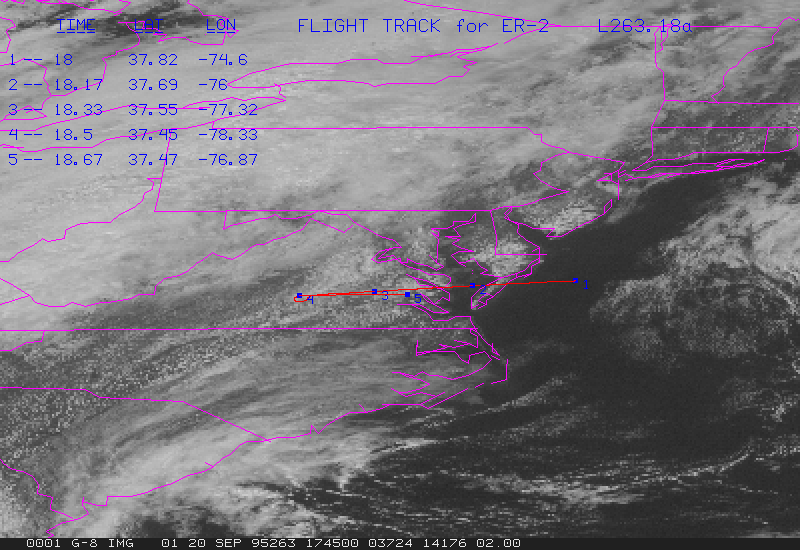
G06-263.18a.gif contains GOES data at 1815Z, and flight track from 1800Z to 1840Z.
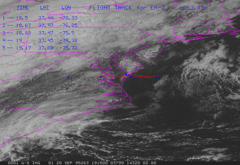
G06-263.18b.gif contains GOES data at 1845Z, and flight track from 1830Z to 1910Z.
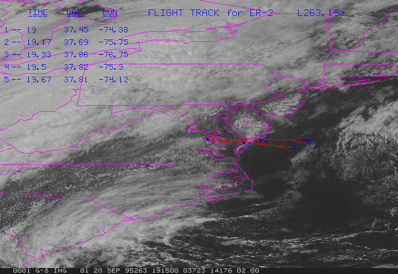
G06-263.19a.gif contains GOES data at 1915Z, and flight track from 1900Z to 1940Z.
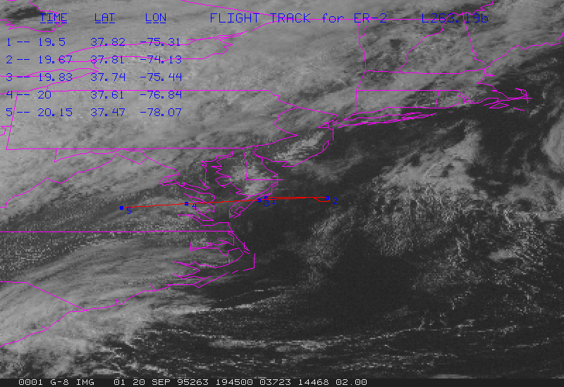
G06-263.19b.gif contains GOES data at 1945Z, and flight track from 1930Z to 2010Z.
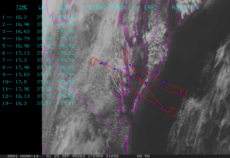
A06-263.17a.gif contains AVHRR data at 1729Z, and flight track from 1615Z to 1815Z.
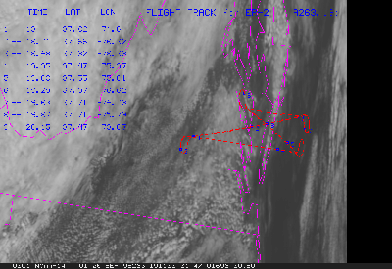
A06-263.19a.gif contains AVHRR data at 1911Z, and flight track from 1800Z to 2015Z.
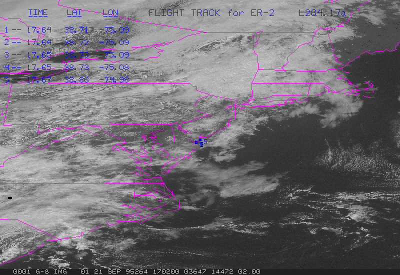
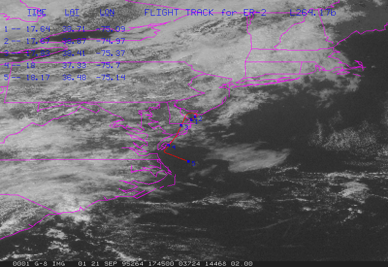
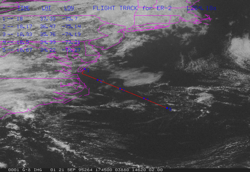
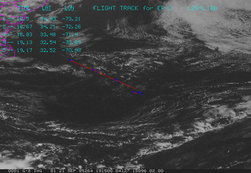
Flight 7
G07-264.17a.gif contains GOES data at 1715Z, and flight track from 1700Z to 1740Z.
G07-264.17b.gif contains GOES data at 1745Z, and flight track from 1730Z to 1810Z.
G07-264.18a.gif contains GOES data at 1815Z, and flight track from 1800Z to 1840Z.
G07-264.18b.gif contains GOES data at 1845Z, and flight track from 1830Z to 1910Z.
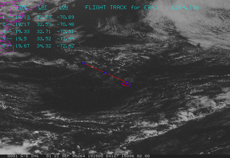
G07-264.19a.gif contains GOES data at 1915Z, and flight track from 1900Z to 1940Z.
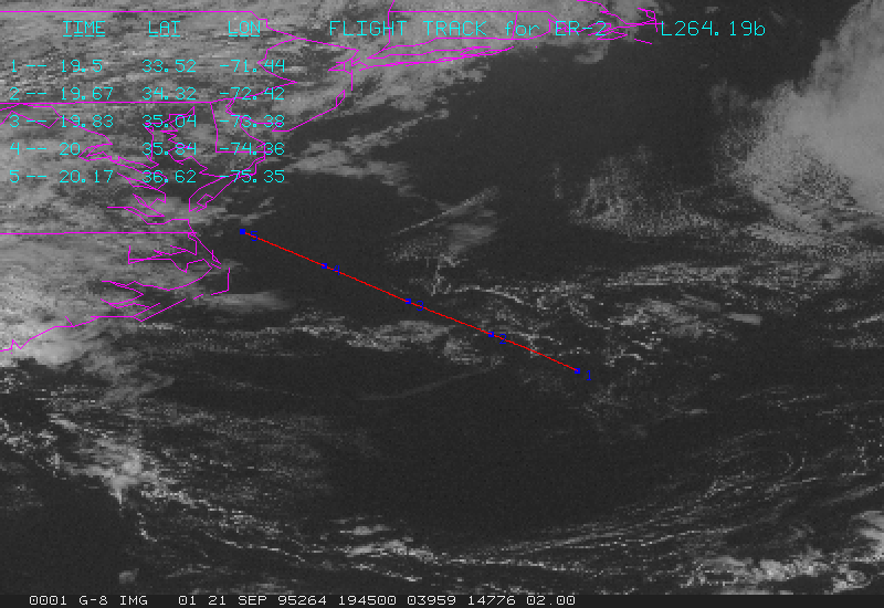
G07-264.19b.gif contains GOES data at 1945Z, and flight track from 1930Z to 2010Z.
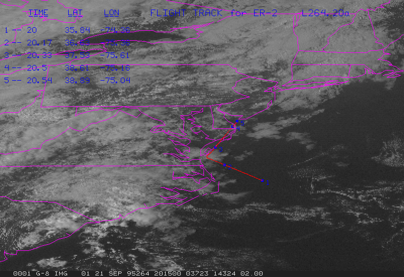
G07-264.20a.gif contains GOES data at 2015Z, and flight track from 2000Z to 2040Z.
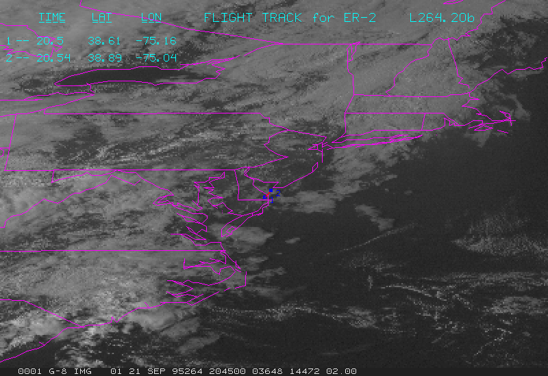
G07-264.20b.gif contains GOES data at 2045Z, and flight track from 2030Z to 2110Z.
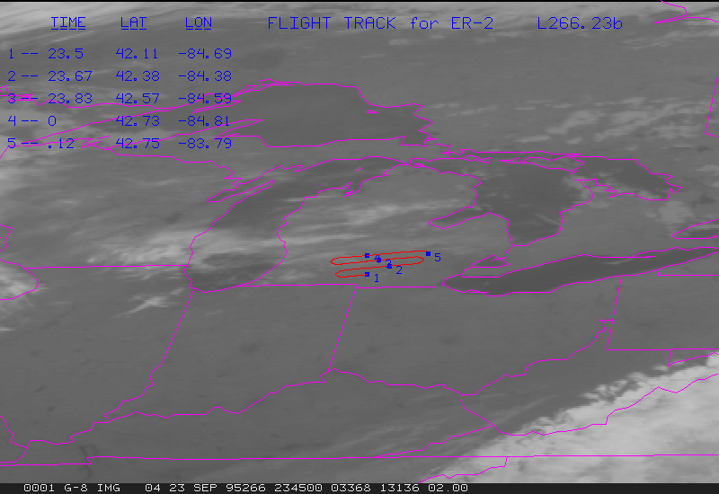
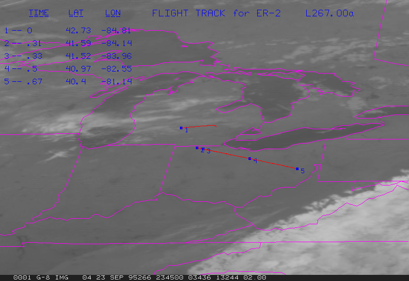
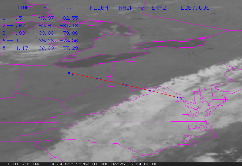
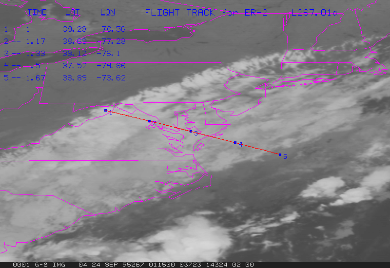
Flight 8
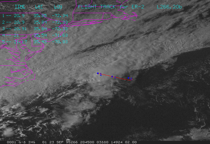
G08-266.20b.gif contains GOES data at 2045Z, and flight track from 2030Z to 2110Z.
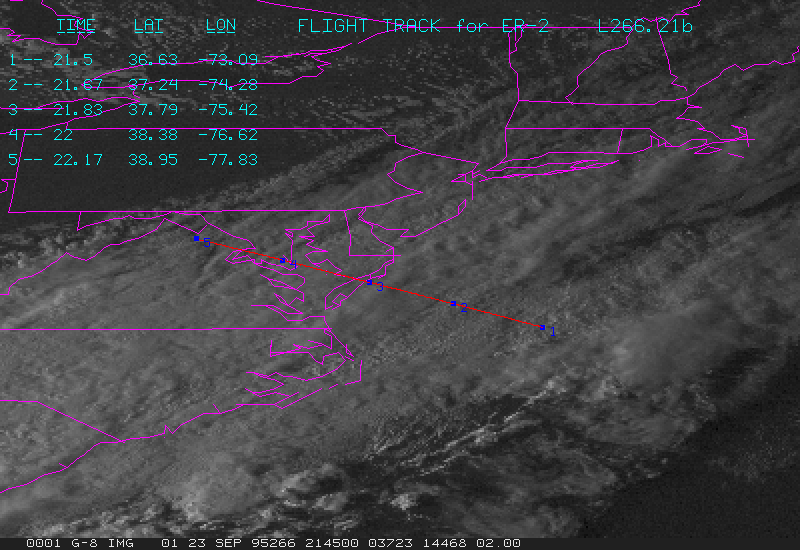
G08-266.21b.gif contains GOES data at 2145Z, and flight track from 2130Z to 2210Z.
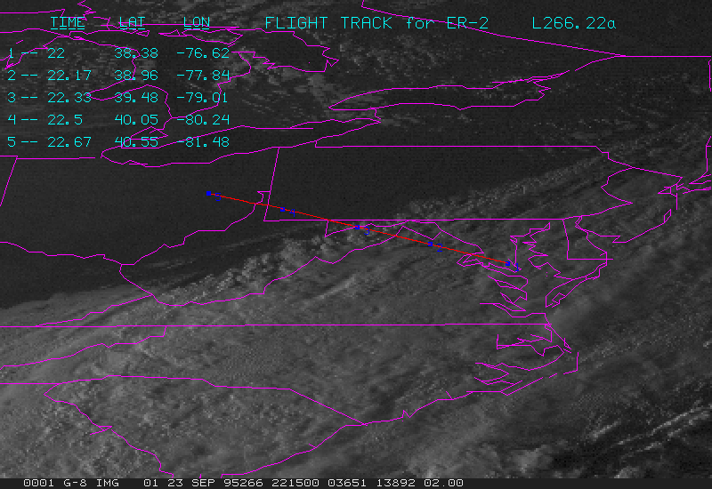
G08-266.22a.gif contains GOES data at 2215Z, and flight track from 2200Z to 2240Z.
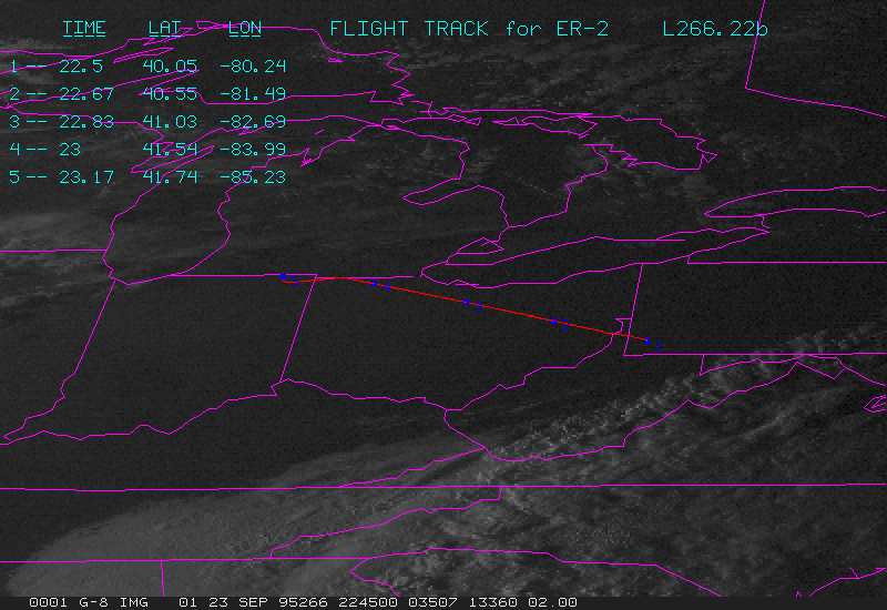
G08-266.22b.gif contains GOES data at 2245Z, and flight track from 2230Z to 2310Z.
G08-266.23a.gif contains GOES data at 2315Z, and flight track from 2300Z to 2340Z.
G08-266.23b.gif contains GOES data at 2345Z, and flight track from 2330Z to 0010Z.
G08-267.00a.gif contains GOES data at 0015Z, and flight track from 0000Z to 0040Z.
G08-267.00b.gif contains GOES data at 0045Z, and flight track from 0030Z to 0110Z.
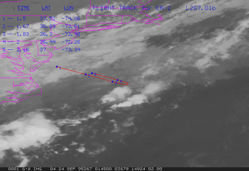
G08-267.01a.gif contains GOES data at 0115Z, and flight track from 0100Z to 0140Z.
G08-267.01b.gif contains GOES data at 0145Z, and flight track from 0130Z to 0210Z.
Flight 9
G09-268.17b.gif contains GOES data at 1745Z, and flight track from 1730Z to 1810Z.
G09-268.18a.gif contains GOES data at 1815Z, and flight track from 1800Z to 1840Z.
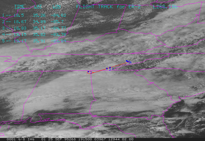
G09-268.18b.gif contains GOES data at 1845Z, and flight track from 1830Z to 1910Z.
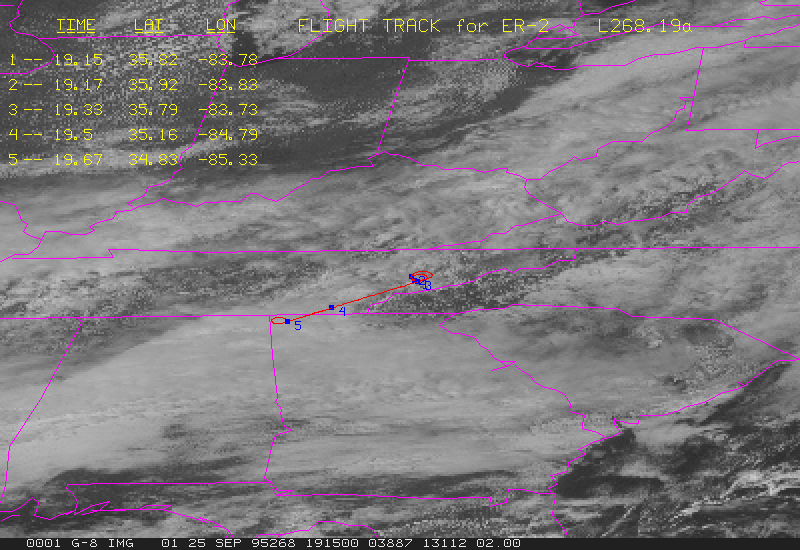
G09-268.19a.gif contains GOES data at 1915Z, and flight track from 1900Z to 1940Z.
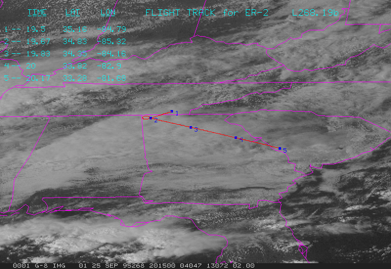
G09-268.19b.gif contains GOES data at 1945Z, and flight track from 1930Z to 2010Z.
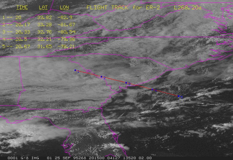
G09-268.20a.gif contains GOES data at 2015Z, and flight track from 2000Z to 2040Z.
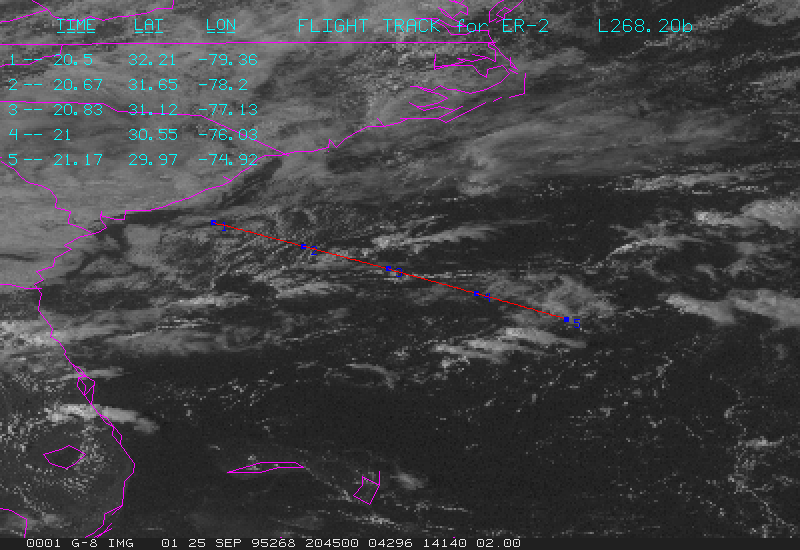
G09-268.20b.gif contains GOES data at 2045Z, and flight track from 2030Z to 2110Z.
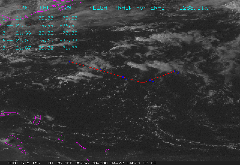
G09-268.21a.gif contains GOES data at 2115Z, and flight track from 2100Z to 2140Z.
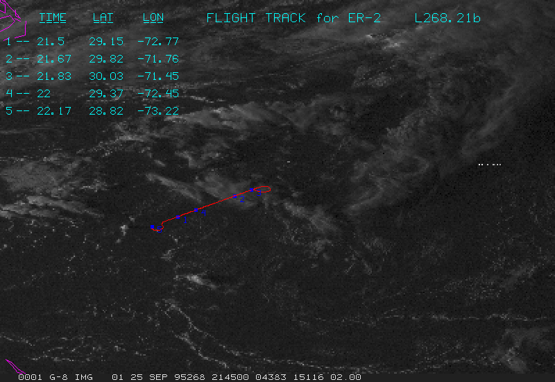
G09-268.21b.gif contains GOES data at 2145Z, and flight track from 2130Z to 2210Z.
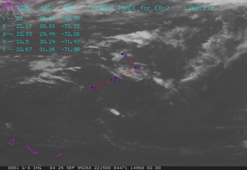
G09-268.22a.gif contains GOES data at 2215Z, and flight track from 2200Z to 2240Z.
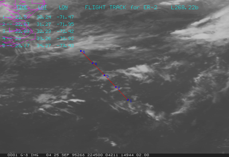
G09-268.22b.gif contains GOES data at 2245Z, and flight track from 2230Z to 2310Z.
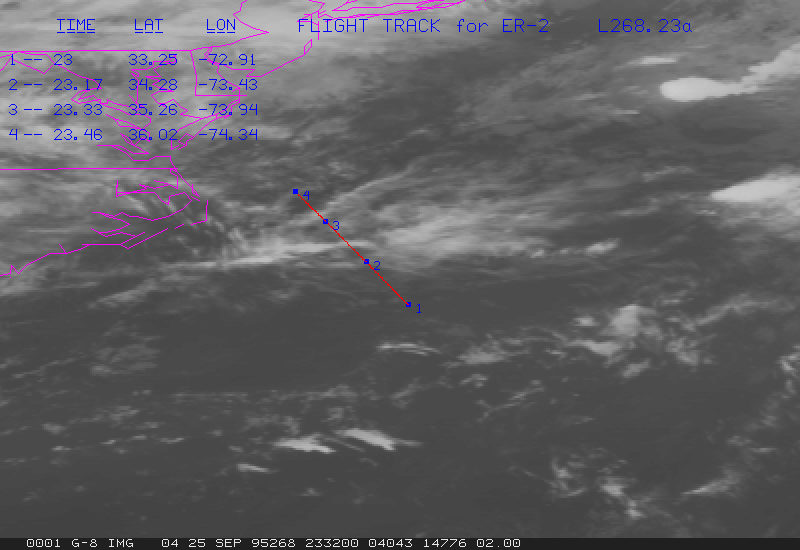
G09-268.23a.gif contains GOES data at 2315Z, and flight track from 2300Z to 2340Z.
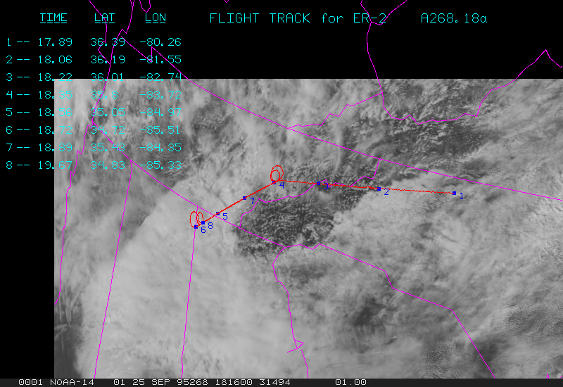
A09-268.18a.gif contains AVHRR data at 1816Z, and flight track from 1755Z to 1940Z.
Flight 10
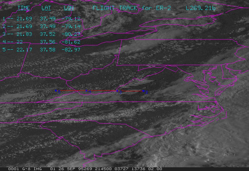
G10-269.21b.gif contains GOES data at 2145Z, and flight track from 2130Z to 2210Z.
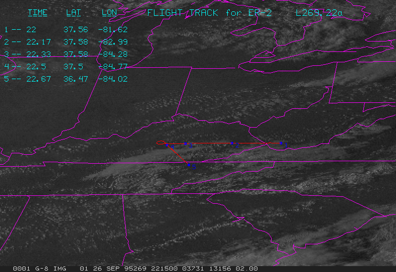
G10-269.22a.gif contains GOES data at 2215Z, and flight track from 2200Z to 2240Z.
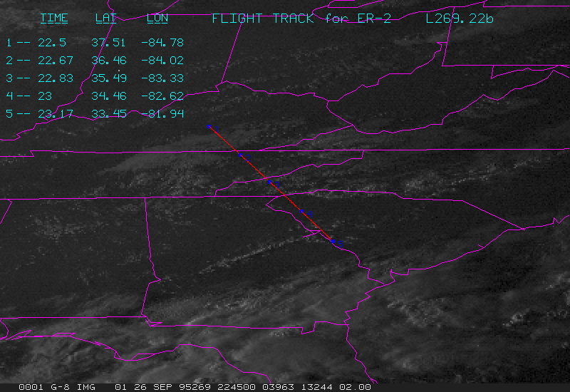
G10-269.22b.gif contains GOES data at 2245Z, and flight track from 2230Z to 2310Z.
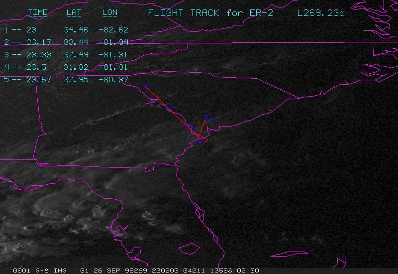
G10-269.23a.gif contains GOES data at 2315Z, and flight track from 2300Z to 2340Z.
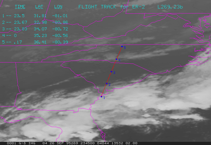
G10-269.23b.gif contains GOES data at 2345Z, and flight track from 2330Z to 0010Z.
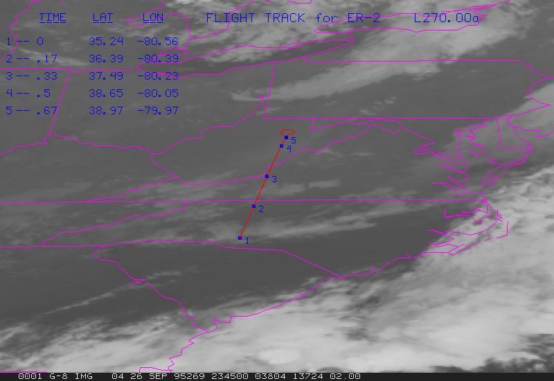
G10-270.00a.gif contains GOES data at 0015Z, and flight track from 0000Z to 0040Z.
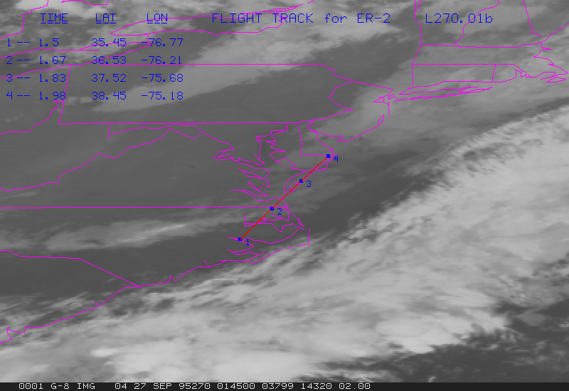
G10-270.01a.gif contains GOES data at 0115Z, and flight track from 0100Z to 0140Z.
G10-270.01b.gif contains GOES data at 0145Z, and flight track from 0130Z to 0210Z.
Return to LIDAR Applications Group Home Page
