
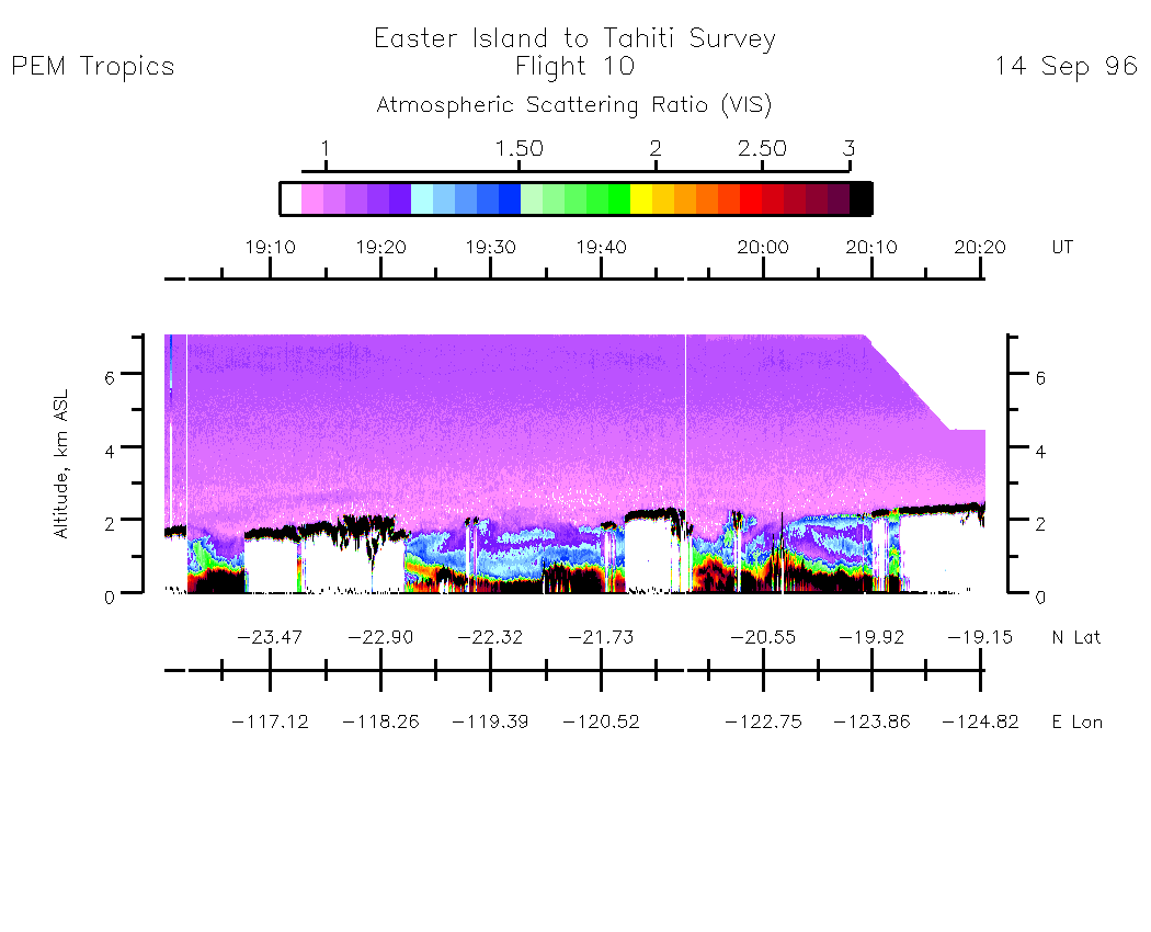
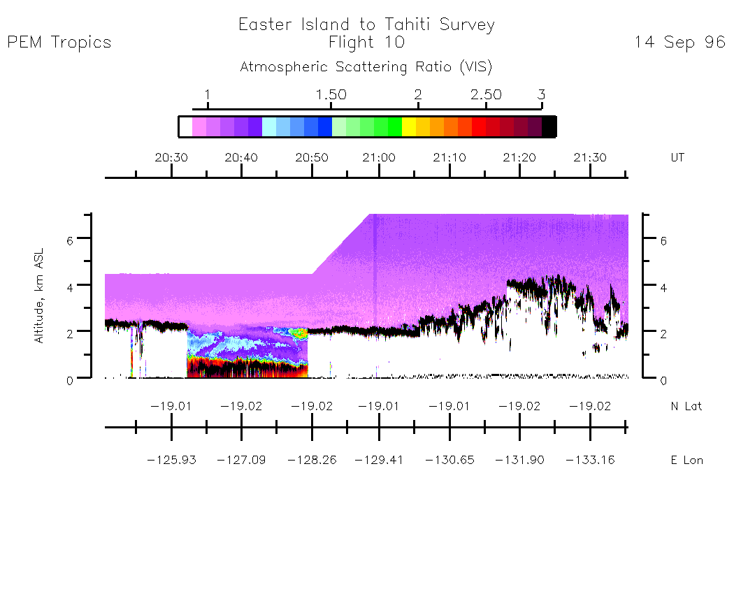
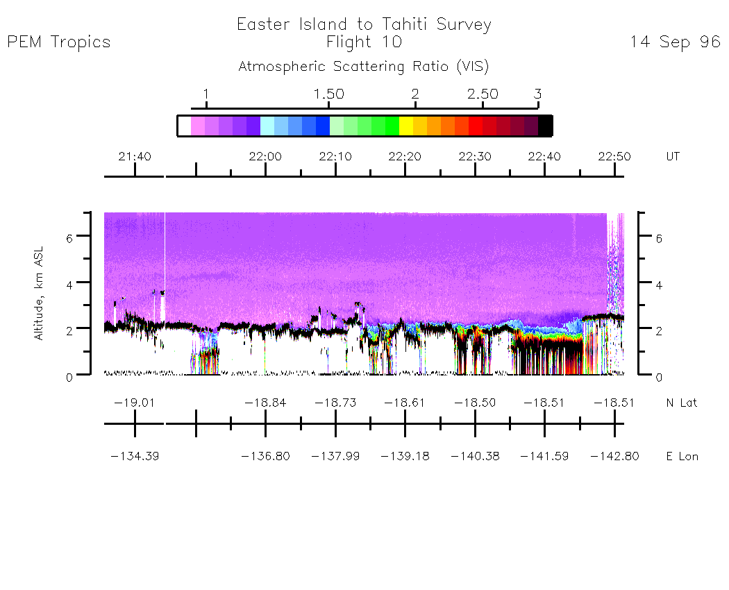
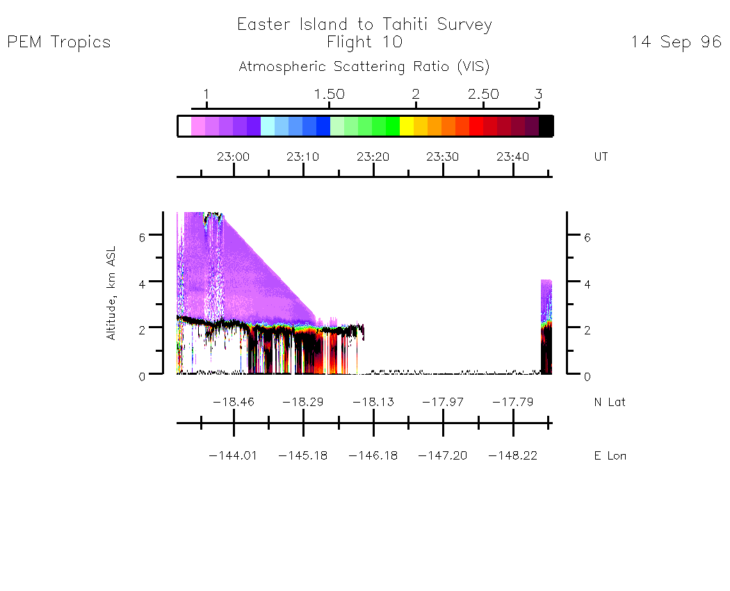
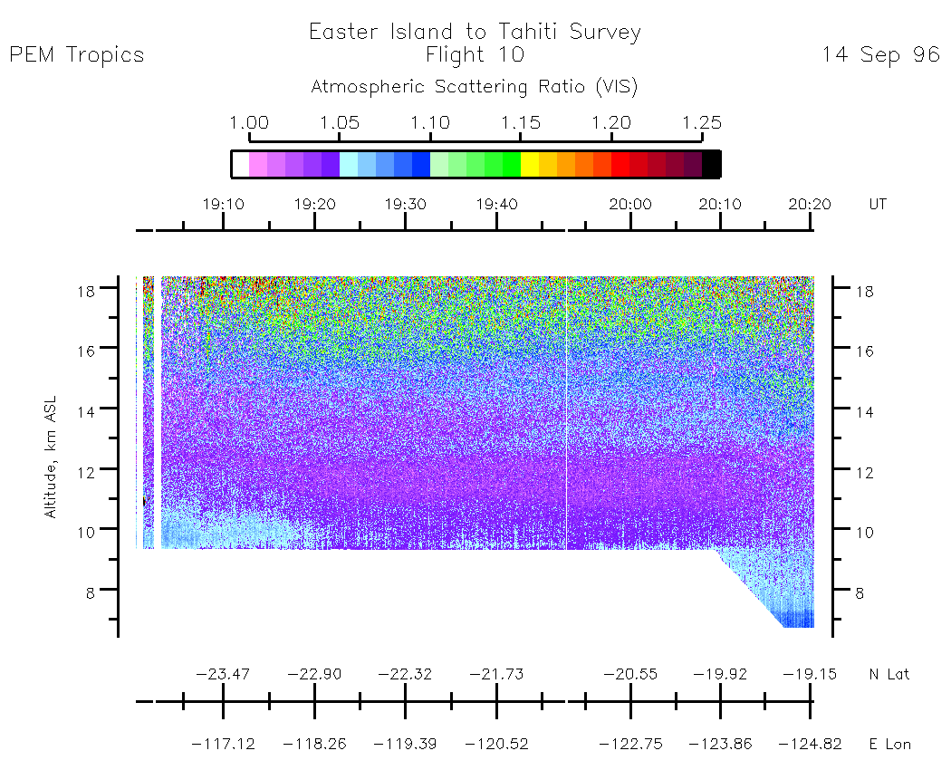
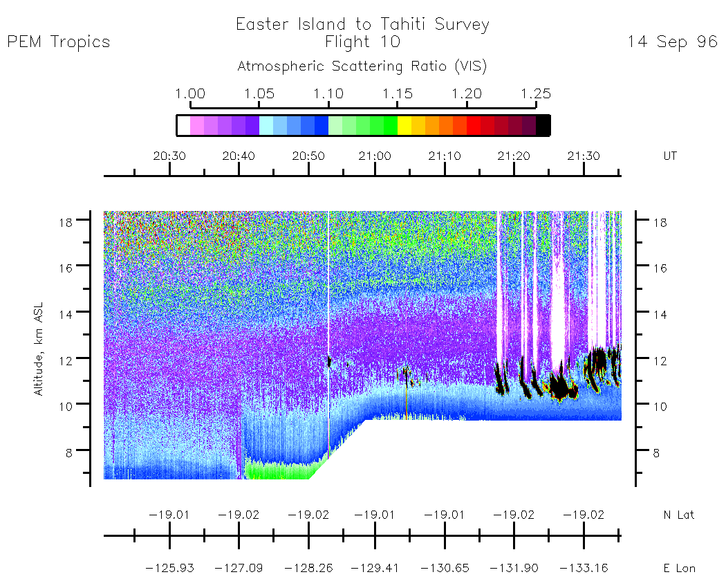
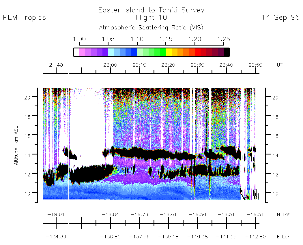
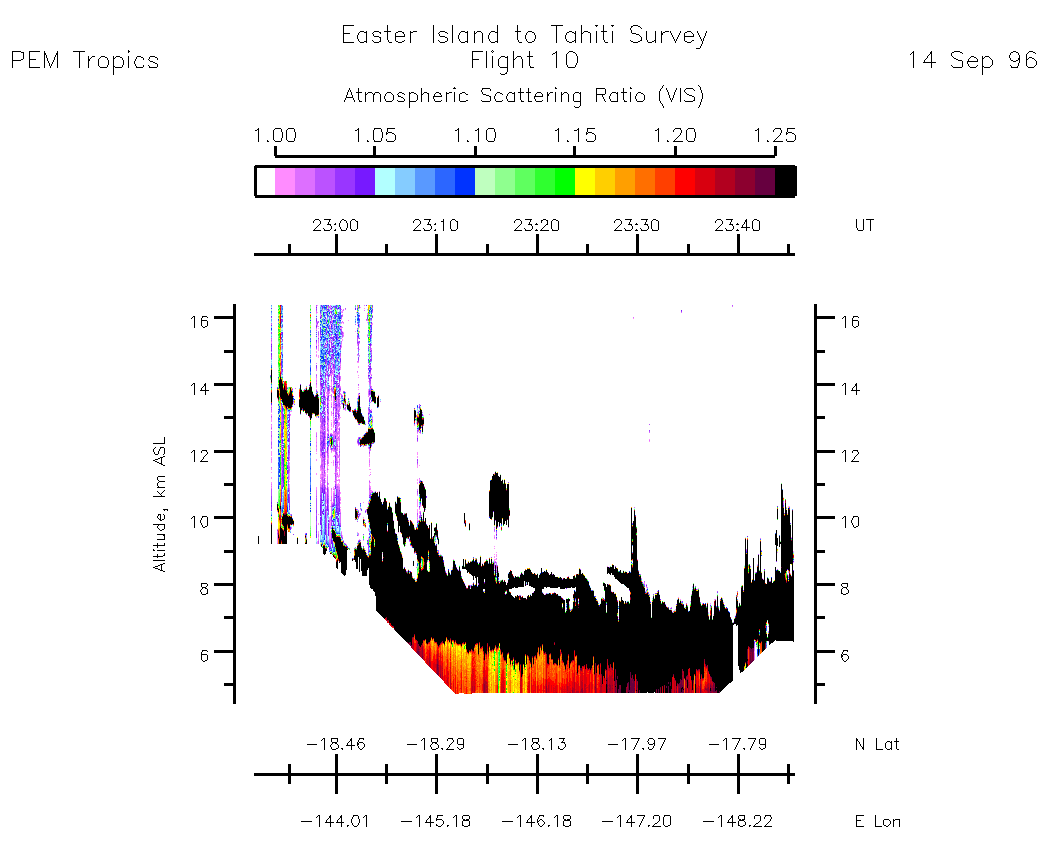
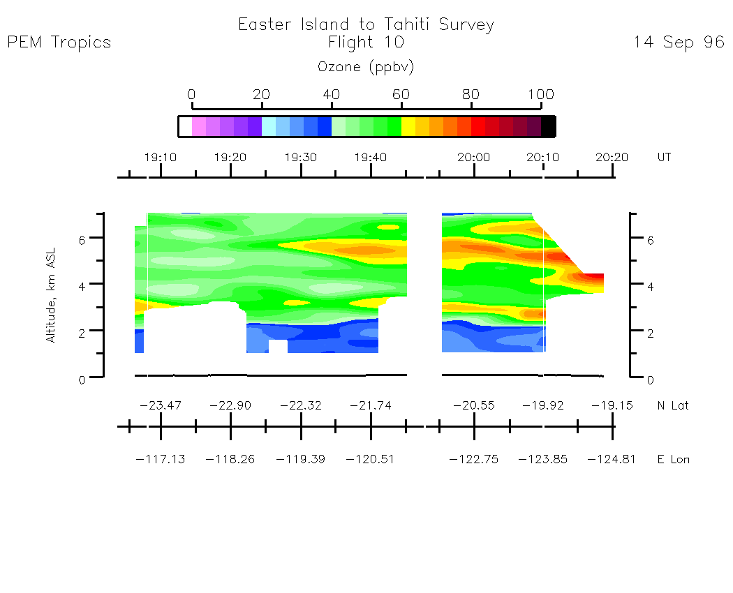
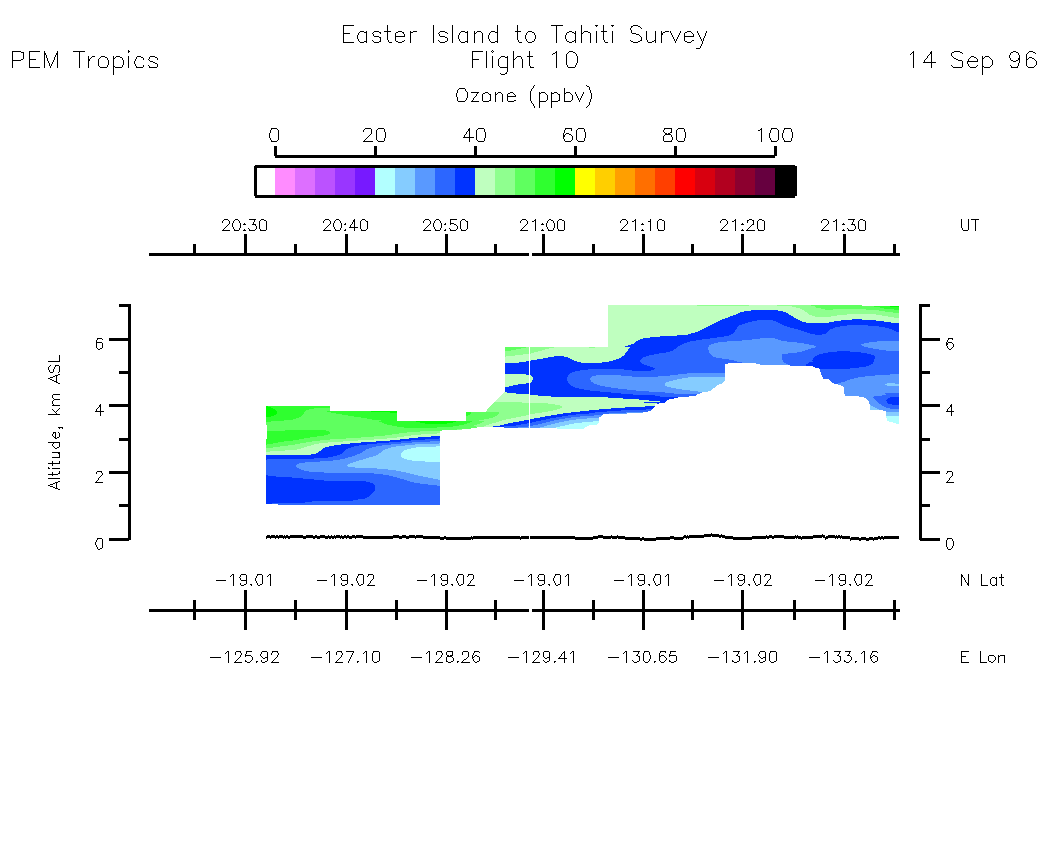
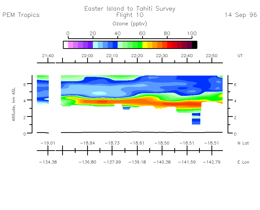
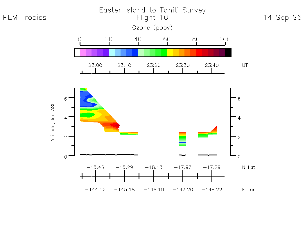
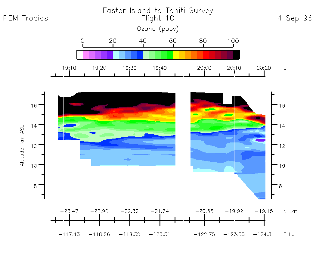
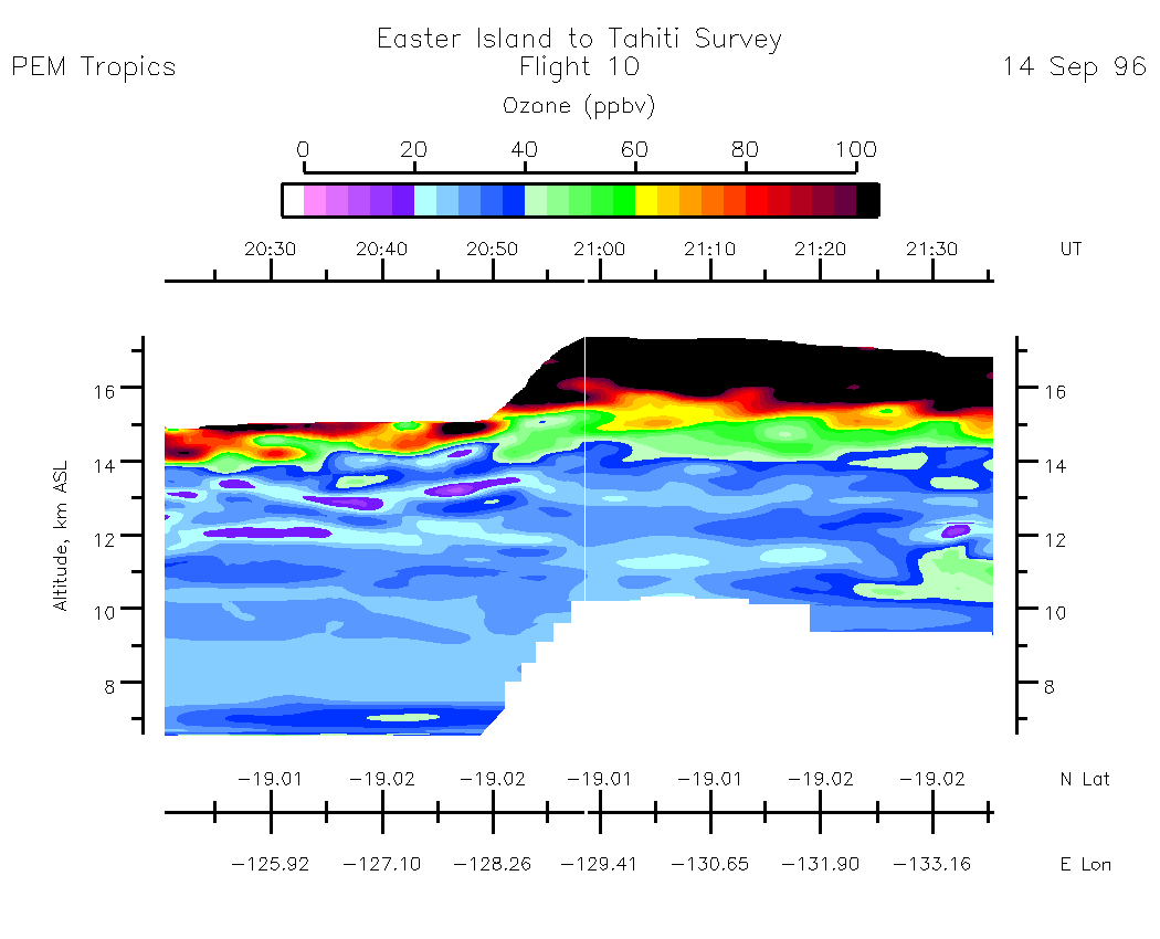
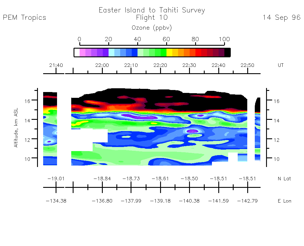
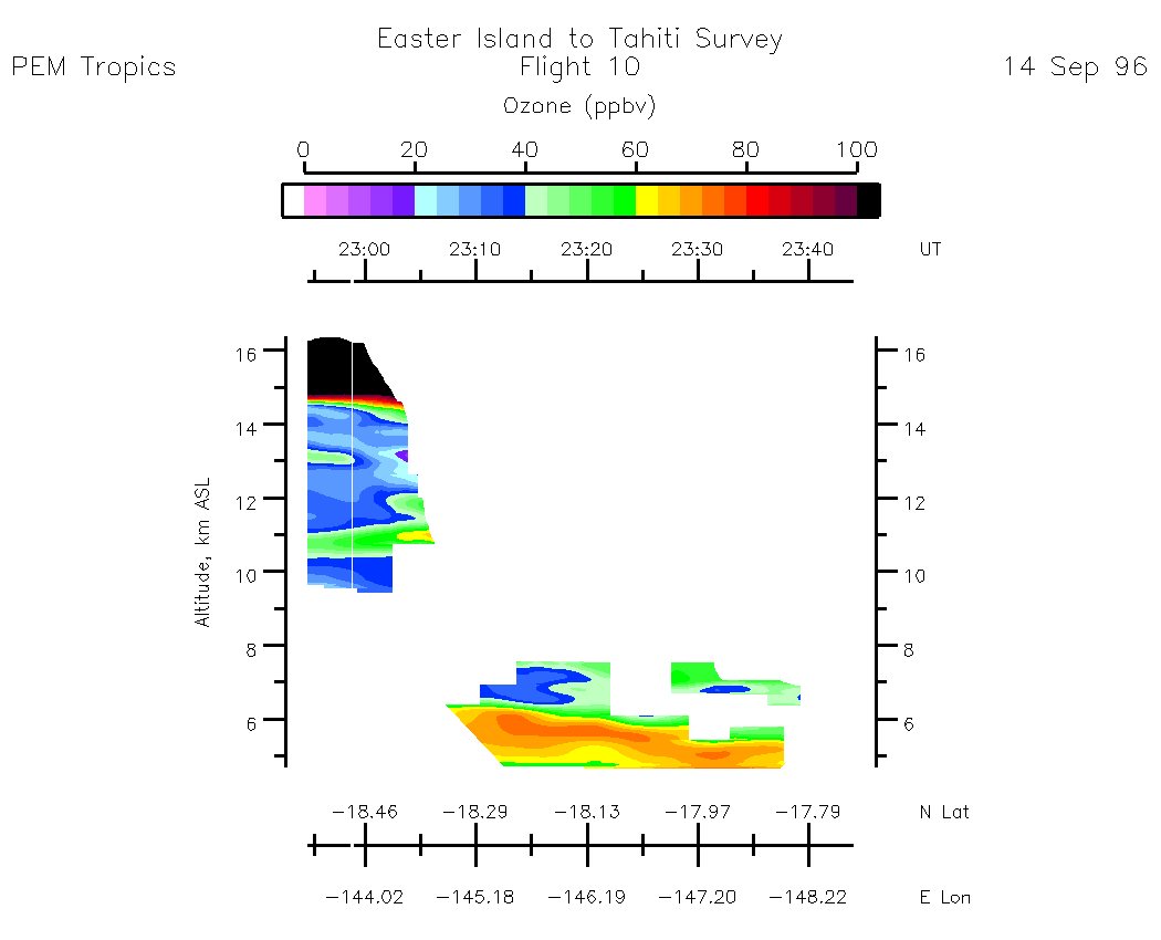
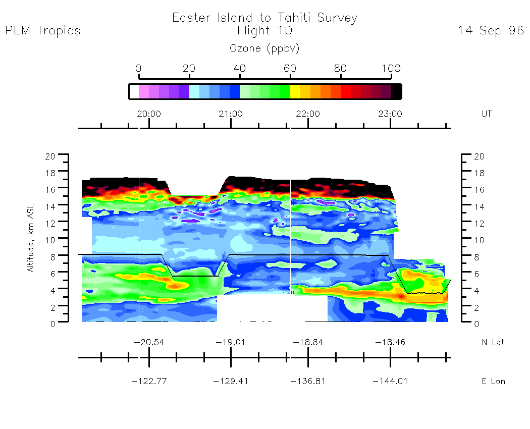
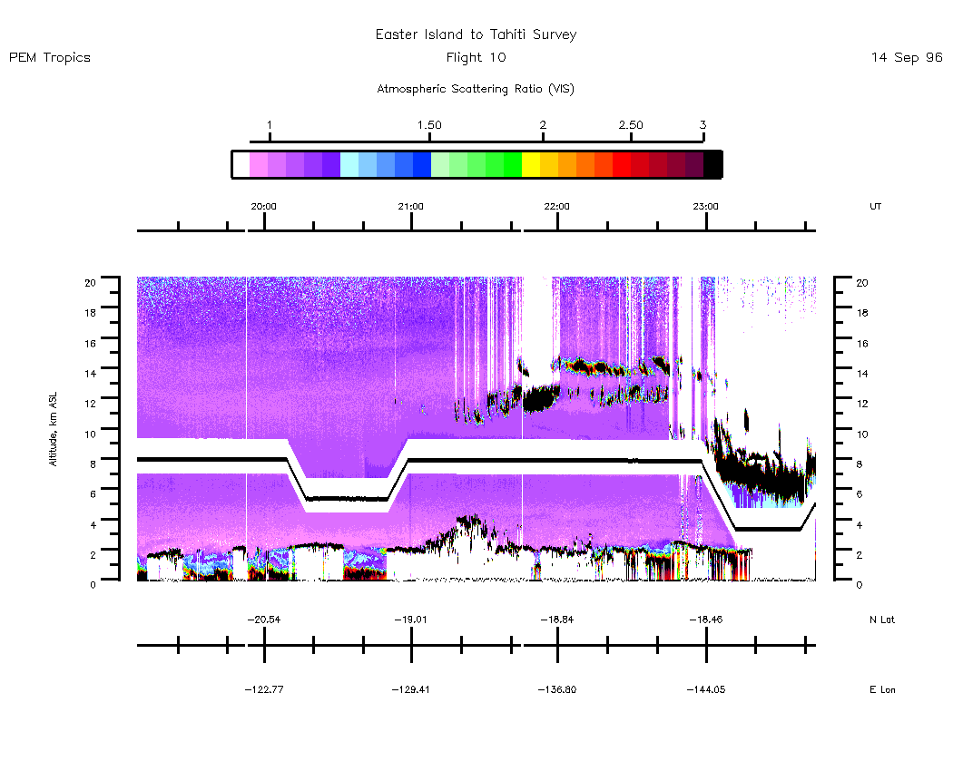
Flight 10 / Easter Island to Tahiti : Survey / 14 Sept. 96
Nadir Aerosol - (Atmospheric Scattering Ratio)
18:52:52 - 20:20:31
| 20:20:37 - 21:35:33
| 21:35:37 - 22:51:28
| 22:51:34 - 23:45:44
| movie_loop_all |
Zenith Aerosol - (Atmospheric Scattering Ratio)
18:52:52 - 20:20:31
| 20:20:37 - 21:35:33
| 21:35:39 - 22:51:28
| 22:51:34 - 23:45:44
| movie_loop_all |
Nadir Ozone Mixing Ratio
19:03:17 - 20:20:30
| 20:20:35 - 21:35:32
| 21:35:37 - 22:54:24
| 22:54:29 - 23:44:17
| movie_loop_all |
Zenith Ozone Mixing Ratio
19:03:17 - 20:20:30
| 20:20:35 - 21:35:32
| 21:35:37 - 22:54:24
| 22:54:29 - 23:44:17
| movie_loop_all |
Composite Tropospheric Ozone Cross-Sections --- (Note: Blackline depicts aircraft altitude) Composite Aerosol Cross-Sections --- (Note: Blackline depicts aircraft altitude)
Ozone Column Amounts and Tropopause Altitude
Information Regarding PEM-Tropics DIAL/In-Situ Ozone Profile Intercomparisons
There are no ozone profile intercomparisons for this flight.