
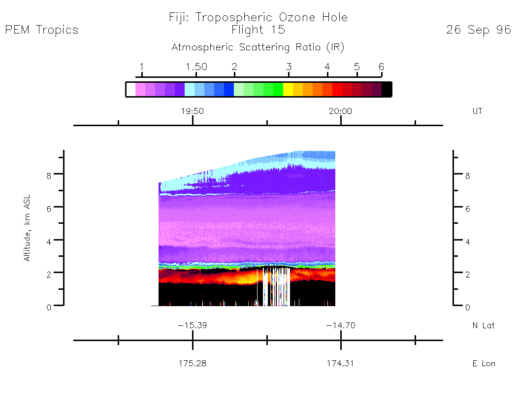
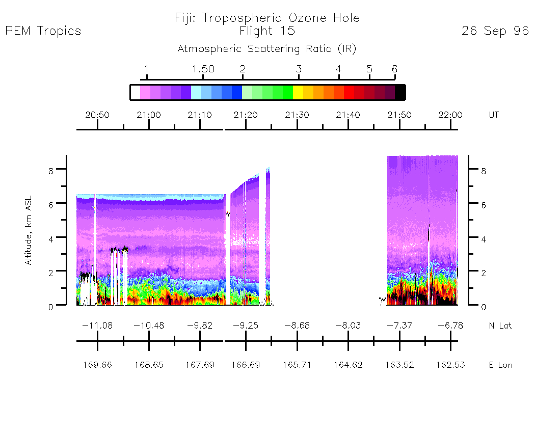
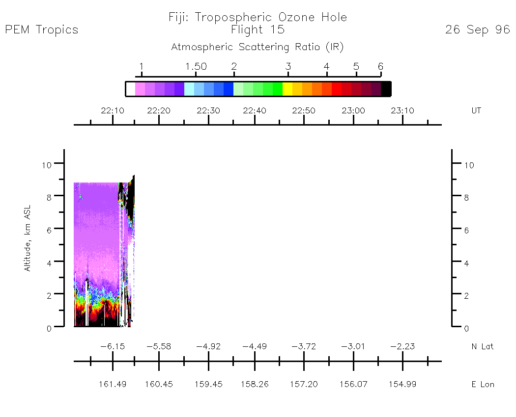
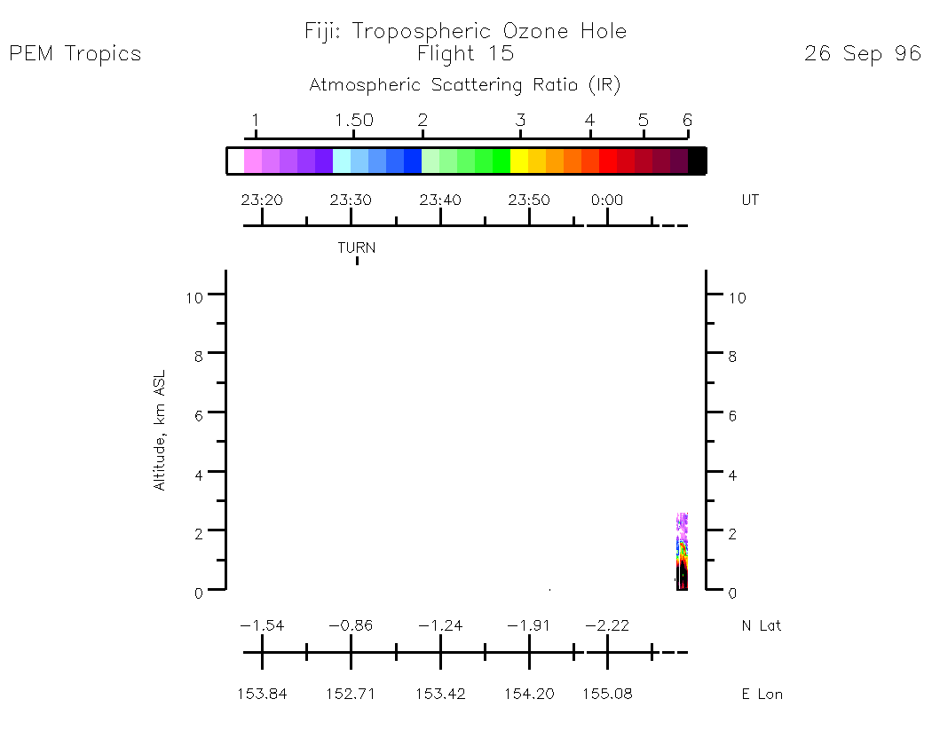
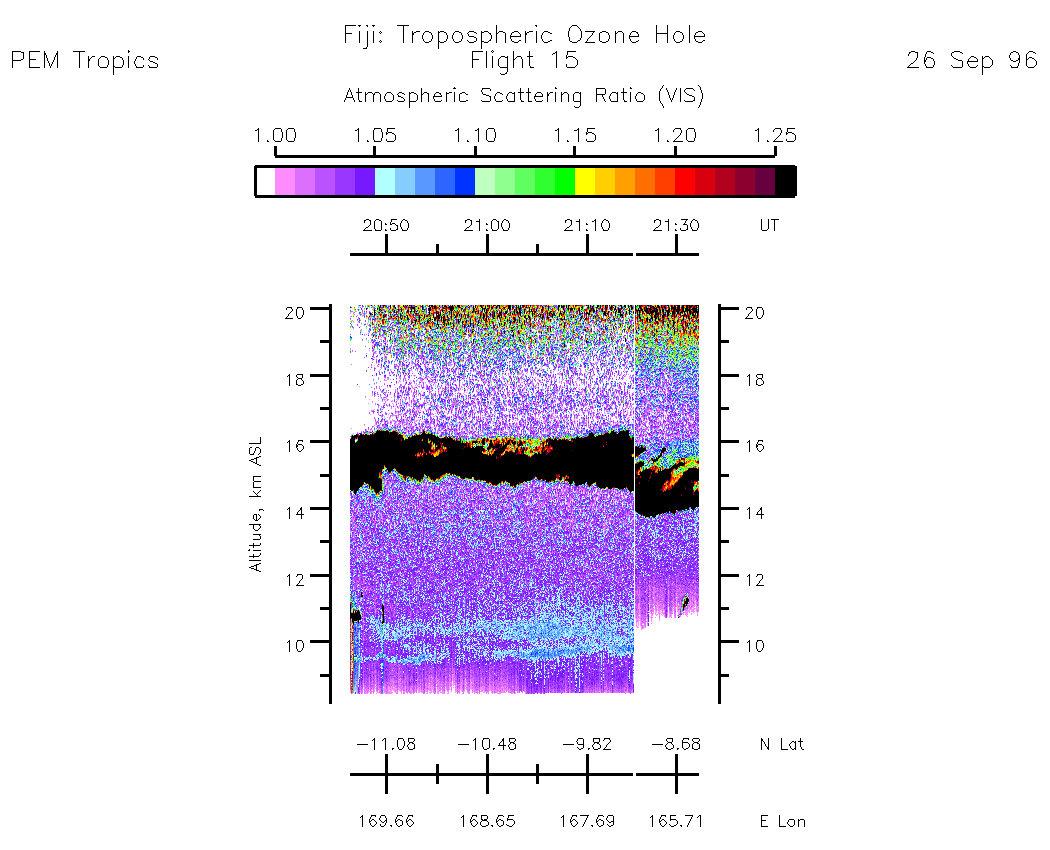
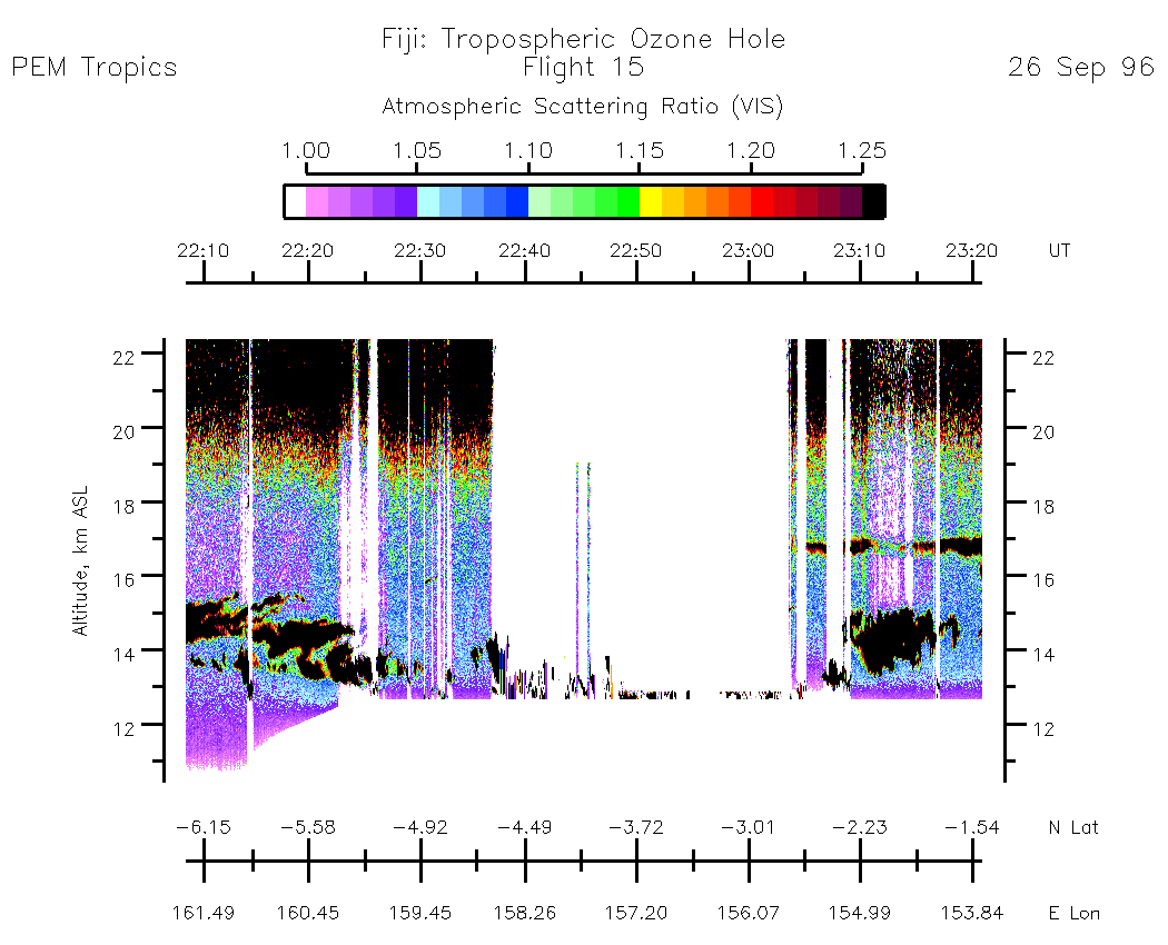
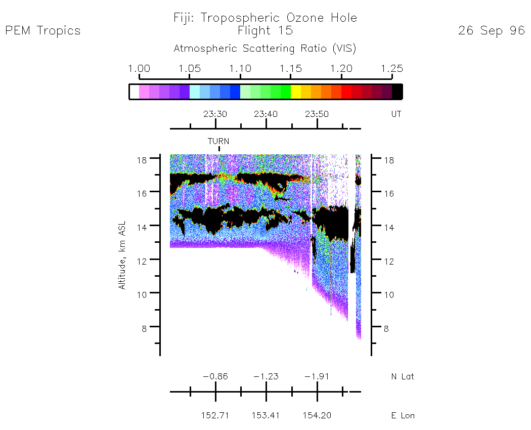
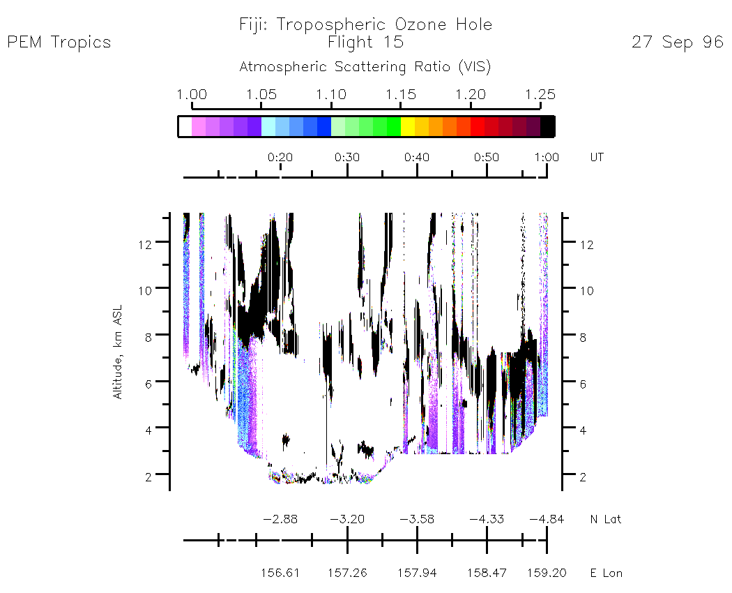
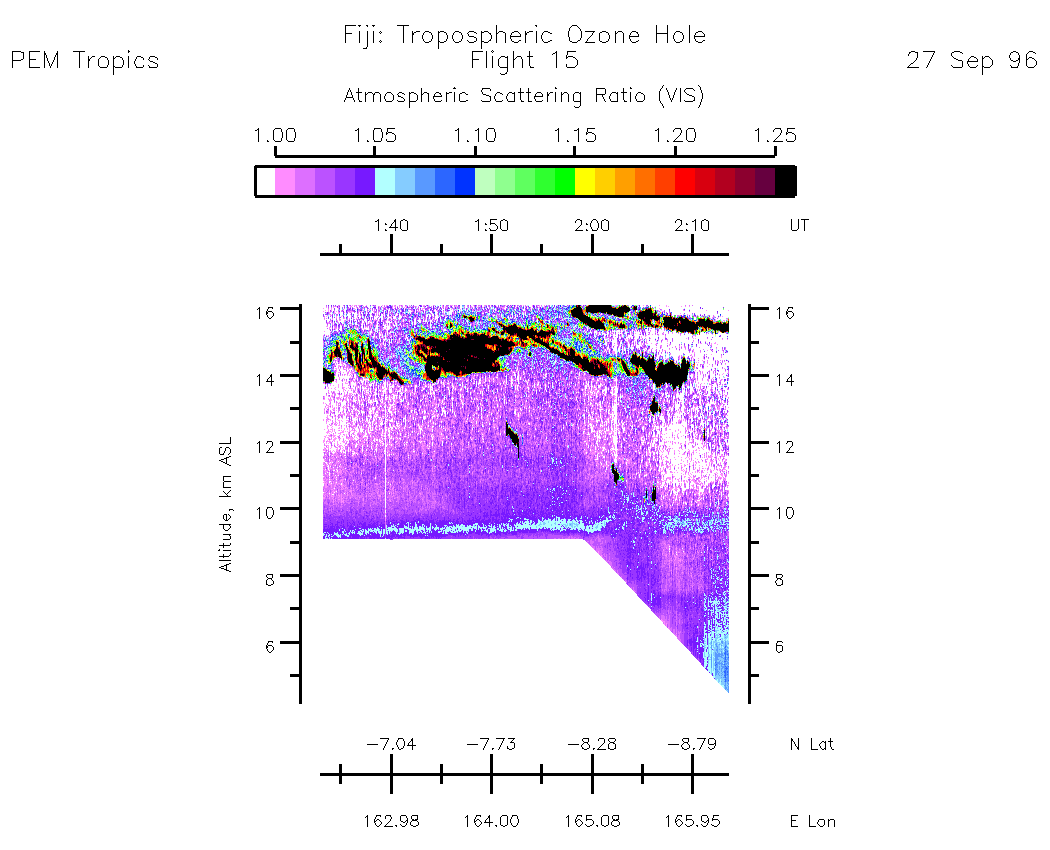
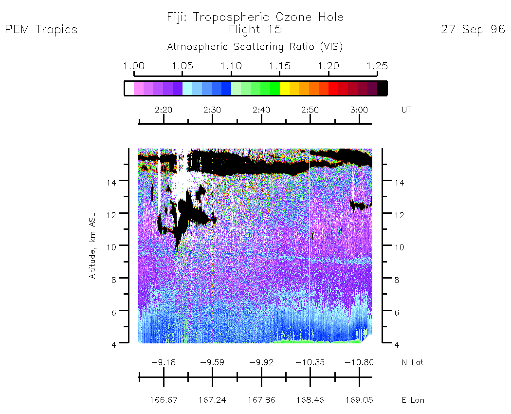
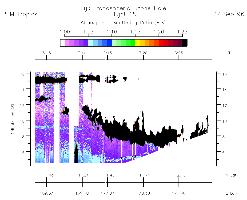
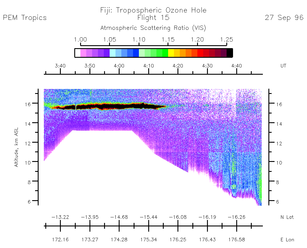
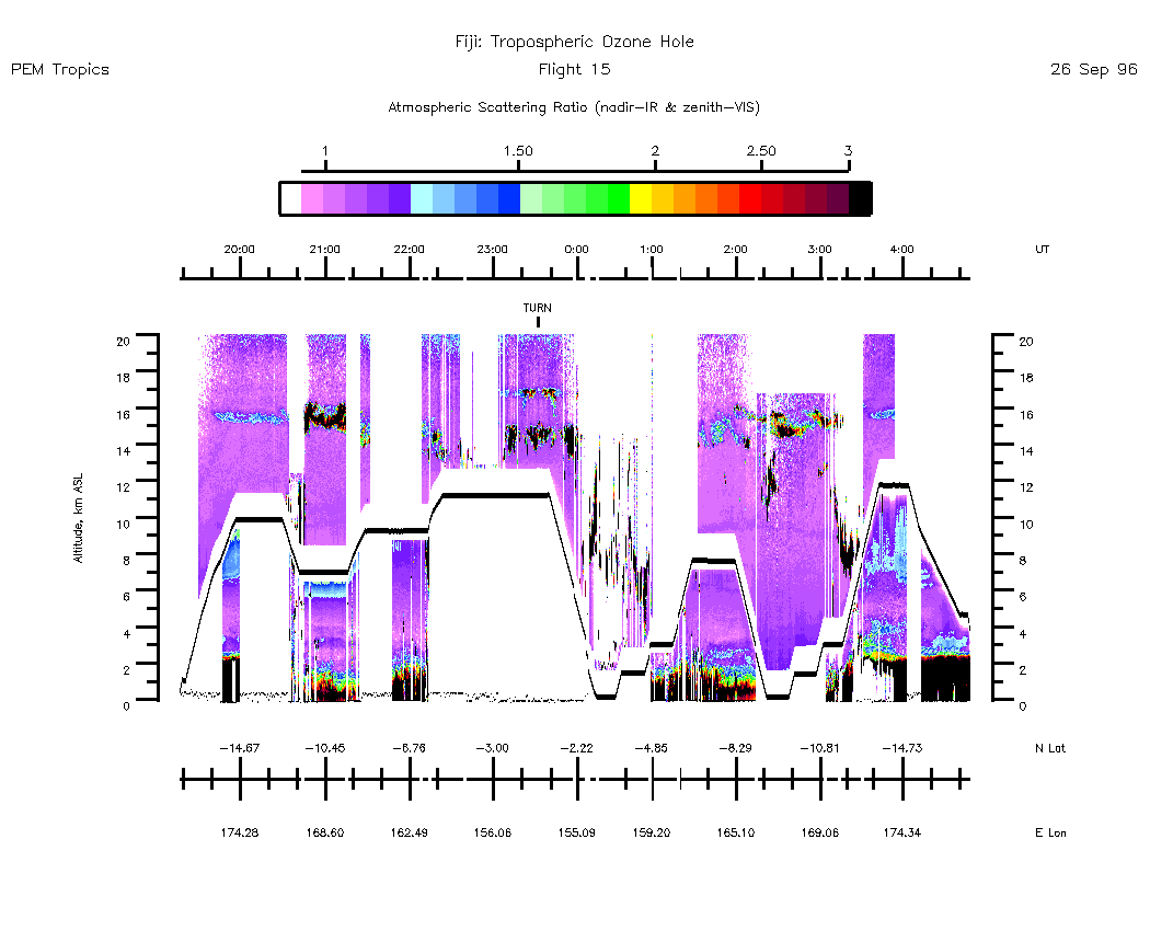
Flight 15 / Fiji : Tropospheric Ozone Hole / 26-27 Sept. 96
Nadir Aerosol - (Atmospheric Scattering Ratio)
19:30:42 - 20:45:59
| 20:45:56 - 22:01:32
| 22:01:38 - 23:17:58
| 23:17:58 - 00:59:55
| 00:58:40 - 02:13:37
| 03:03:25 - 03:34:21
| 03:34:26 - 04:48:38
| movie_loop_all |
Zenith Aerosol - (Atmospheric Scattering Ratio)
19:30:42 - 20:45:59
| 20:46:26 - 21:32:19
| 22:08:26 - 23:20:58
| 23:21:05 - 23:59:56
| 00:00:01 - 01:00:08
| 01:33:00 - 02:13:37
| 02:14:53 - 03:02:40
| 03:03:25 - 03:34:21
| 03:34:26 - 04:48:38
| movie_loop_all |
Nadir Ozone Mixing Ratio
20:45:56 - 22:01:31
| 22:01:36 - 23:17:59
| 23:17:56 - 00:10:00
| 00:58:40 - 02:12:04
| 03:04:59 - 03:34:20
| 03:34:26 - 04:47:36
| movie_loop_all |
Zenith Ozone Mixing Ratio
19:58:00 - 20:32:00
| 20:46:04 - 22:04:38
| 22:04:43 - 23:21:04
| 23:21:09 - 23:59:53
| 00:00:03 - 01:00:05
| 01:33:00 - 02:12:08
| 02:16:21 - 03:02:38
| 03:02:41 - 03:34:18
| 03:34:22 - 04:47:32
| movie_loop_all |
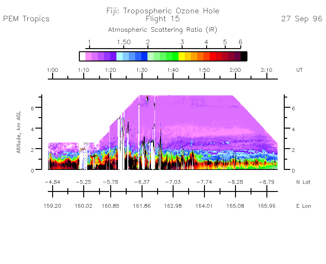
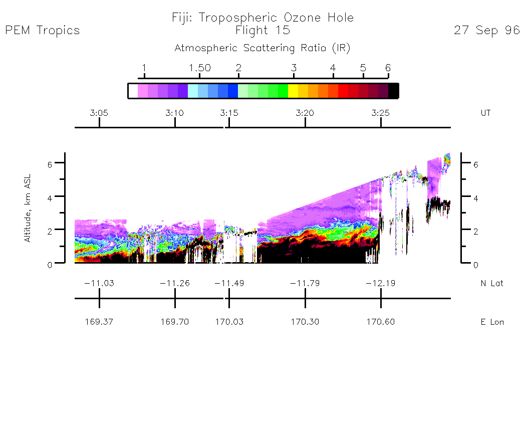
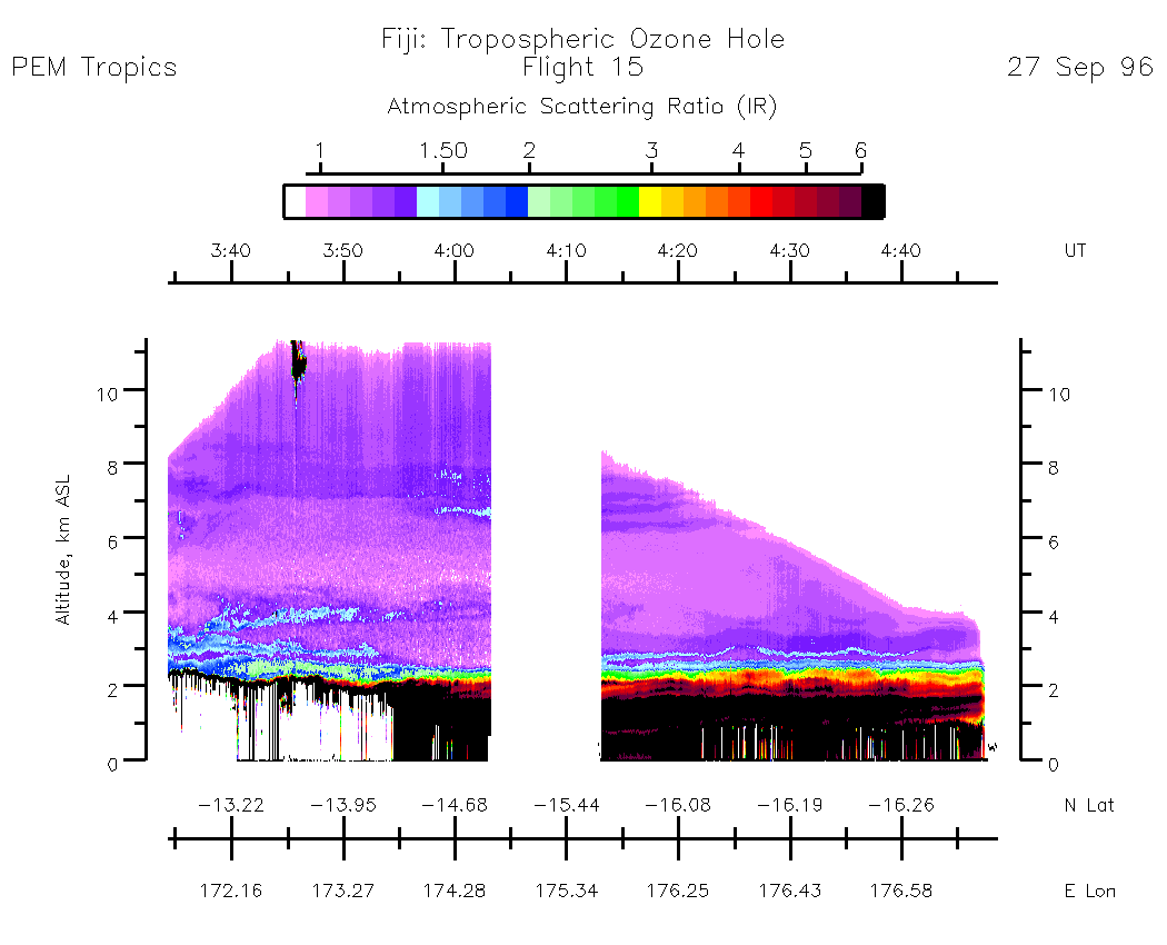
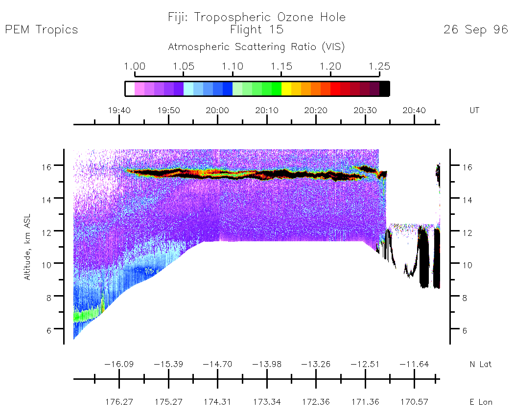
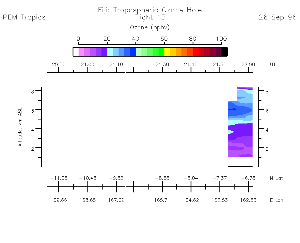
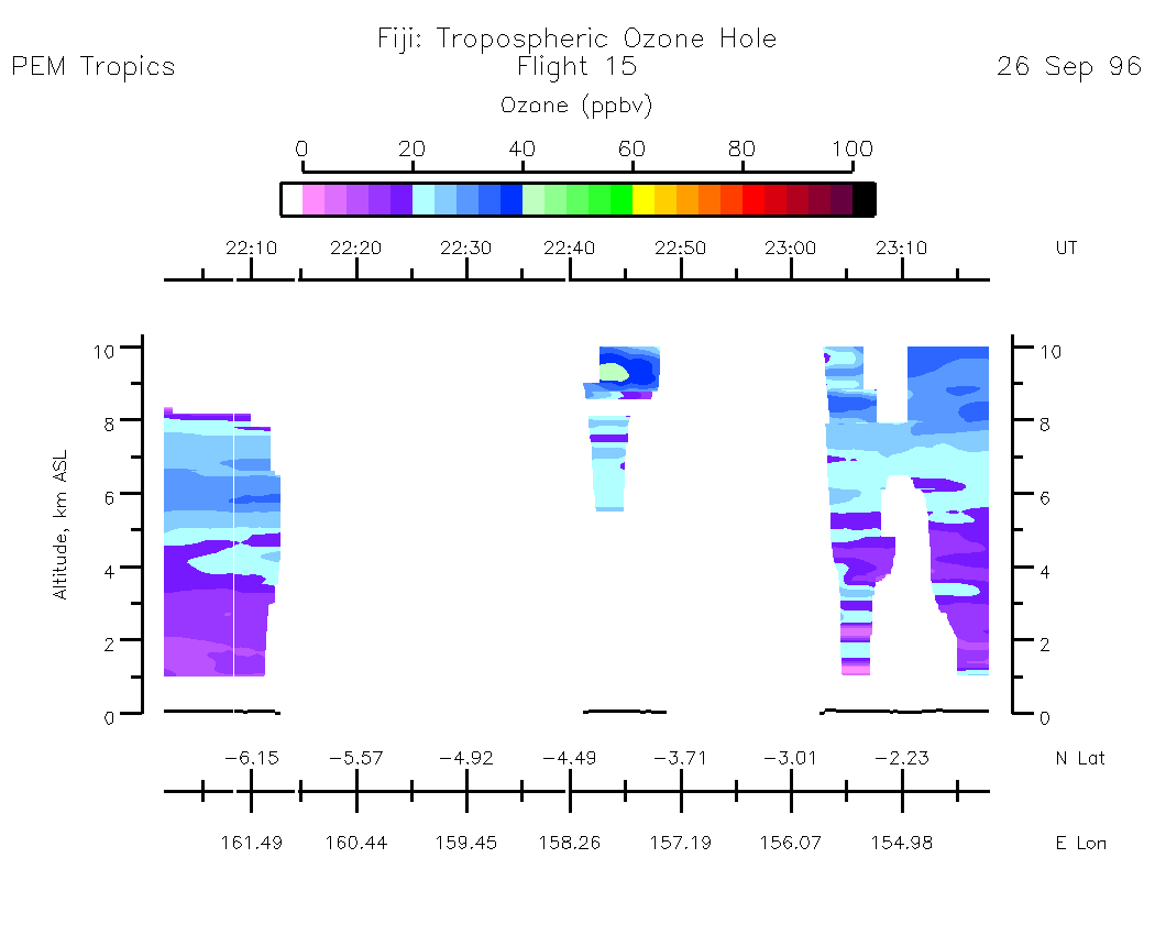
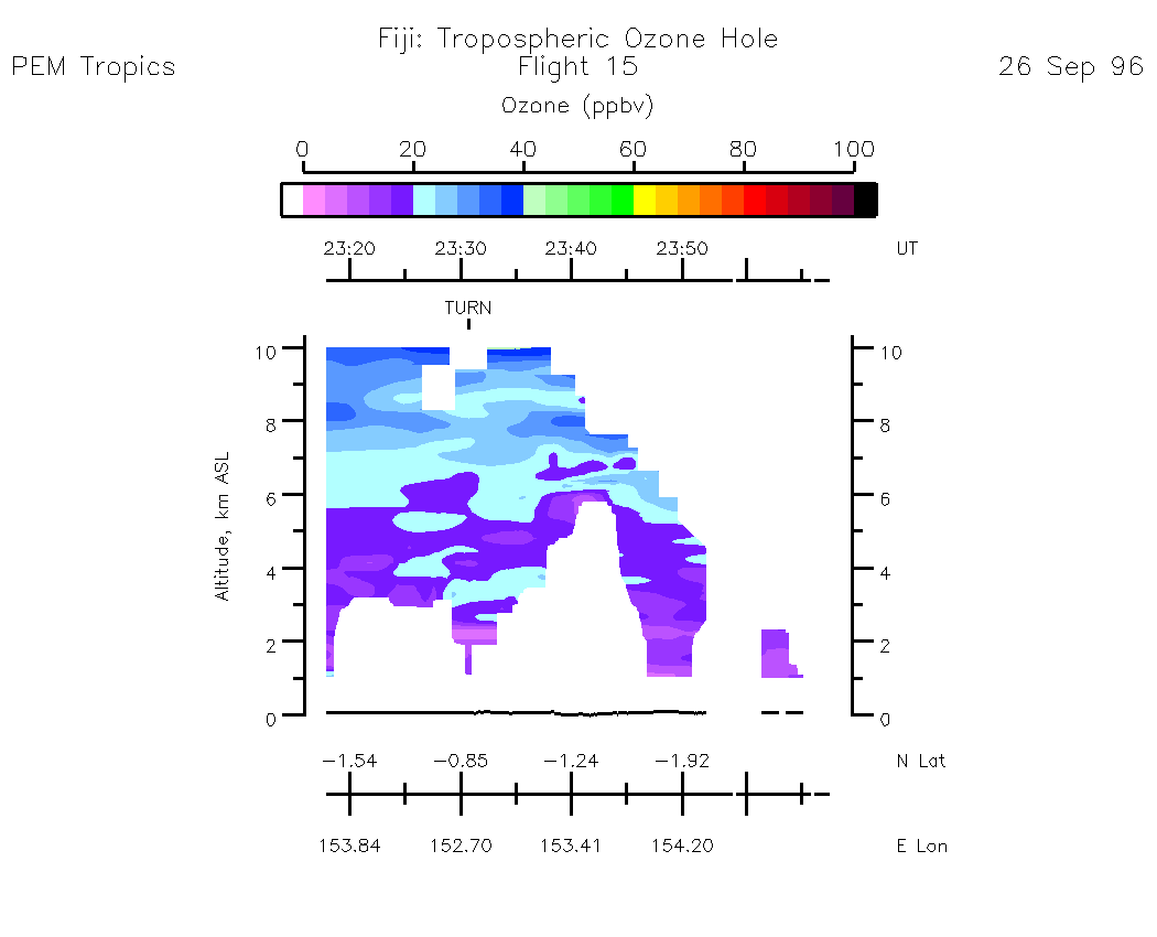
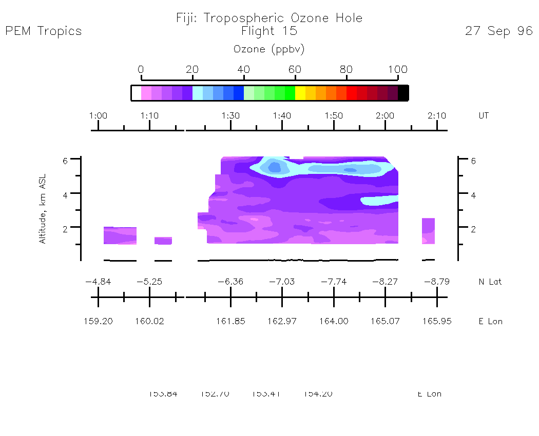
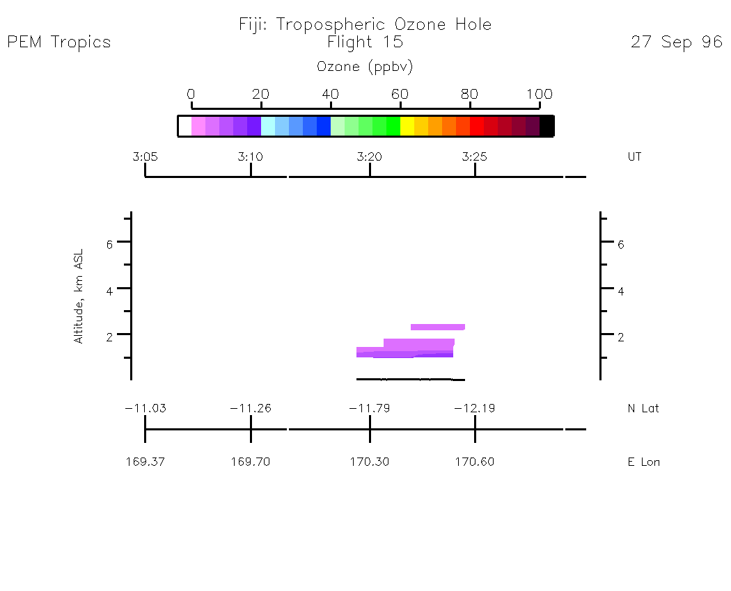
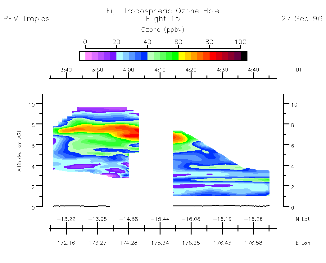
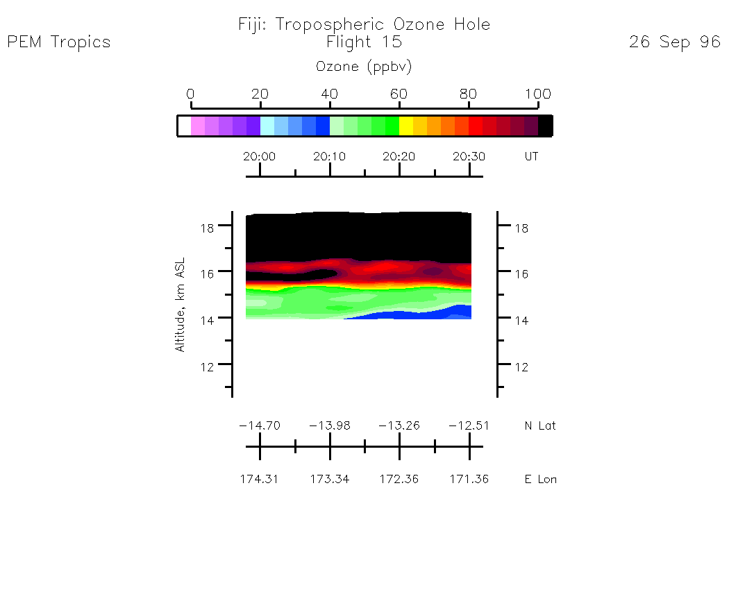
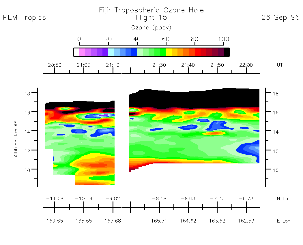
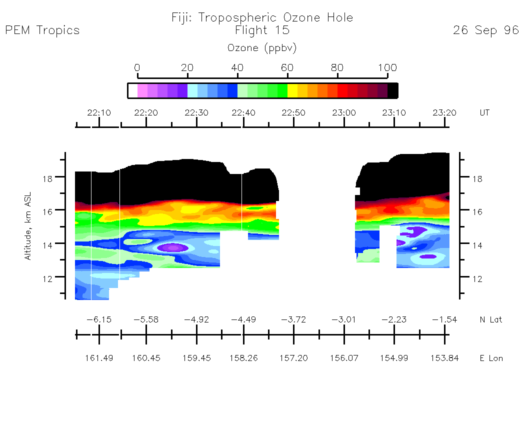
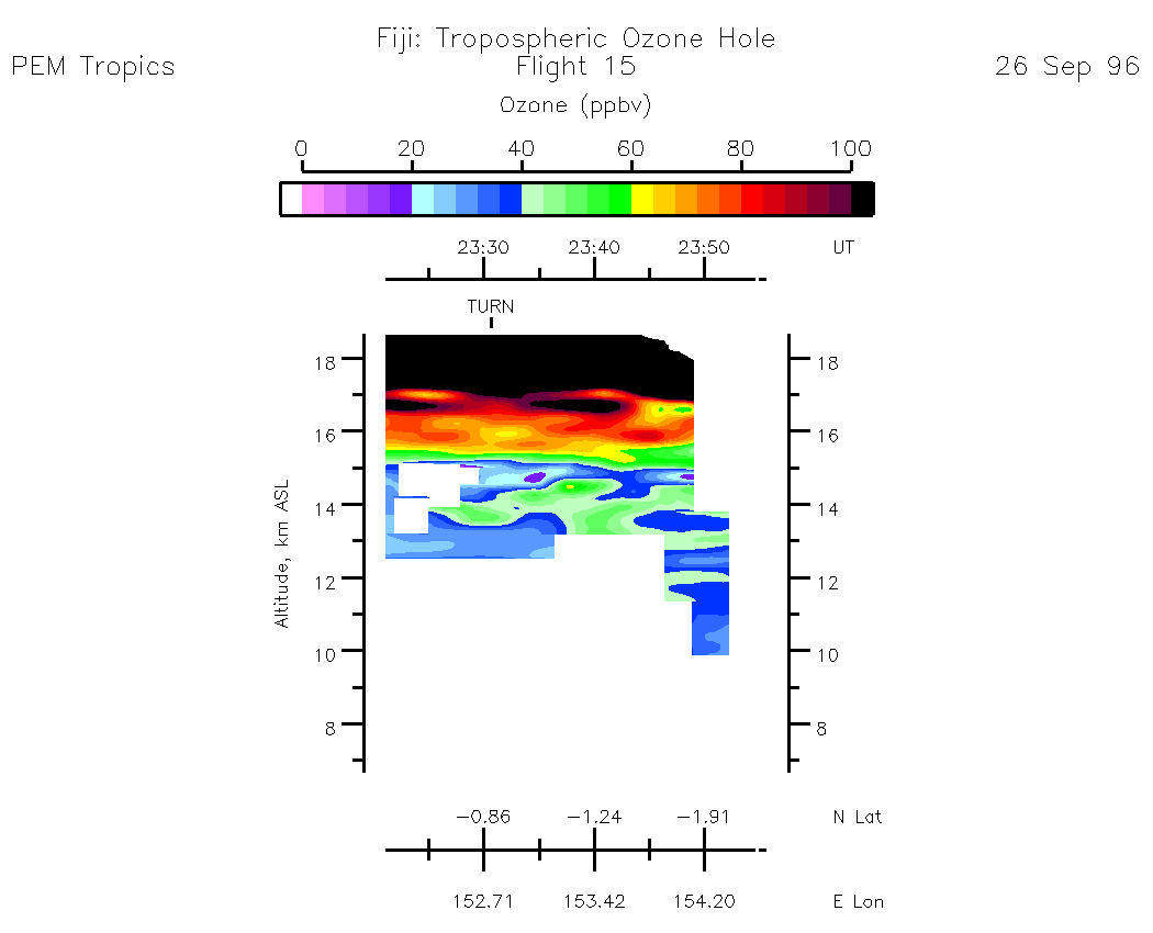
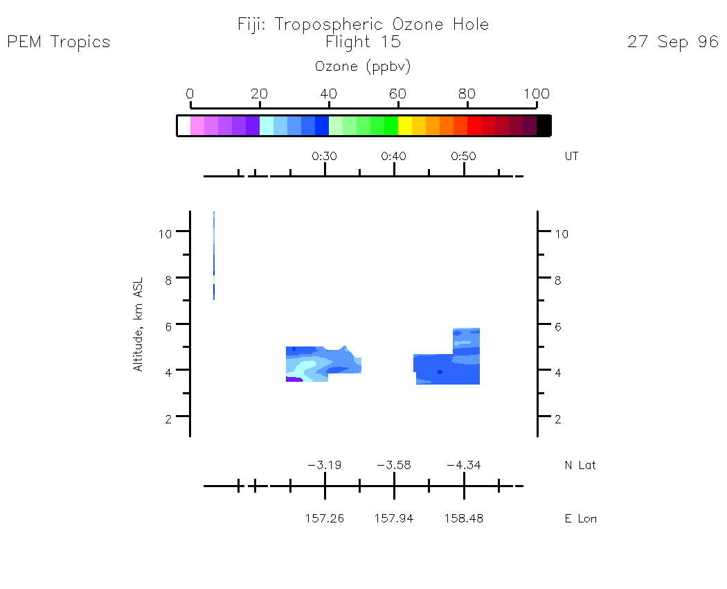
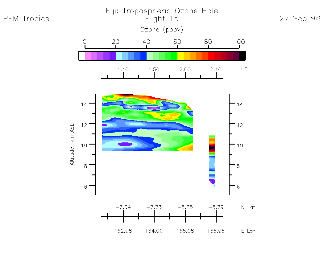
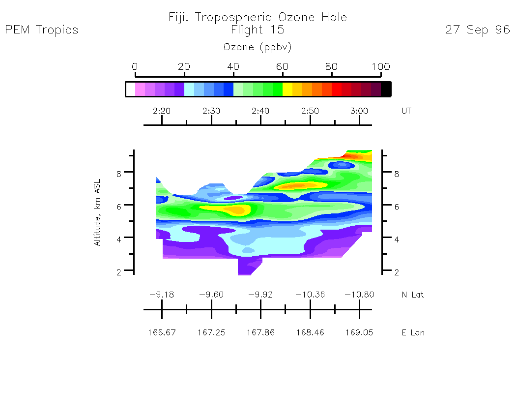
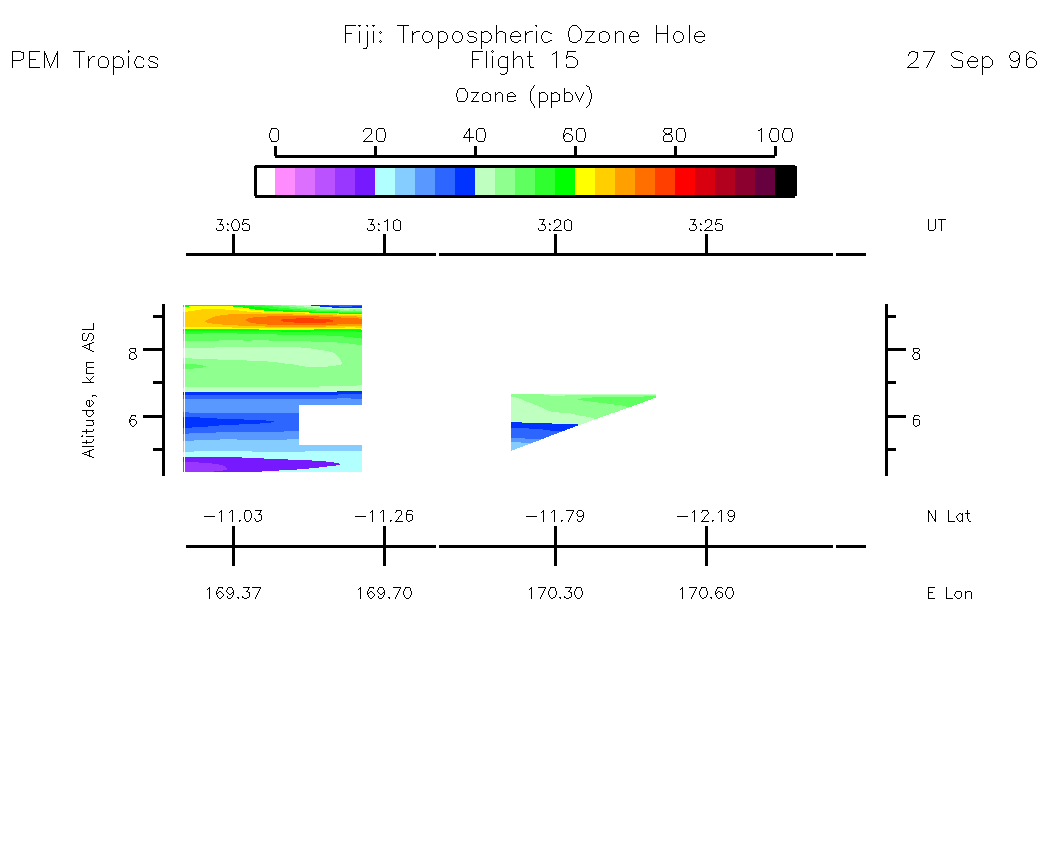
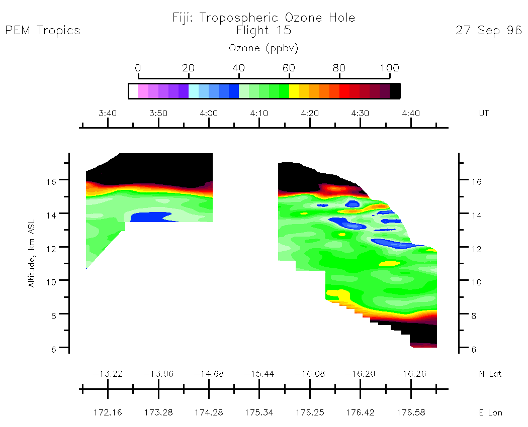
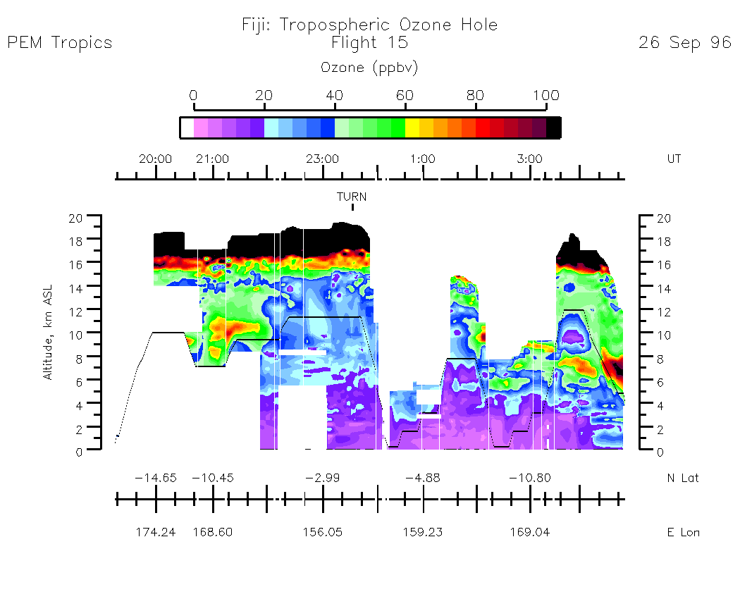
Composite Tropospheric Ozone Cross-Sections --- (Note: Blackline depicts aircraft altitude) Composite Aerosol Cross-Sections --- (Note: Blackline depicts aircraft altitude)
Ozone Column Amounts and Tropopause Altitude
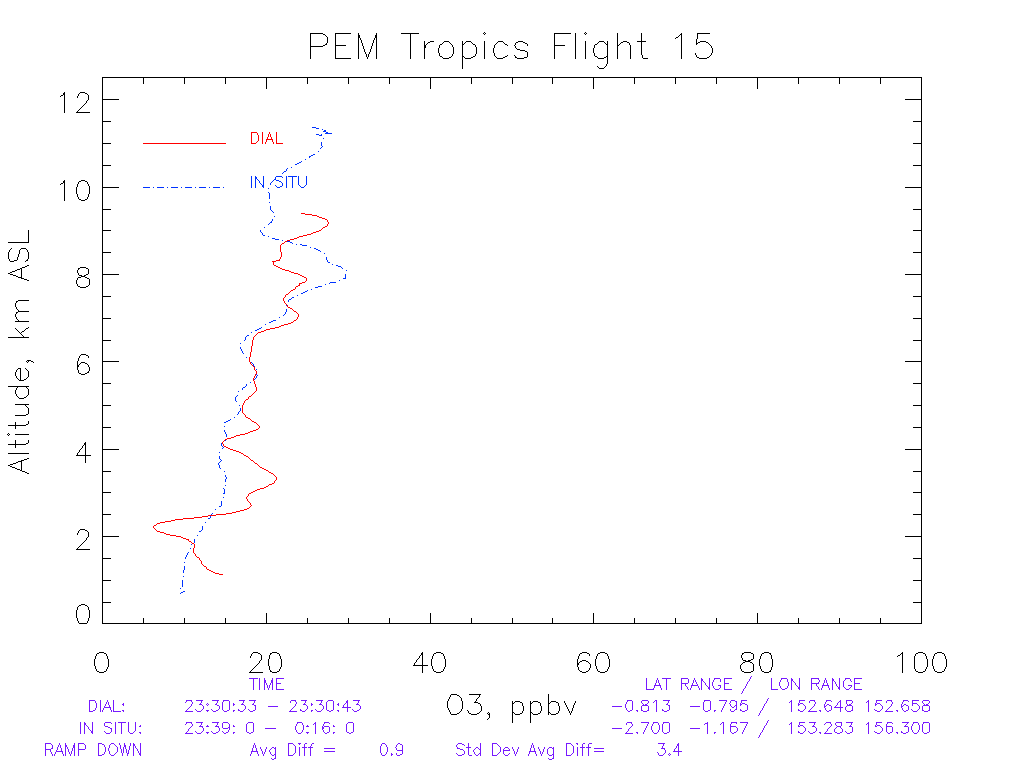
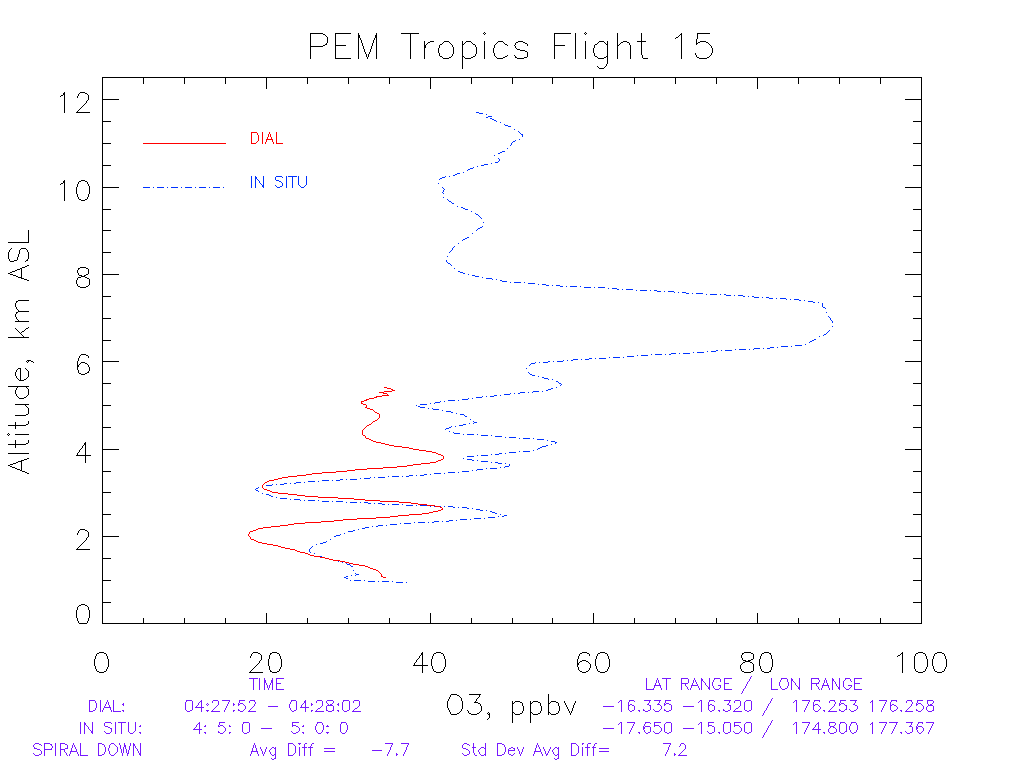
Information Regarding PEM-Tropics DIAL/In-Situ Ozone Profile Intercomparisons
Line Plot of Nadir O3 Comparison - Ramp Down at: 23:30:33
Line Plot of Nadir O3 Comparison - Spiral Down at: 04:27:52
Line Plot of Zenith O3 Comparison - Spiral Down at: 04:43:02