
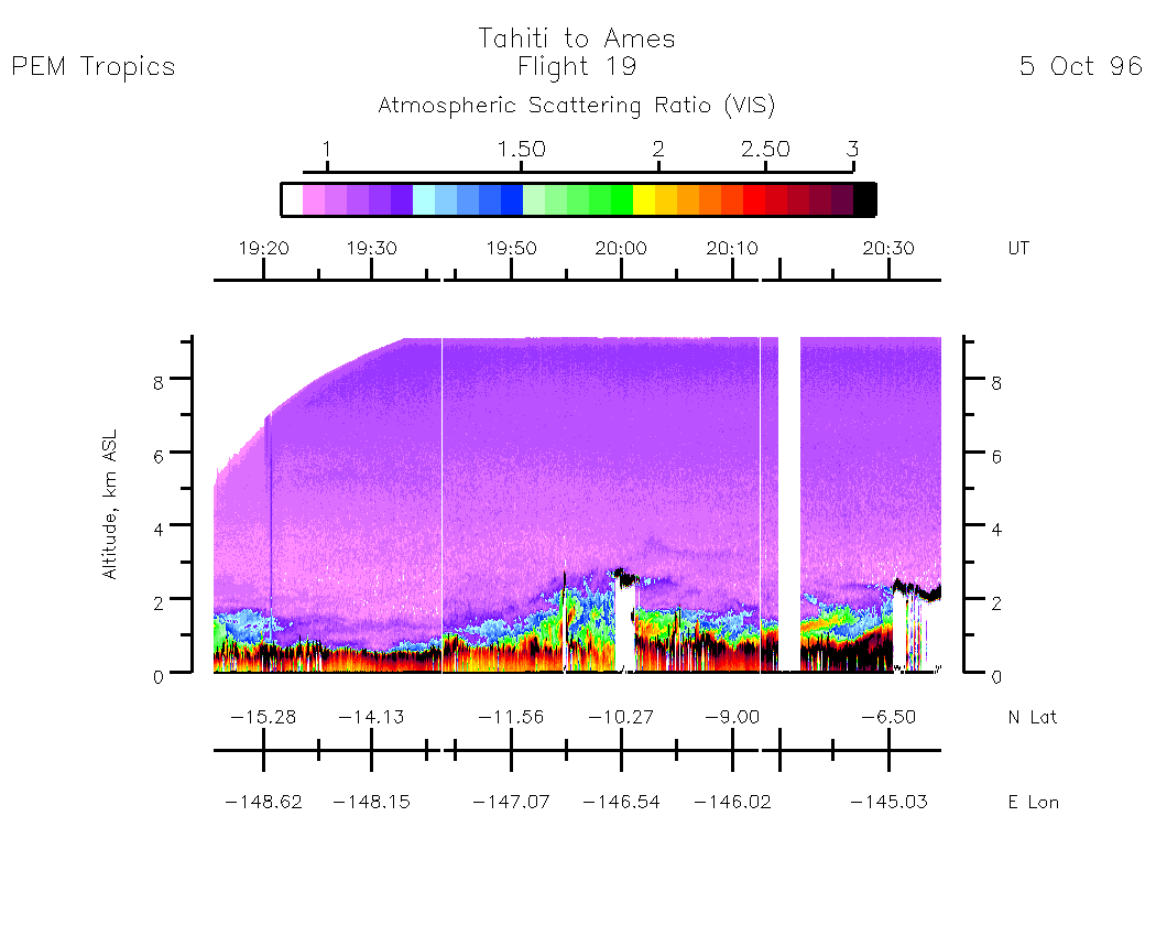
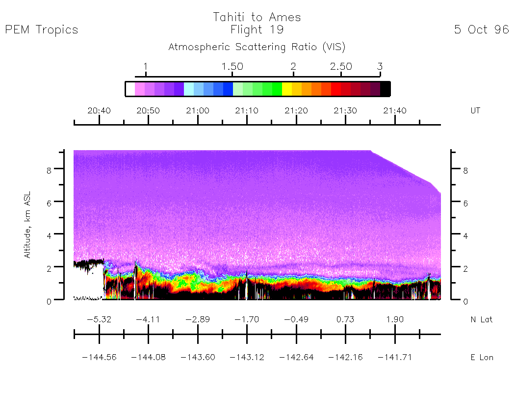
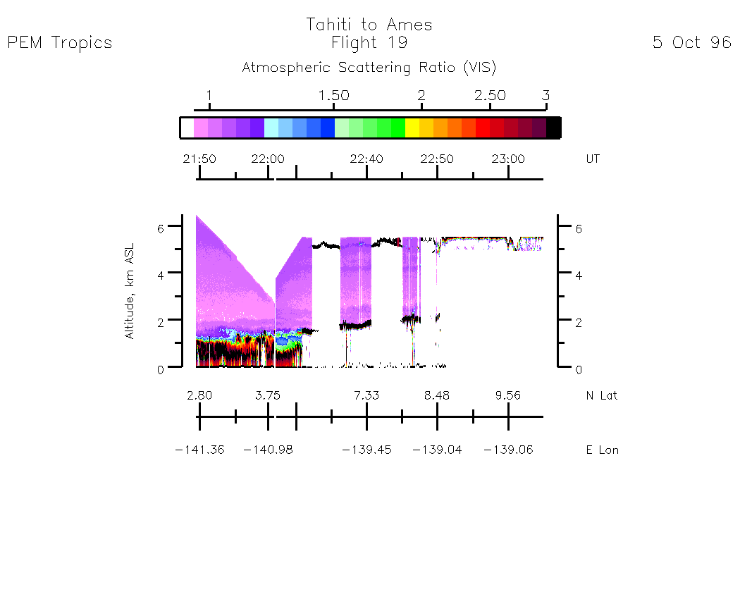
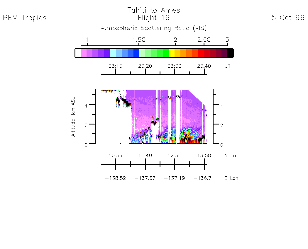
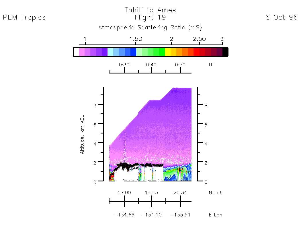
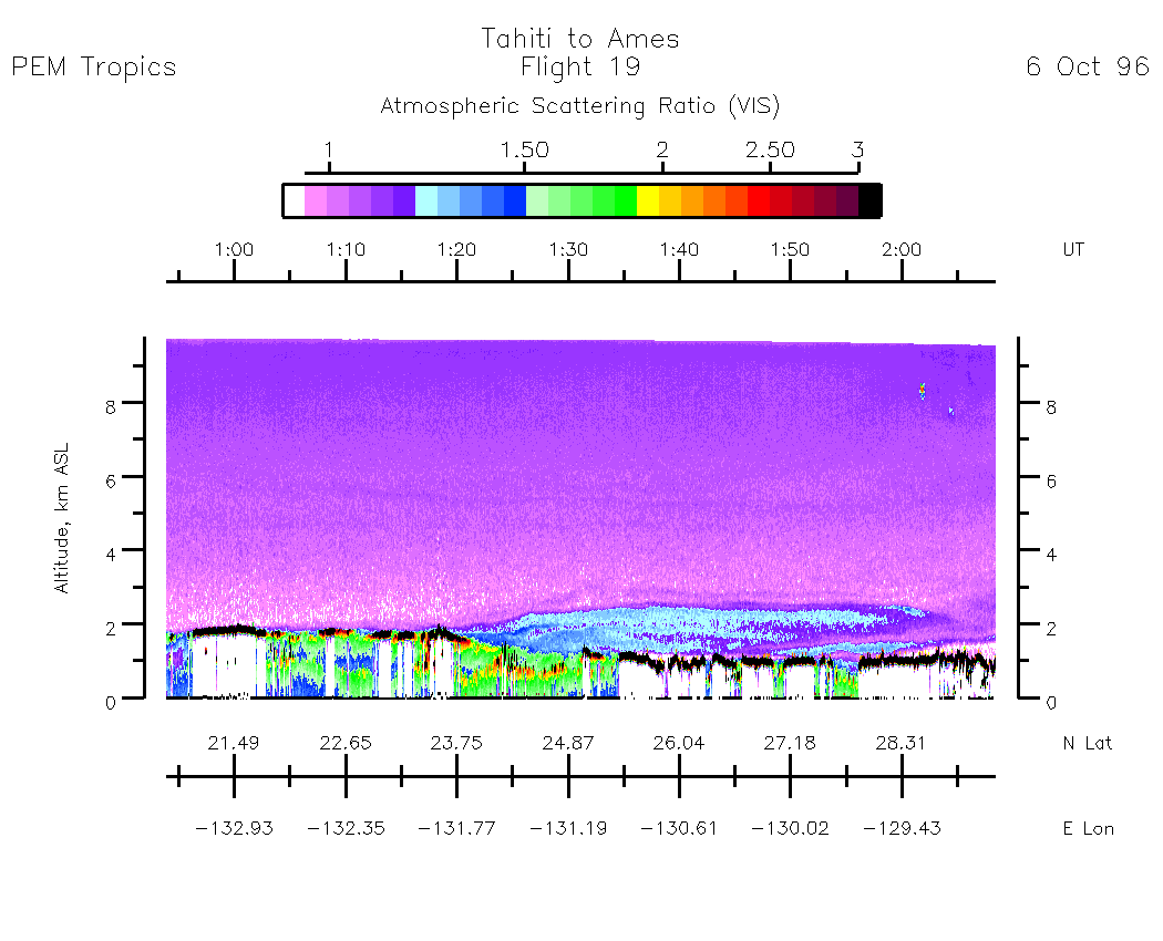
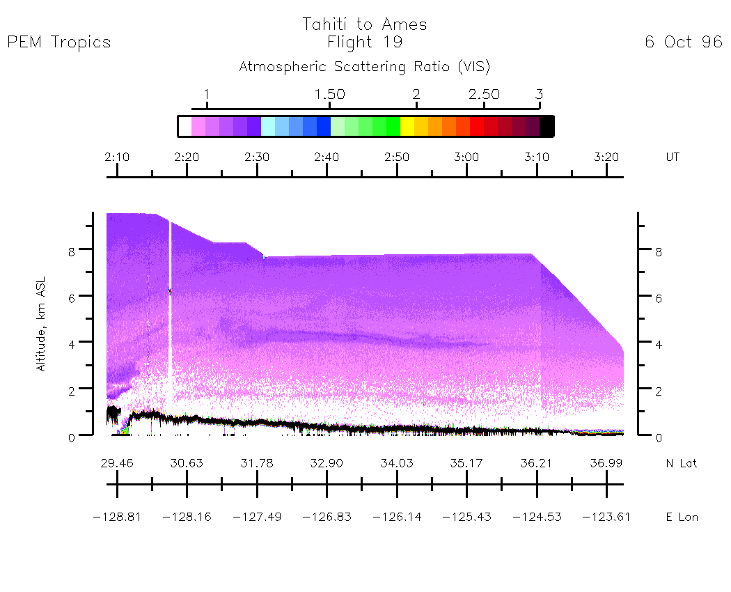
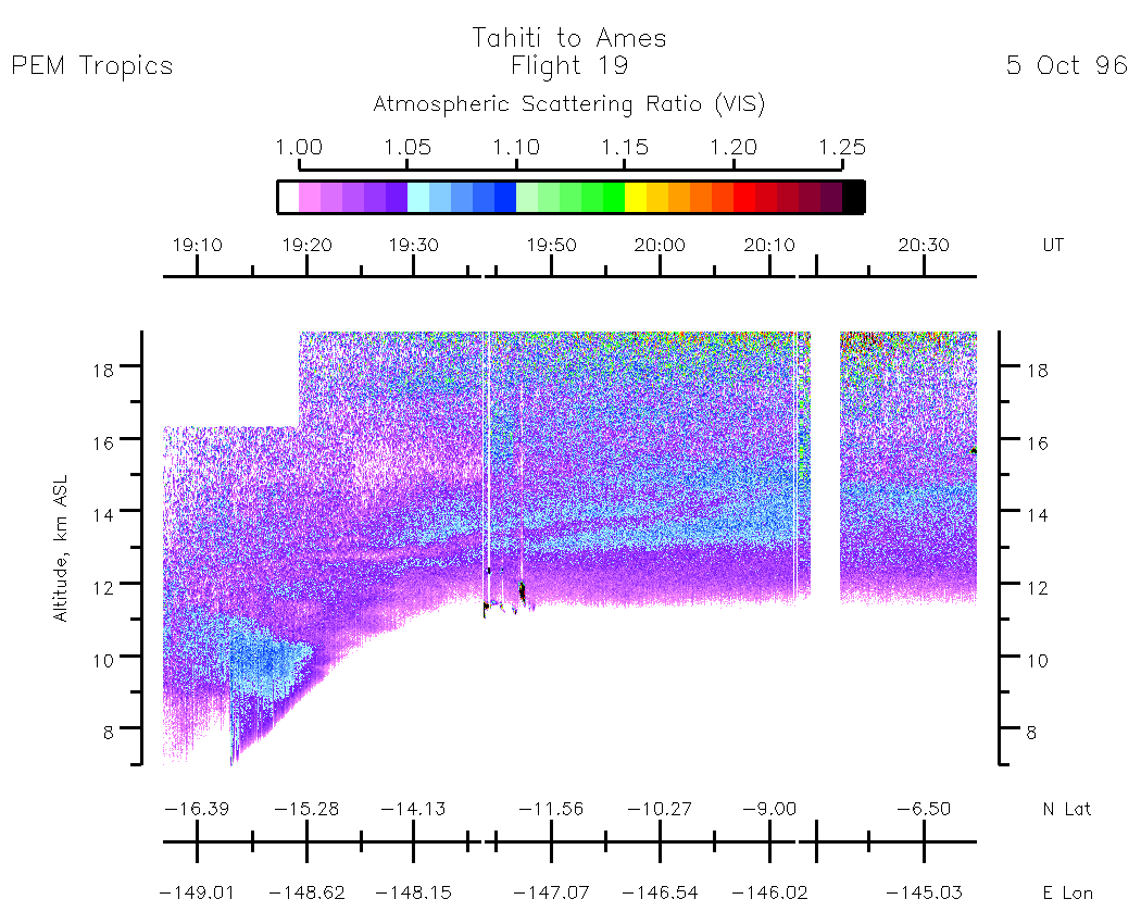
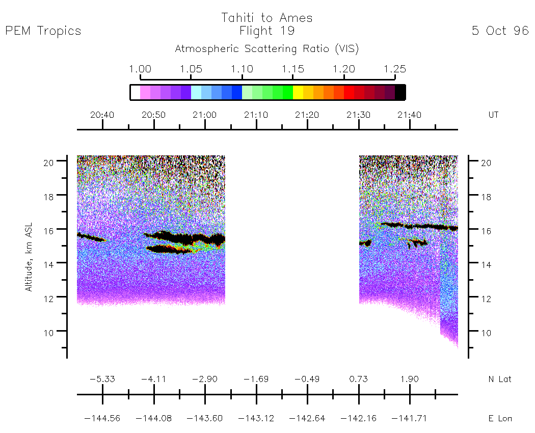
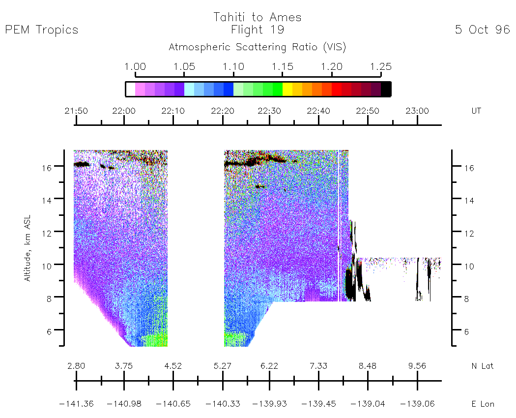
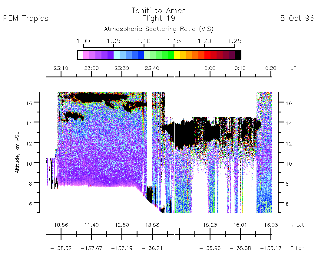
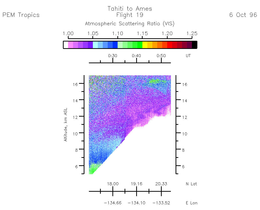
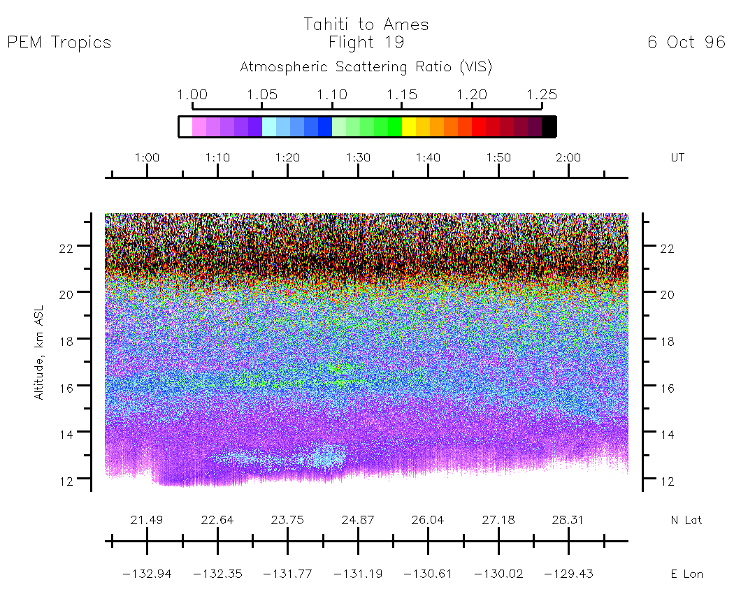
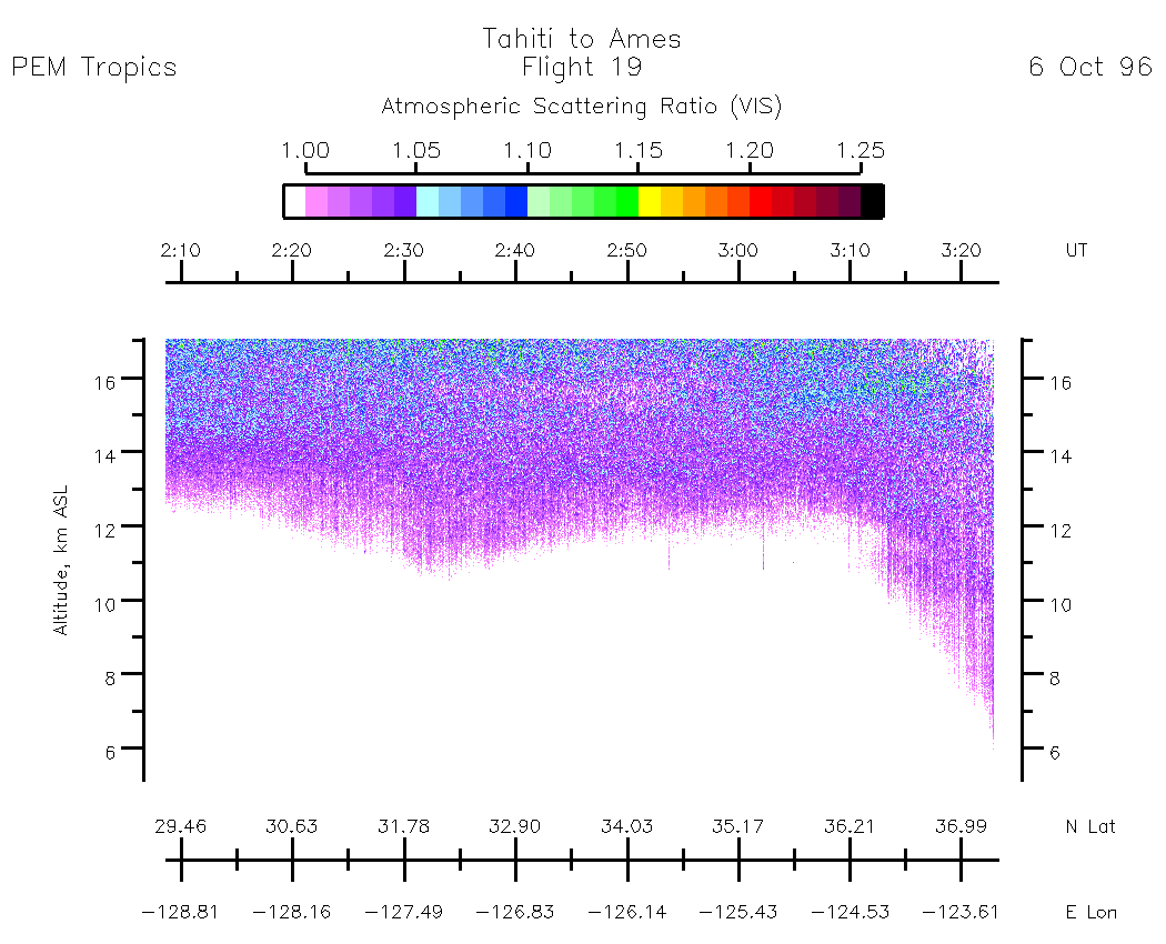
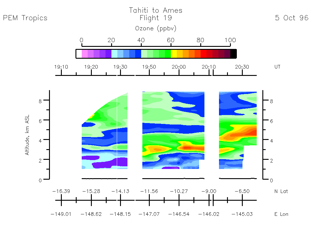
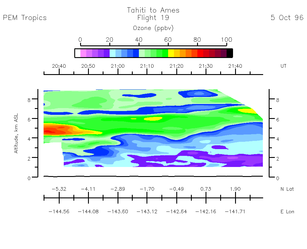
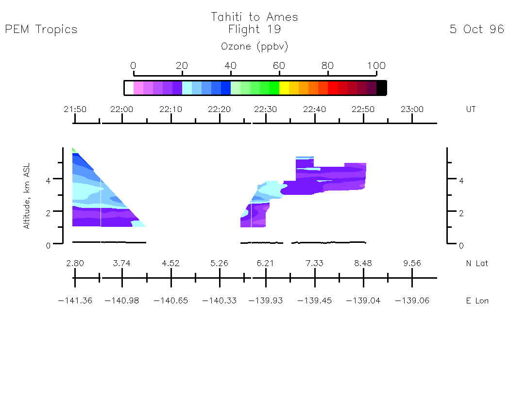
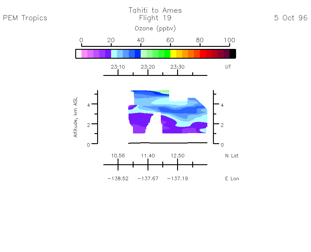
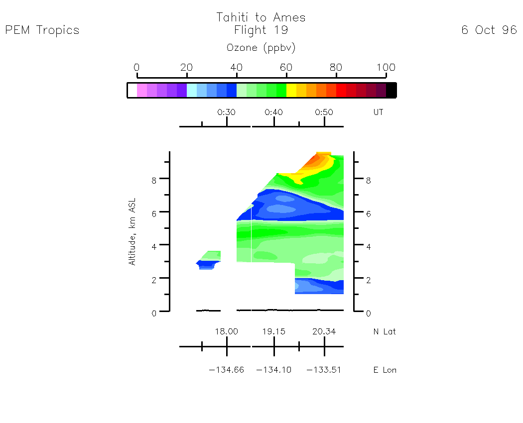
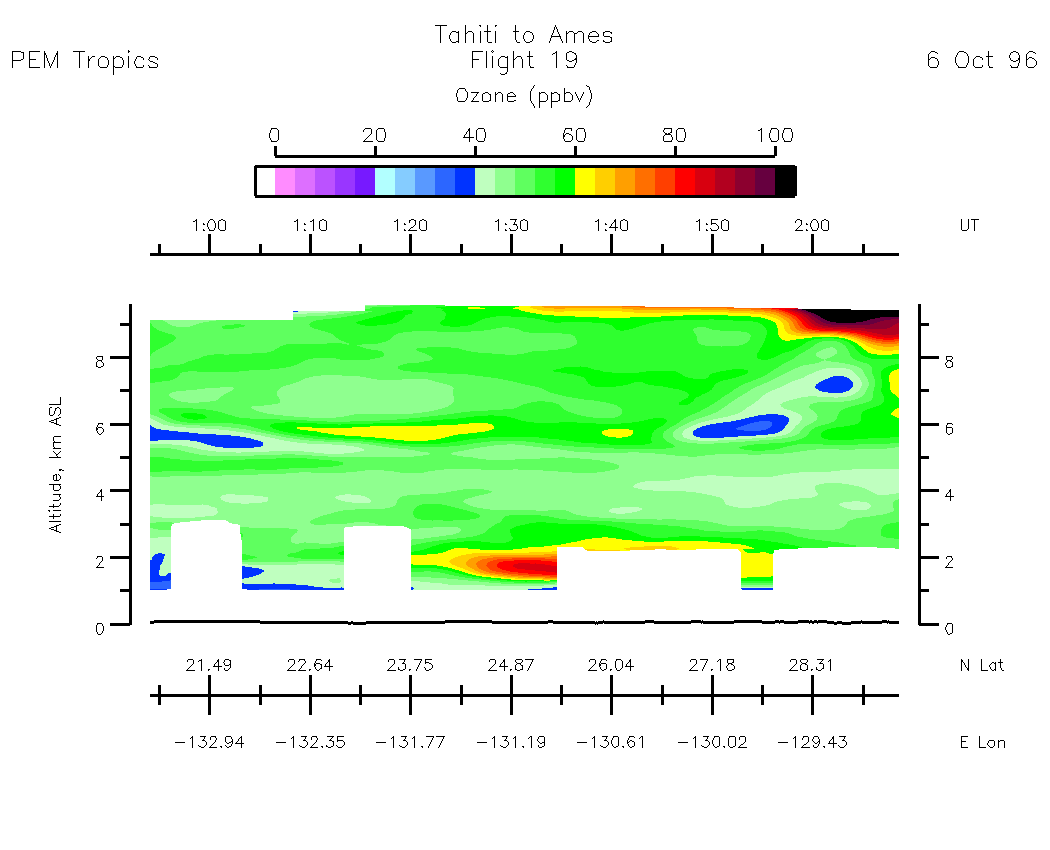
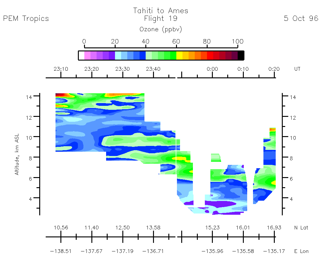
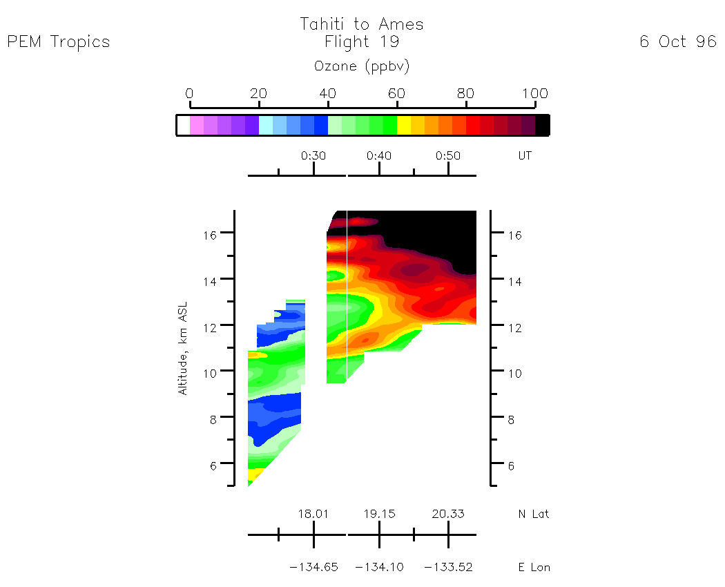
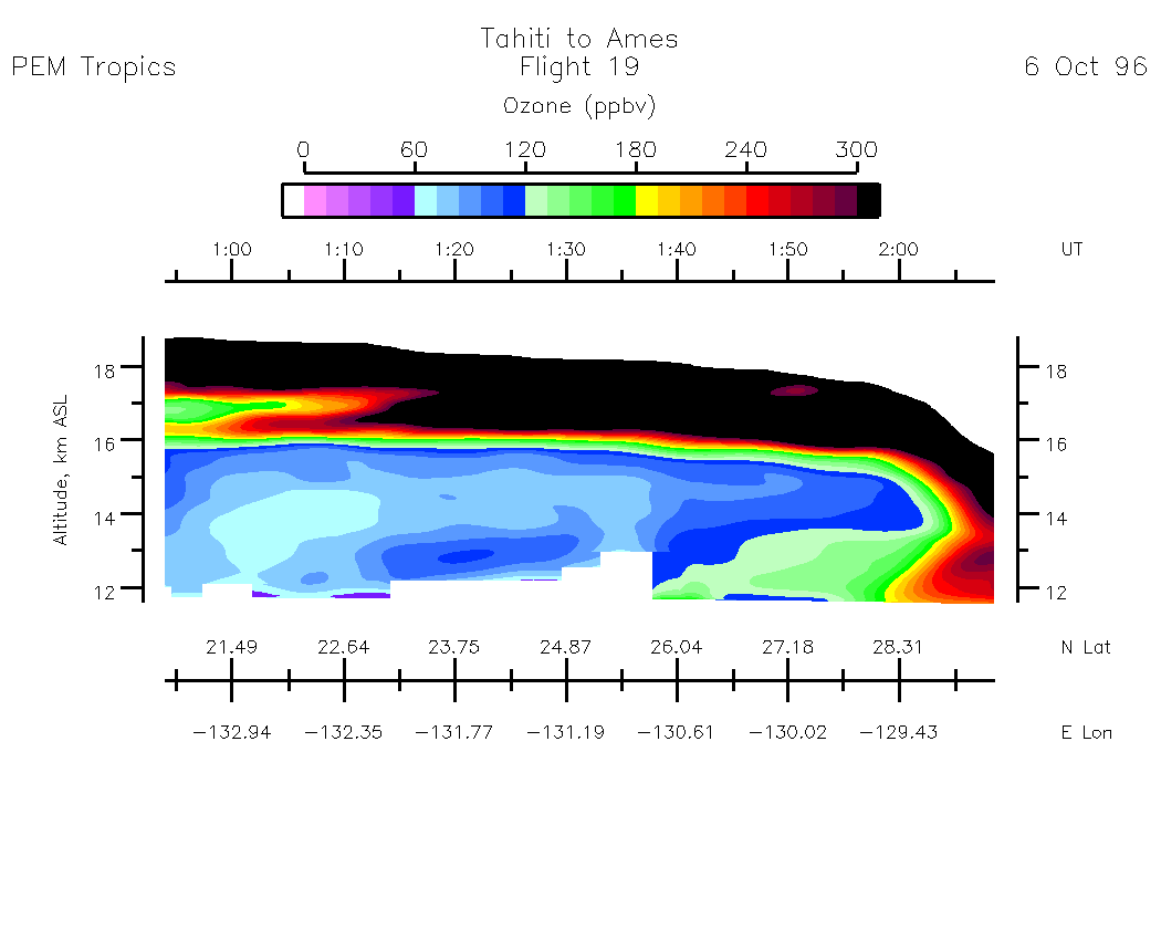
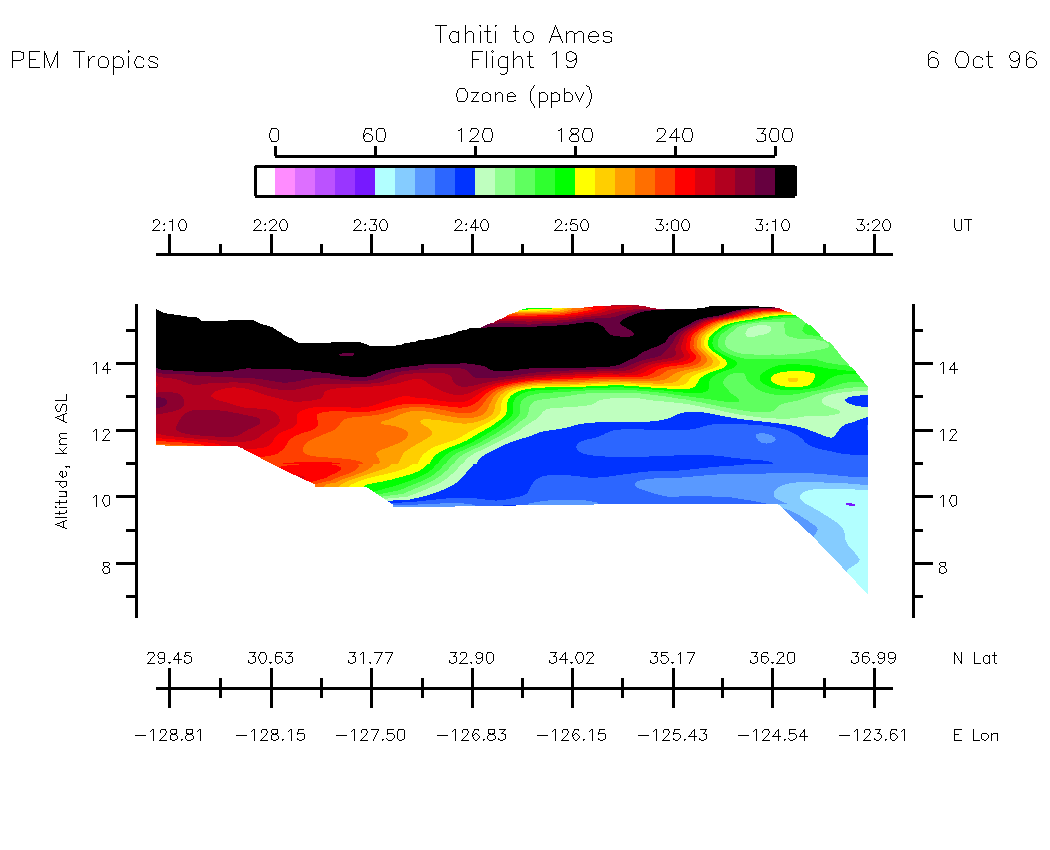
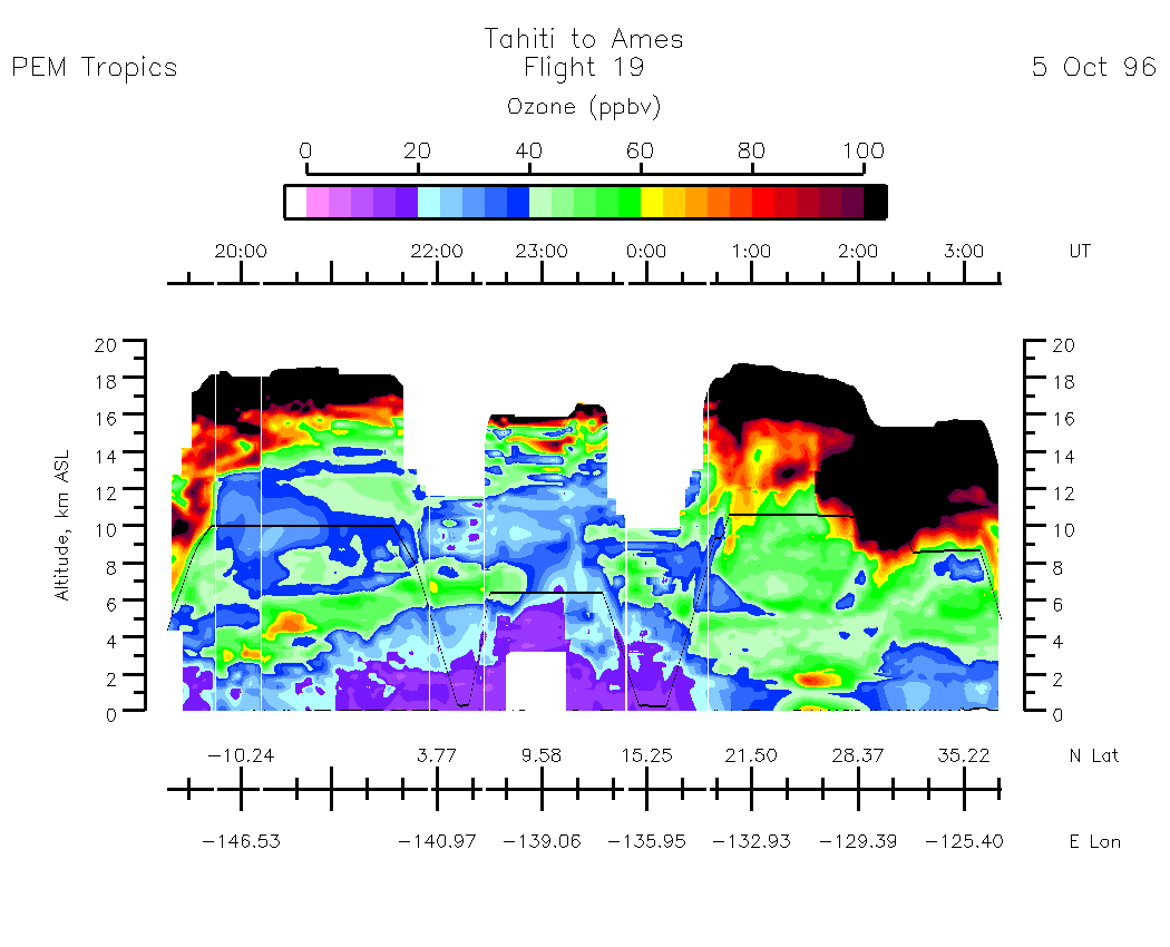
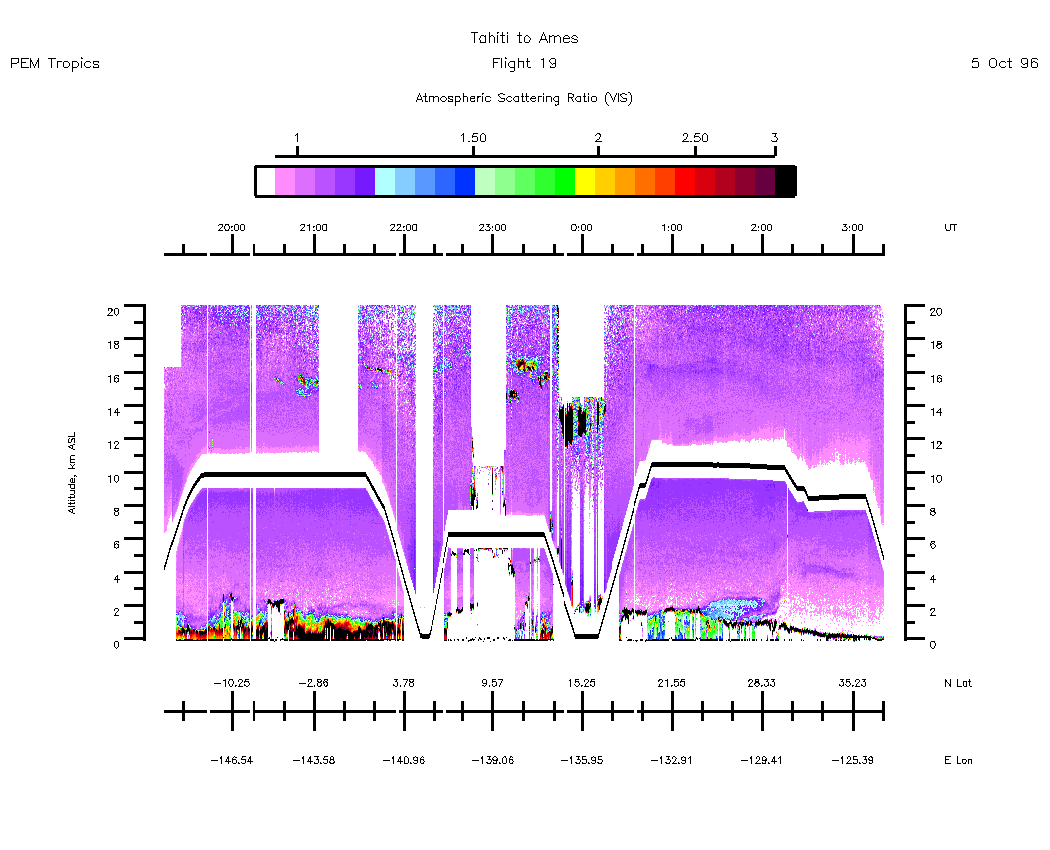
Flight 19 / Tahiti to Ames : Transit / 05-06 Oct. 96
Nadir Aerosol - (Atmospheric Scattering Ratio)
19:15:35 - 20:34:52
| 20:34:54 - 21:49:27
| 21:49:31 - 23:04:59
| 23:05:01 - 23:41:04
| 00:24:52 - 00:53:57
| 00:53:57 - 02:08:30
| 02:08:34 - 03:22:31
| movie_loop_all |
Zenith Aerosol - (Atmospheric Scattering Ratio)
19:06:53 - 20:34:54
| 20:35:02 - 21:49:29
| 21:49:31 - 23:05:01
| 23:05:03 - 00:20:27
| 00:20:27 - 00:53:55
| 00:54:01 - 02:08:34
| 02:08:46 - 03:23:25
| movie_loop_all |
Nadir Ozone Mixing Ratio
19:08:01 - 20:34:54
| 20:34:54 - 21:49:28
| 21:49:33 - 23:05:05
| 23:05:07 - 23:40:00
| 00:20:35 - 00:53:58
| 00:54:07 - 02:08:34
| 02:08:40 - 03:21:55
| movie_loop_all |
Zenith Ozone Mixing Ratio
19:08:01 - 20:34:54
| 20:34:58 - 21:49:31
| 21:49:35 - 23:05:05
| 23:05:11 - 00:20:33
| 00:20:37 - 00:54:01
| 00:54:01 - 02:08:40
| 02:08:46 - 03:21:53
| movie_loop_all |
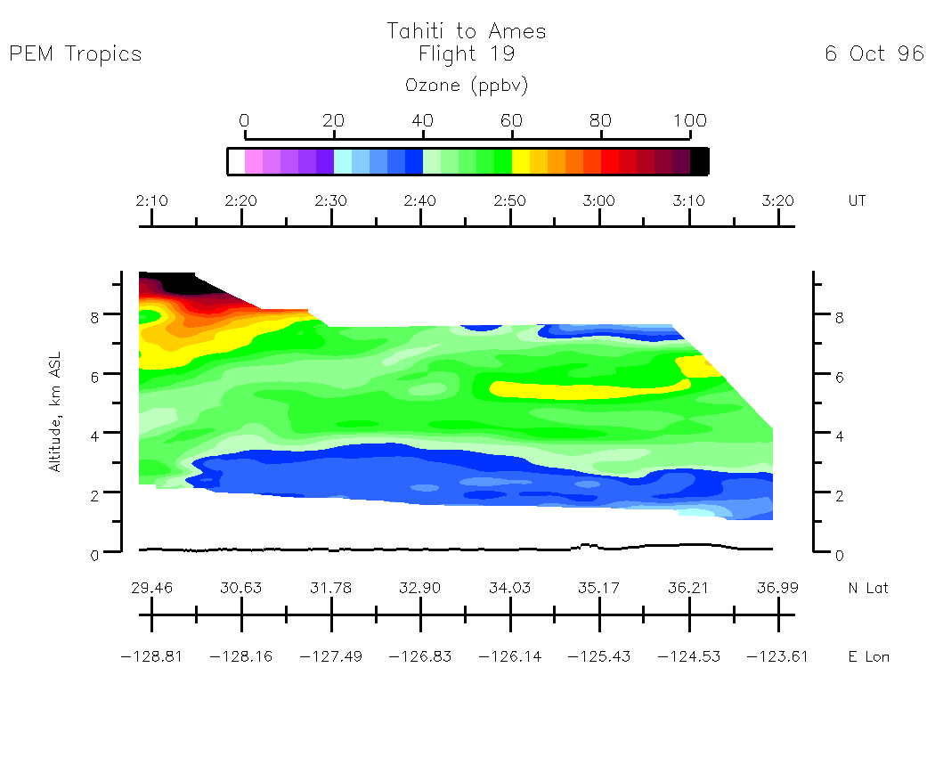
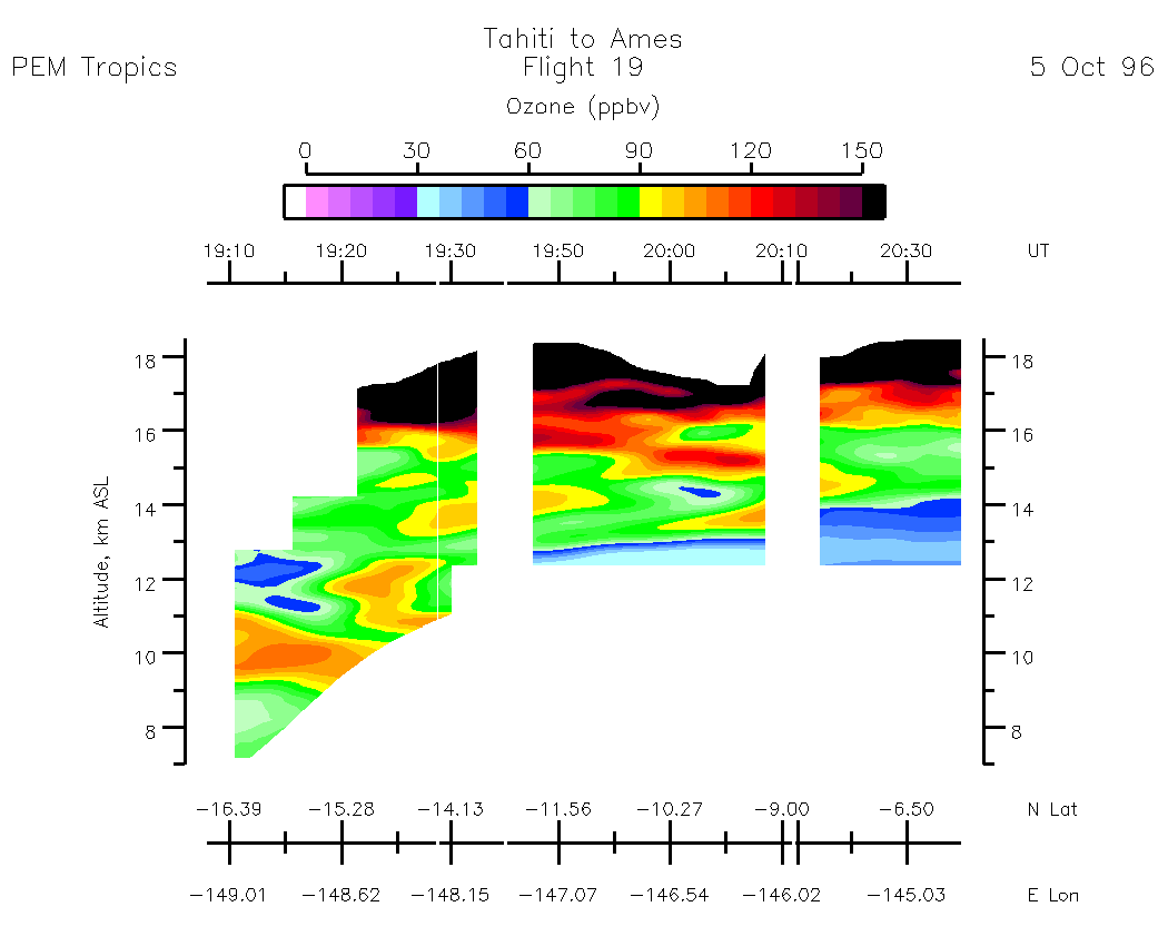
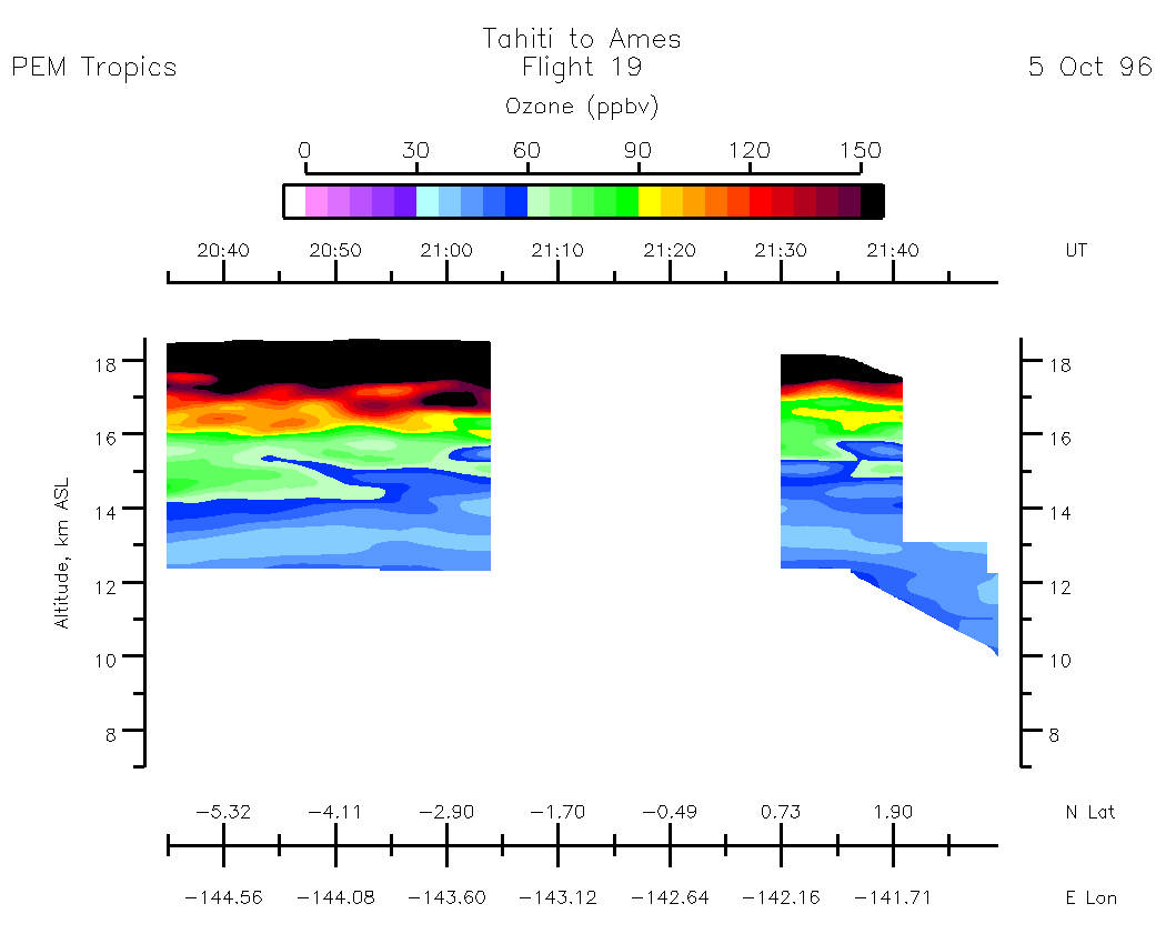
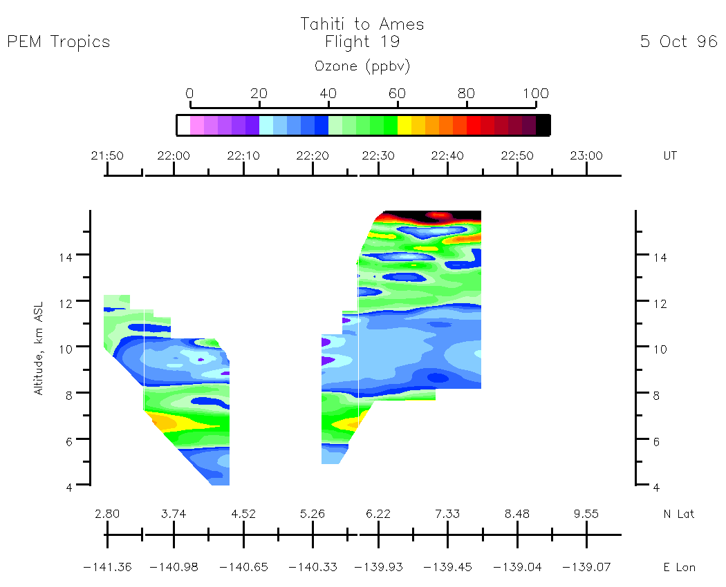
Composite Tropospheric Ozone Cross-Sections --- (Note: Blackline depicts aircraft altitude) Composite Aerosol Cross-Sections --- (Note: Blackline depicts aircraft altitude)
Ozone Column Amounts and Tropopause Altitude
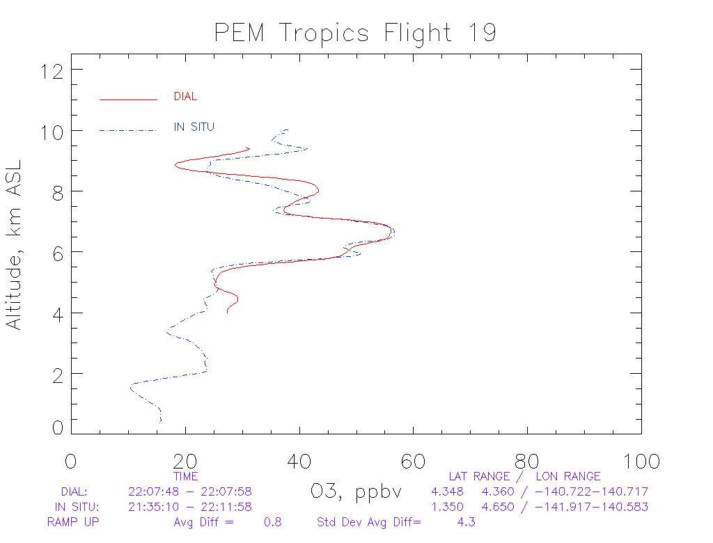
Information Regarding PEM-Tropics DIAL/In-Situ Ozone Profile Intercomparisons
Line Plot of Zenith O3 Comparison - Ramp Up at: 22:07:48