 for additional data.
 Flight 06 / PEM-Tropics B -- Hilo Local 1 Sunrise/ March 9, 1999
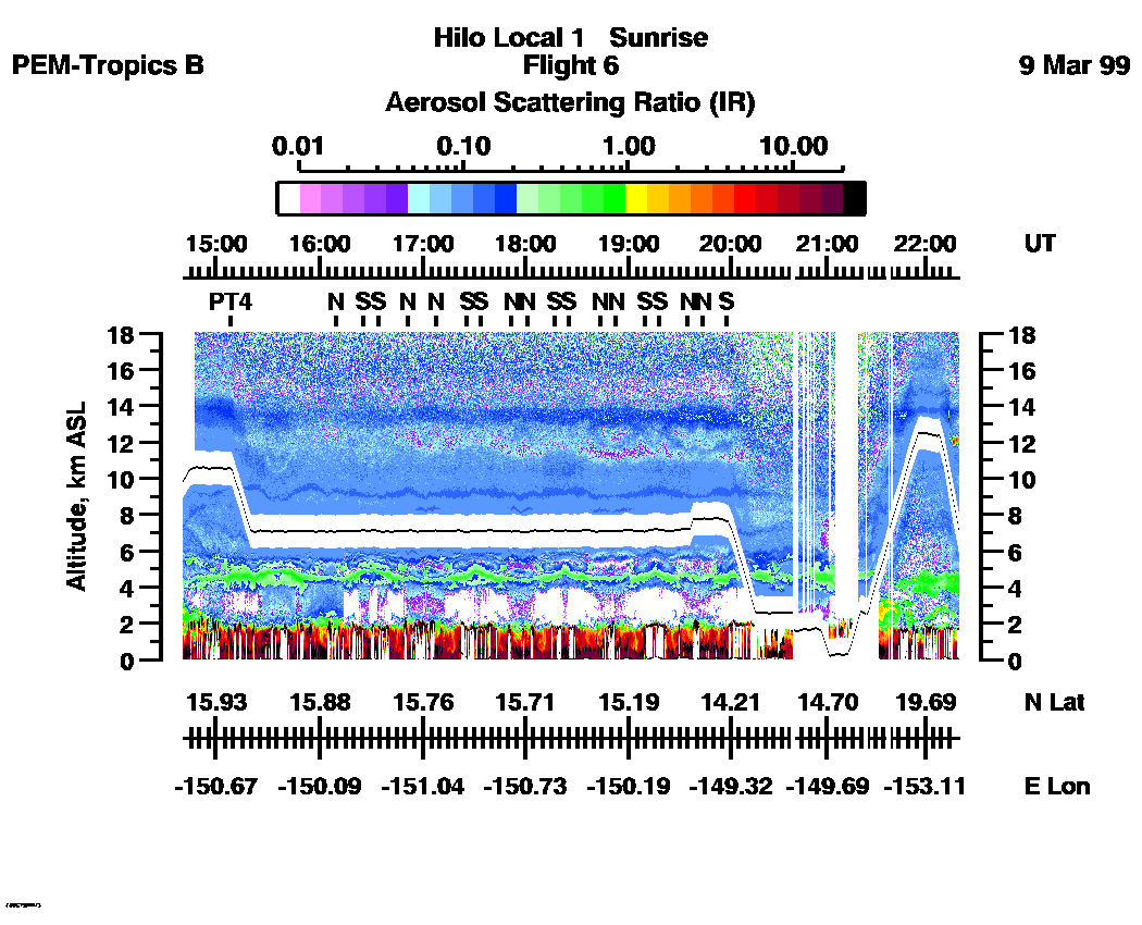
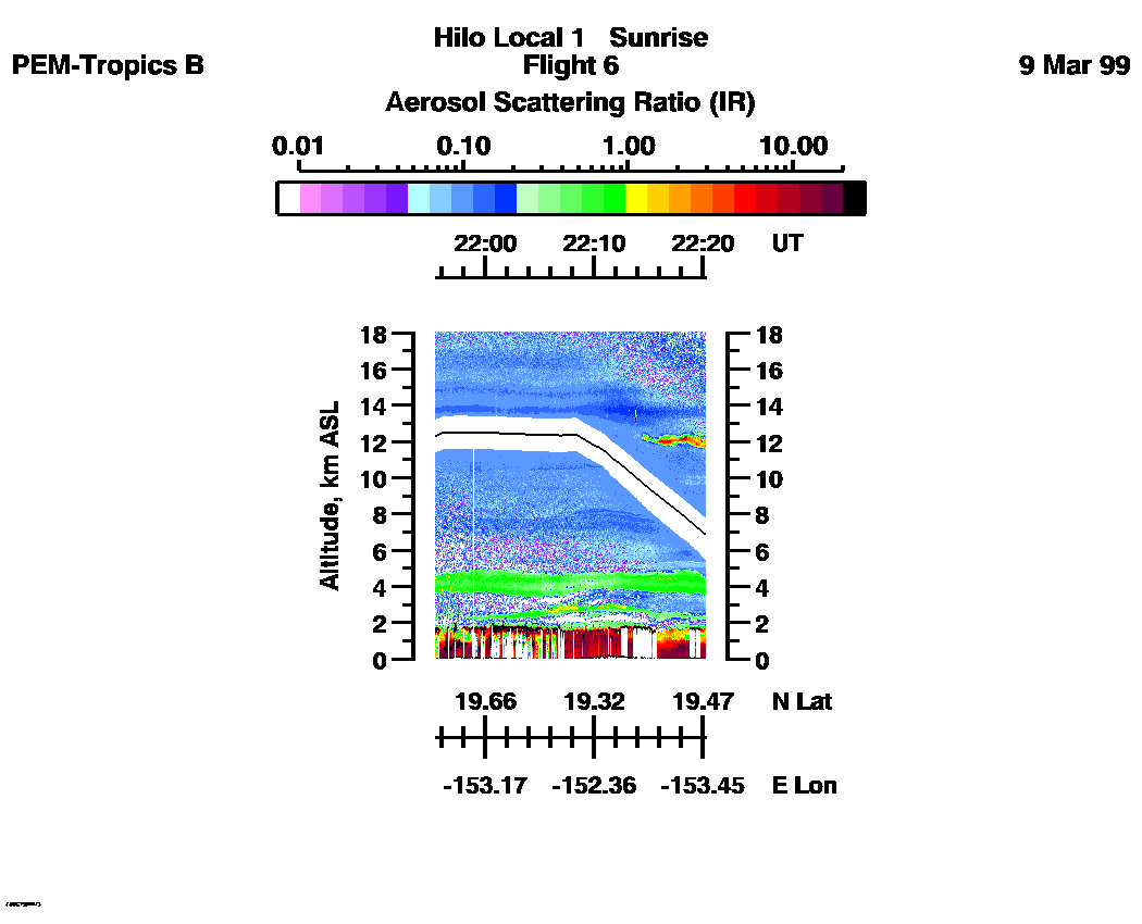
Combined Nadir/Zenith Aerosol Scattering Ratio image for the entire flight
UV-DIAL Aerosol Image : | 14:40:24 - 22:19:32 |
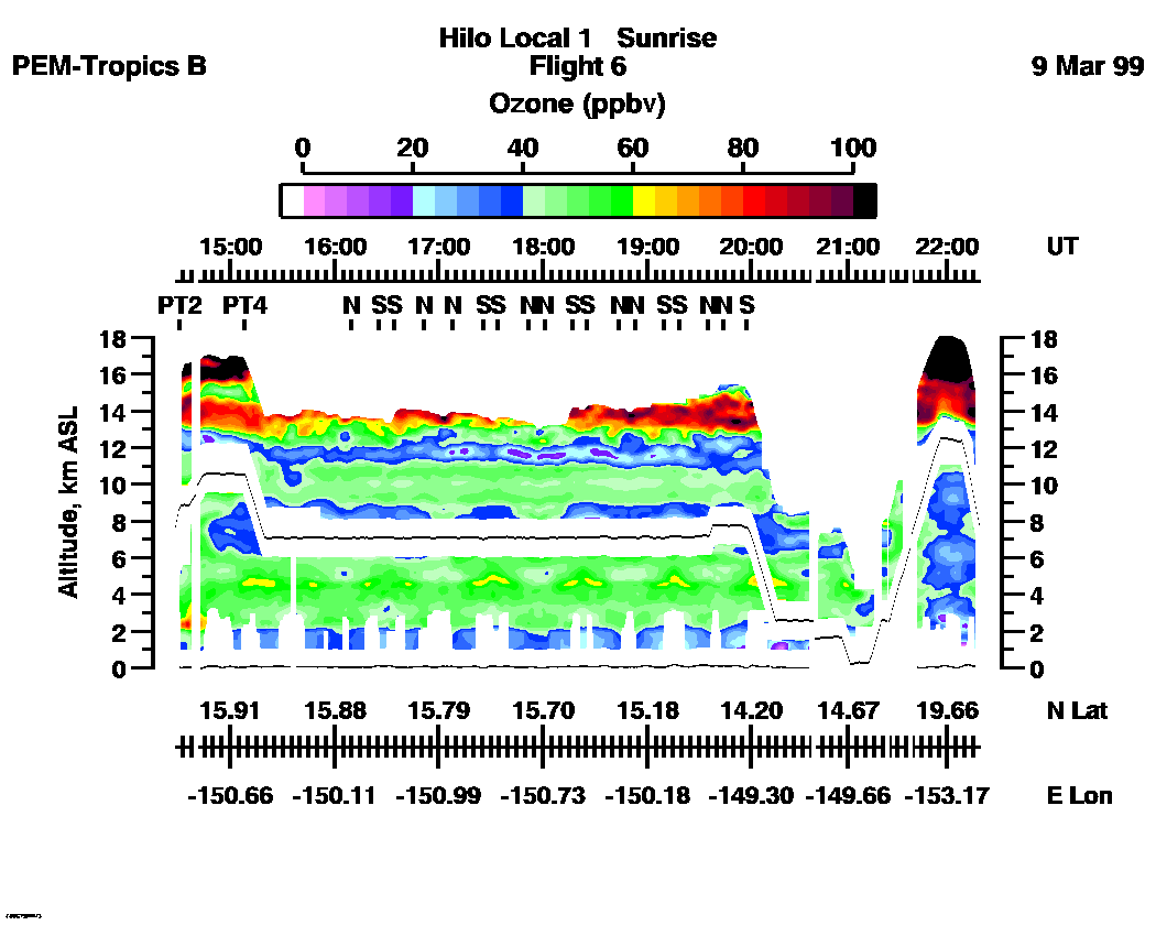
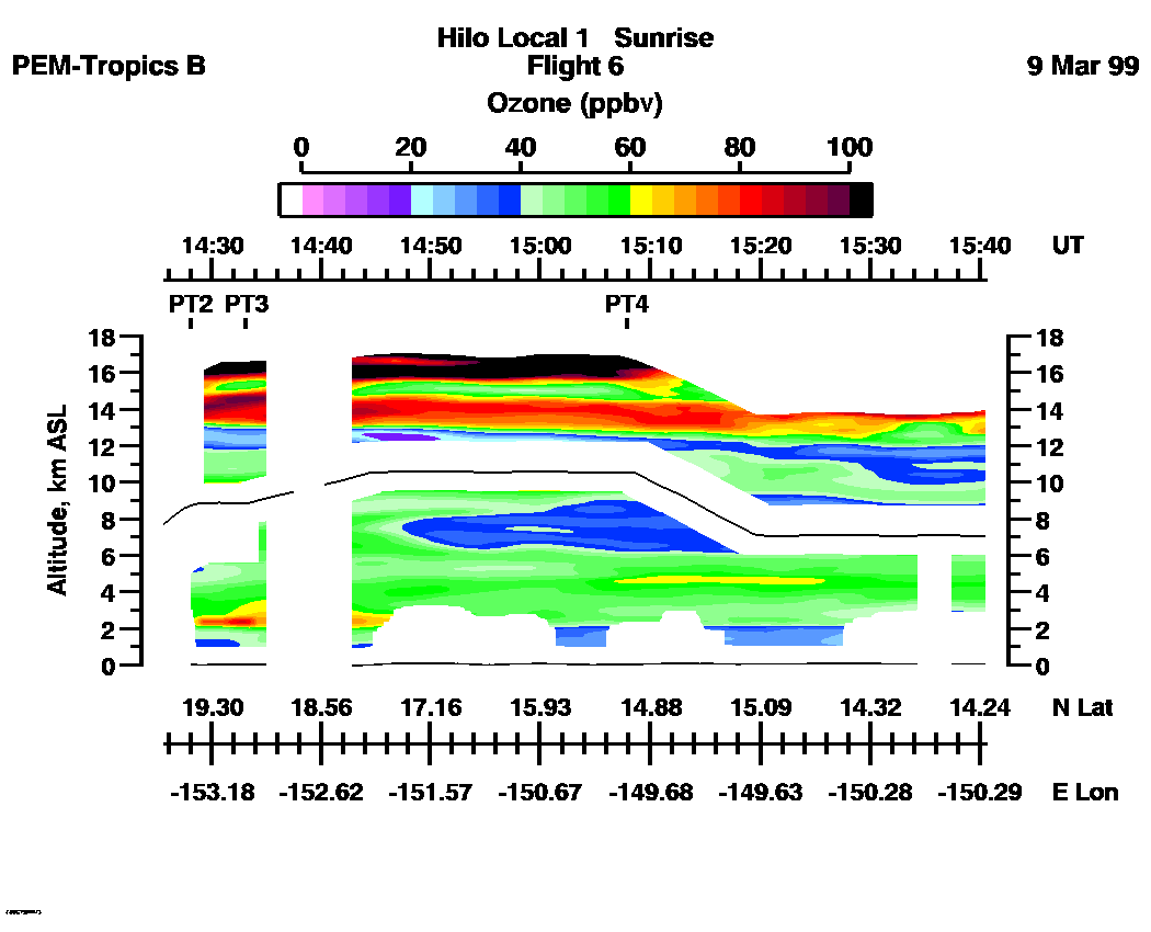
Combined Nadir/Zenith Ozone Mixing Ratio image for the entire flight
UV-DIAL Ozone Image :| 14:25:40 - 22:18:24 |
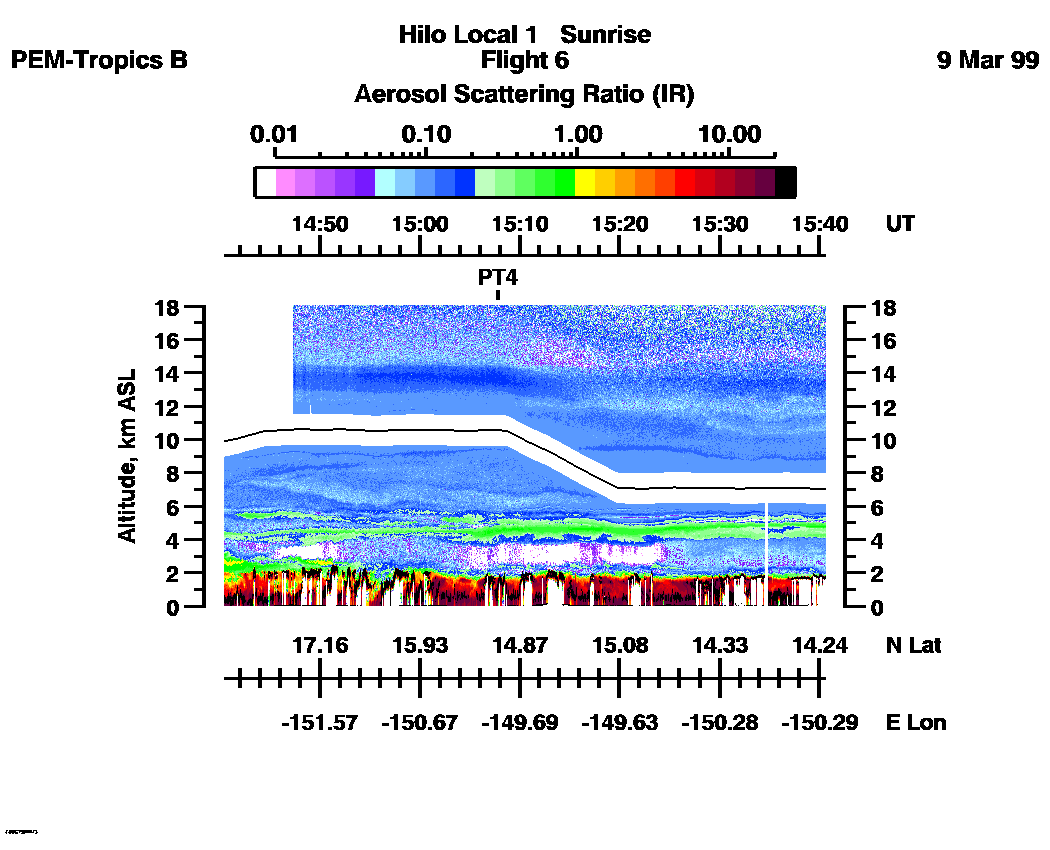
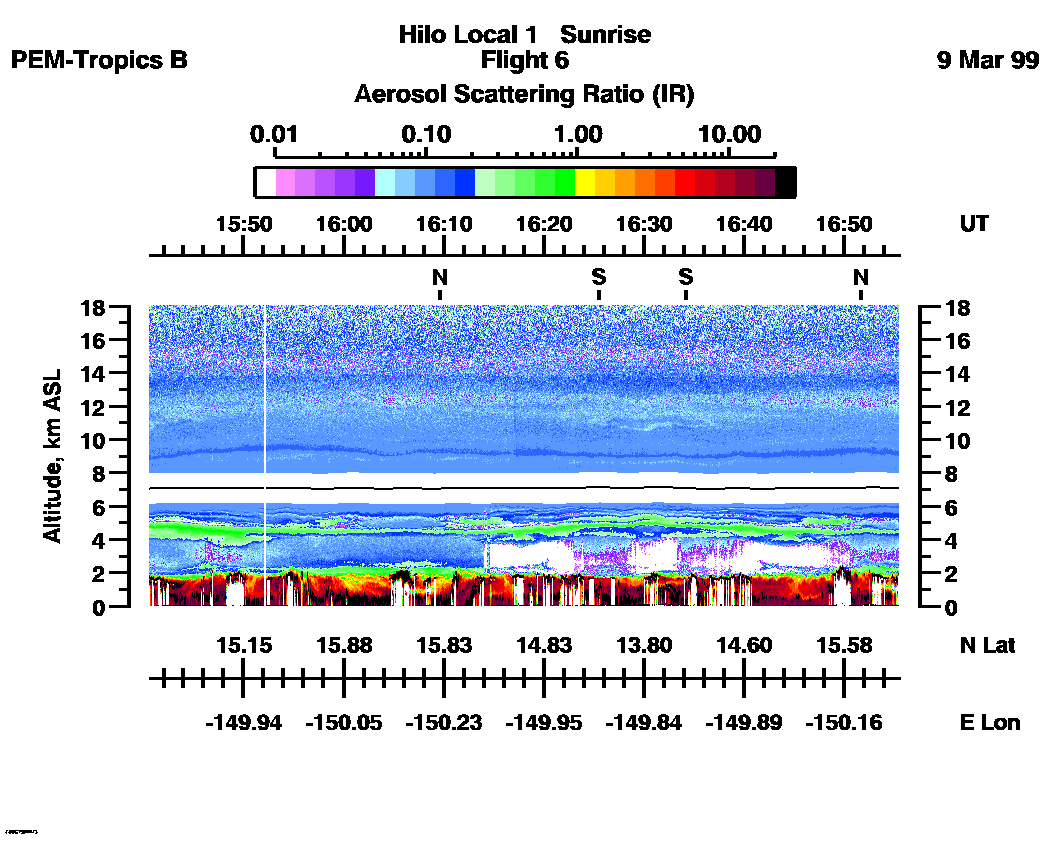
Combined UV-DIAL Aerosol Scattering Ratio Images
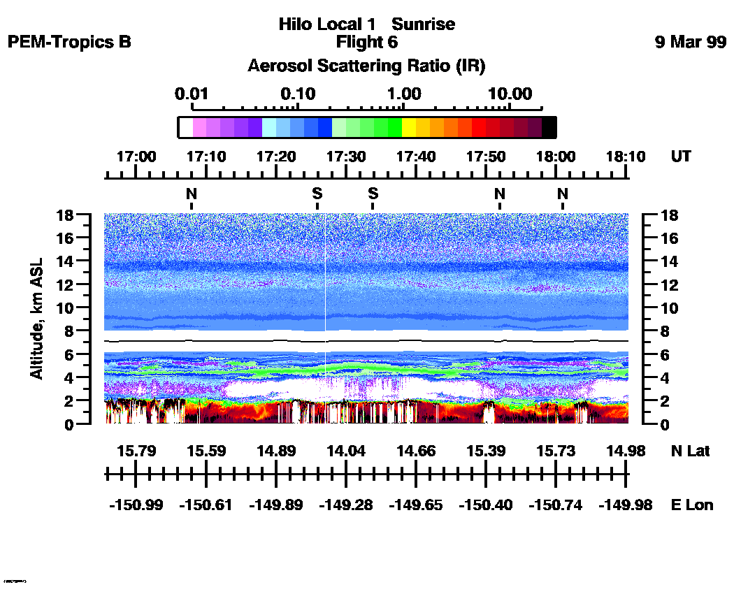
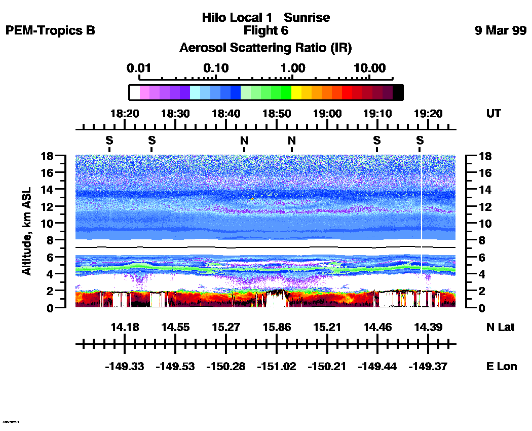
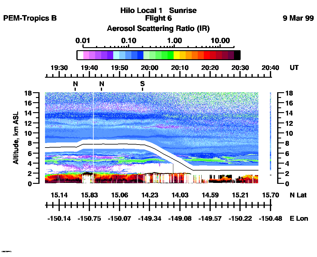
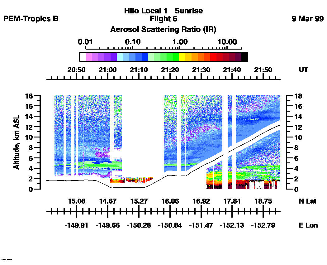
Aerosol Images :| 14:40:24 - 22:19:32
| 15:40:37 - 16:55:31
| 16:55:33 - 18:10:27
| 18:10:29 - 19:25:25
| 19:25:25 - 20:40:21
| 20:40:21 - 21:56:00
| 21:56:00 - 22:19:32
| movie_loop_all |
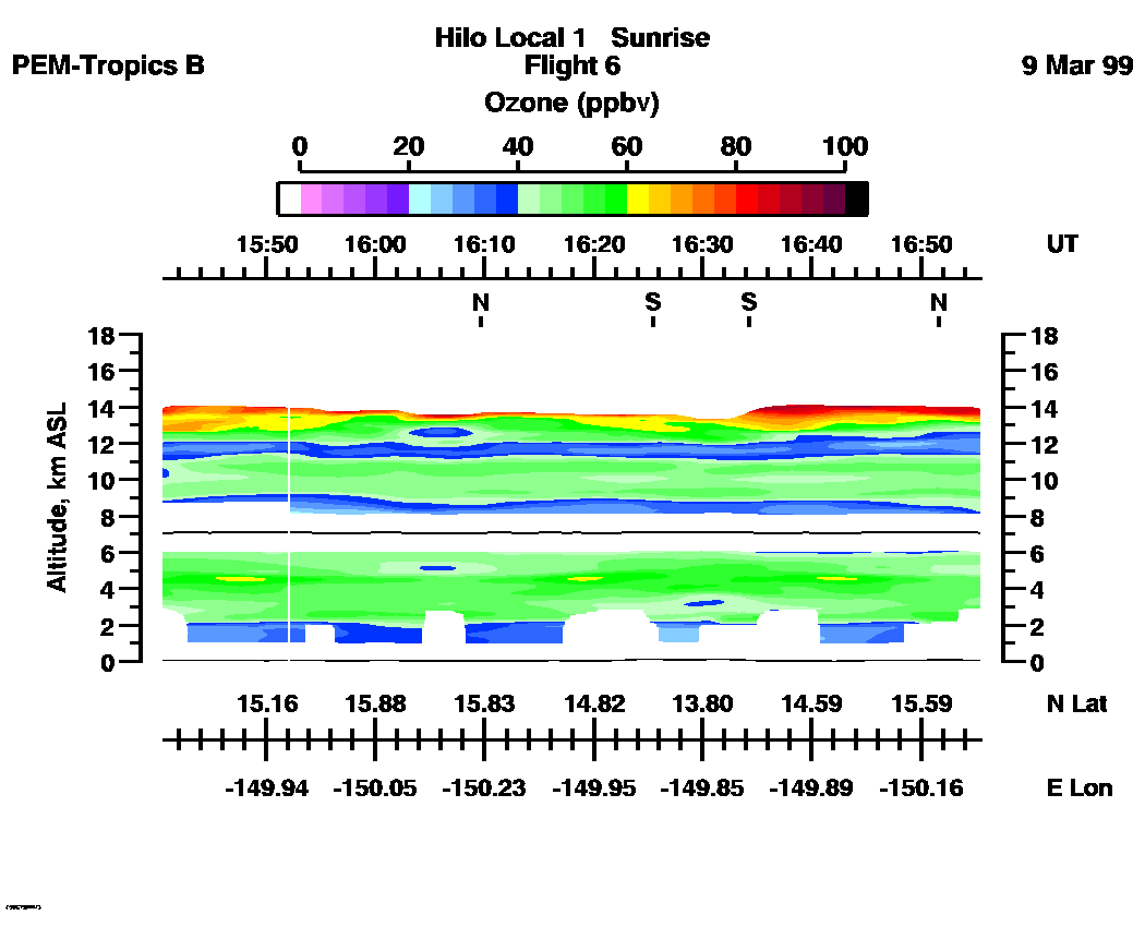
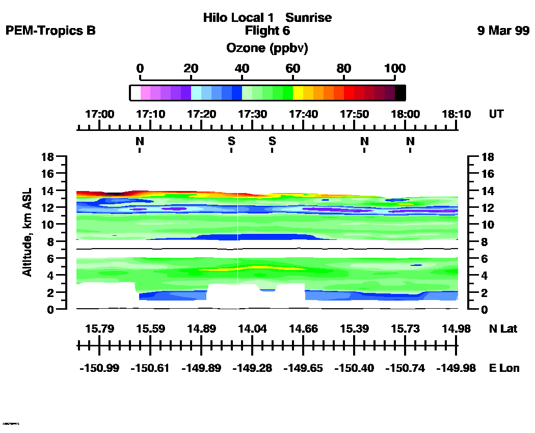
Combined UV-DIAL Ozone Images
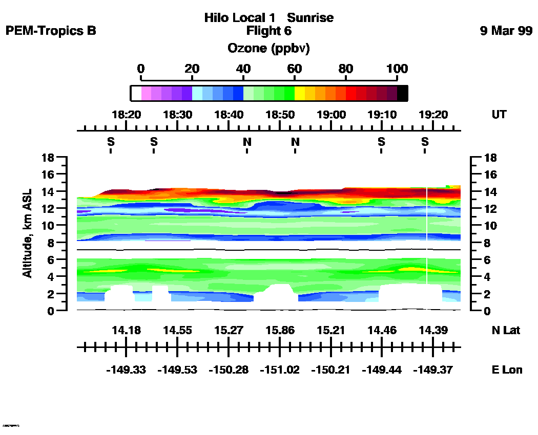
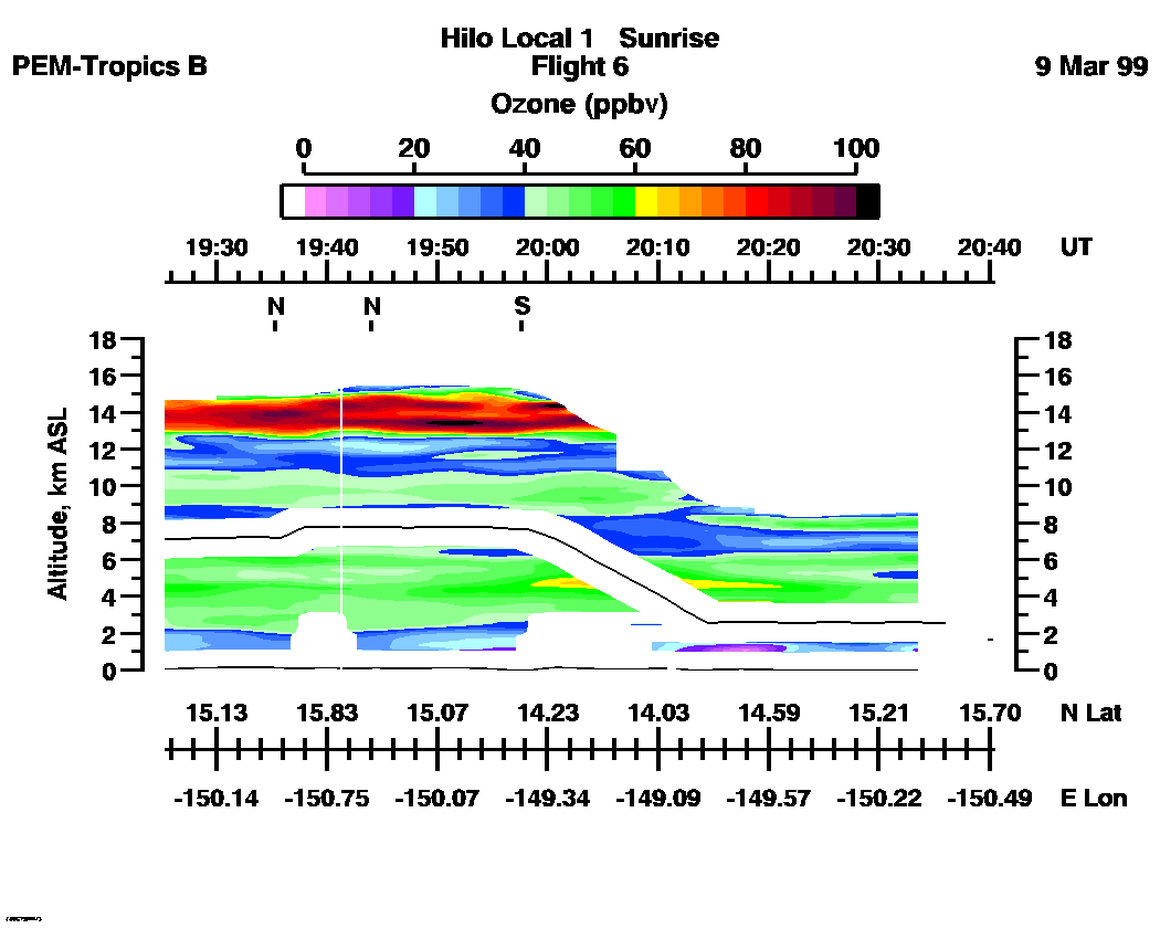
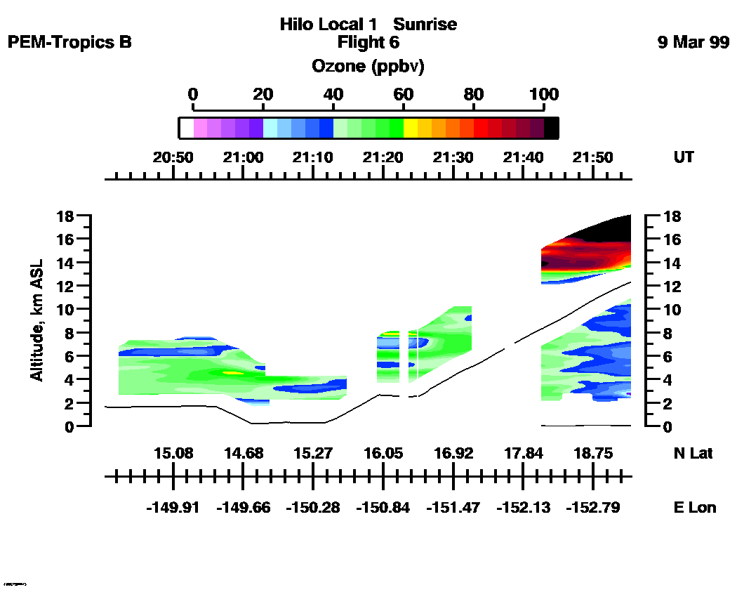
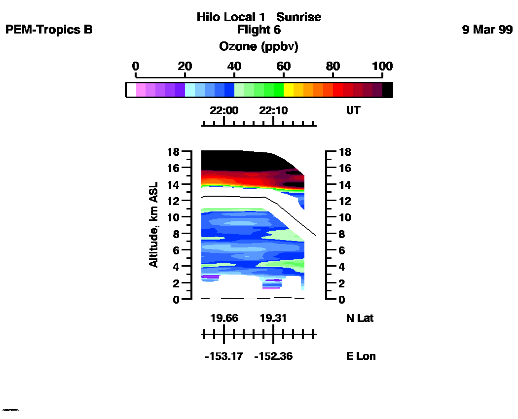
Ozone Images :| 14:40:24 - 22:19:32
| 15:40:37 - 16:55:31
| 16:55:33 - 18:10:27
| 18:10:29 - 19:25:25
| 19:25:25 - 20:40:21
| 20:40:21 - 21:56:00
| 21:56:00 - 22:18:24
| movie_loop_all |
for additional data. 