 for additional data.
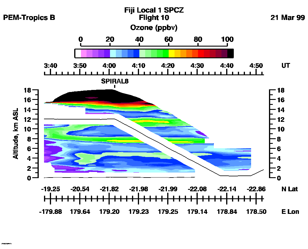
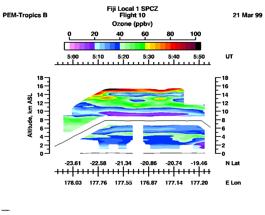
 Flight 10 / PEM-Tropics B -- Fiji Local 1 SPCZ / March 20-21, 1999
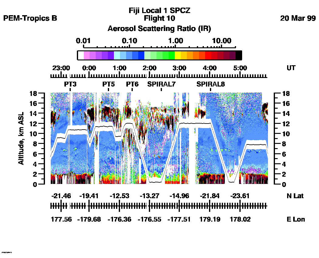
Combined Nadir/Zenith Aerosol Scattering Ratio image for the entire flight
UV-DIAL Aerosol Image : | 22:39:18 - 05:57:26 |
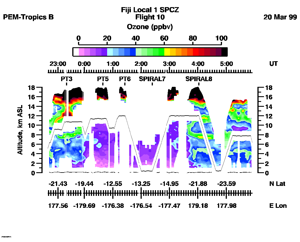
Combined Nadir/Zenith Ozone Mixing Ratio image for the entire flight
UV-DIAL Ozone Image :| 22:38:25 - 05:54:32 |
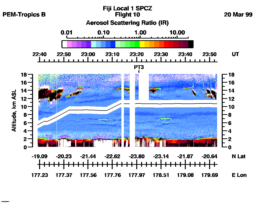
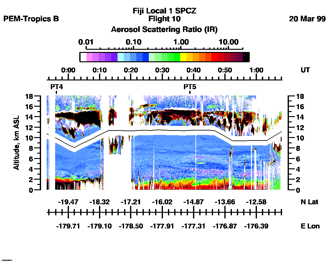
Combined UV-DIAL Aerosol Scattering Ratio Images
Aerosol Images :| 22:39:18 - 23:53:16
| 23:53:18 - 01:08:06
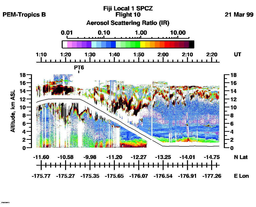
| 01:08:08 - 02:23:00
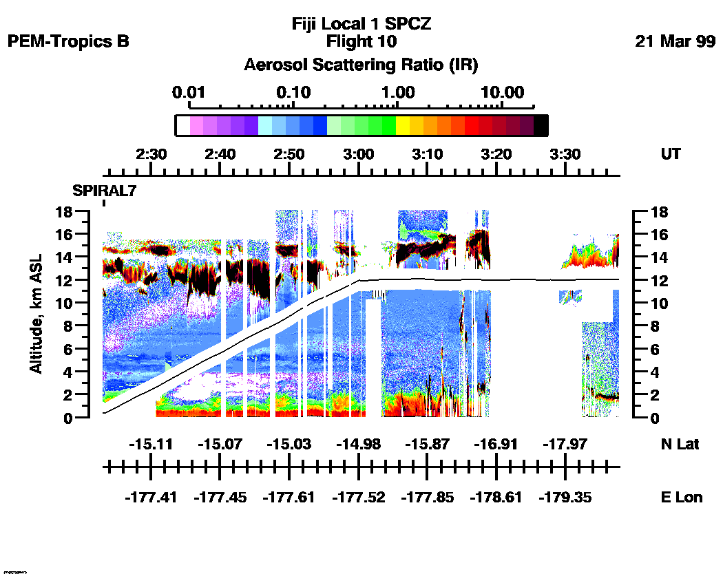
| 02:23:02 - 03:37:49
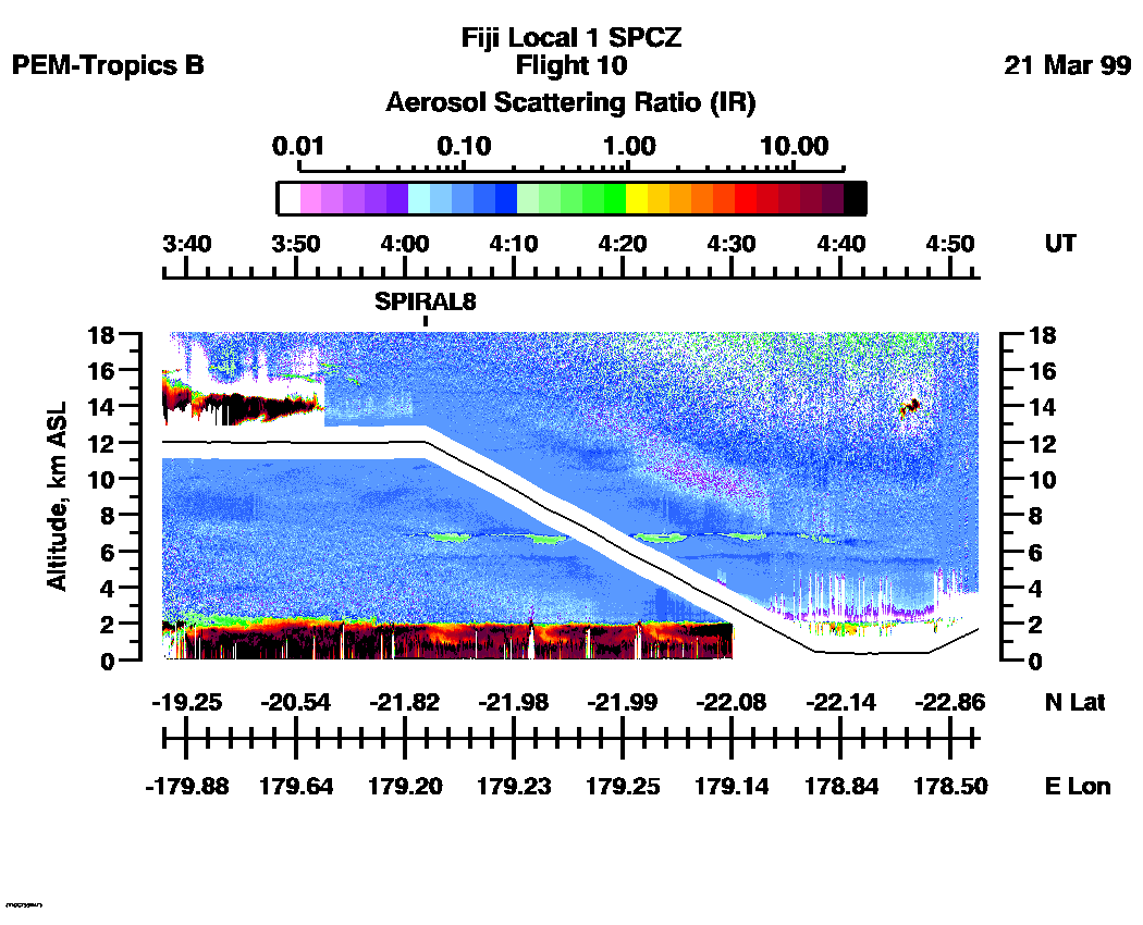
| 03:37:50 - 04:52:41
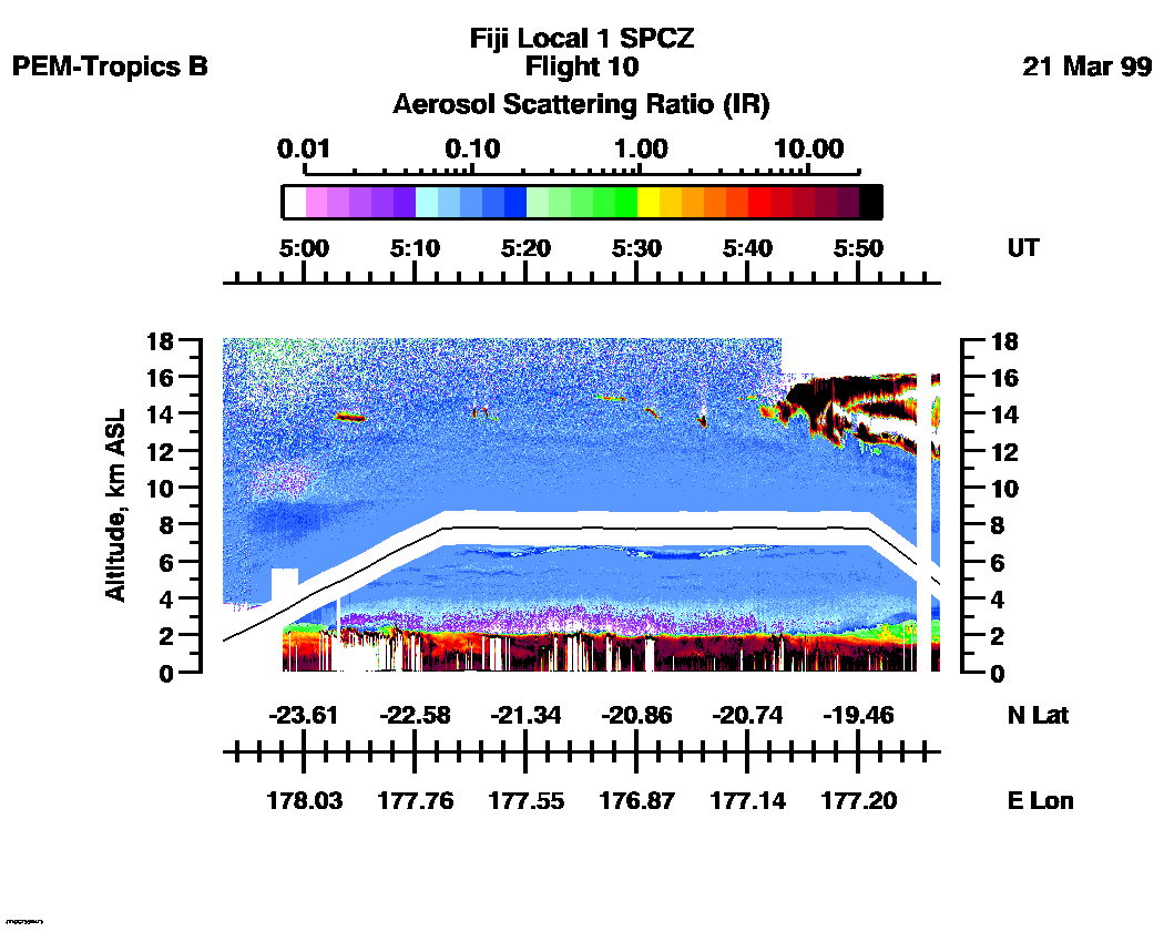
| 04:52:43 - 05:57:20
| movie_loop_all |
Combined UV-DIAL Ozone Images
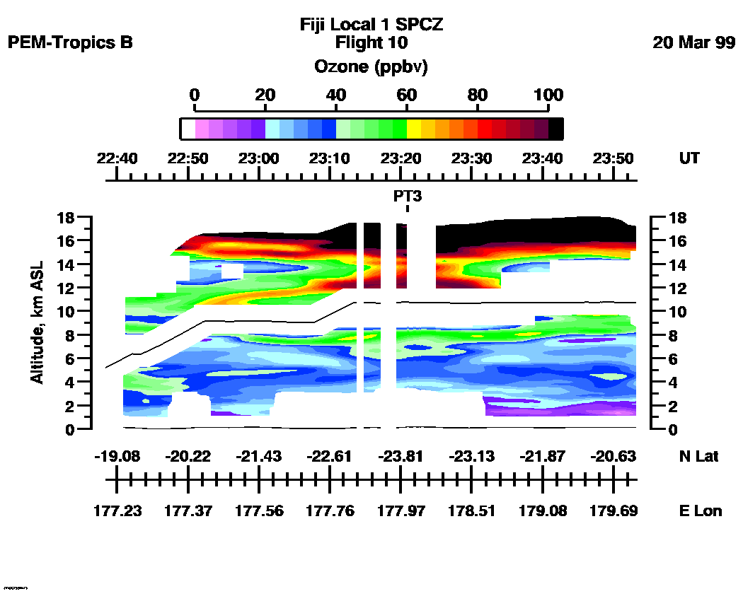
Ozone Images :| 22:38:25 - 23:53:16
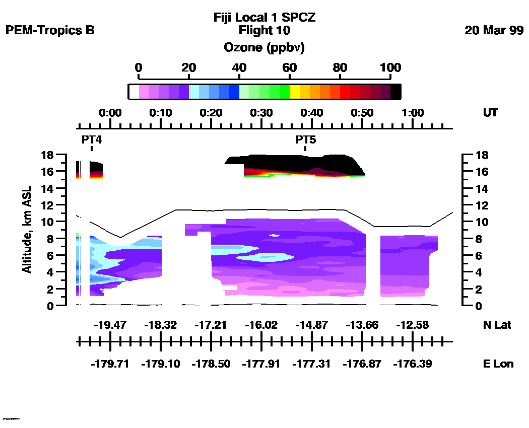
| 23:53:18 - 01:07:55
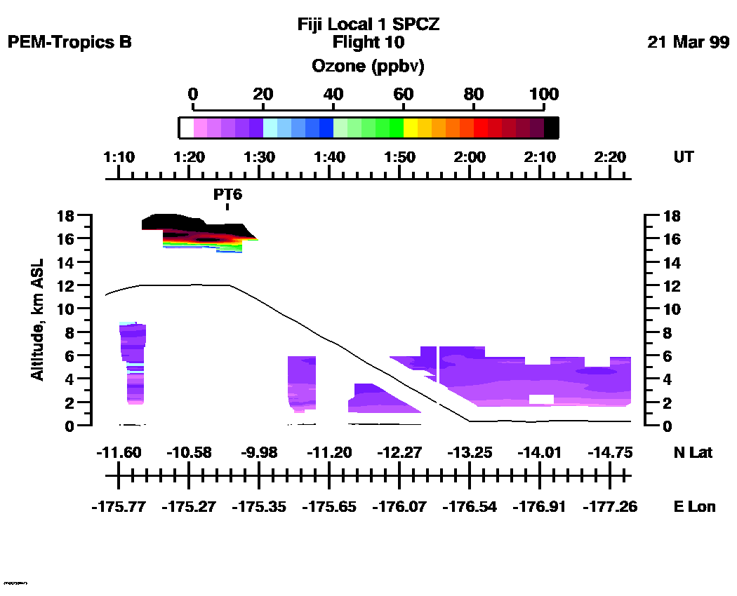
| 01:08:08 - 02:23:00
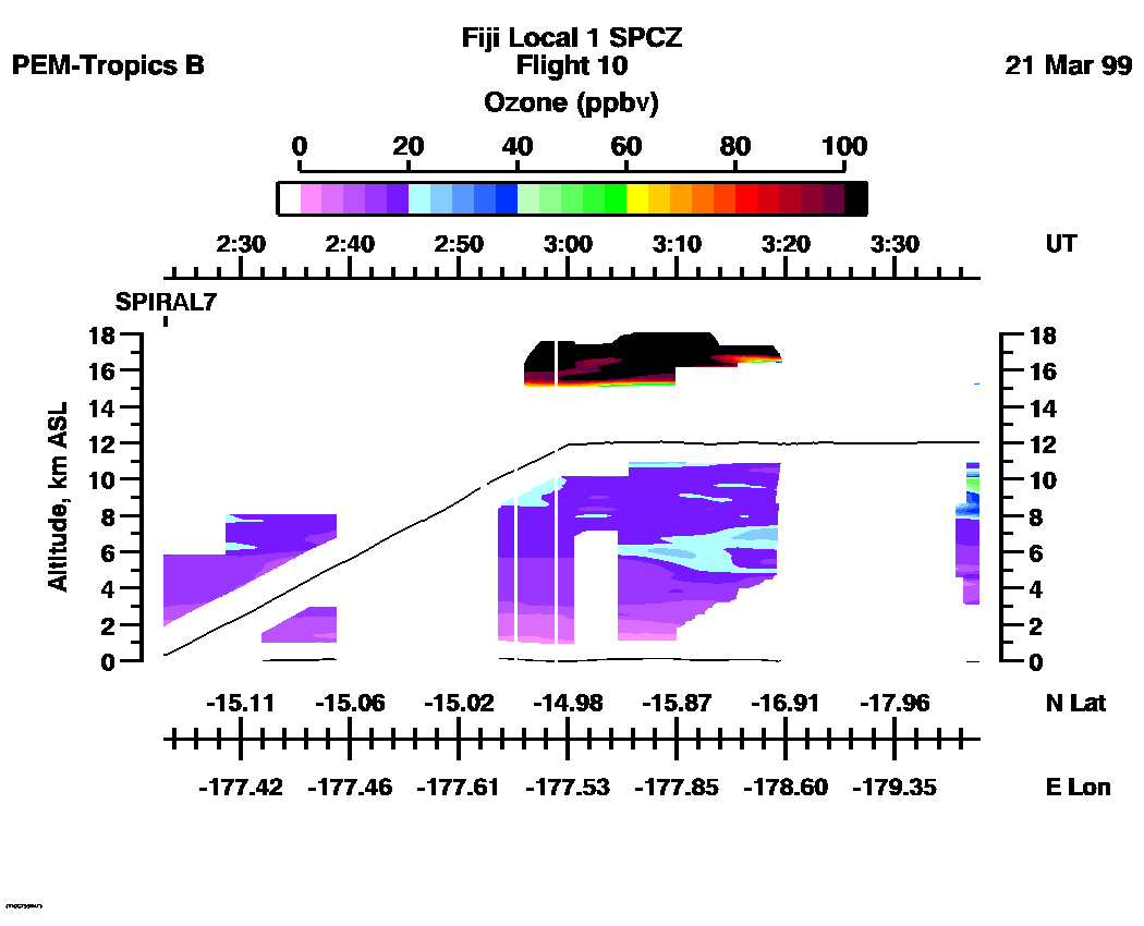
| 02:23:02 - 03:37:49
| 03:37:50 - 04:52:41
| 04:52:43 - 05:54:24
| movie_loop_all |
for additional data. 