 for additional data.
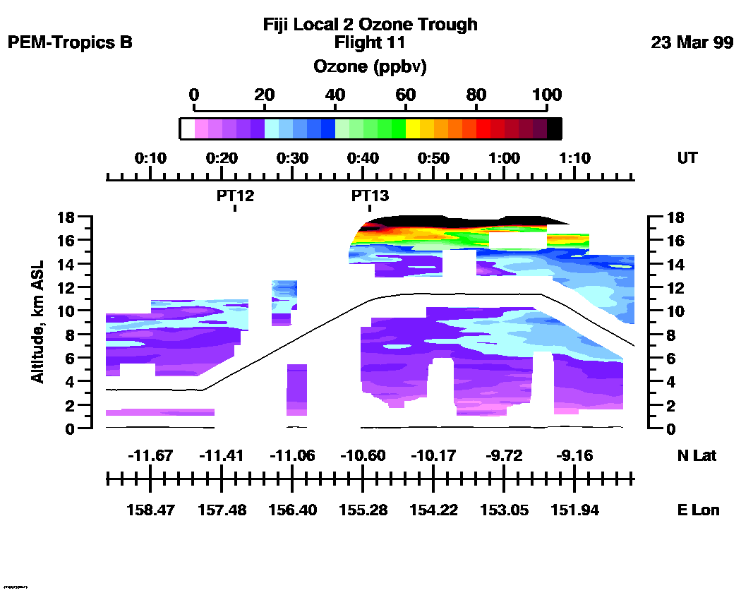
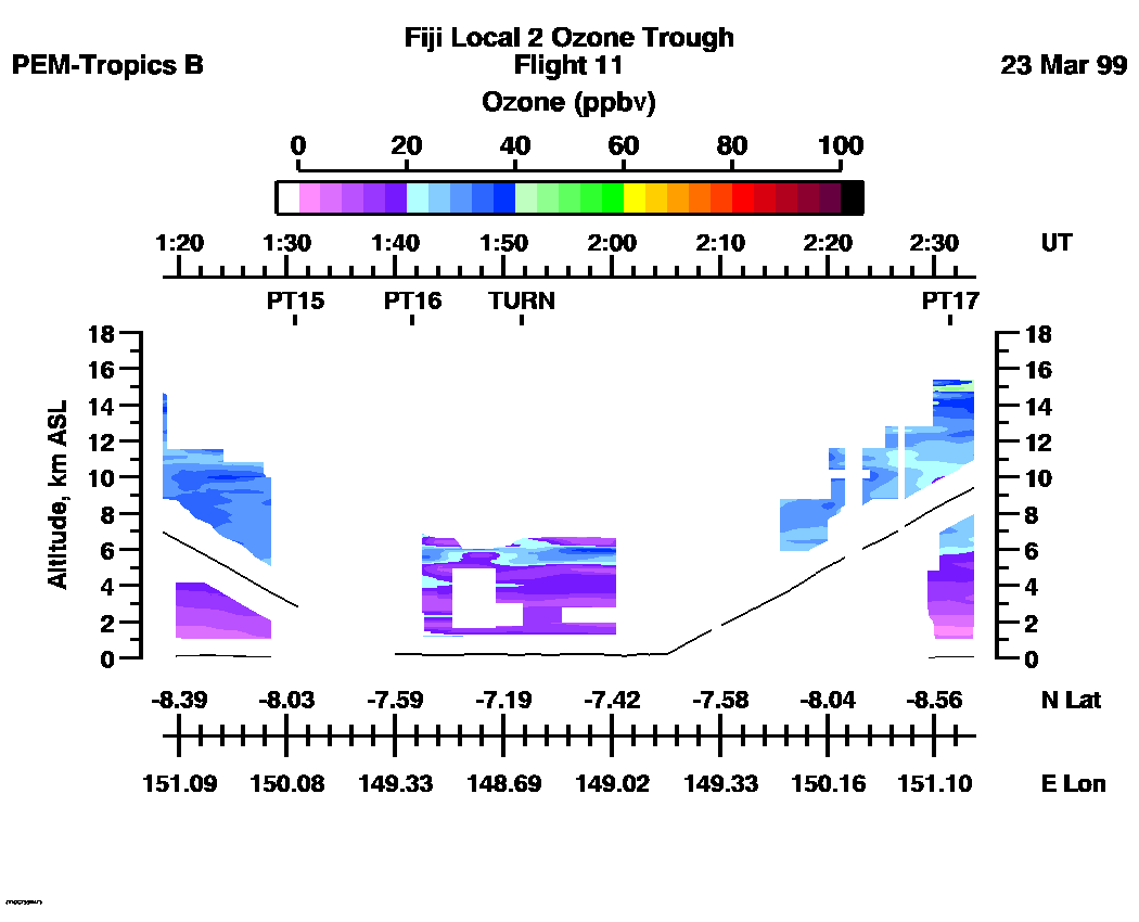
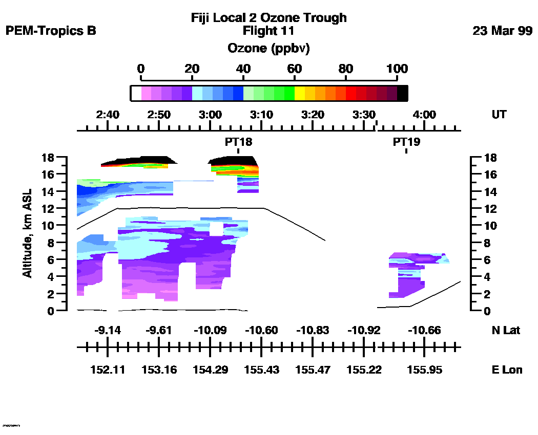
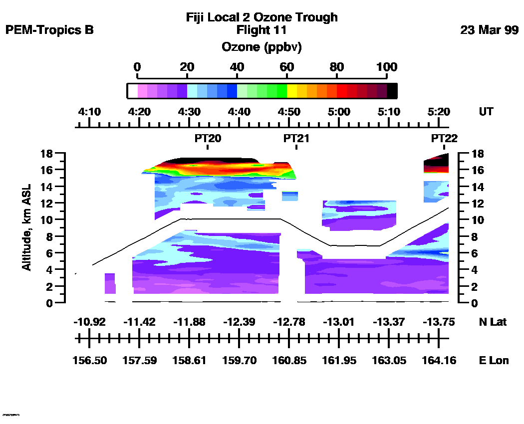
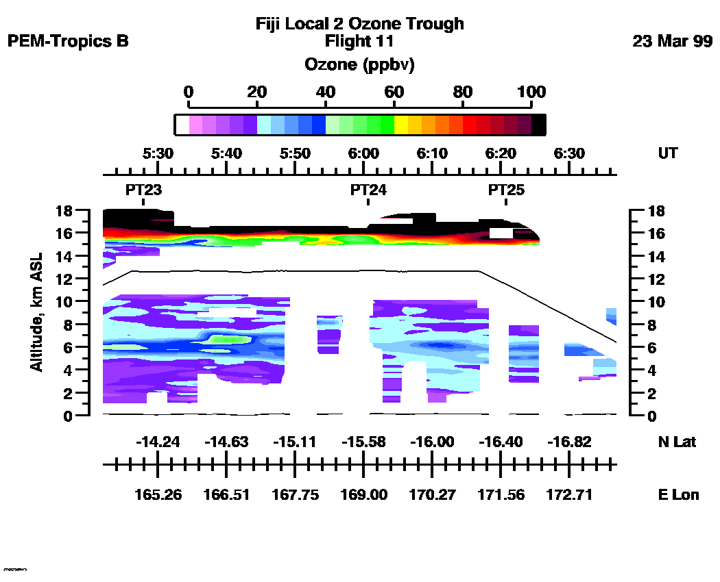
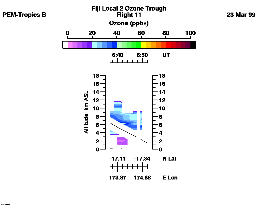
 Flight 11 / PEM-Tropics B -- Fiji Local 2 Ozone Trough / March 22-23, 1999
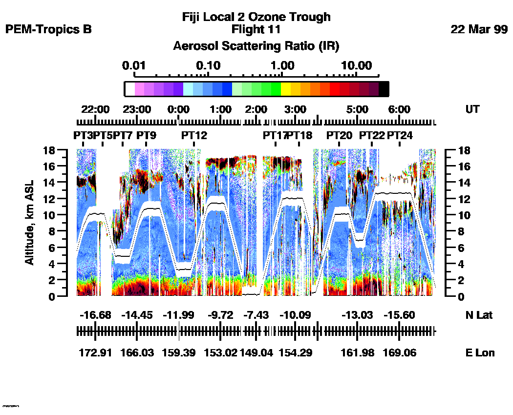
Combined Nadir/Zenith Aerosol Scattering Ratio image for the entire flight
UV-DIAL Aerosol Image : | 21:33:53 - 06:53:49 |
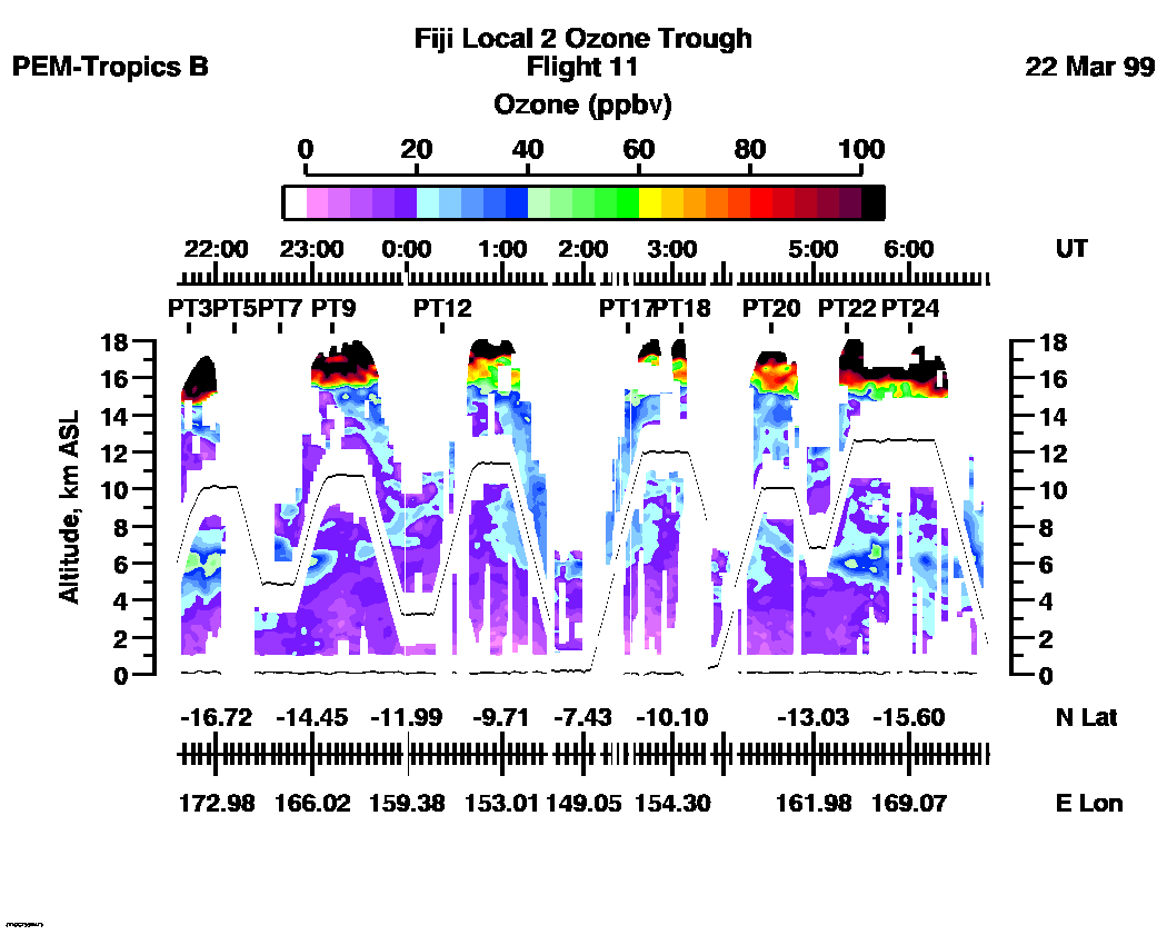
Combined Nadir/Zenith Ozone Mixing Ratio image for the entire flight
UV-DIAL Ozone Image :| 21:35:23 - 06:52:14 |
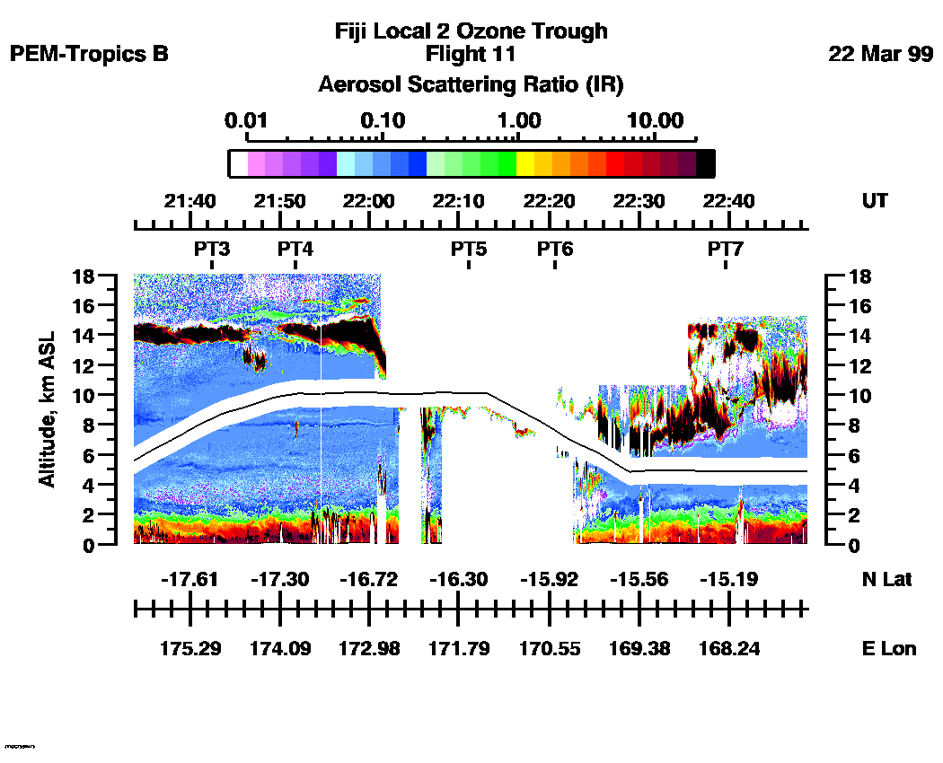
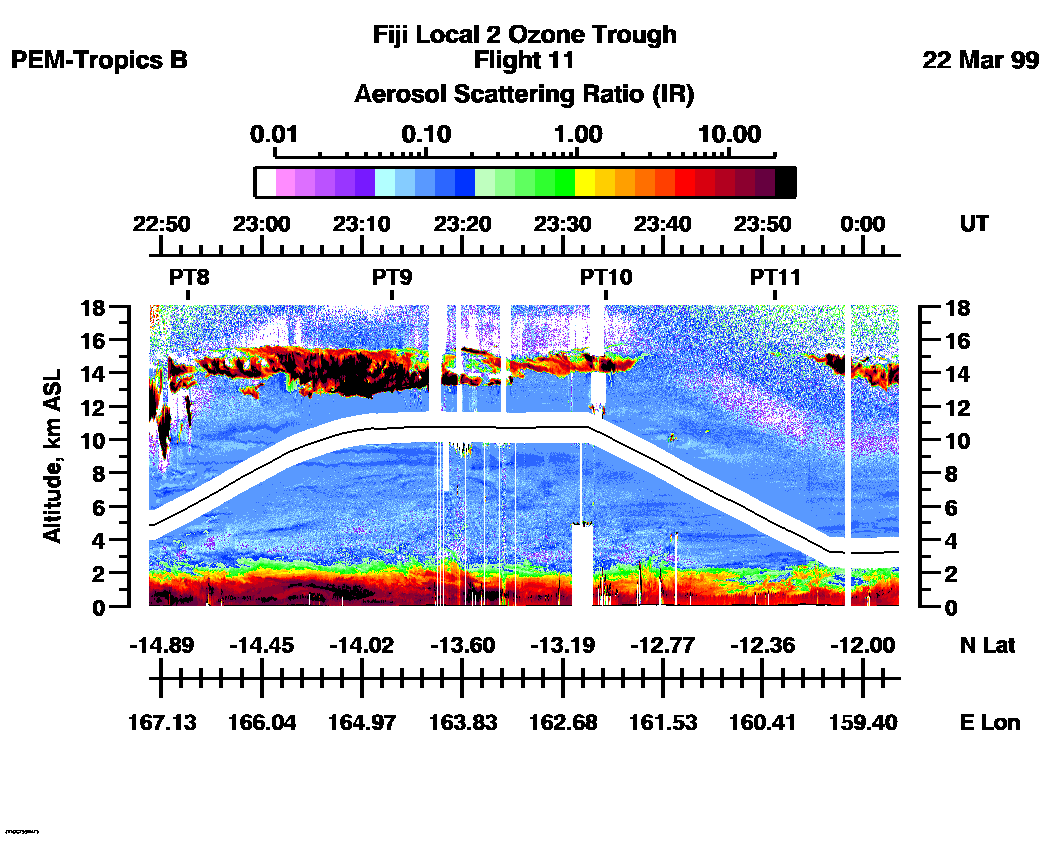
Combined UV-DIAL Aerosol Scattering Ratio Images
Aerosol Images :| 21:33:53 - 22:48:46
| 22:48:48 - 00:03:40
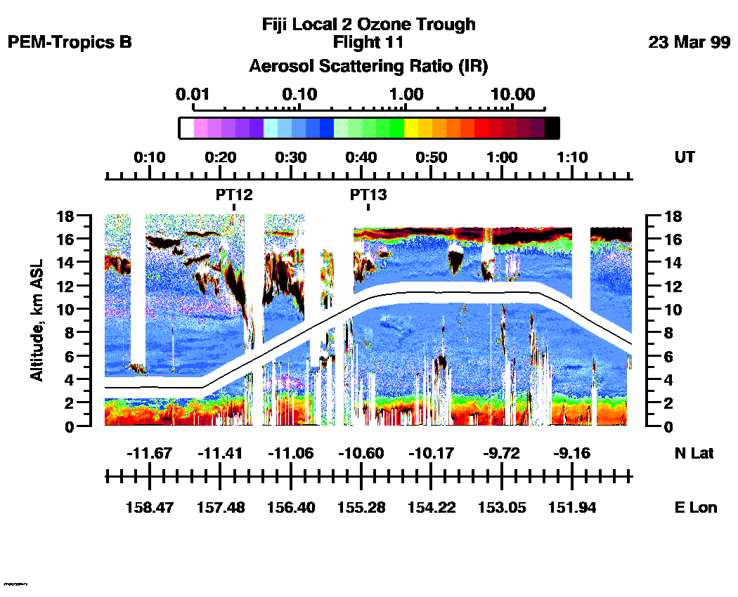
| 00:03:42 - 01:18:34
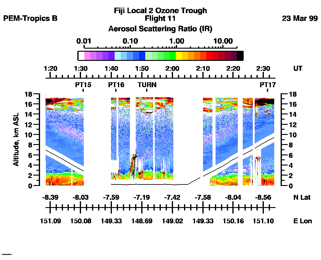
| 01:18:36 - 02:33:49
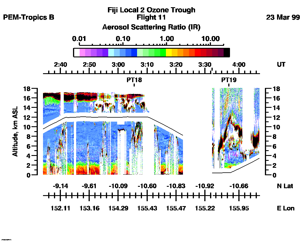
| 02:34:02 - 04:07:09
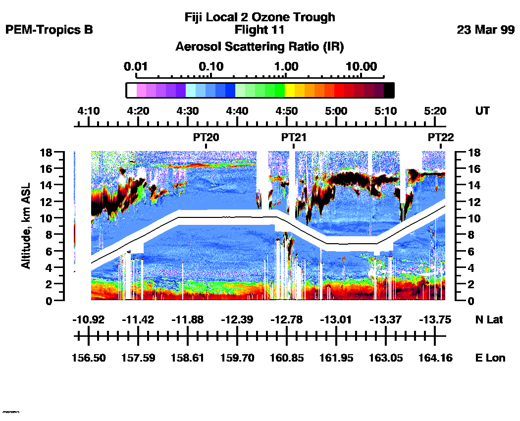
| 04:07:11 - 05:22:03
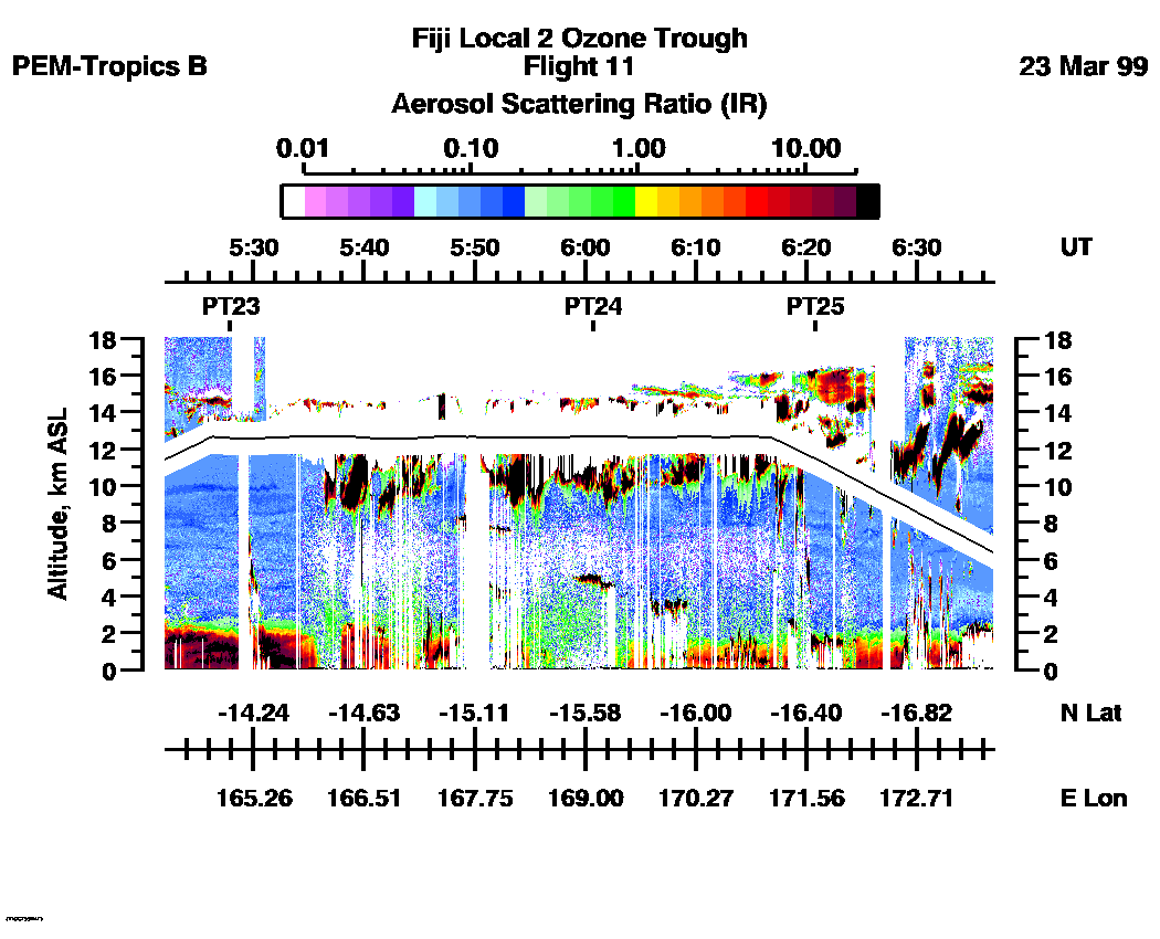
| 05:22:03 - 06:36:56
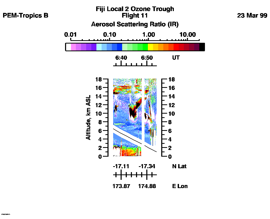
| 06:36:56 - 06:53:43
| movie_loop_all |
Combined UV-DIAL Ozone Images
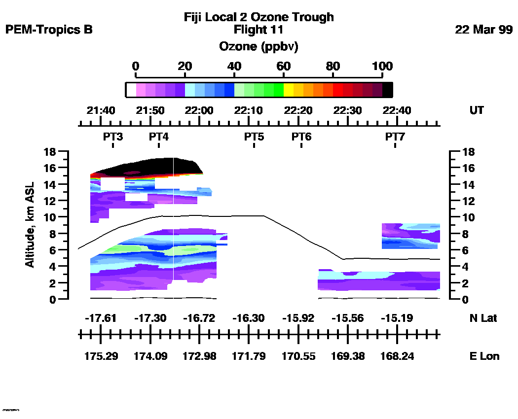
Ozone Images :| 21:35:23 - 22:48:41
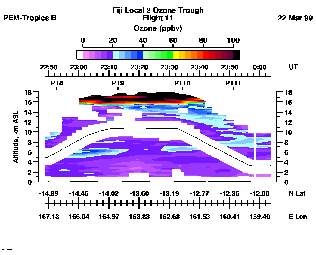
| 22:48:48 - 00:03:40
| 00:03:42 - 01:18:34
| 01:18:36 - 02:33:49
| 02:34:02 - 04:07:09
| 04:07:11 - 05:21:57
| 05:22:03 - 06:36:56
| 06:36:56 - 06:52:13
| movie_loop_all |
for additional data. 