 for additional data.
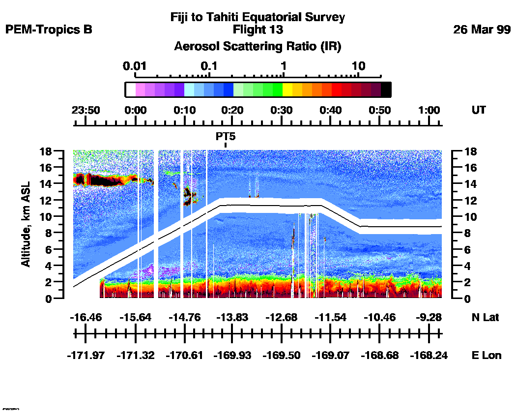
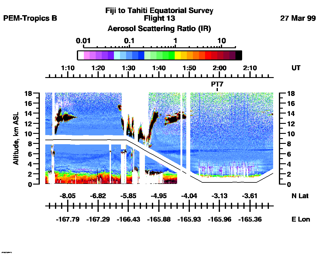
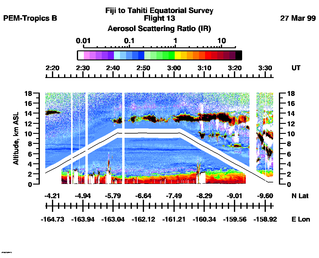
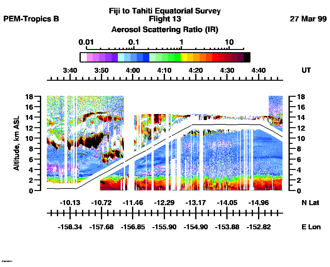
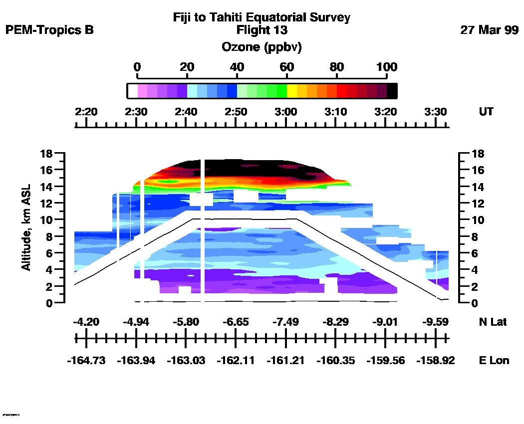
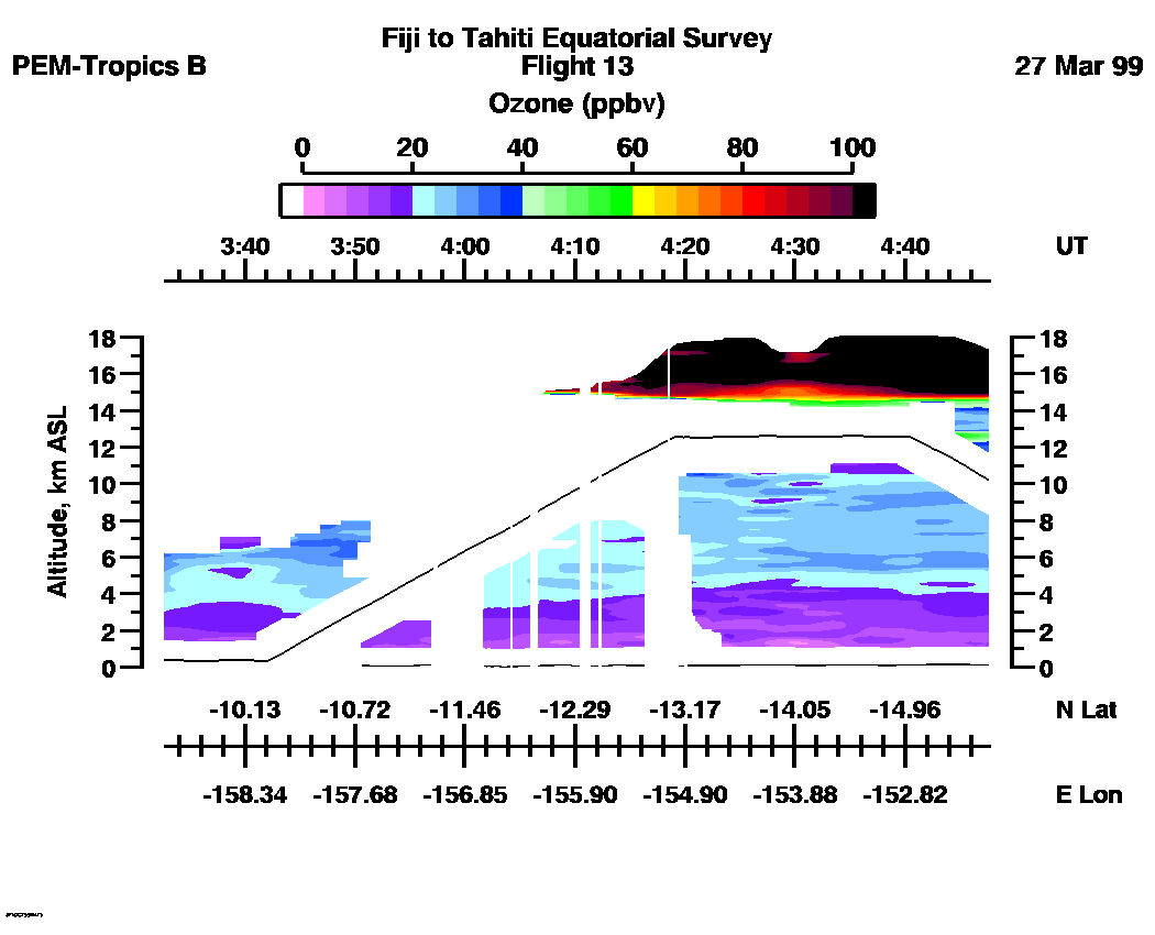
 Flight 13 / PEM-Tropics B -- Fiji to Tahiti Equatorial Survey / March 26-27, 1999
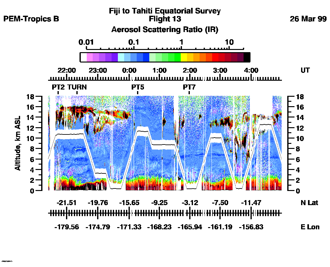
Combined Nadir/Zenith Aerosol Scattering Ratio image for the entire flight
UV-DIAL Aerosol Image : | 21:25:01 - 05:11:37 |
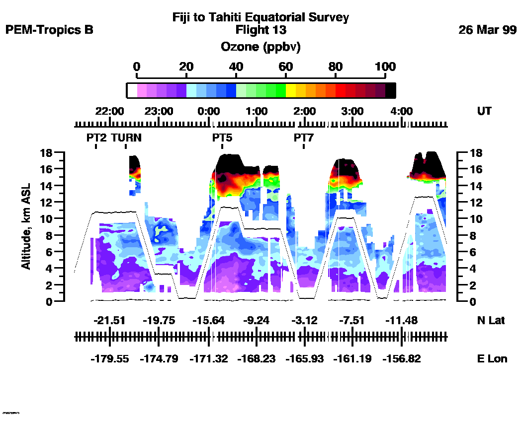
Combined Nadir/Zenith Ozone Mixing Ratio image for the entire flight
UV-DIAL Ozone Image :| 21:17:38 - 04:59:03 |
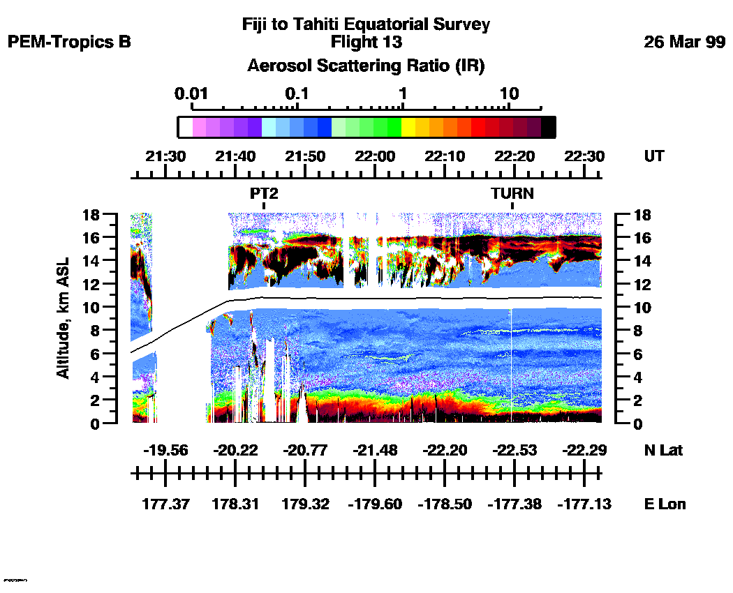
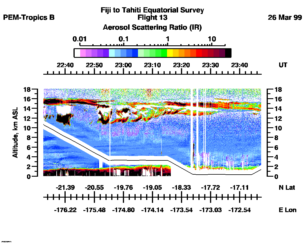
Combined UV-DIAL Aerosol Scattering Ratio Images
Aerosol Images :| 21:17:38 - 22:32:25
| 22:32:34 - 23:47:24
| 23:47:30 - 01:02:40
| 01:02:44 - 02:17:38
| 02:17:44 - 03:32:42
| 03:32:46 - 04:47:37
| movie_loop_all |
Combined UV-DIAL Ozone Images
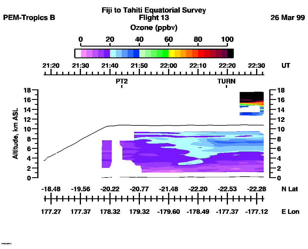
Ozone Images :| 21:17:38 - 22:32:28
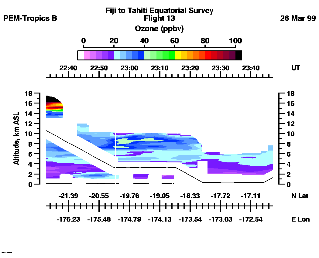
| 22:32:36 - 23:47:14
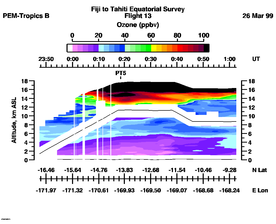
| 23:47:30 - 01:02:34
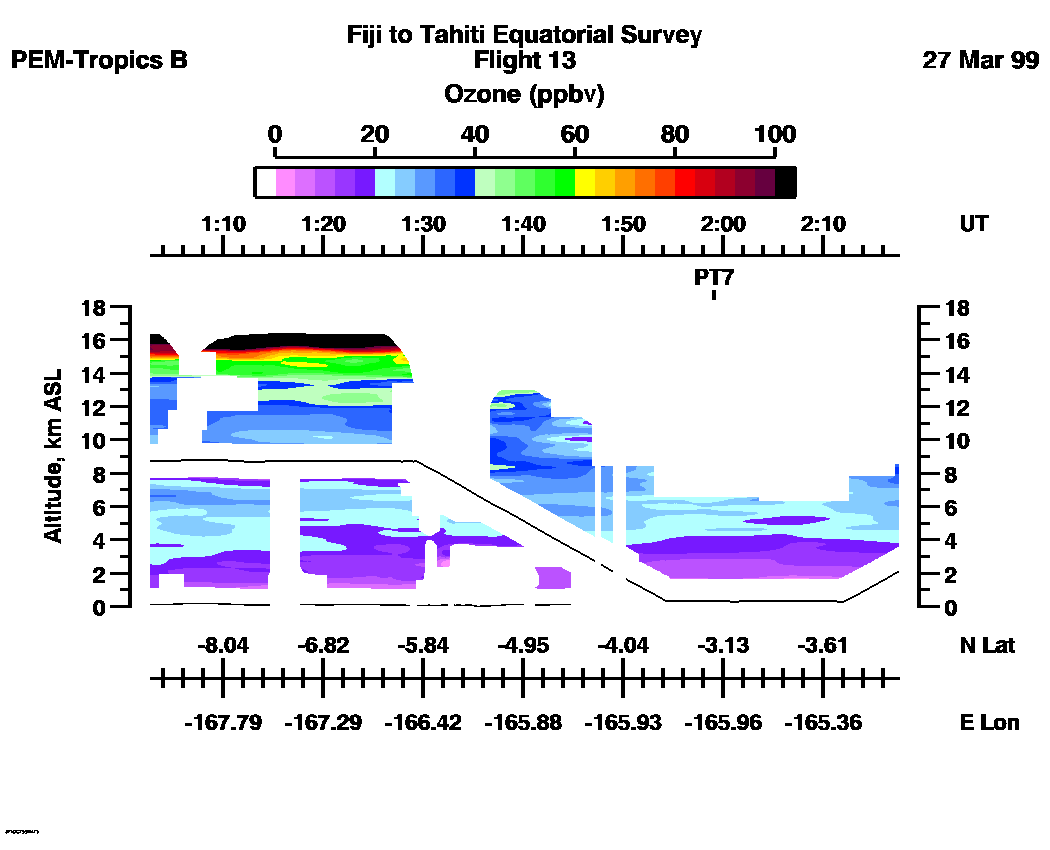
| 01:02:46 - 02:17:34
| 02:17:42 - 03:32:40
| 03:32:46 - 04:47:37
| movie_loop_all |
for additional data. 