 for additional data.
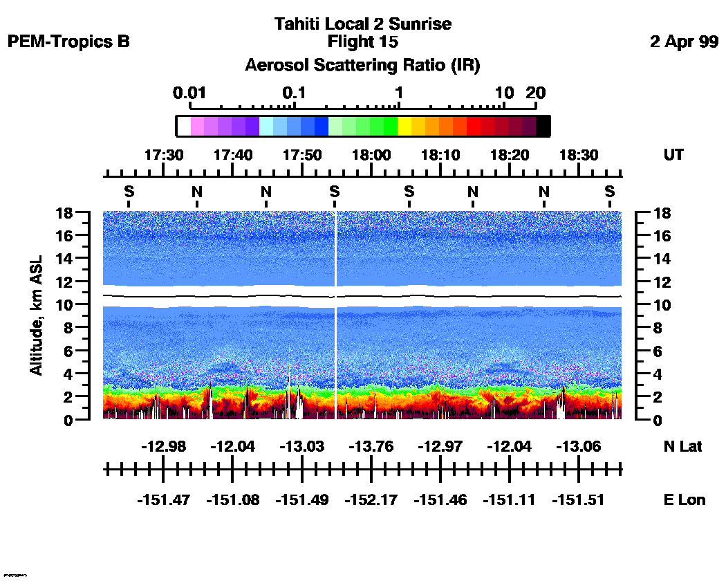
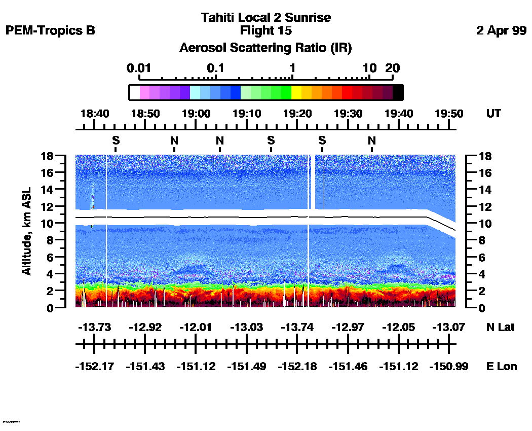
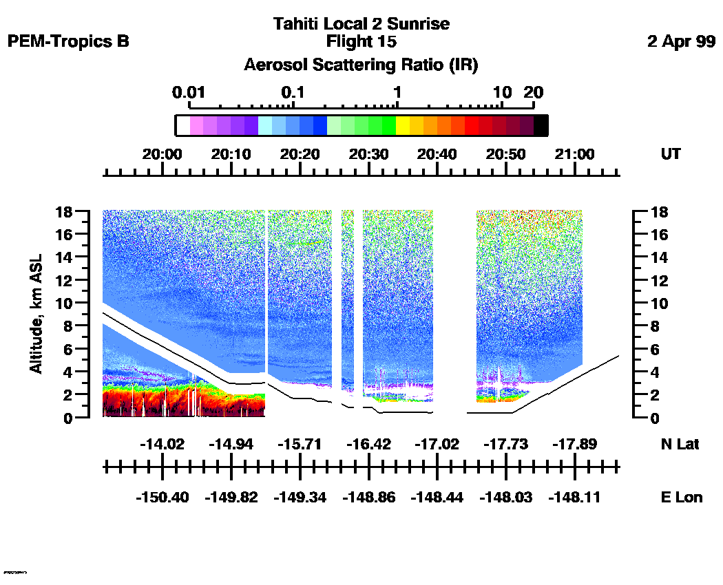
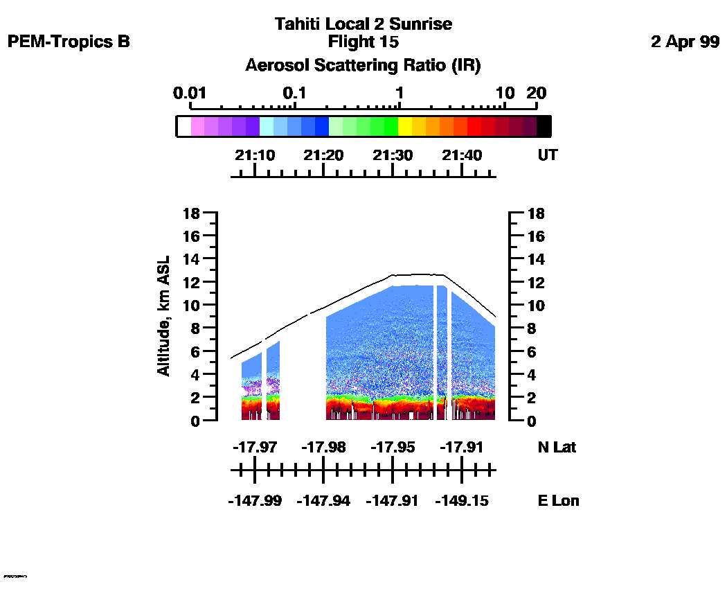
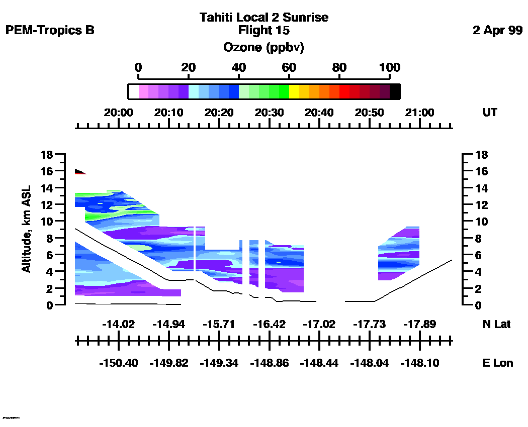
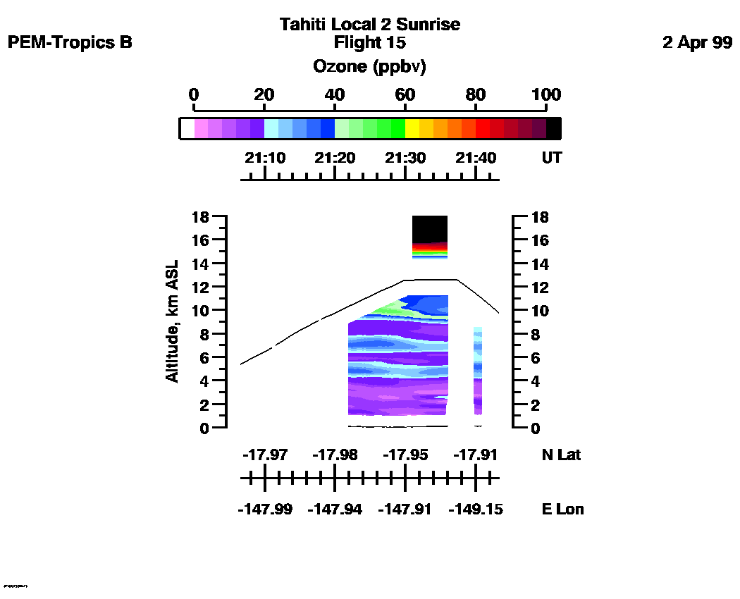
 Flight 15 / PEM-Tropics B -- Tahiti Local 2 Sunrise / April 2, 1999
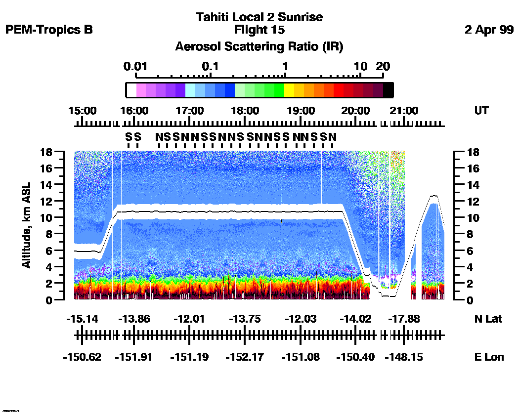
Combined Nadir/Zenith Aerosol Scattering Ratio image for the entire flight
UV-DIAL Aerosol Image : | 14:51:32 - 21:44:53 |
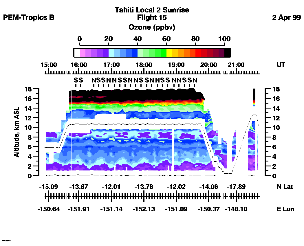
Combined Nadir/Zenith Ozone Mixing Ratio image for the entire flight
UV-DIAL Ozone Image :| 14:53:02 - 21:43:19 |
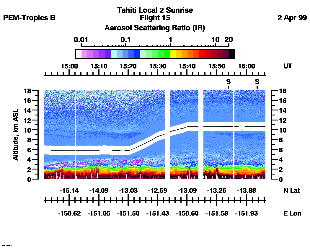
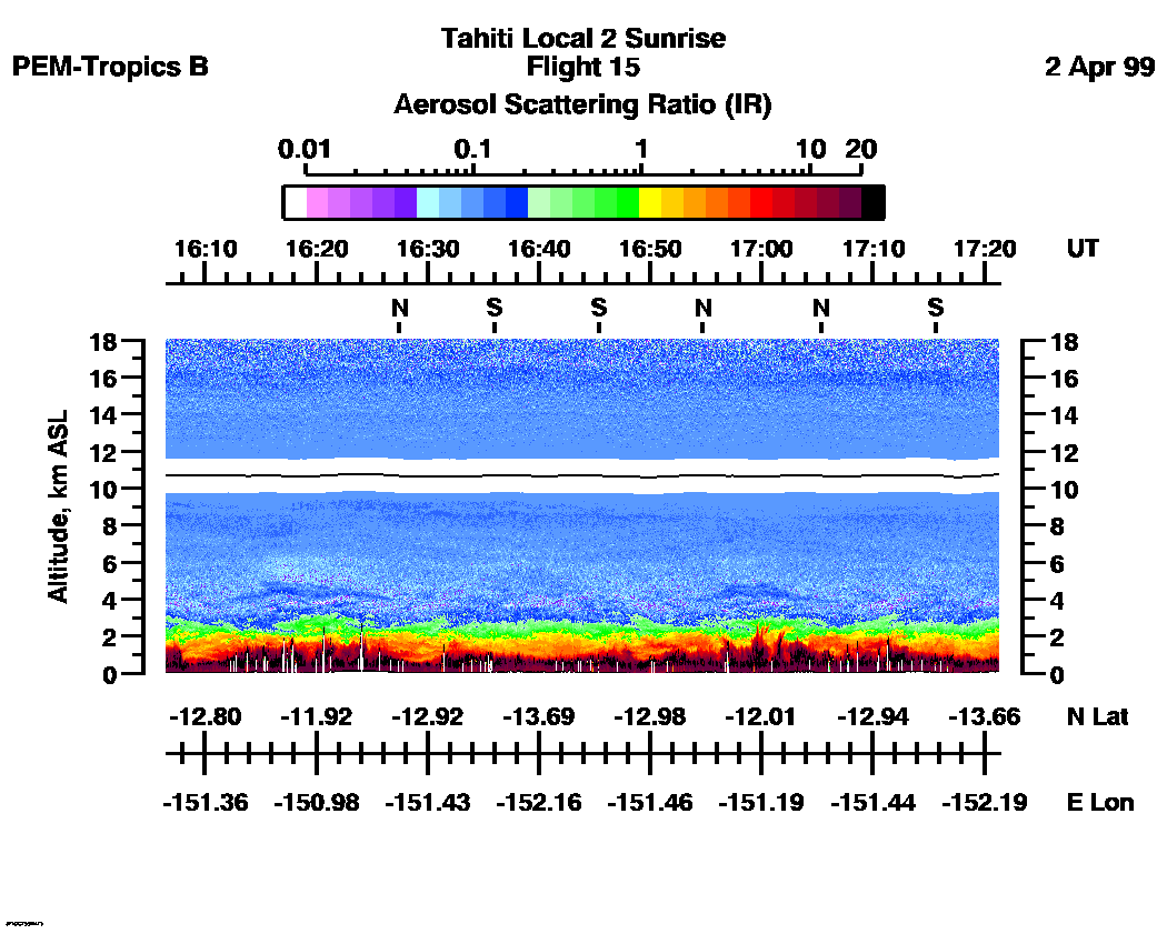
Combined UV-DIAL Aerosol Scattering Ratio Images
Aerosol Images :| 14:51:32 - 16:06:27
| 16:06:31 - 17:21:23
| 17:21:23 - 18:36:15
| 18:36:21 - 19:51:19
| 19:51:25 - 21:06:28
| 21:06:34 - 21:44:49
| movie_loop_all |
Combined UV-DIAL Ozone Images
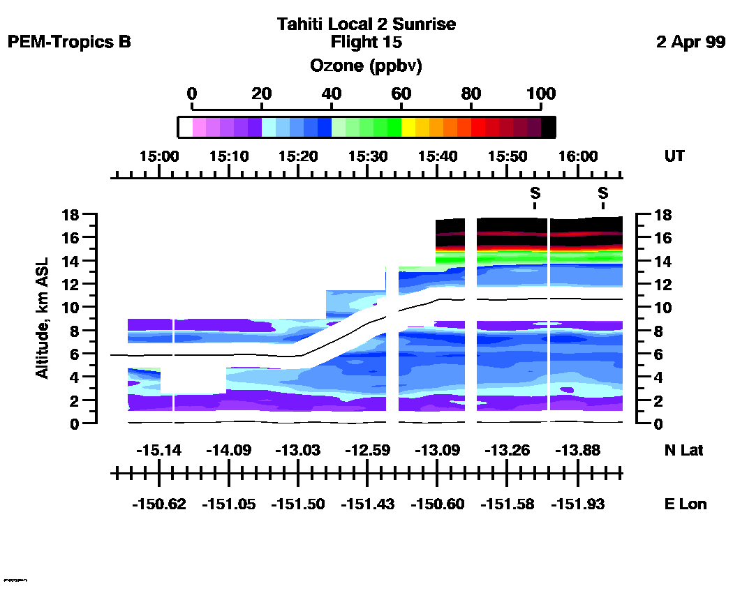
Ozone Images :| 14:53:02 - 16:06:21
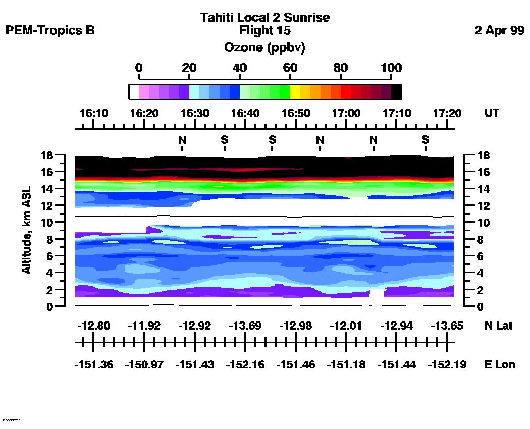
| 16:06:27 - 17:21:19
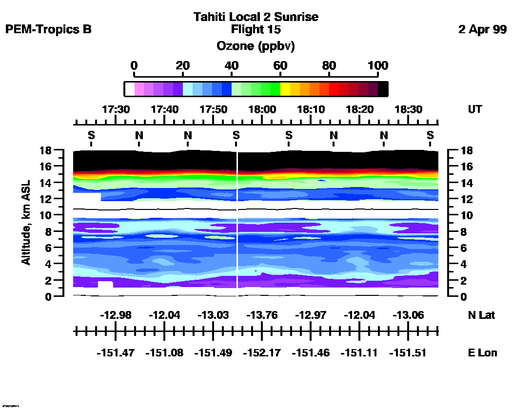
| 17:21:23 - 18:36:09
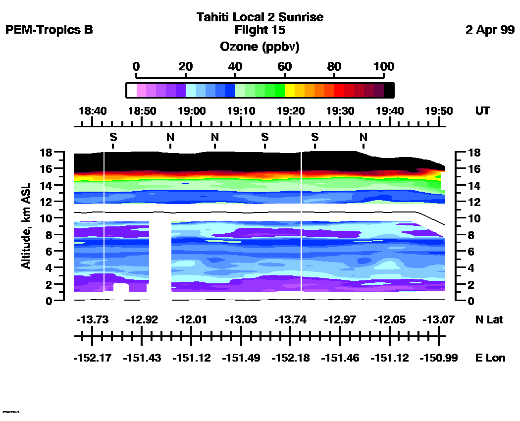
| 18:36:21 - 19:51:19
| 19:51:25 - 21:06:24
| 21:06:34 - 21:43:13
| movie_loop_all |
for additional data. 