 for additional data.
 Flight 16 / PEM-Tropics B -- Tahiti Local 3 Sunset / April 4-5, 1999
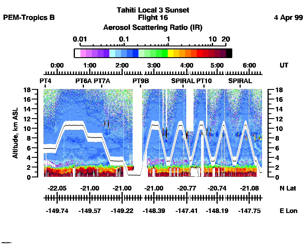
Combined Nadir/Zenith Aerosol Scattering Ratio image for the entire flight
UV-DIAL Aerosol Image : | 23:35:59 - 06:32:52 |
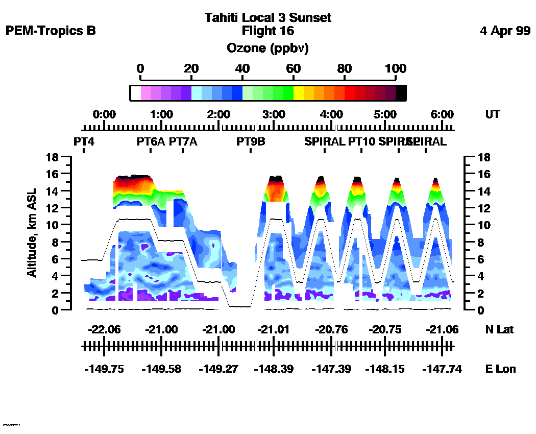
Combined Nadir/Zenith Ozone Mixing Ratio image for the entire flight
UV-DIAL Ozone Image :| 23:36:23 - 06:12:19 |
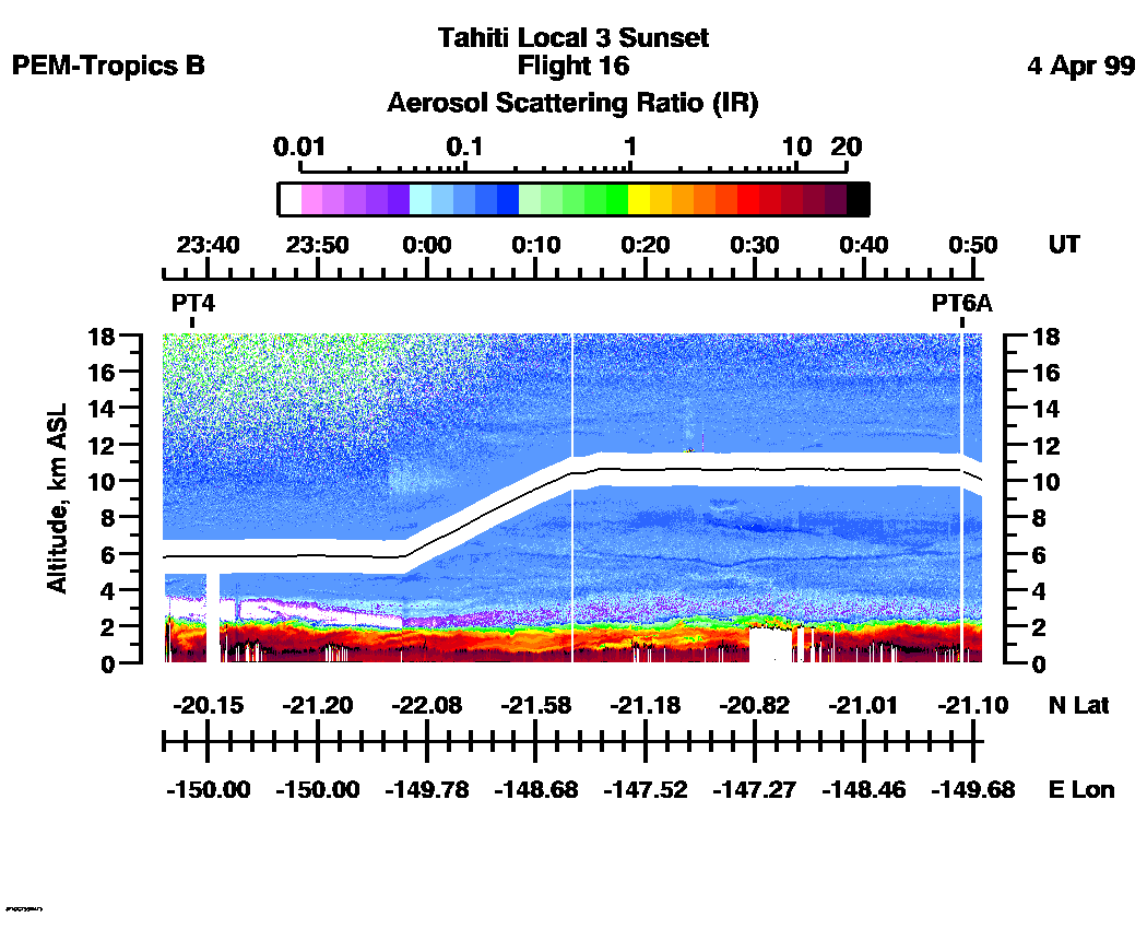
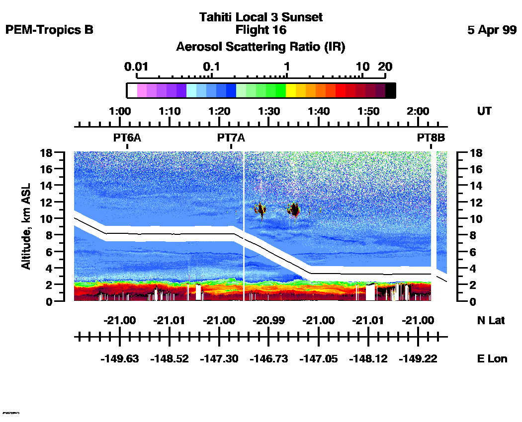
Combined UV-DIAL Aerosol Scattering Ratio Images
Aerosol Images :| 23:35:59 - 00:50:52
| 00:50:56 - 02:05:49
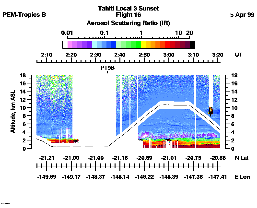
| 02:05:53 - 03:20:58
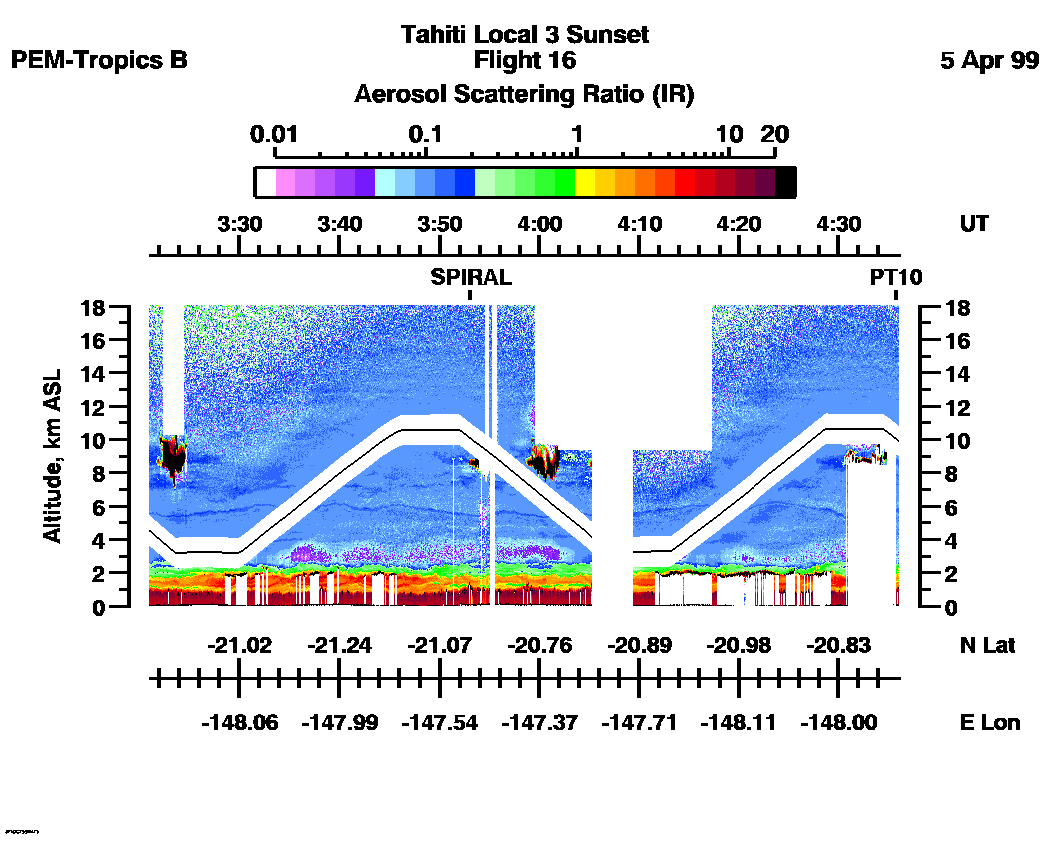
| 03:21:02 - 04:36:02
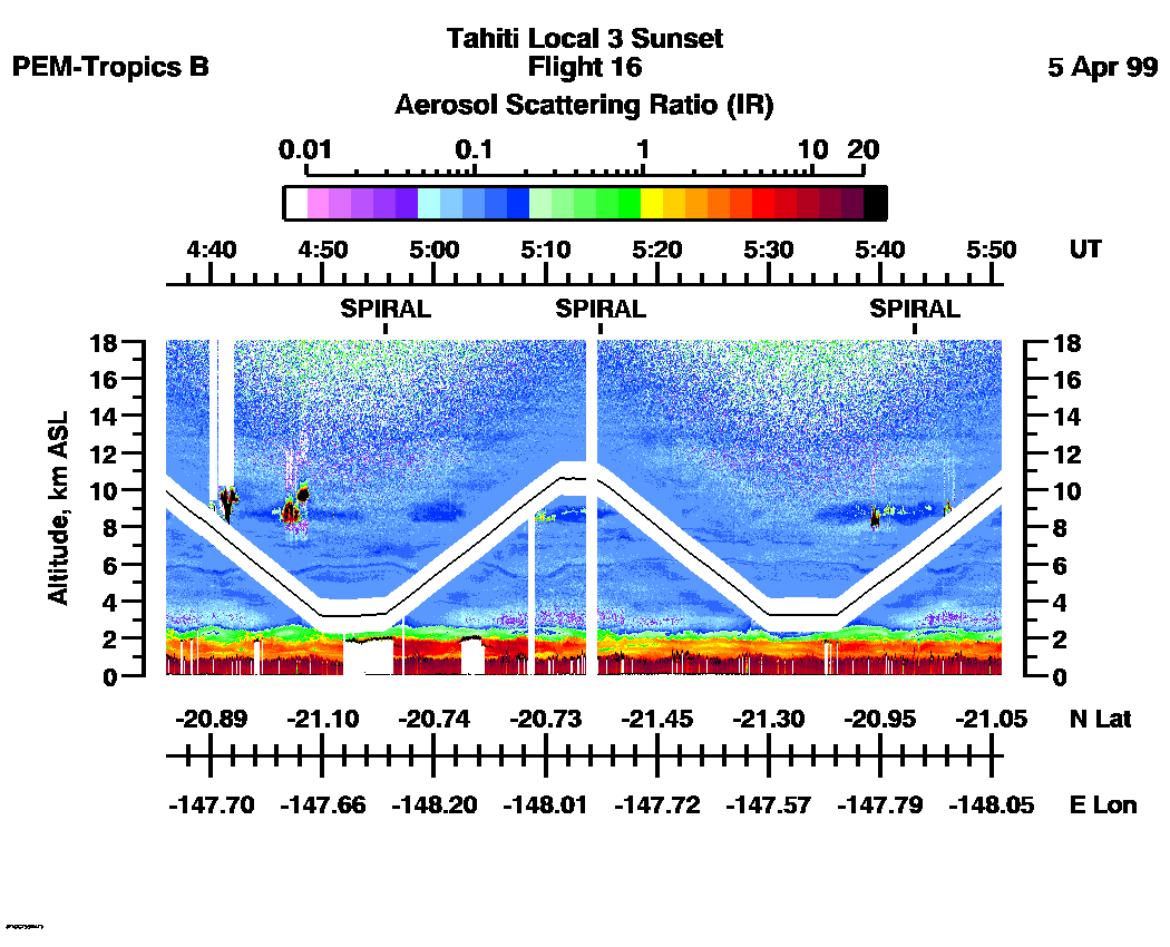
| 04:36:02 - 05:50:57
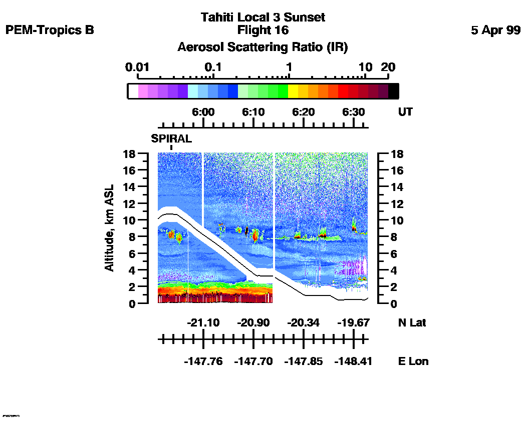
| 05:50:59 - 06:32:50
| movie_loop_all |
Combined UV-DIAL Ozone Images
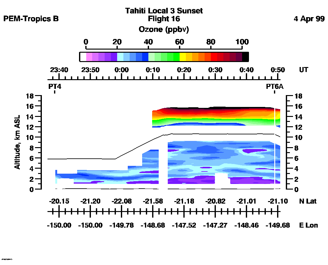
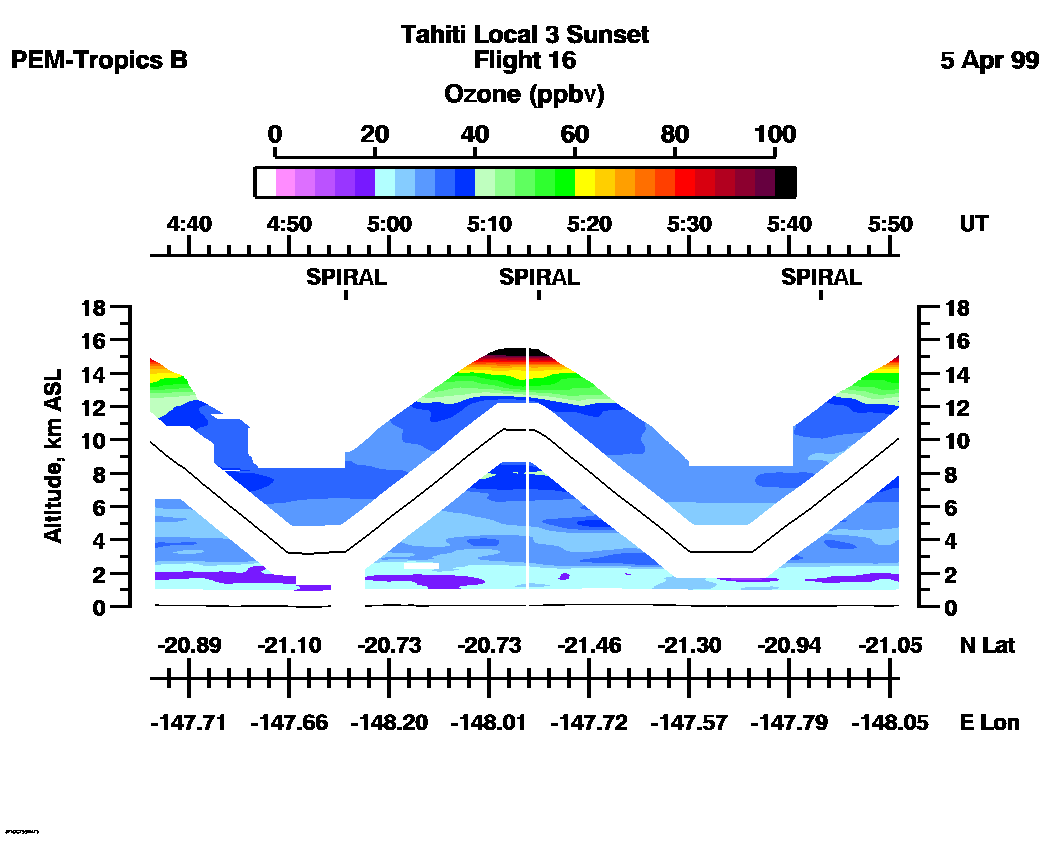
Ozone Images :| 23:36:23 - 00:50:46
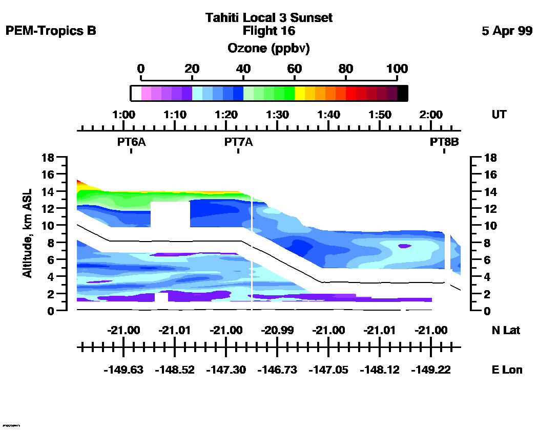
| 00:50:56 - 02:05:43
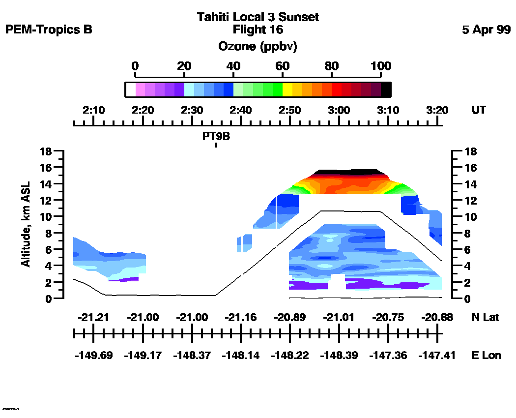
| 02:05:53 - 03:20:58
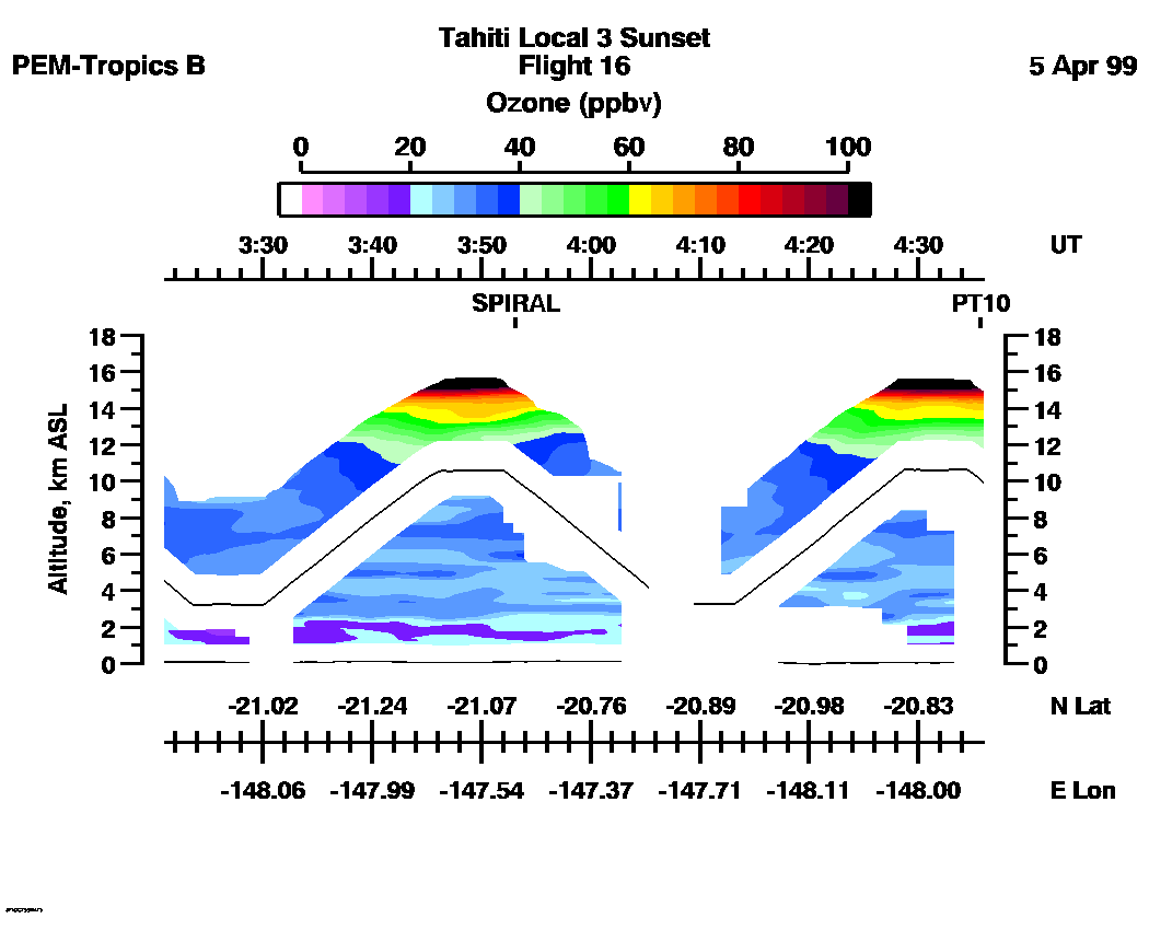
| 03:21:02 - 04:35:56
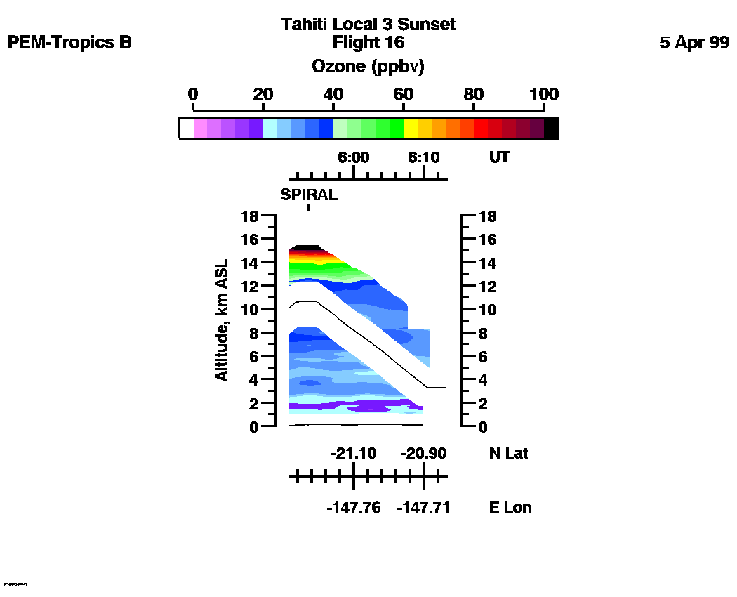
| 04:36:06 - 05:50:53
| 05:50:57 - 06:13:15
| movie_loop_all |
for additional data. 