 for additional data.
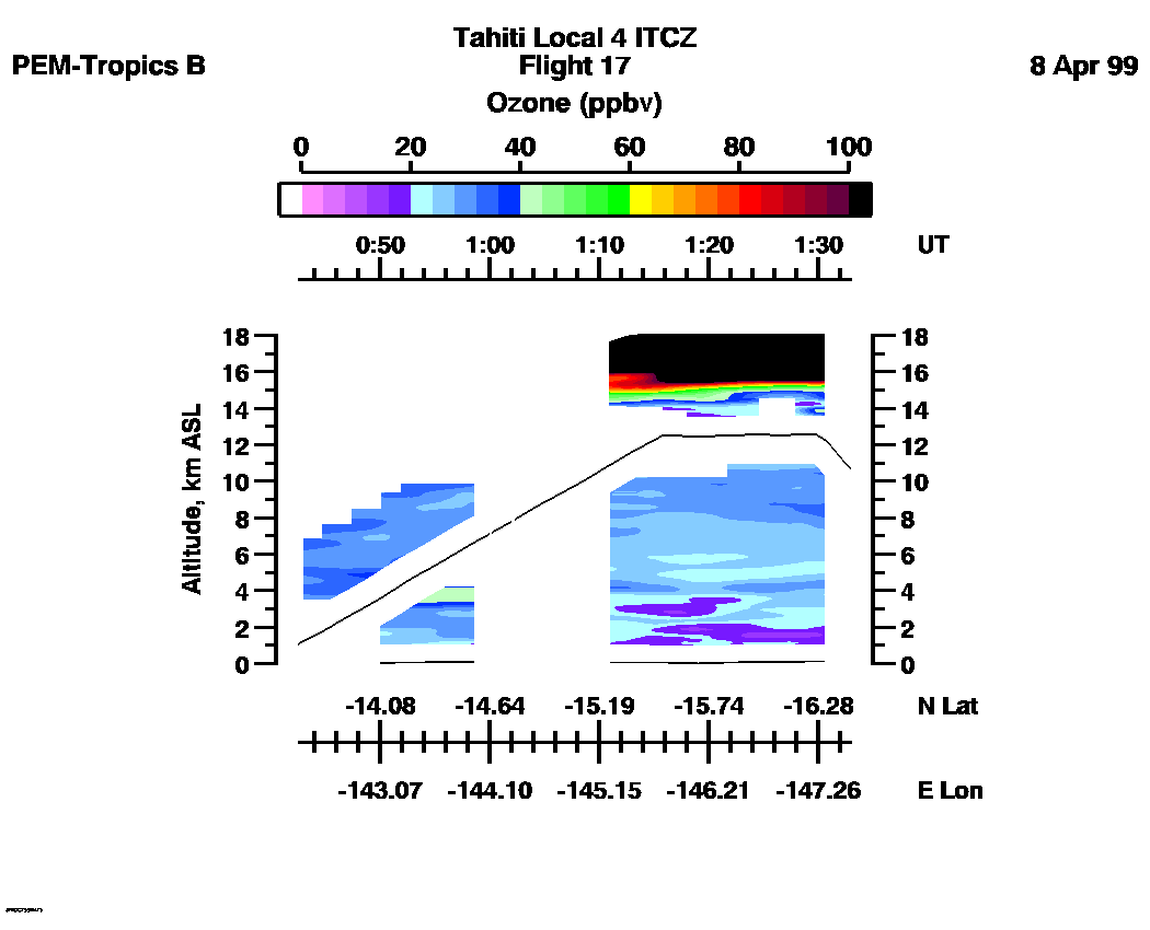
 Flight 17 / PEM-Tropics B -- Tahiti Local 4 ITCZ / April 7-8, 1999
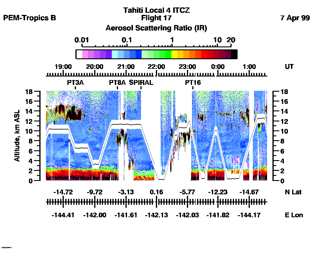
Combined Nadir/Zenith Aerosol Scattering Ratio image for the entire flight
UV-DIAL Aerosol Image : | 18:27:05 - 01:34:37 |
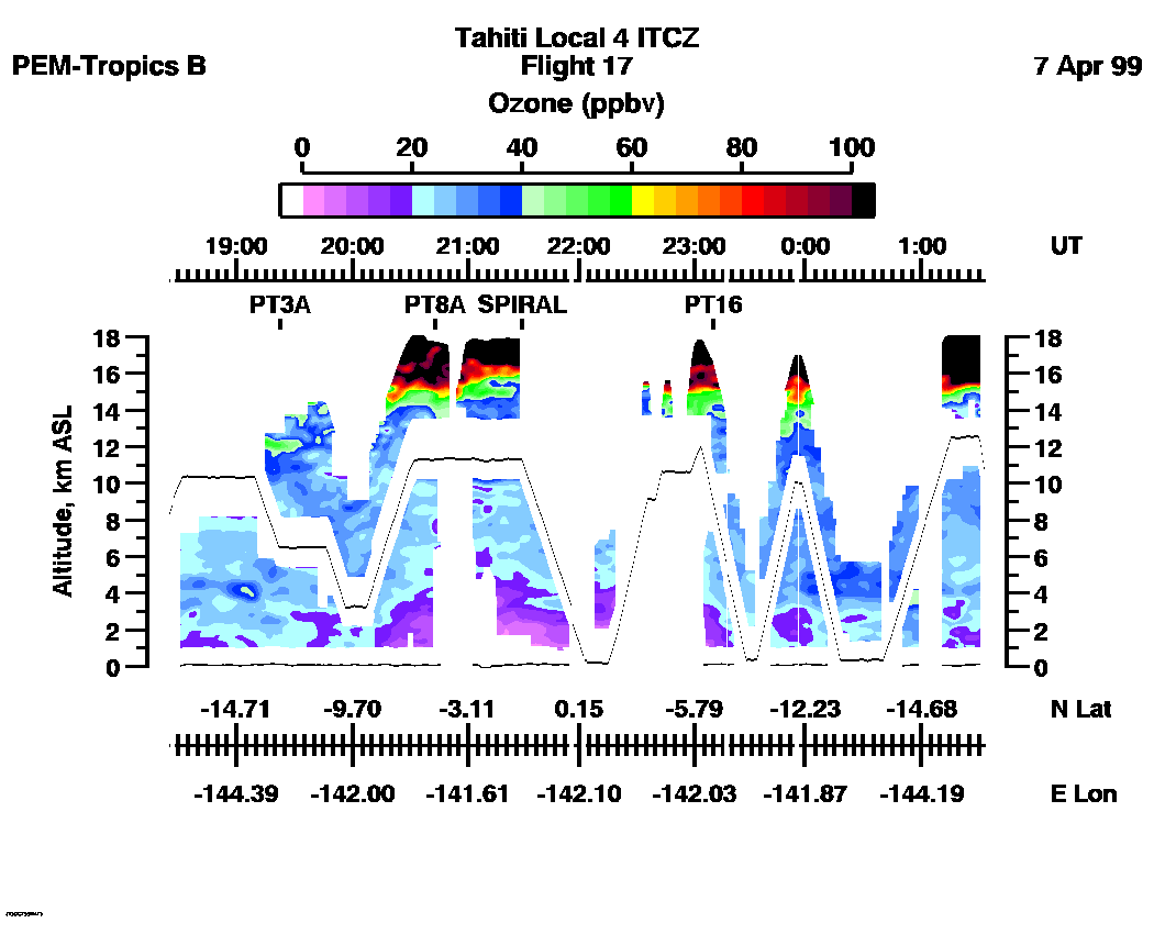
Combined Nadir/Zenith Ozone Mixing Ratio image for the entire flight
UV-DIAL Ozone Image :| 18:25:06 - 01:33:03 |
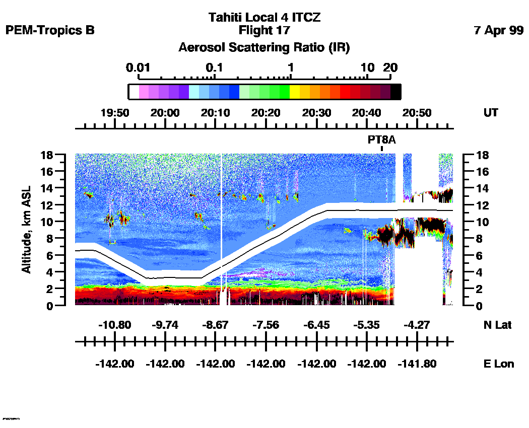
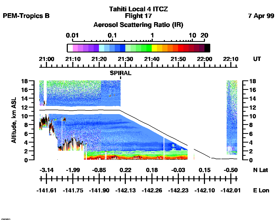
Combined UV-DIAL Aerosol Scattering Ratio Images
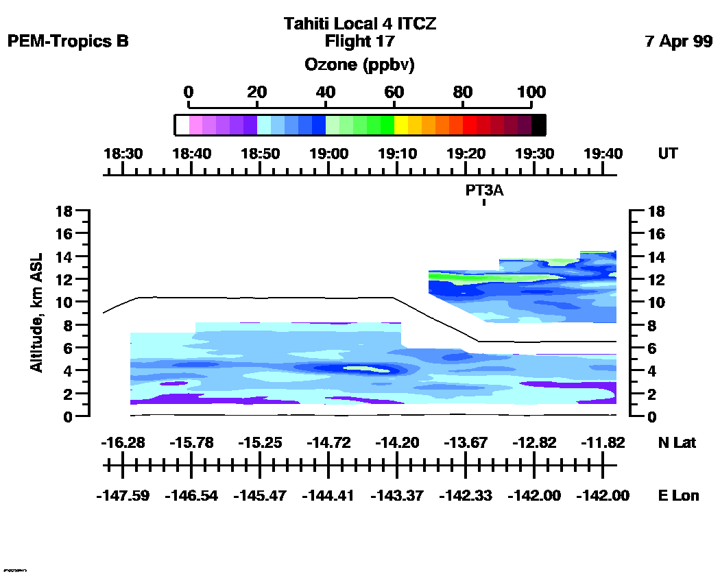
Aerosol Images :| 18:27:05 - 19:42:03
| 19:42:09 - 20:57:11
| 20:57:17 - 22:12:24
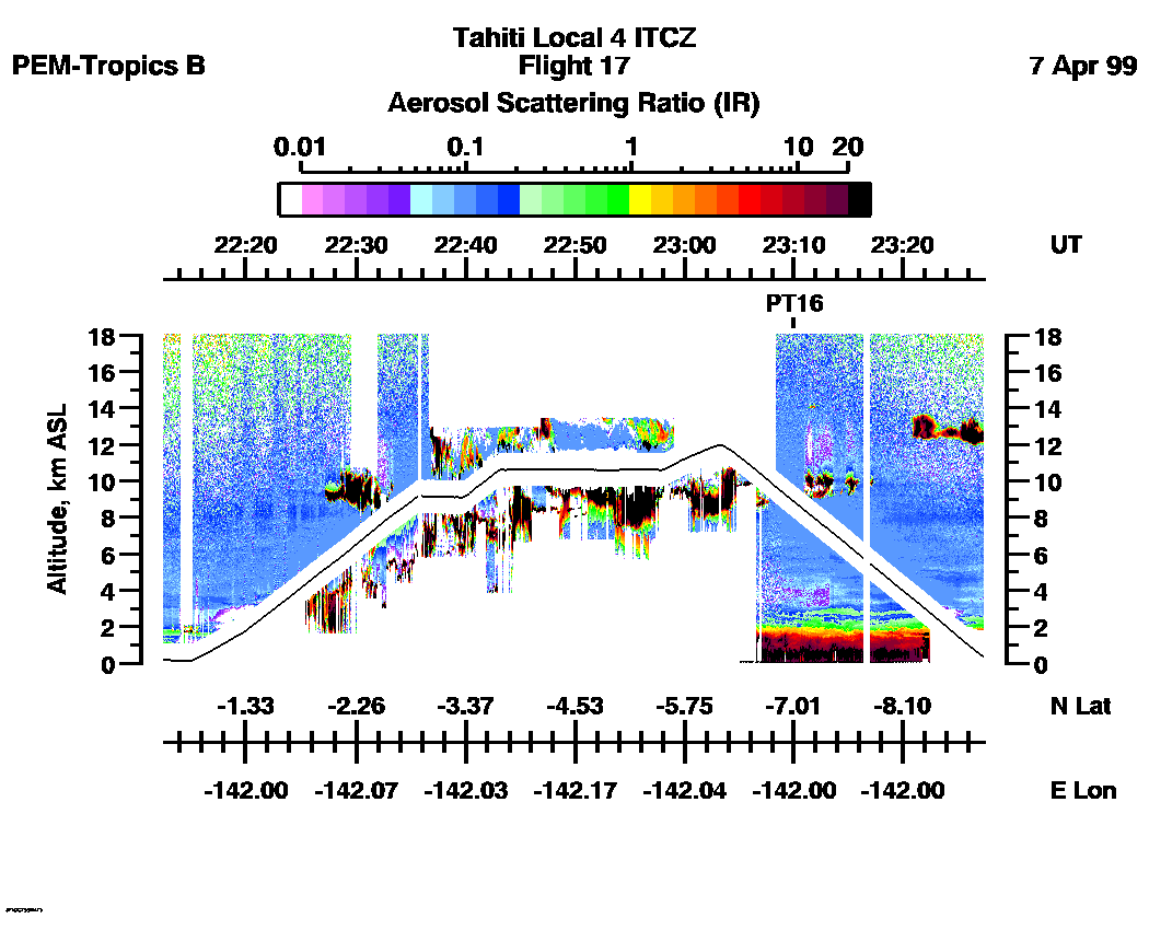
| 22:12:30 - 23:27:24
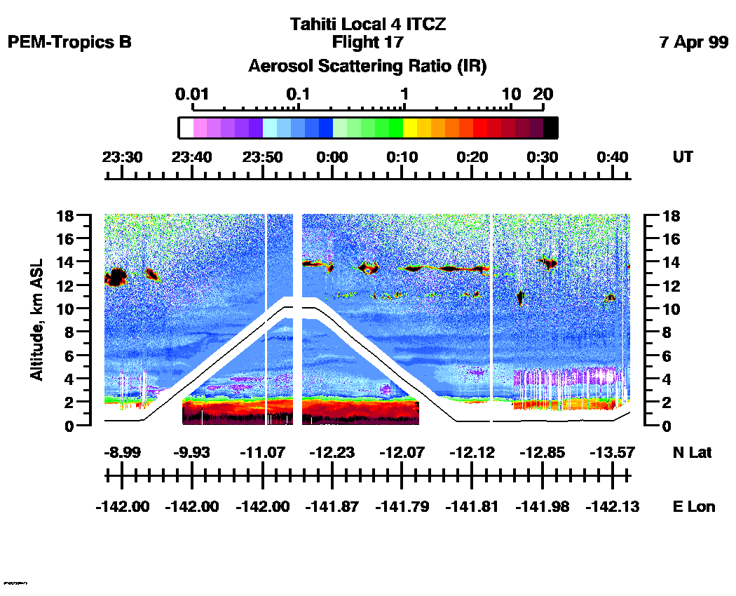
| 23:27:30 - 00:42:31
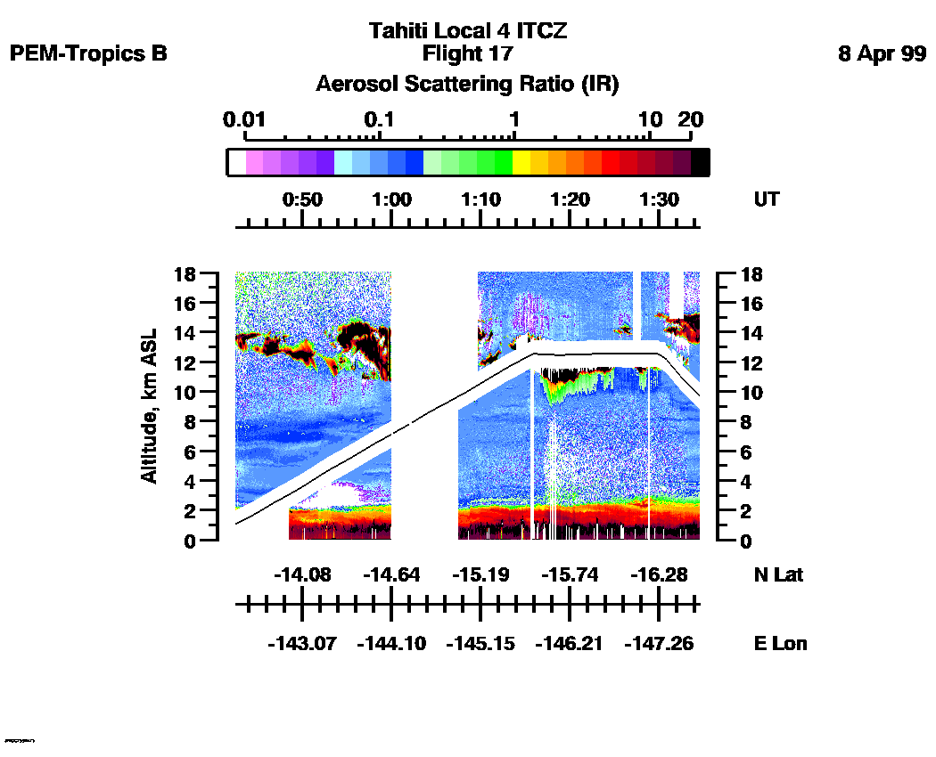
| 00:42:31 - 01:34:35
| movie_loop_all |
Combined UV-DIAL Ozone Images
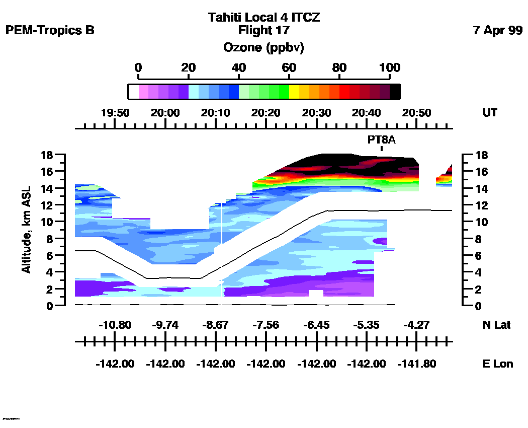
Ozone Images :| 18:27:05 - 19:41:57
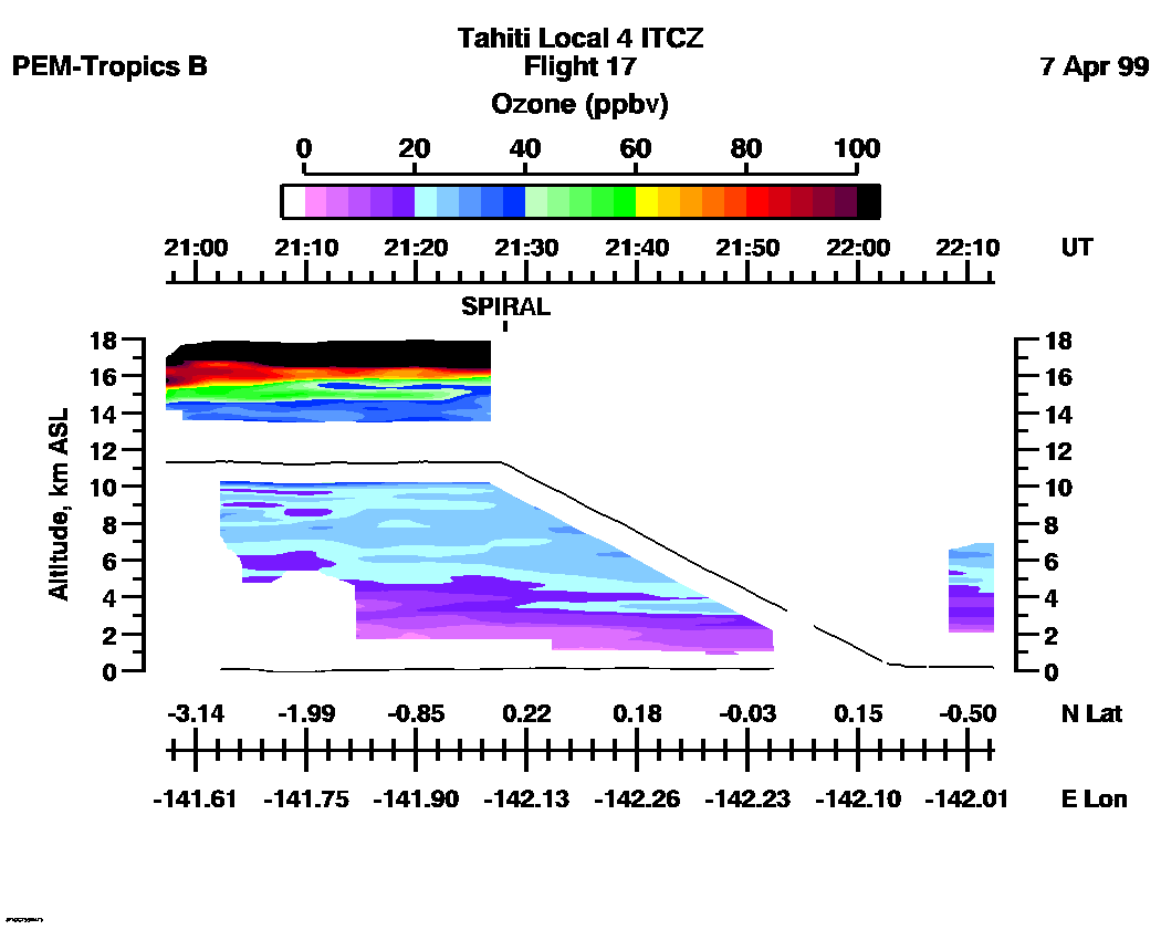
| 19:42:03 - 20:57:05
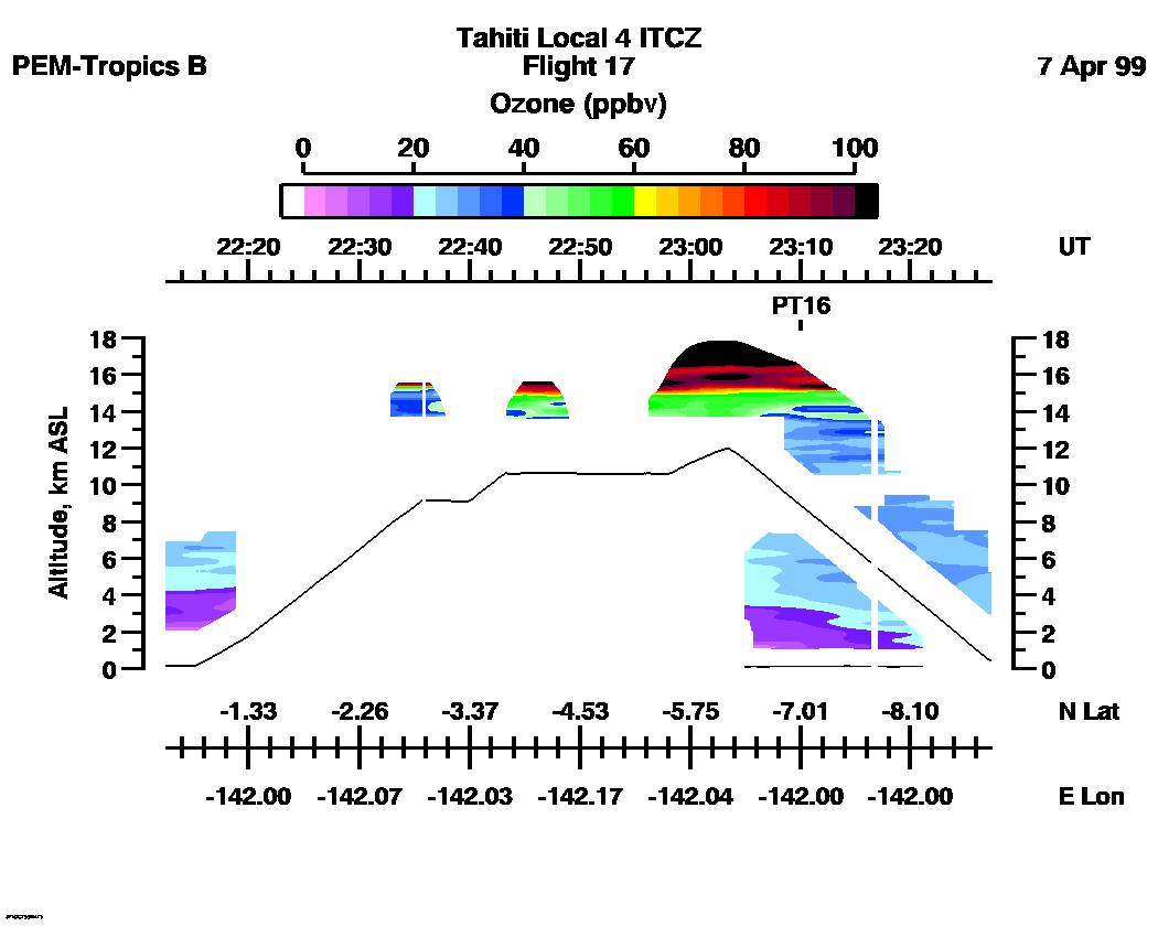
| 20:57:17 - 22:12:18
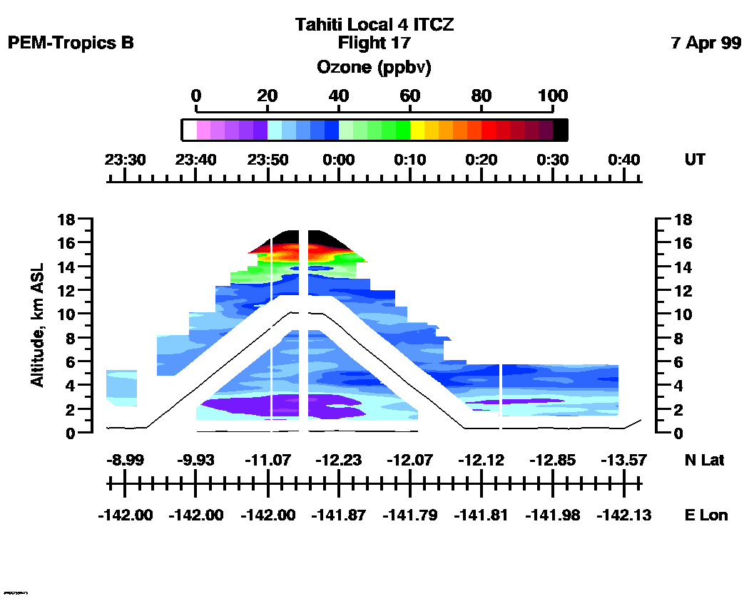
| 22:12:30 - 23:27:18
| 23:27:24 - 00:42:25
| 00:42:31 - 01:32:59
| movie_loop_all |
for additional data. 