 for additional data.
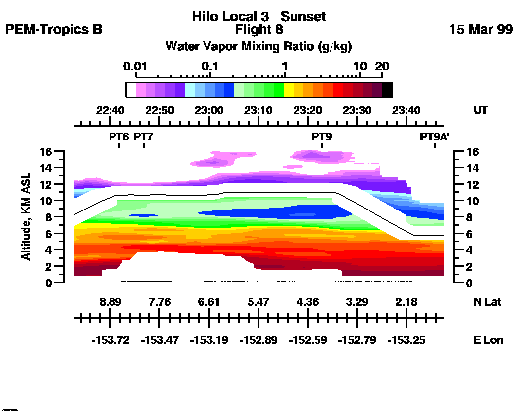
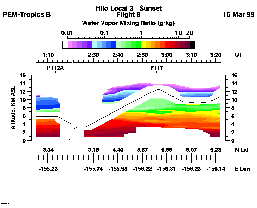
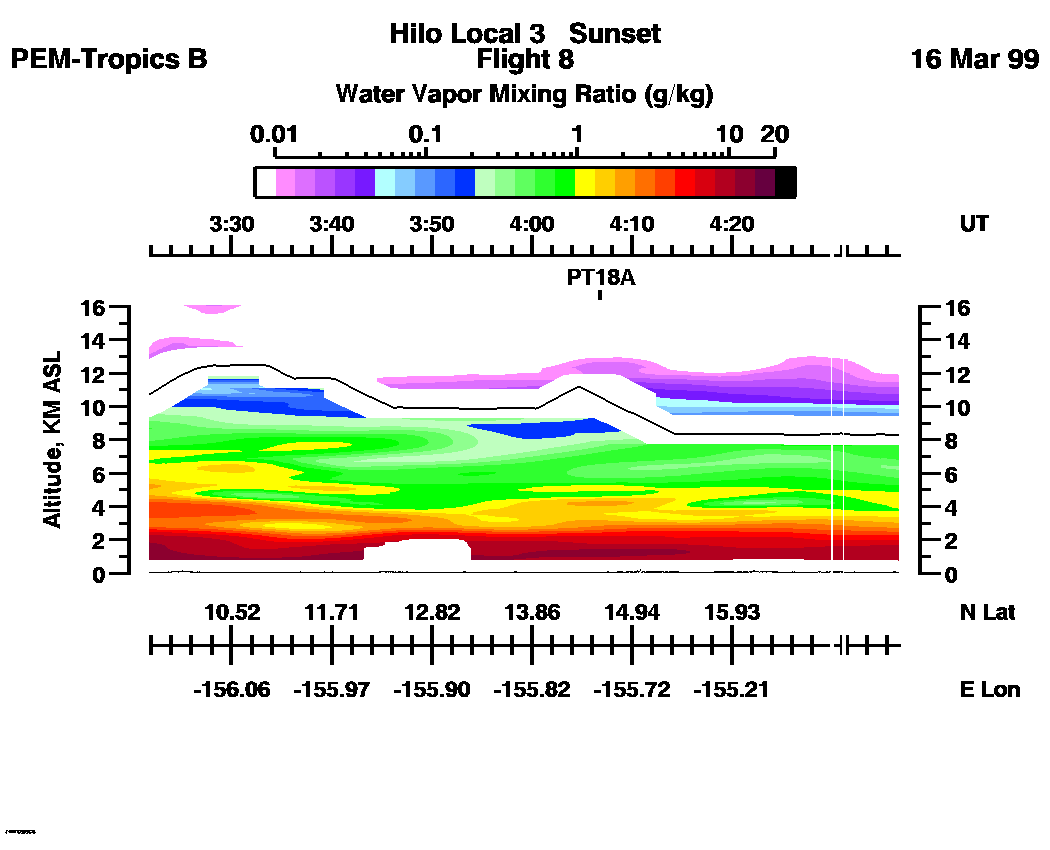
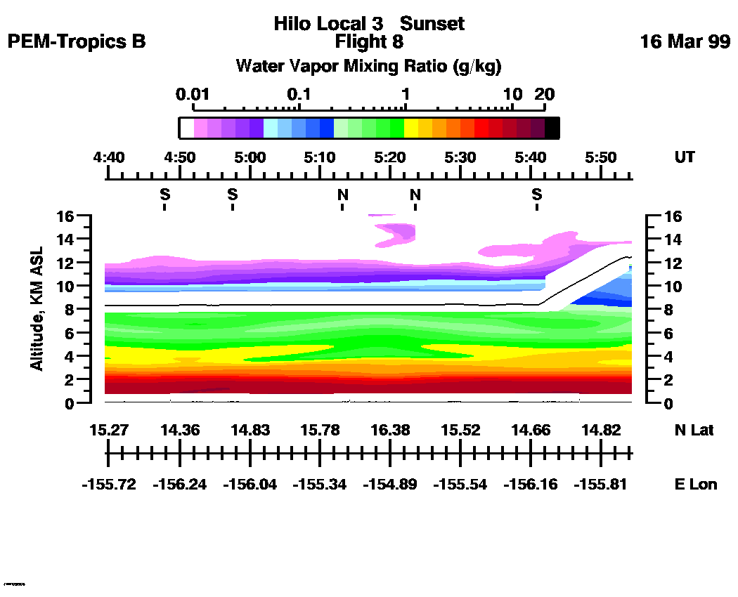
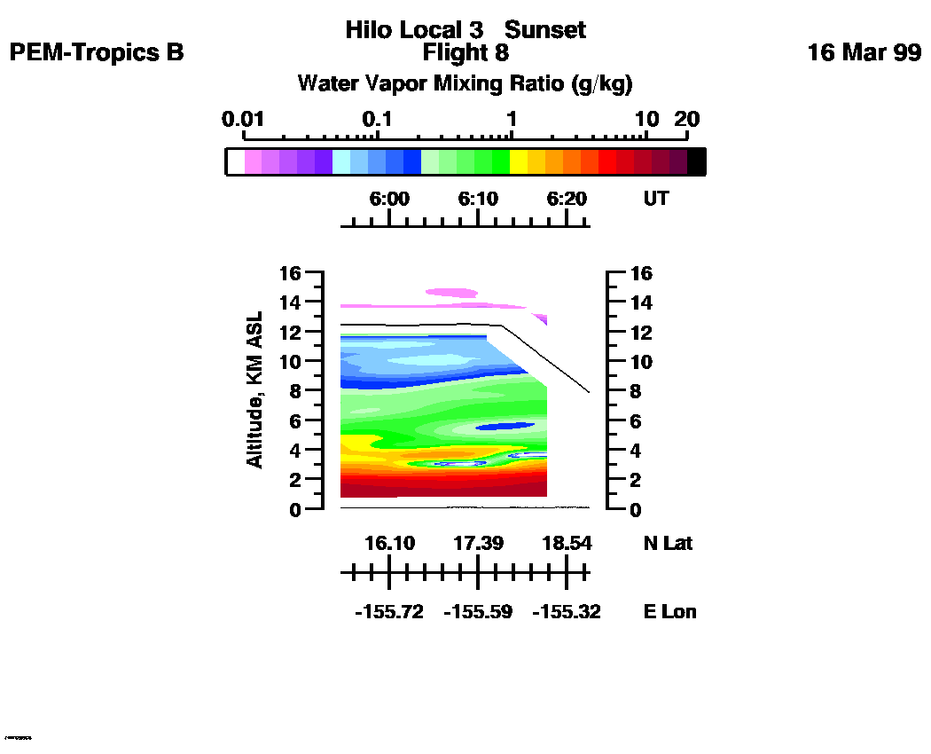
 Flight 08 / PEM-Tropics B -- Hilo Local 3 / Sunset / Mar. 15-16, 1999
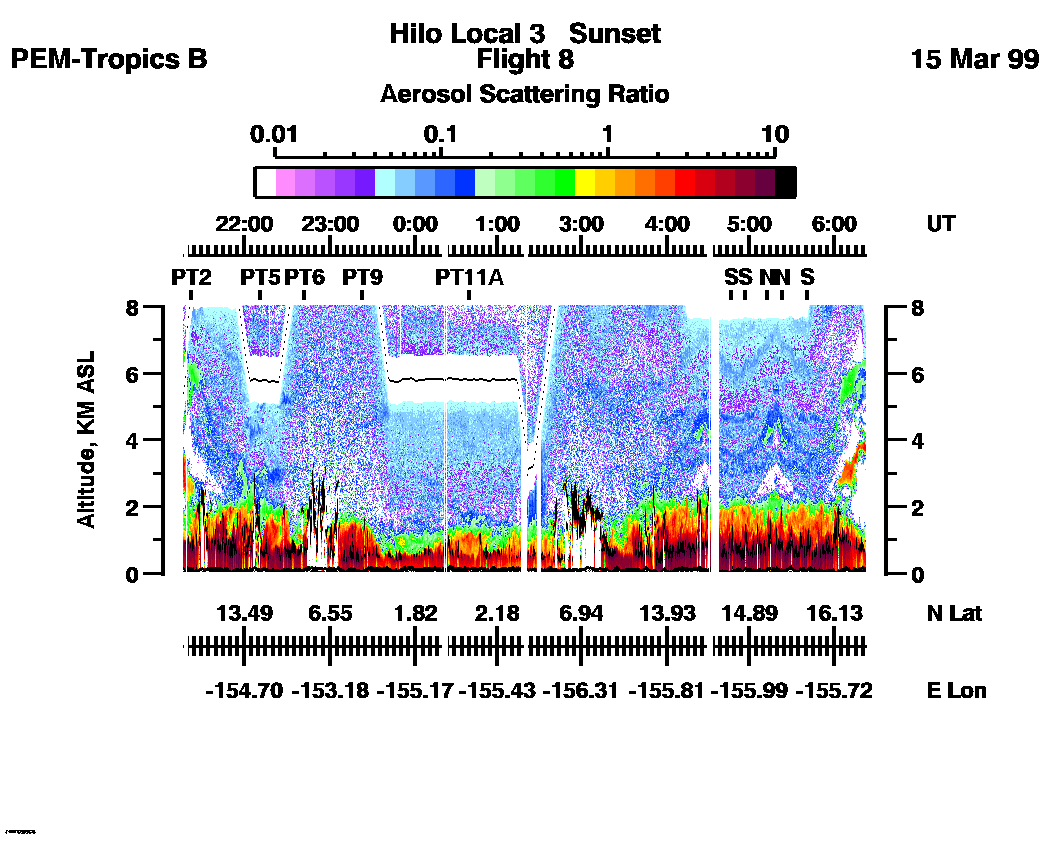
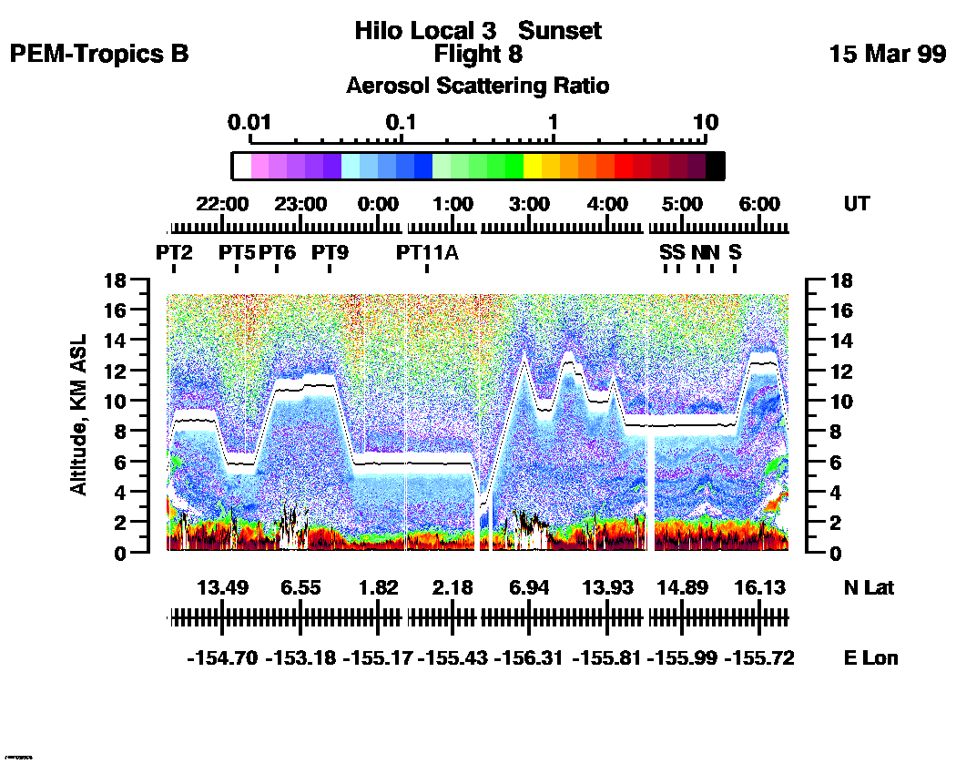
Combined Nadir/Zenith Aerosol Scattering Ratio image for the entire flight
LASE Aerosol Image : | 21:15:34 - 06:21:57 -- (0 - 8 km)
|| 21:15:34 - 06:21:27 -- (0 - 17 km) |
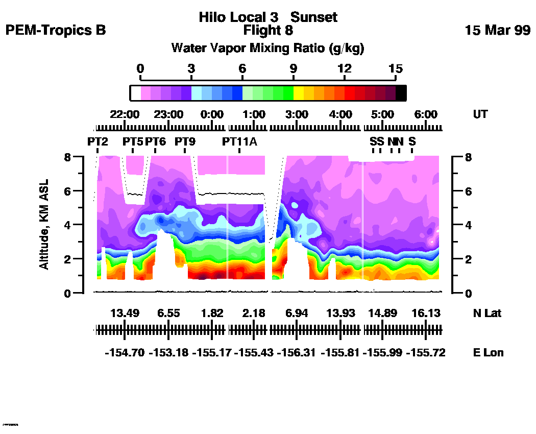
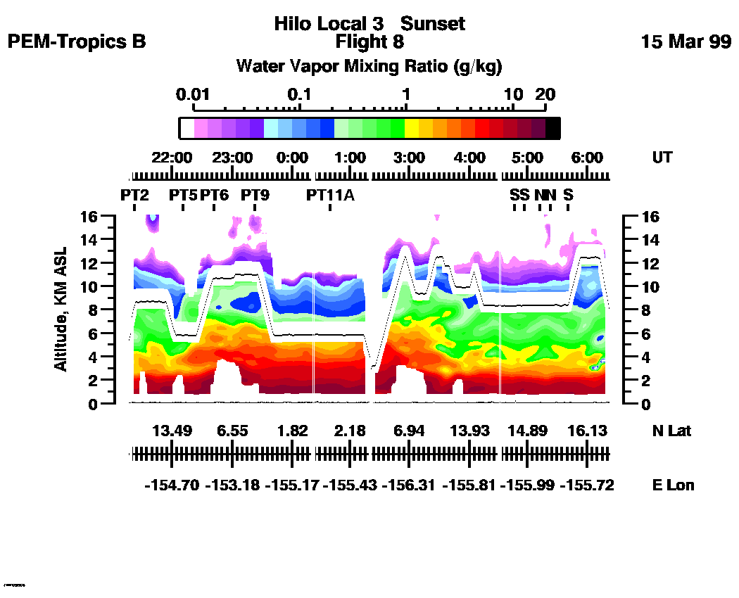
Combined Nadir/Zenith Water Vapor Mixing Ratio images for the entire flight
LASE Water Vapor Image : | 21:15:34 - 06:21:57 -- (0 - 8 km)
|| 21:15:34 - 06:21:27 -- (0 - 16 km) |
Combined LASE Aerosol Scattering Ratio Images
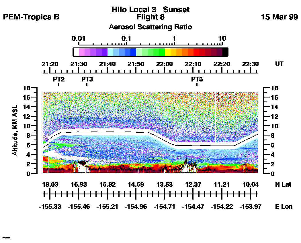
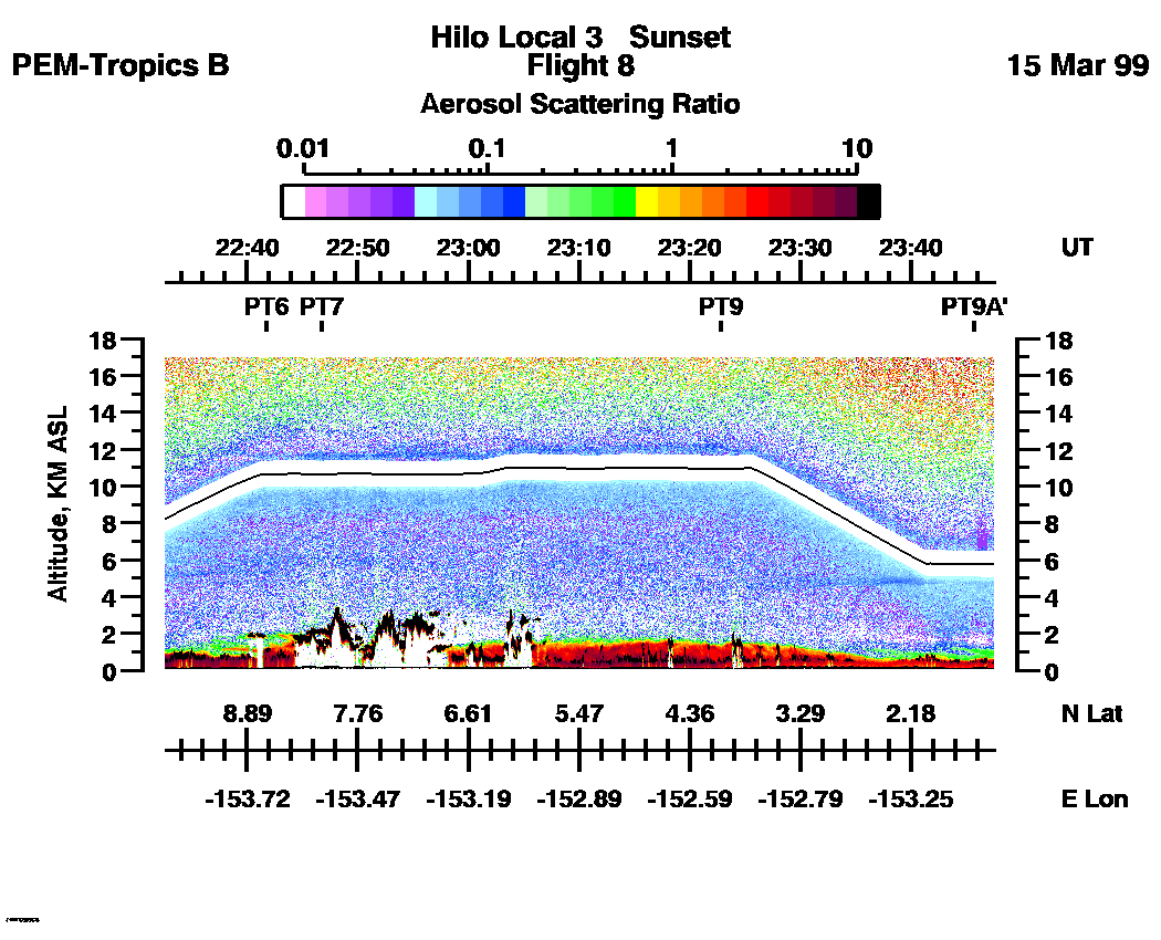
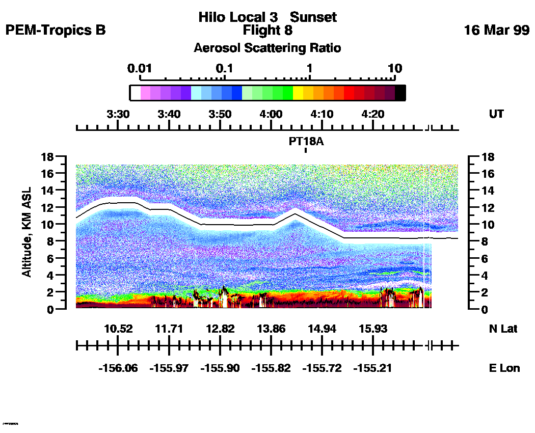
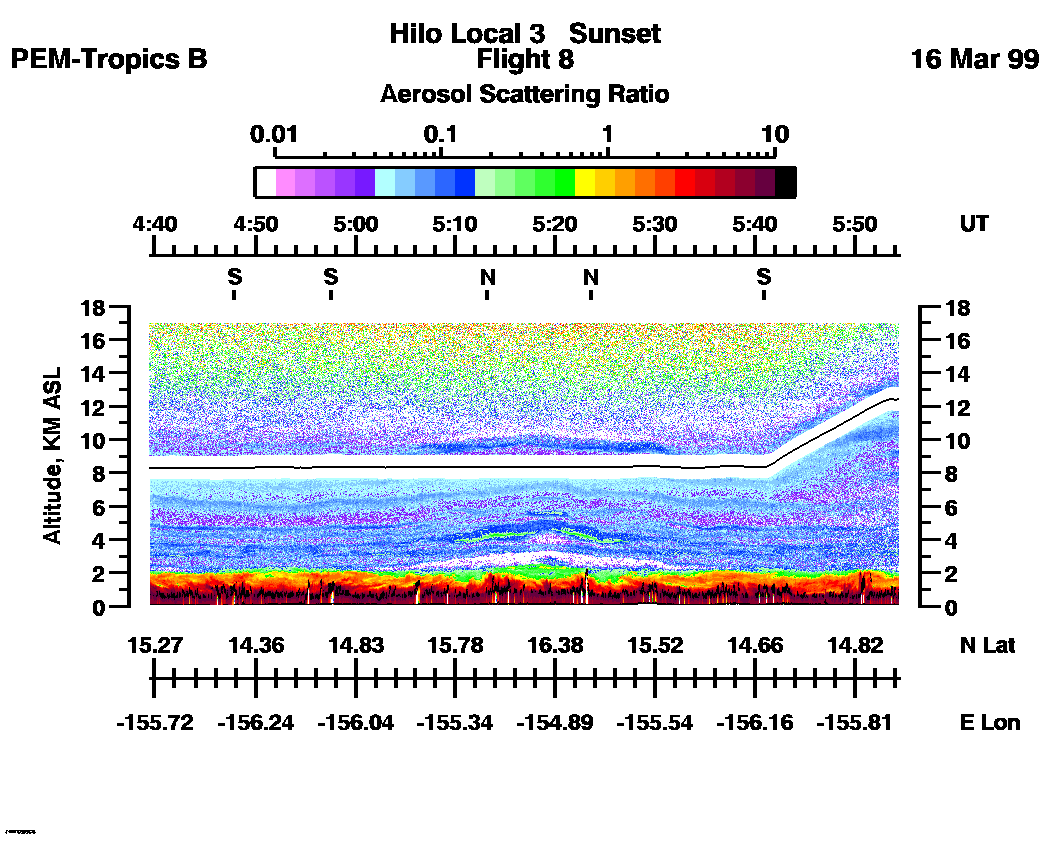
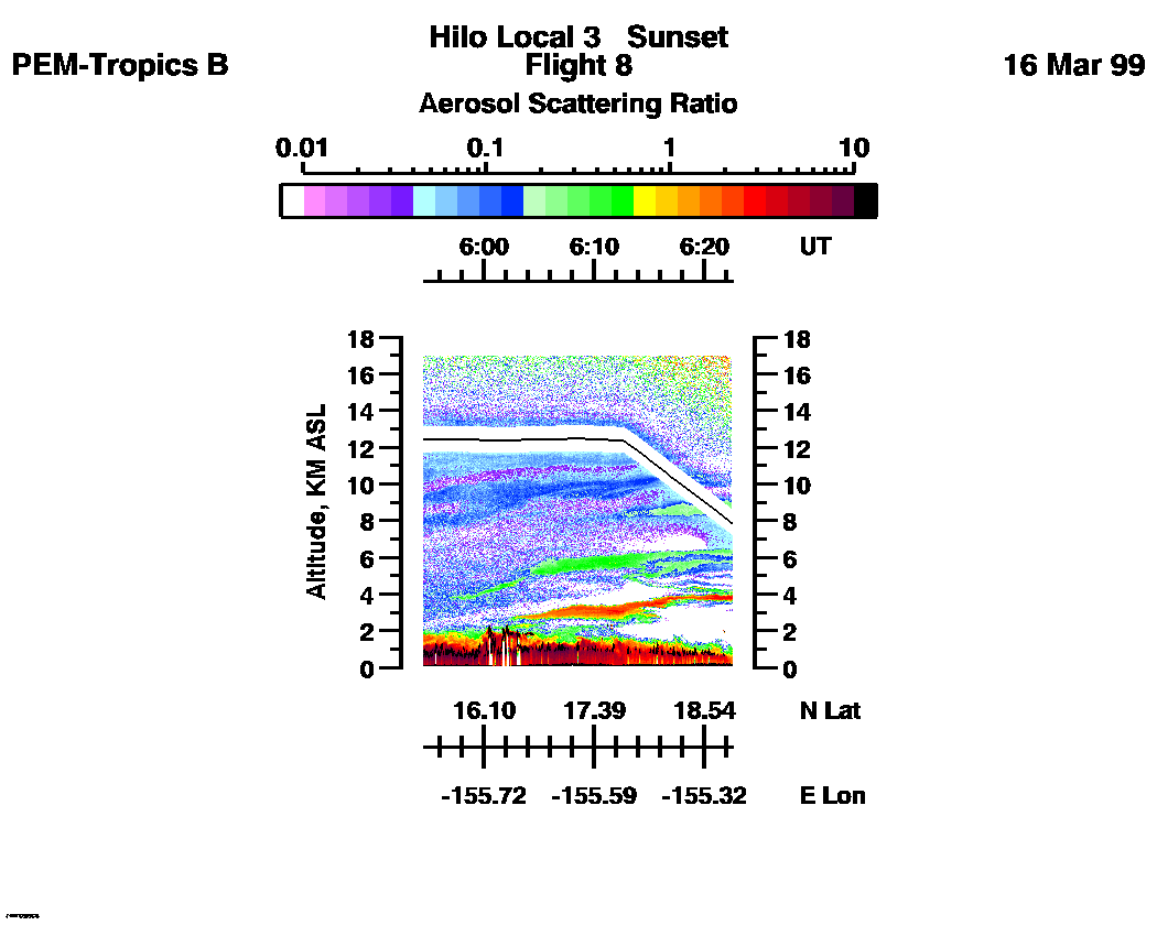
Aerosol Images :| 21:15:34 - 22:32:31
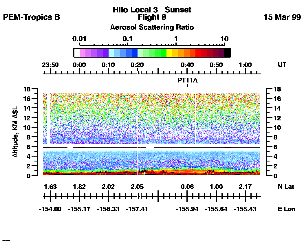
| 22:32:37 - 23:47:33
| 23:47:39 - 01:05:13
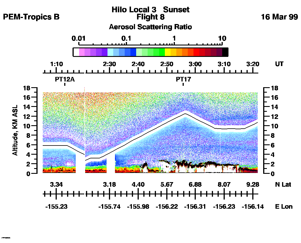
| 01:05:19 - 03:21:43
| 03:21:49 - 04:39:24
| 04:39:24 - 05:54:26
| 05:54:32 - 06:22:33
| movie_loop_all |
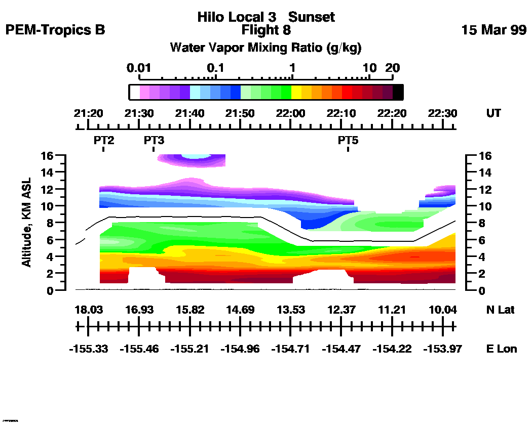
Combined LASE Water Vapor Images
Water Vapor Images :| 21:15:34 - 22:32:31 | 22:32:37 - 23:47:33 | 23:47:39 - 01:05:13 | 01:05:19 - 03:21:43 | 03:21:49 - 04:39:24 | 04:39:24 - 05:54:26 | 05:54:32 - 06:22:33 | movie_loop_all |
for additional data. 