 for additional data.
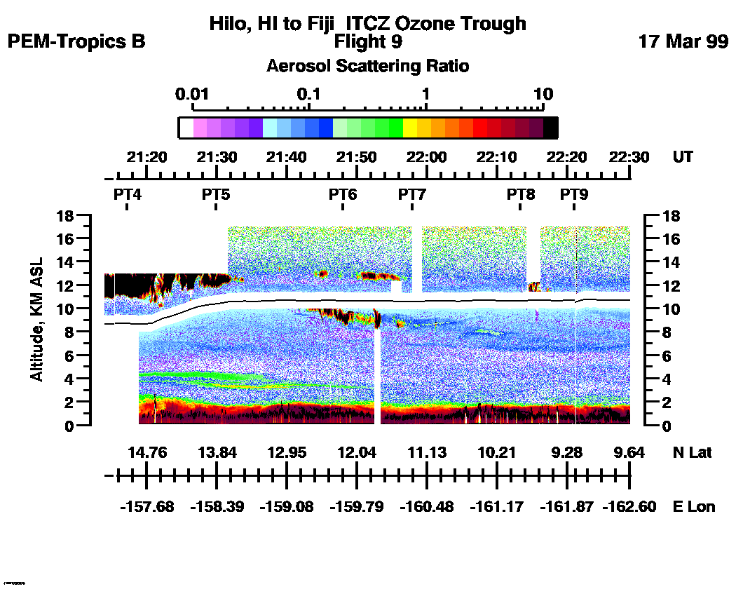
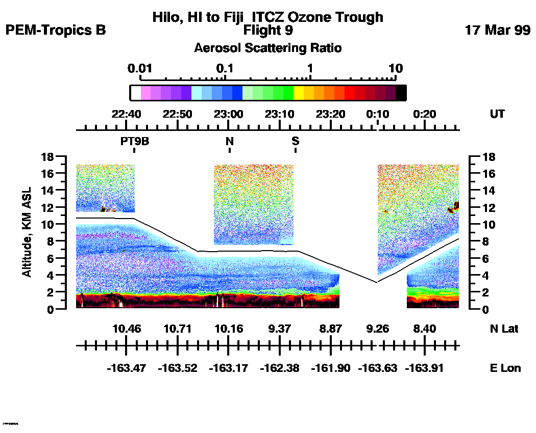
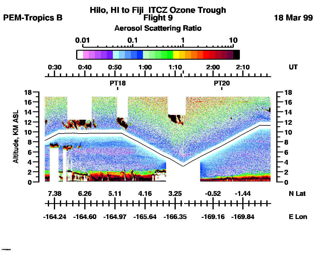
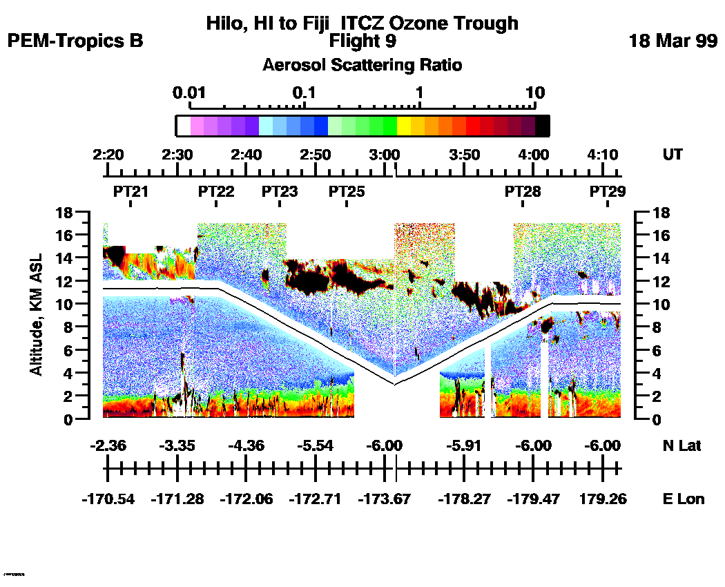
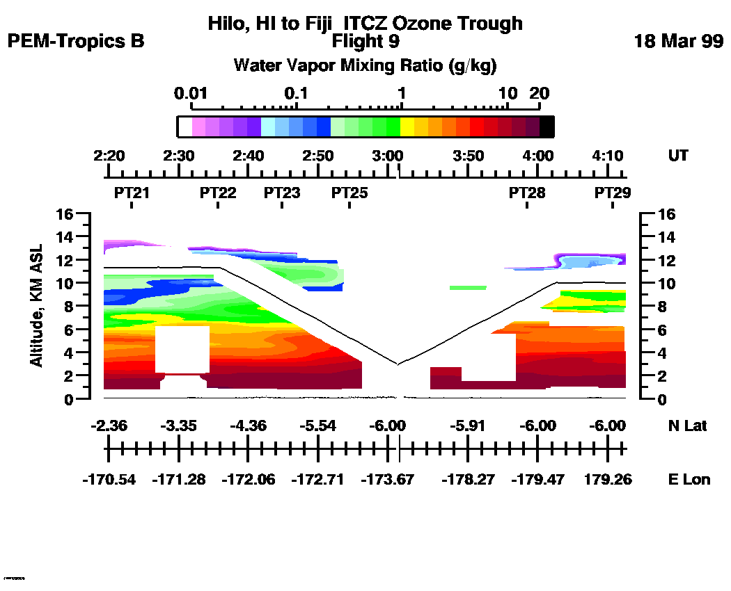
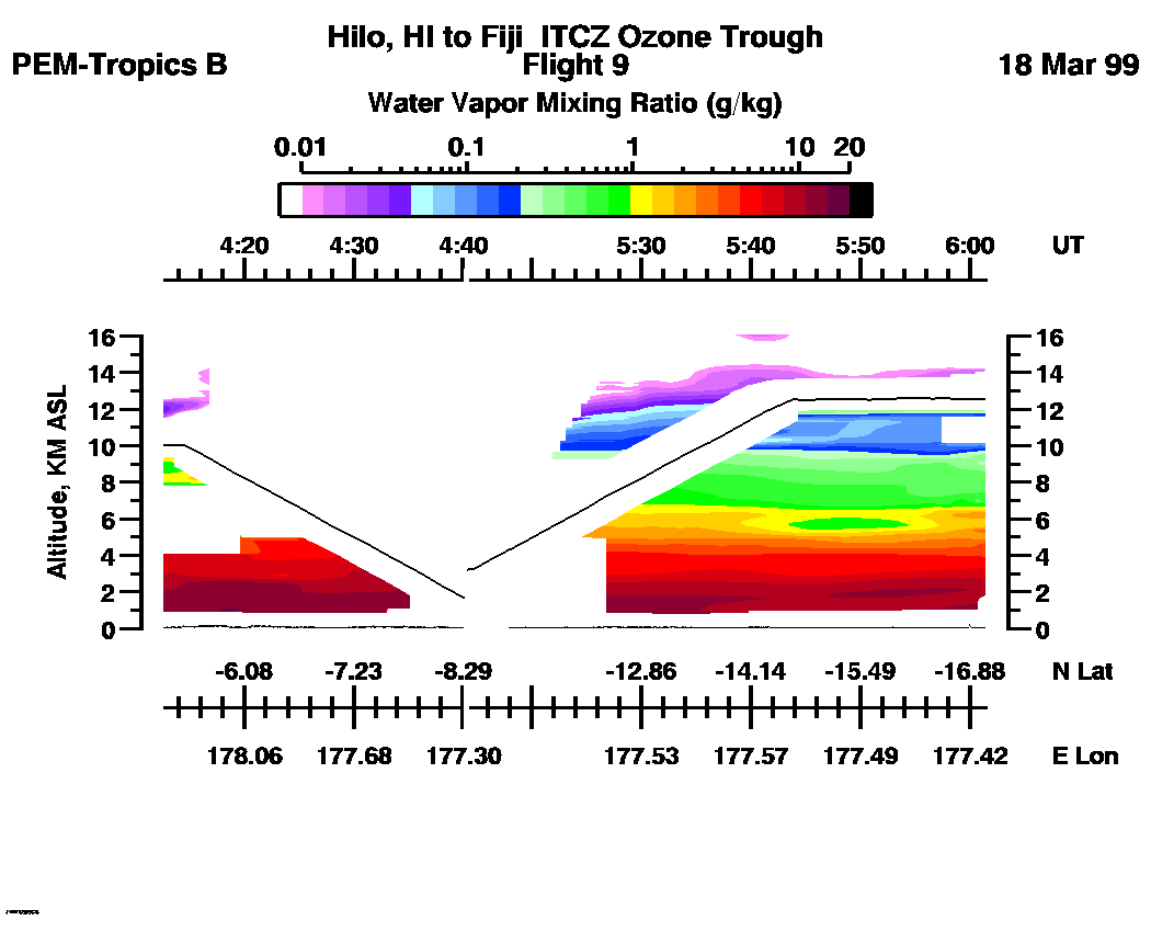
 Flight 09 / PEM-Tropics B -- Hilo, Hi to Fiji / ITCZ Ozone Trough / Mar. 17-18, 1999
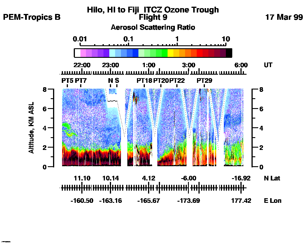
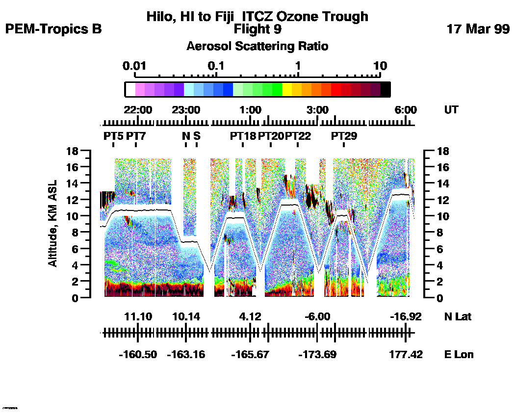
Combined Nadir/Zenith Aerosol Scattering Ratio image for the entire flight
LASE Aerosol Image : | 21:12:04 - 06:10:34 -- (0 - 8 km)
|| 21:12:04 - 06:10:34 -- (0 - 17 km) |
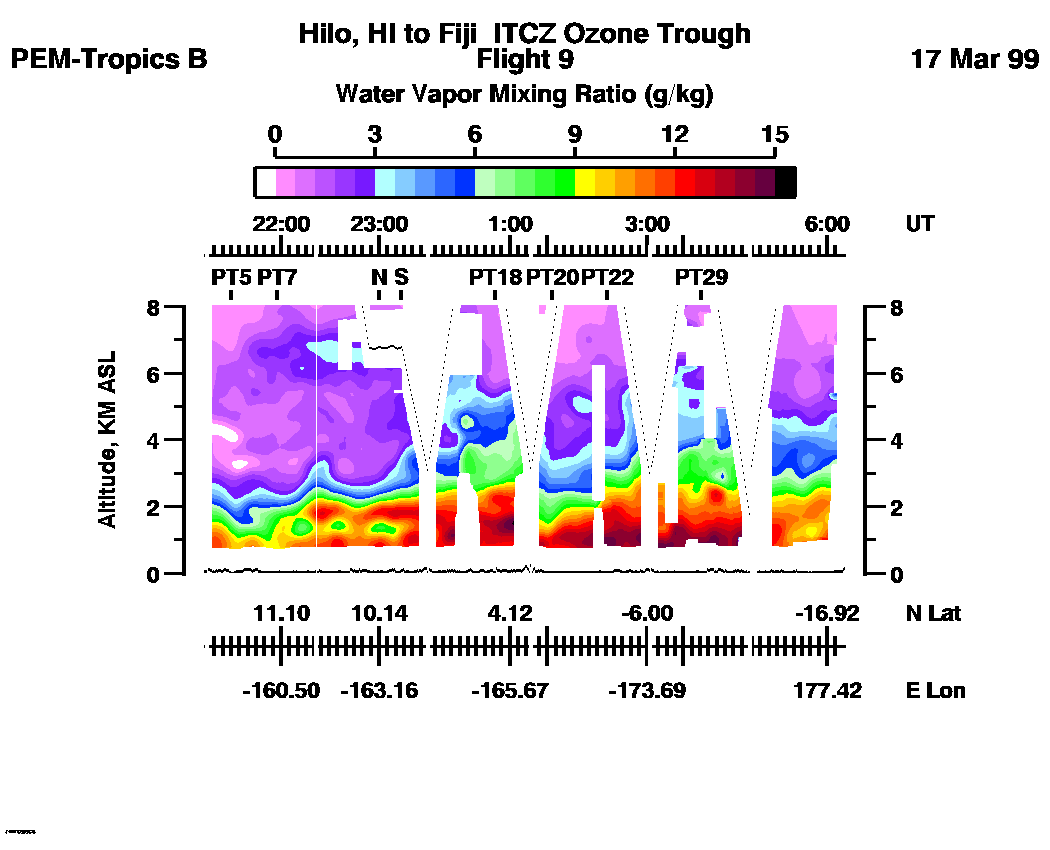
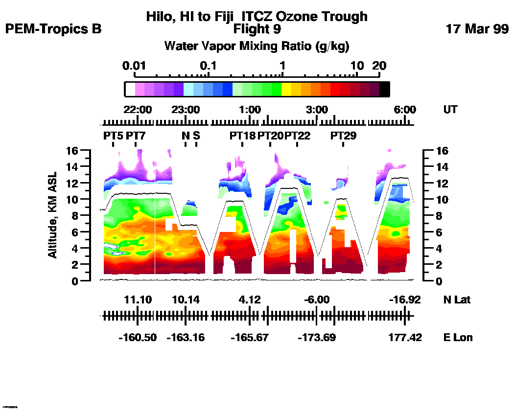
Combined Nadir/Zenith Water Vapor Mixing Ratio images for the entire flight
LASE Water Vapor Image : | 21:12:04 - 06:10:34 -- (0 - 8 km)
|| 21:12:04 - 06:10:34 -- (0 - 16 km) |
Combined LASE Aerosol Scattering Ratio Images
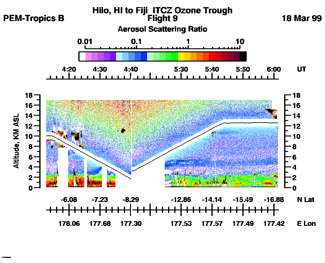
Aerosol Images :| 21:12:04 - 22:30:10
| 22:30:16 - 00:26:46
| 00:26:52 - 02:19:12
| 02:19:18 - 04:12:41
| 04:12:47 - 06:01:28
| movie_loop_all |
Combined LASE Water Vapor Images
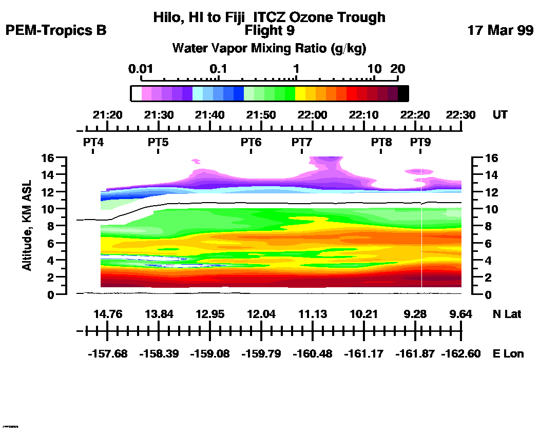
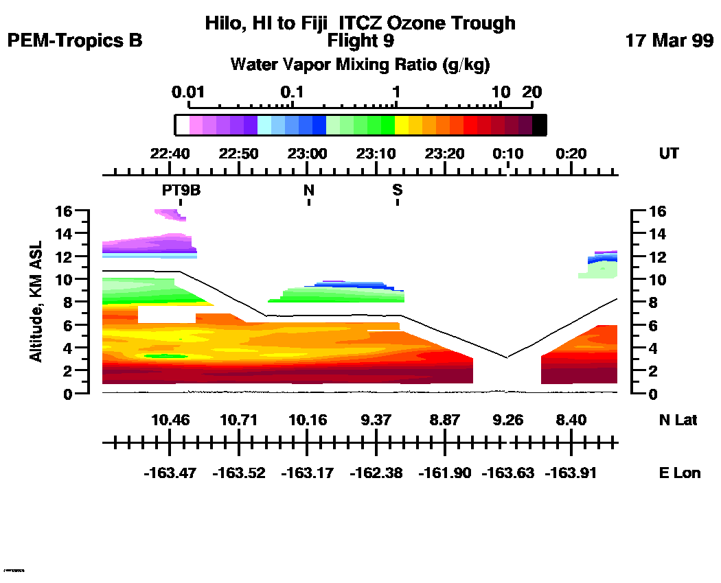
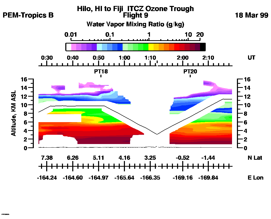
Water Vapor Images :| 21:12:04 - 22:30:10 | 22:30:16 - 00:26:46 | 00:26:52 - 02:19:12 | 02:19:18 - 04:12:41 | 04:12:47 - 06:01:28 | movie_loop_all |
for additional data. 