 for additional data.
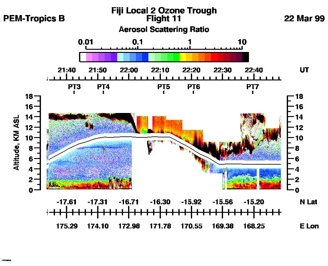
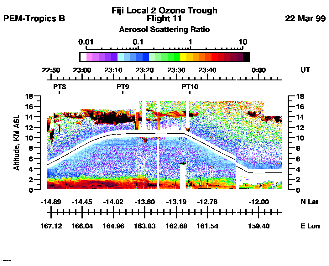
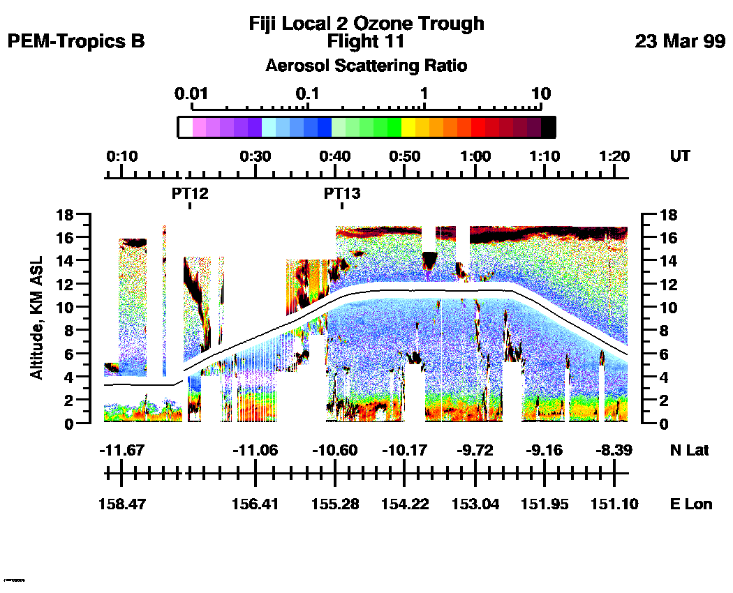
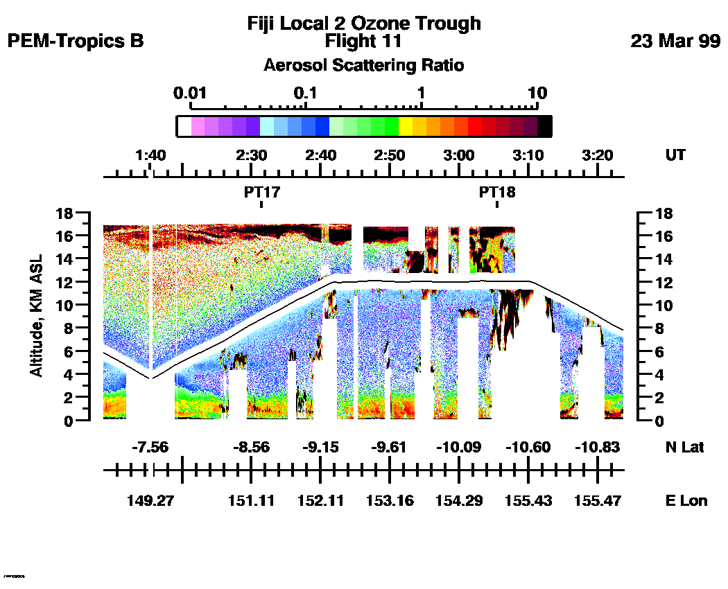
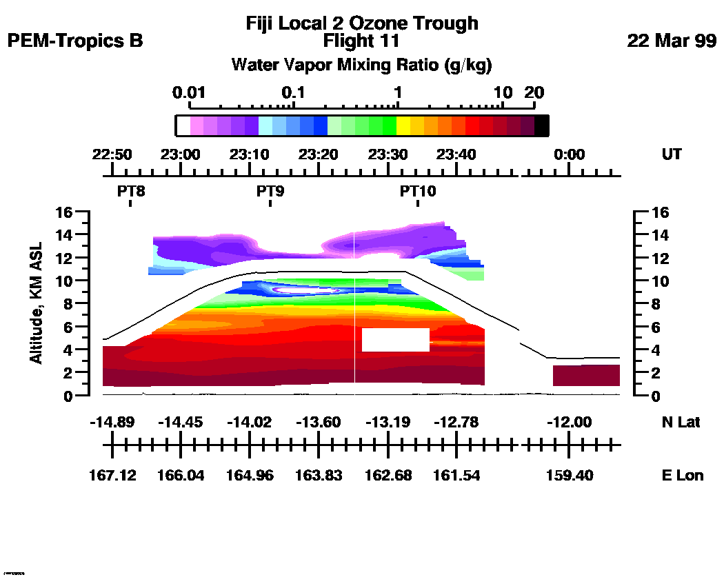
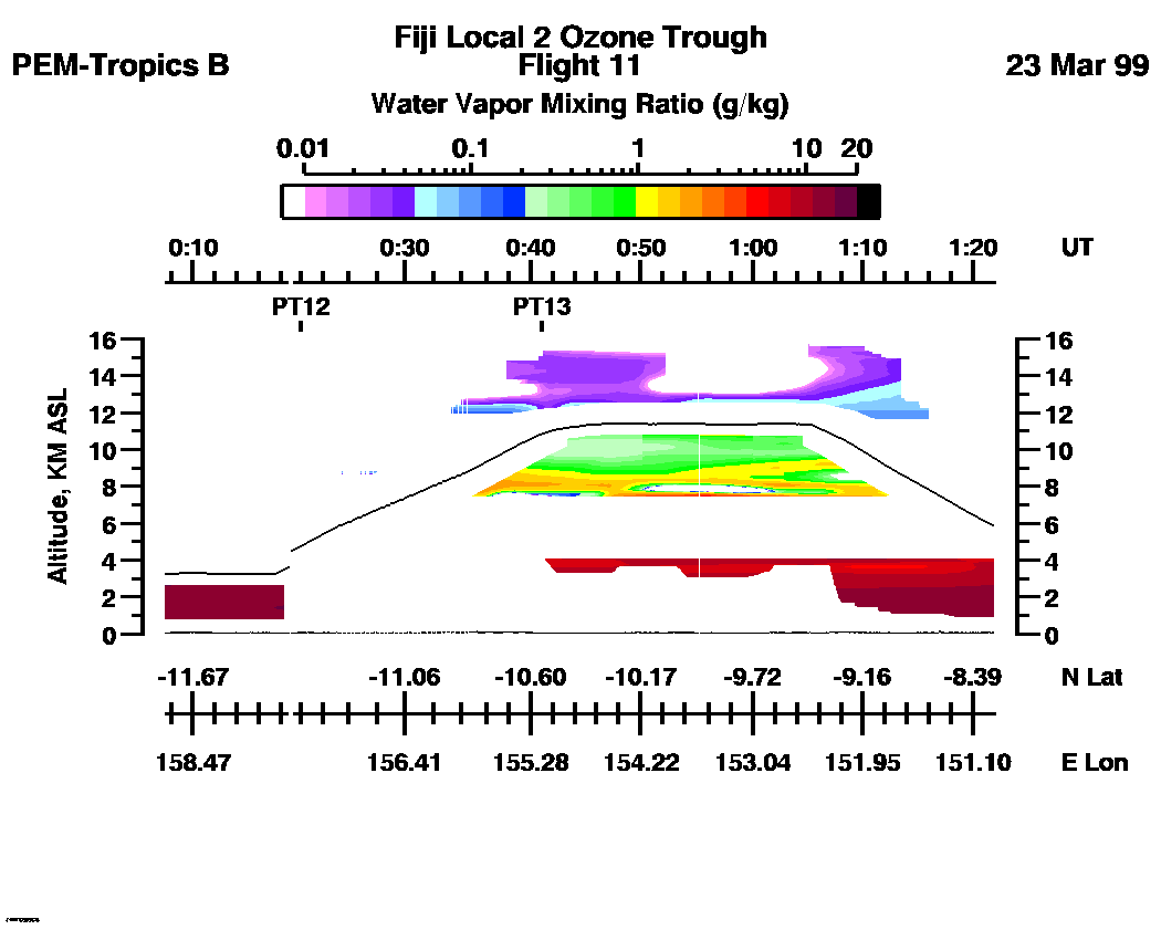
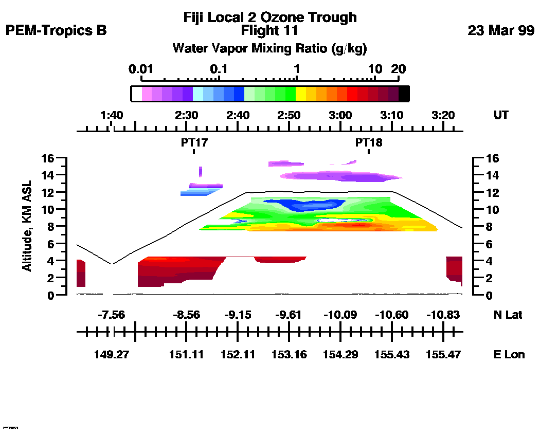
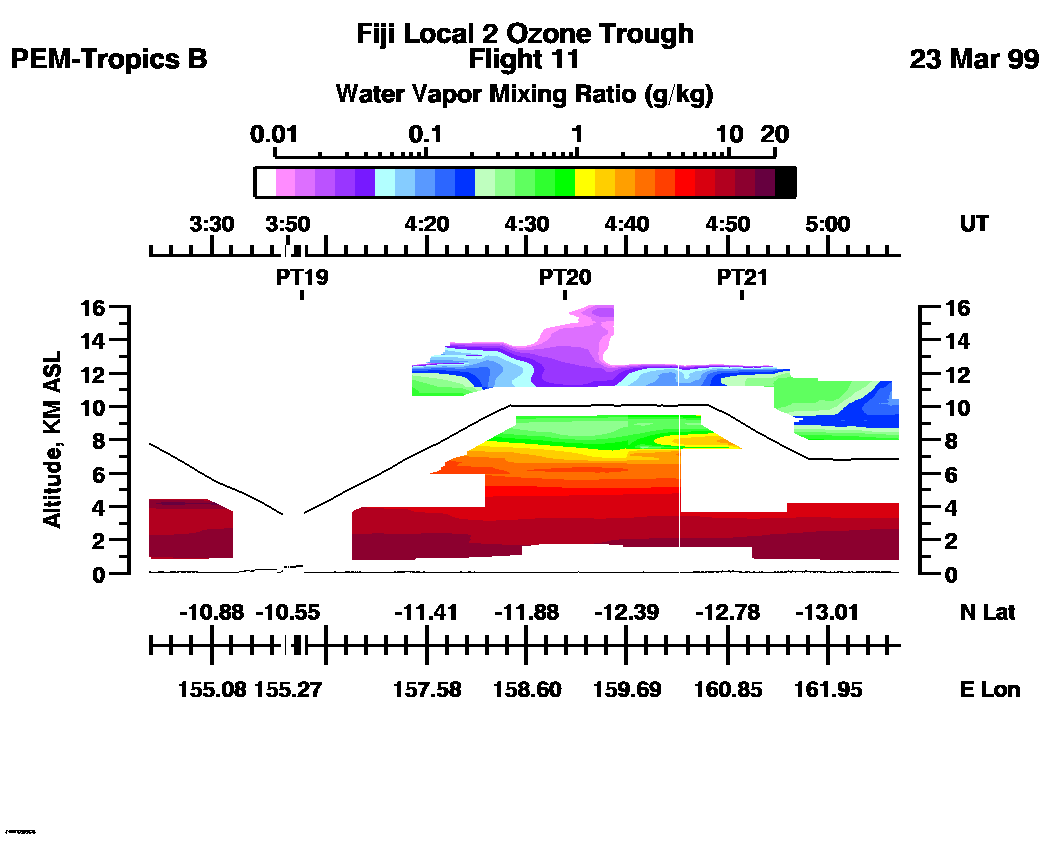
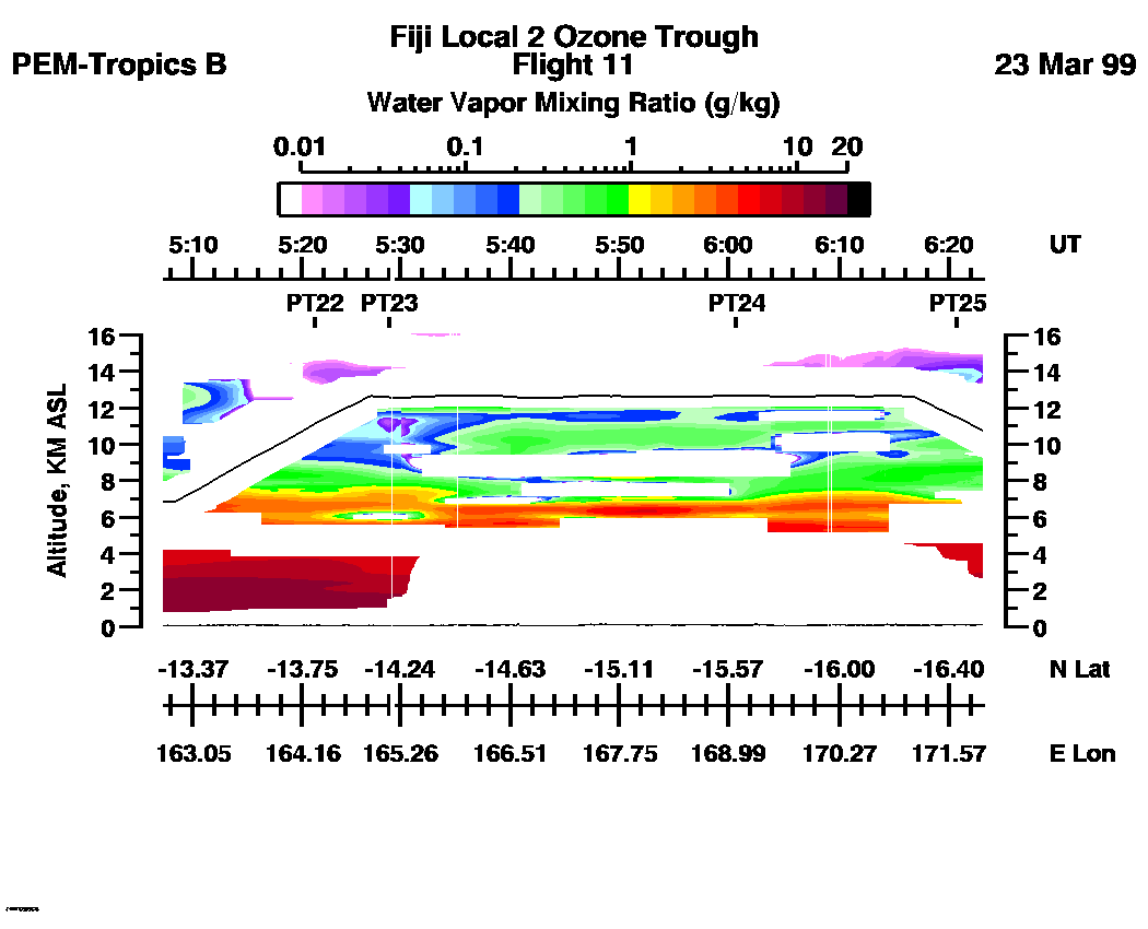
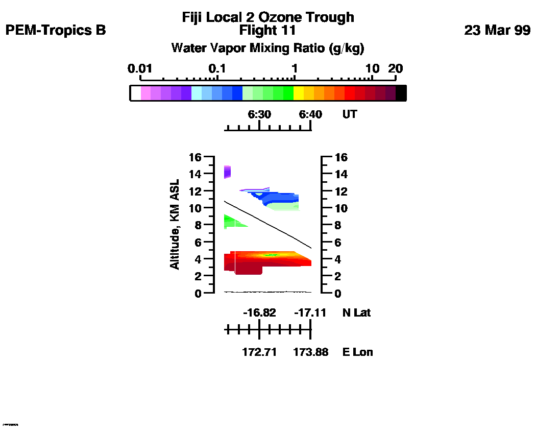
 Flight 11 / PEM-Tropics B -- Fiji Local 2 / Ozone Trough / Mar. 22-23, 1999
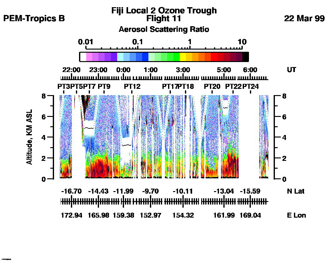
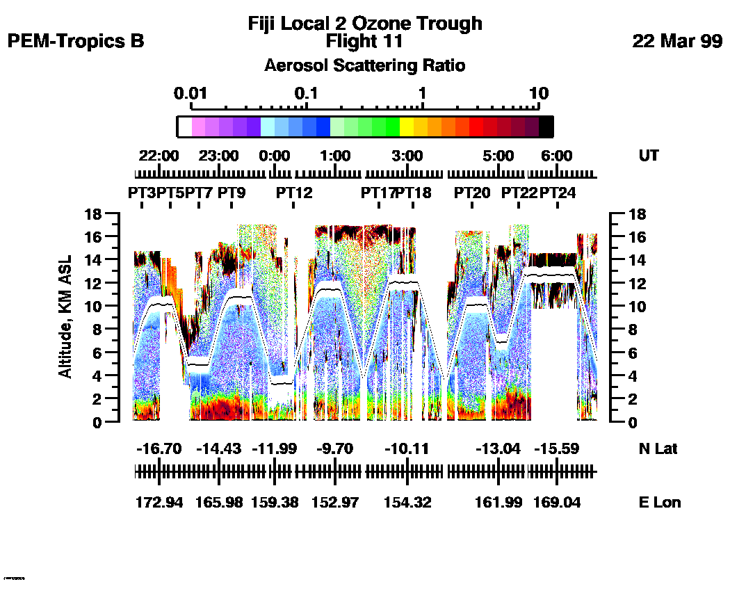
Combined Nadir/Zenith Aerosol Scattering Ratio image for the entire flight
LASE Aerosol Image : | 21:31:40 - 06:40:05 -- (0 - 8 km)
|| 21:31:40 - 06:40:05 -- (0 - 17 km) |
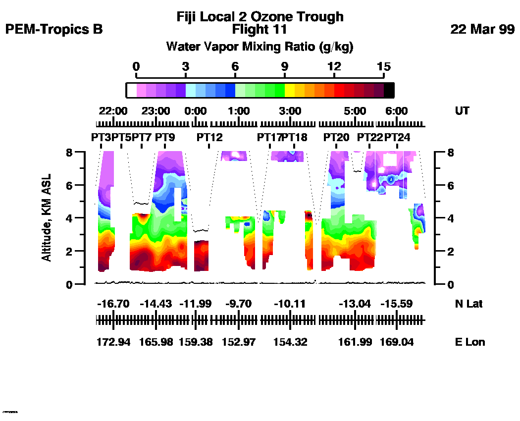
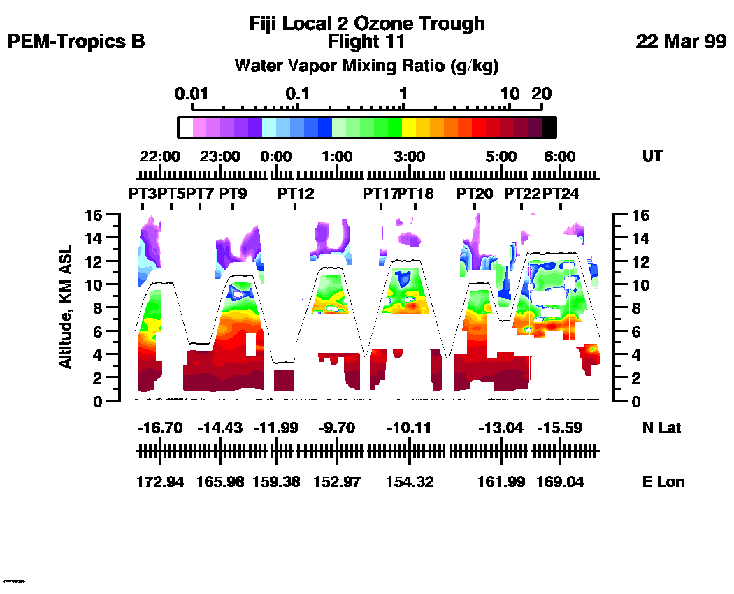
Combined Nadir/Zenith Water Vapor Mixing Ratio images for the entire flight
LASE Water Vapor Image : | 21:31:40 - 06:40:05 -- (0 - 8 km)
|| 21:31:40 - 06:40:05 -- (0 - 16 km) |
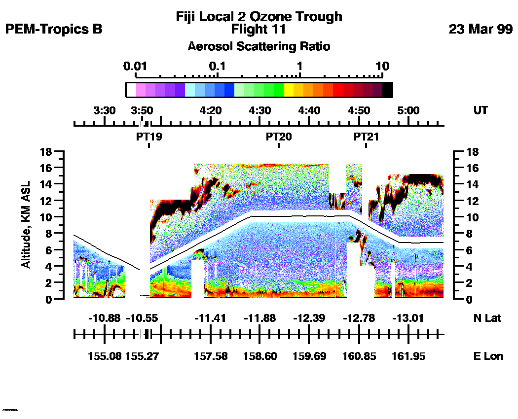
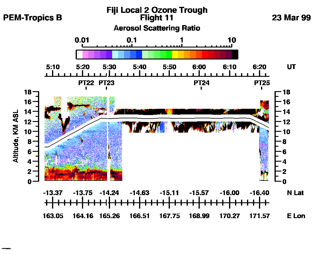
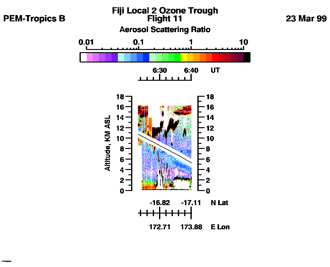
Combined LASE Aerosol Scattering Ratio Images
Aerosol Images :| 21:31:40 - 22:48:41
| 22:48:47 - 00:07:19
| 00:07:25 - 01:21:55
| 01:22:01 - 03:23:45
| 03:23:51 - 05:07:12
| 05:07:18 - 06:23:09
| 06:23:15 - 06:40:11
| movie_loop_all |
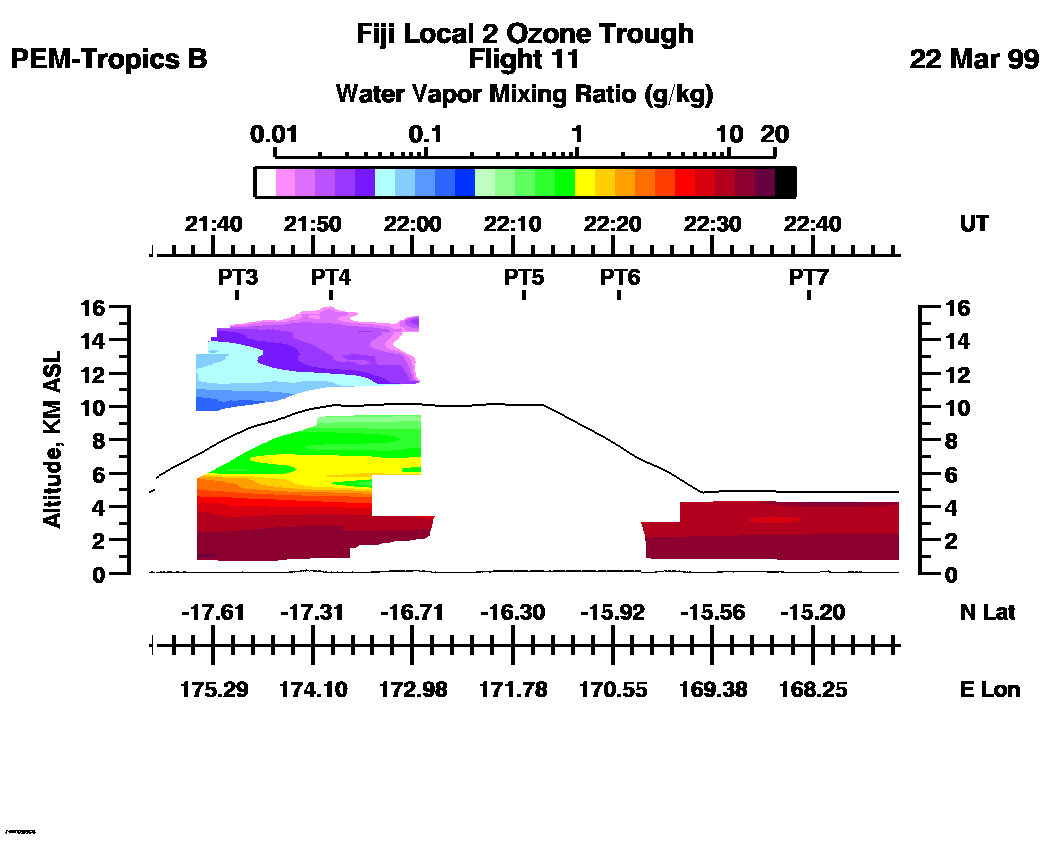
Combined LASE Water Vapor Images
Water Vapor Images :| 21:31:40 - 22:48:41 | 22:48:47 - 00:07:19 | 00:07:25 - 01:21:55 | 01:22:01 - 03:23:45 | 03:23:51 - 05:07:12 | 05:07:18 - 06:23:09 | 06:23:15 - 06:40:11 | movie_loop_all |
for additional data. 