 for additional data.
 Flight 13 / PEM-Tropics B -- Fiji to Tahiti / Equatorial Survey / Mar. 26-27, 1999
Combined Nadir/Zenith Aerosol Scattering Ratio image for the entire flight
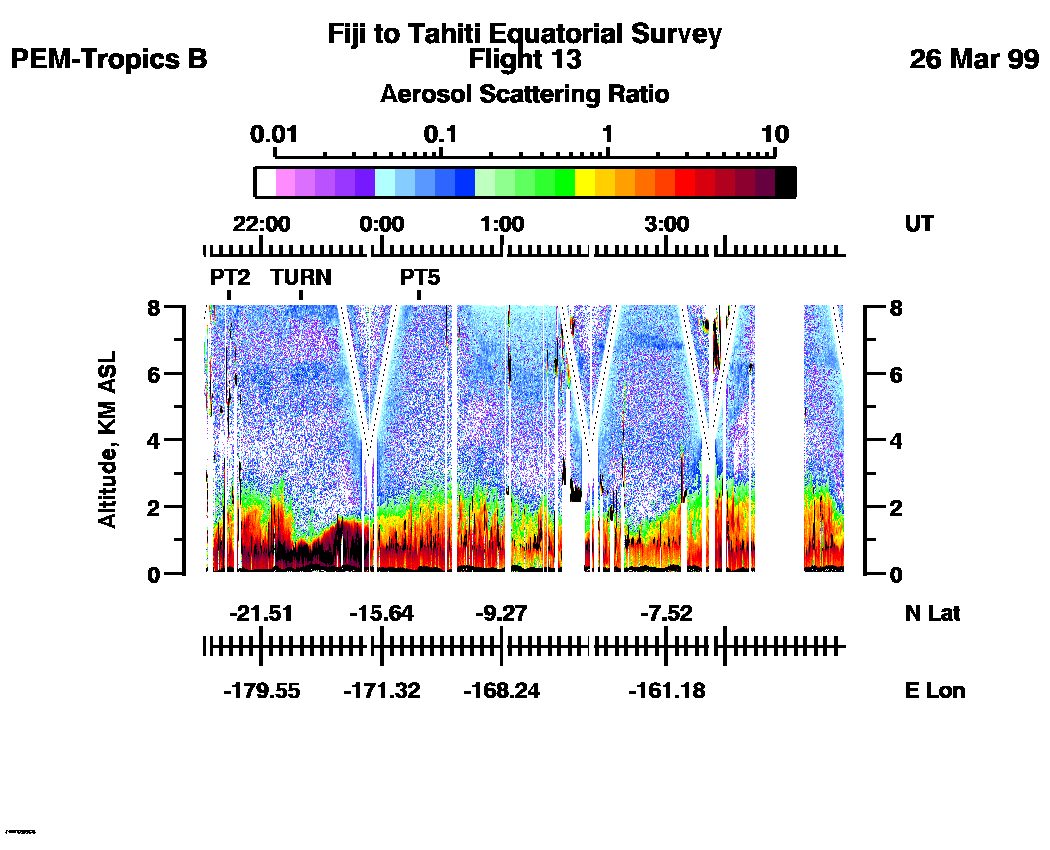
LASE Aerosol Image : | 21:29:54 - 04:59:27 -- (0 - 8 km)
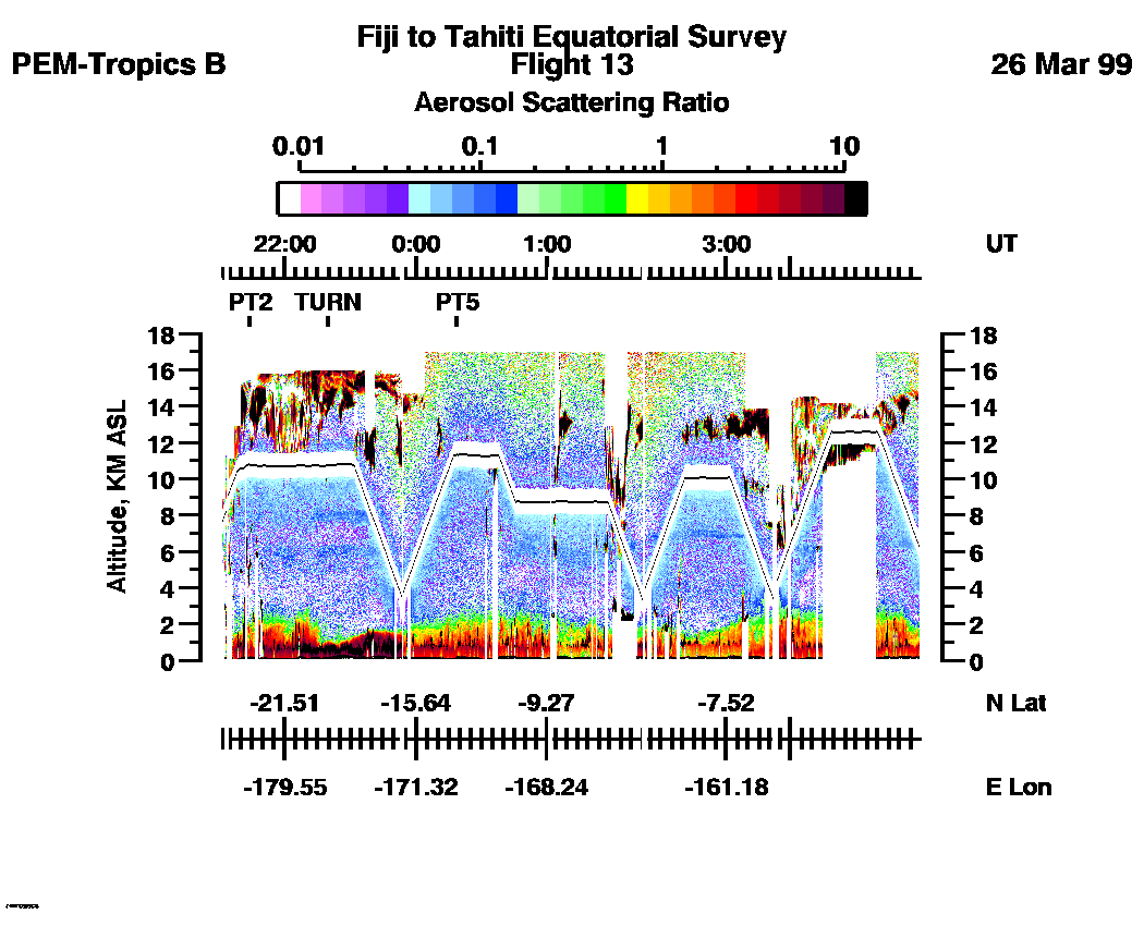
|| 21:29:54 - 04:59:27 -- (0 - 17 km) |
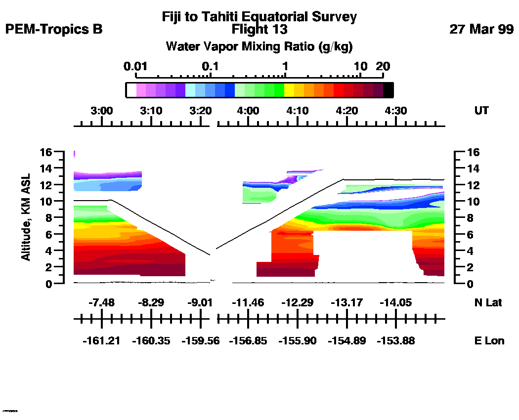
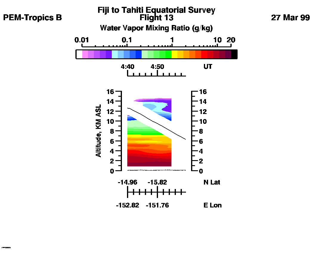
Combined Nadir/Zenith Water Vapor Mixing Ratio images for the entire flight
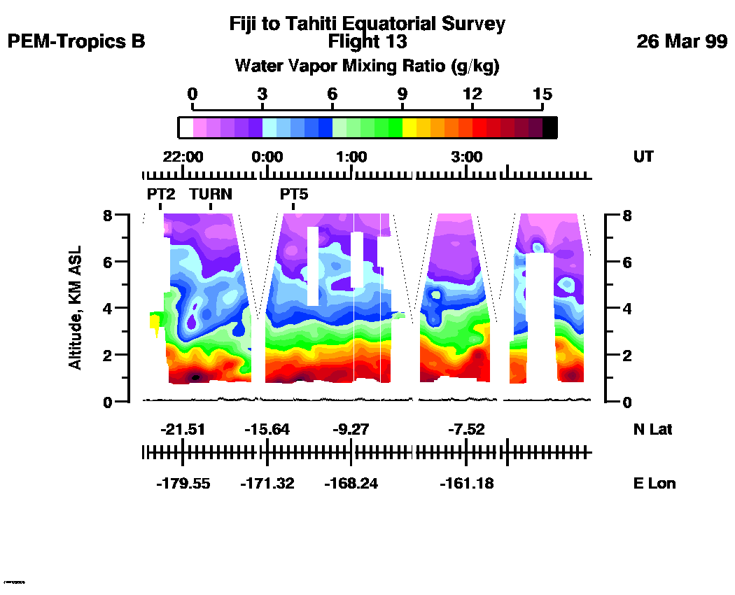
LASE Water Vapor Image : | 21:29:54 - 04:59:27 -- (0 - 8 km)
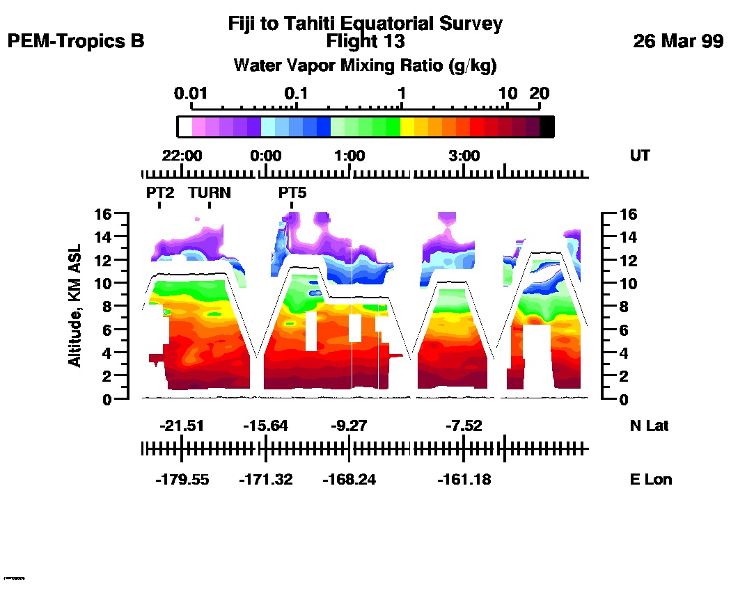
|| 21:29:54 - 04:59:27 -- (0 - 16 km) |
Combined LASE Aerosol Scattering Ratio Images
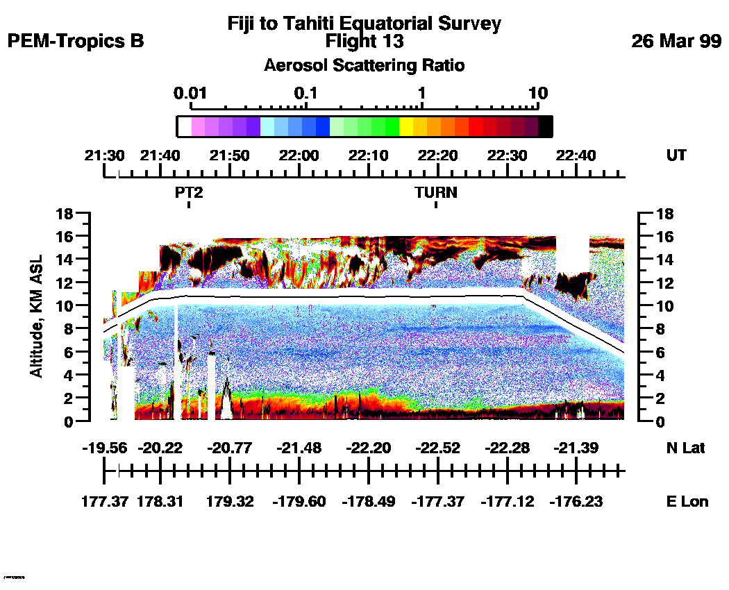
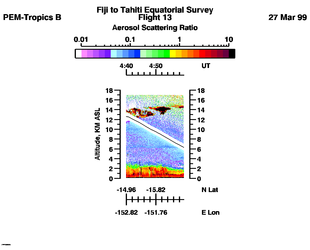
Aerosol Images :| 21:29:54 - 22:46:55
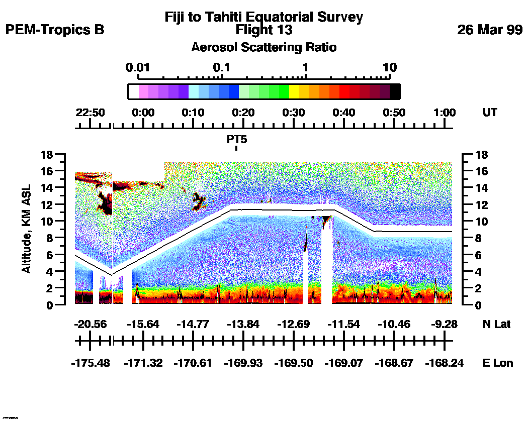
| 22:47:01 - 01:01:34
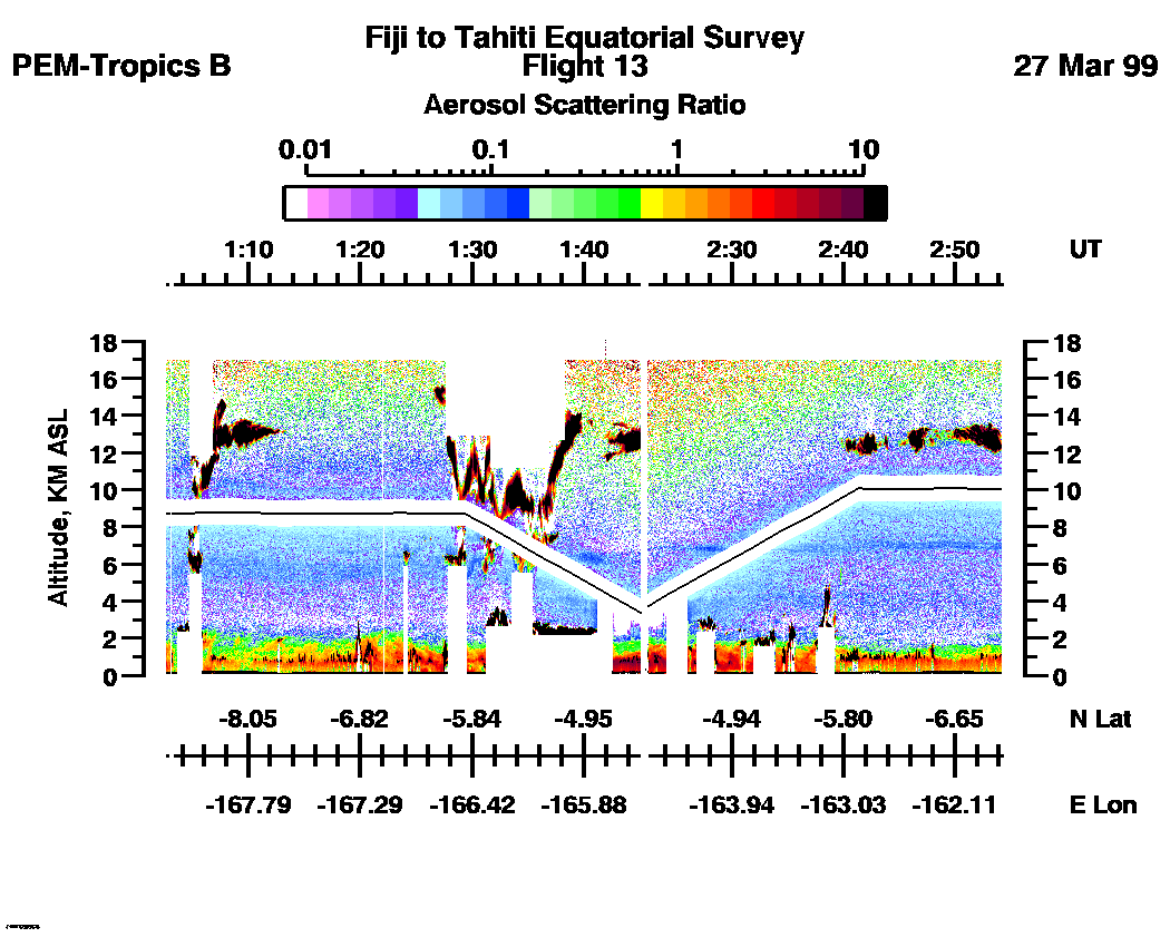
| 01:01:40 - 02:54:18
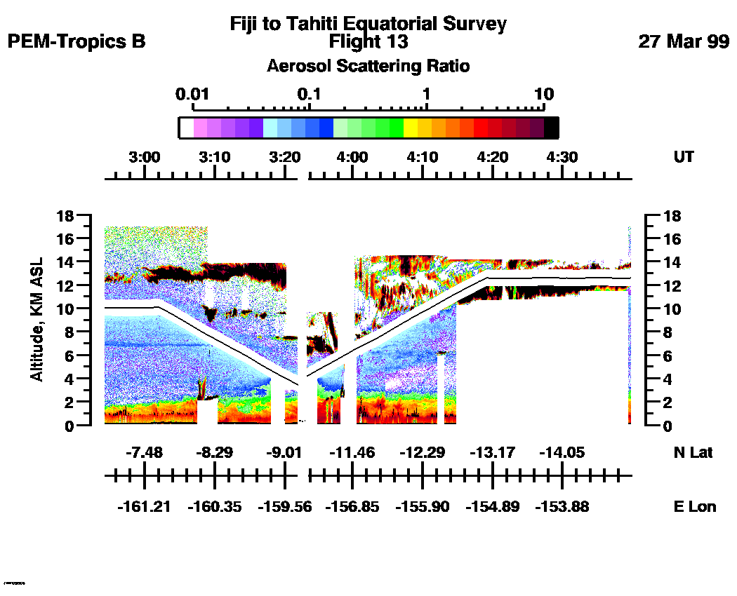
| 02:54:24 - 04:39:49
| 04:39:55 - 04:59:27
| movie_loop_all |
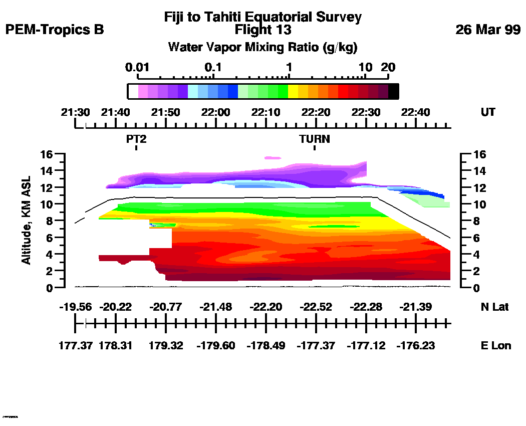
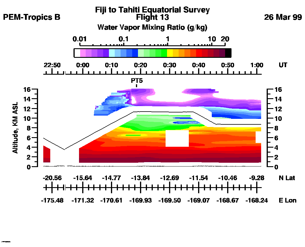
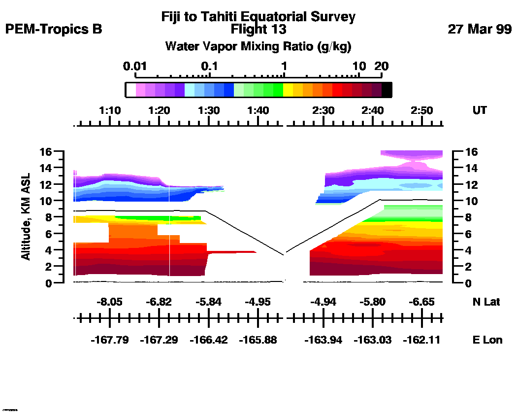
Combined LASE Water Vapor Images
Water Vapor Images :| 21:29:54 - 22:46:55 | 22:47:01 - 01:01:34 | 01:01:40 - 02:54:18 | 02:54:24 - 04:39:49 | 04:39:55 - 04:59:27 | movie_loop_all |
for additional data. 