 for additional data.
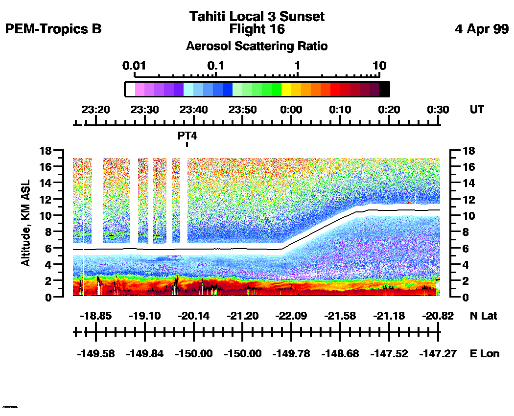
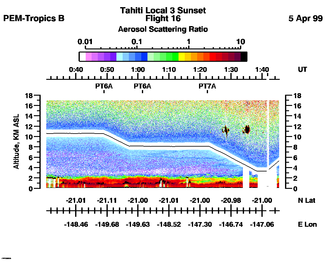
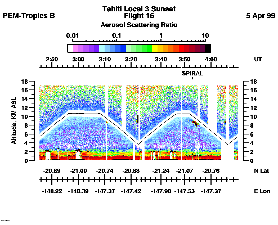
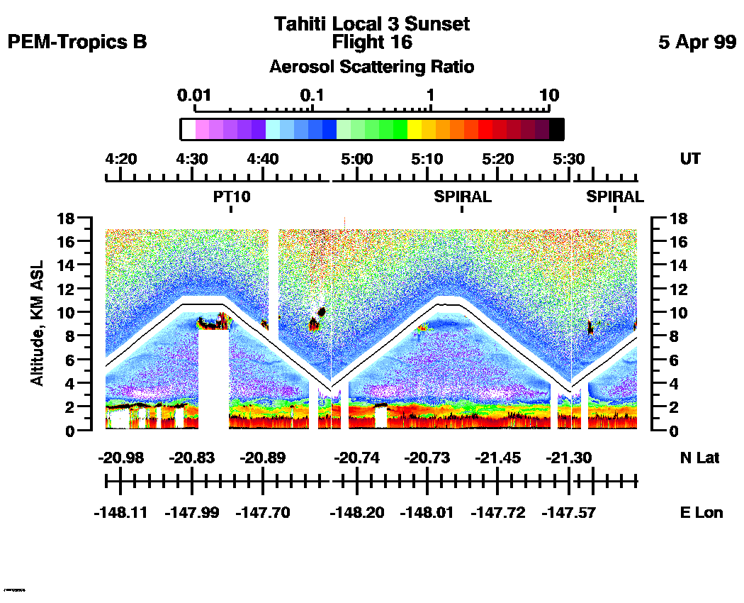
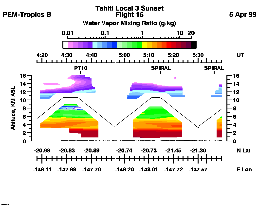
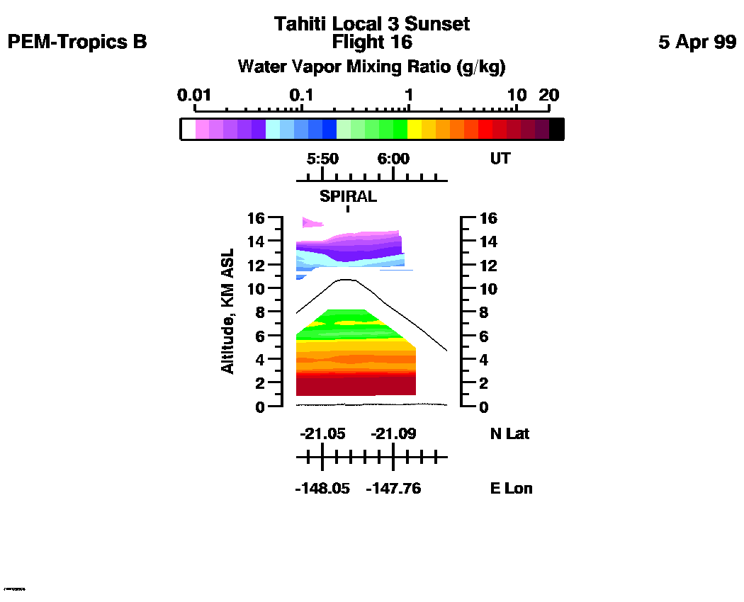
 Flight 16 / PEM-Tropics B -- Tahiti Local 3 / Sunset / Apr. 4-5, 1999
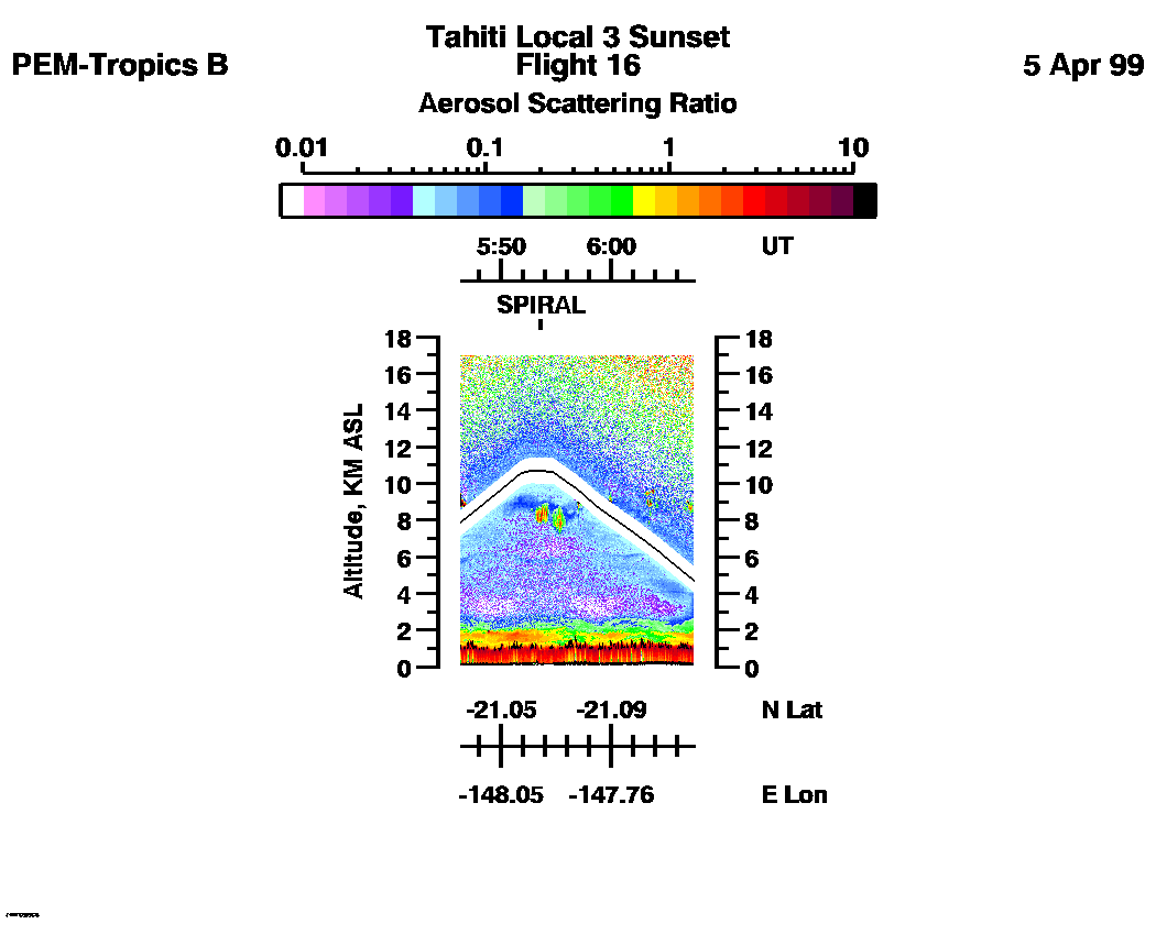
Combined Nadir/Zenith Aerosol Scattering Ratio image for the entire flight
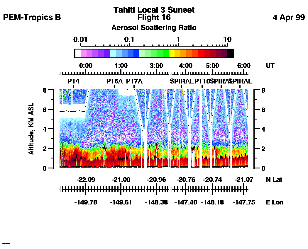
LASE Aerosol Image : | 23:13:29 - 06:07:23 -- (0 - 8 km)
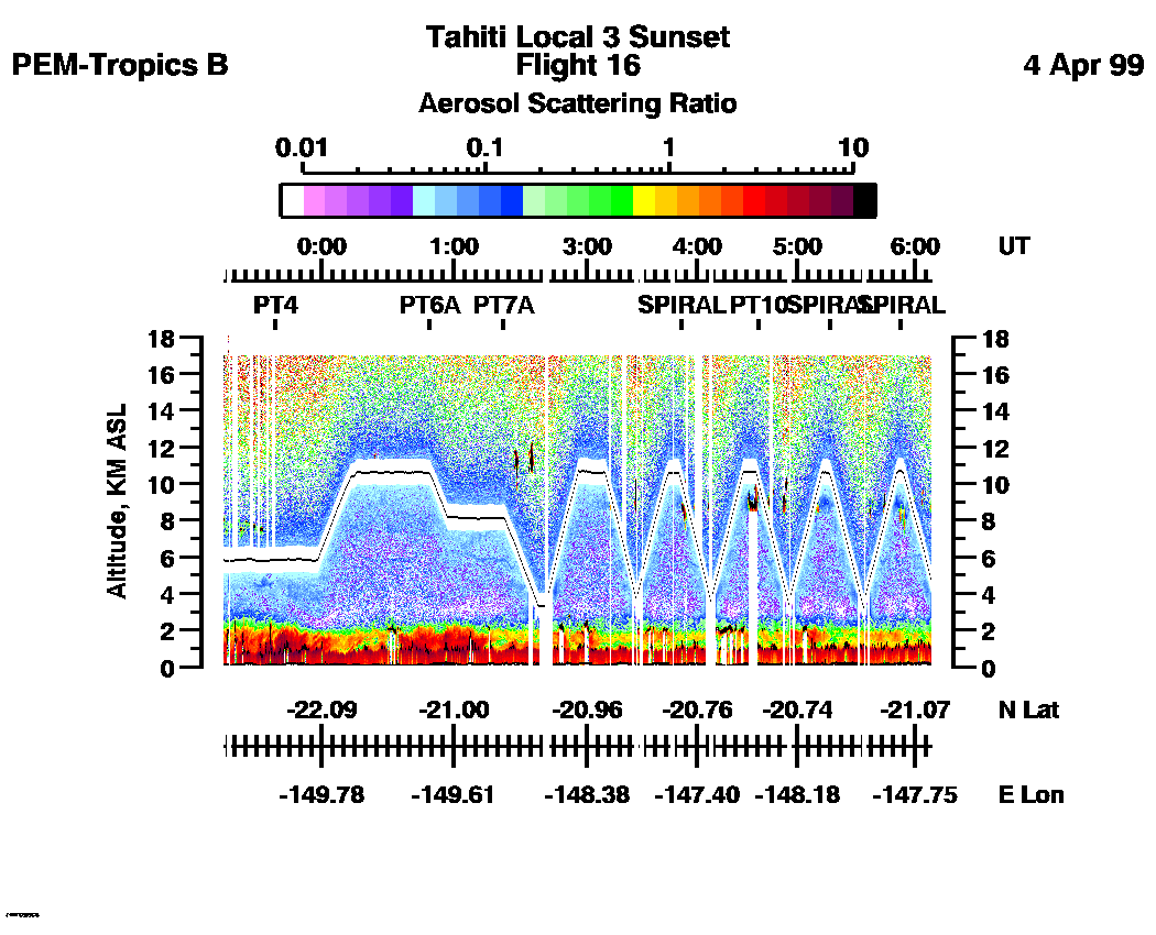
|| 23:13:29 - 06:07:23 -- (0 - 17 km) |
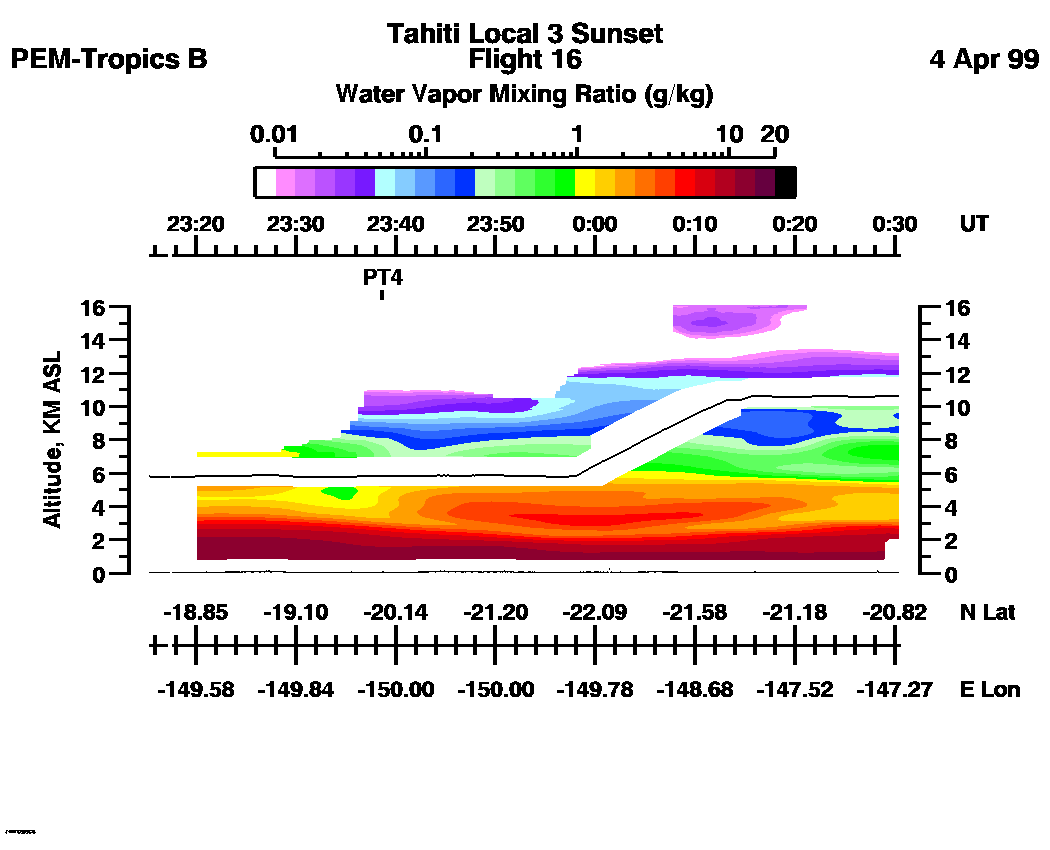
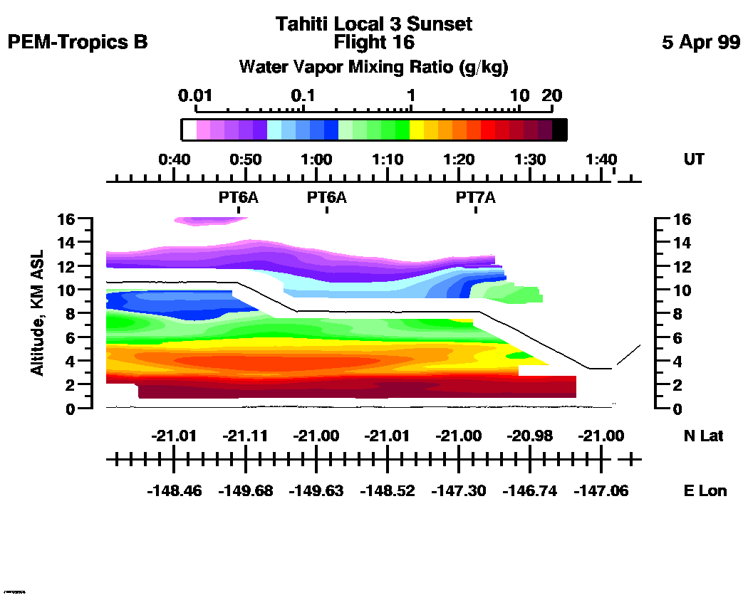
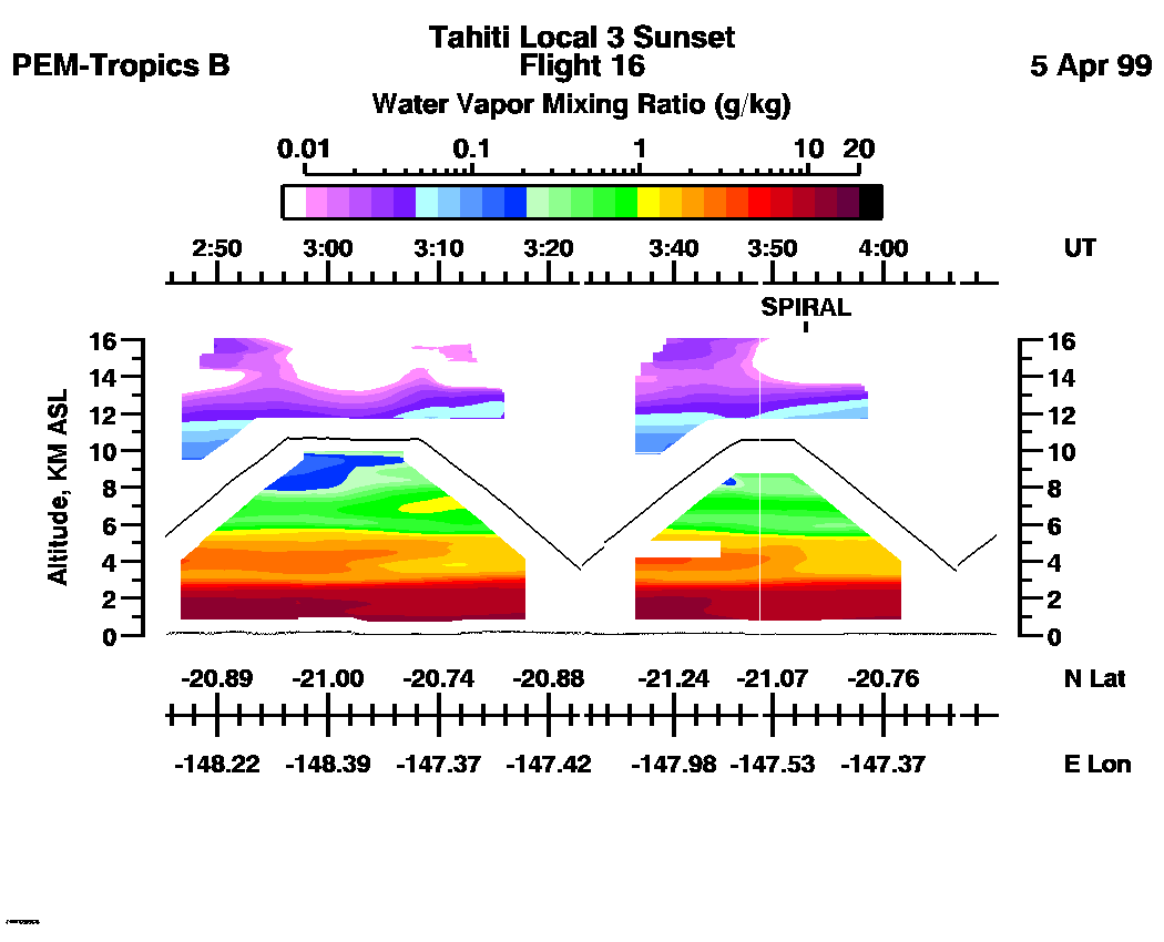
Combined Nadir/Zenith Water Vapor Mixing Ratio images for the entire flight
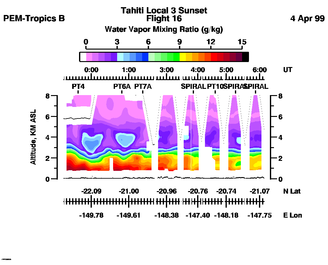
LASE Water Vapor Image : | 23:13:29 - 06:07:23 -- (0 - 8 km)
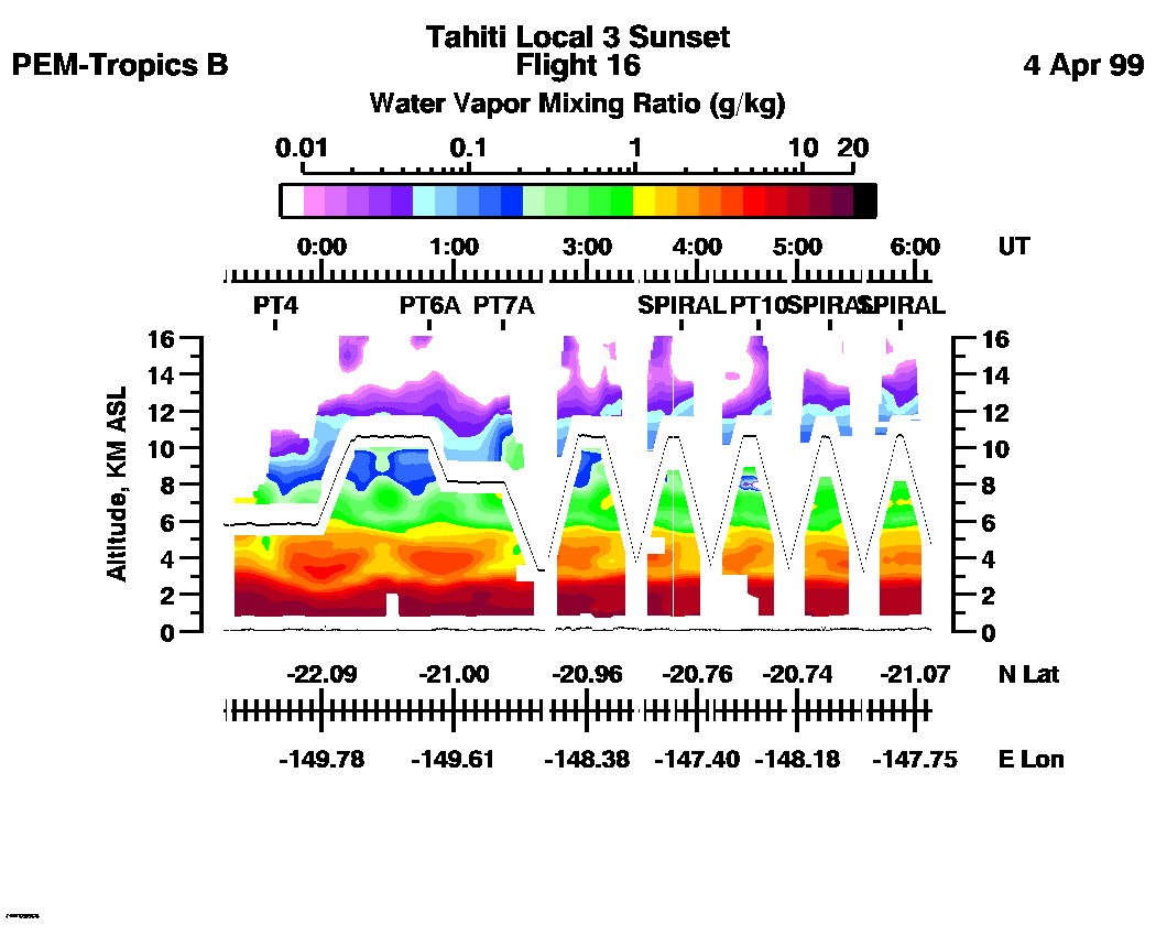
|| 23:13:29 - 06:07:23 -- (0 - 16 km) |
Combined LASE Aerosol Scattering Ratio Images
Aerosol Images :| 23:13:29 - 00:30:27
| 00:30:33 - 02:45:20
| 02:45:26 - 04:17:49
| 04:17:55 - 05:46:15
| 05:46:21 - 06:07:35
| movie_loop_all |
Combined LASE Water Vapor Images
Aerosol Images :| 23:13:29 - 00:30:27 | 00:30:33 - 02:45:20 | 02:45:26 - 04:17:49 | 04:17:55 - 05:46:15 | 05:46:21 - 06:07:35 | movie_loop_all |
for additional data. 