 for additional data.
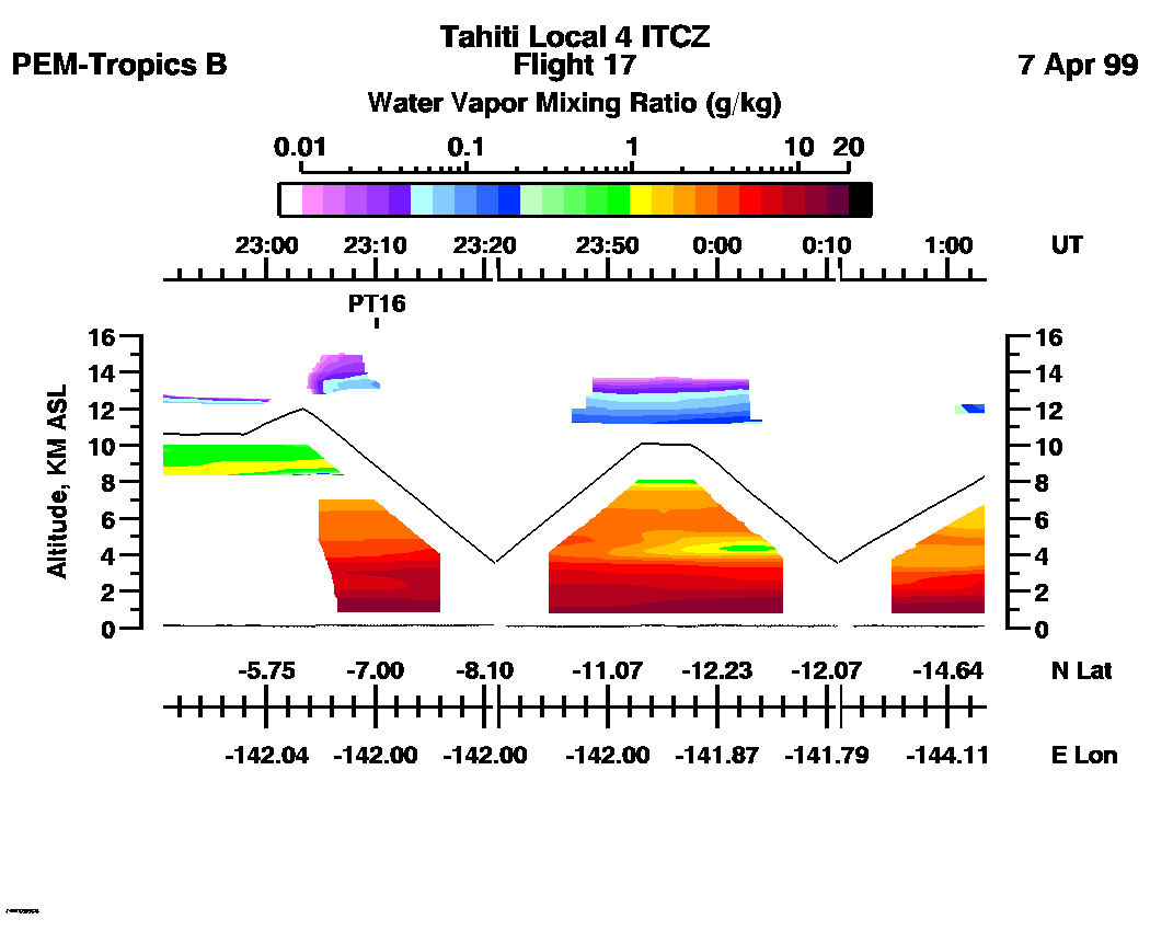
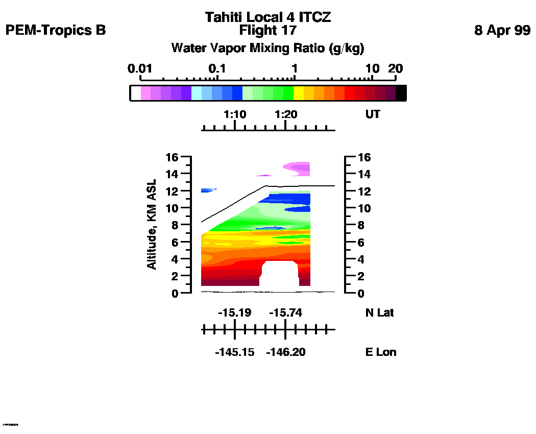
 Flight 17 / PEM-Tropics B -- Tahiti Local 4 ITCZ / Apr. 7-8, 1999
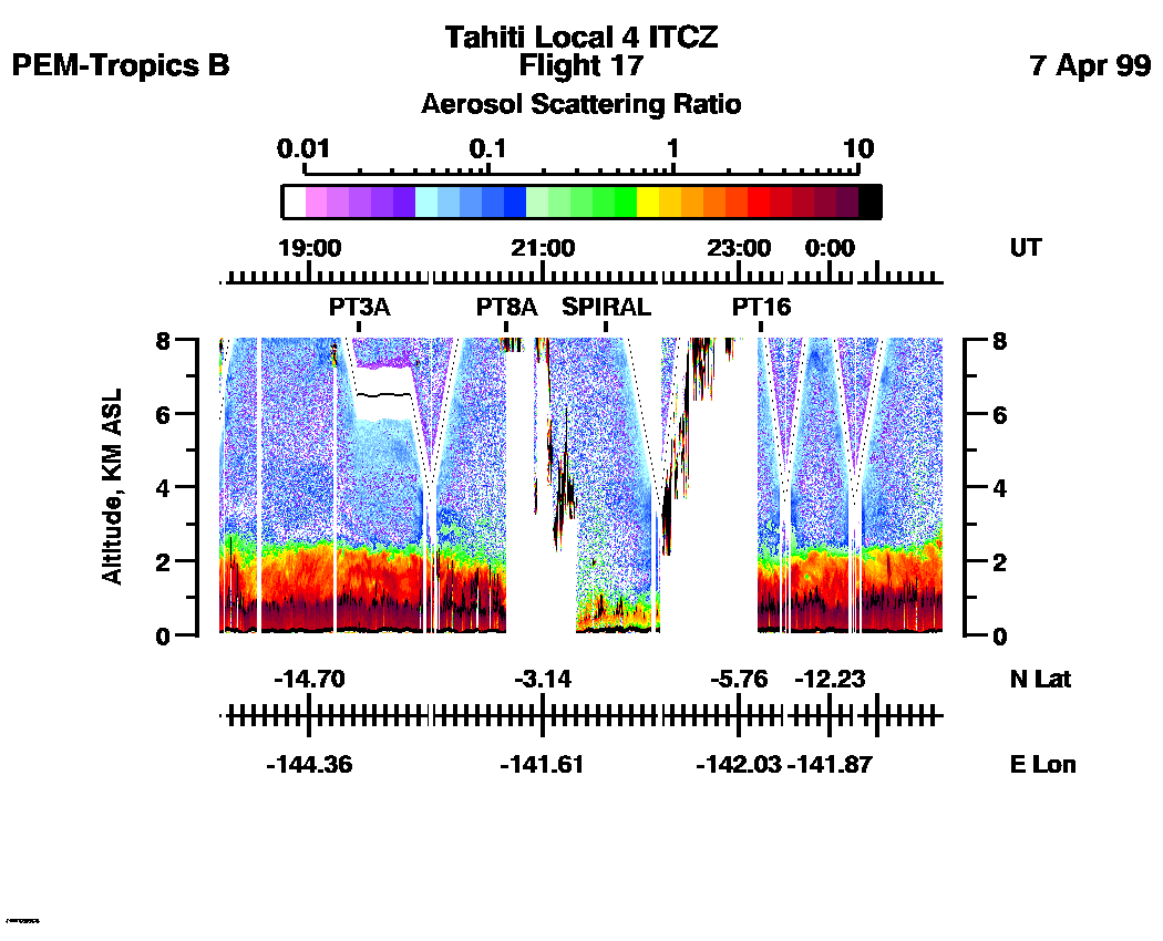
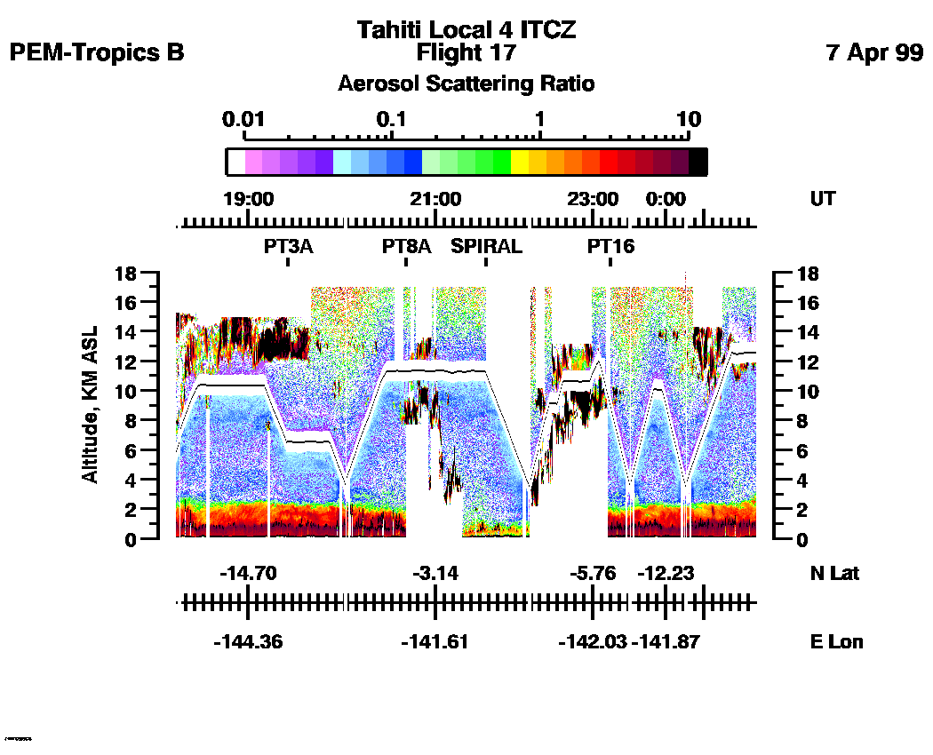
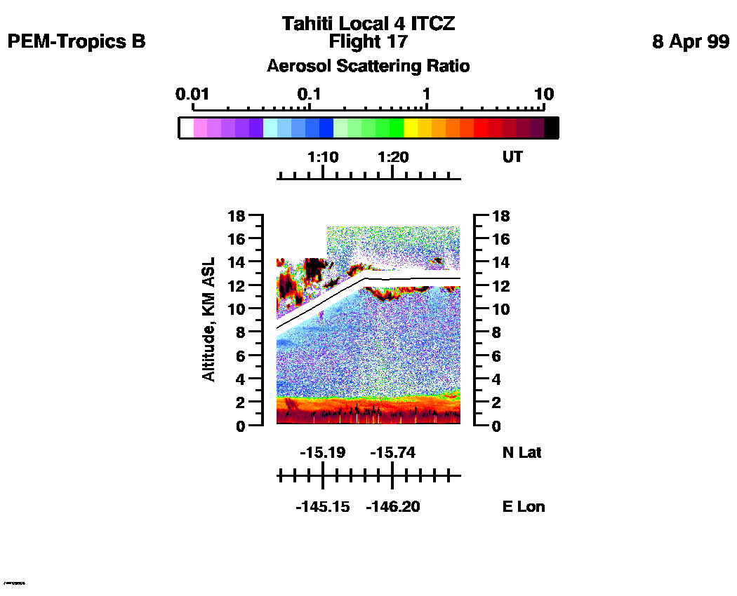
Combined Nadir/Zenith Aerosol Scattering Ratio image for the entire flight
LASE Aerosol Image : | 18:17:52 - 01:29:27 -- (0 - 8 km)
|| 18:17:52 - 01:29:27 -- (0 - 17 km) |
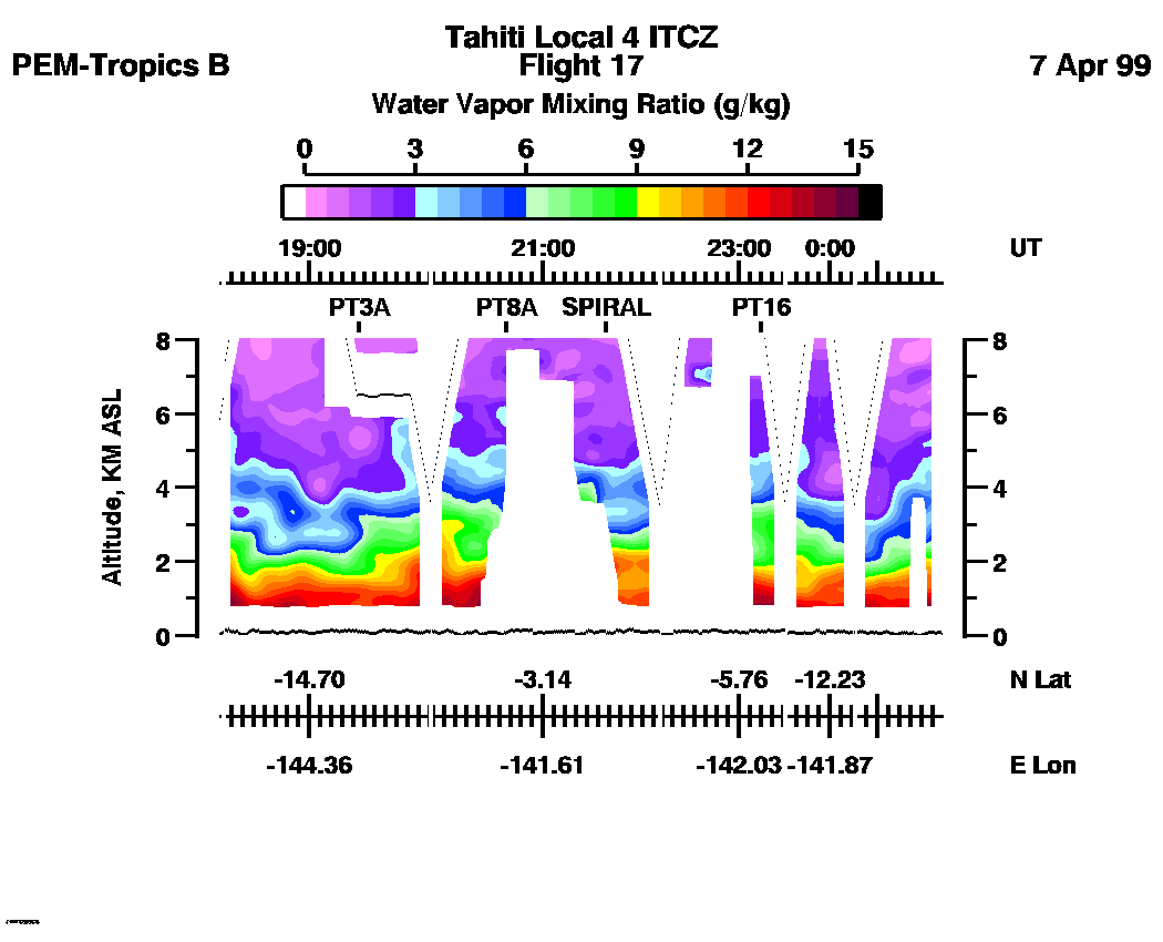
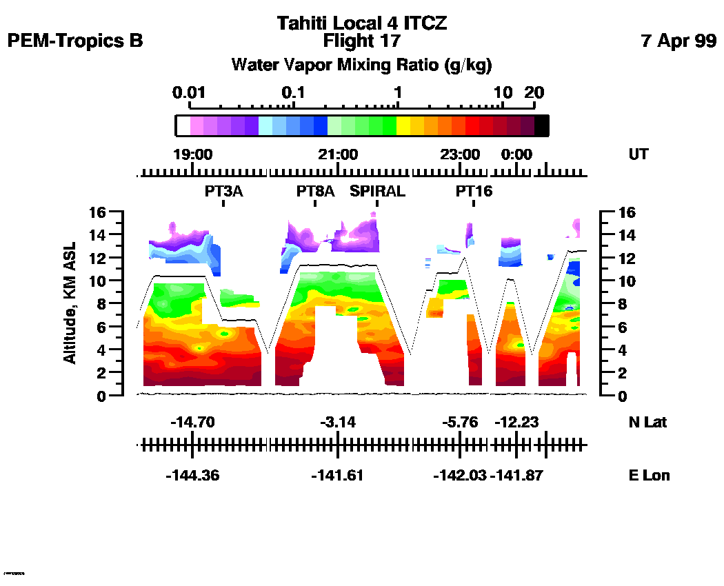
Combined Nadir/Zenith Water Vapor Mixing Ratio images for the entire flight
LASE Water Vapor Image : | 18:17:52 - 01:29:27 -- (0 - 8 km)
|| 18:17:52 - 01:29:27 -- (0 - 16 km) |
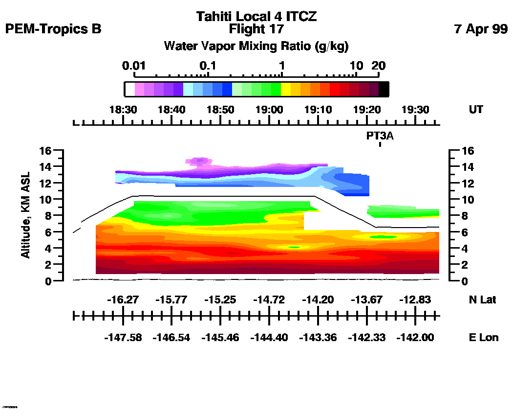
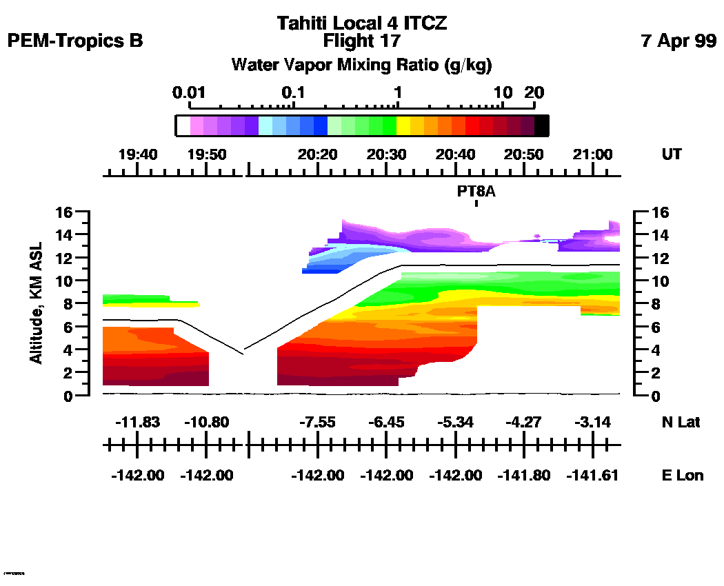
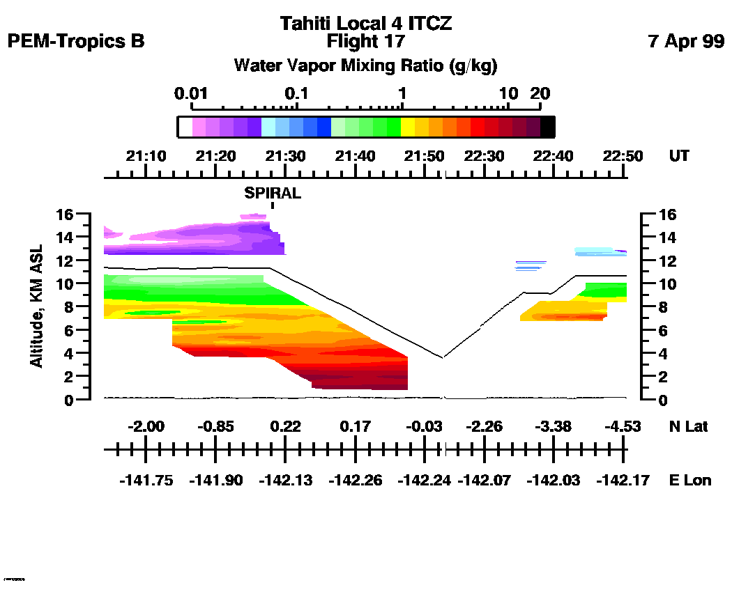
Combined LASE Aerosol Scattering Ratio Images
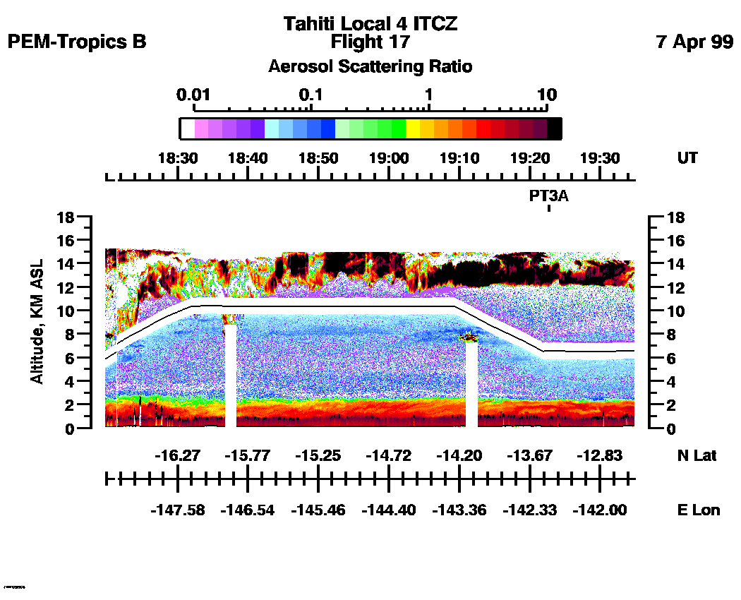
Aerosol Images :| 18:17:52 - 19:34:55
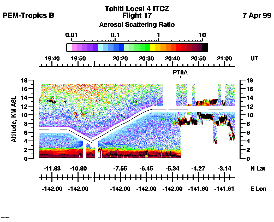
| 19:35:01 - 21:03:55
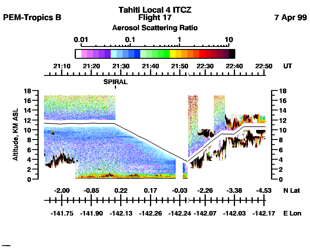
| 21:04:01 - 22:50:34
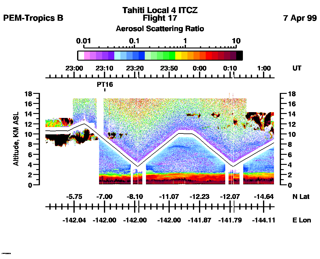
| 22:50:40 - 01:03:18
| 01:03:24 - 01:29:33
| movie_loop_all |
Combined LASE Water Vapor Images
Water Vapor Images :| 18:17:52 - 19:34:55 | 19:35:01 - 21:03:55 | 21:04:01 - 22:50:34 | 22:50:40 - 01:03:18 | 01:03:24 - 01:29:33 | movie_loop_all |
for additional data. 