 for additional data.
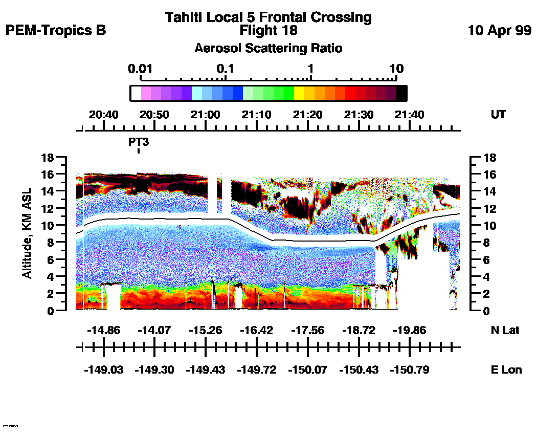
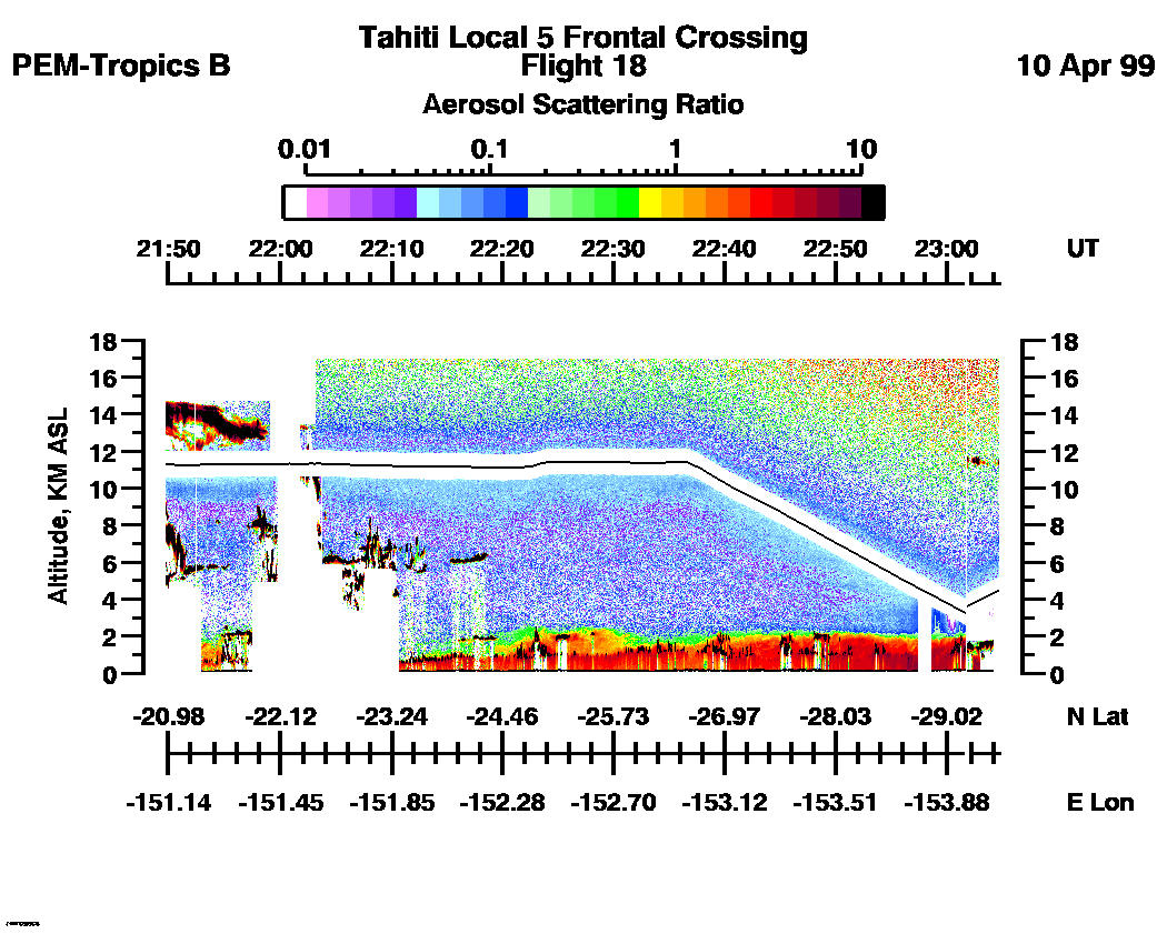
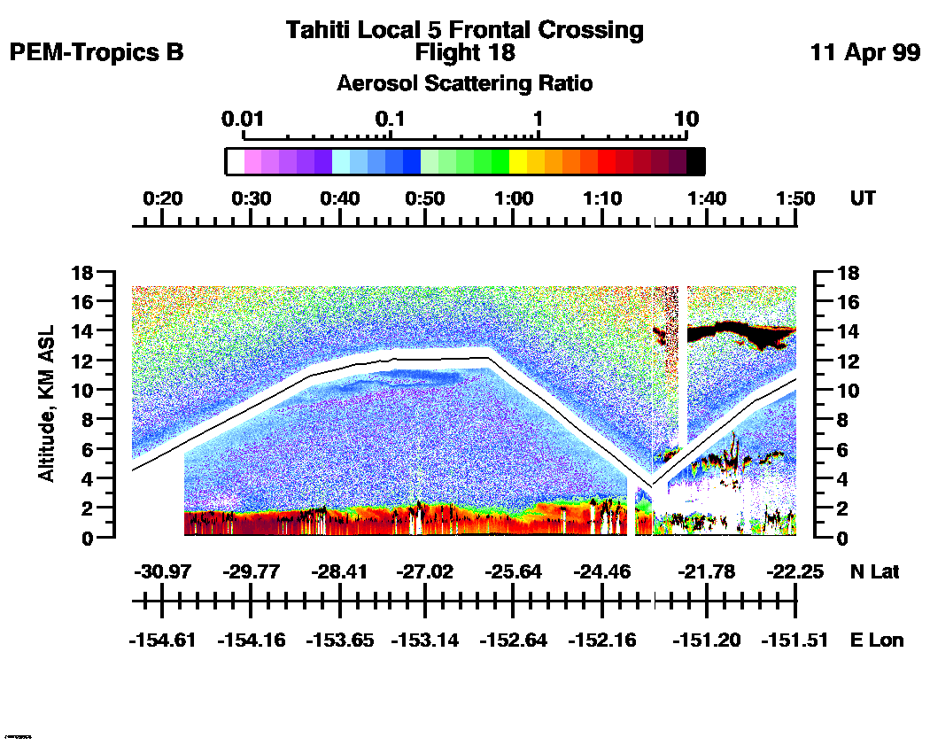
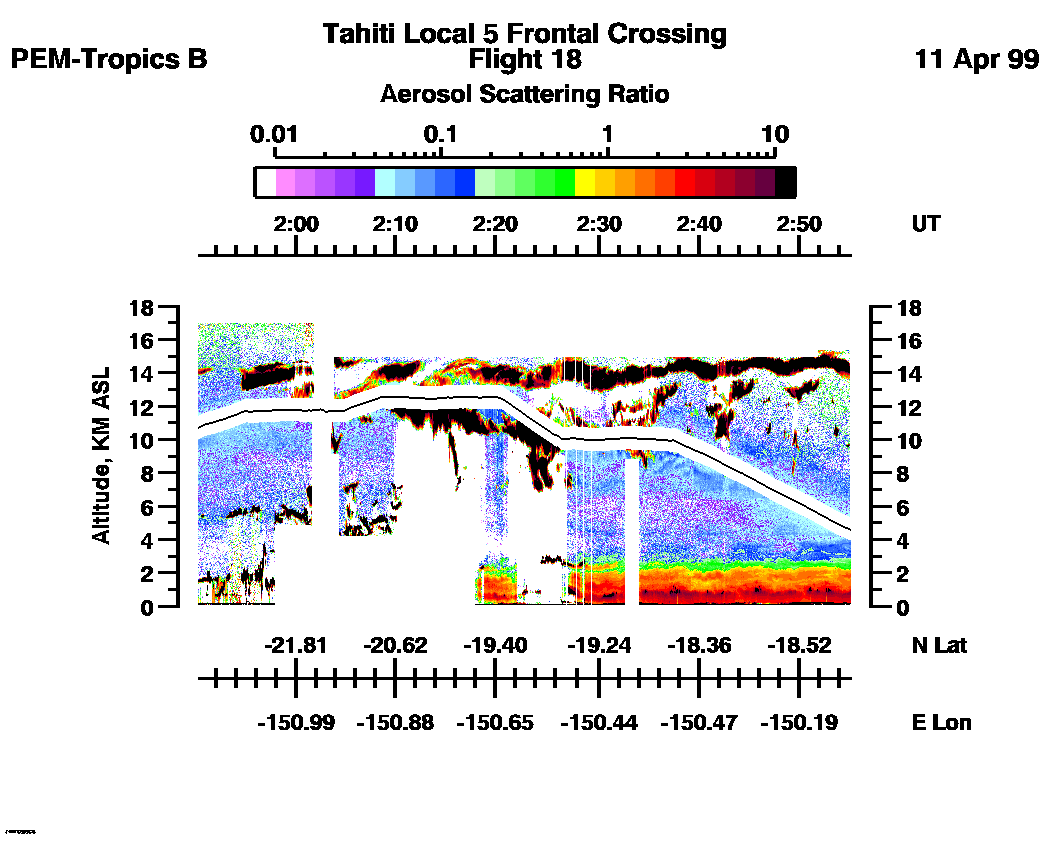
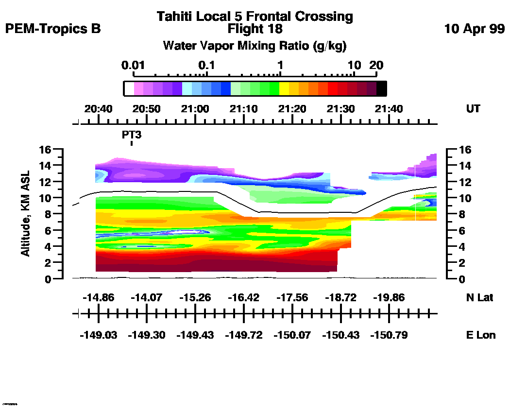
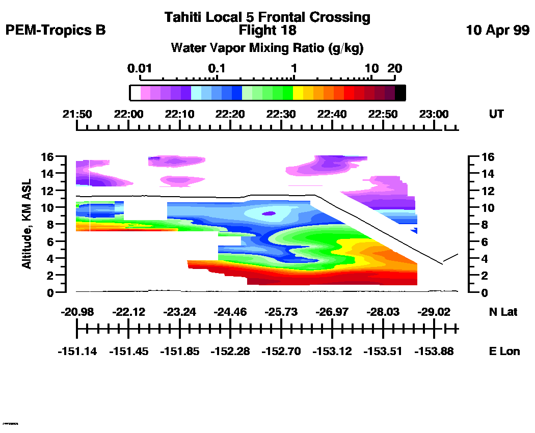
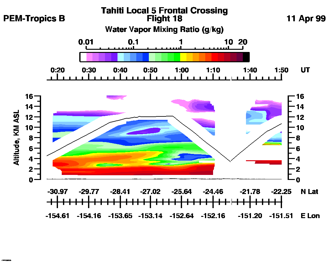
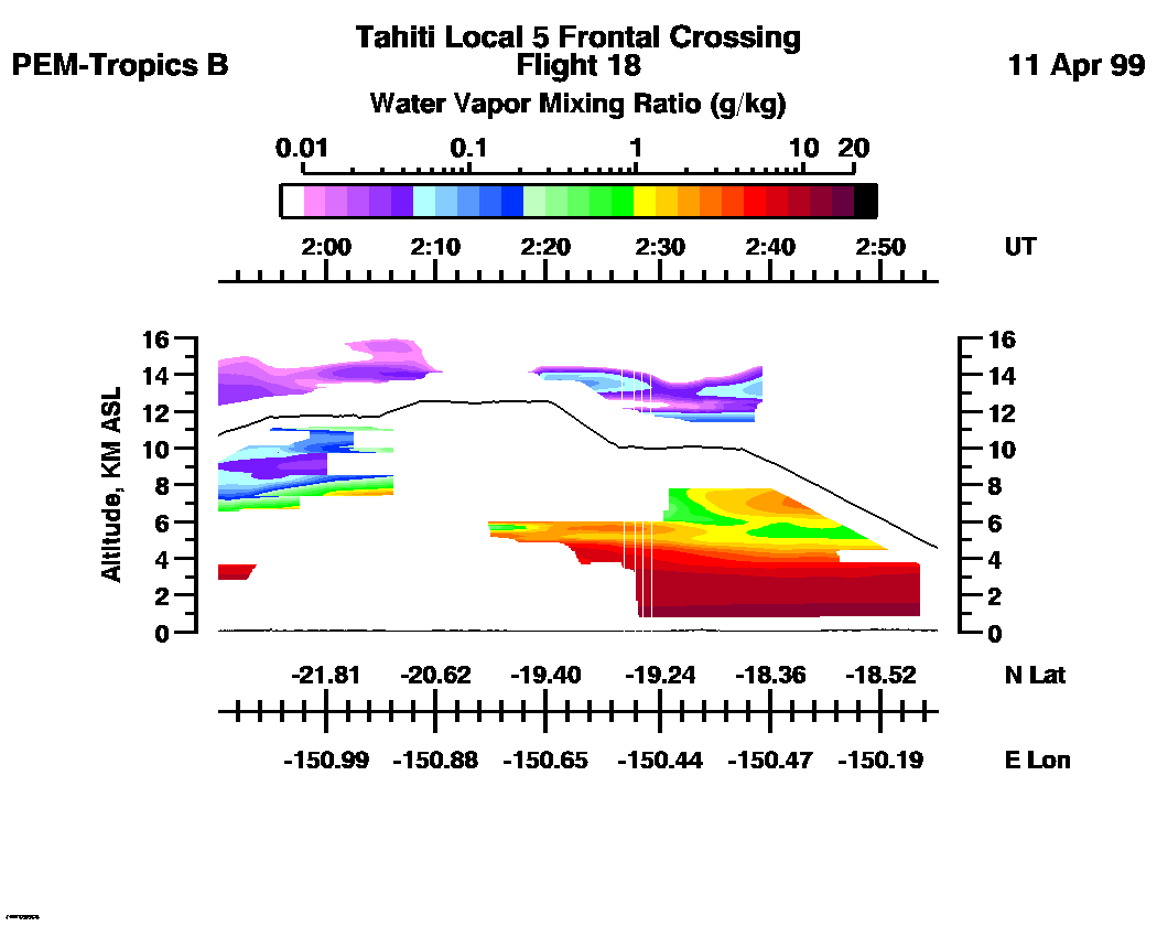
 Flight 18 / PEM-Tropics B -- Tahiti Local 5 / Frontal Crossing / Apr. 10-11, 1999
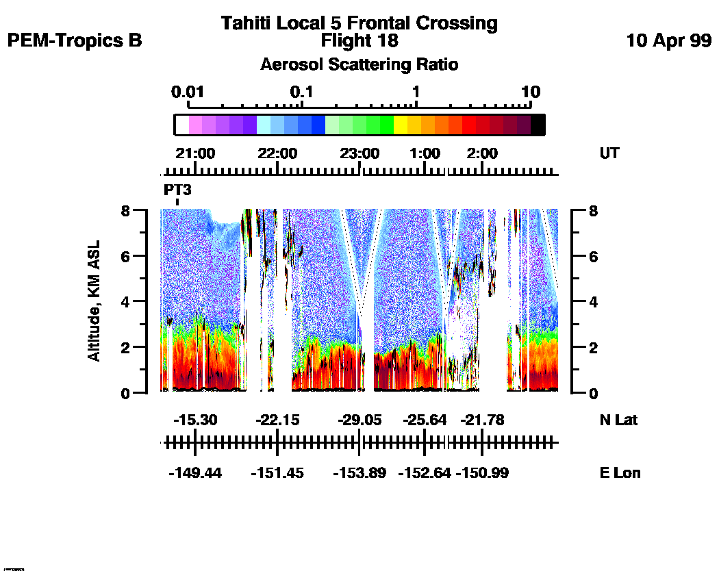
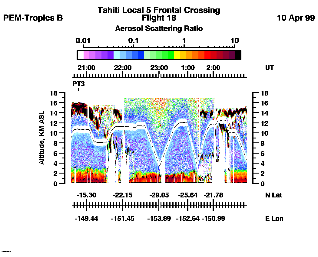
Combined Nadir/Zenith Aerosol Scattering Ratio image for the entire flight
LASE Aerosol Image : | 20:32:46 - 02:54:58 -- (0 - 8 km)
|| 20:32:46 - 02:54:58 -- (0 - 17 km) |
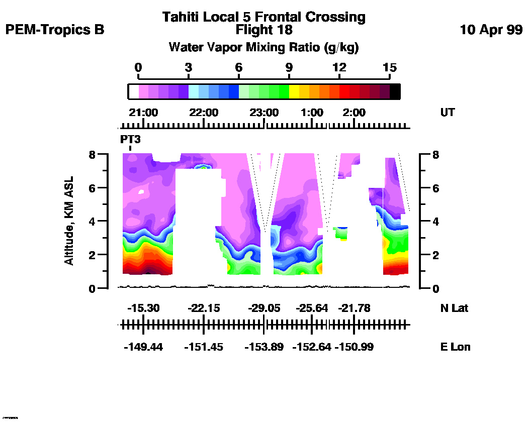
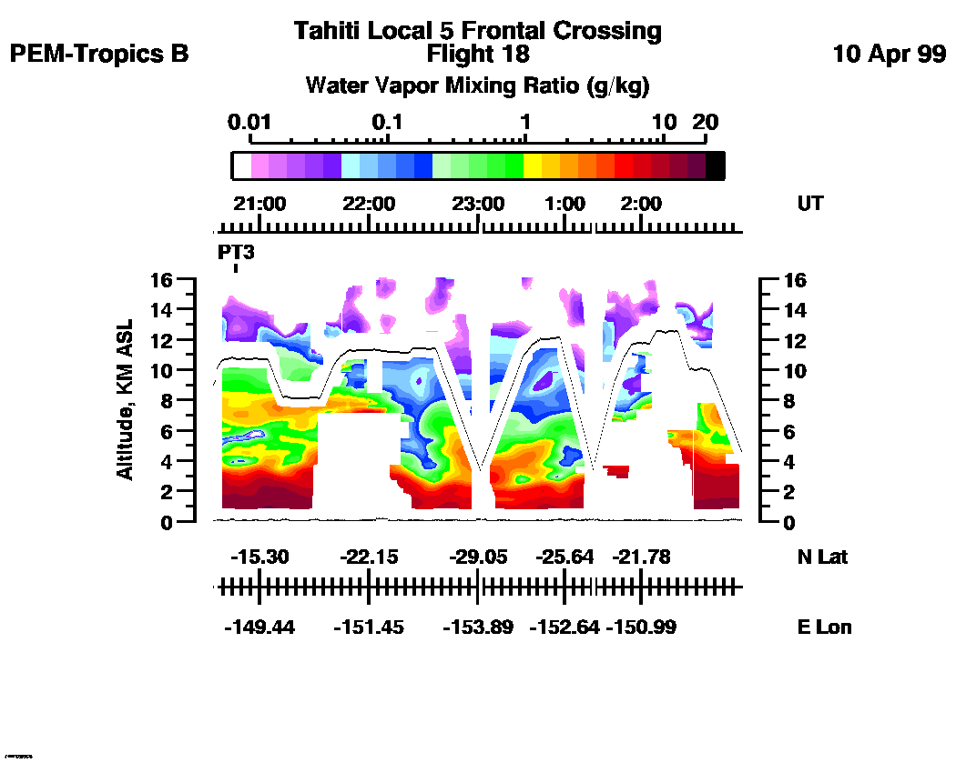
Combined Nadir/Zenith Water Vapor Mixing Ratio images for the entire flight
LASE Water Vapor Image : | 20:32:46 - 02:54:58 -- (0 - 8 km)
|| 20:32:46 - 02:54:58 -- (0 - 16 km) |
Combined LASE Aerosol Scattering Ratio Images
Aerosol Images :| 20:32:46 - 21:49:44
| 21:49:50 - 00:16:32
| 00:16:38 - 01:50:08
| 01:50:14 - 02:55:10
| movie_loop_all |
Combined LASE Water Vapor Images
Water Vapor Images :| 20:32:46 - 21:49:44 | 21:49:50 - 00:16:32 | 00:16:38 - 01:50:08 | 01:50:14 - 02:55:10 | movie_loop_all |
for additional data. 