 for additional data.
 Flight 19 / PEM-Tropics B -- Tahiti to Easter / Tropical Air Masses / Apr. 13-14, 1999
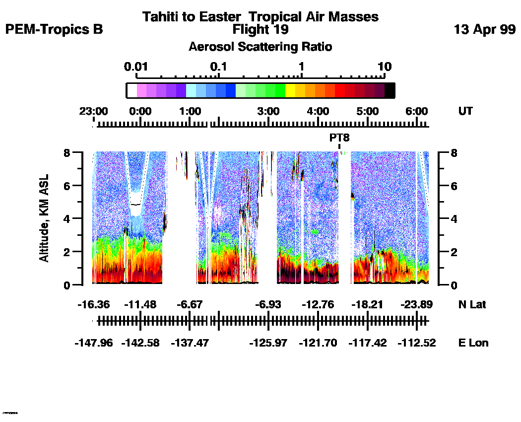
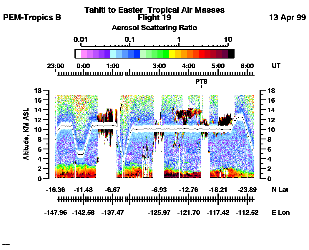
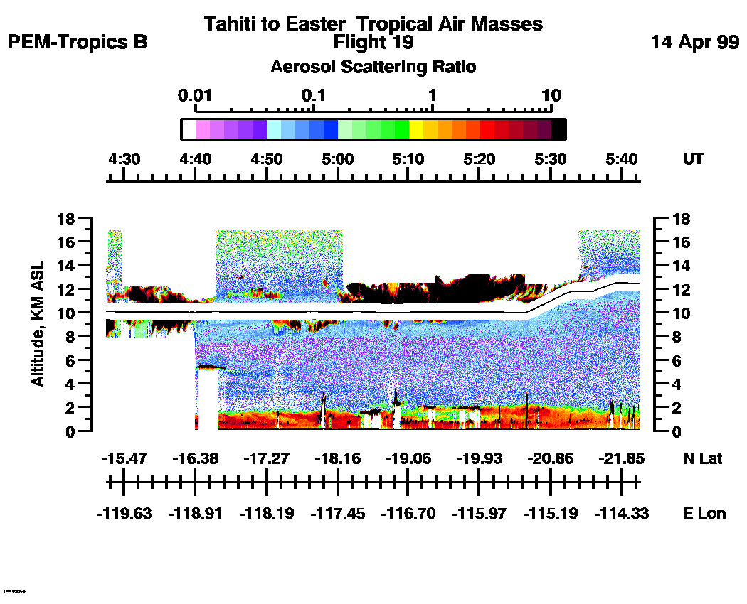
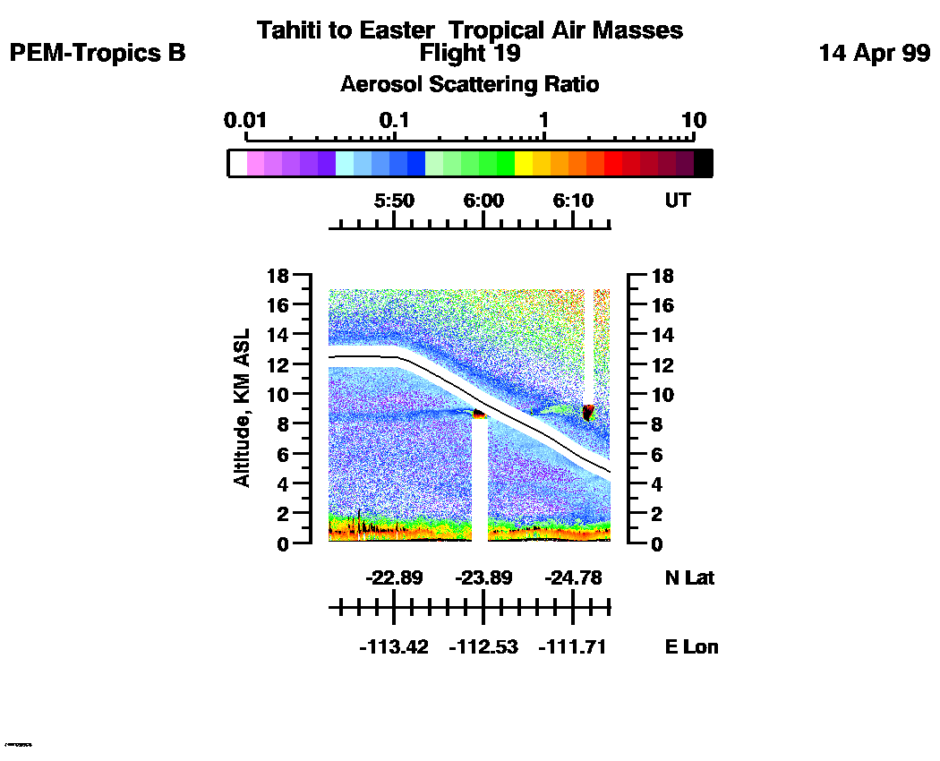
Combined Nadir/Zenith Aerosol Scattering Ratio image for the entire flight
LASE Aerosol Image : | 22:56:40 - 06:13:57 -- (0 - 8 km)
|| 22:56:40 - 06:13:57 -- (0 - 17 km) |
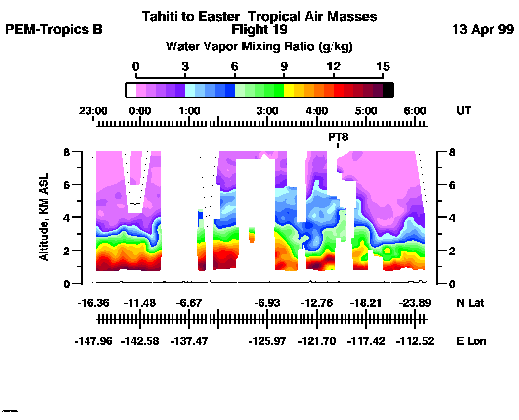
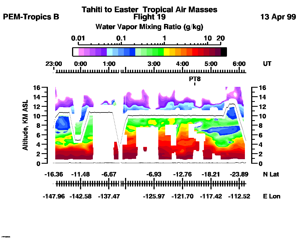
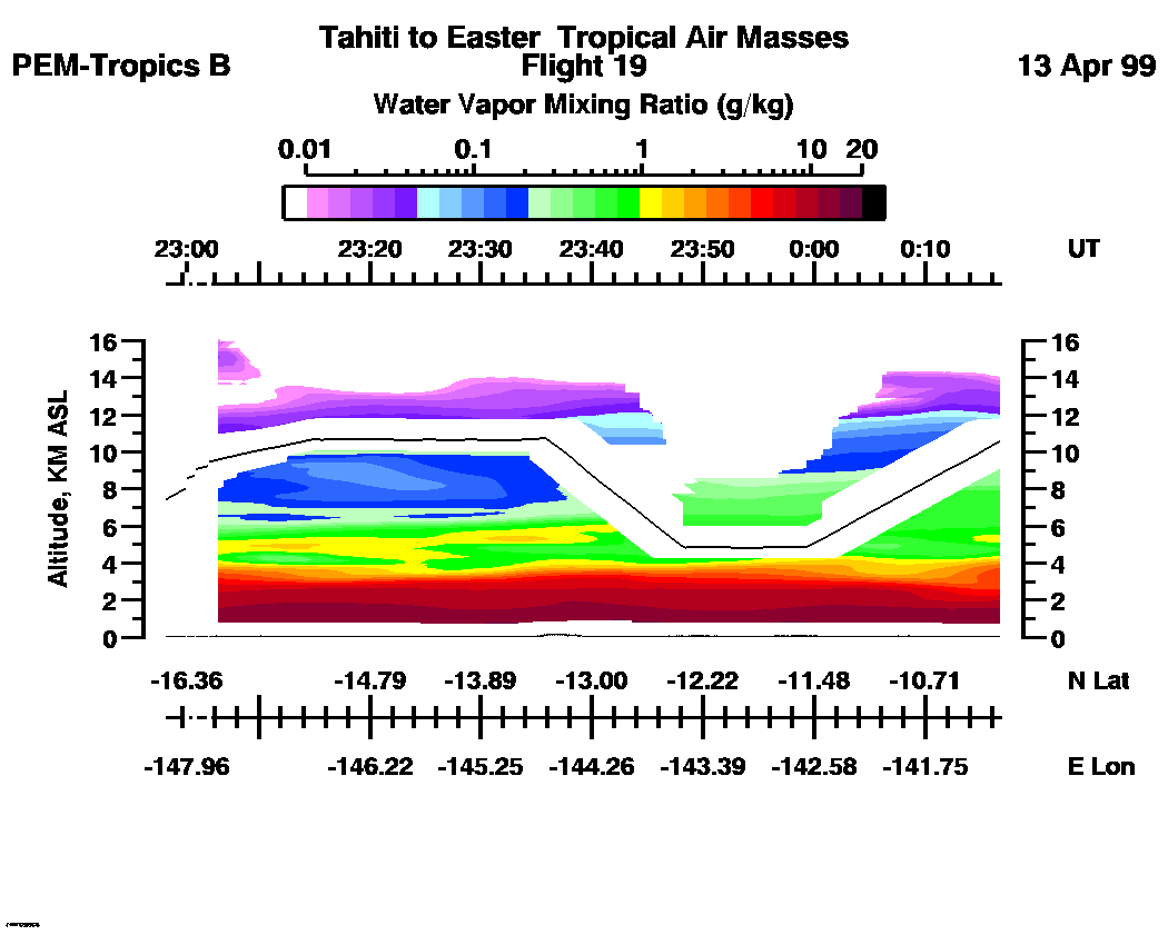
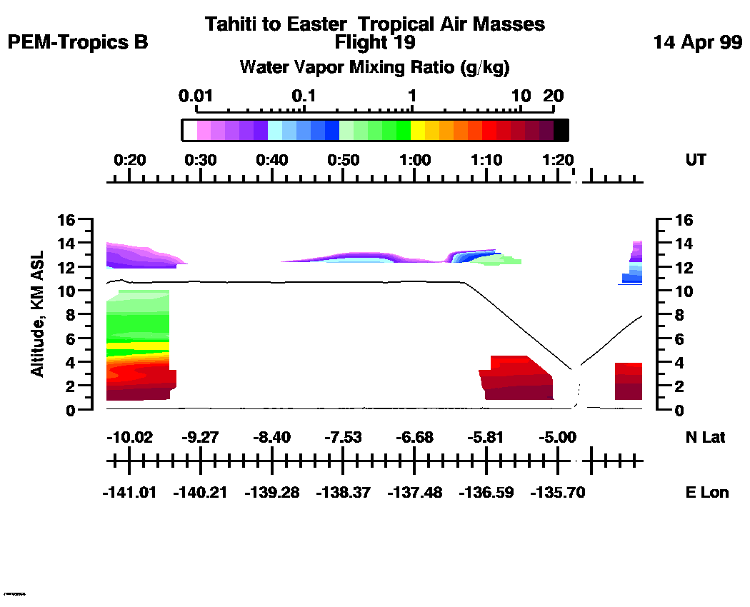
Combined Nadir/Zenith Water Vapor Mixing Ratio images for the entire flight
LASE Water Vapor Image : | 22:56:40 - 06:13:57 -- (0 - 8 km)
|| 22:56:40 - 06:13:57 -- (0 - 16 km) |
Combined LASE Aerosol Scattering Ratio Images
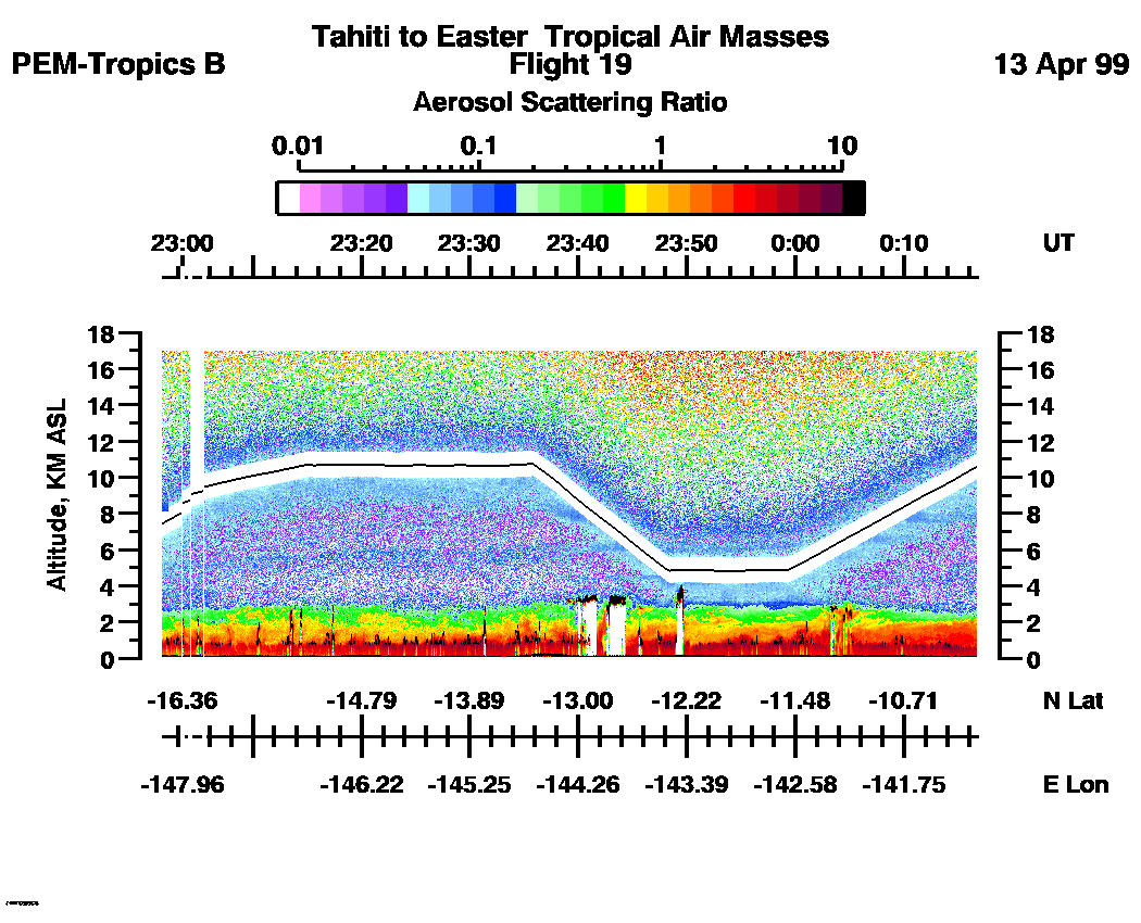
Aerosol Images :| 22:56:40 - 00:16:47
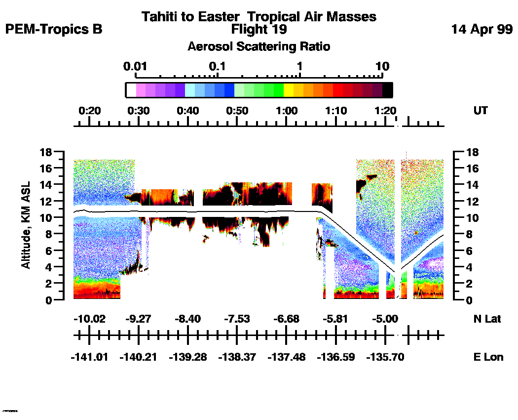
| 00:16:53 - 01:57:05
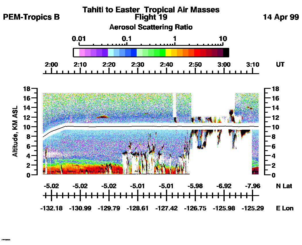
| 01:57:11 - 03:12:03
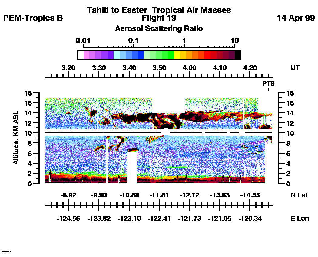
| 03:12:09 - 04:27:23
| 04:27:29 - 05:42:35
| 05:42:41 - 06:14:09
| movie_loop_all |
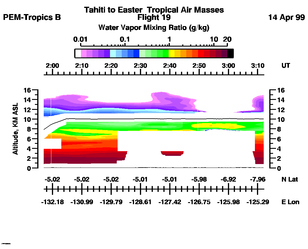
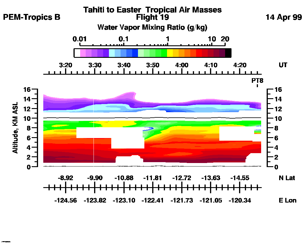
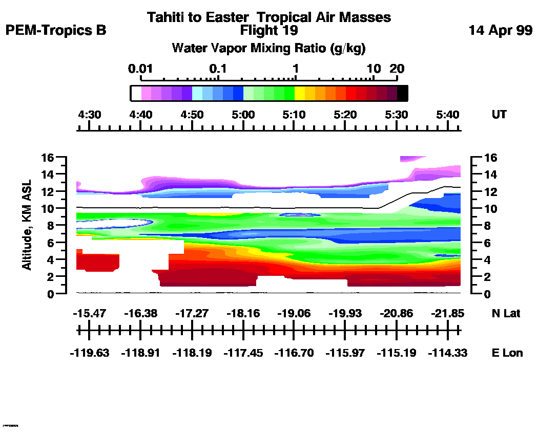
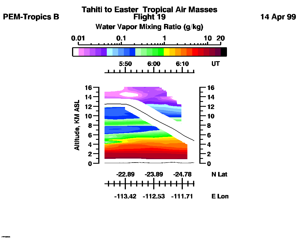
Combined LASE Water Vapor Images
Aerosol Images :| 22:56:40 - 00:16:47 | 00:16:53 - 01:57:05 | 01:57:11 - 03:12:03 | 03:12:09 - 04:27:23 | 04:27:29 - 05:42:35 | 05:42:41 - 06:14:09 | movie_loop_all |
for additional data. 