
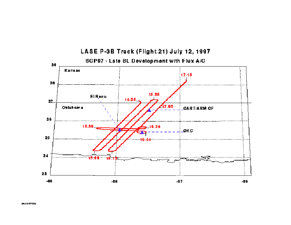
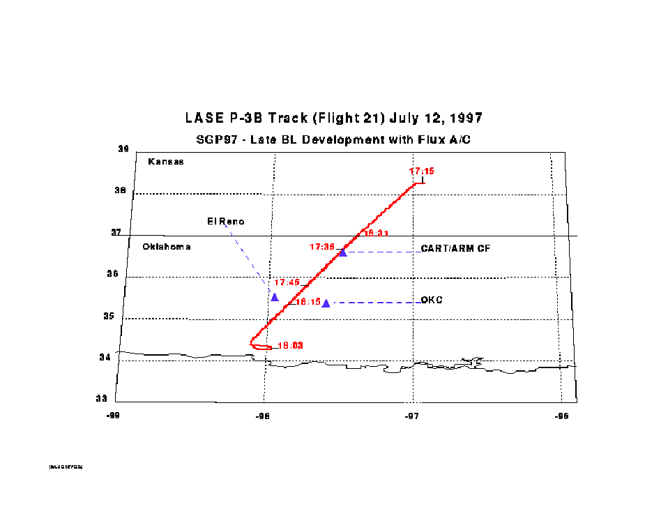
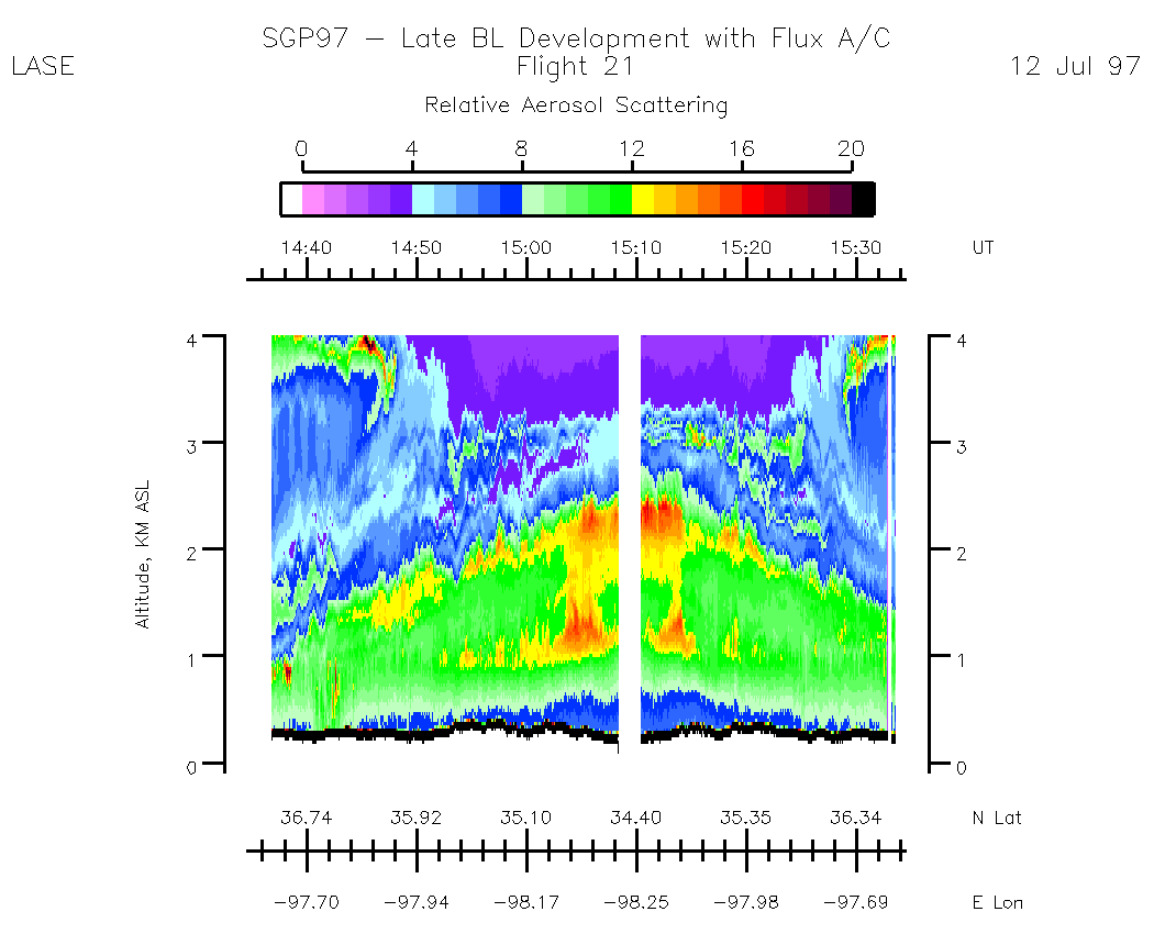
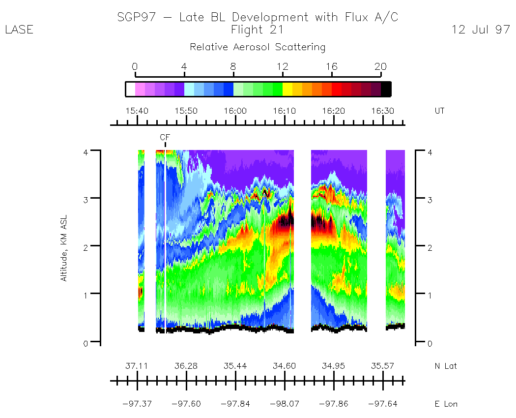
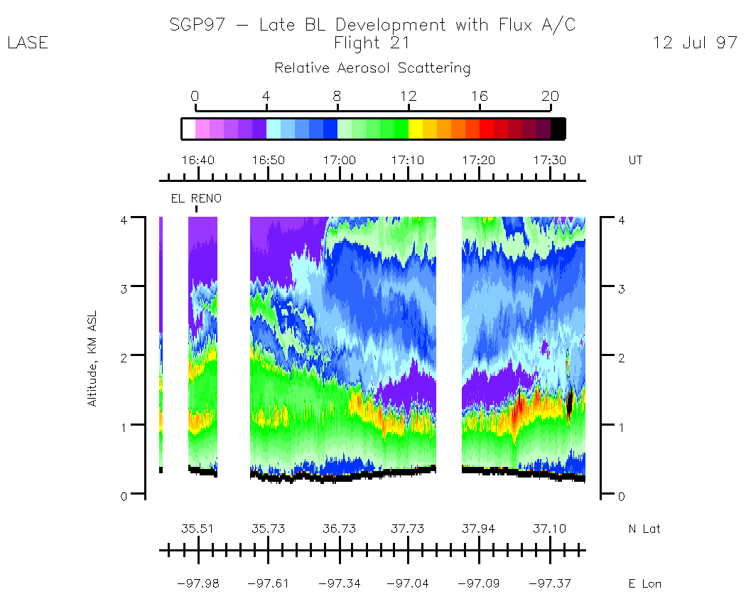
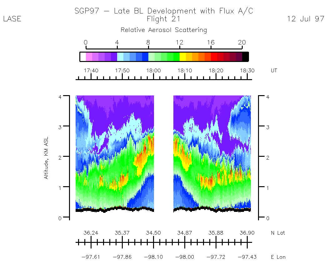
Flight 21 / SGP97 -- Late BL Development with Flux A/C / 12 July 1997
LASE (NASA P3) Flight Track
Flight tracks are shown when LASE was available for taking data. There are many instances when LASE laser beams were blocked (i.e, in clouds, aircraft turns, other aircraft in vicinity, etc) due to laser eye safty. The track has been split into segments to enhance labeling of UT time, therefore, aerosol and water vapor images can be easily linked to the P3 LASE track.
Flight Track Images (by UT):| 14:35 - 17:15 | 17:15 - 18:31 |
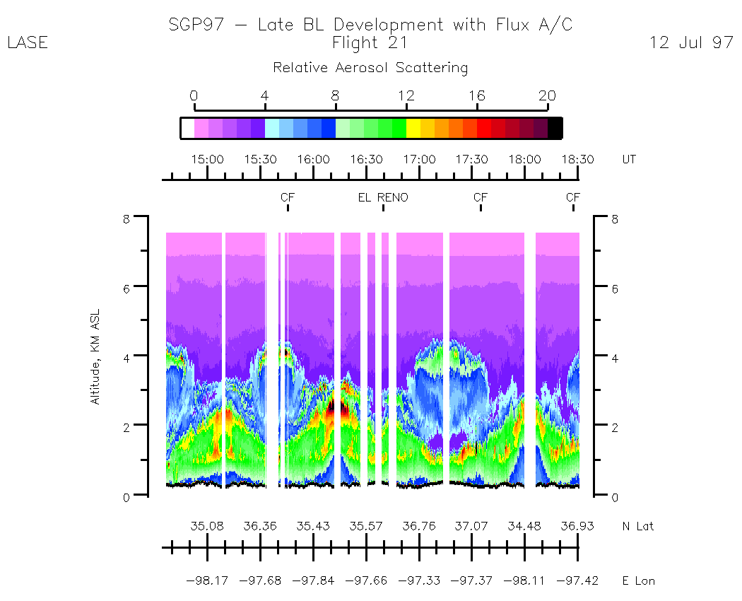
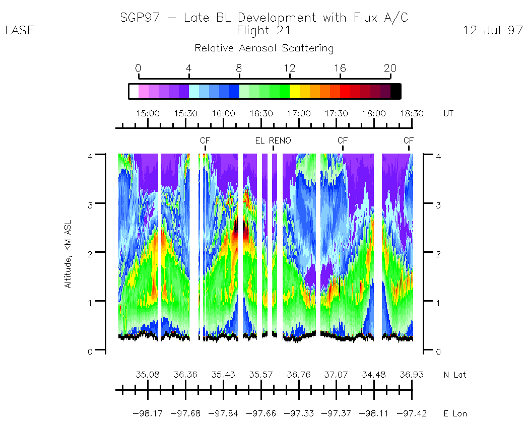
Aerosols -- Relative Aerosol Backscatter
Entire Flight Summary: | Aerosol Scale: 0 - 20 / Alt Scale: 0 - 8 km |
Entire Flight Summary: | Aerosol Scale: 0 - 20 / Alt Scale: 0 - 4 km |
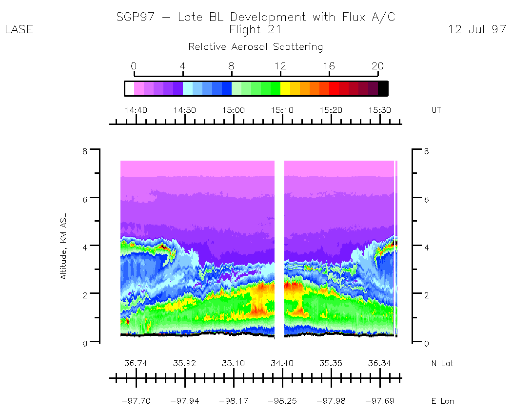
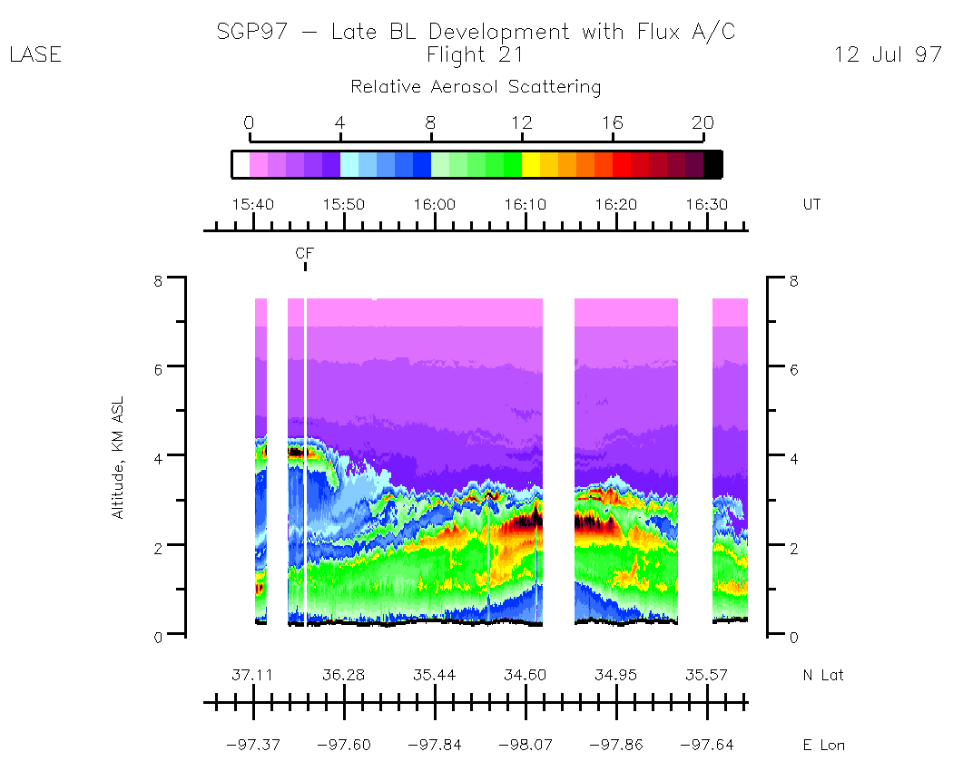
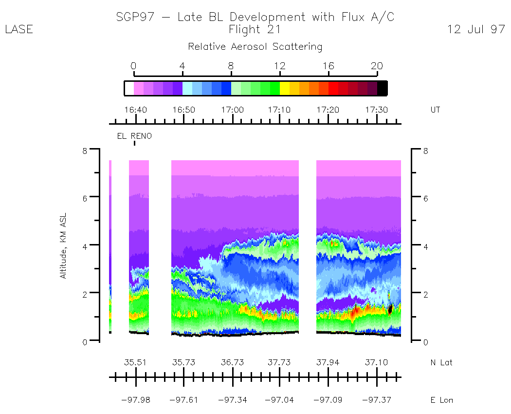
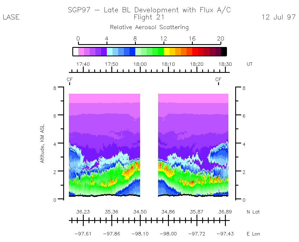
Subset Aerosol Images (by UT) and Alt Scale 0 - 8 km :| 14:34:37 - 15:34:33 | 15:34:39 - 16:34:35 | 16:34:35 - 17:35:07 | 17:35:07 - 18:31:09 |
Subset Aerosol Images (by UT) and Alt Scale 0 - 4 km :| 14:34:37 - 15:34:33 | 15:34:39 - 16:34:35 | 16:34:35 - 17:35:07 | 17:35:07 - 18:31:09
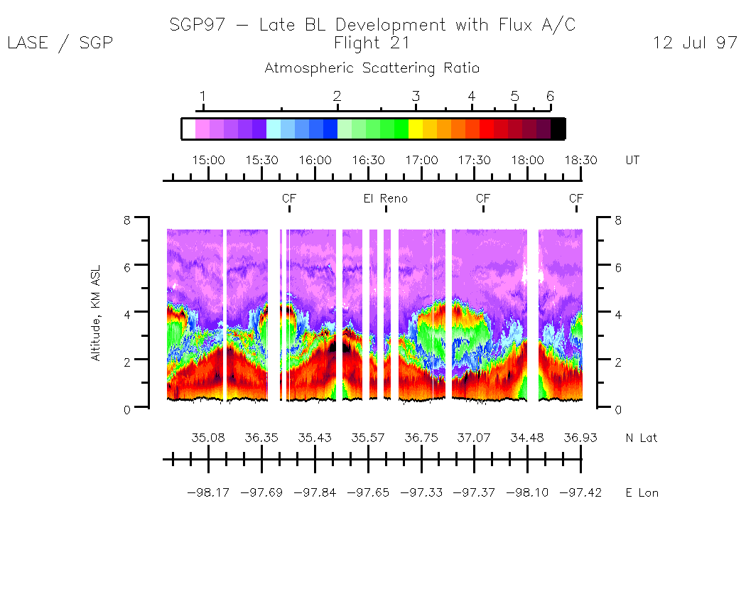
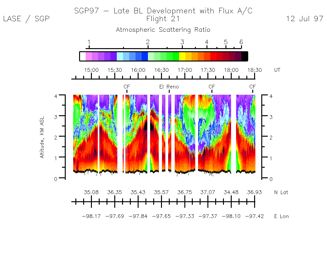
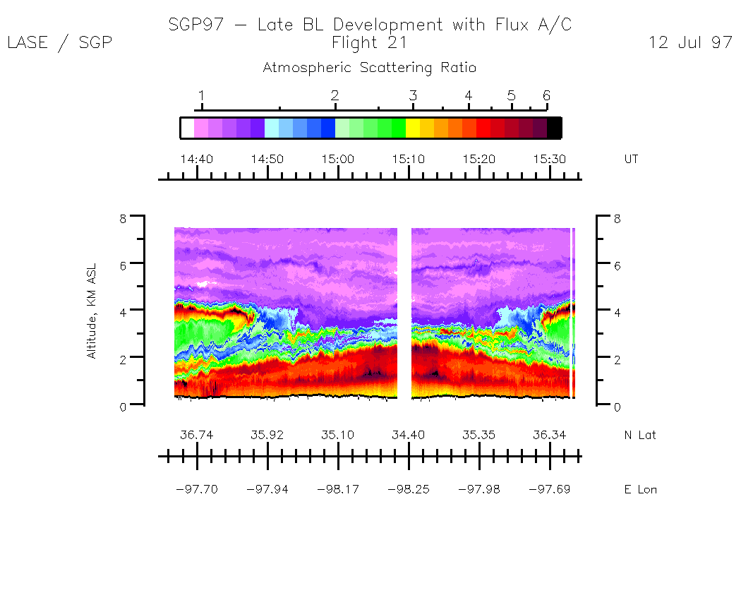
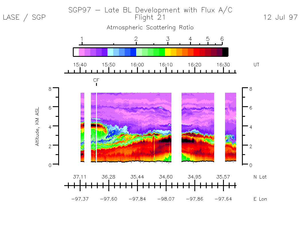
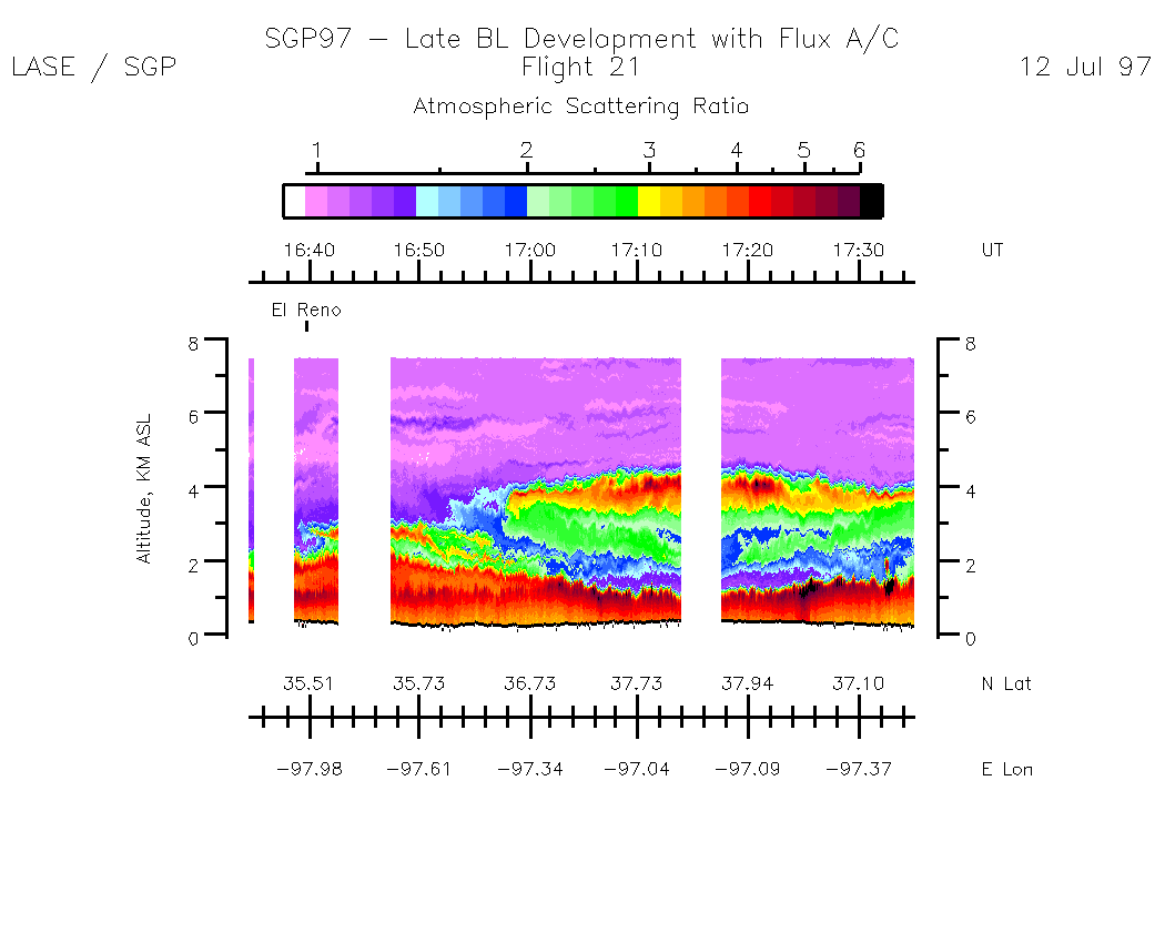
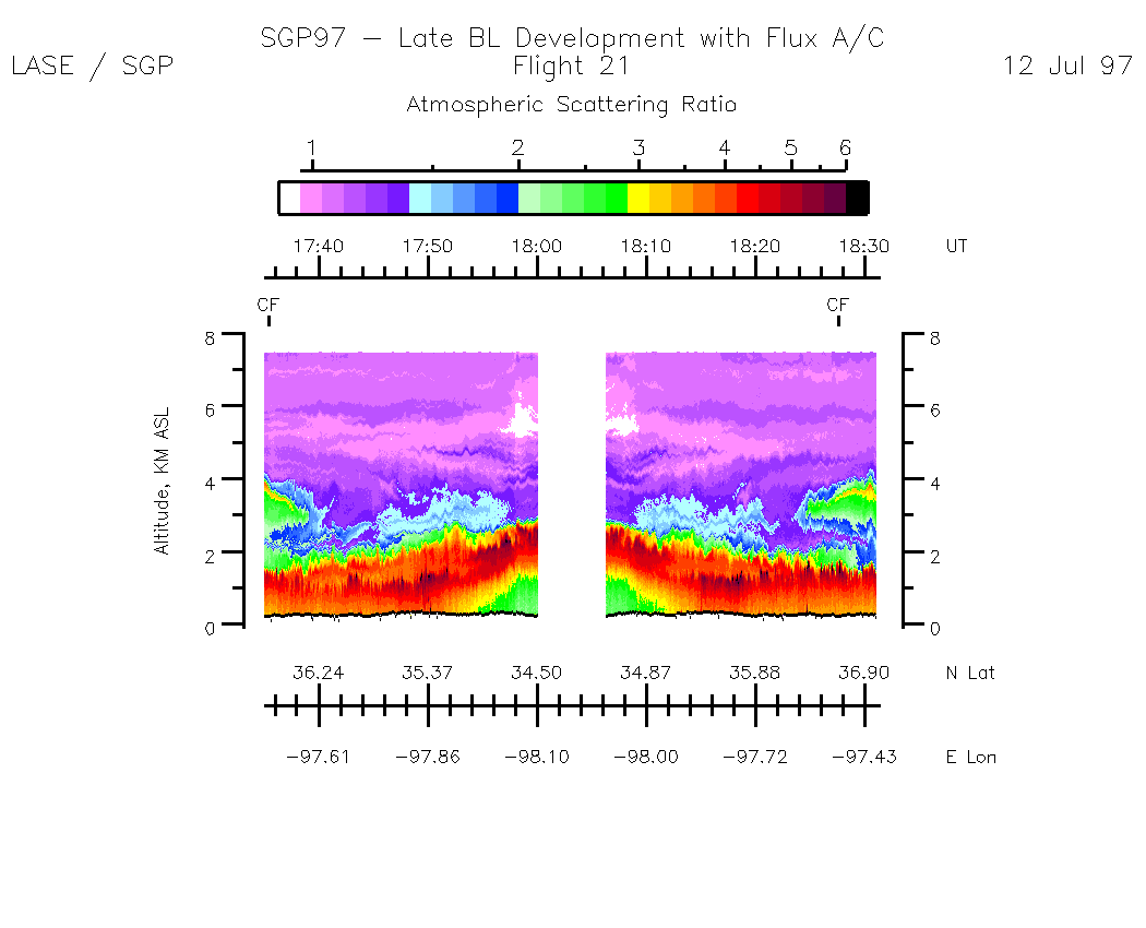
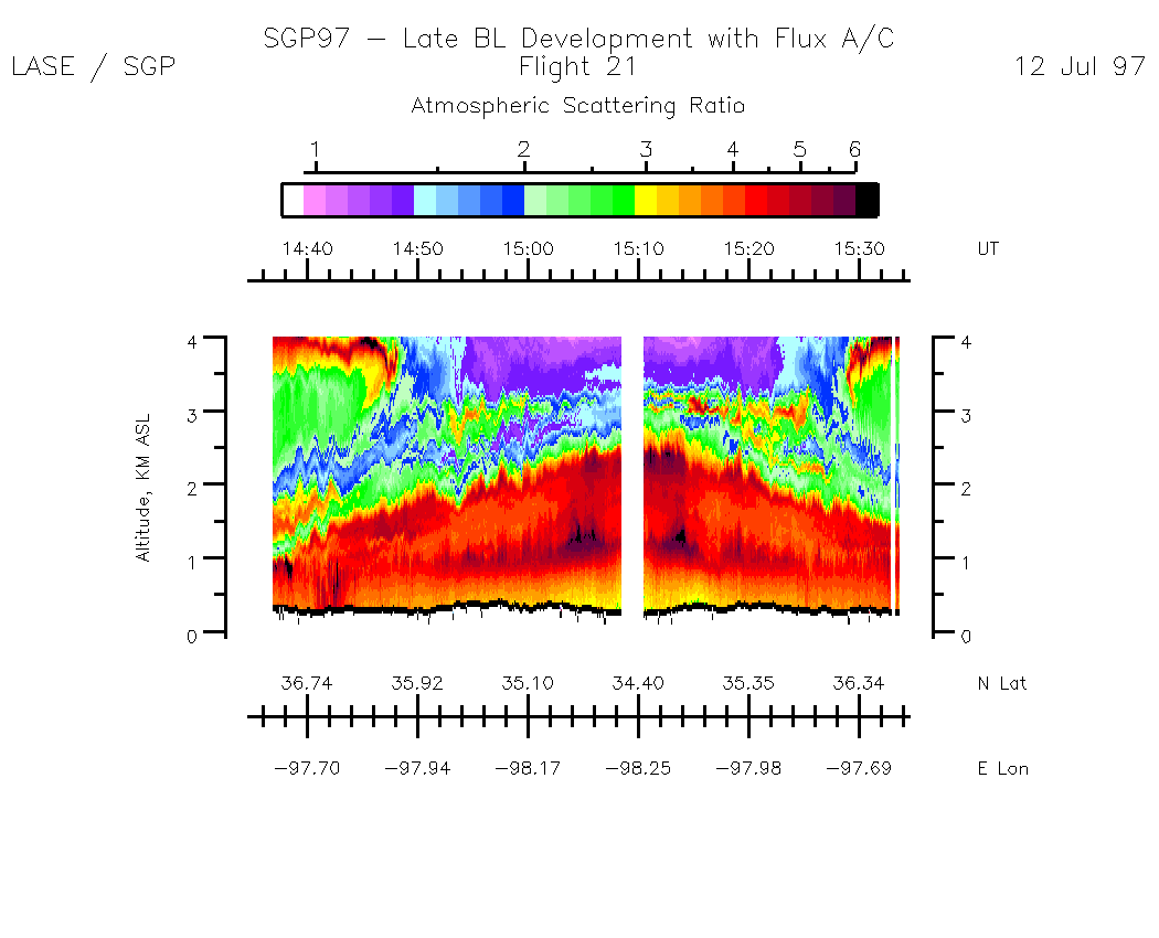
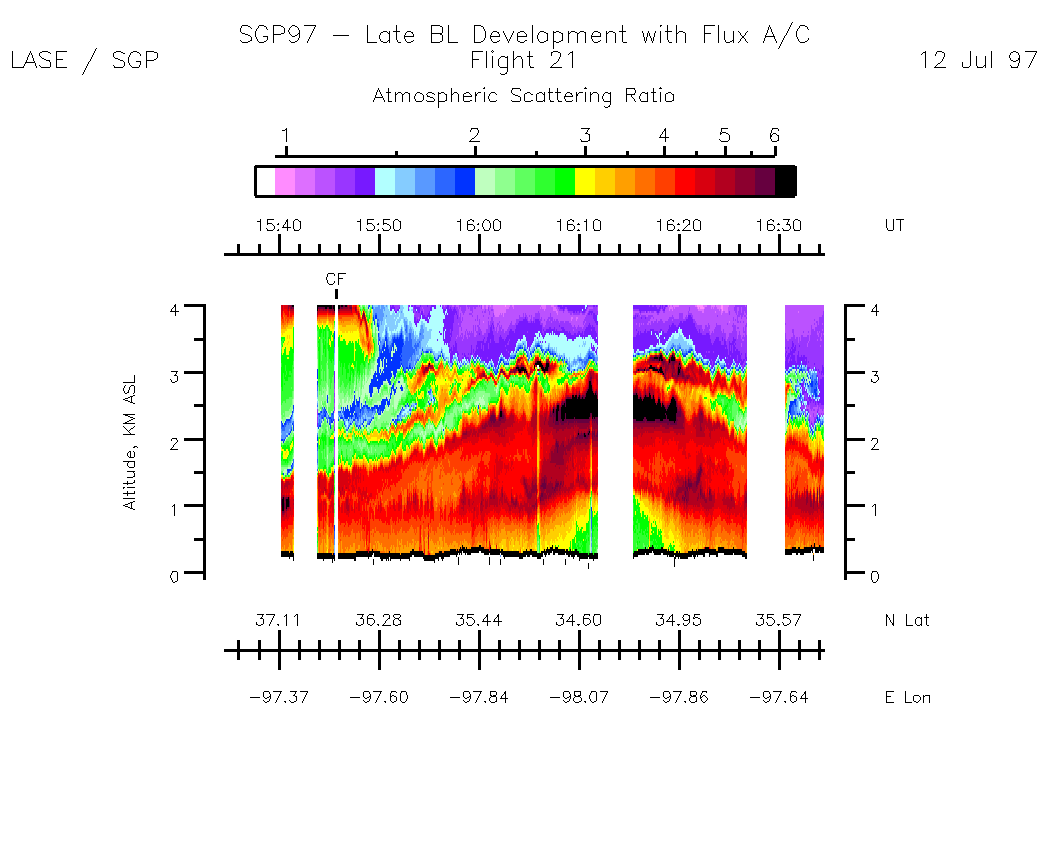
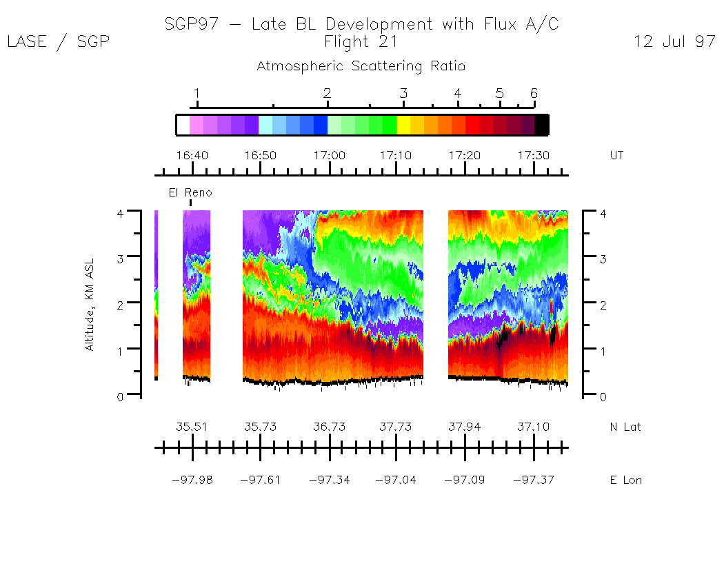
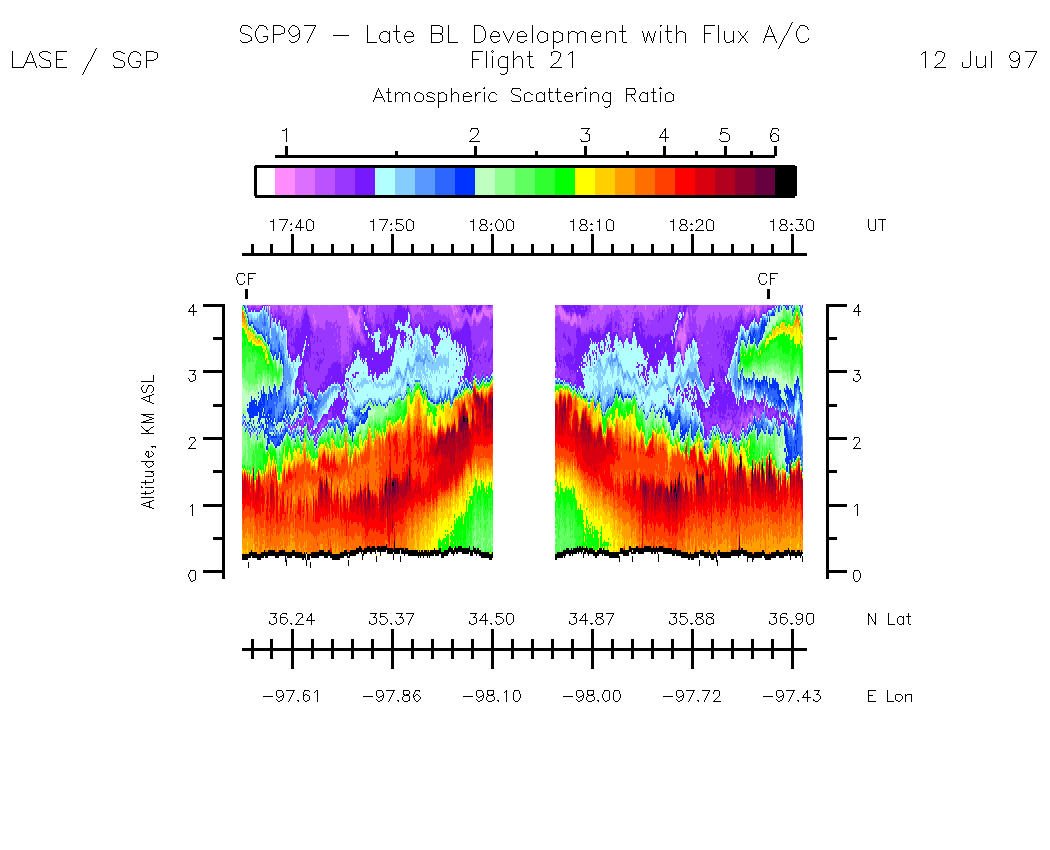
Aerosols -- Atmospheric Scattering Ratio (ASR)
Entire Flight Summary: | ASR Scale: 1 - 6 / Alt Scale: 0 - 8 km |
Entire Flight Summary: | ASR Scale: 1 - 6 / Alt Scale: 0 - 4 km |
Subset Images (ASR Altitude scale 0 - 8 km, ASR Scale 1 - 6, and by UT):| 14:34:37 - 15:34:33 | 15:34:39 - 16:34:35 | 16:34:35 - 17:35:07 | 17:35:07 - 18:31:09 | movie_loop_all |
Subset Images (ASR Altitude scale 0 - 4 km, ASR Scale 1 - 6, and by UT):| 14:34:37 - 15:34:33 | 15:34:39 - 16:34:35 | 16:34:35 - 17:35:07 | 17:35:07 - 18:31:09 | movie_loop_all |
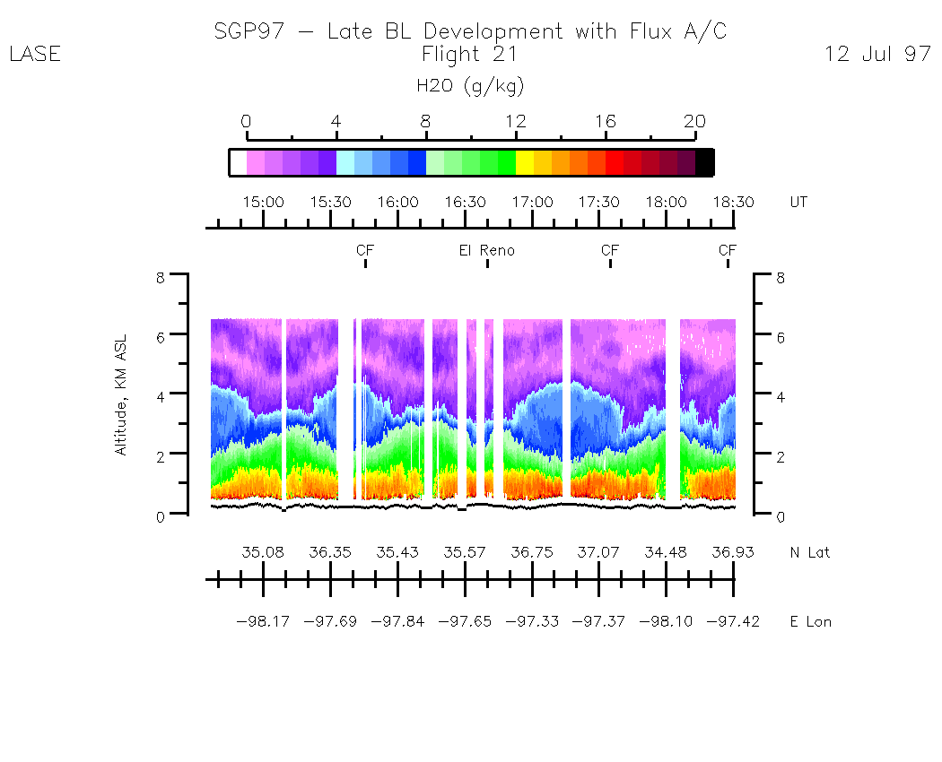
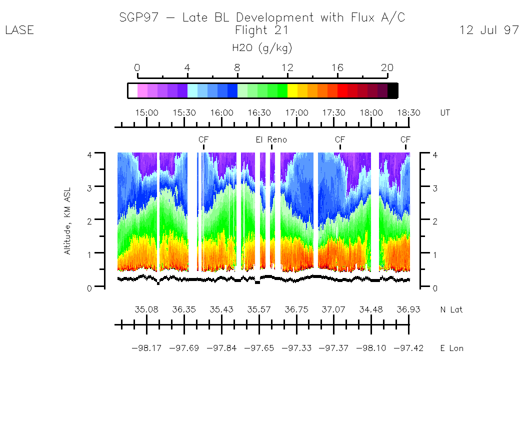
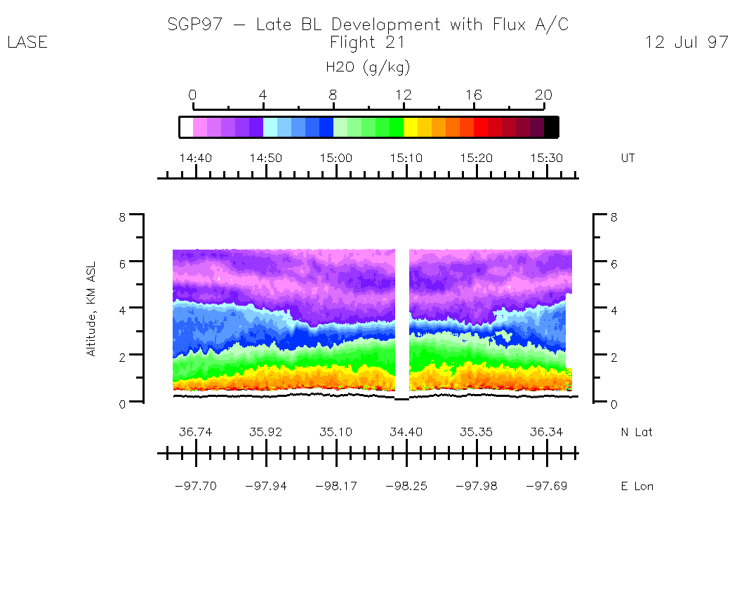
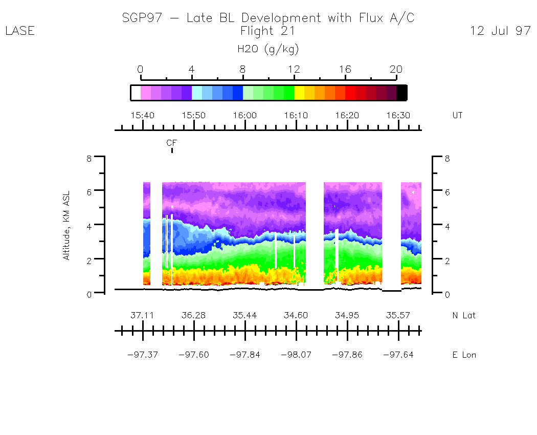
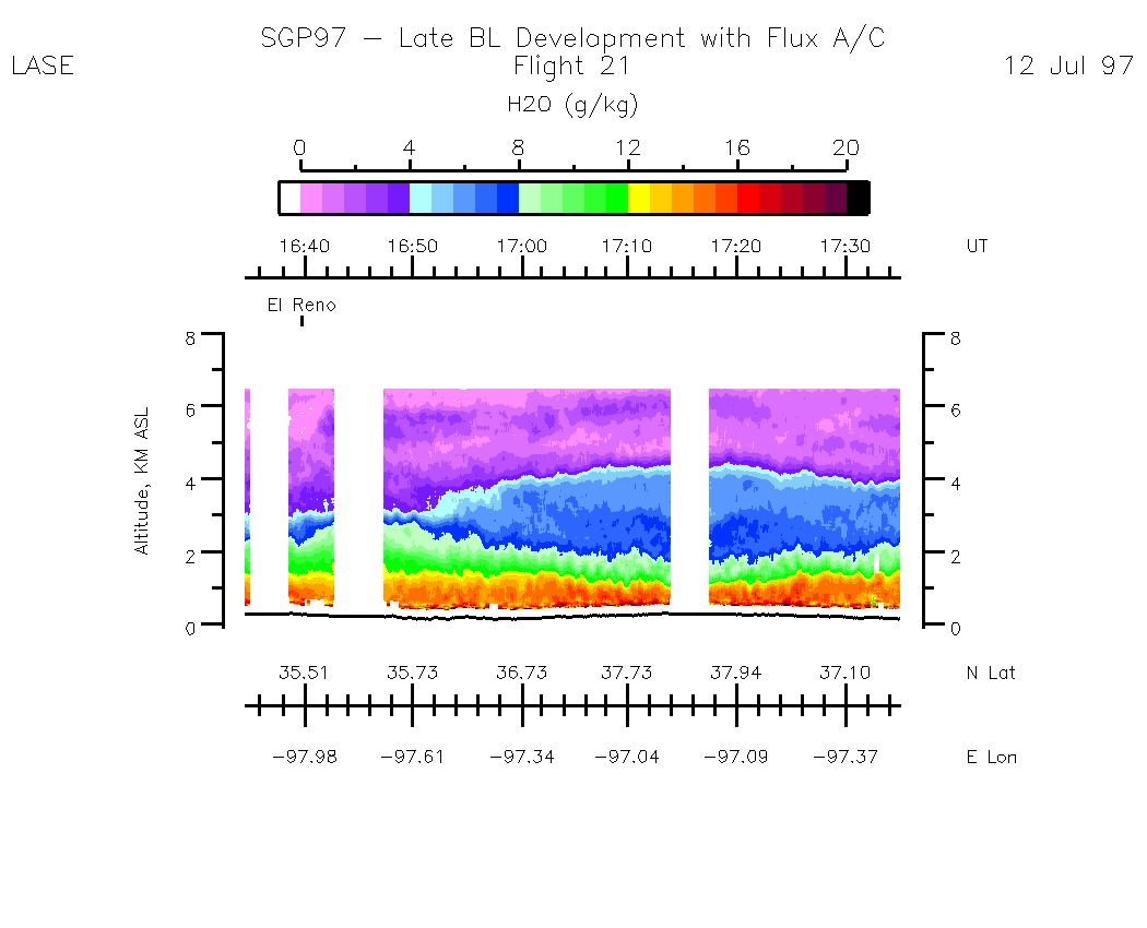
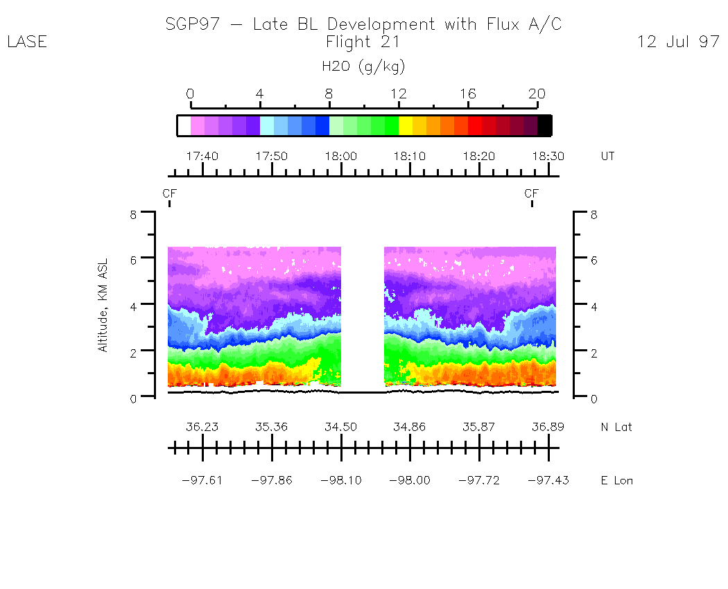
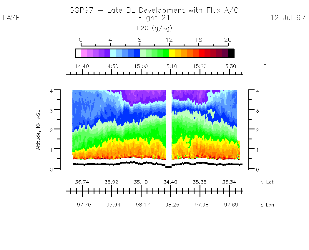
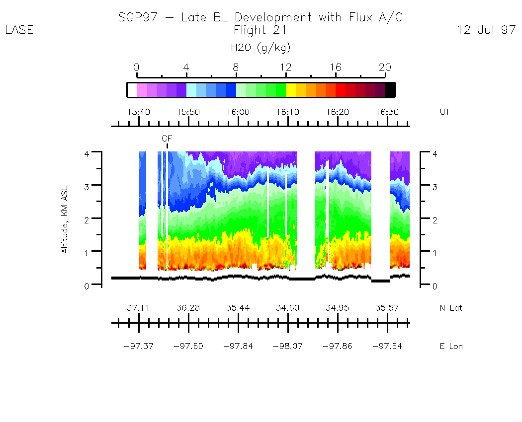
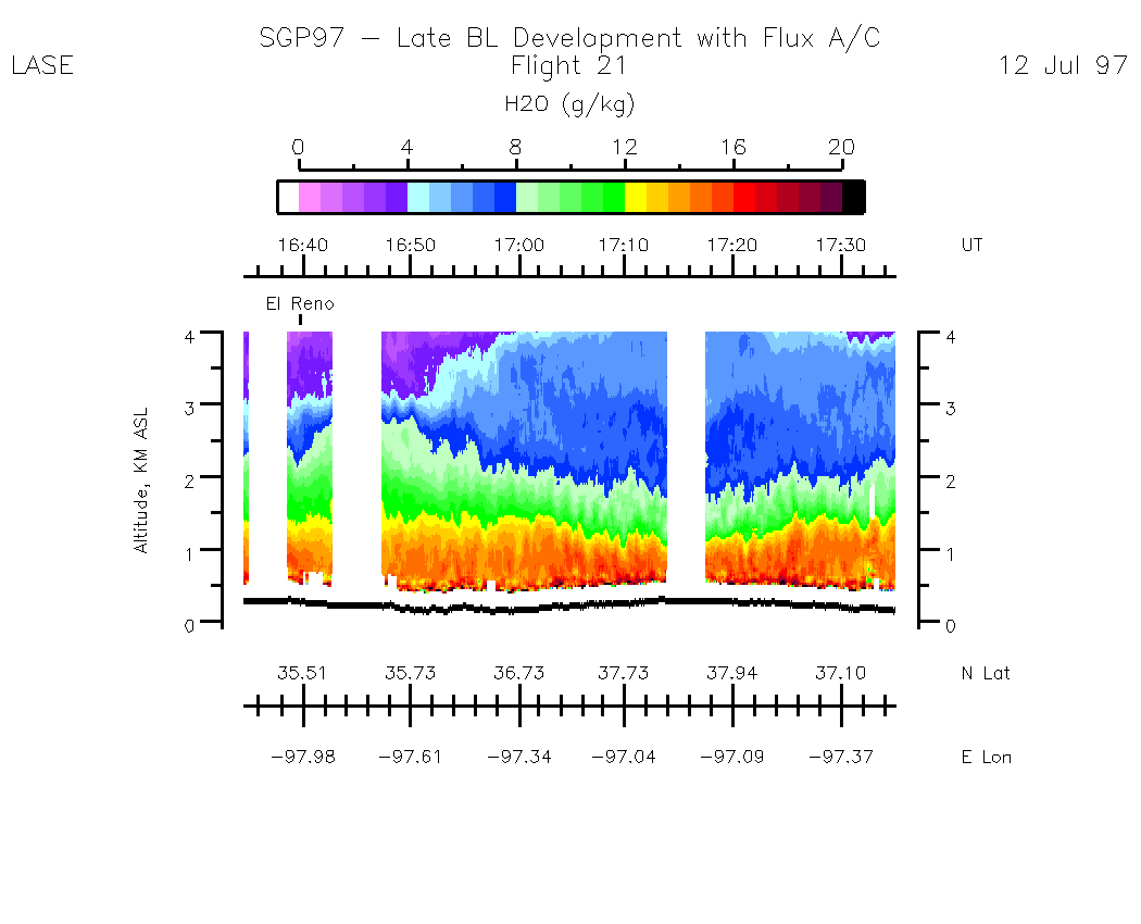
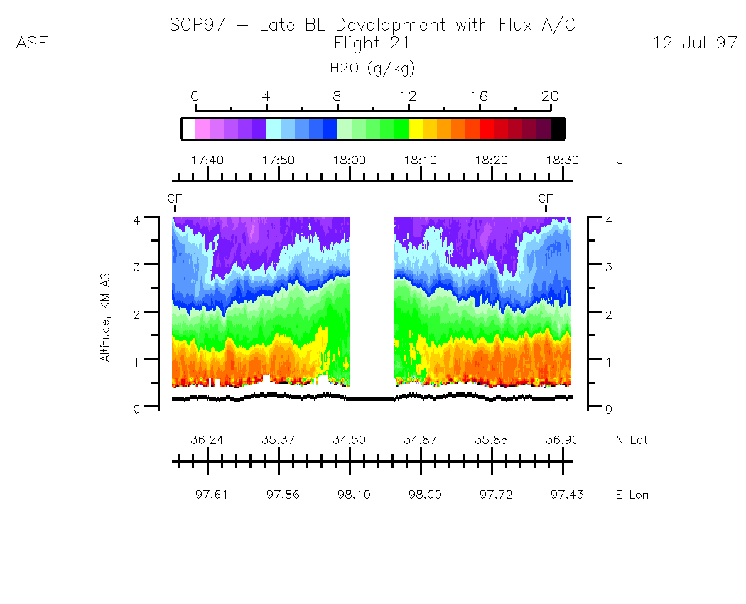
Water Vapor (WV)
Entire Flight Summary: | Water Vapor Alt Scale: 0 - 8 km |
Entire Flight Summary: | Water Vapor Alt Scale: 0 - 4 km |
Subset Water Vapor Images (by UT) and Alt Scale 0 - 8 km :| 14:34:37 - 15:34:33 | 15:34:39 - 16:34:35 | 16:34:35 - 17:35:07 | 17:35:07 - 18:31:09 | movie_loop_all |
Subset Water Vapor Images (by UT) and Alt Scale 0 - 4 km :| 14:34:37 - 15:34:33 | 15:34:39 - 16:34:35 | 16:34:35 - 17:35:07 | 17:35:07 - 18:31:09 | movie_loop_all |
Return to SGP97 Public Home Page
Return to GSFC DAAC SGP97 Data Archive Home Page.
Return to LIDAR Applications Group Home Page