
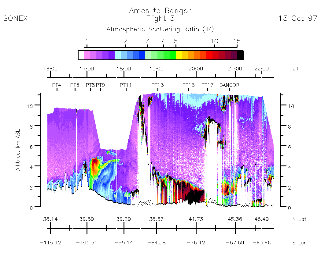
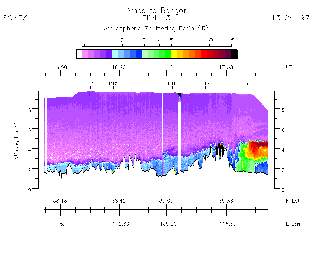
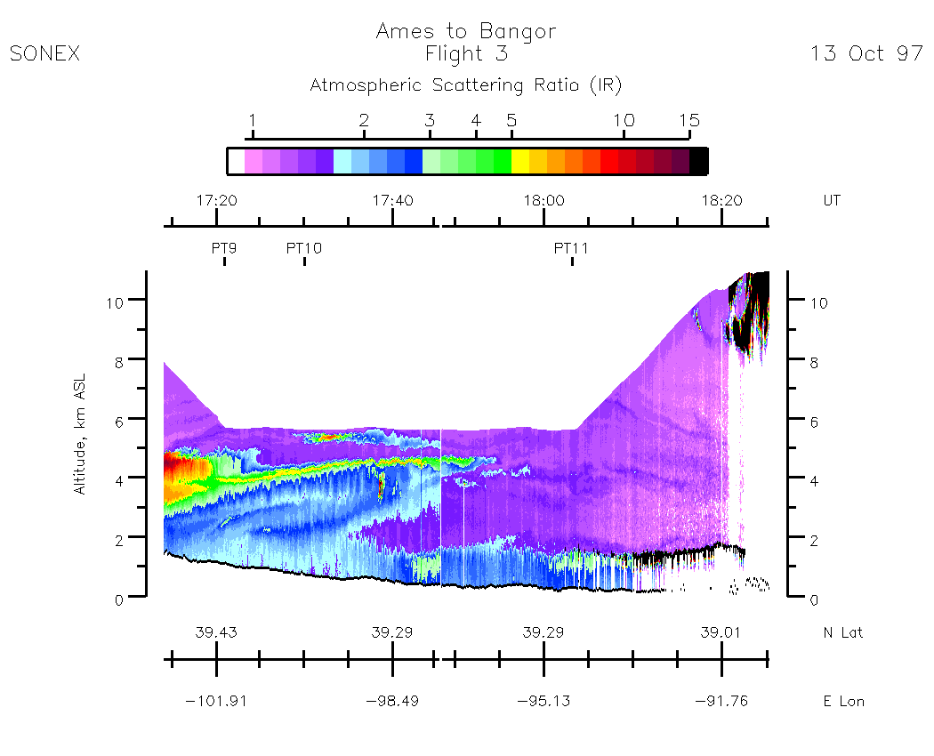
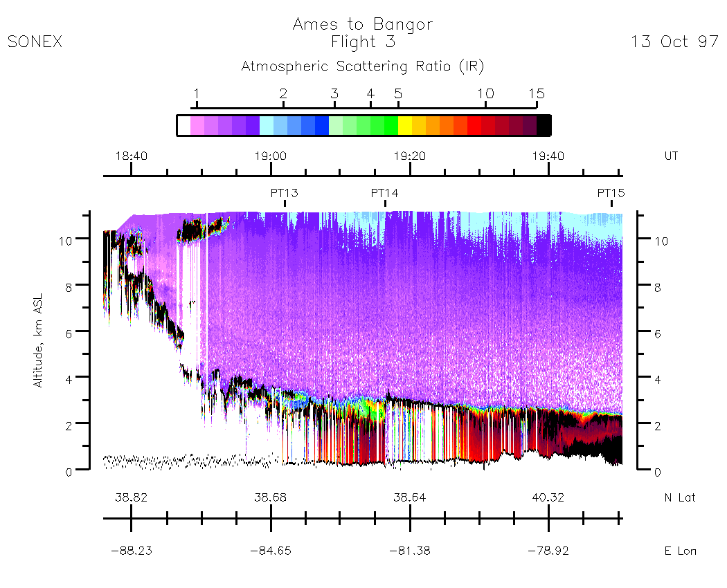
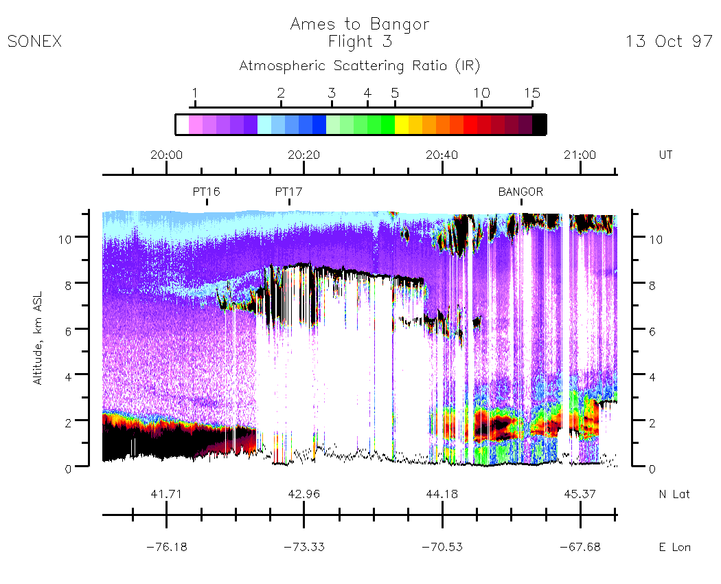
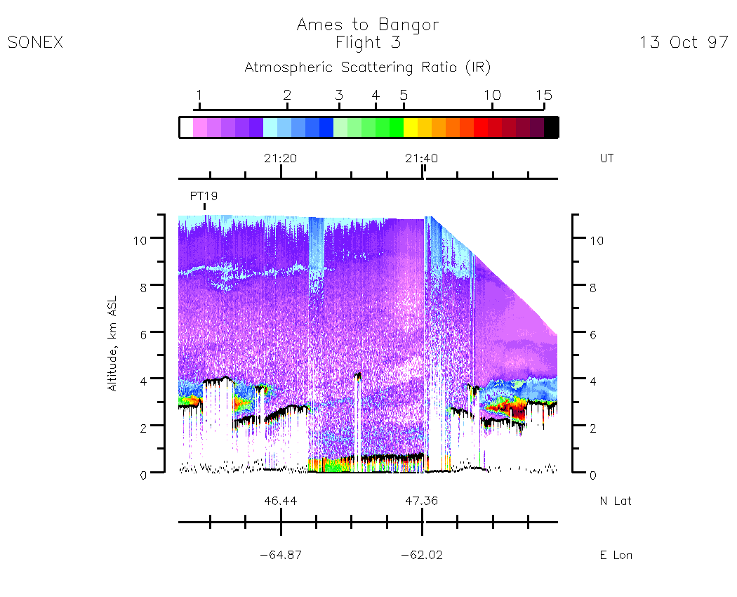
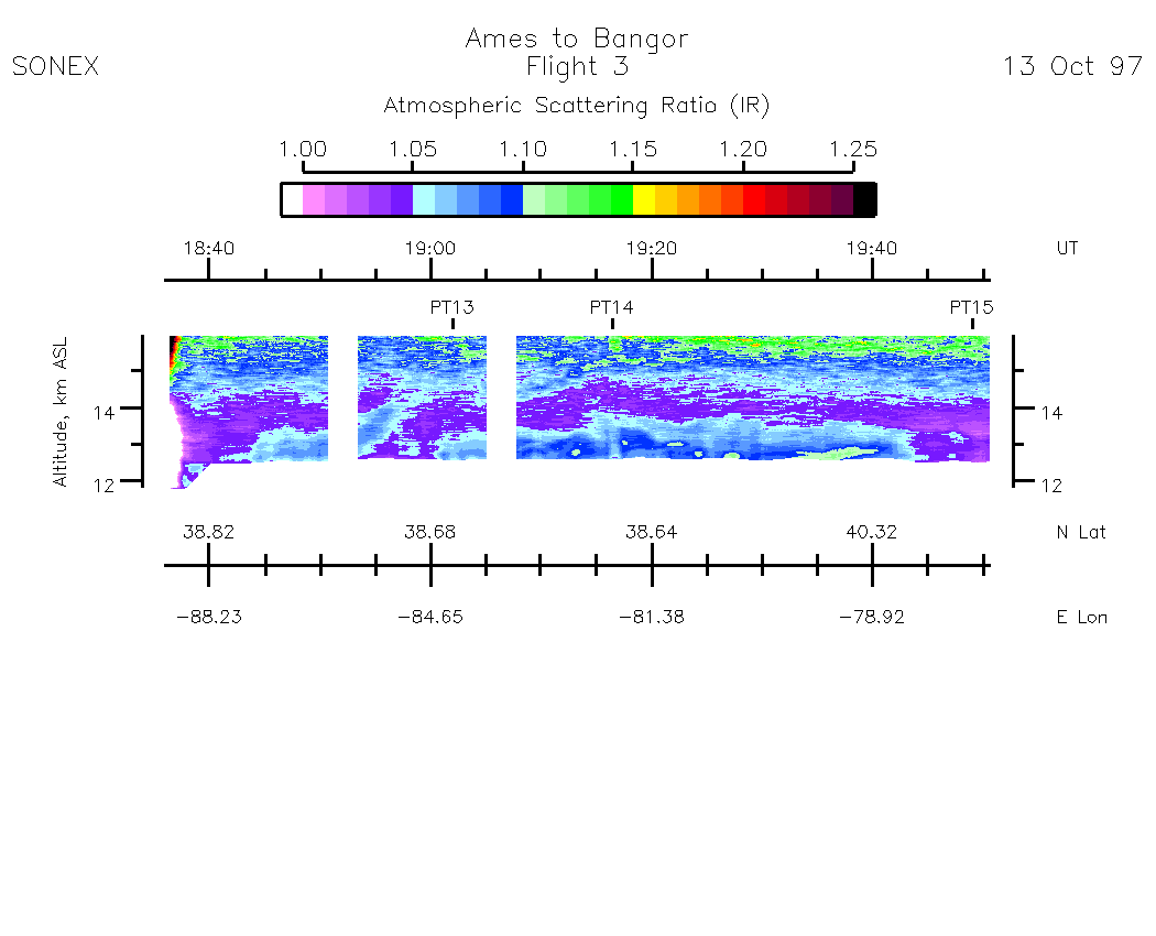
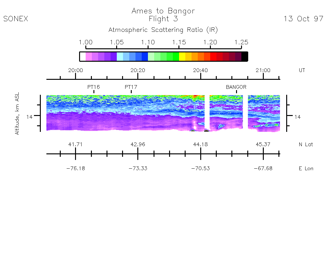
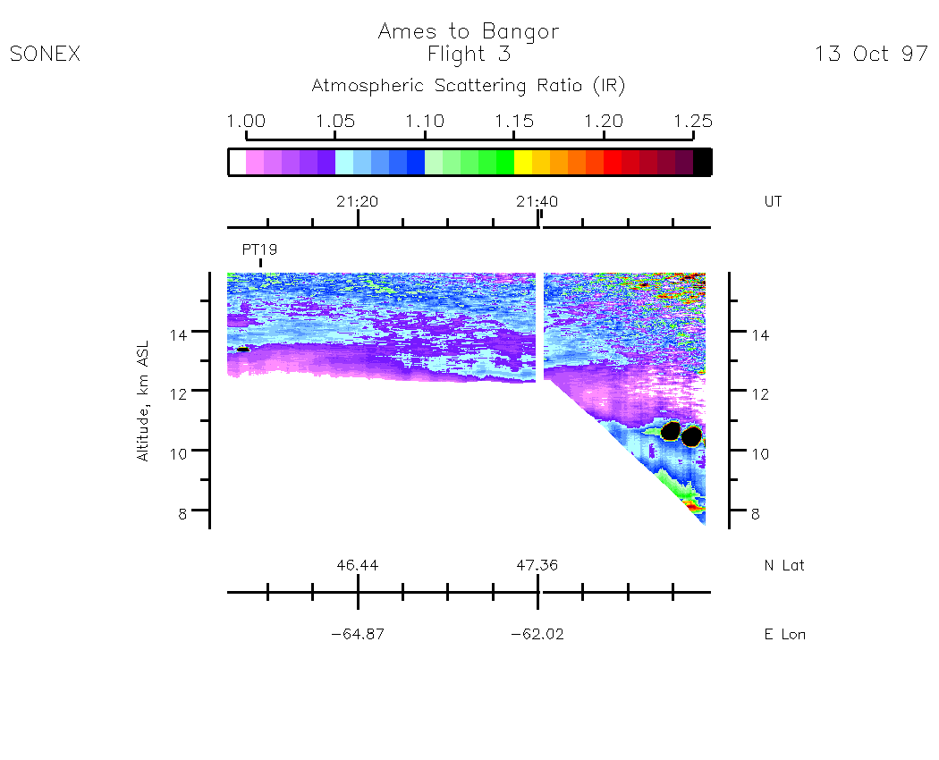
Nadir Aerosol - (Infrared Atmospheric Scattering Ratio)
Subset Images by UT:| 15:55 - 17:14 | 17:14 - 18:25 | 18:36 - 19:50 | 19:50 - 21:05 | 21:05 - 22:20 | movie_loop_all |
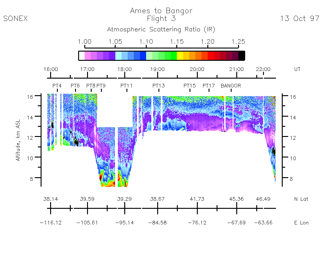
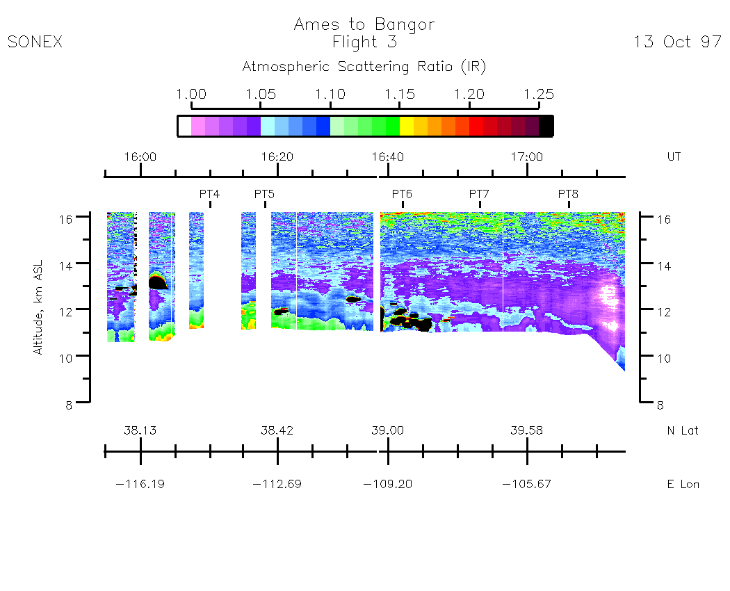
Zenith Aerosol - (Infrared Atmospheric Scattering Ratio)
Subset Images by UT:| 15:55 - 17:14 | 17:14 - 18:25 | 18:36 - 19:50 | 19:50 - 21:05 | 21:05 - 22:20 | movie_loop_all |
Nadir Ozone Mixing Ratio
Subset Images by UT:| 15:56 - 17:14 | 17:14 - 18:25 | 18:36 - 19:50 | 19:50 - 21:05 | 21:05 - 22:20 | movie_loop_all |
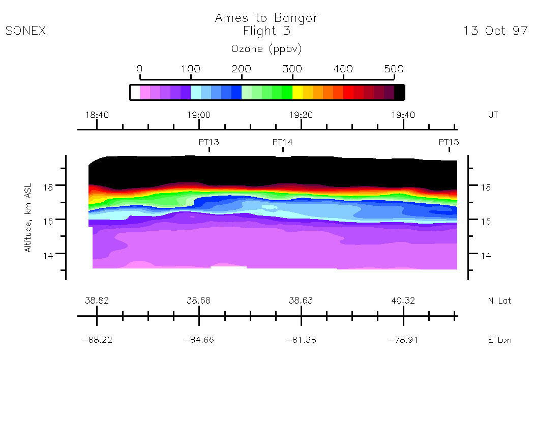
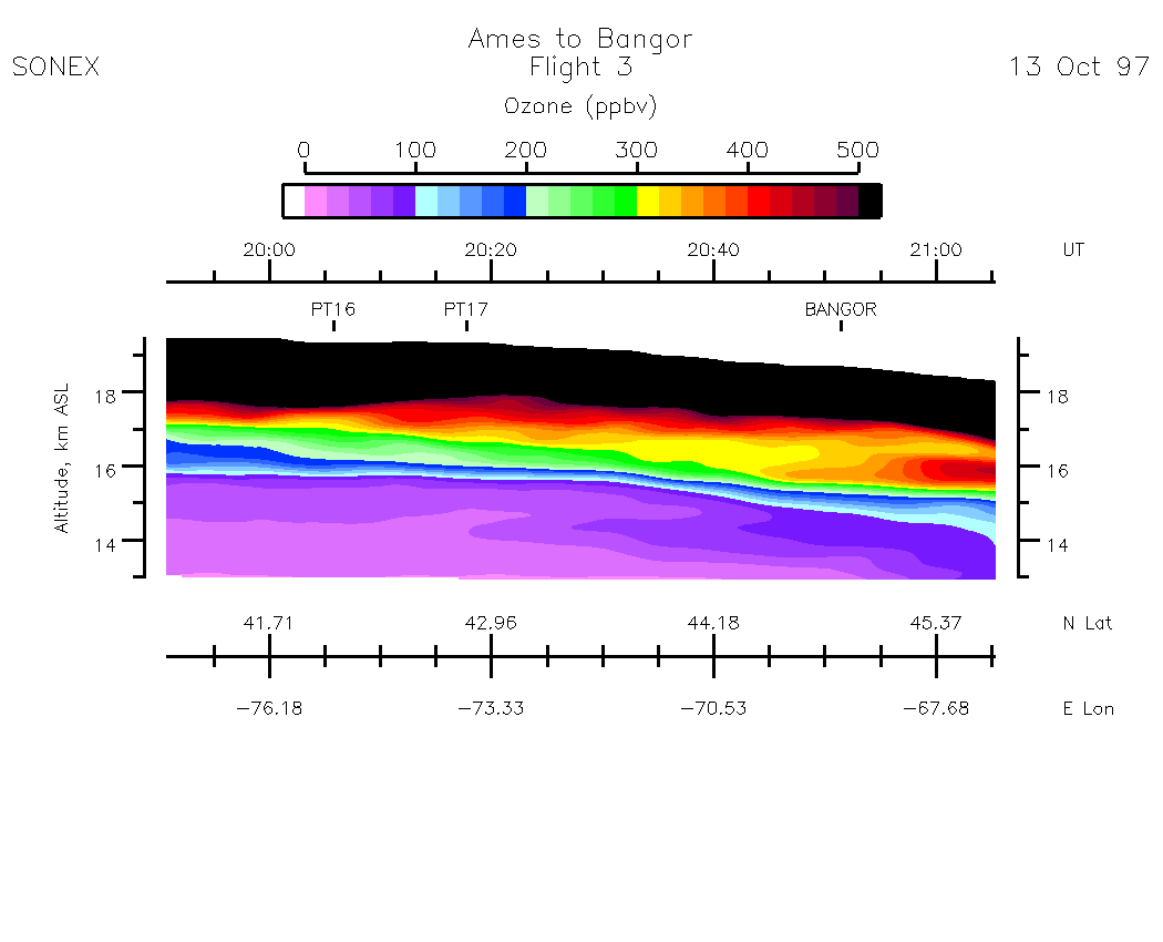
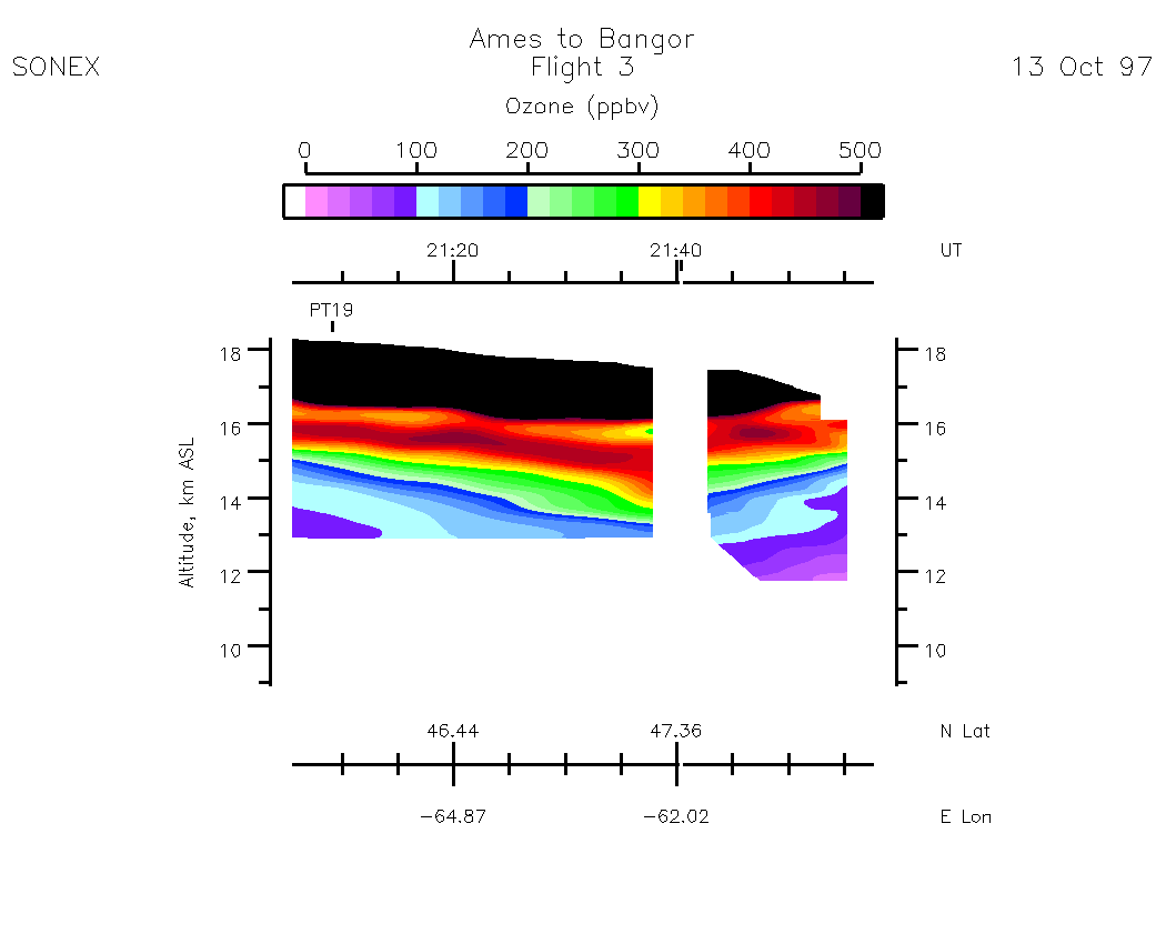
Zenith Ozone Mixing Ratio
Subset Images by UT:|15:56 - 17:14 | 17:14 - 18:25 | 18:36 - 19:50 | 19:50 - 21:05 | 21:05 - 22:20 | movie_loop_all |
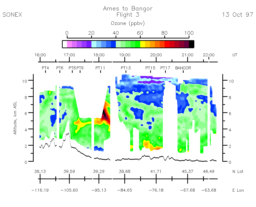
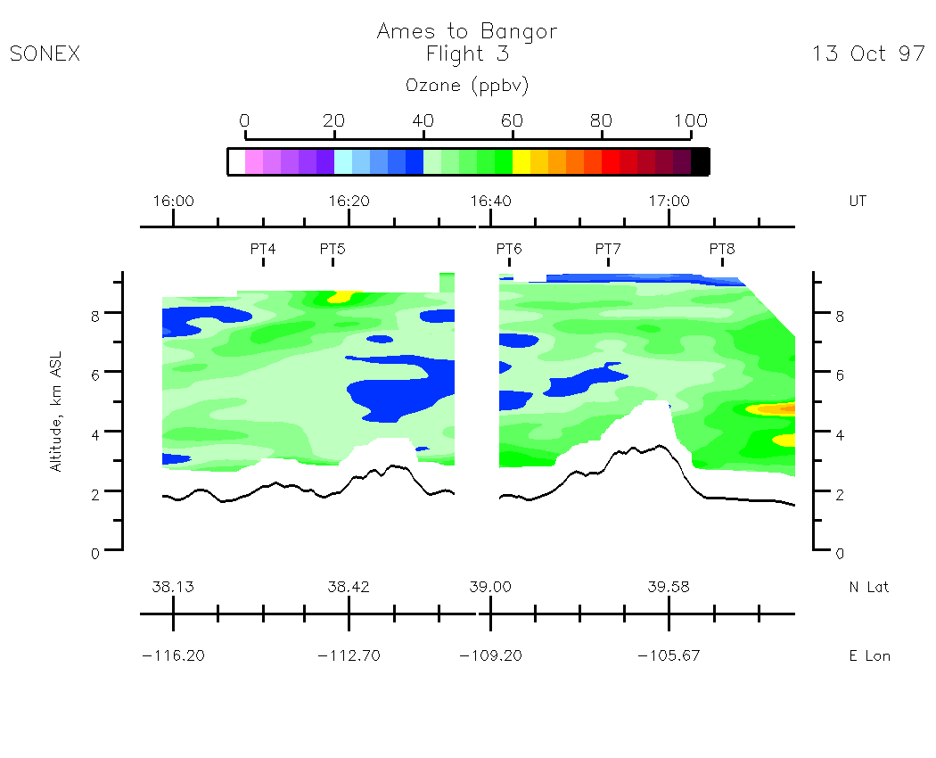
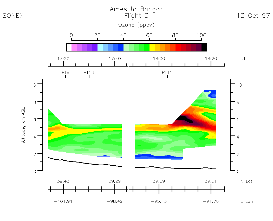
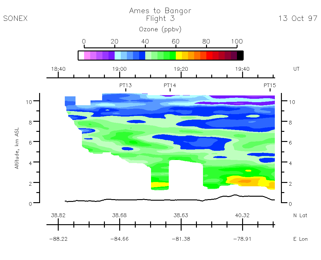
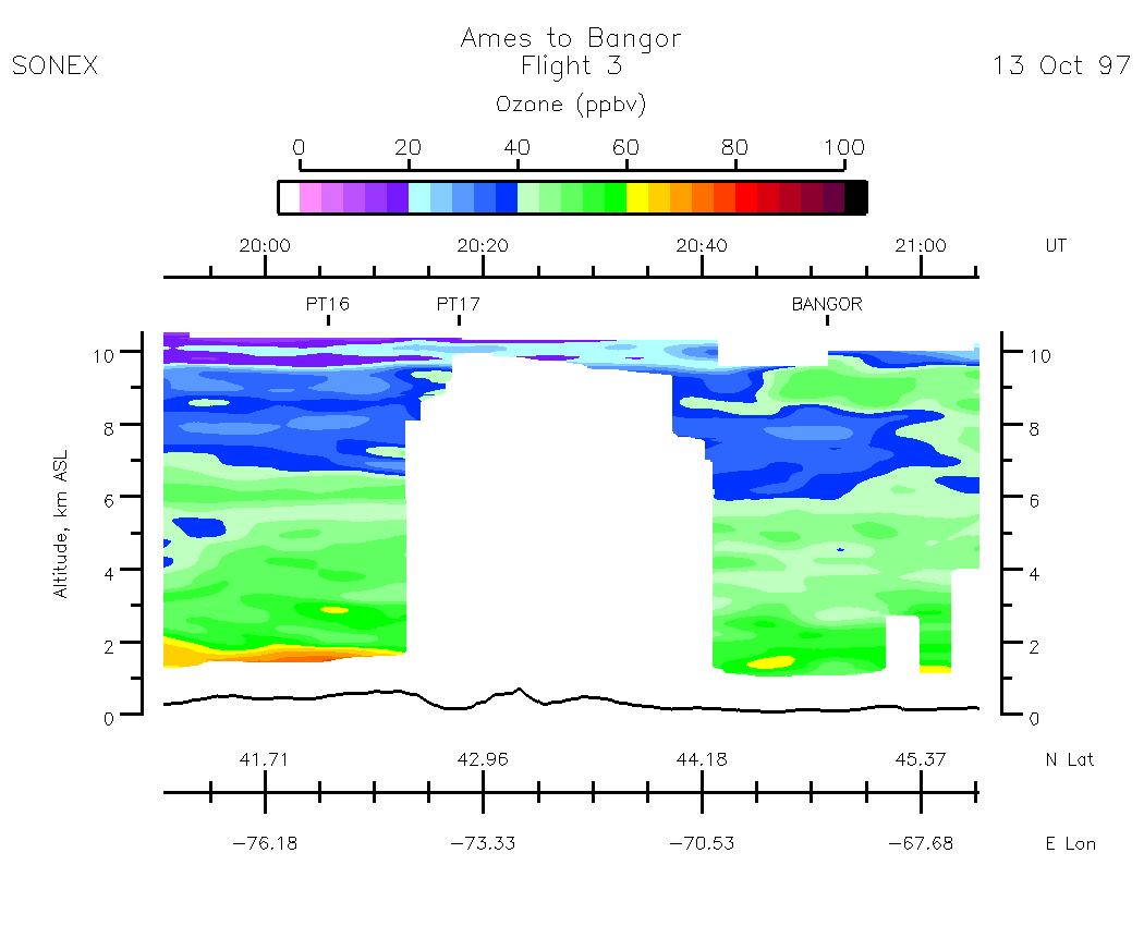
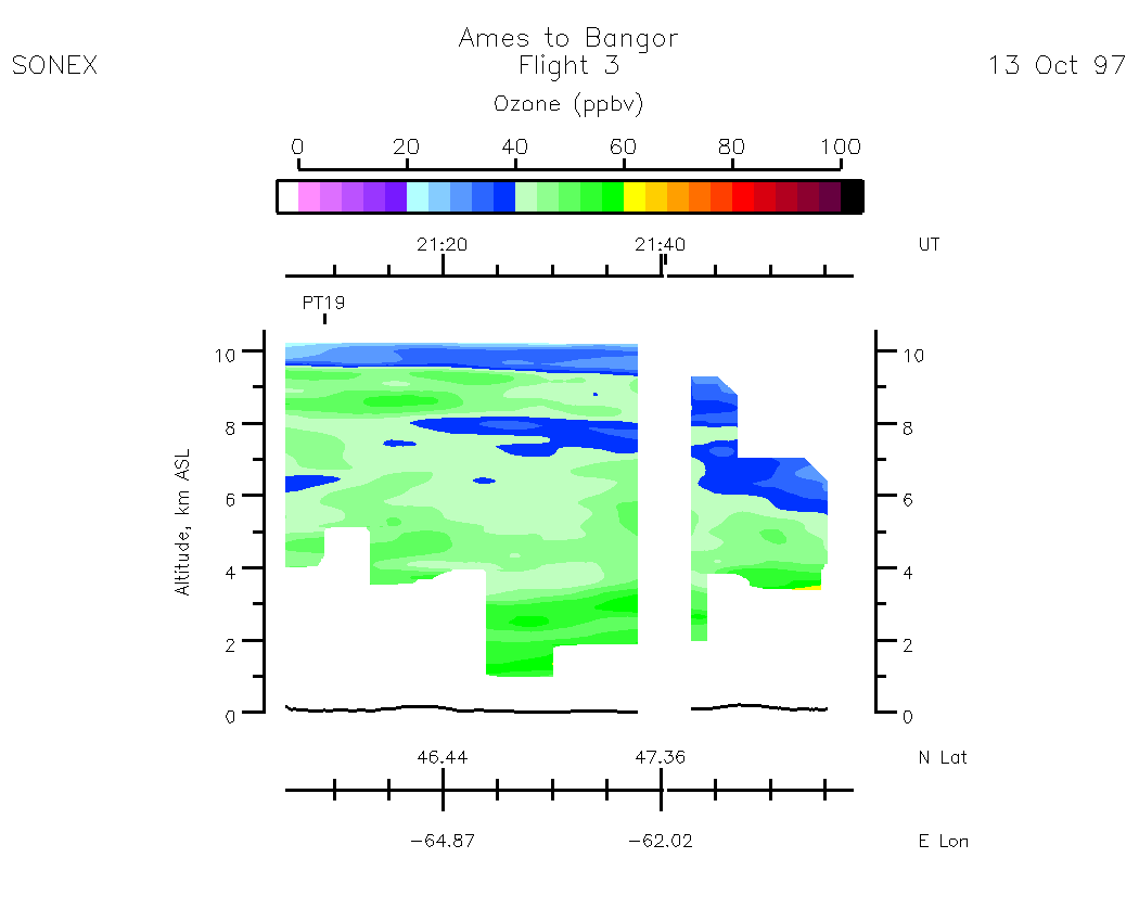
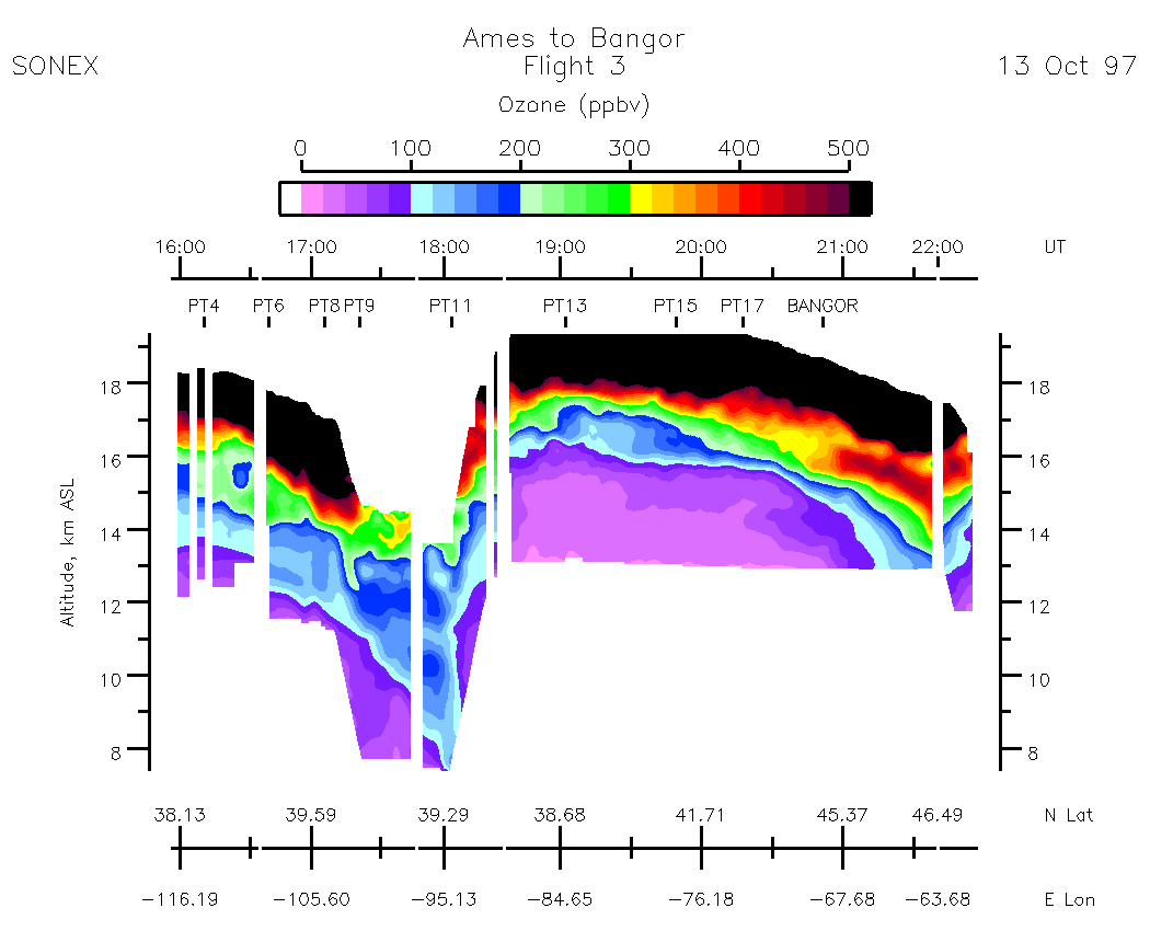
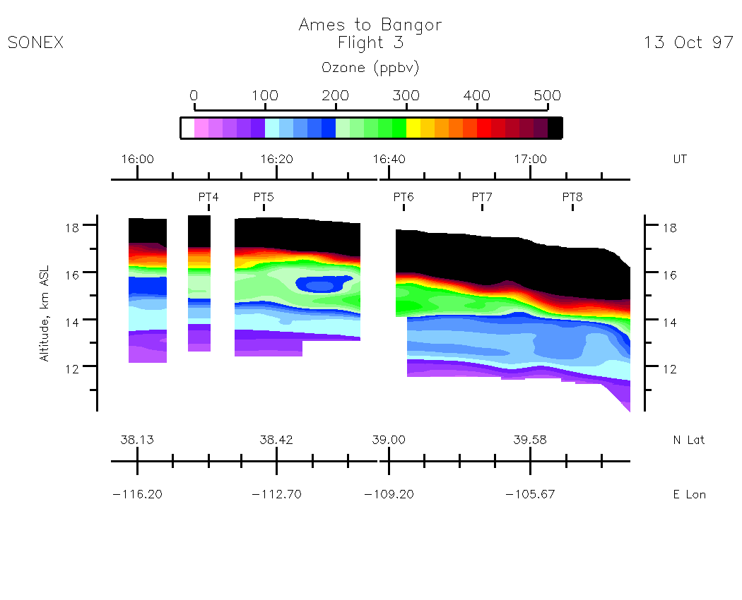
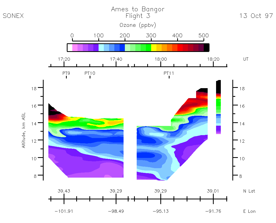
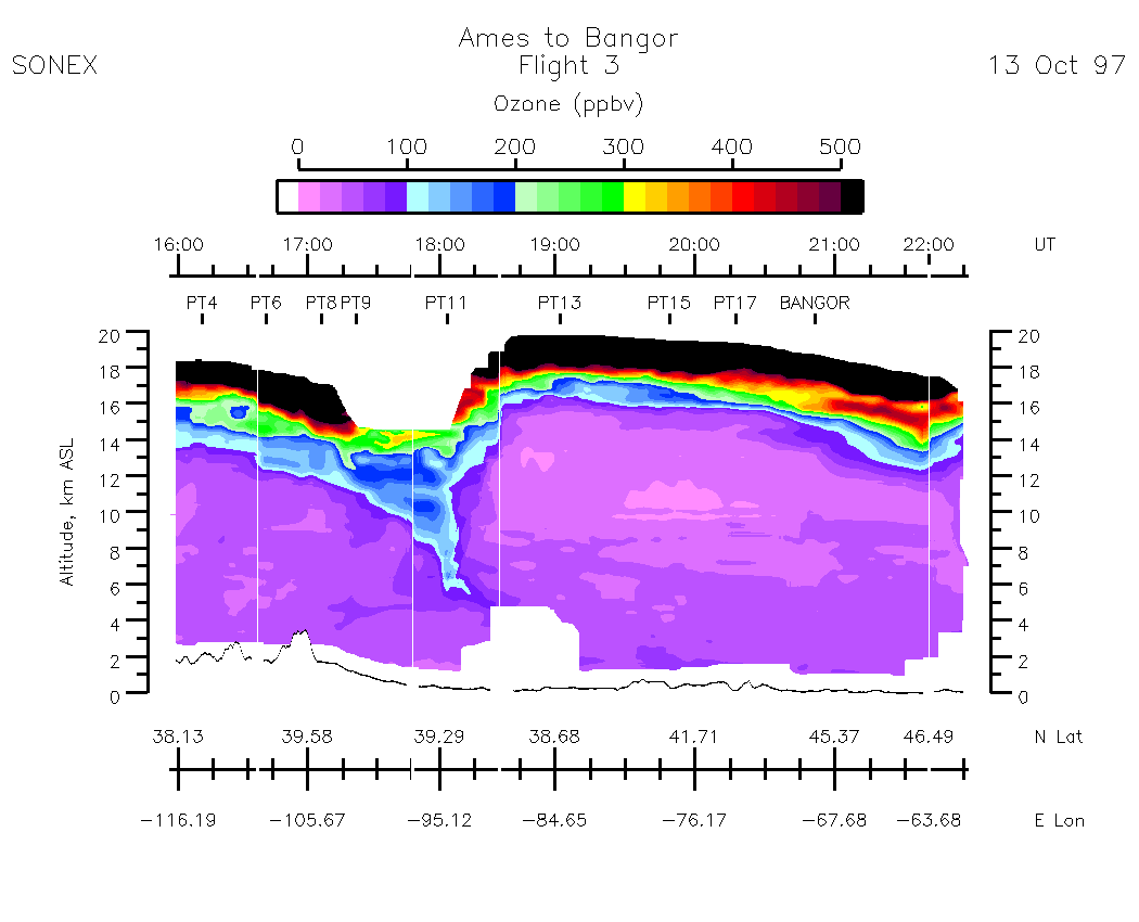
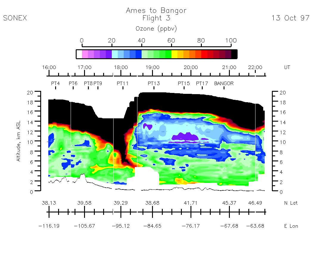
Composite Tropospheric Ozone Cross-Sections
| 0-500 scale | 0 - 100 scale |