
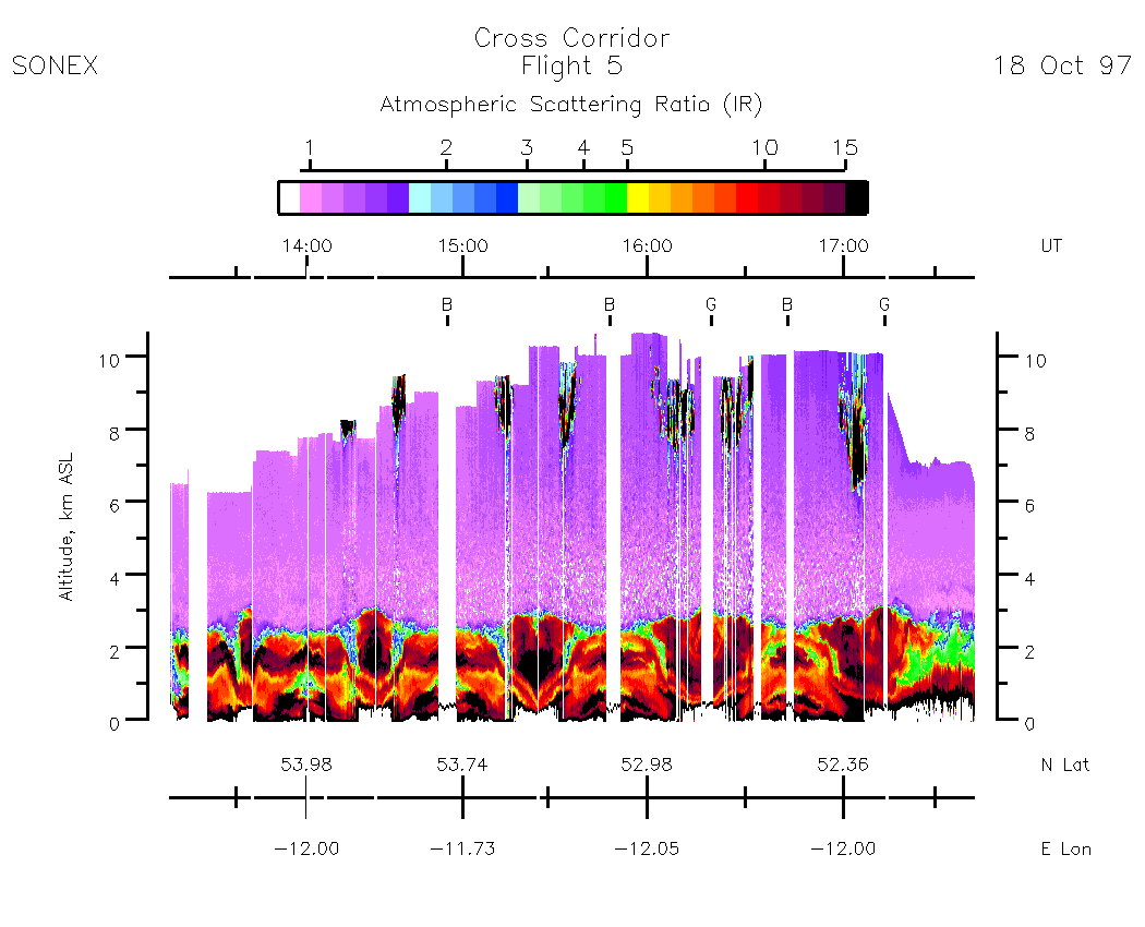
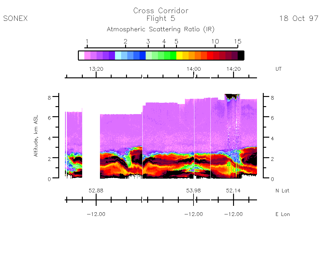
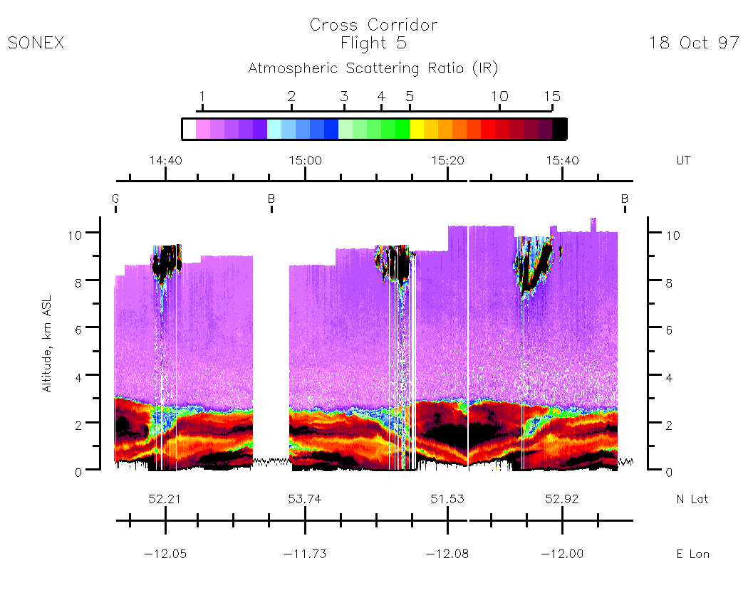
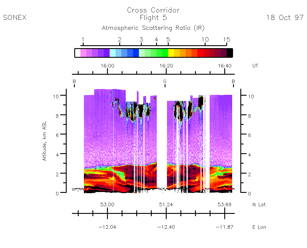
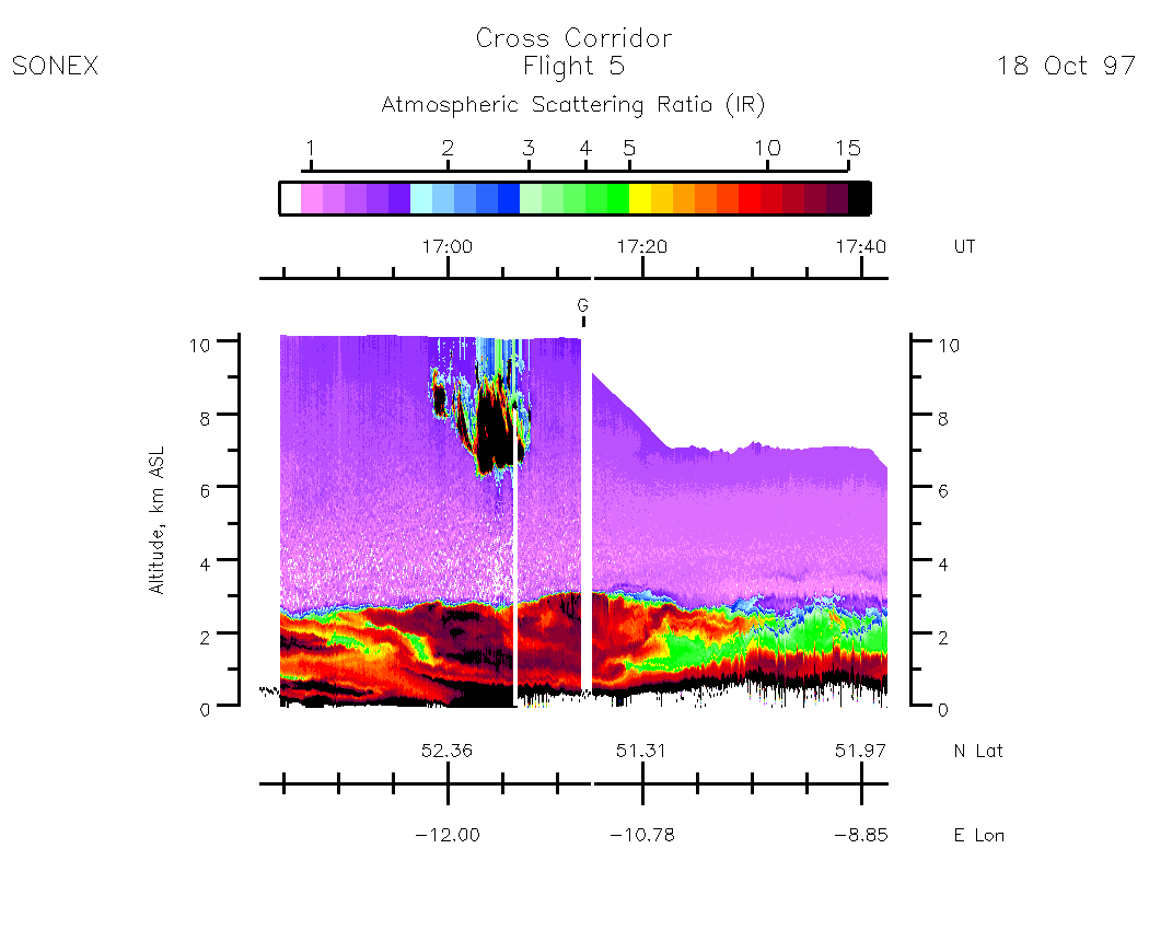
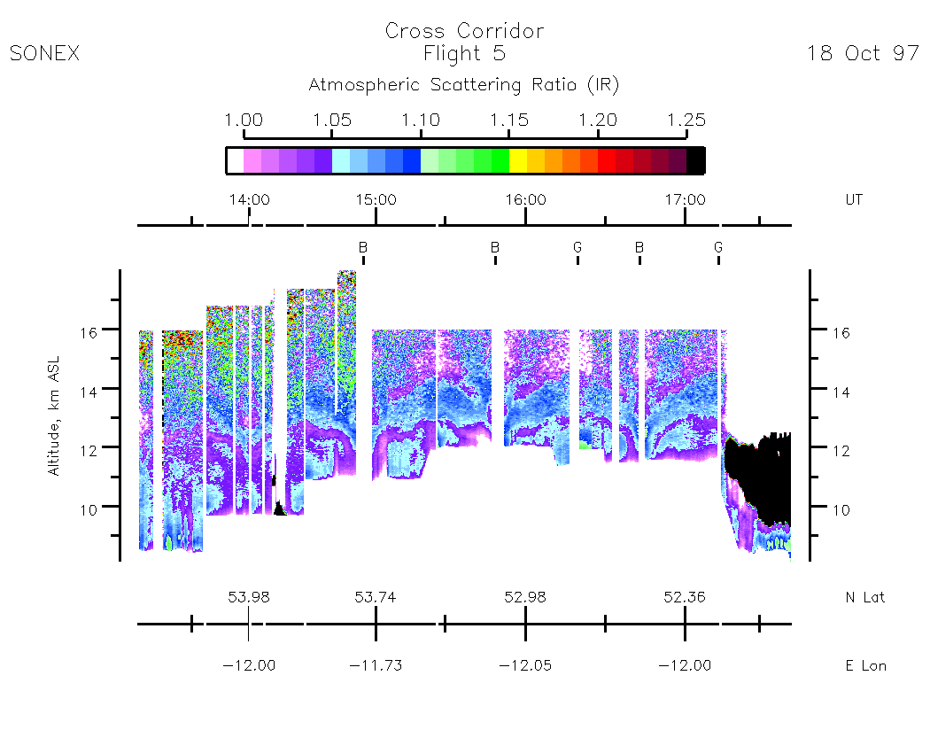
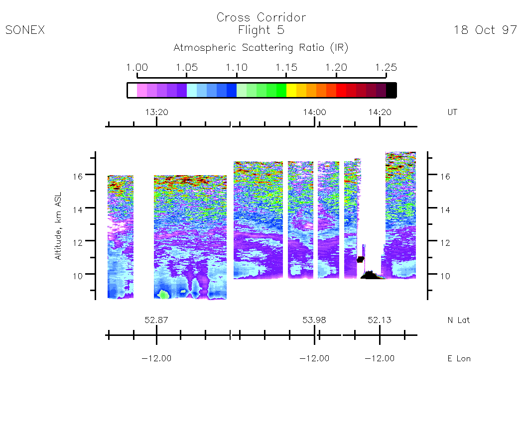
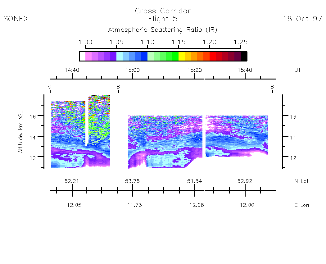
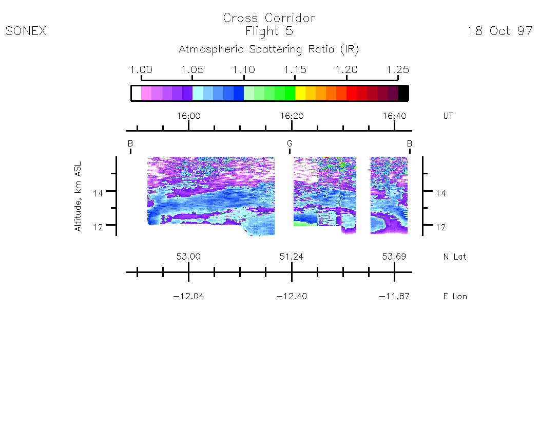
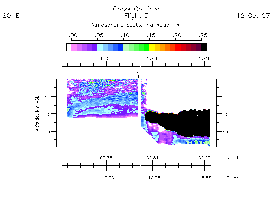
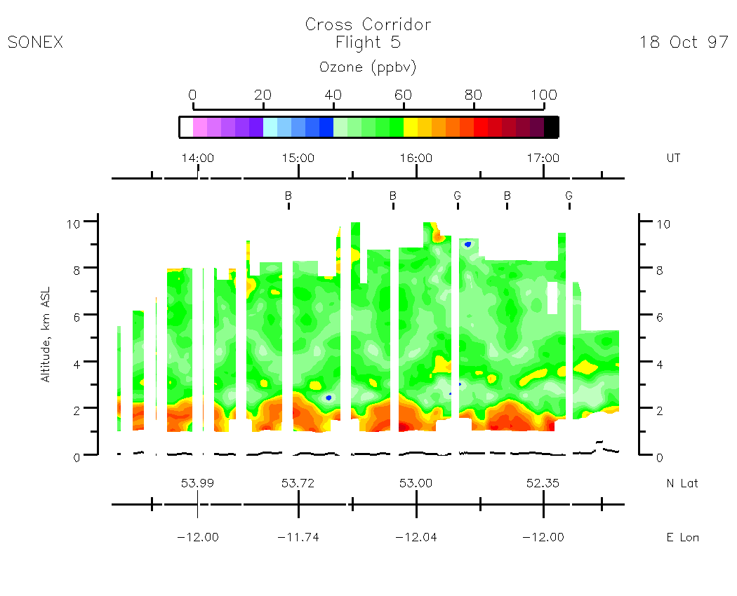
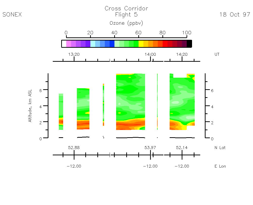
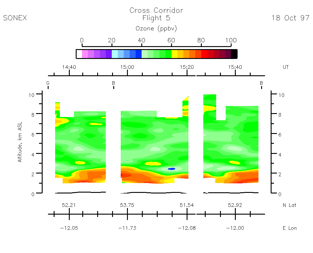
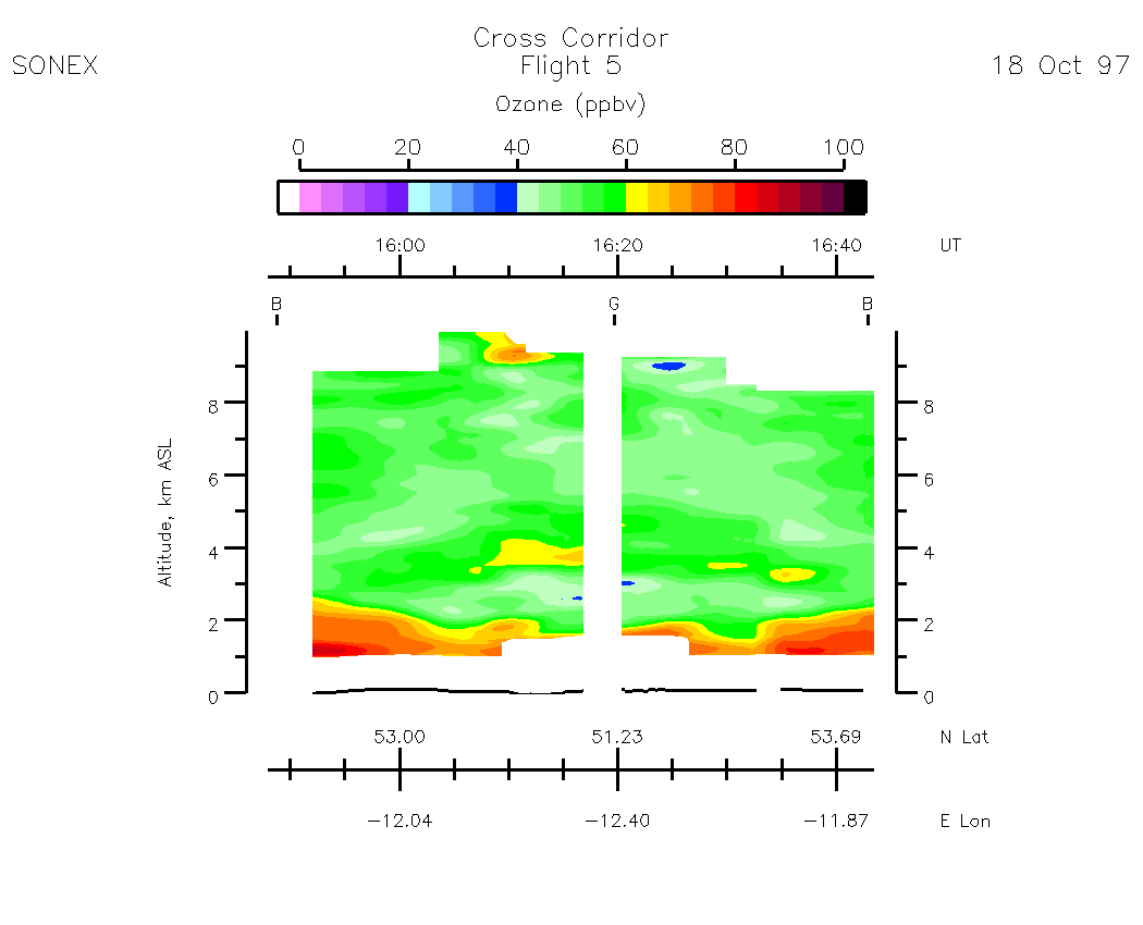
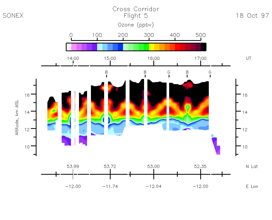
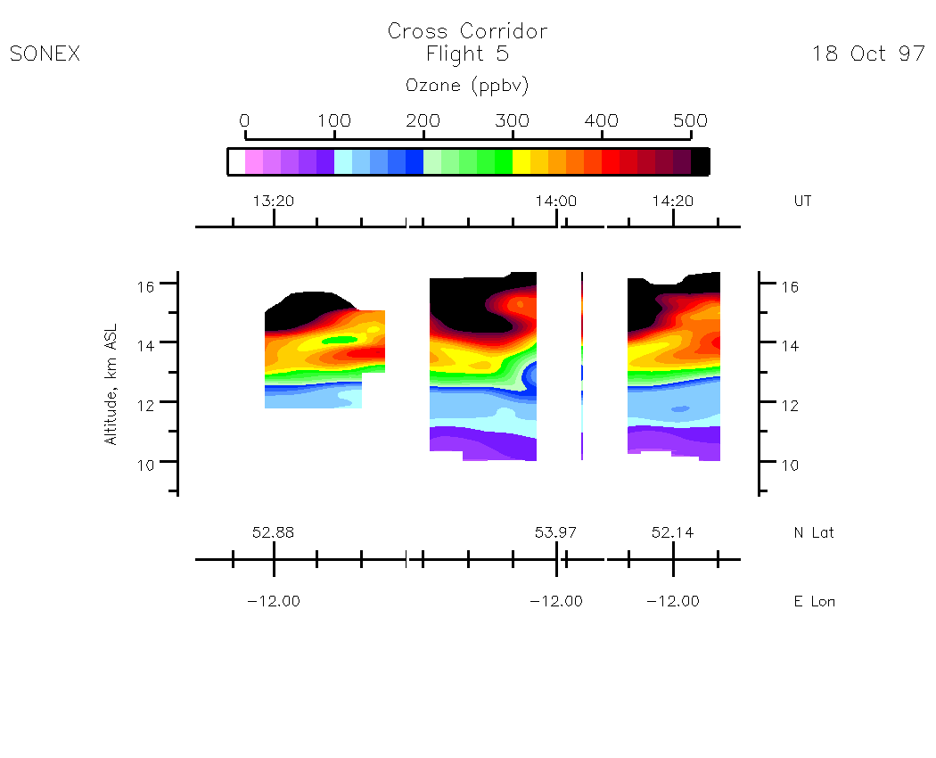
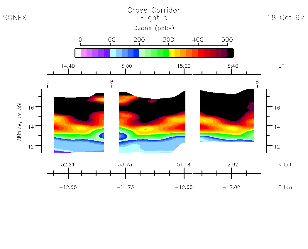
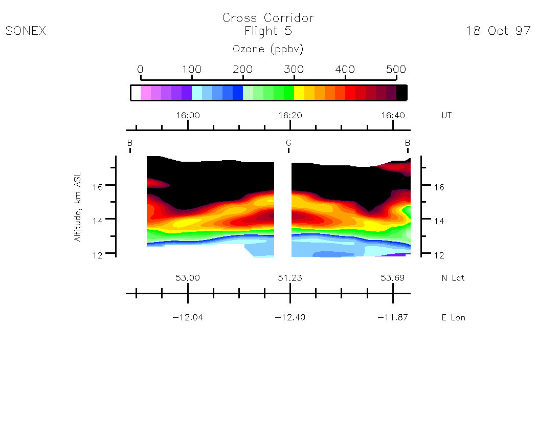
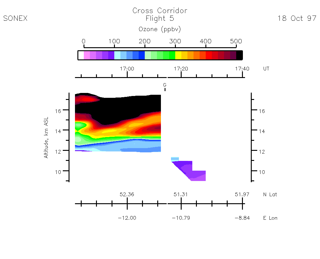
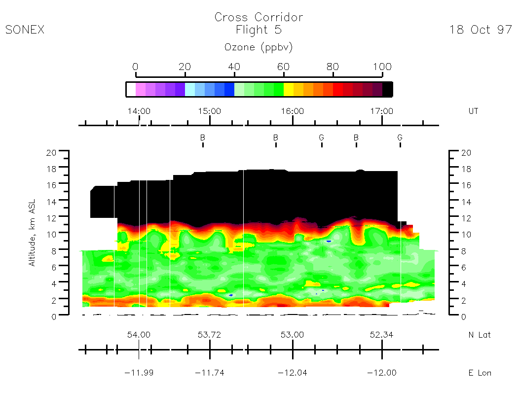
Flight 05 / Cross Corridor / 18 Oct. 1997
Nadir Aerosol - (Infrared Atmospheric Scattering Ratio)
Subset Images by UT:| 13:09 - 14:27 | 14 :33 - 15:50 | 15:48 -16:43 | 16:43 -17:43 | movie_loop_all |
Zenith Aerosol - (Infrared Atmospheric Scattering Ratio)
Subset Images by UT:| 13:09 - 14:27 | 14 :33 - 15:50 | 15:48 -16:43 | 16:43 -17:43 | movie_loop_all |
Nadir Ozone Mixing Ratio
Subset Images by UT:| 13:11 - 14:27 | 14 :33 - 15:50 | 15:48 -16:43 | 16:43 -17:41 | movie_loop_all |
Zenith Ozone Mixing Ratio
Subset Images by UT:| 13:11 - 14:27 | 14 :33 - 15:50 | 15:48 -16:43 | 16:43 -17:41 | movie_loop_all |
Composite Tropospheric Ozone Cross-Sections
| 0-500 scale | 0 - 100 scale |