
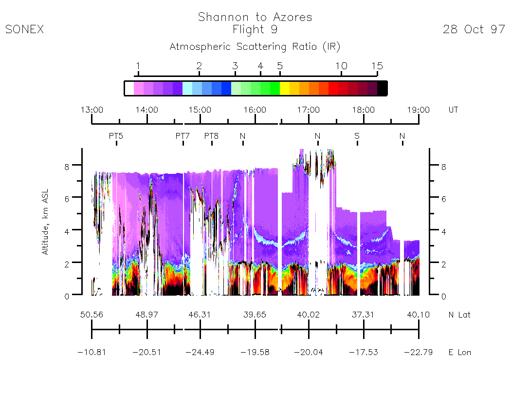
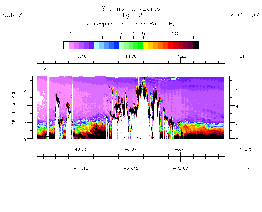
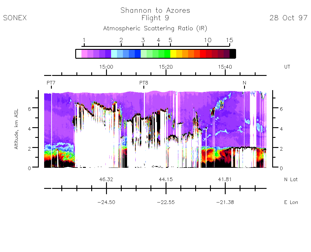
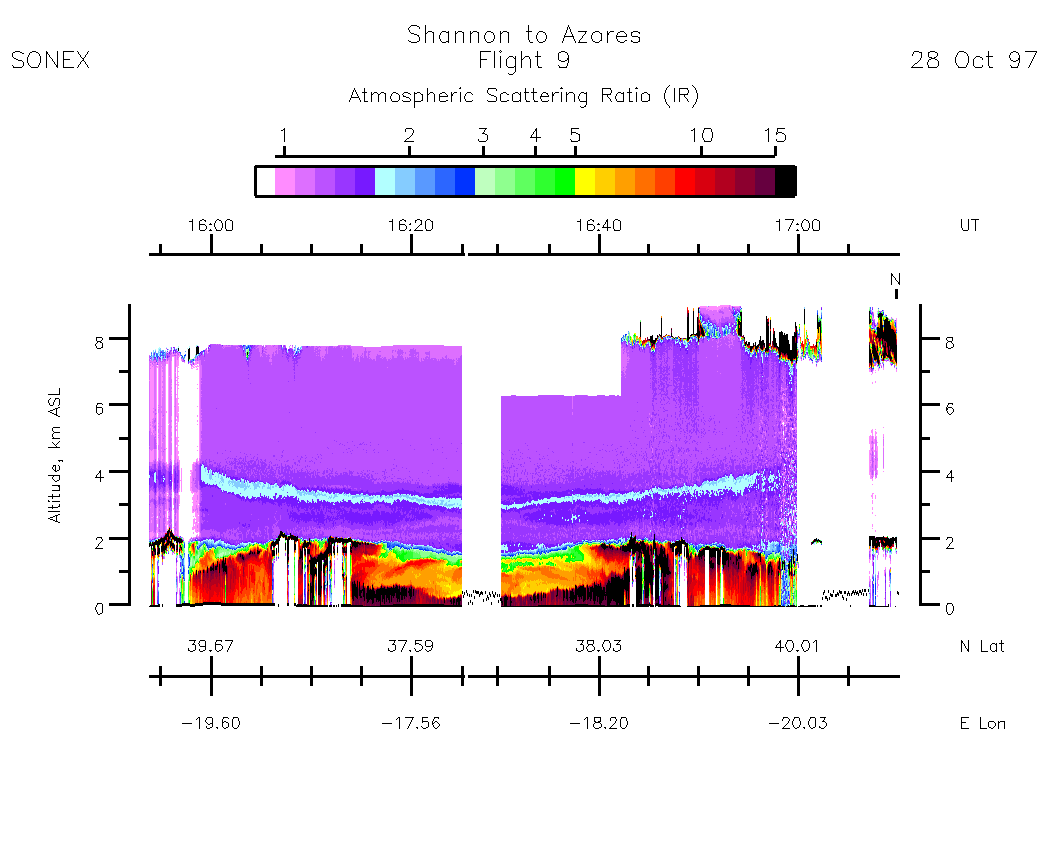
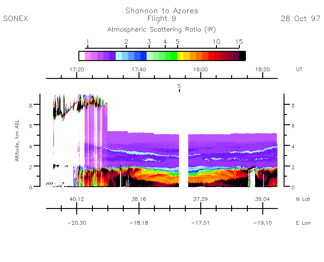
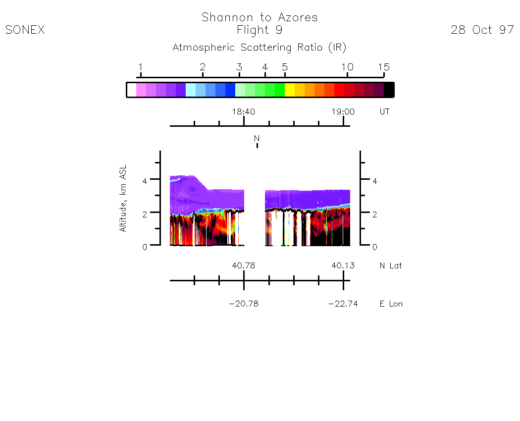
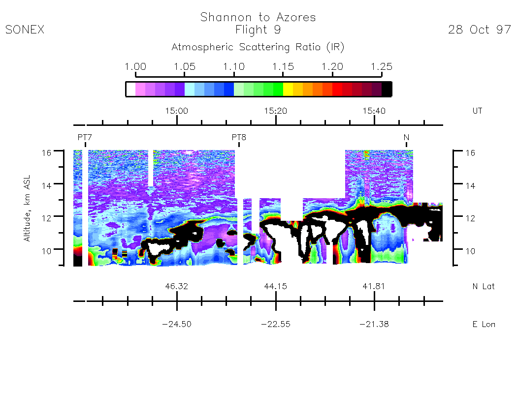
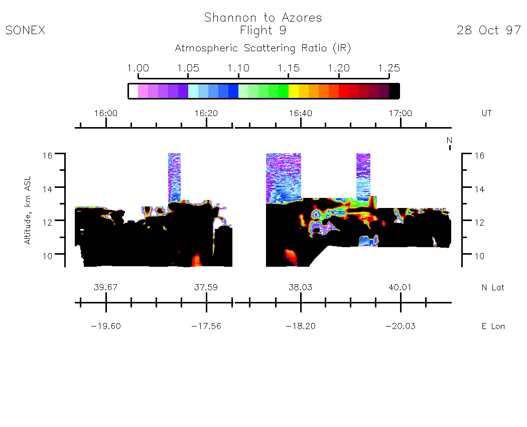
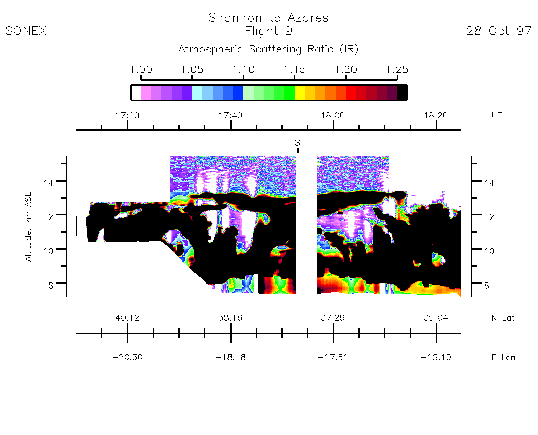
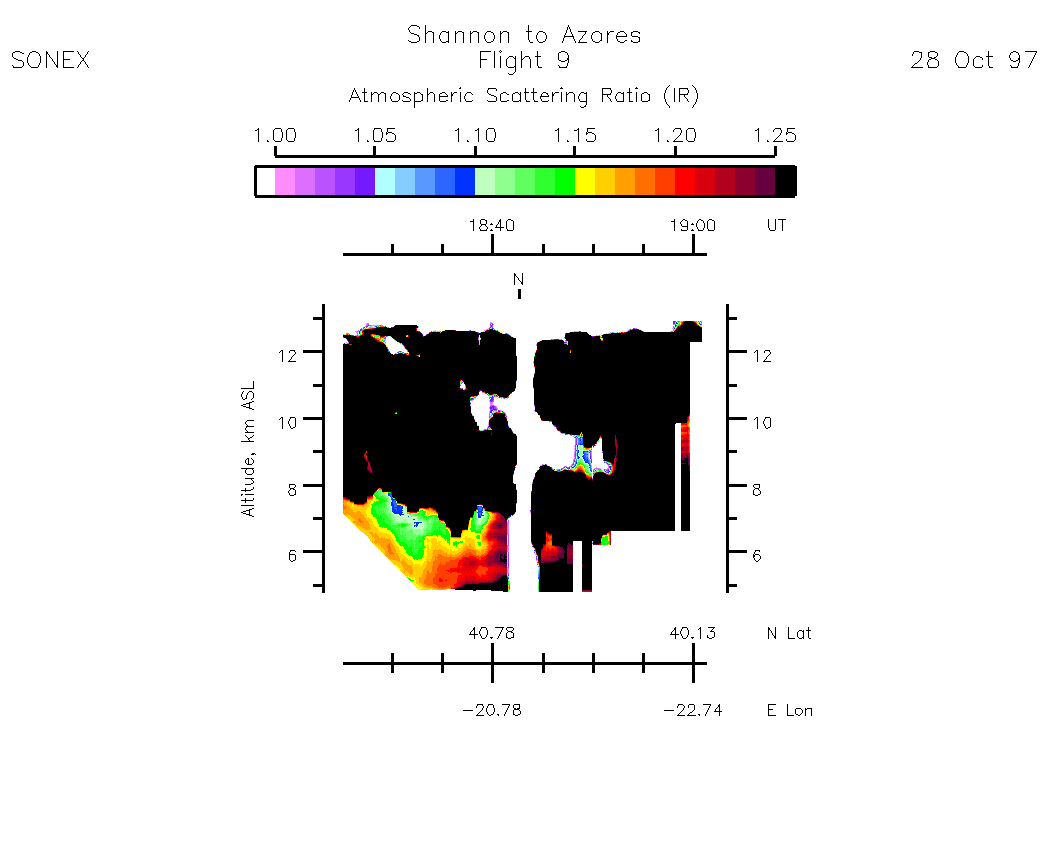
Nadir Aerosol - (Infrared Atmospheric Scattering Ratio)
Subset Images by UT:| 13:23 - 14:38 | 14:38 - 15:54 | 15:54 - 17:10 | 17:10 - 18:25 | 18:25 - 19:01 | movie_loop_all |
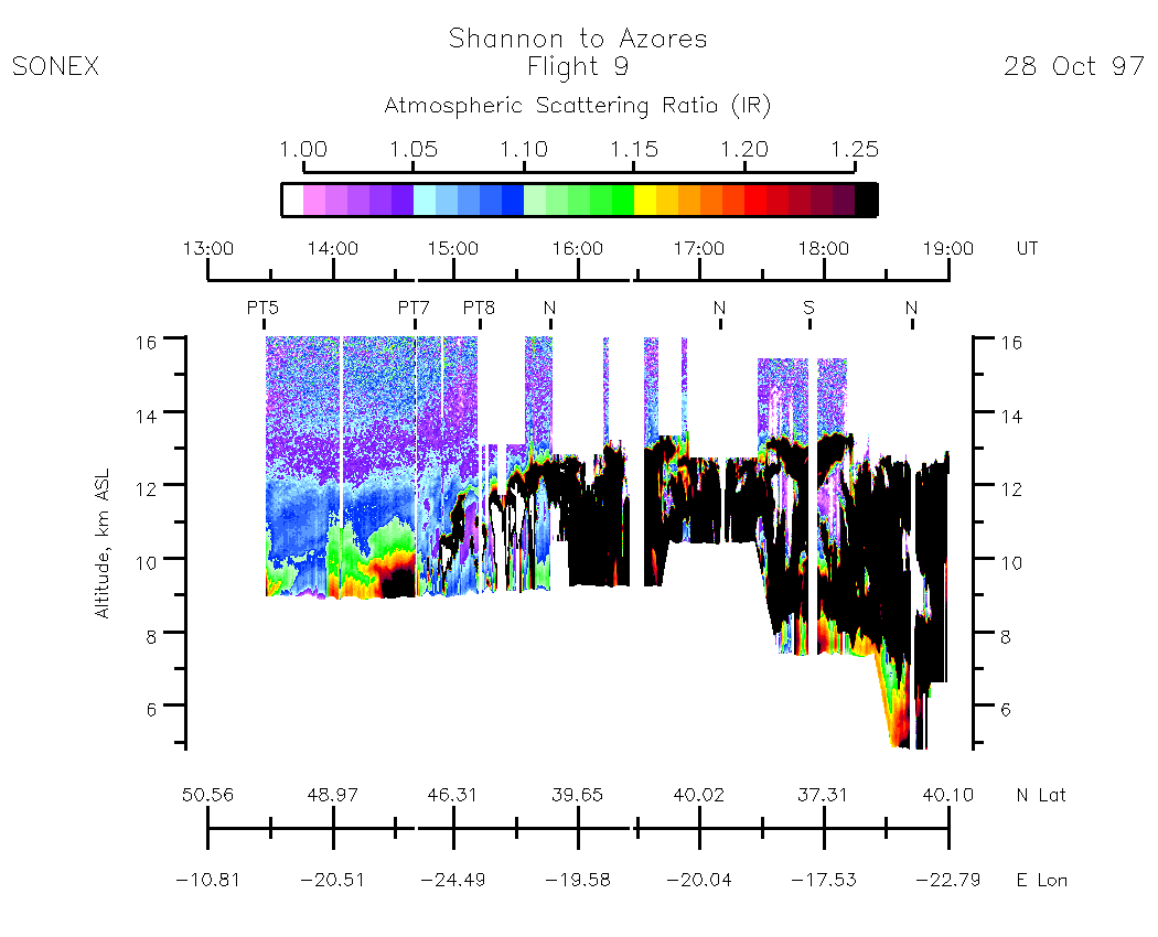
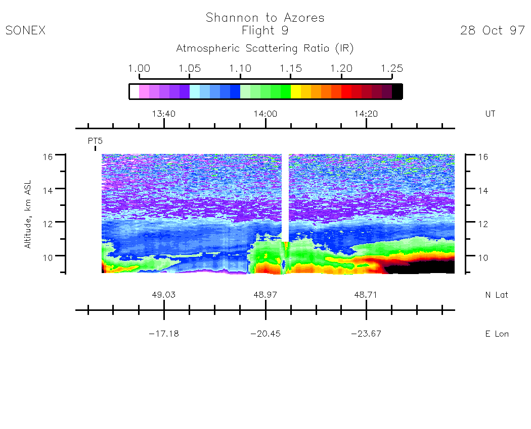
Zenith Aerosol - (Infrared Atmospheric Scattering Ratio)
Subset Images by UT:| 13:23 - 14:38 | 14:38 - 15:54 | 15:54 - 17:10 | 17:10 - 18:25 | 18:25 - 19:01 | movie_loop_all |
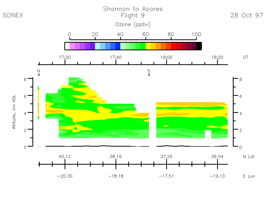
Nadir Ozone Mixing Ratio
Subset Images by UT:| 13:22 - 14:37 | 14:37 - 15:53 | 15:53 - 17:09 | 17:09 - 18:24 | 18:24 - 19:00 | movie_loop_all |
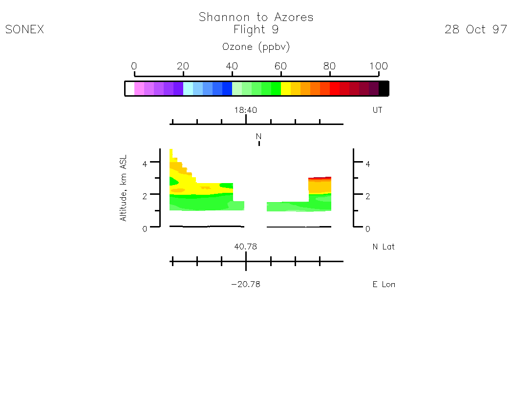
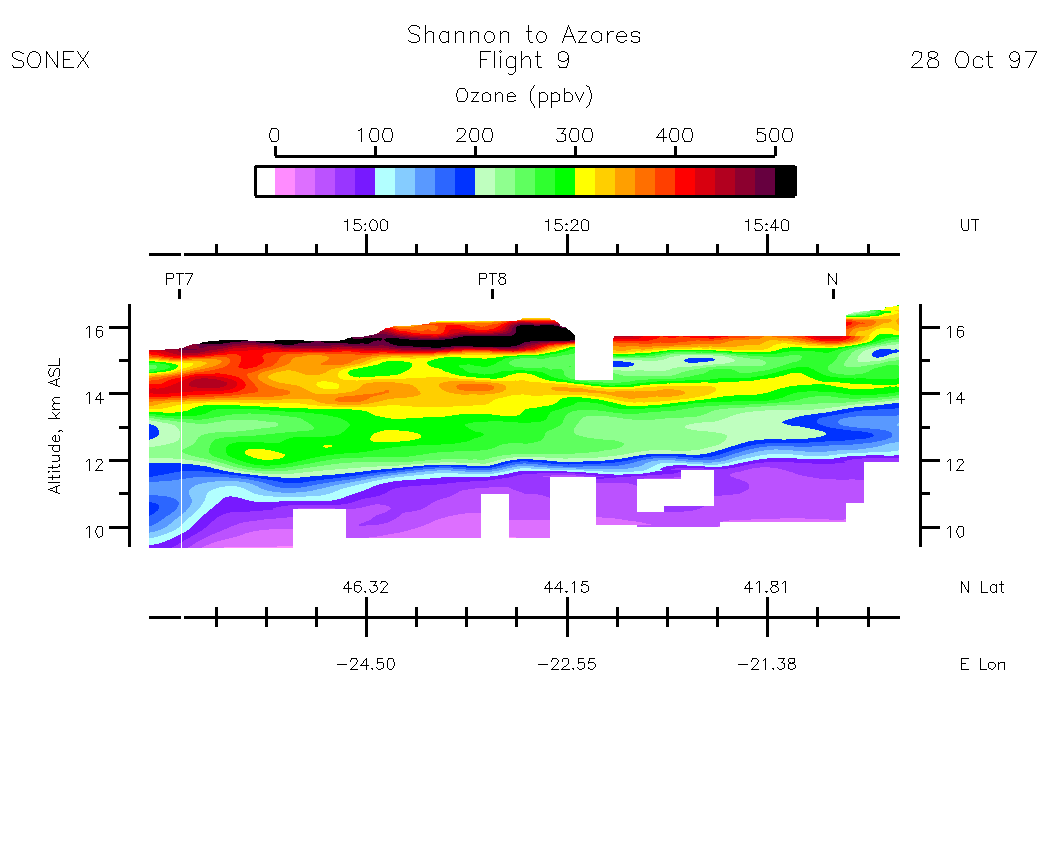
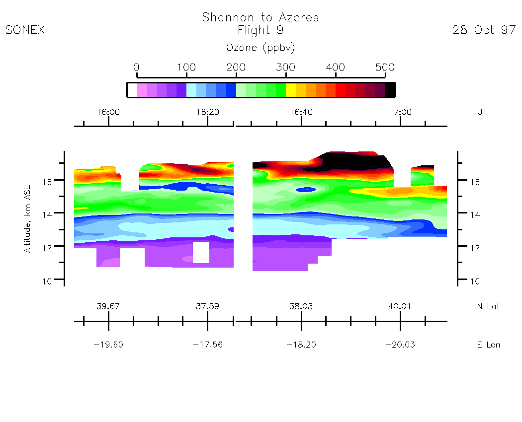
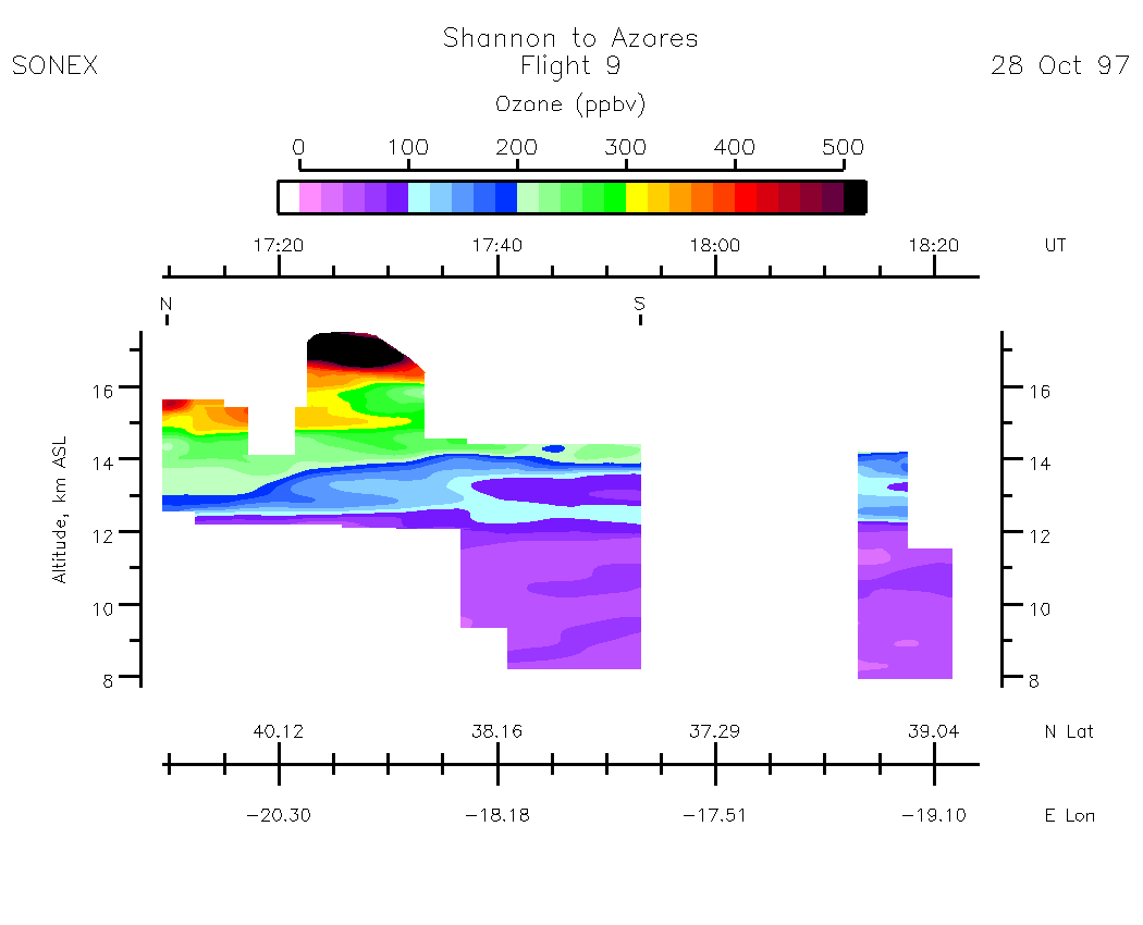
Zenith Ozone Mixing Ratio
Subset Images by UT:|13:22 - 14:37 | 14:37 - 15:53 | 15:53 - 17:09 | 17:09 - 18:24 | 18:24 - 19:00 | movie_loop_all |
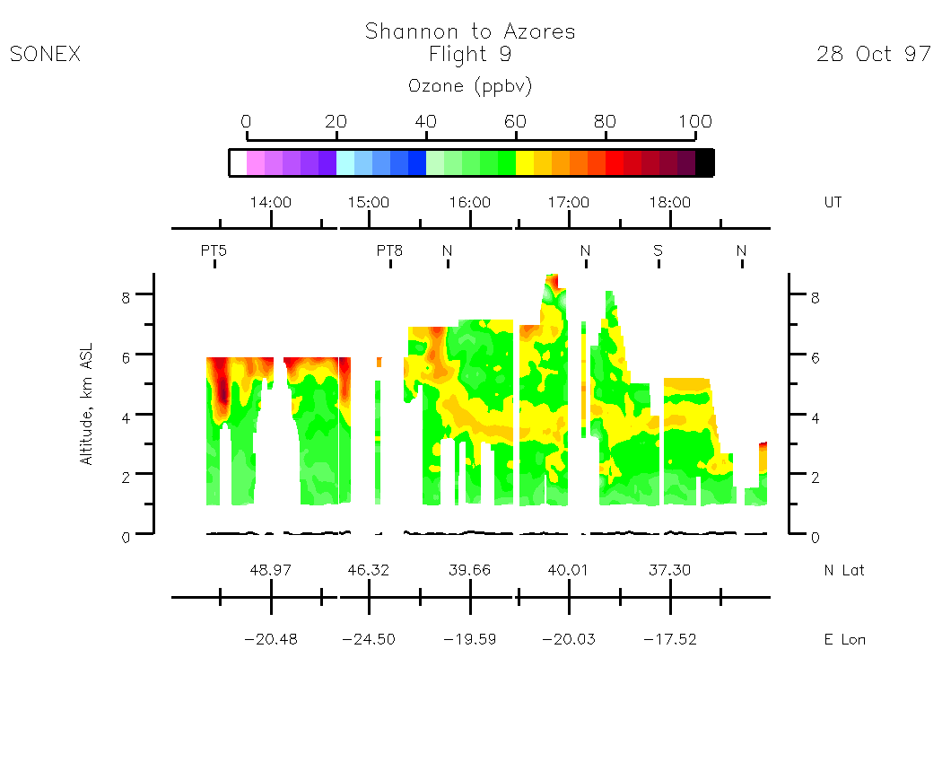
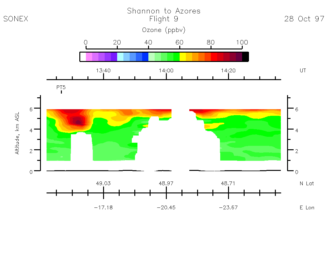
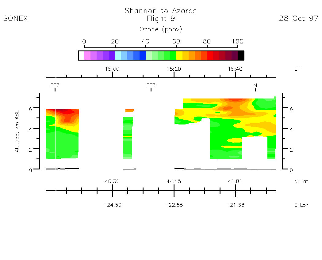
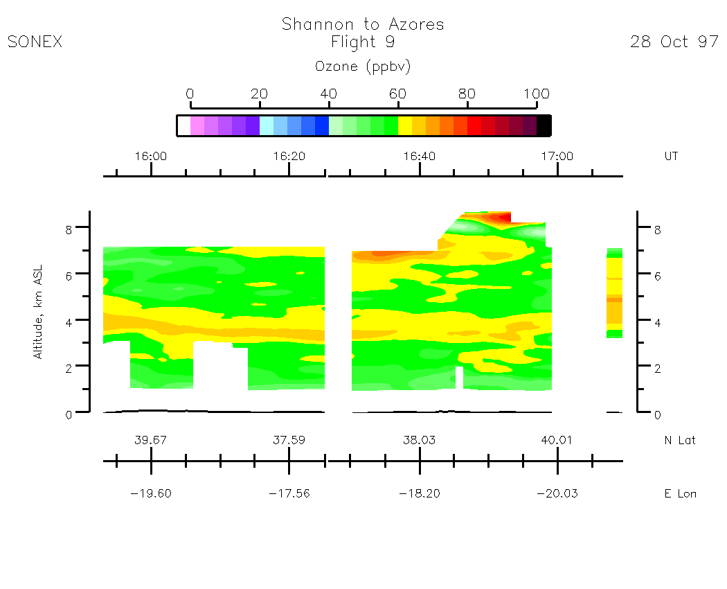
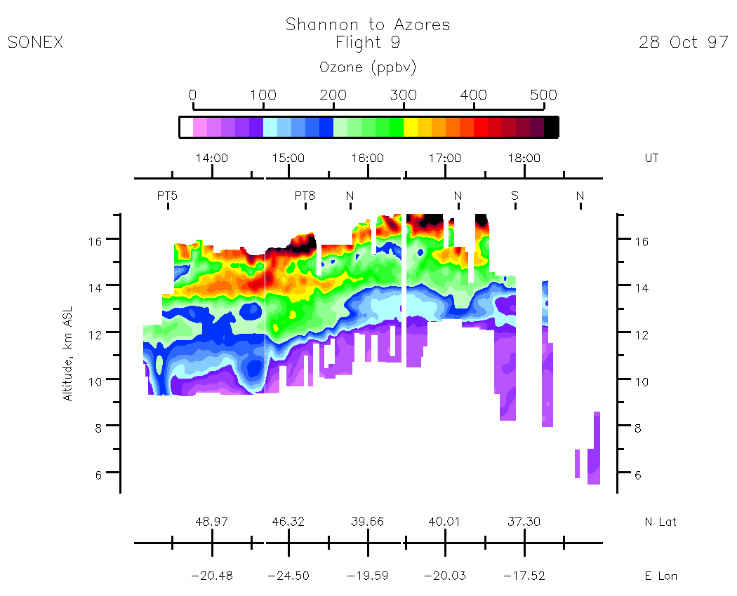
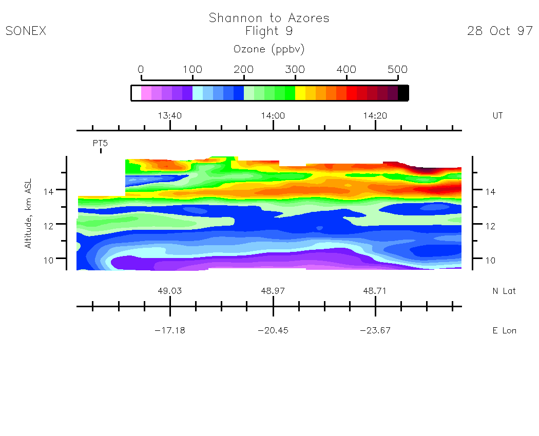
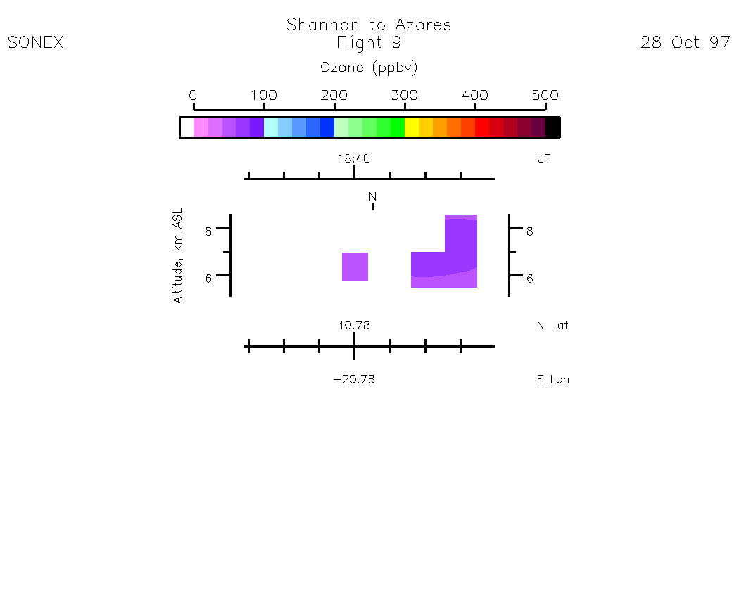
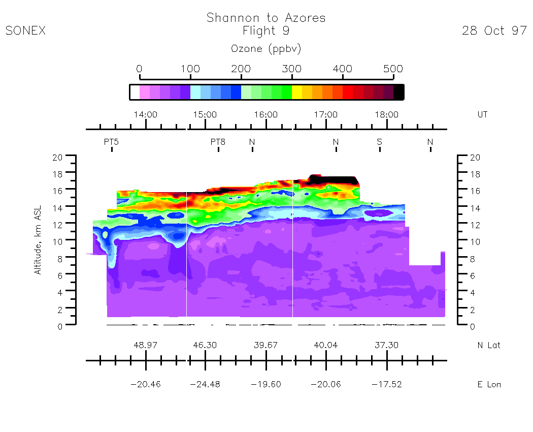
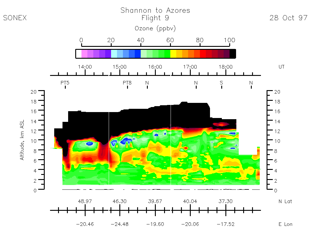
Composite Tropospheric Ozone Cross-Sections
| 0-500 scale | 0 - 100 scale |