
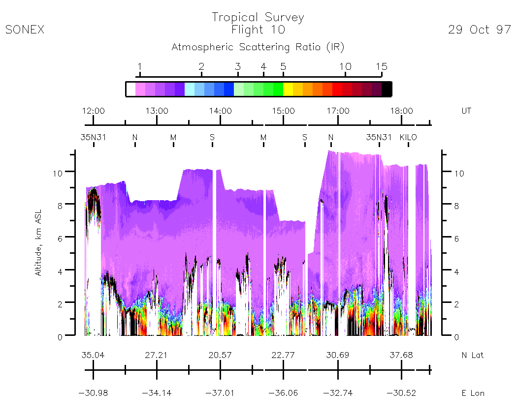
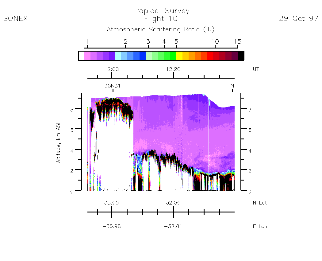
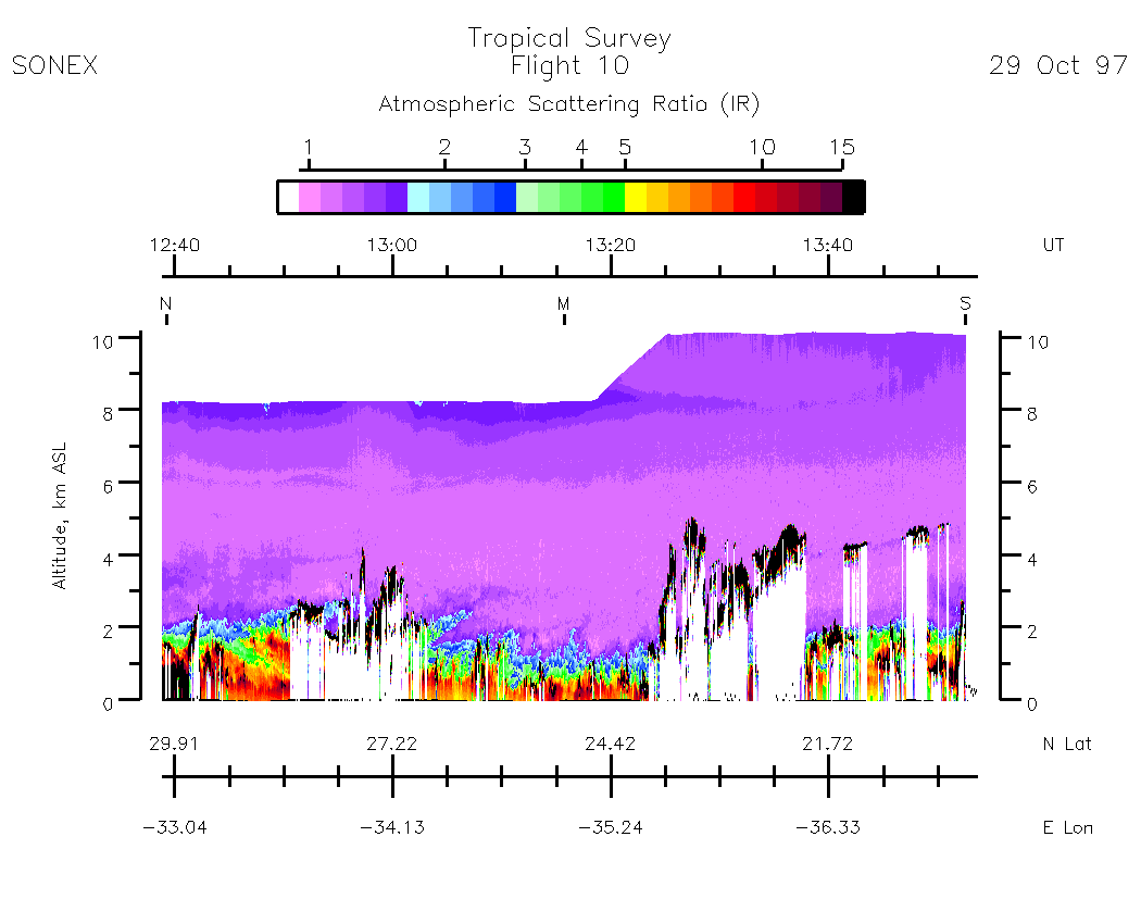
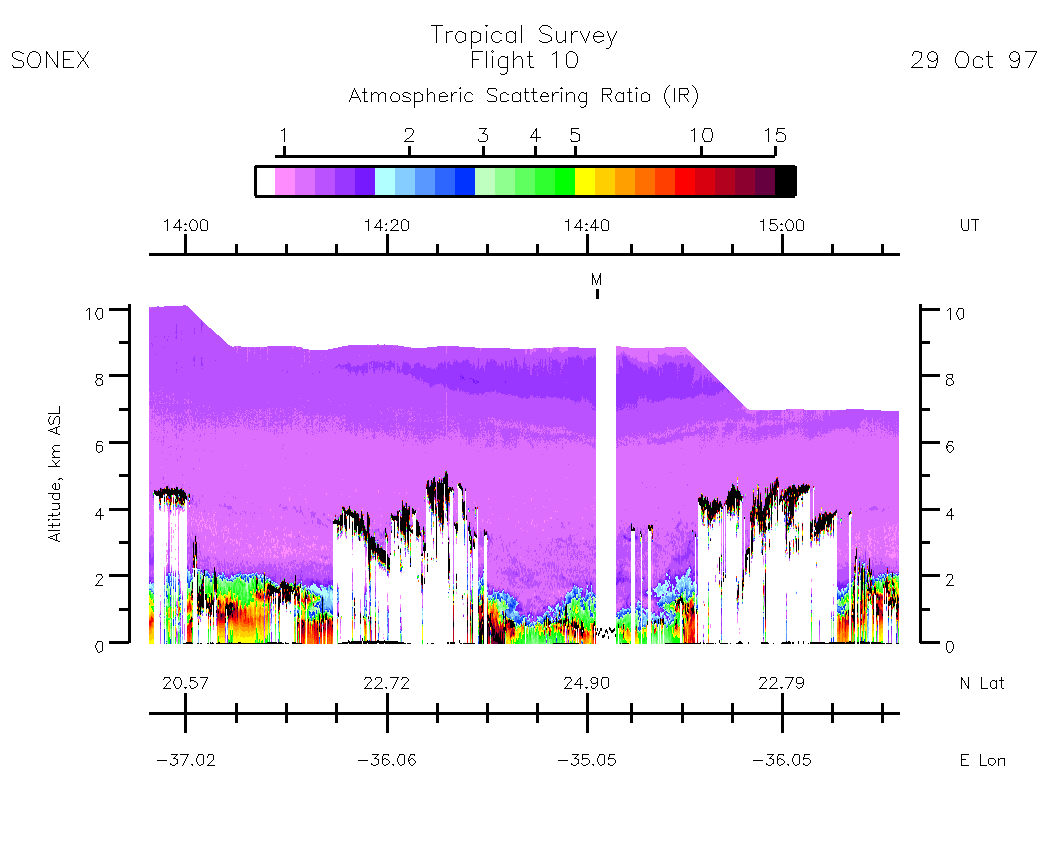
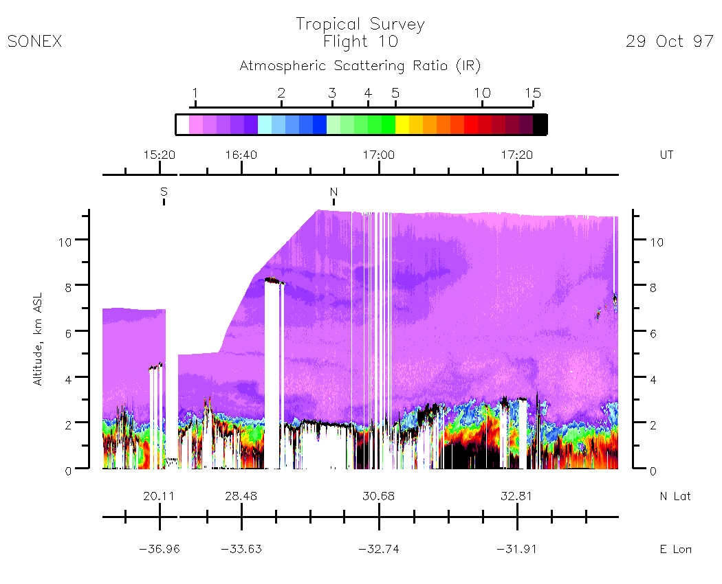
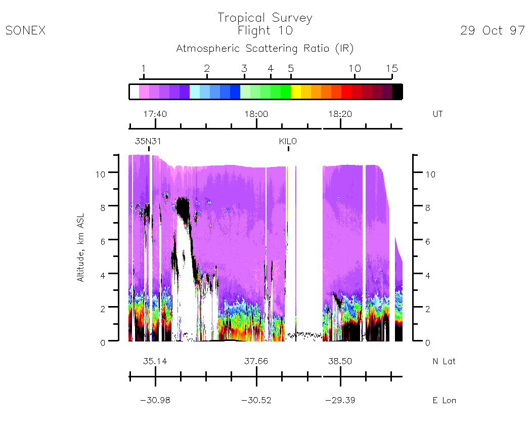
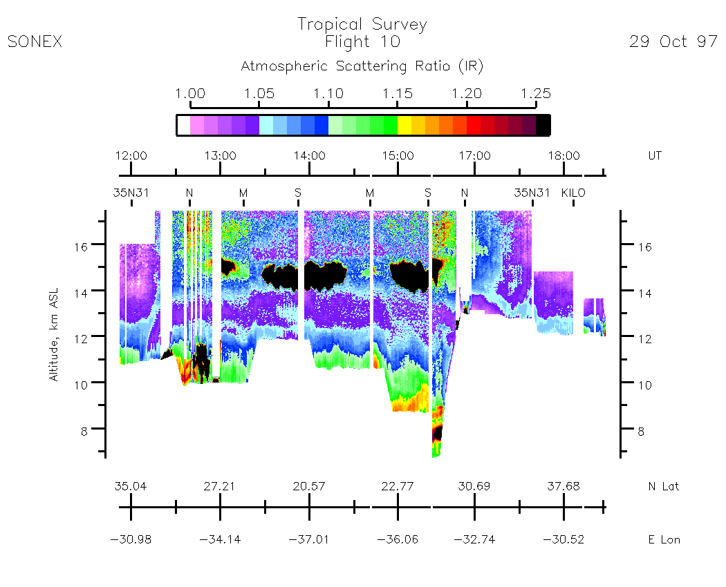
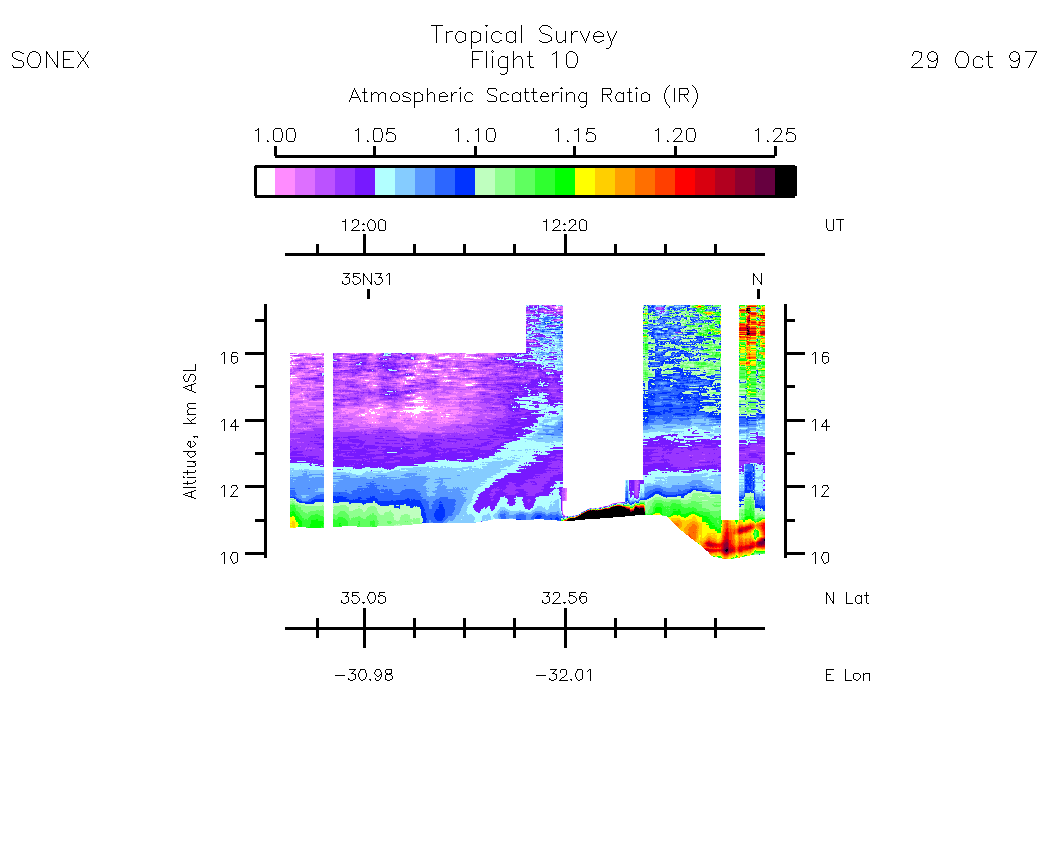
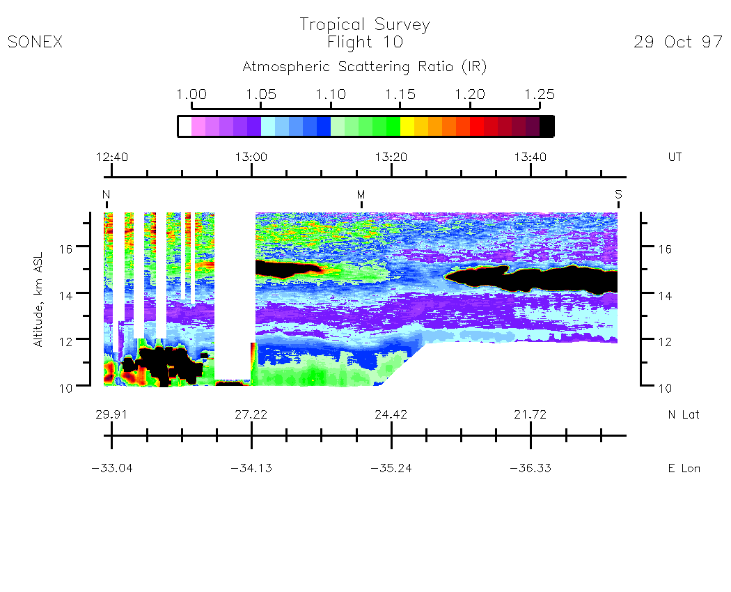
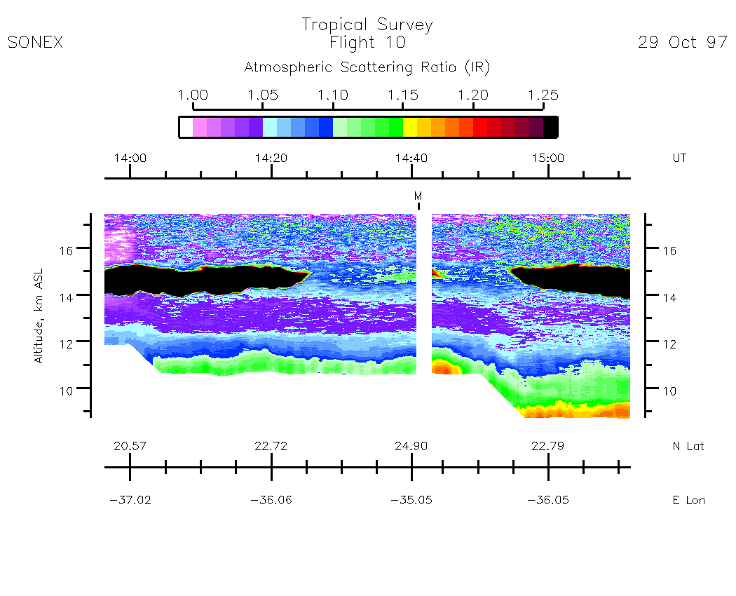
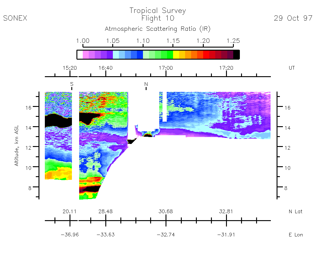
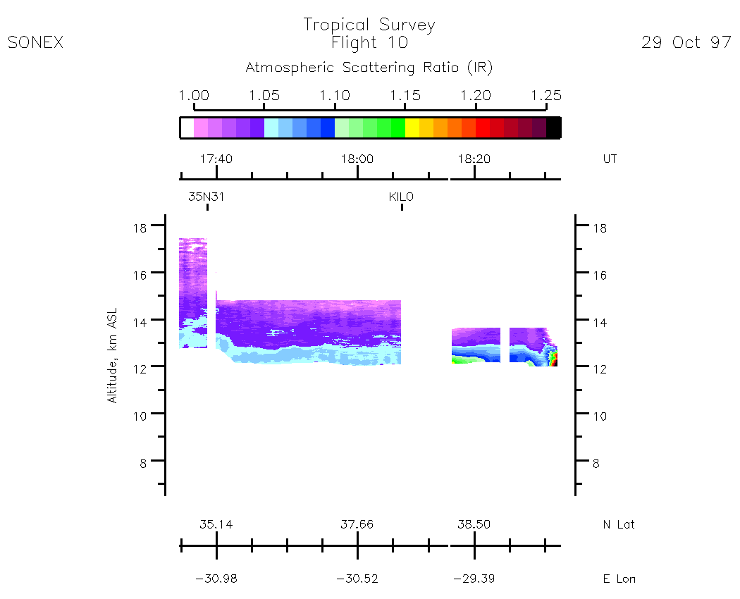
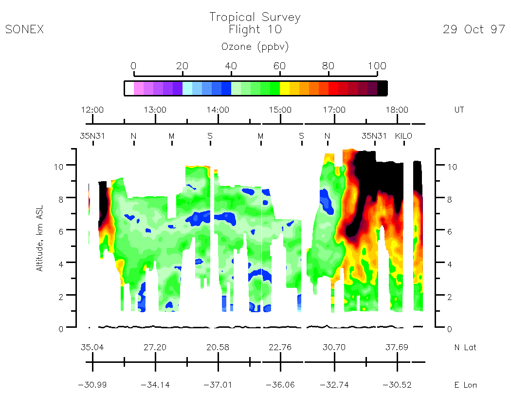
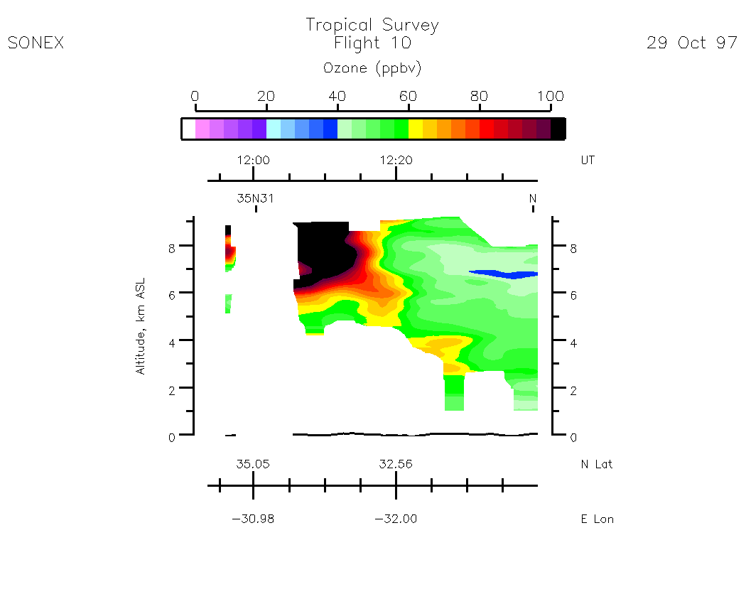
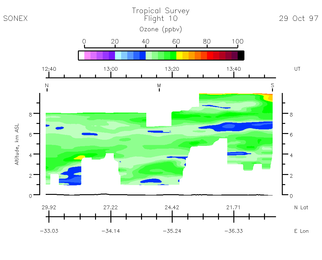
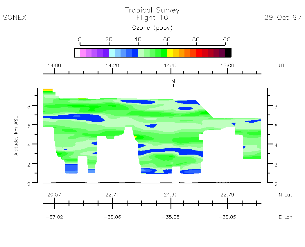
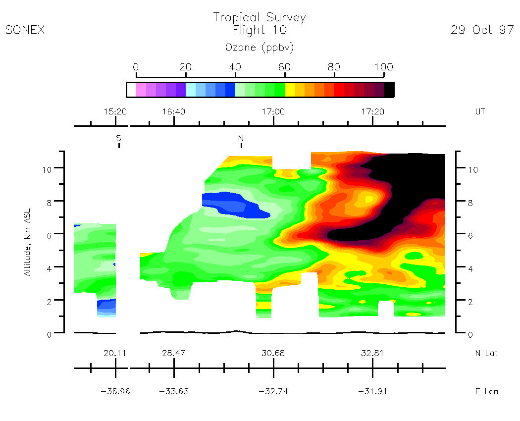
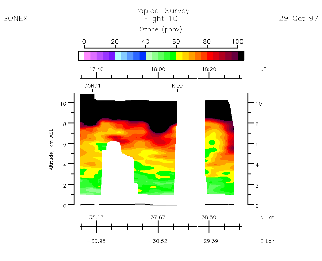
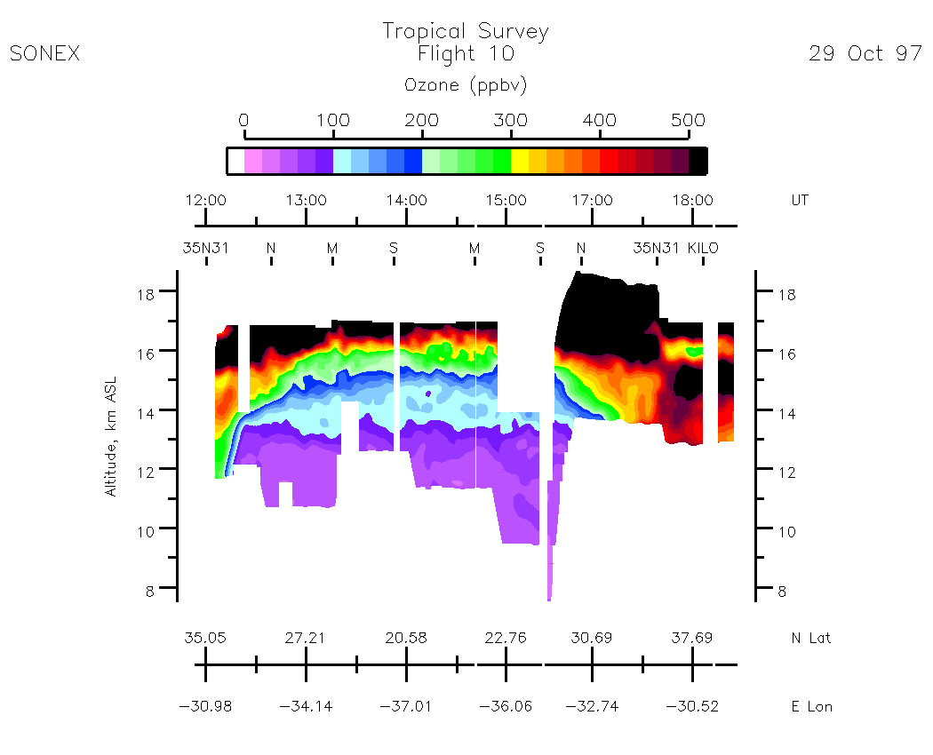
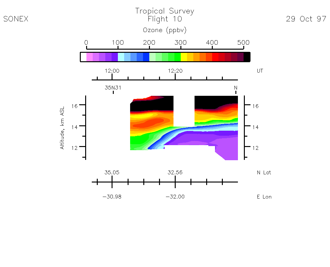
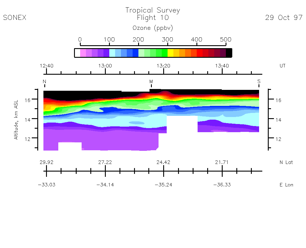
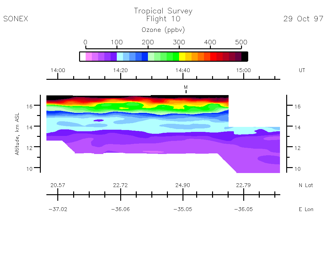
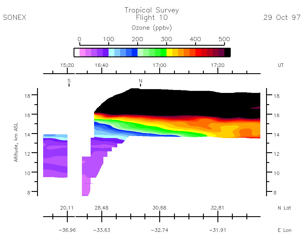
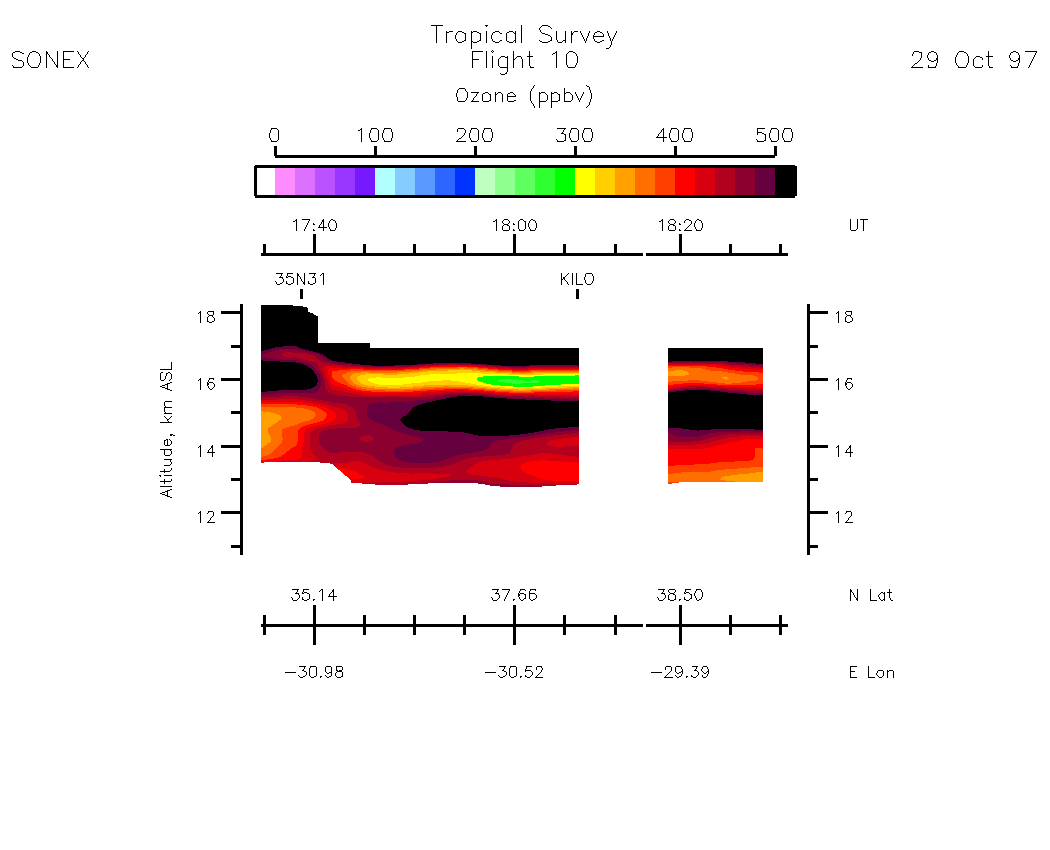
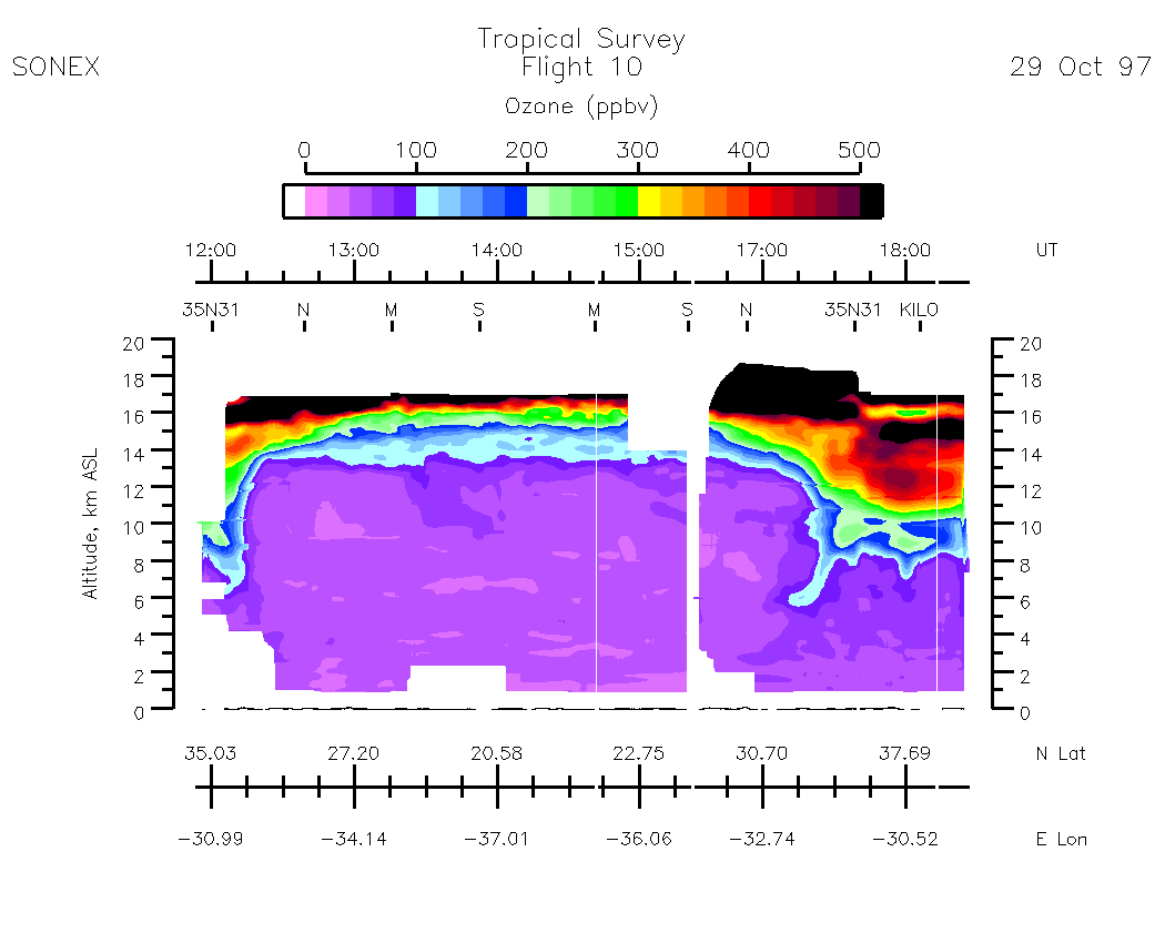
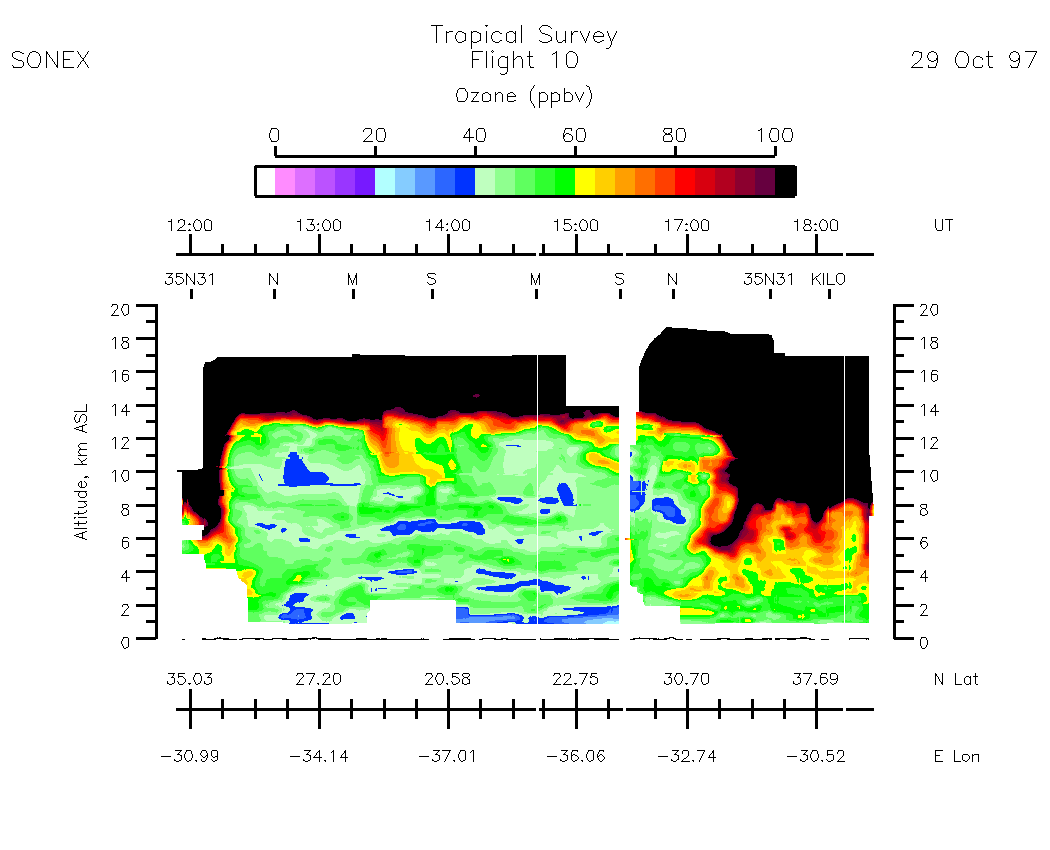
Flight 10 / Tropical Survey / 29 Oct. 1997
Nadir Aerosol - (Infrared Atmospheric Scattering Ratio)
Subset Images by UT:| 11:52 - 12:40 | 12:39 - 13:54 | 13:57 -15:12 | 15:12 -17:35 | 17:35 -18:32 | movie_loop_all |
Zenith Aerosol - (Infrared Atmospheric Scattering Ratio)
Subset Images by UT:| 11:52 - 12:40 | 12:39 - 13:54 | 13:57 -15:12 | 15:12 -17:35 | 17:35 -18:32 | movie_loop_all |
Nadir Ozone Mixing Ratio
Subset Images by UT:| 11:53 - 12:40 | 12:39 - 13:54 | 13:57 -15:12 | 15:12 -17:35 | 17:35 -18:31 | movie_loop_all |
Zenith Ozone Mixing Ratio
Subset Images by UT:|11:53 - 12:40 | 12:39 - 13:54 | 13:57 -15:12 | 15:12 -17:35 | 17:35 -18:31 | movie_loop_all |
Composite Tropospheric Ozone Cross-Sections
| 0-500 scale | 0 - 100 scale |