
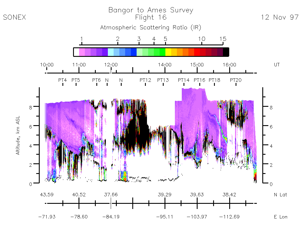
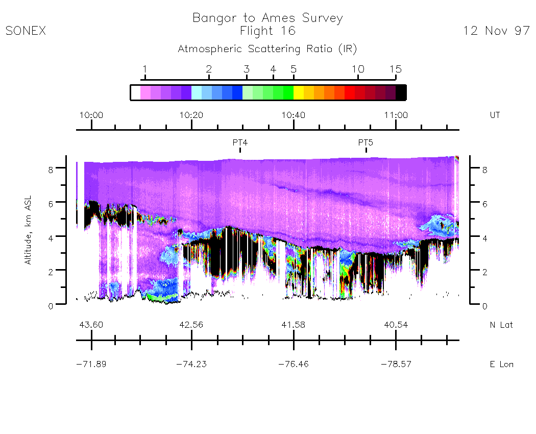
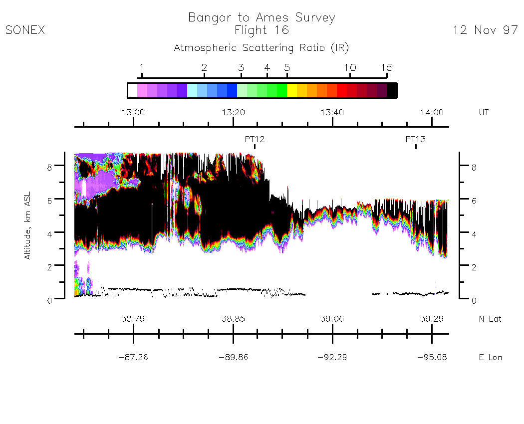
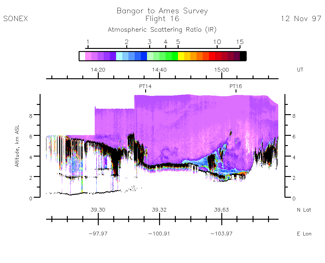
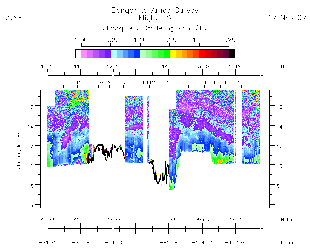
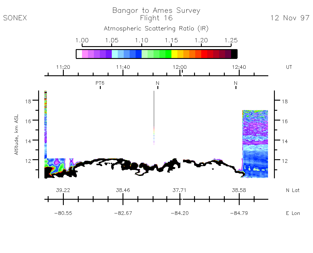
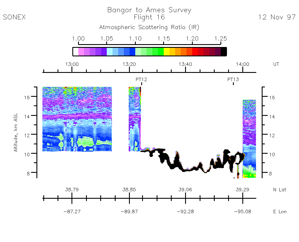
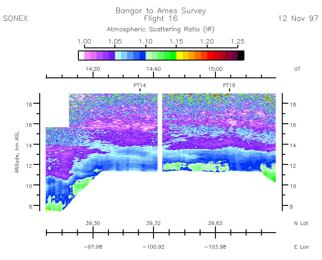
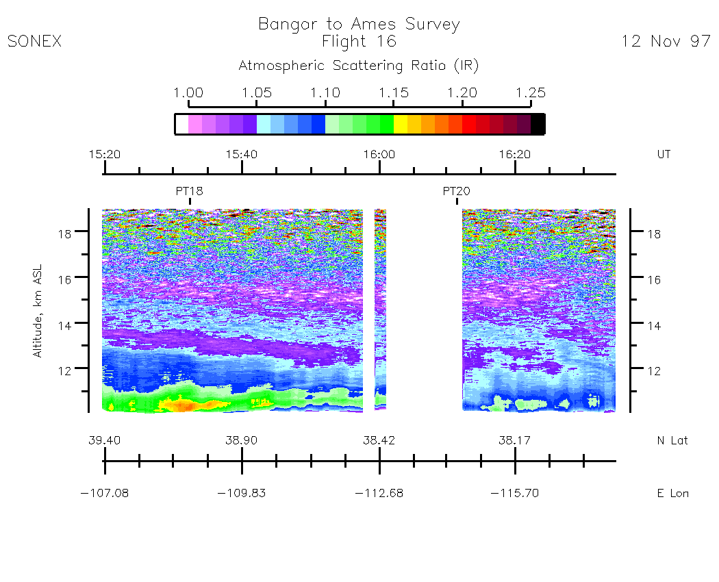
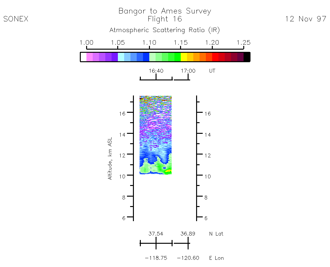
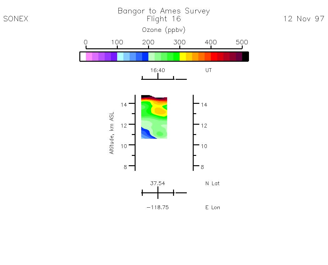
Nadir Aerosol - (Infrared Atmospheric Scattering Ratio)
Subset Images by UT:| 9:58 - 11:12 | 11:12 - 12:48 | 12:49 - 14:03 | 14:03 - 15:18 | 15:18 - 16:33 | 16:33 - 17:01 | movie_loop_all |
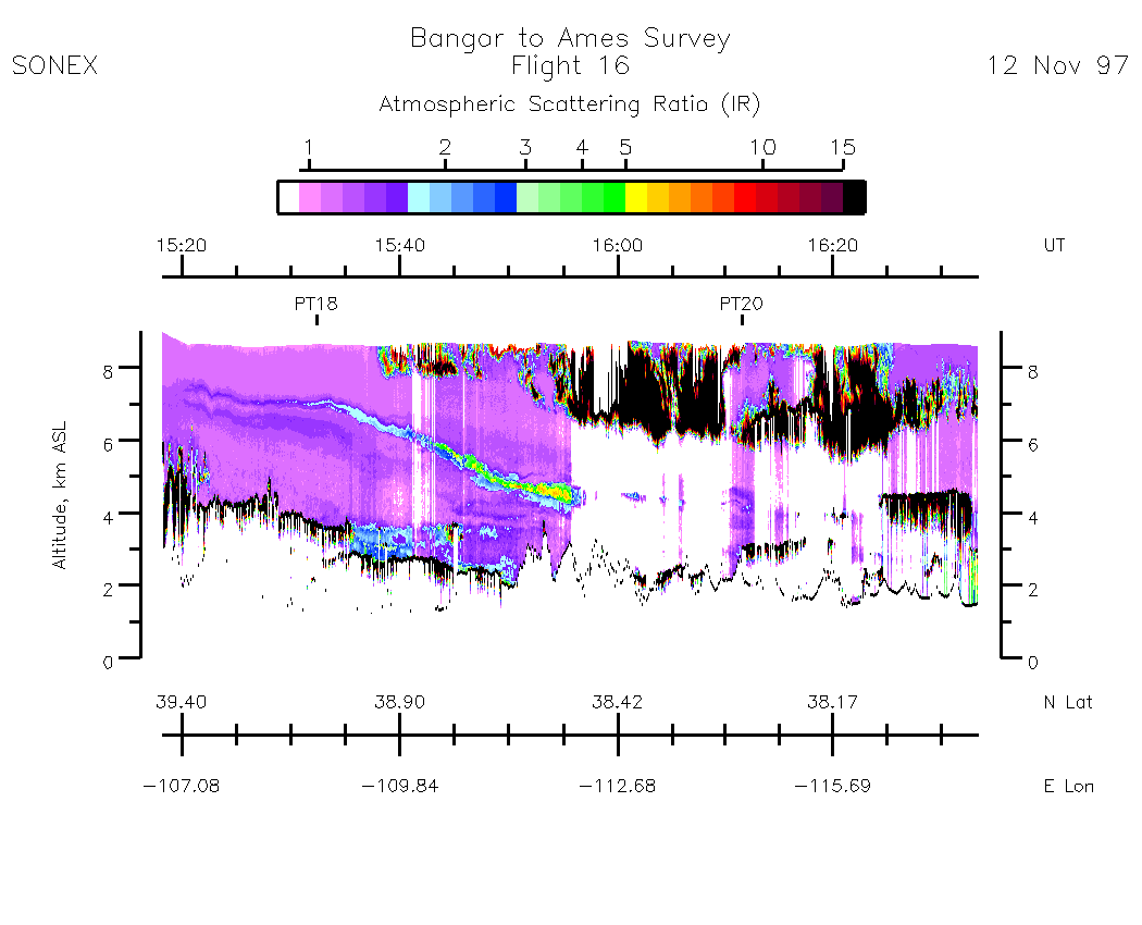
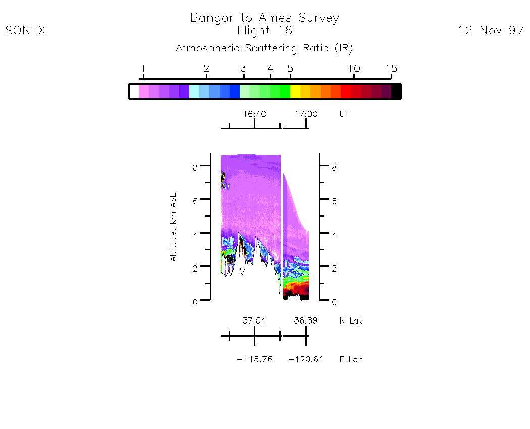
Zenith Aerosol - (Infrared Atmospheric Scattering Ratio)
Subset Images by UT:| 19:58 - 11:14 | 11:14 - 12:49 | 12:50 - 14:04 | 14:05 - 15:20 | 15:20 - 16:35 | 16:35 - 17:01 | movie_loop_all |
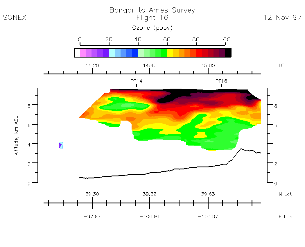
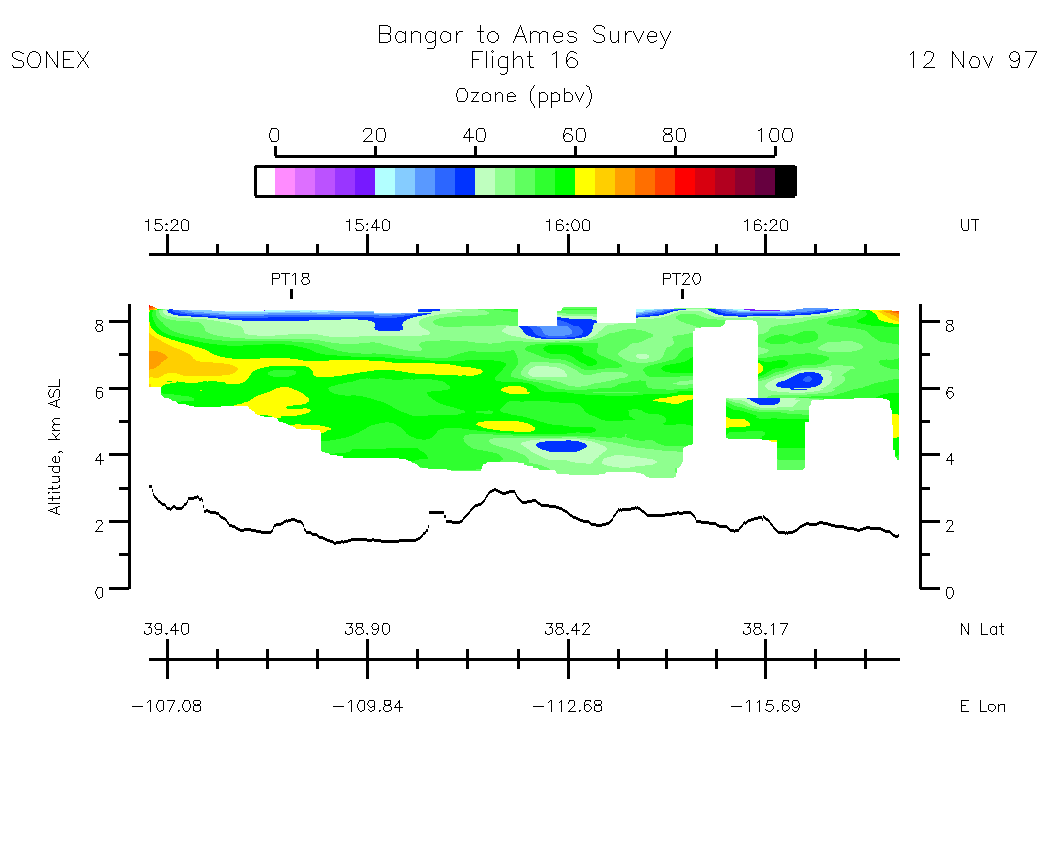
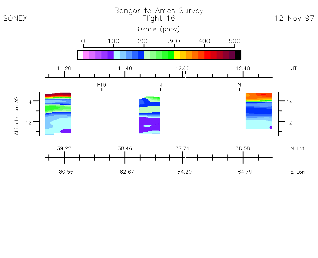
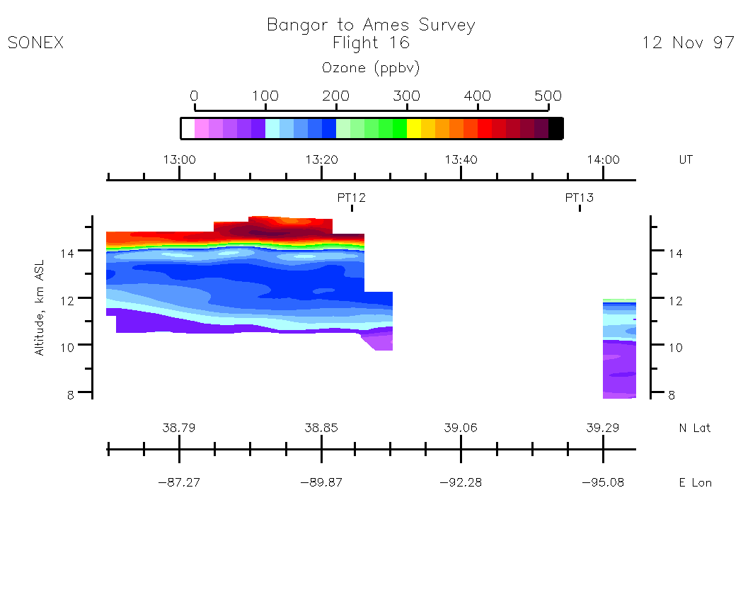
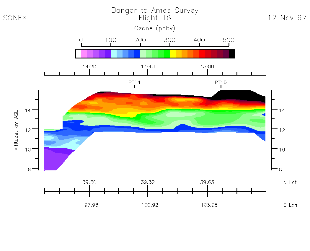
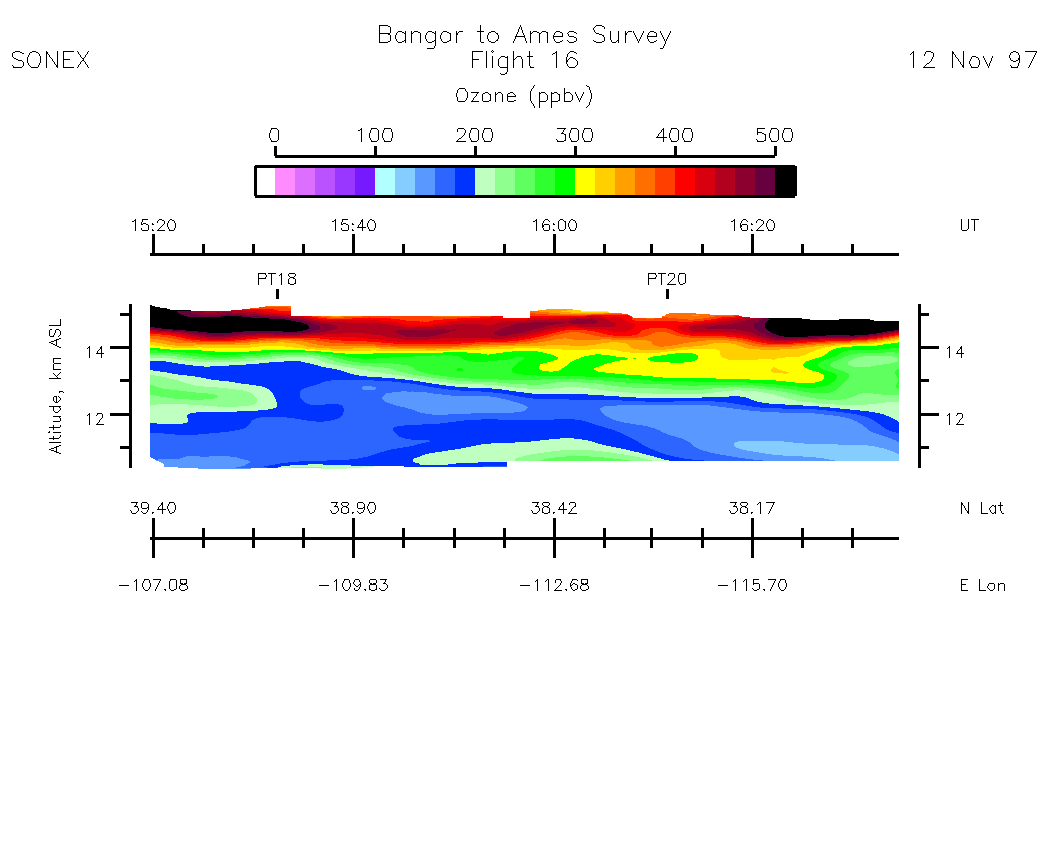
Nadir Ozone Mixing Ratio
Subset Images by UT:| 10:02 - 11:12 | 11:12 - 12:48 | 12:49 - 14:03 | 14:03 - 15:18 | 15:18 - 16:33 | 16:33 - 16:59 | movie_loop_all |
Zenith Ozone Mixing Ratio
Subset Images by UT:| 10:02 - 11:14 | 11:14 - 12:50 | 12:50 - 14:05 | 14:05 - 15:20 | 15:20 - 16:35 | 16:35 - 16:59 | movie_loop_all |
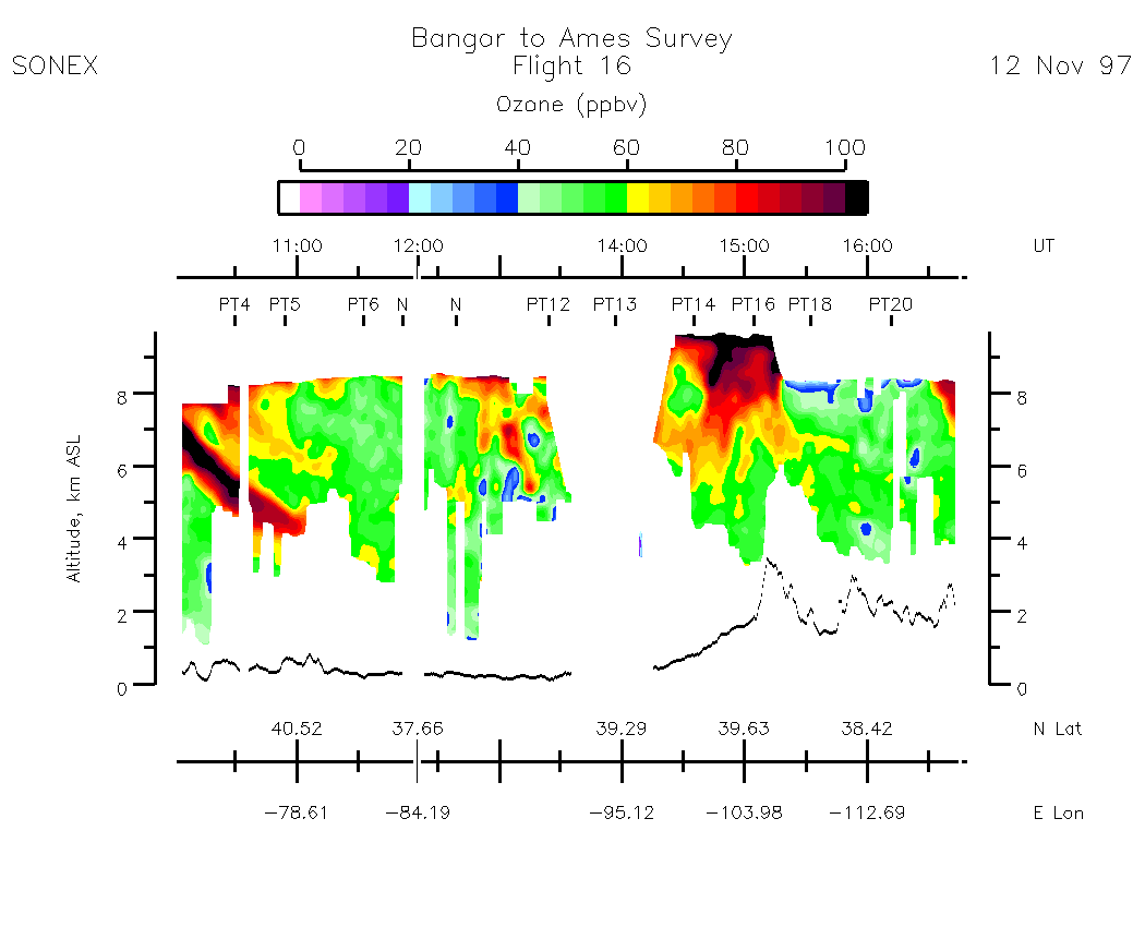
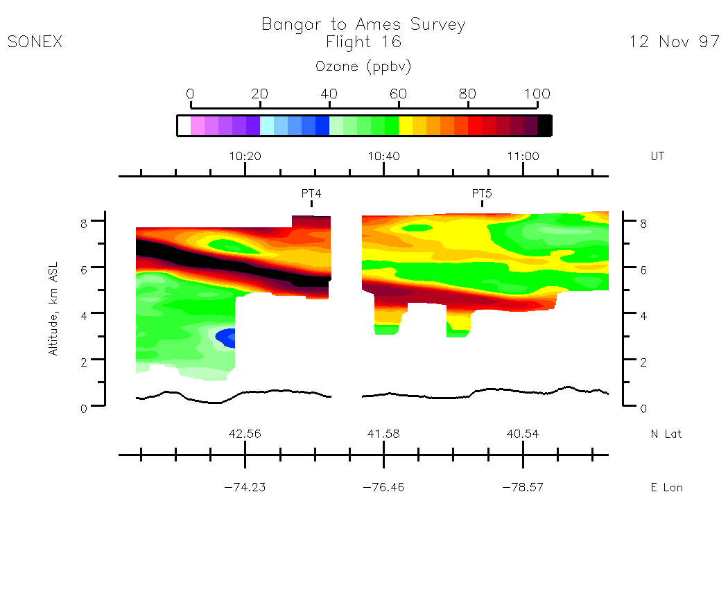
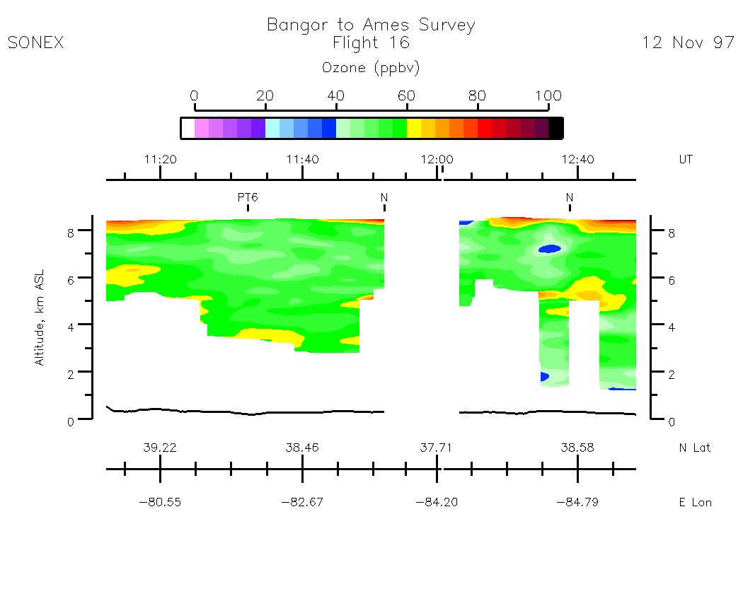
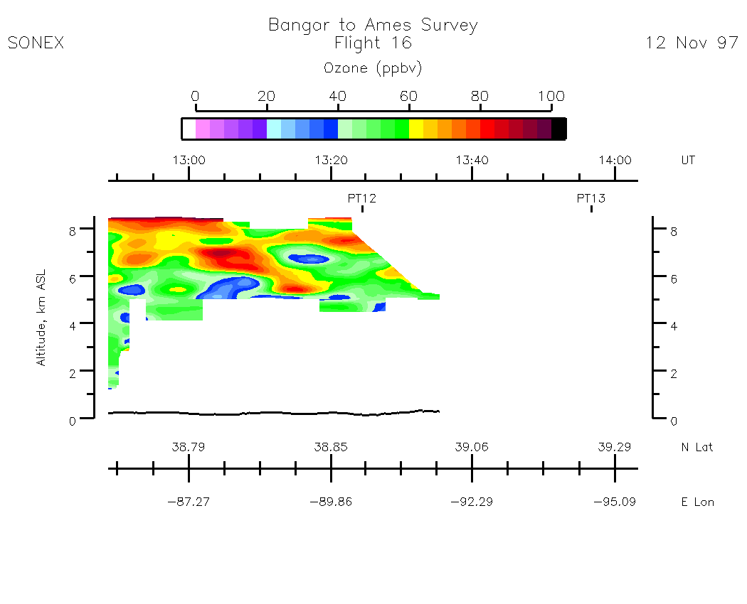
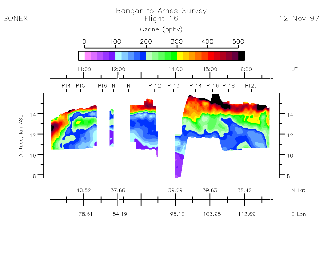
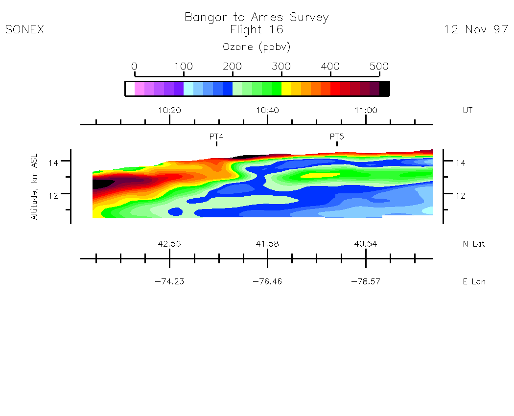
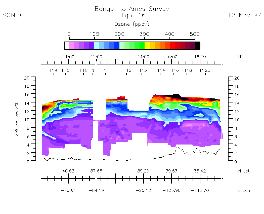
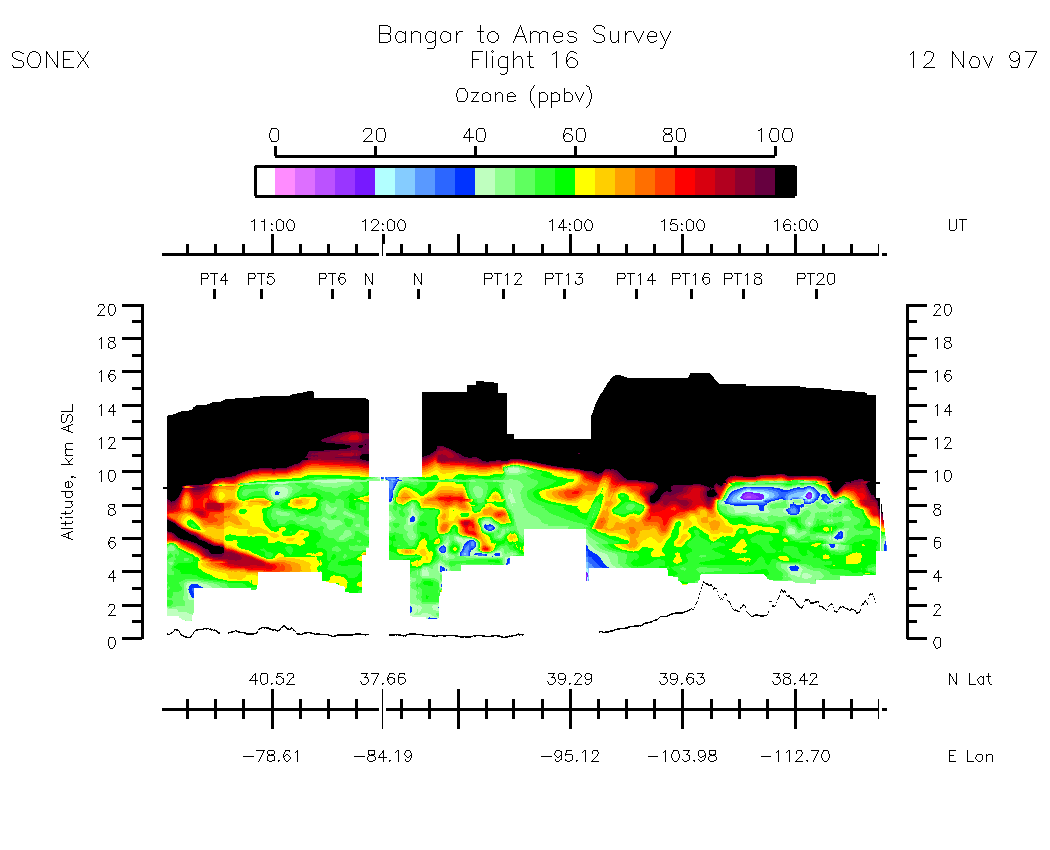
Composite Tropospheric Ozone Cross-Sections
| 0-500 scale | 0 - 100 scale |