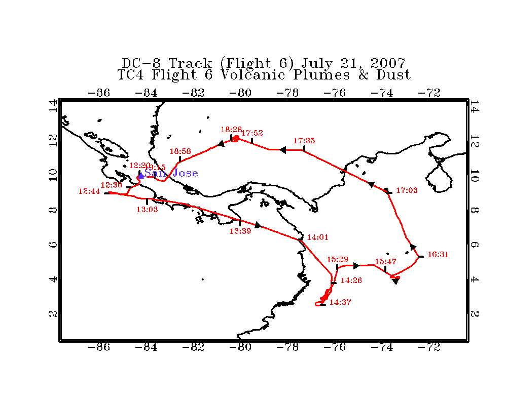
TC4 Flight 06
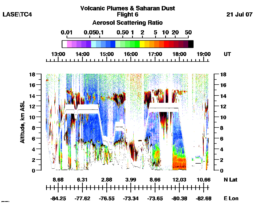
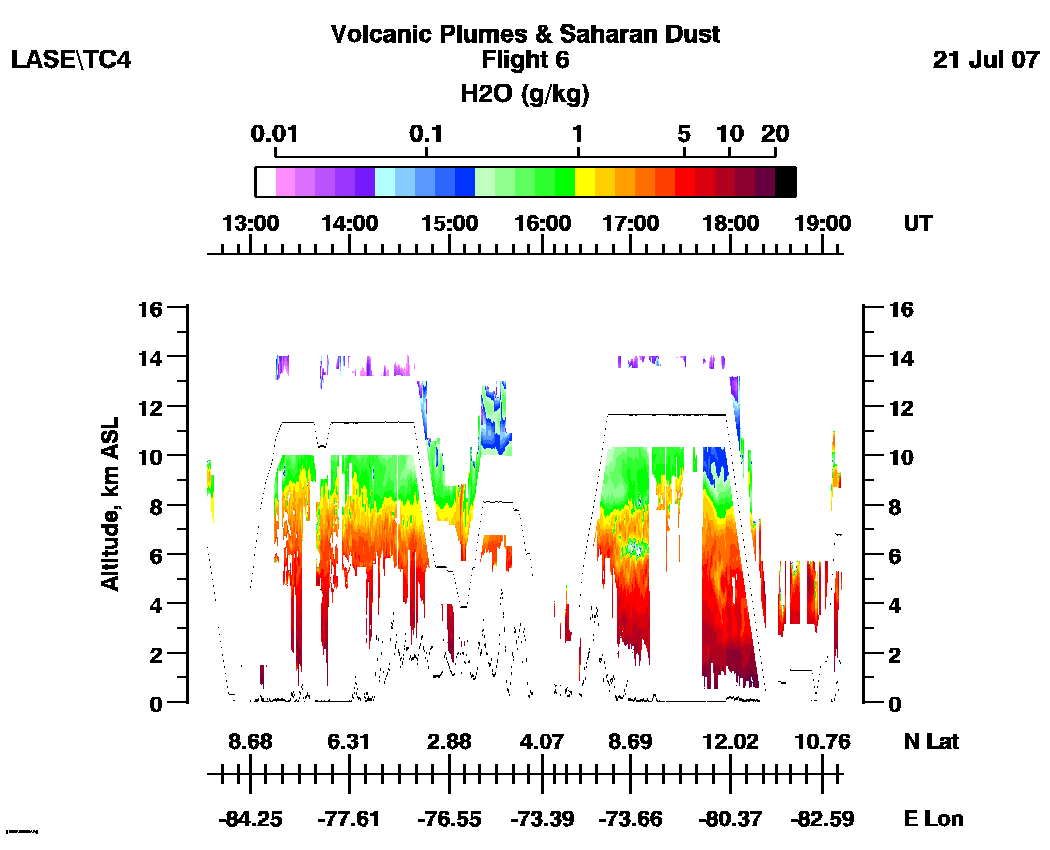
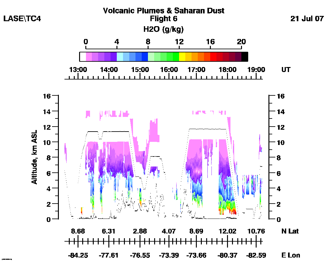
LASE Aerosol and Water Vapor Distributions
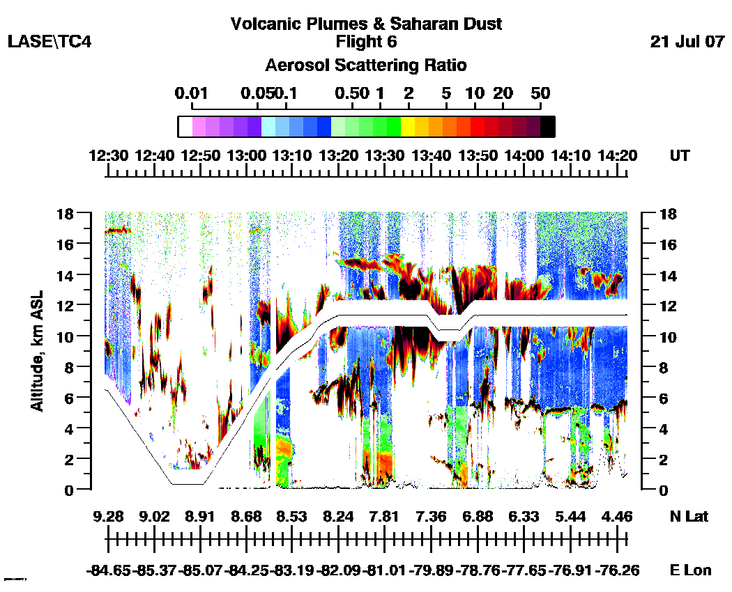
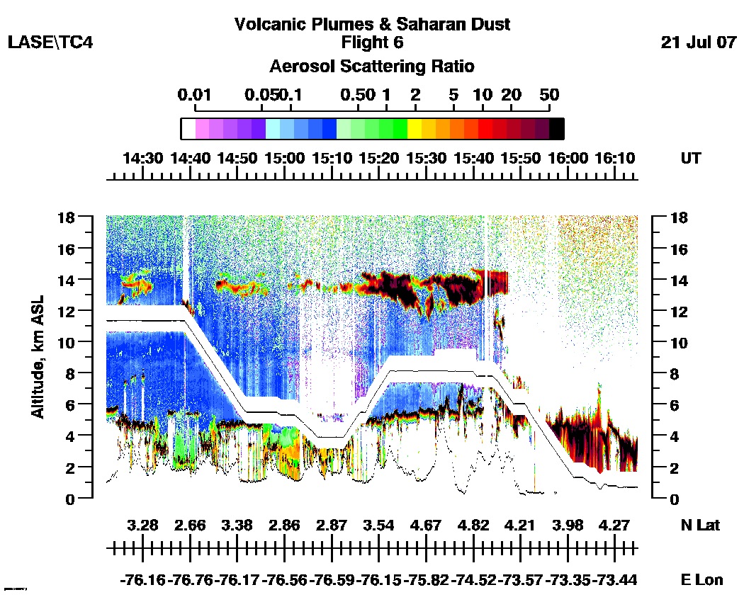
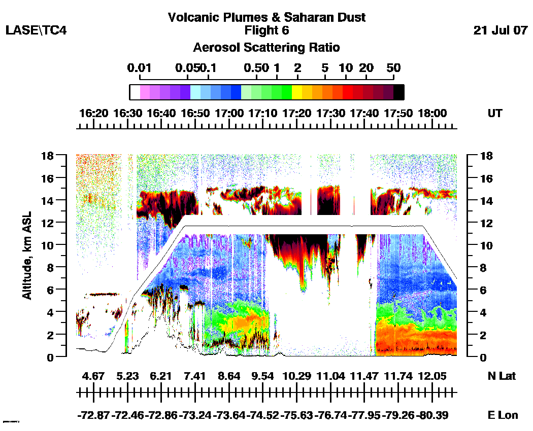
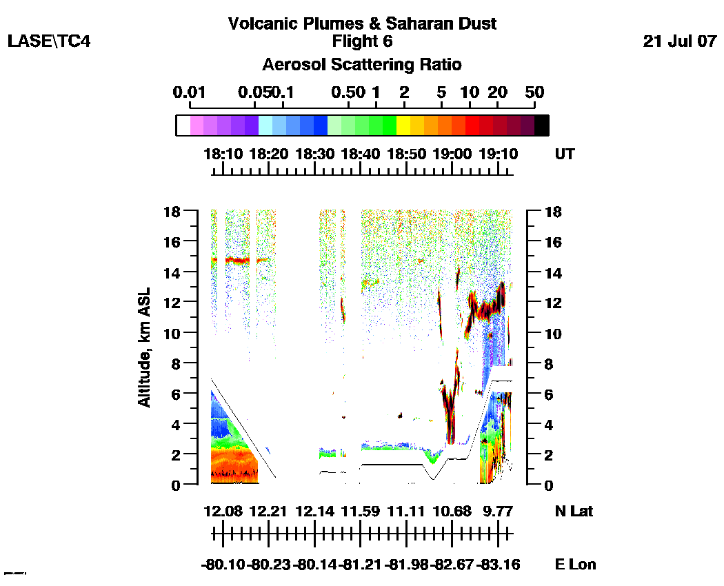
Flight 06 / Volcanic Plumes & Dust/
July 21, 2007
DC-8 flight track images | Entire
Flight |
LASE full flight images
(12:30 - 19:13 UT)
| Aerosol | Water Vapor Mixing Ratio (Log Scale) | Water Vapor Mixing Ratio (Linear Scale) |
Subset aerosol images
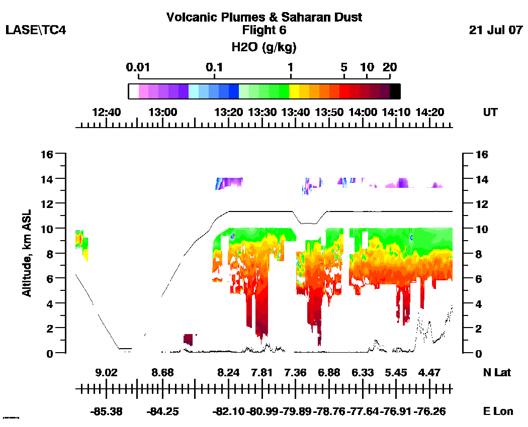
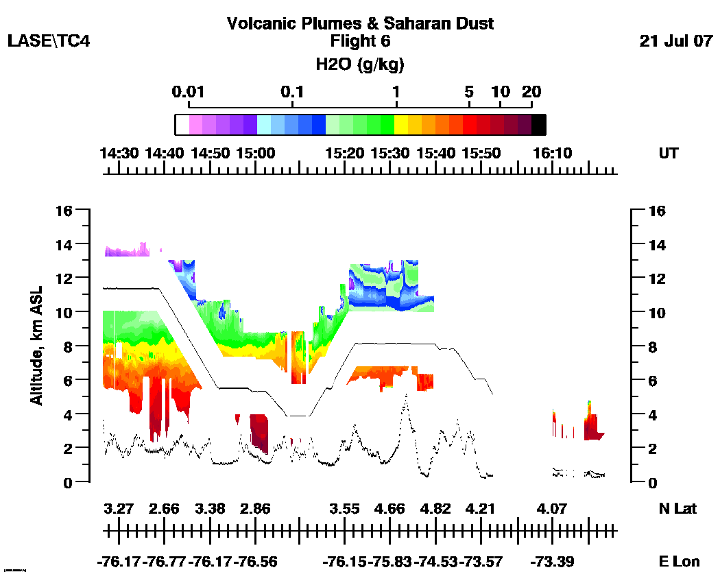
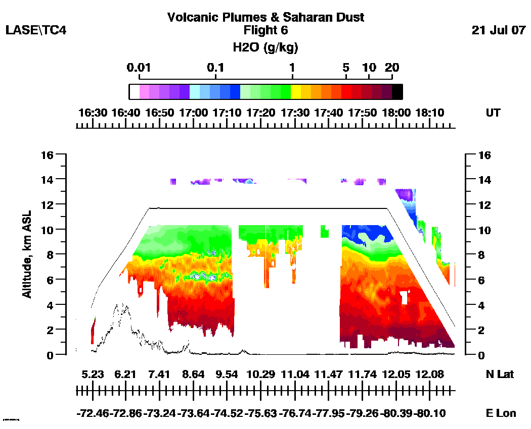
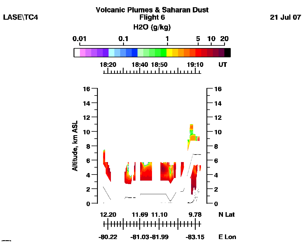
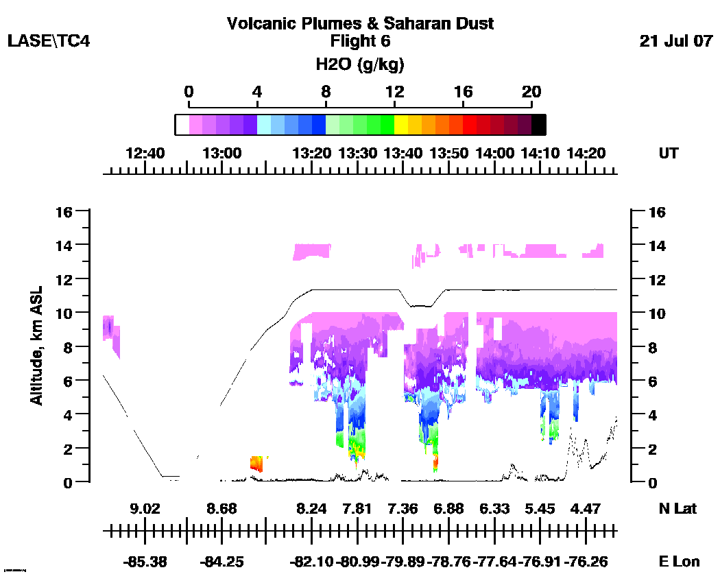
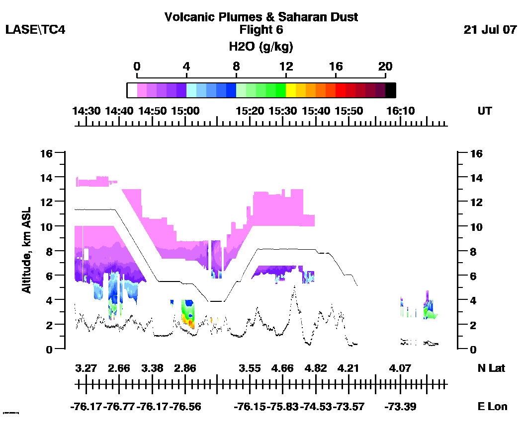
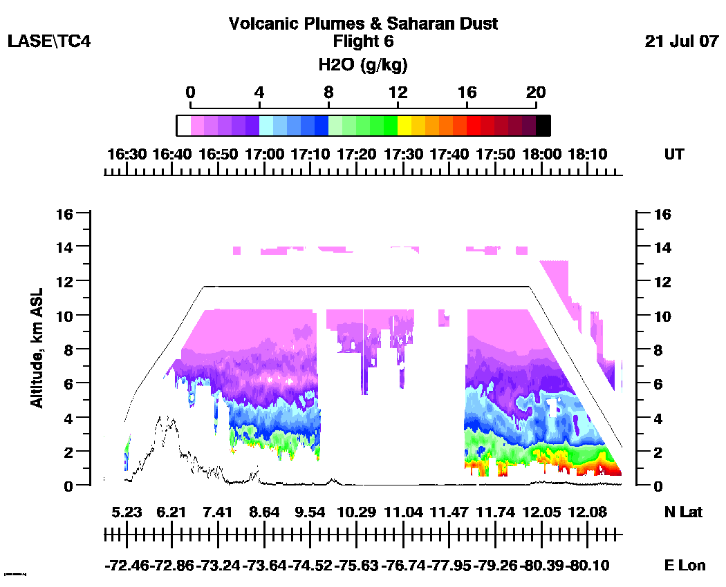
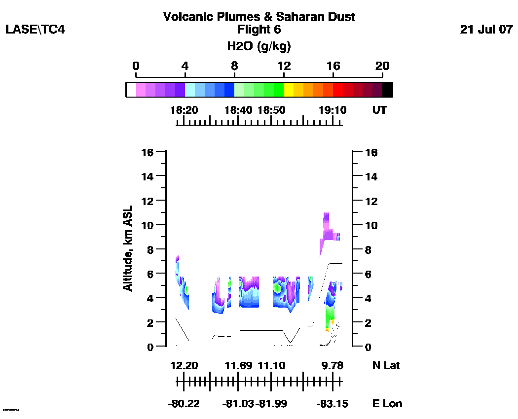
| 12:30 - 14:26| 14:26 - 16:27 | 16:29 - 18:22 | 18:31 - 19:13 |loop |
Subset water vapor mixing
ratio images (g/kg)
H2O (Log Scale): | 12:30 - 14:26| 14:26 - 16:27 | 16:29 - 18:22 | 18:31 - 19:13 | loop |
H2O (Linear Scale): | 12:30 - 14:26| 14:26 - 16:27 | 16:29 - 18:22 | 18:31 - 19:13 |loop |
