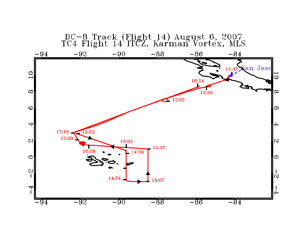
TC4 Flight 14
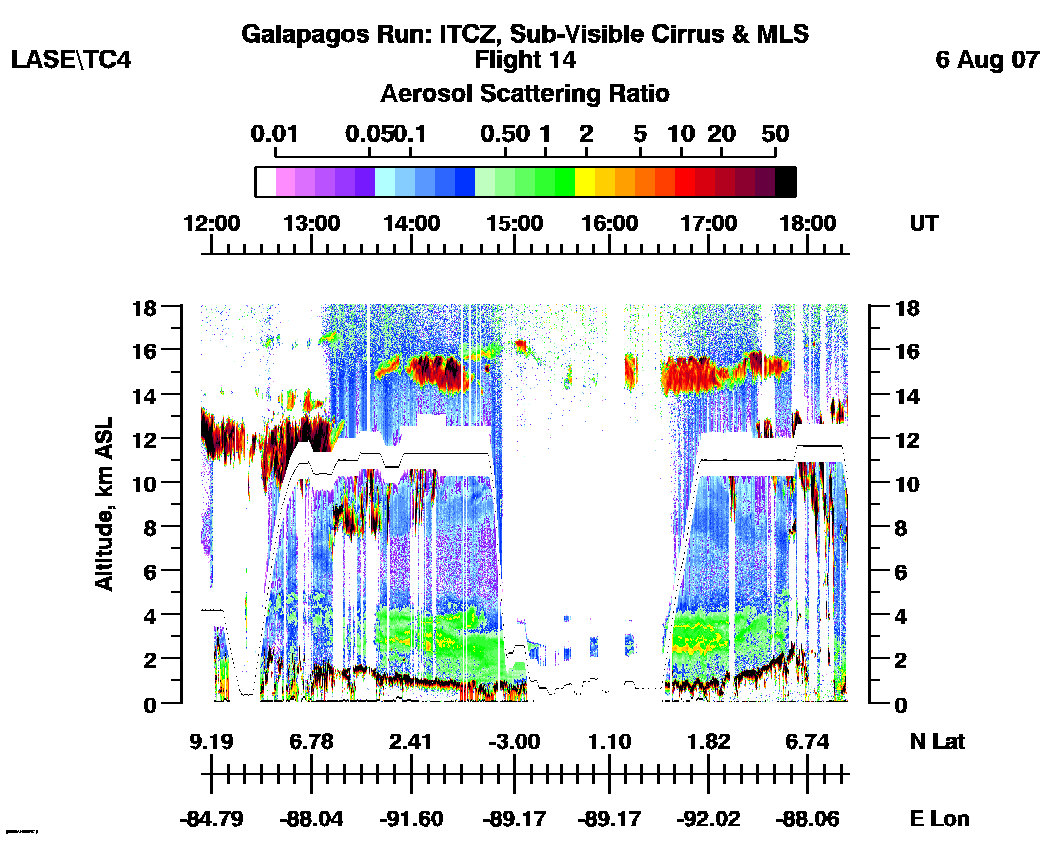
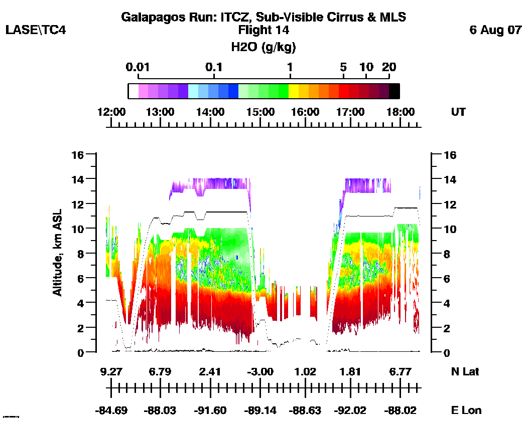
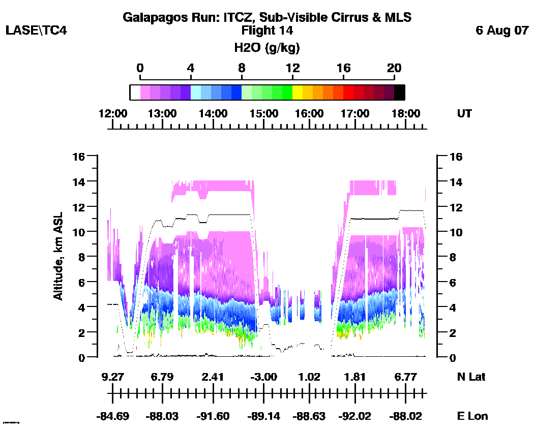
LASE Aerosol and Water Vapor Distributions
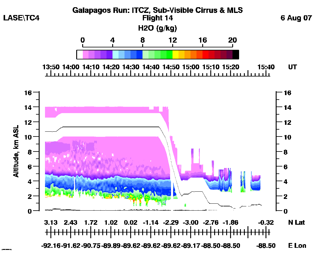
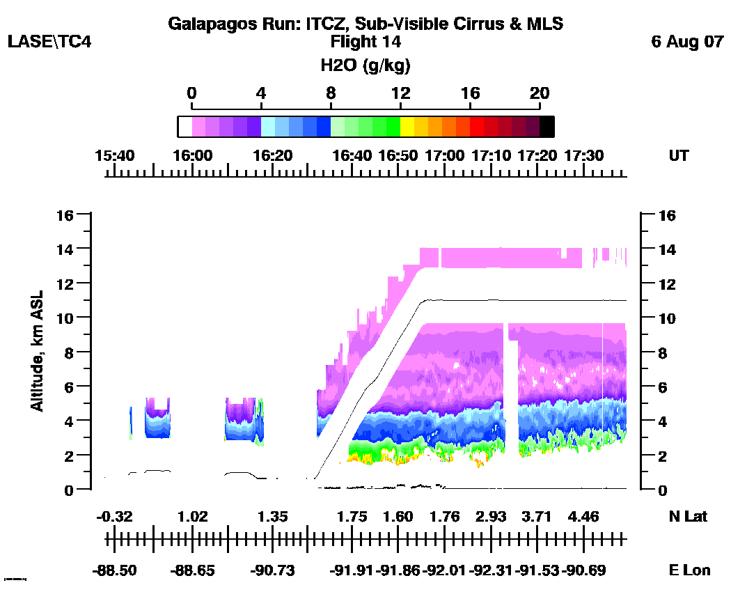
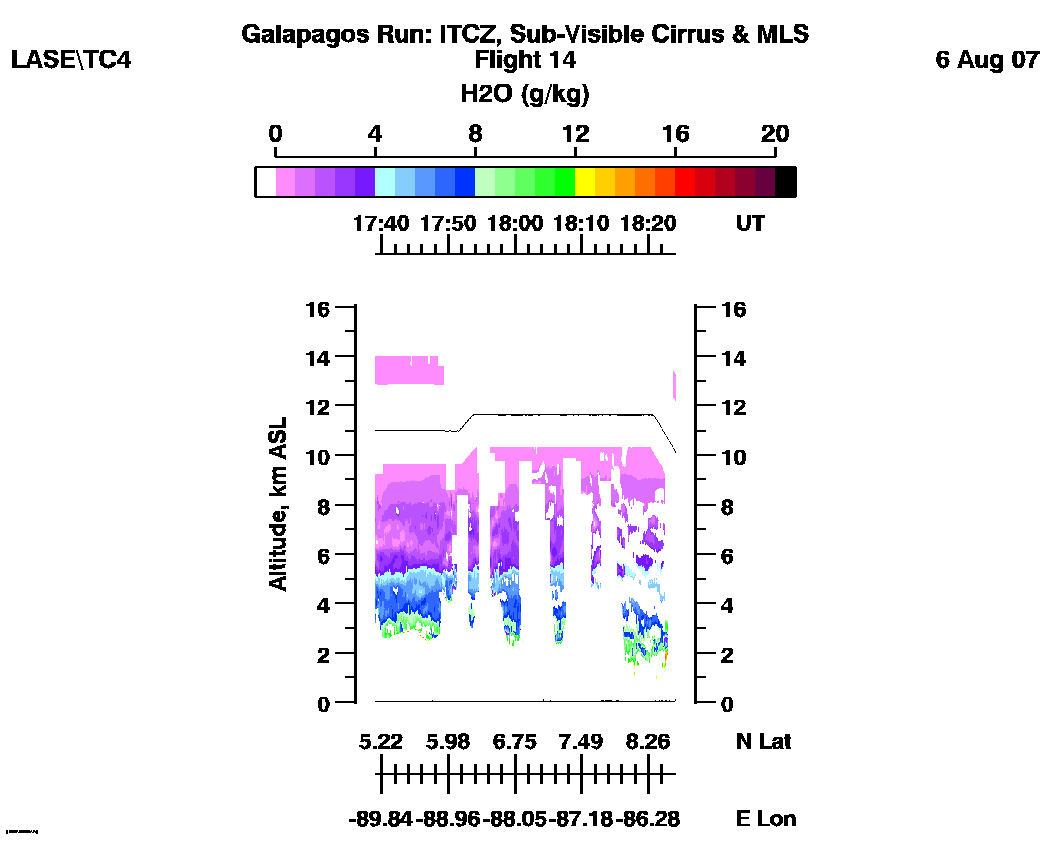
Flight 14 / Galapagos Run, ITCZ & MLS
Underpass / August 6, 2007
DC-8 flight track images | Entire
Flight |
LASE full flight images
(11:54 - 18:24 UT)
| Aerosol | Water Vapor Mixing Ratio (Log Scale) | Water Vapor Mixing Ratio (Linear Scale) |
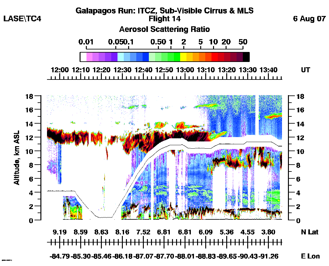
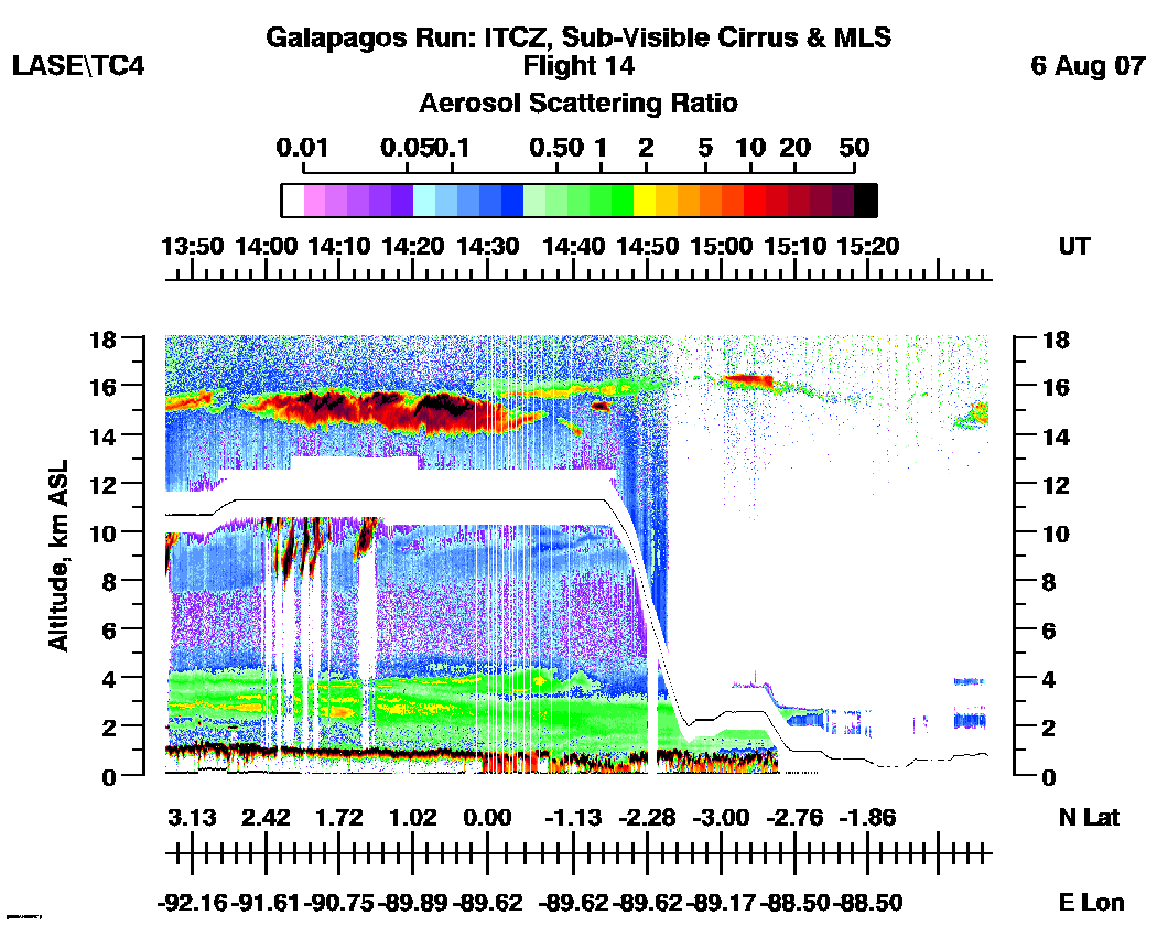
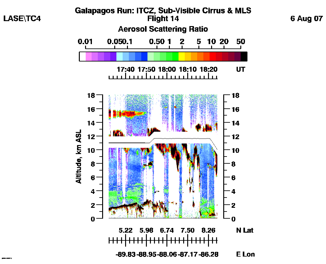
Subset aerosol images
| 11:54 - 13:47 | 13:47 - 15:42 | 15:37 - 17:39 | 17:39 - 18:24|loop |
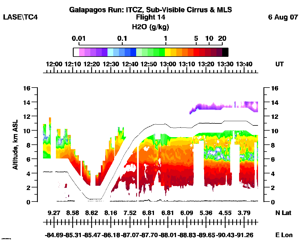
Subset water vapor mixing
ratio images (g/kg)
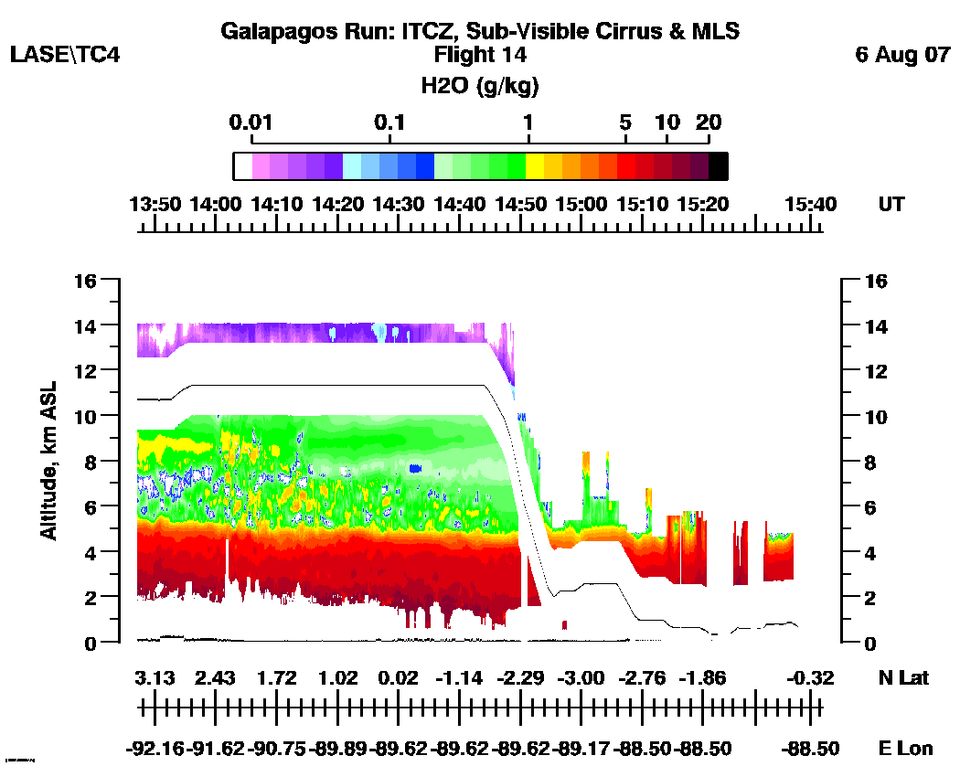
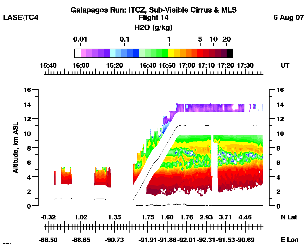
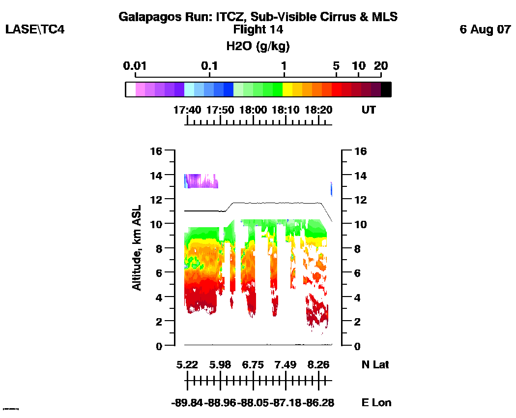
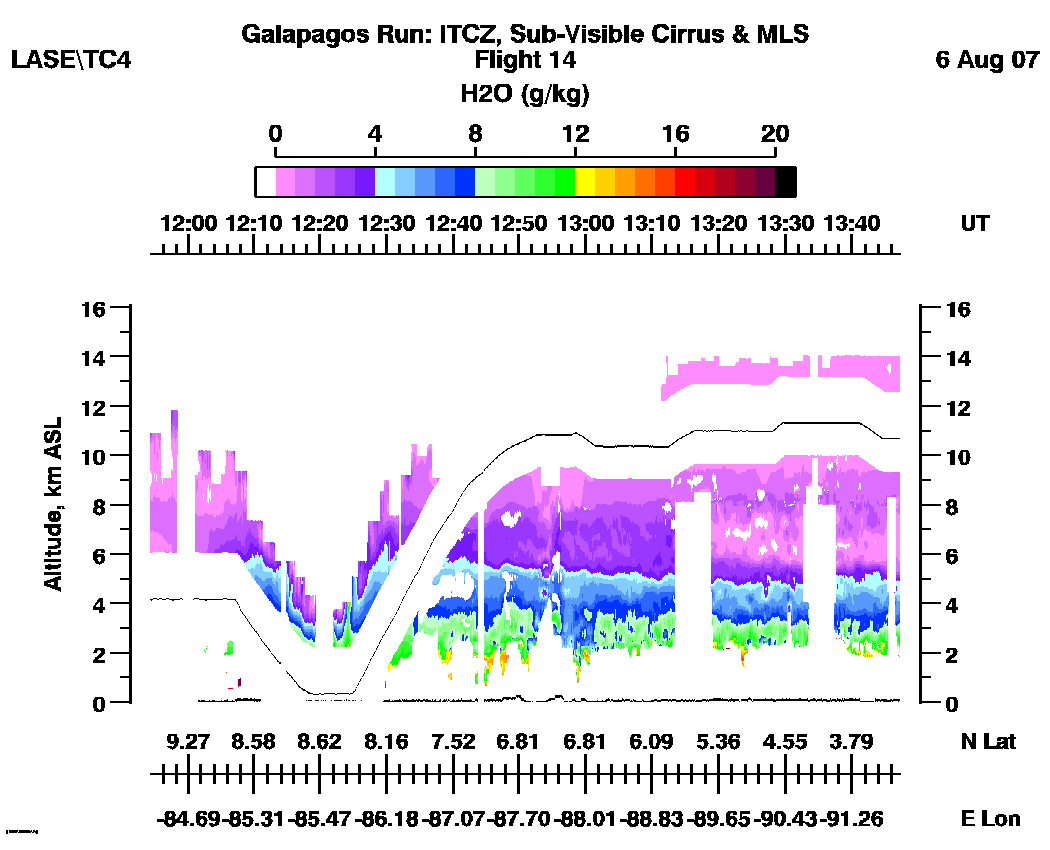
H2O (Log Scale): | 11:54 - 13:47 | 13:47 - 15:42 | 15:37 - 17:39 | 17:39 - 18:24 |loop |
H2O (Linear Scale): | 11:54 - 13:47 | 13:47 - 15:42 | 15:37 - 17:39 | 17:39 - 18:24 |loop |
