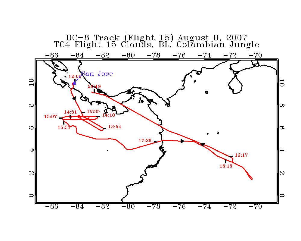
TC4 Flight 15
LASE Aerosol and Water Vapor Distributions
Flight 15 / Clouds, BL, Columbian Jungle/
August 8, 2007
DC-8 flight track images | Entire
Flight |
LASE full flight images
(12:11 - 20:51 UT)
| Aerosol | Water Vapor Mixing Ratio (Log Scale) | Water Vapor Mixing Ratio (Linear Scale) |
Subset aerosol images
| 12:11 - 14:04 | 14:04 - 15:56 | 15:57 - 17:57 | 17:57 - 19:54 | 19:54 - 20:51 | loop |
Subset water vapor mixing
ratio images (g/kg)
H2O (Log Scale): | 12:11 - 14:04 | 14:04 - 15:56 | 15:57 - 17:57 | 17:57 - 19:54 | 19:54 - 20:51 | loop|
H2O (Linear Scale): | 12:11 - 14:04 | 14:04 - 15:56 | 15:57 - 17:57 | 17:57 - 19:54 | 19:54 - 20:51 | loop |
