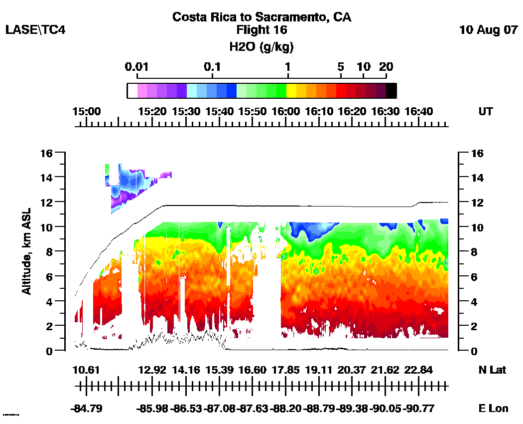
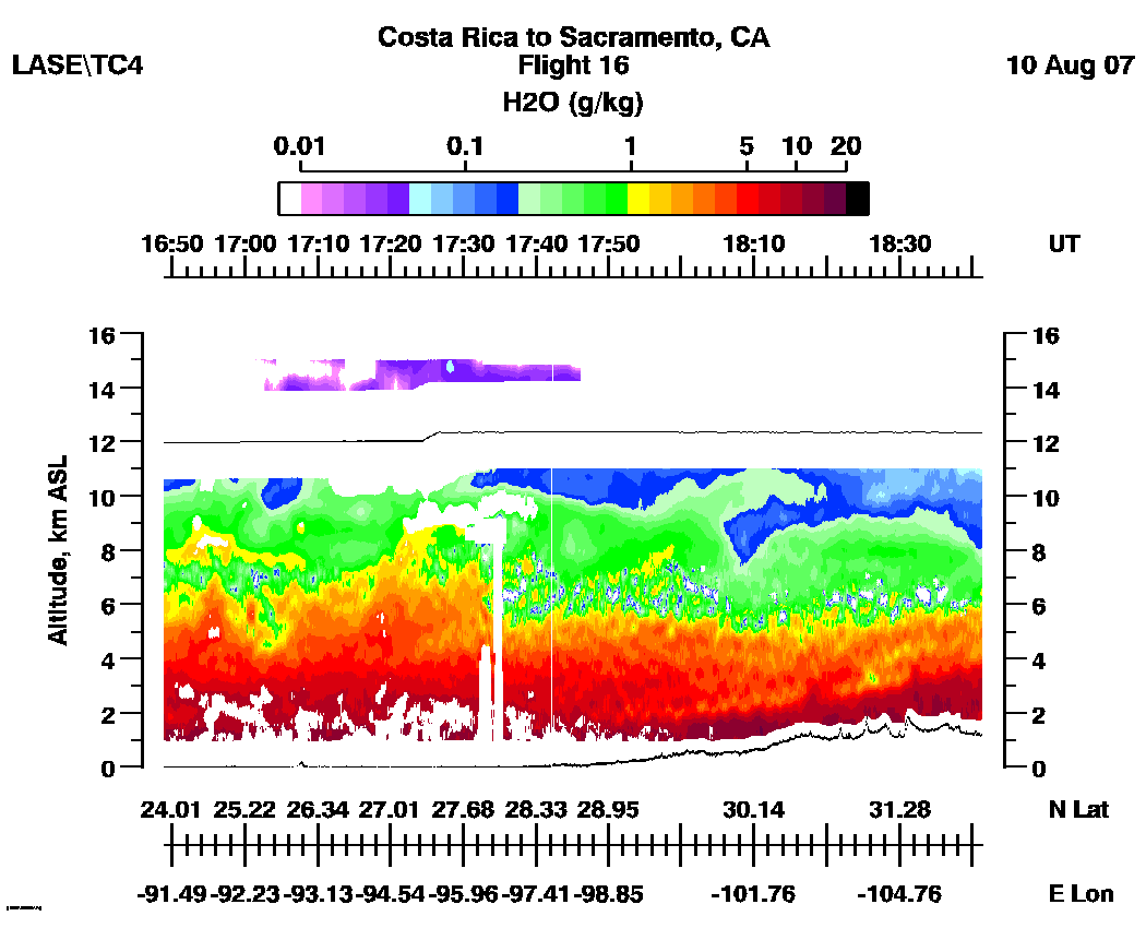
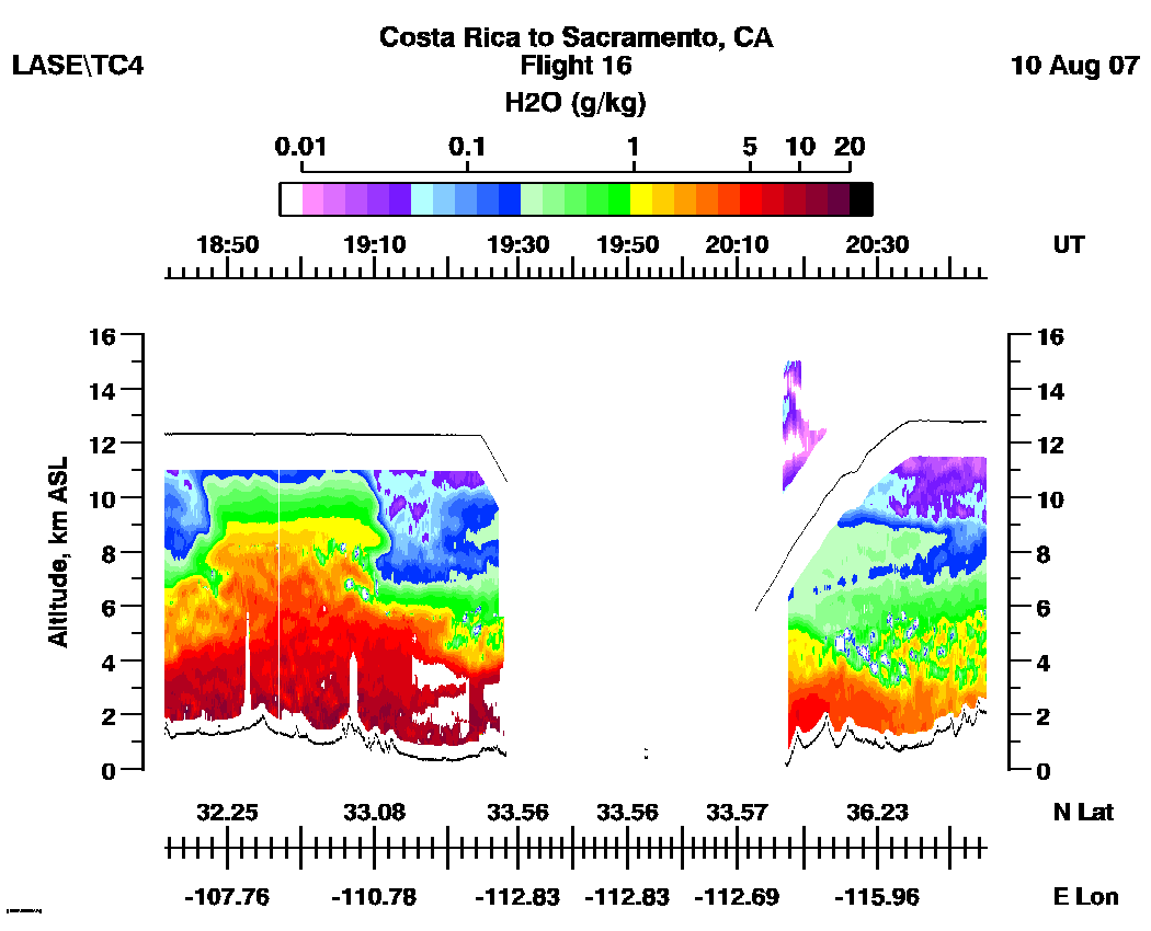
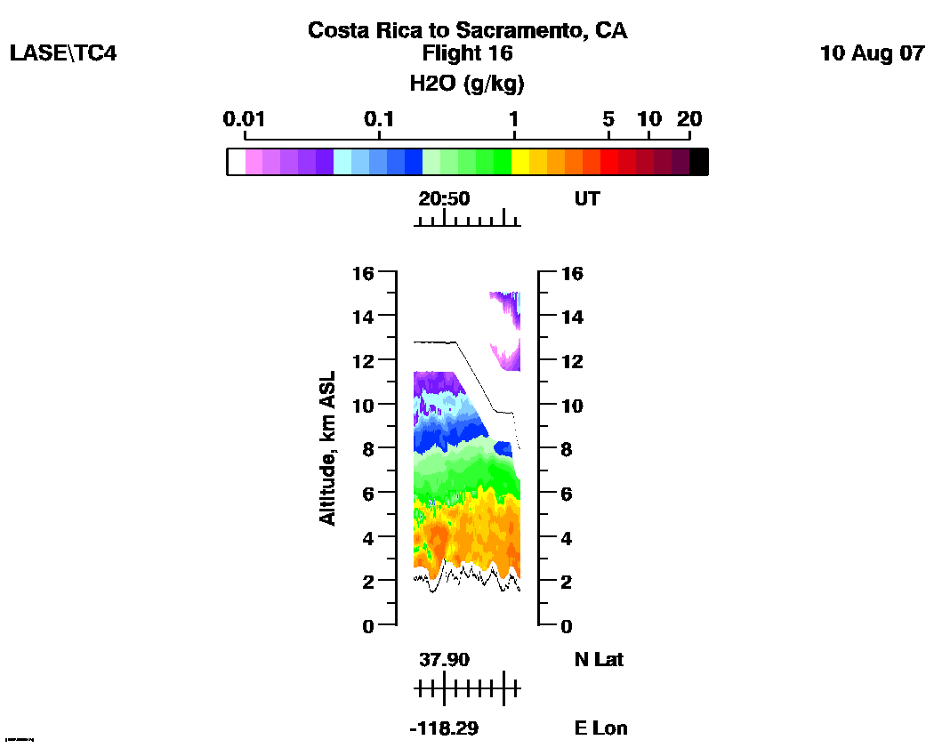
TC4 Flight 16
LASE Aerosol and Water Vapor Distributions
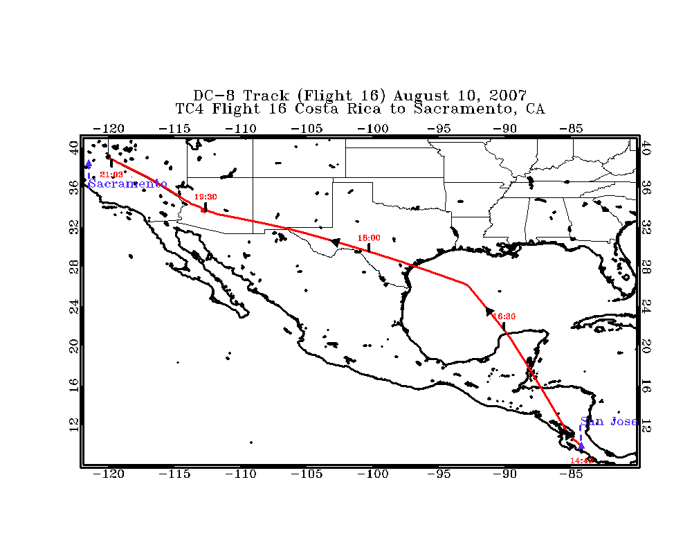
Flight 16 / Costa
Rica to Sacramento ,
CA
DC-8 flight track images | Entire
Flight |
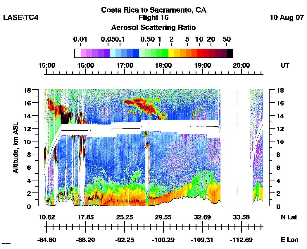
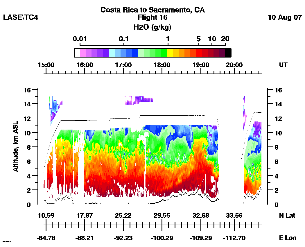
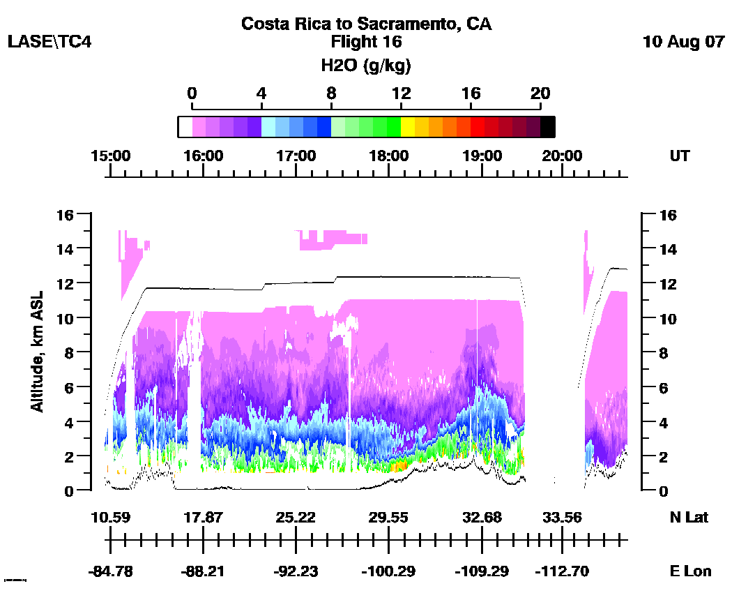
LASE full flight images
(14:56 - 21:02 UT)
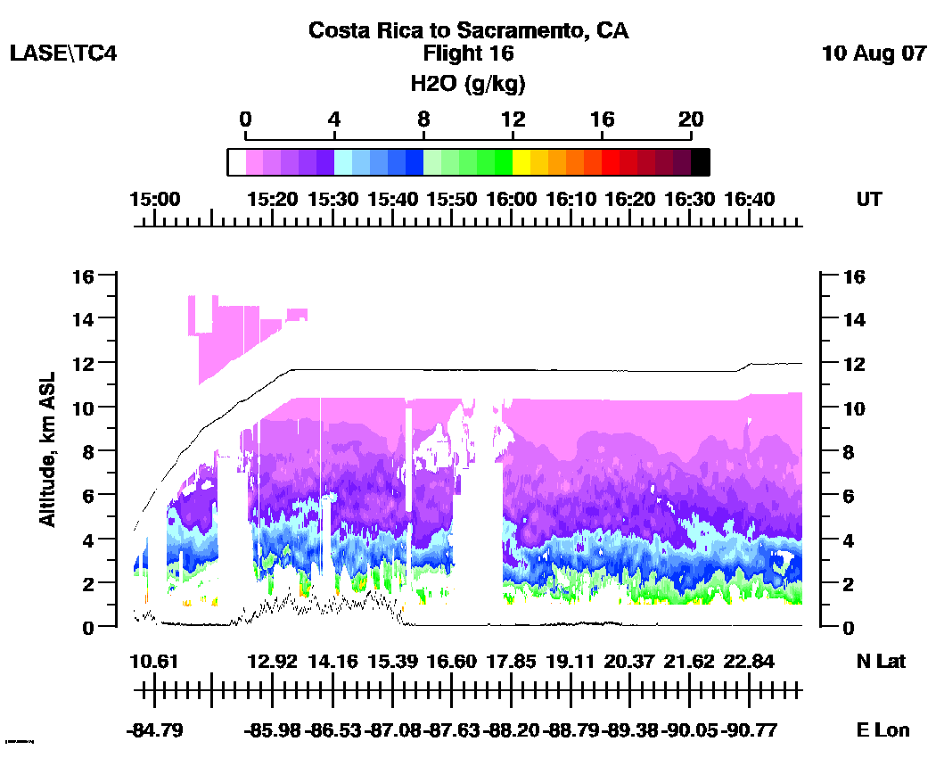
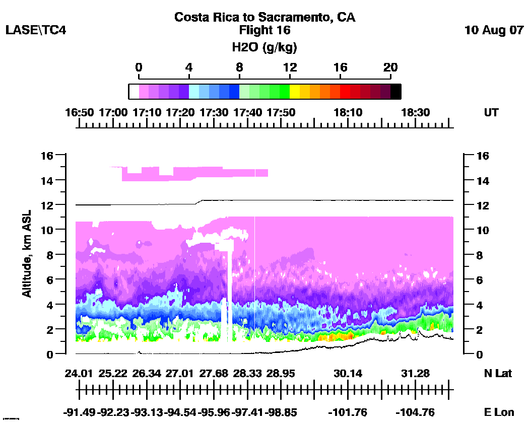
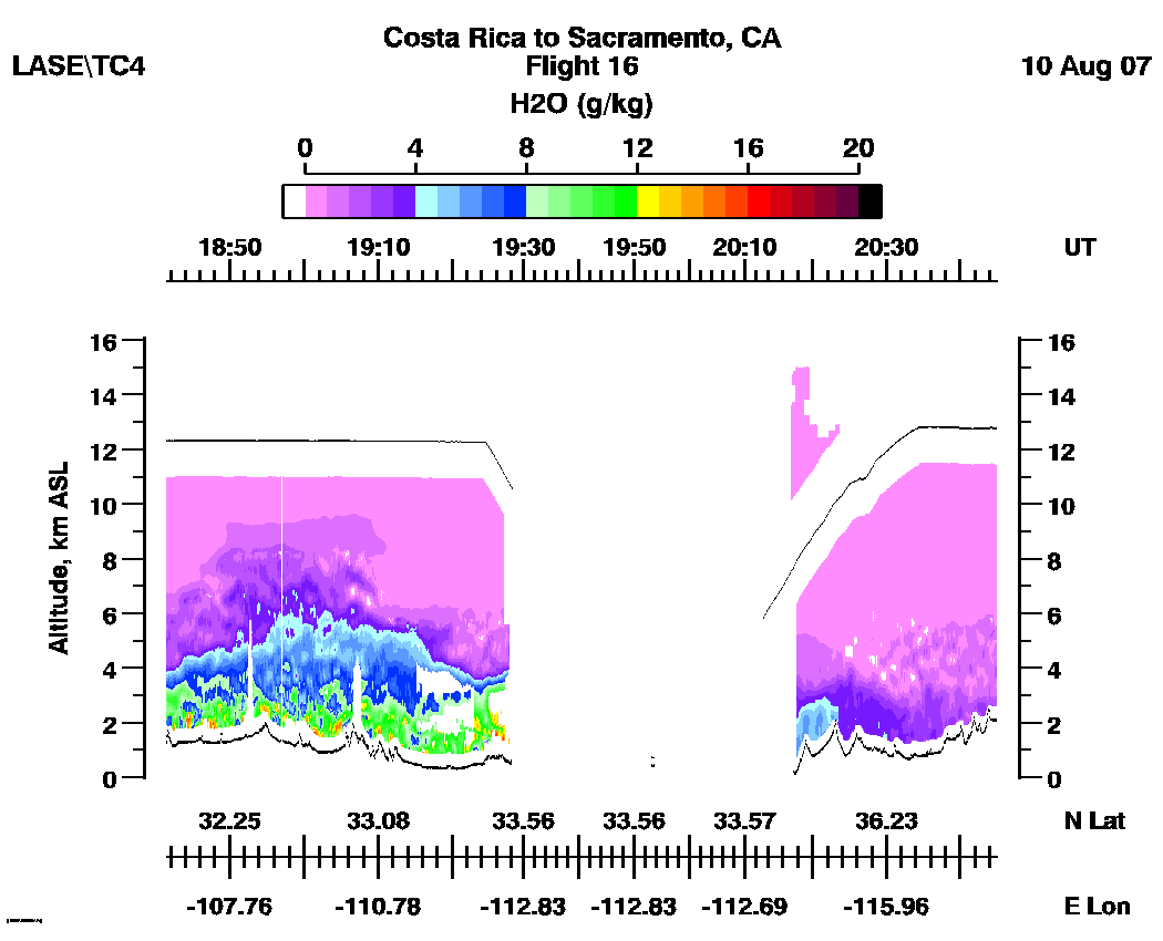
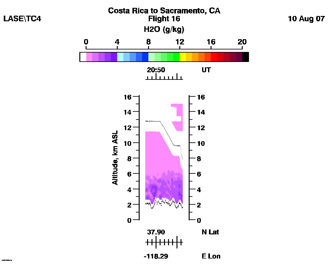
| Aerosol | Water Vapor Mixing Ratio (Log Scale) | Water Vapor Mixing Ratio (Linear Scale) |
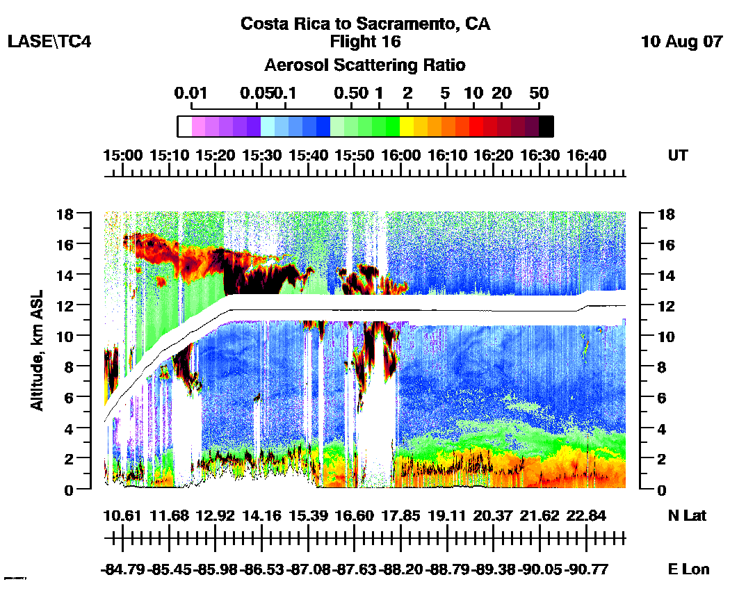
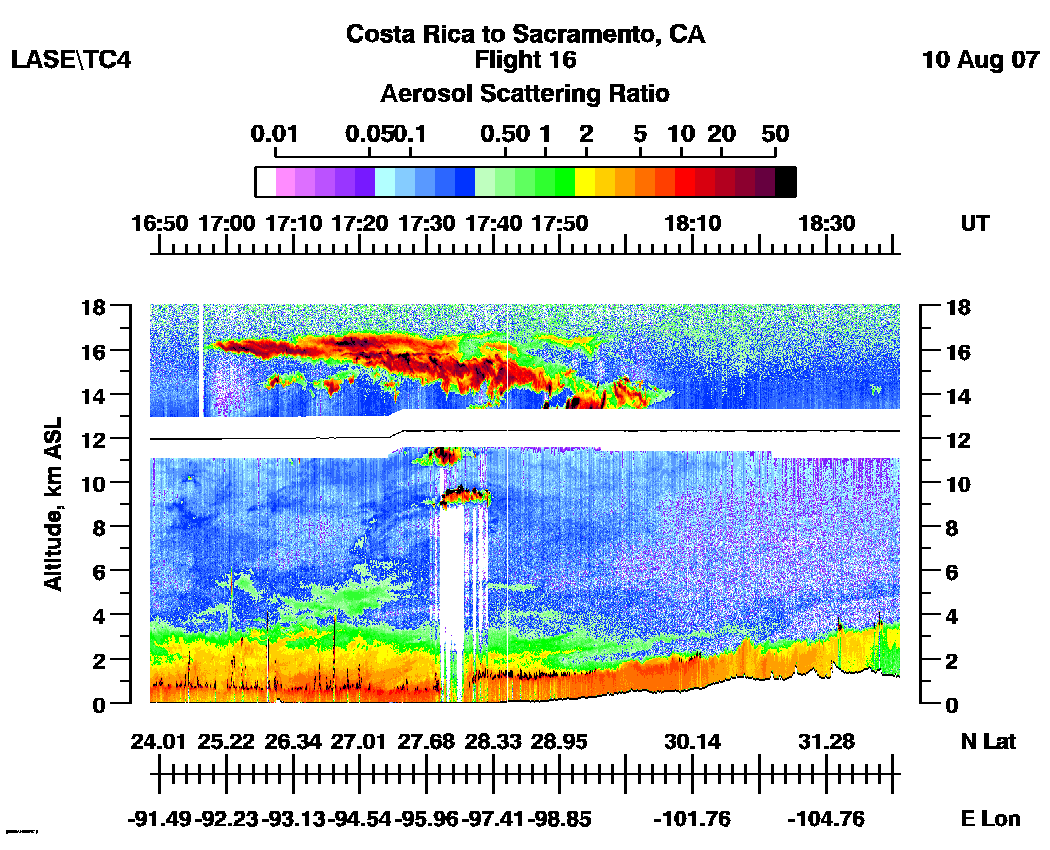
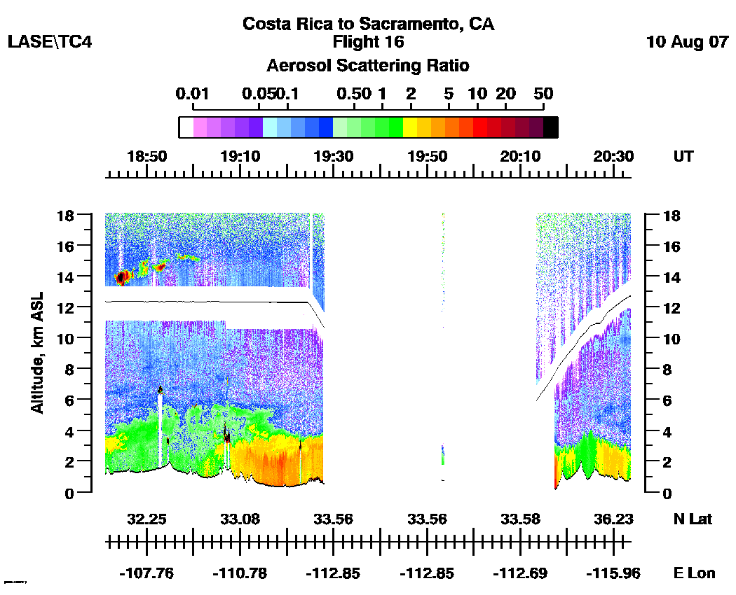
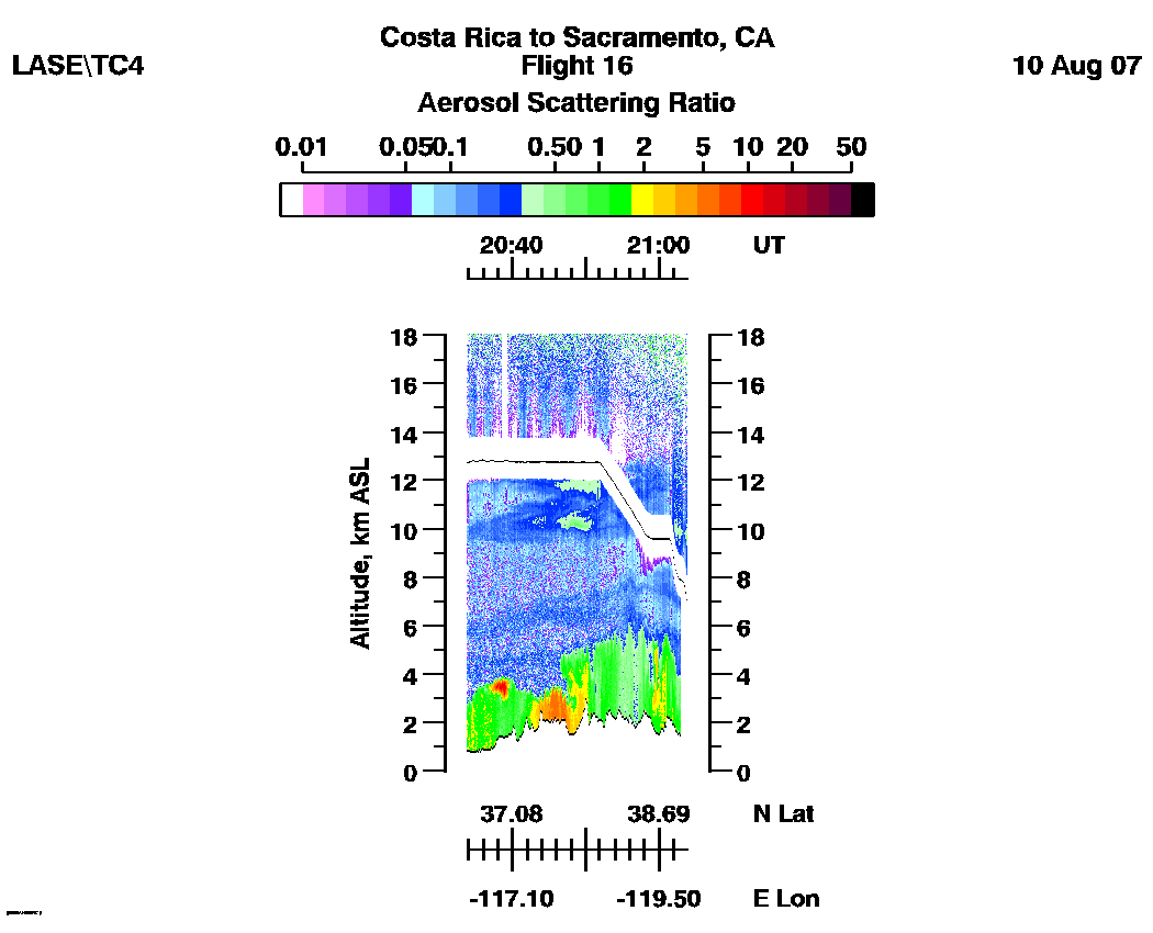
Subset aerosol images
| 14:56 - 16:48 | 16:48 - 18:41 | 18:41 - 20:44 | 20:44 - 21:02 |loop |
Subset water vapor mixing
ratio images (g/kg)
H2O (Log Scale): | 14:56 - 16:48 | 16:48 - 18:41 | 18:41 - 20:44 | 20:44 - 21:02 |loop |
H2O (Linear Scale): | 14:56 - 16:48 | 16:48 - 18:41 | 18:41 - 20:44 | 20:44 - 21:02 | loop |
