
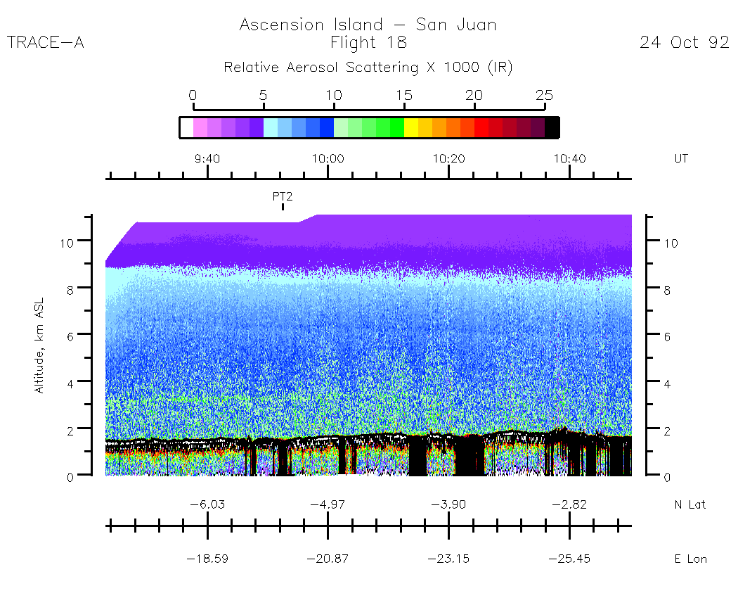
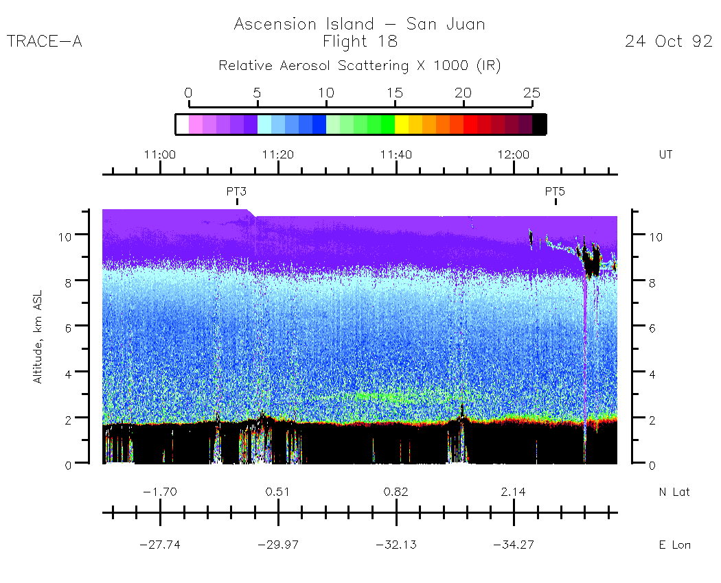
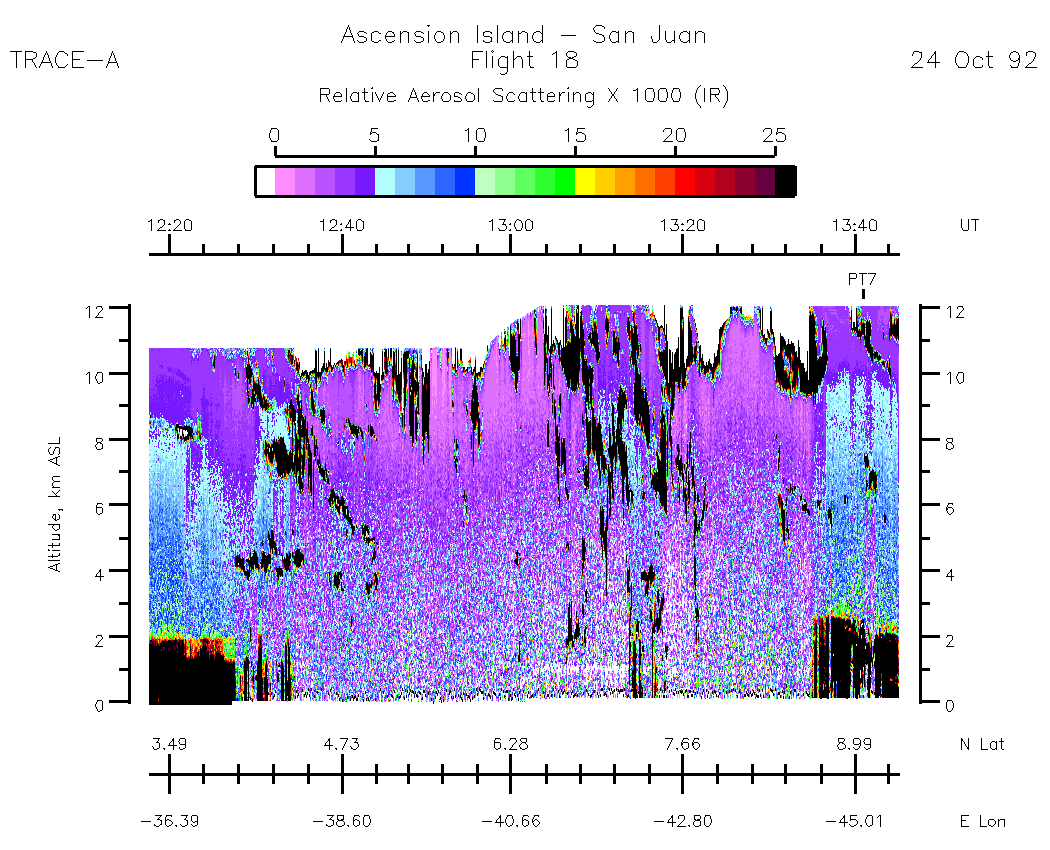
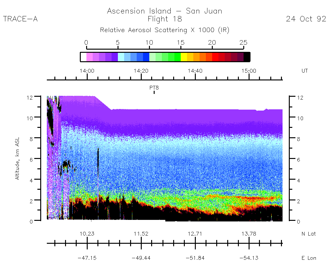
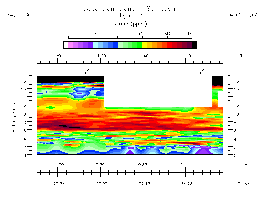
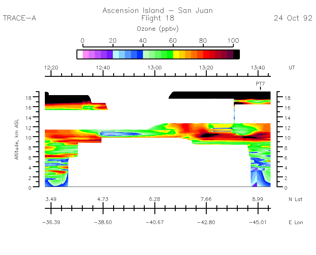
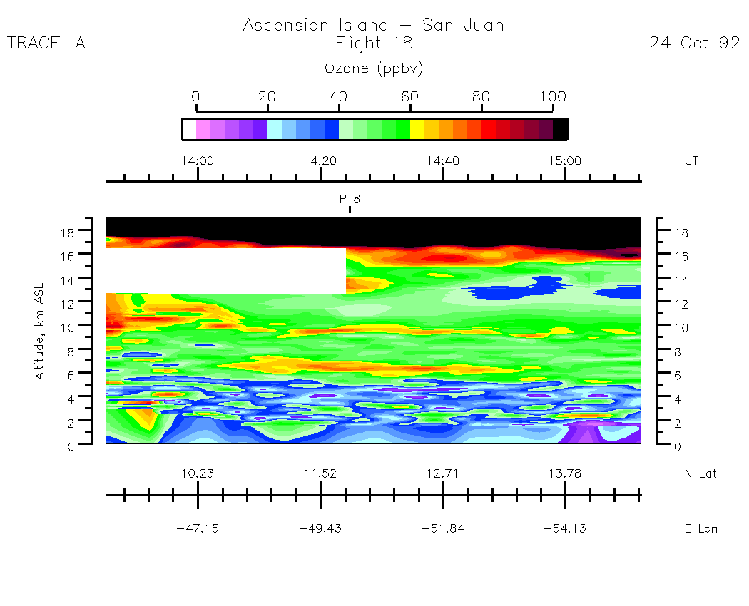
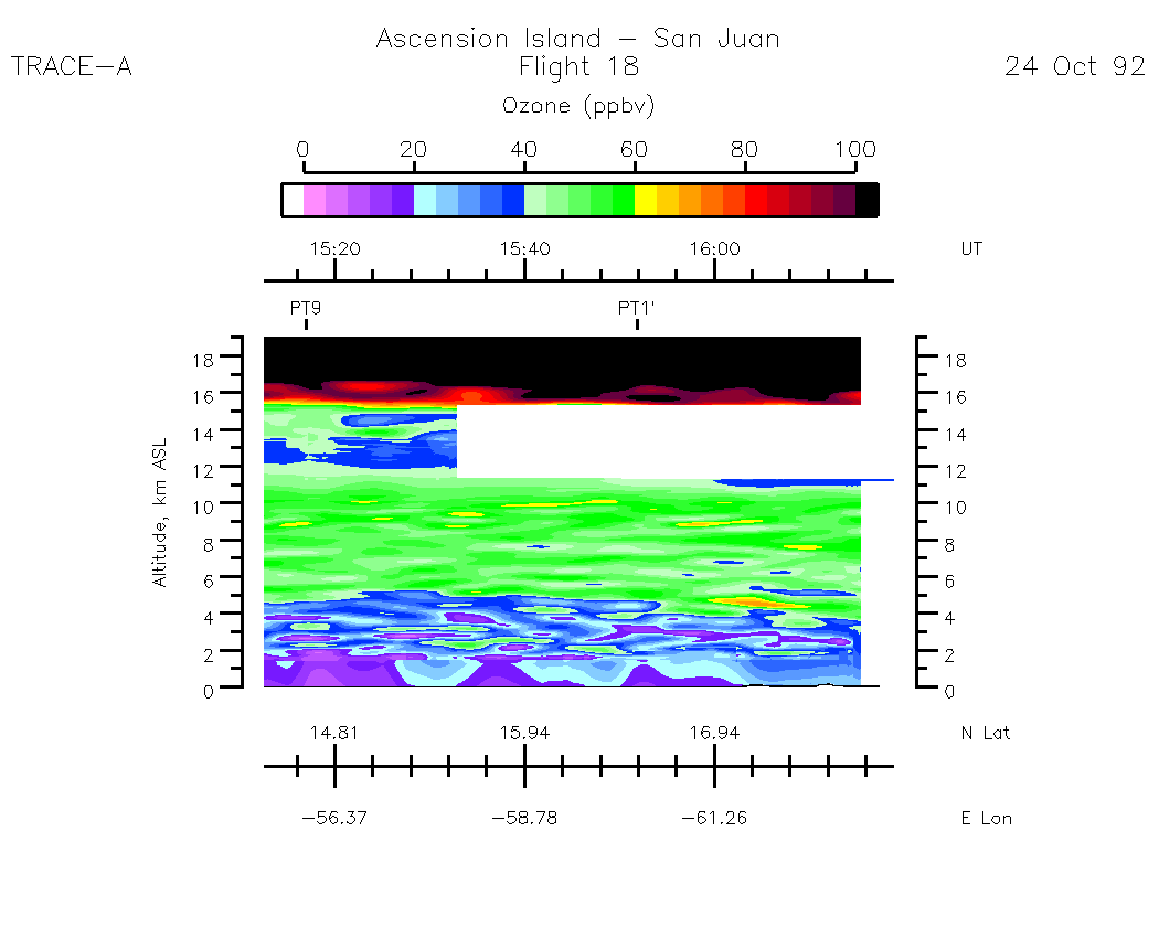
The GIF image dimensions are 1050 X 850 pixels in order to retain resolution. Your WWW browser/GIF viewer may handle the image in various ways. On displays of less than 1050 X 850 pixels the image may have to be scrolled or the image may get resized, losing some clarity of the fonts.
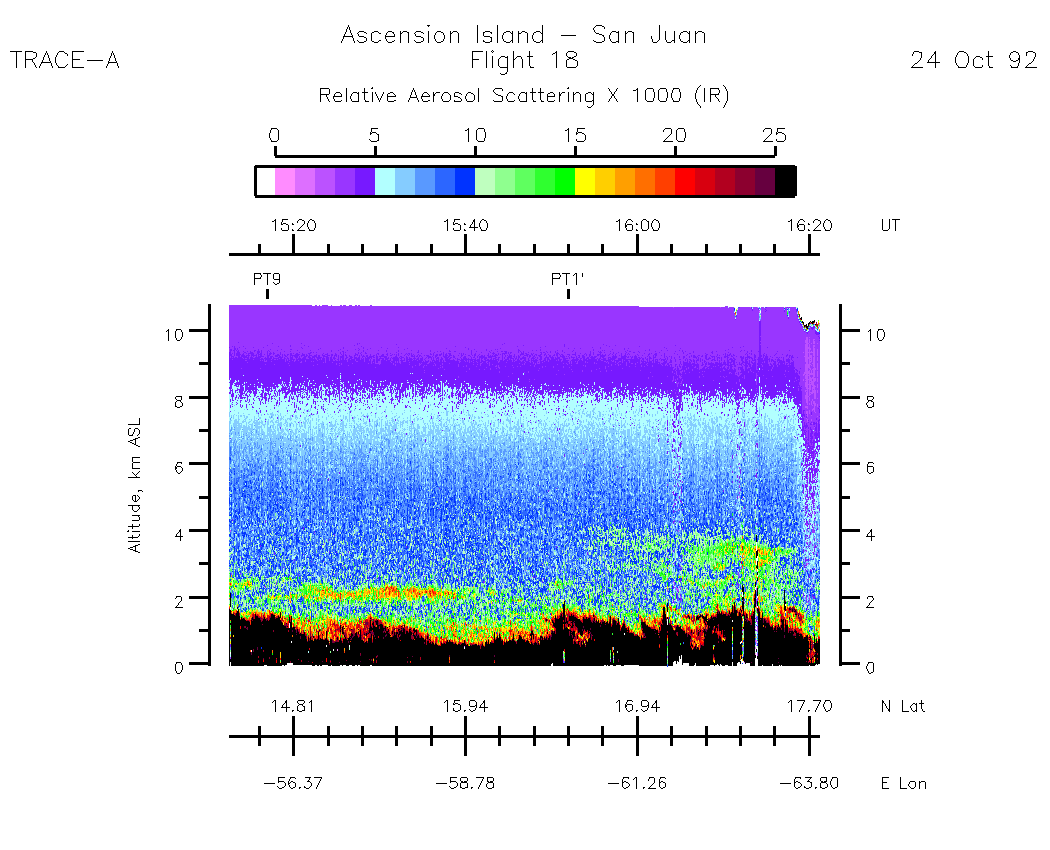
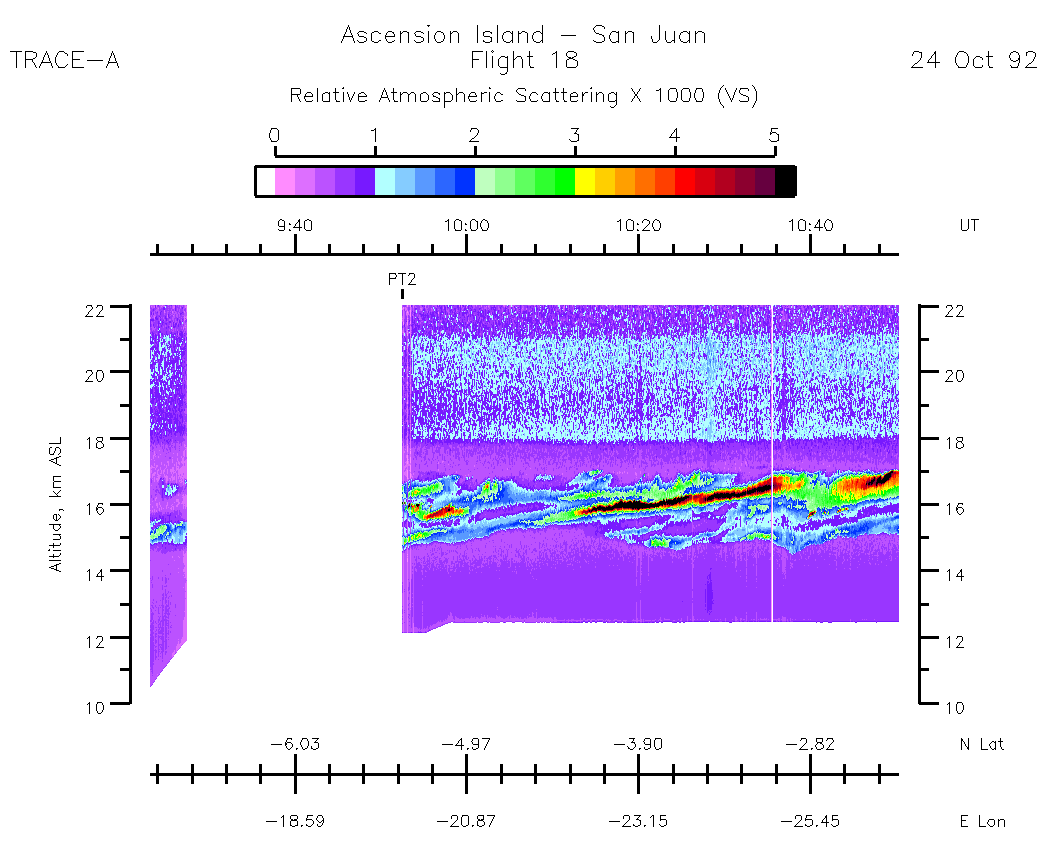
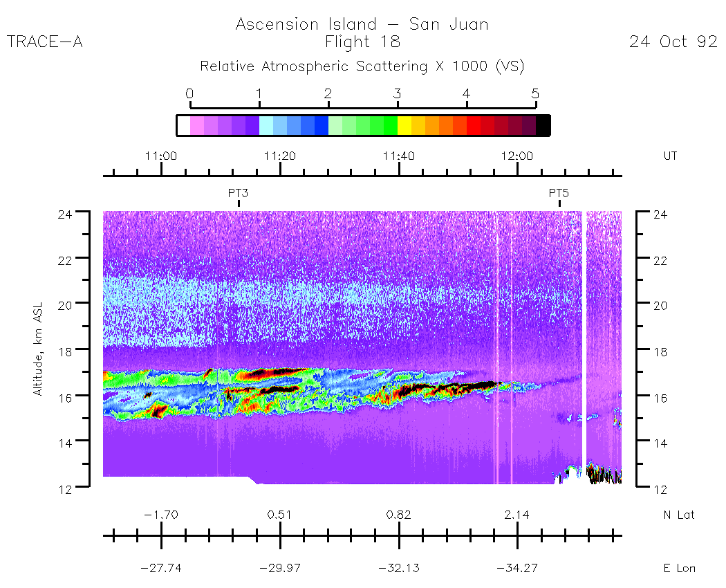
| 09:23:09 - 10:50:22| | 10:52:22 - 12:17:40| | 12:17:41 - 13:45:12| | 13:45:13 - 15:12:32| | 15:12:33 - 16:22:00| |movie loop all|
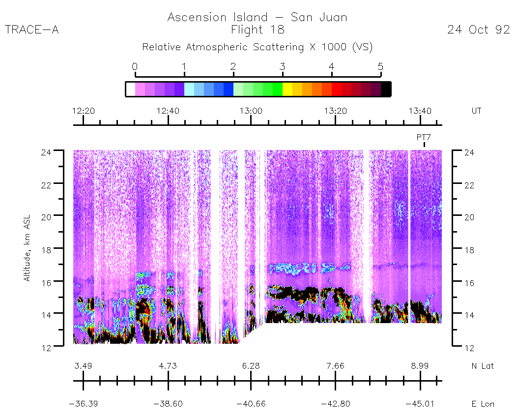
| 09:23:00 - 10:50:22| | 10:50:23 - 12:17:40| | 12:17:41 - 13:45:12| | 13:45:13 - 15:12:32| | 15:12:33 - 16:22:00| |movie loop all|
| entire flight| | 09:23:00 - 10:50:22| | 10:50:23 - 12:17:40| | 12:17:41 - 13:45:12| | 13:45:13 - 15:12:32| | 15:12:33 - 16:22:00| |movie loop all|