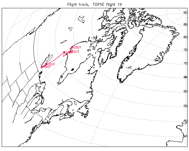
Overview image of Flight Track: | Flight 19 |
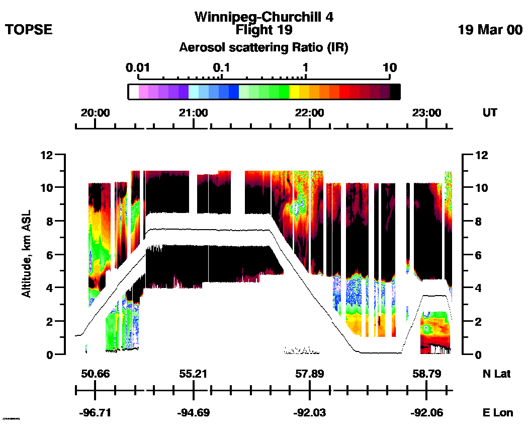
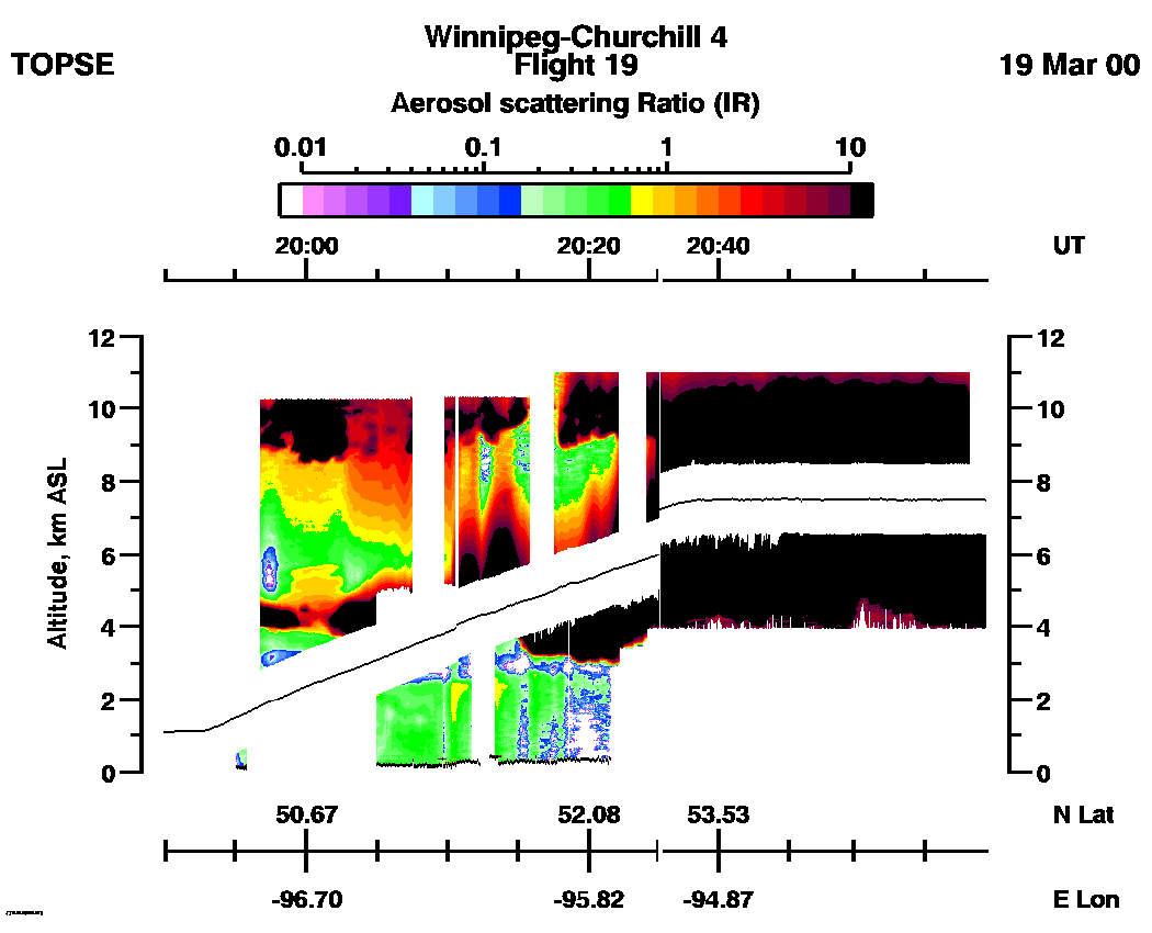
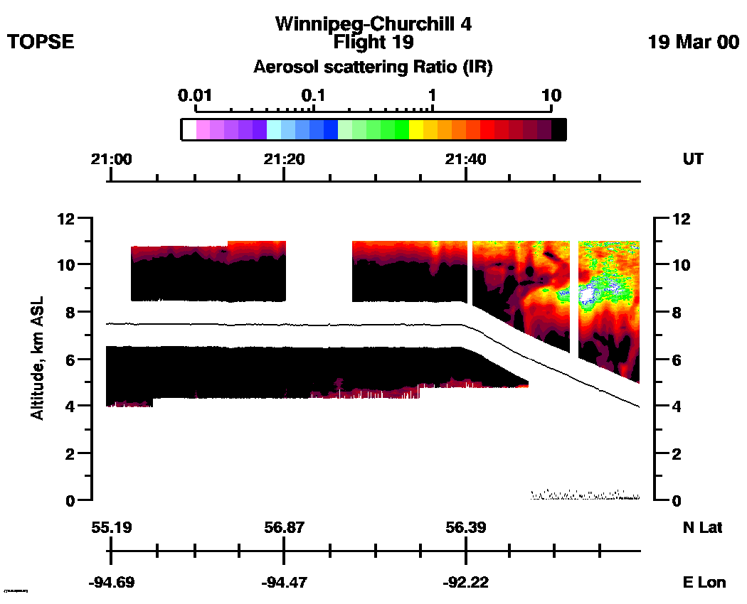
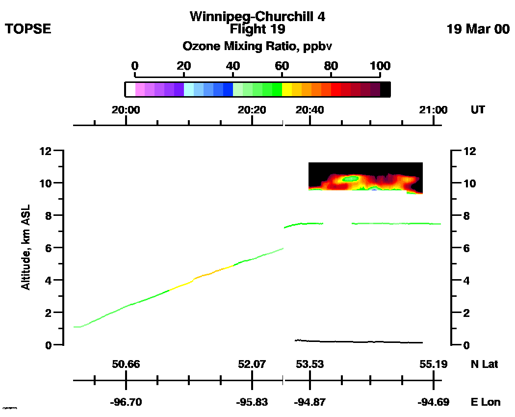
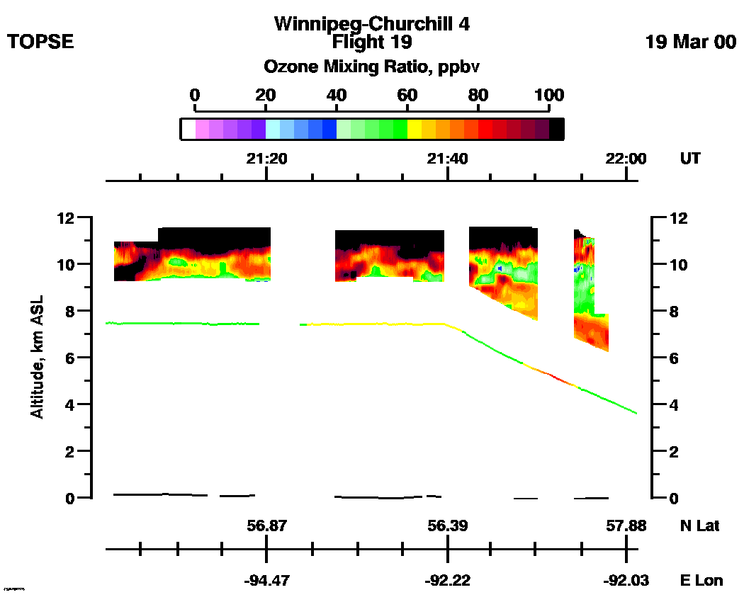
SPECIAL ALERT: Due to extensive cloud effects throughout this flight,we recommend using the Nadir IR Aerosol Scattering Ratio data, (20:30 - 21:50 UT), from this flight only for qualitative information about clouds and atmospheric structure.
Entire Flight Aerosol Scattering Ratio image (IR): | 19:49 - 23:13 |
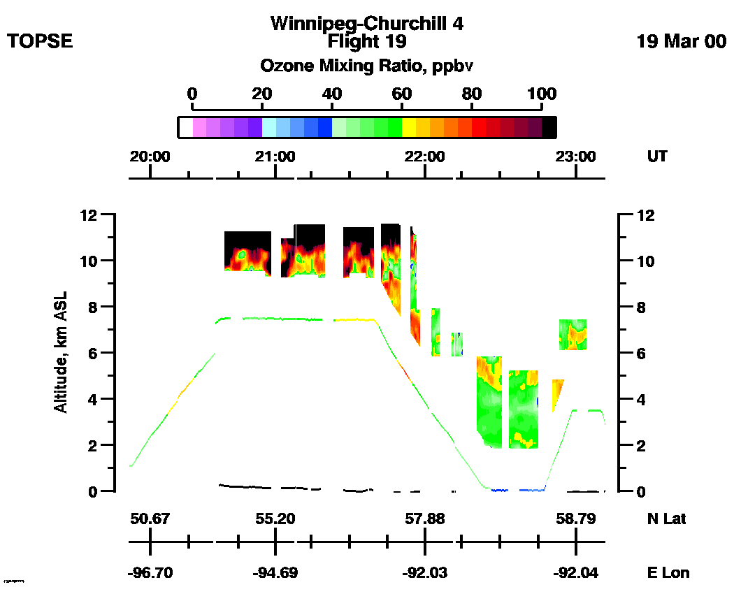
Entire Flight Ozone Mixing Ratio image (Scale: 100 ppbv, 300m range cell): | 19:51 - 23:11 |
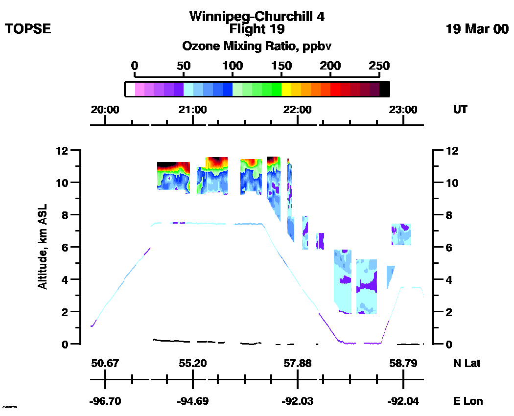
Entire Flight Ozone Mixing Ratio image (Scale: 250 ppbv, 300m range cell): | 19:51 - 23:11 |
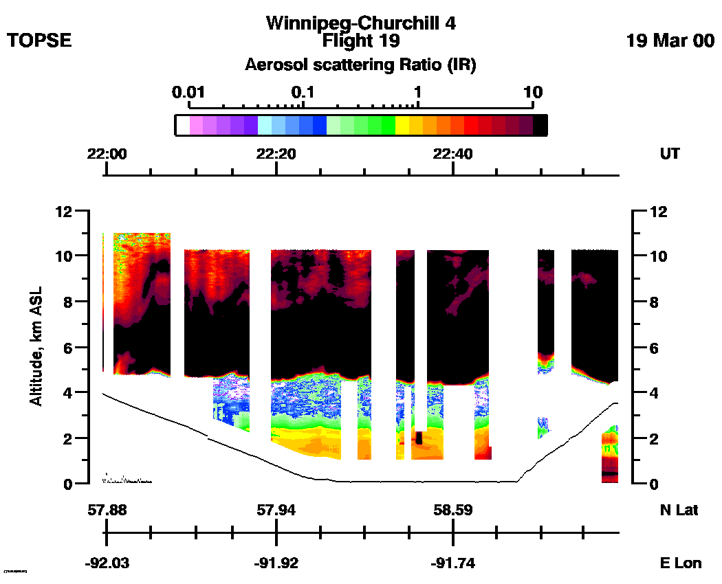
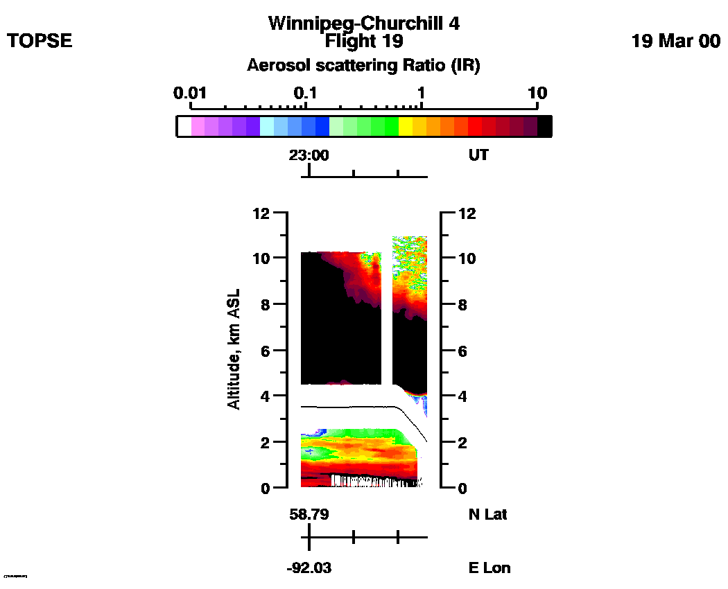
Aerosol Scattering Ratio images (IR): | 19:49 - 20:59 | 20:59 - 21:59 | 21:59 - 22:58 | 22:59 - 23:13 | movie_loop_all |
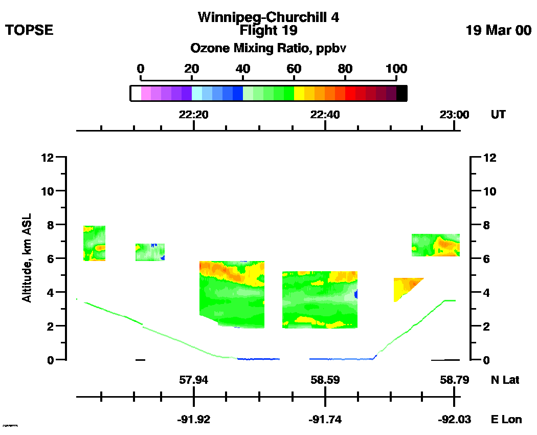
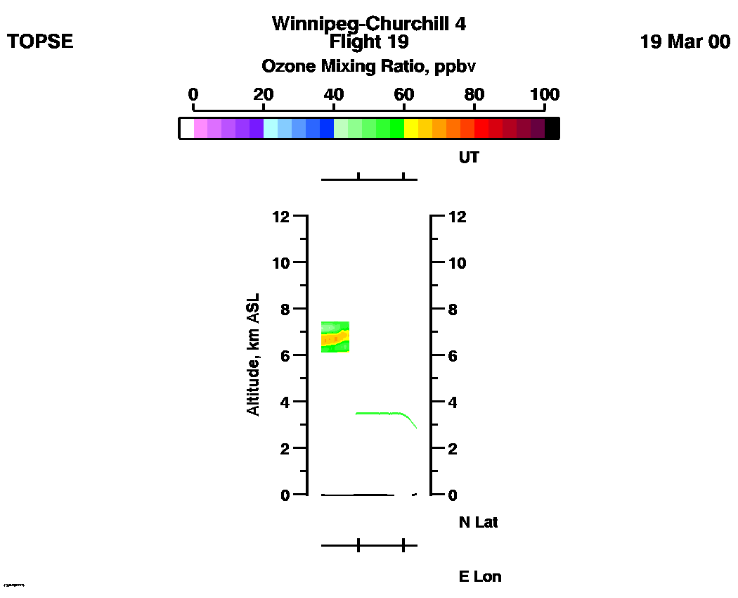
Ozone Mixing Ratio images (Scale: 100 ppbv, 300m range cell): | 19:51 - 21:01 | 21:01 - 22:01 | 22:01 - 23:00 | 23:00 - 23:11 | movie_loop_all |
