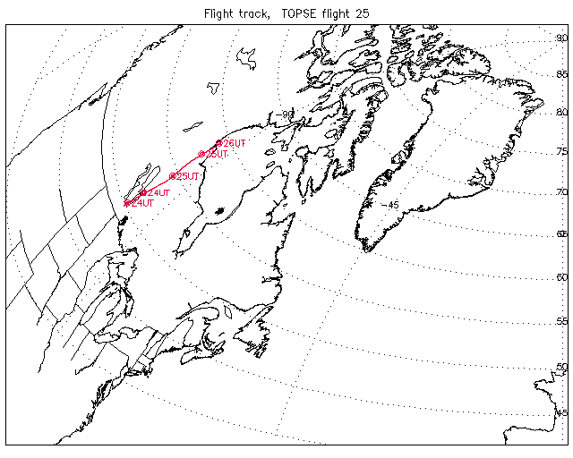
Overview image of Flight Track: | Flight 25 |
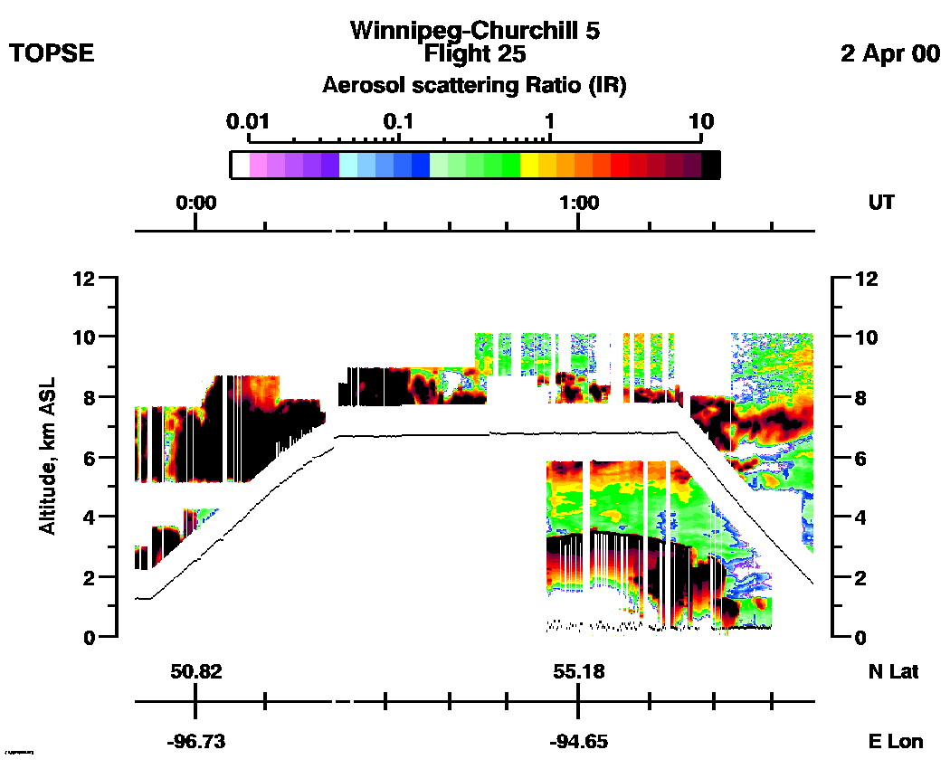
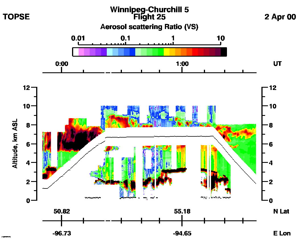
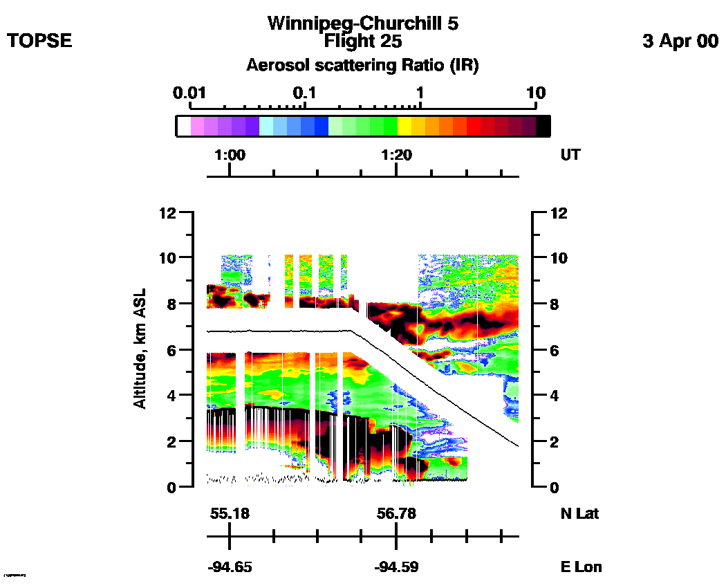
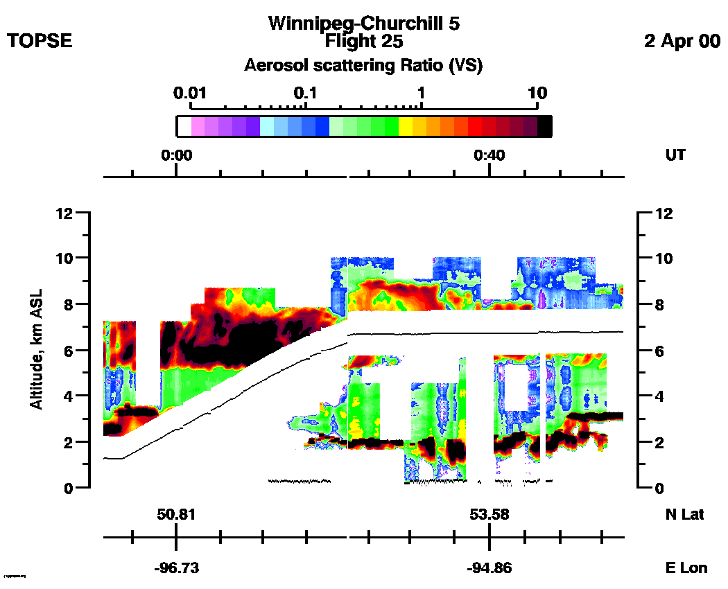
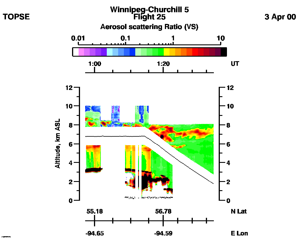
SPECIAL ALERT: Due to extensive cloud effects throughout this flight,we recommend using the VS Aerosol Scattering Ratio data from this flight only for qualitative information about clouds and atmospheric structure.
Entire Flight Aerosol Scattering Ratio image (IR): | 23:51 - 01:37 |
Entire Flight Aerosol Scattering Ratio image (VS): | 23:51 - 01:37 |
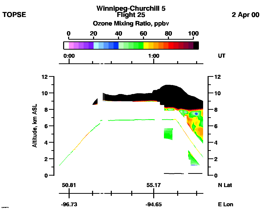
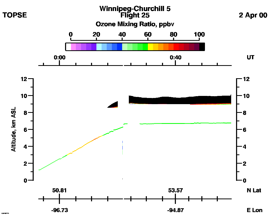
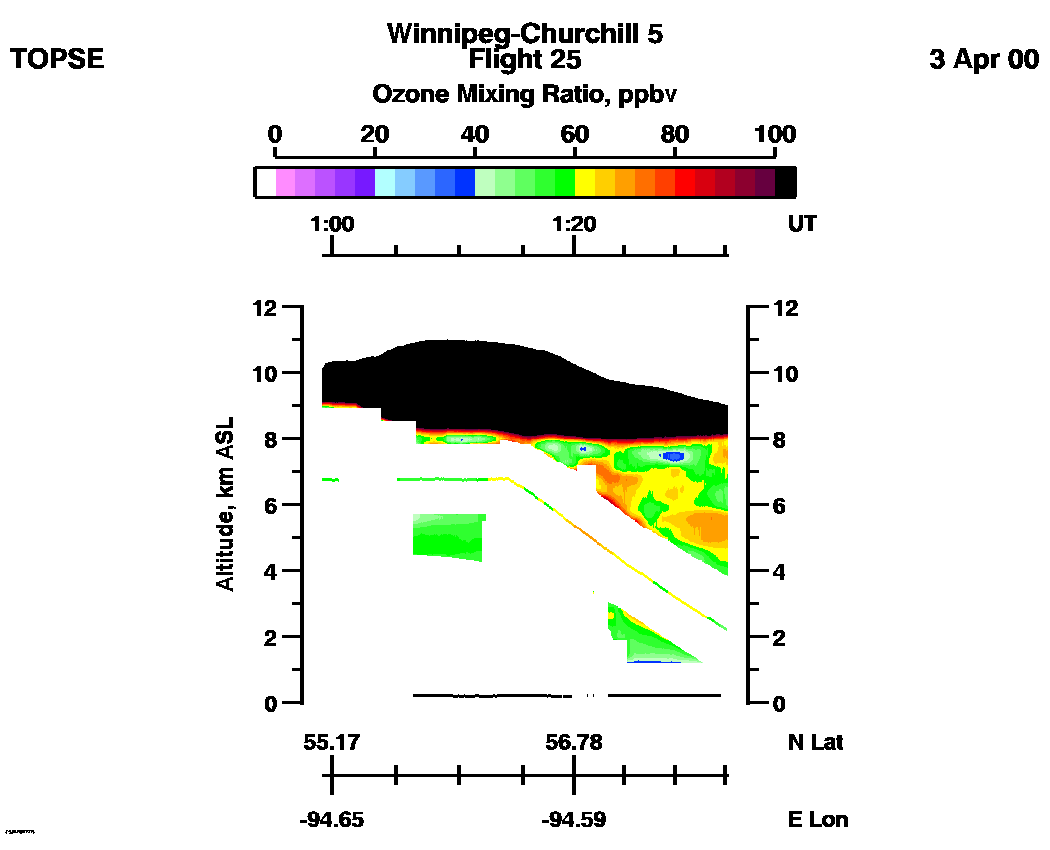
Entire Flight Ozone Mixing Ratio image (Scale: 100 ppbv, 300m range cell): | 23:53 - 01:35 |
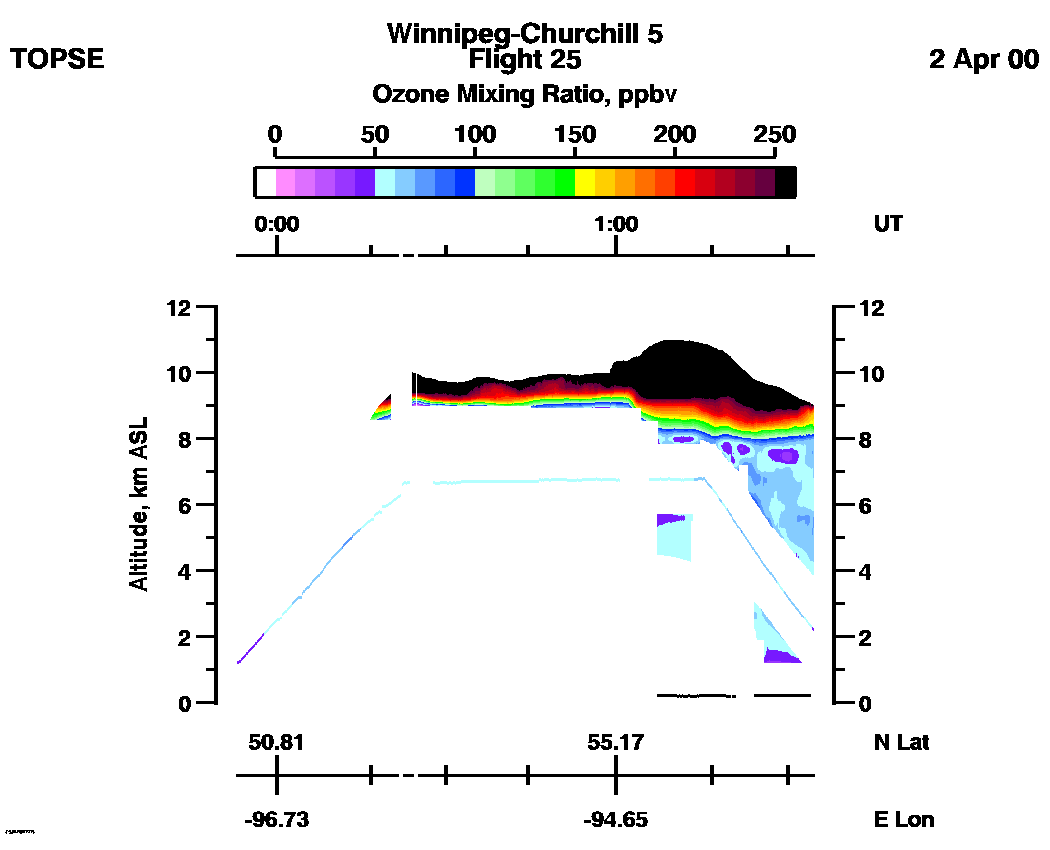
Entire Flight Ozone Mixing Ratio image (Scale: 250 ppbv, 300m range cell): | 23:53 - 01:35 |
Aerosol Scattering Ratio images (IR): | 23:51 - 00:57 | 00:57 - 01:37 | movie_loop_all |
Aerosol Scattering Ratio images (VS): | 23:51 - 00:57 | 00:57 - 01:37 | movie_loop_all |
Ozone Mixing Ratio images (Scale: 100 ppbv, 300m range cell): | 23:53 - 00:59 | 00:59 - 01:35 | movie_loop_all |
