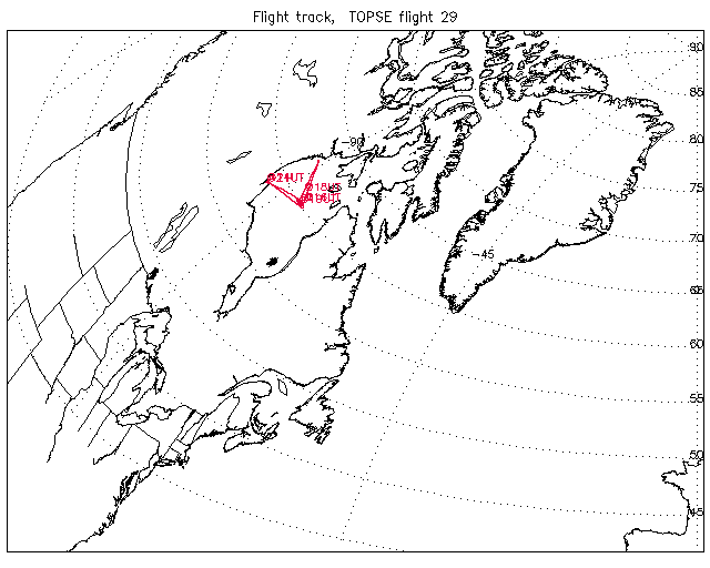
Overview image of Flight Track: | Flight 29 |
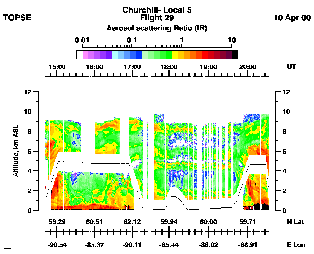
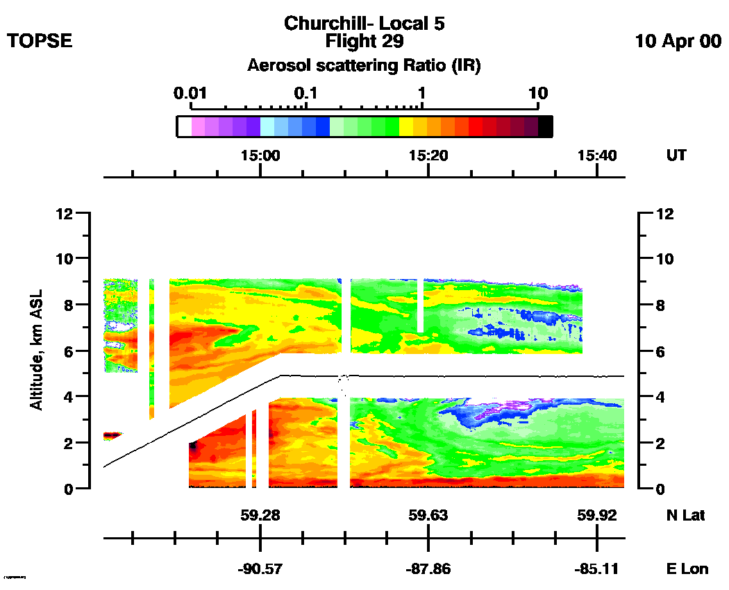
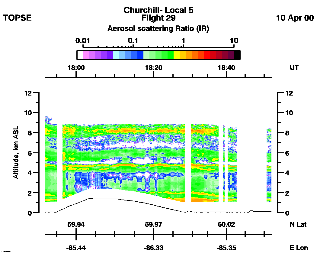
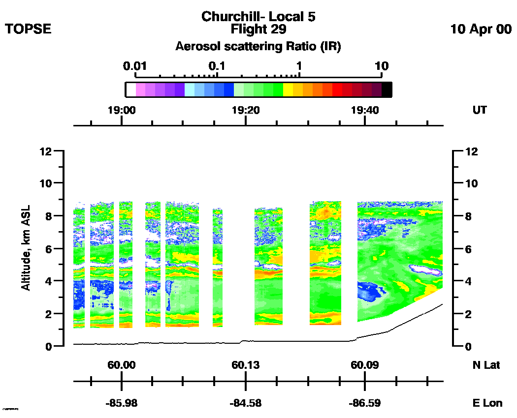
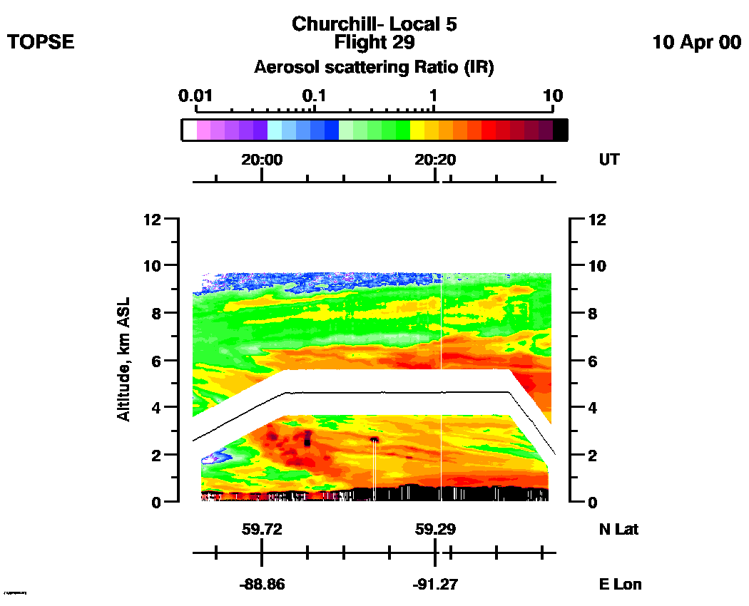
SPECIAL ALERT: Due to extensive cloud effects throughout this flight,we recommend using the IR Aerosol Scattering Ratio data, (17:55 - 19:45 UT), from this flight only for qualitative information about clouds and atmospheric structure.
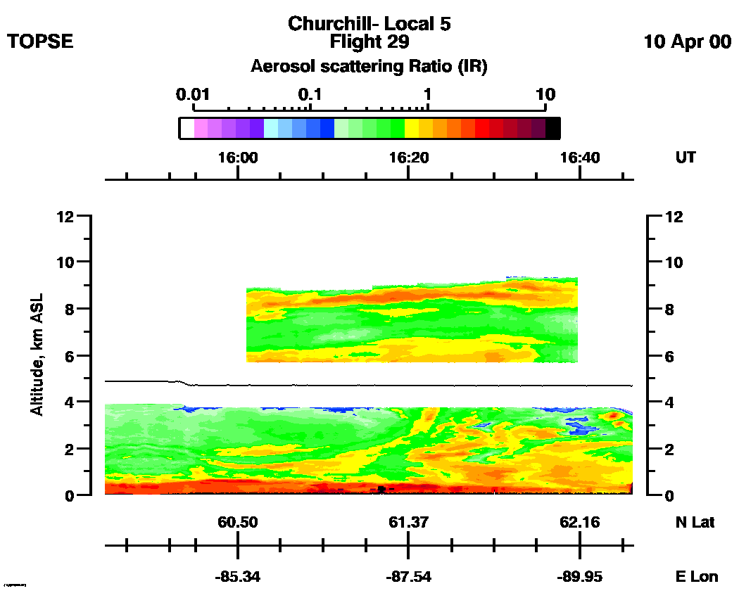
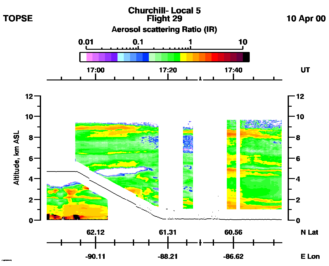
Entire Flight Aerosol Scattering Ratio image (IR): | 14:41 - 20:36 |
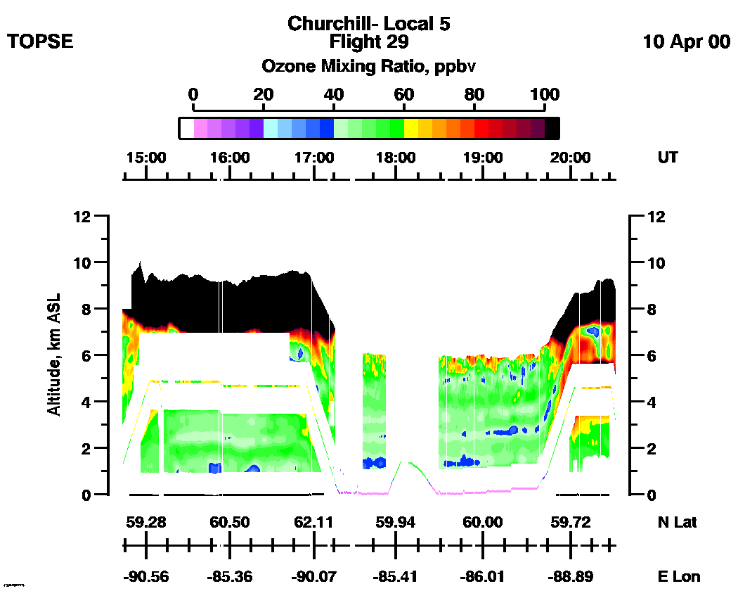
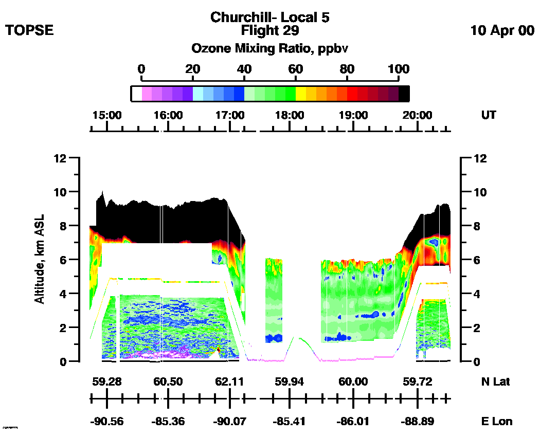
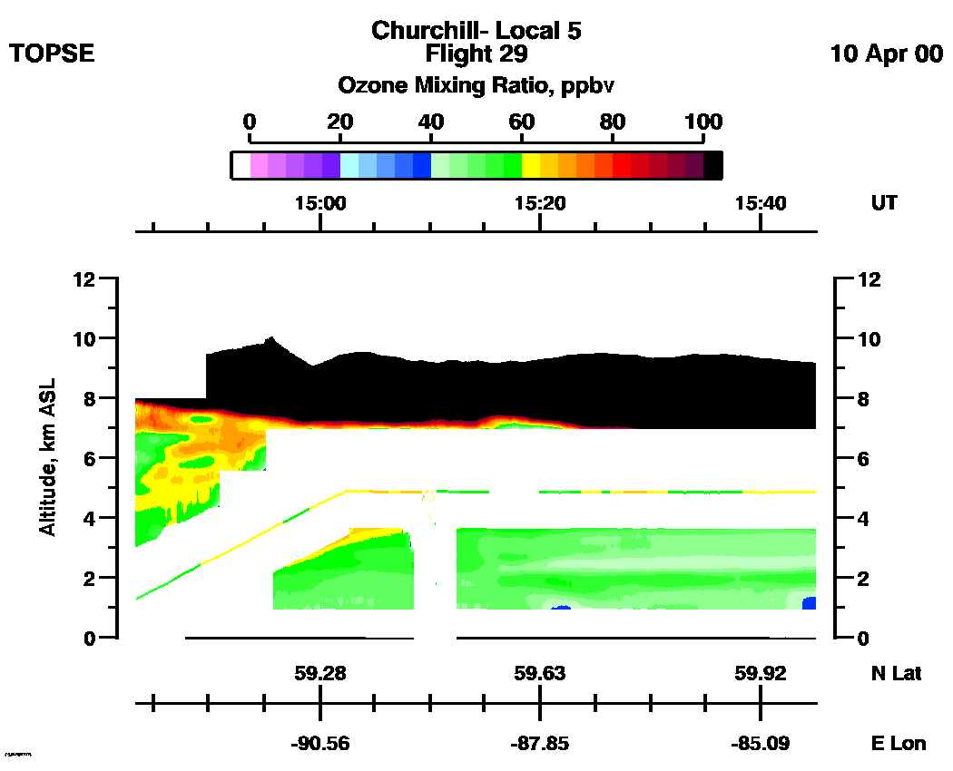
Entire Flight Ozone Mixing Ratio image (Scale: 100 ppbv, 300m range cell): | 14:43 - 20:34 |
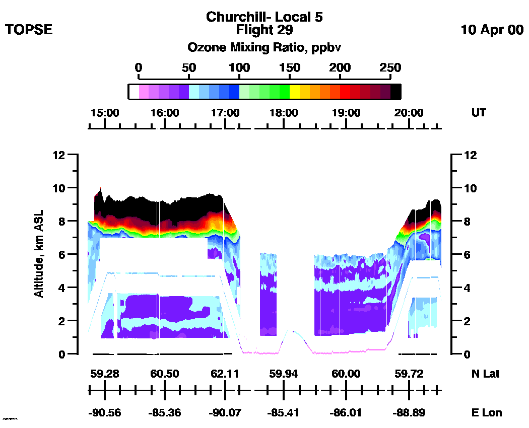
Entire Flight Ozone Mixing Ratio image (Scale: 250 ppbv, 300m range cell): | 14:43 - 20:34 |
Entire Flight Ozone Mixing Ratio image (Scale: 100 ppbv, 100m range cell nadir, 300 meter range cell zenith): | 14:43 - 20:34 |
Aerosol Scattering Ratio images (IR): | 14:41 - 15:42 | 15:42 - 16:46 | 16:46 - 17:52 | 17:52 - 18:51 | 18:51 - 19:52 | 19:52 - 20:36 | movie_loop_all |
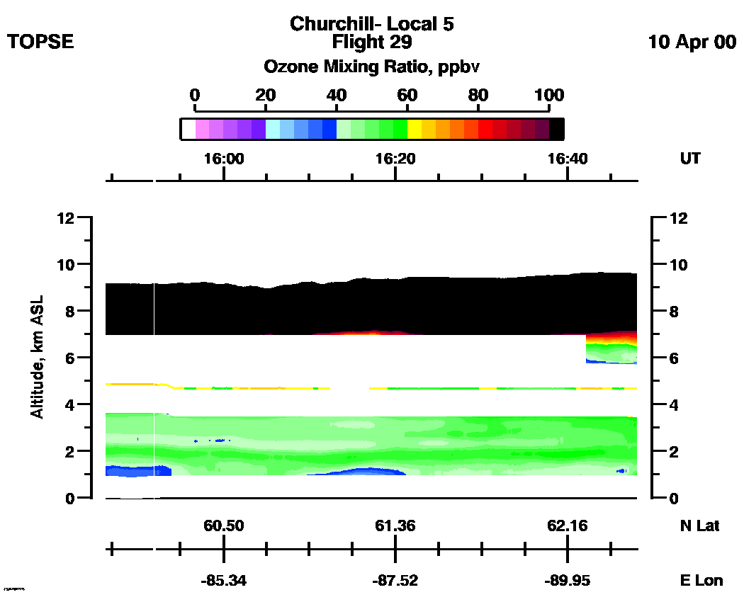
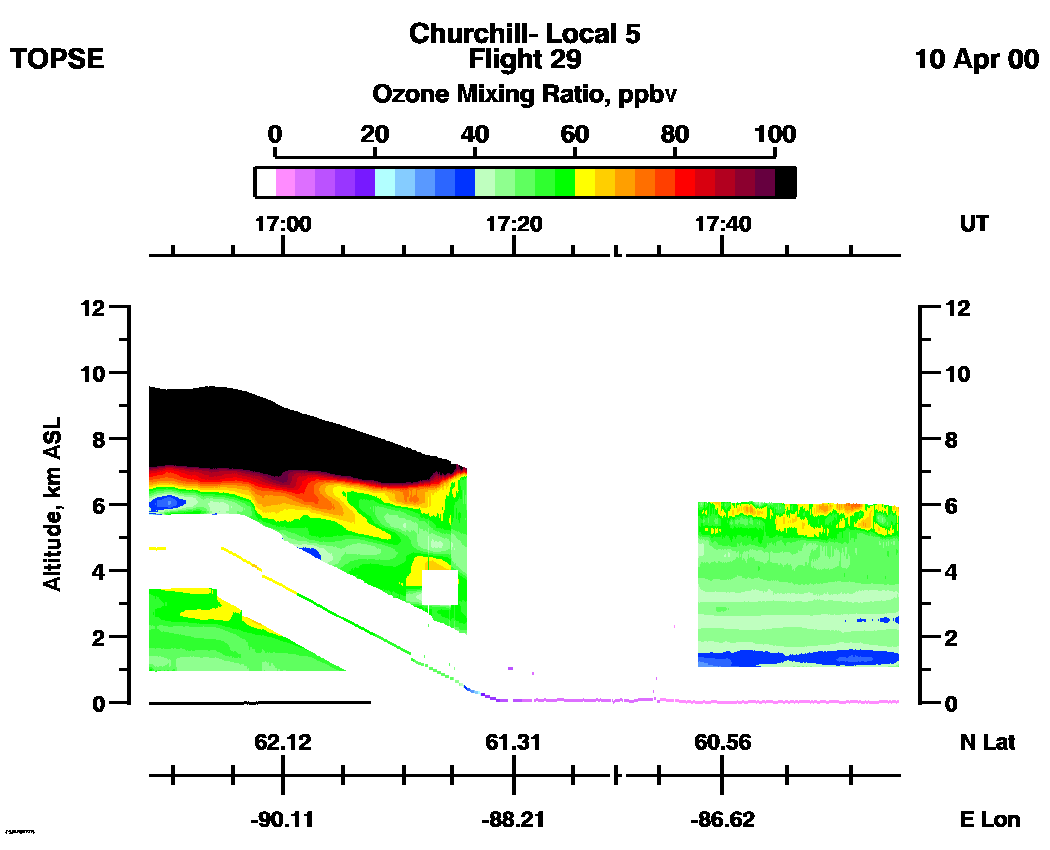
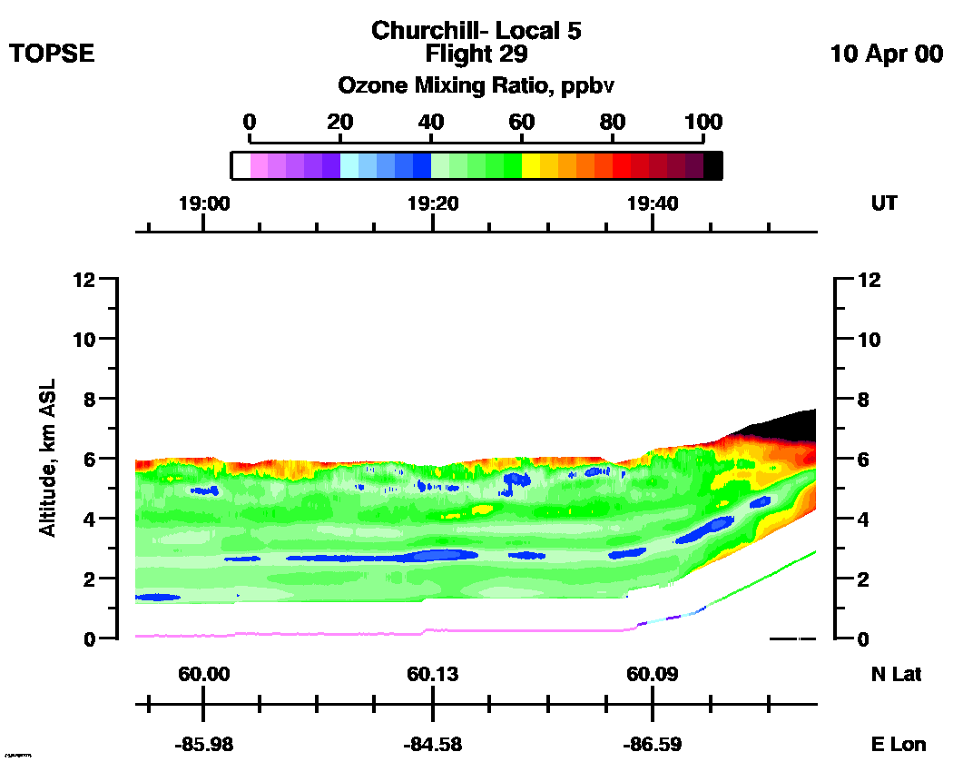
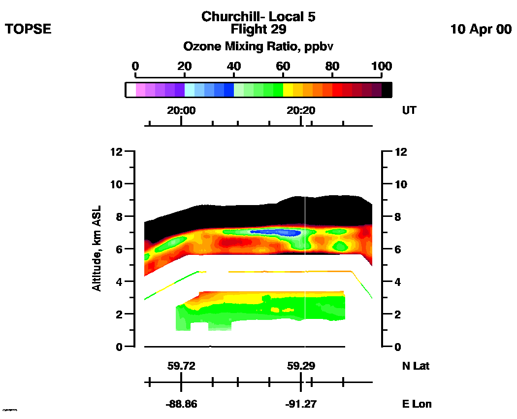
Ozone Mixing Ratio images (Scale: 100 ppbv, 300m range cell): | 14:43 - 15:44 | 15:44 - 16:48 | 16:48 - 17:53 | 17:53 - 18:53 | 18:53 - 19:54 | 19:54 - 20:34 | movie_loop_all |
