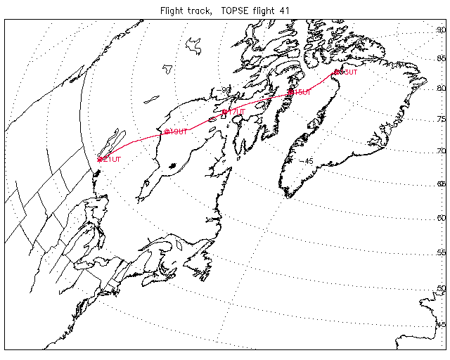
Overview image of Flight Track: | Flight 41 |
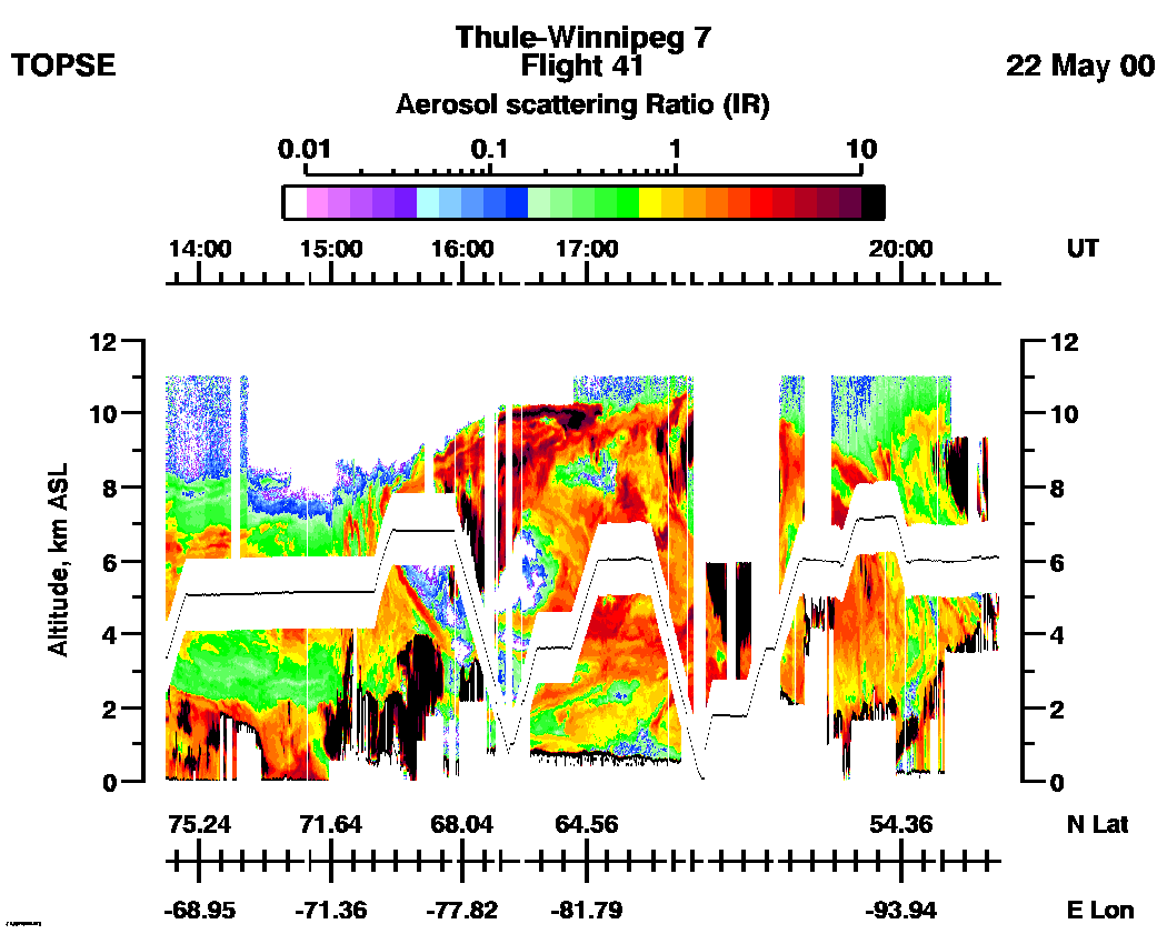
Entire Flight Aerosol Scattering Ratio image (IR): | 13:45 - 20:45 |
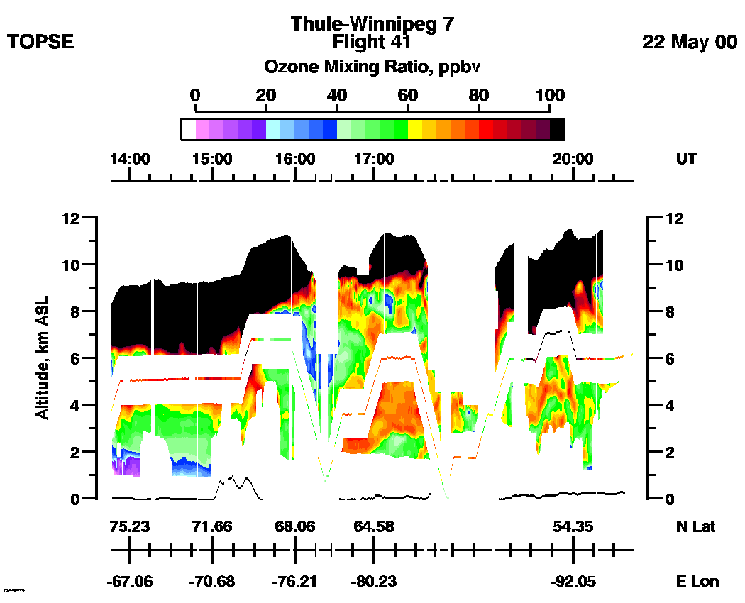
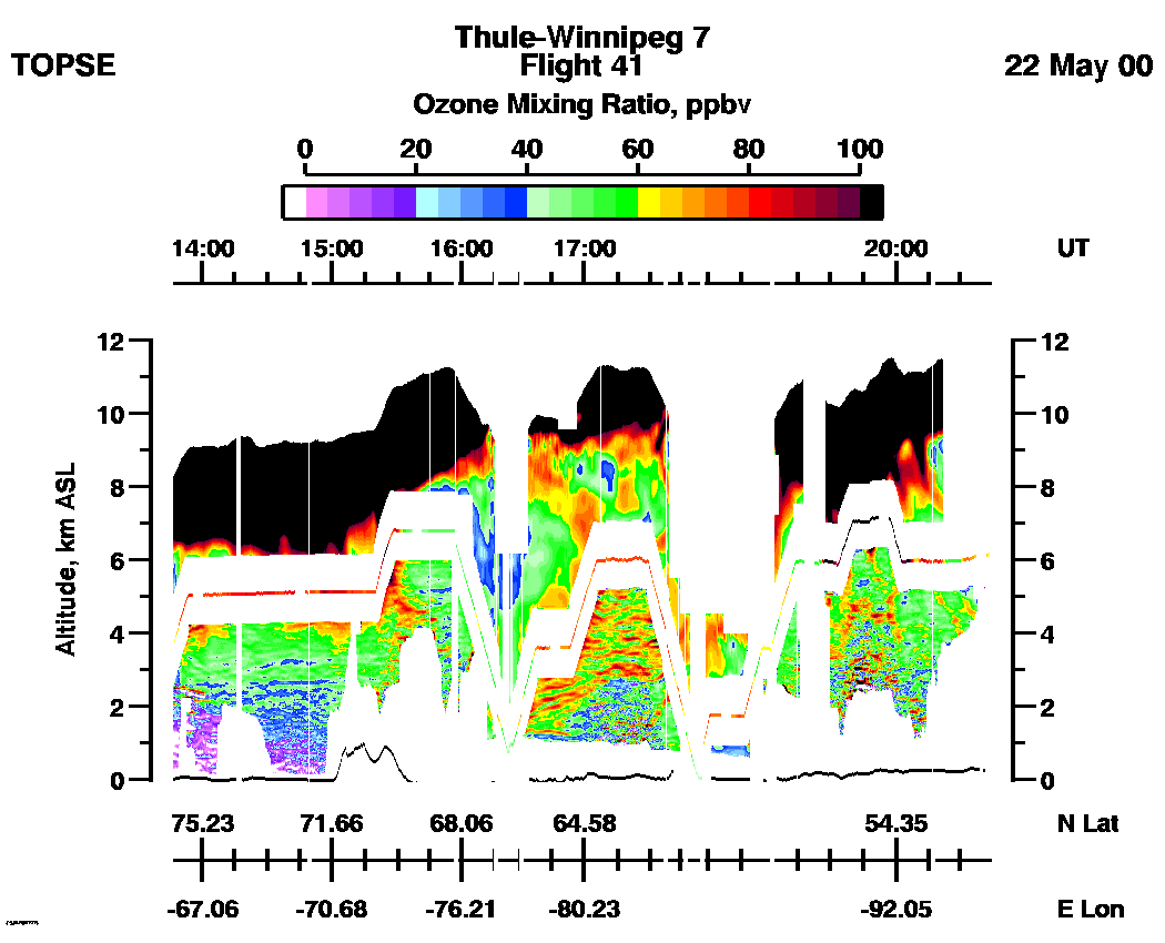
Entire Flight Ozone Mixing Ratio image (Scale: 100 ppbv, 300m range cell): | 13:47 - 20:43 |
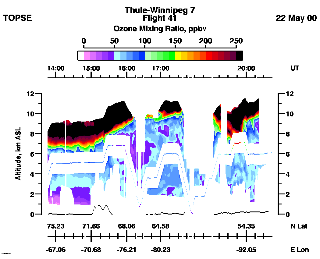
Entire Flight Ozone Mixing Ratio image (Scale: 250 ppbv, 300m range cell): | 13:47 - 20:43 |
Entire Flight Ozone Mixing Ratio image (Scale: 100 ppbv, 100m range cell nadir, 300 meter range cell zenith): | 13:47 - 20:43 |
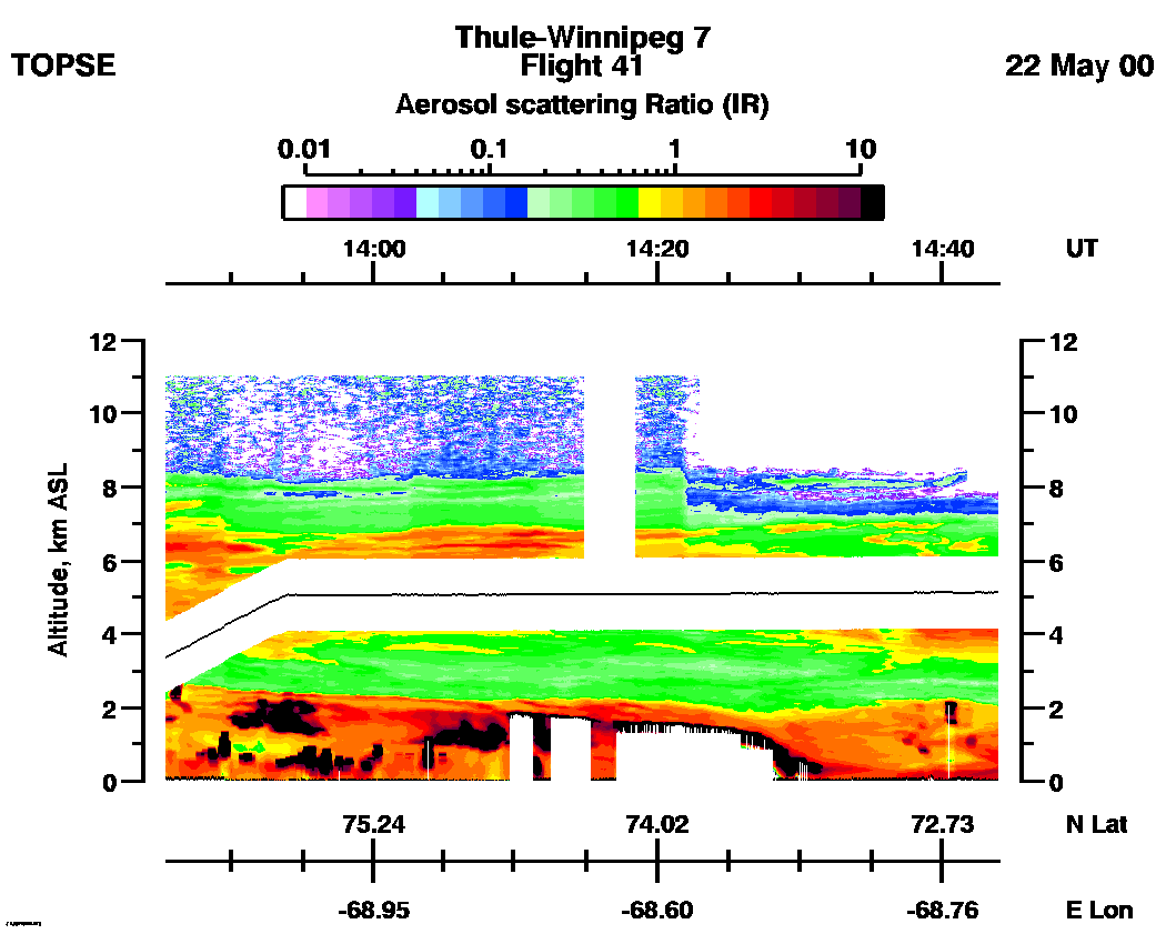
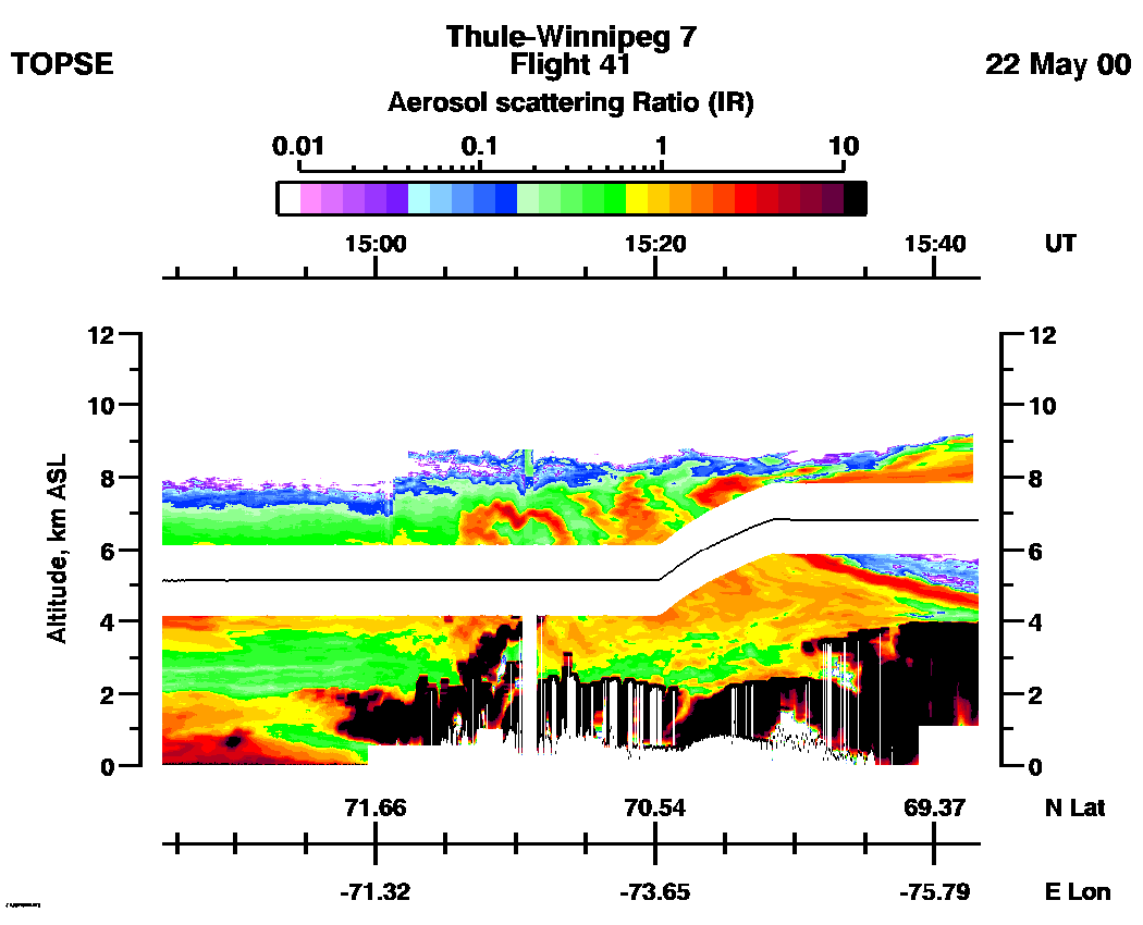
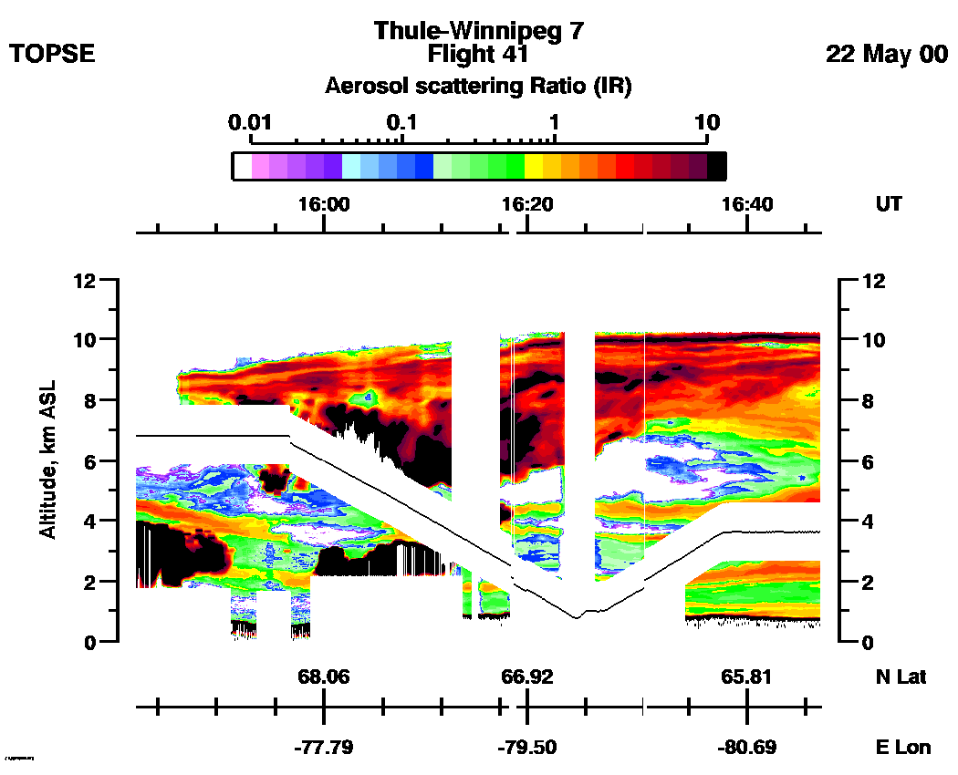
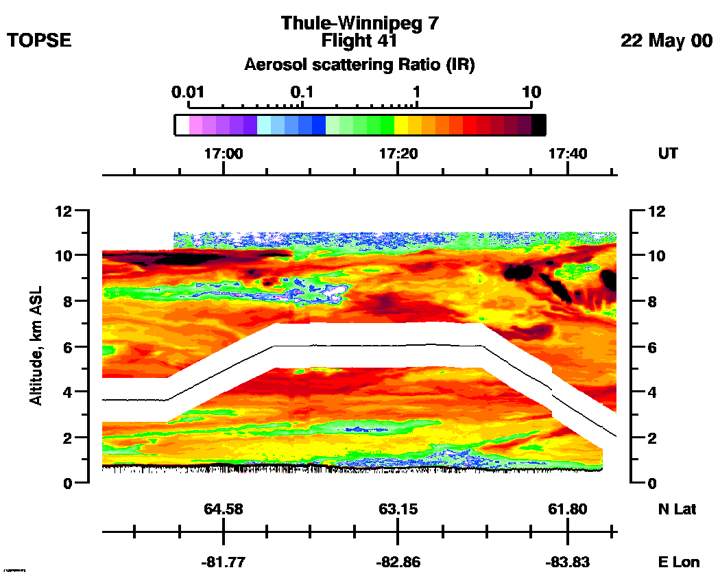
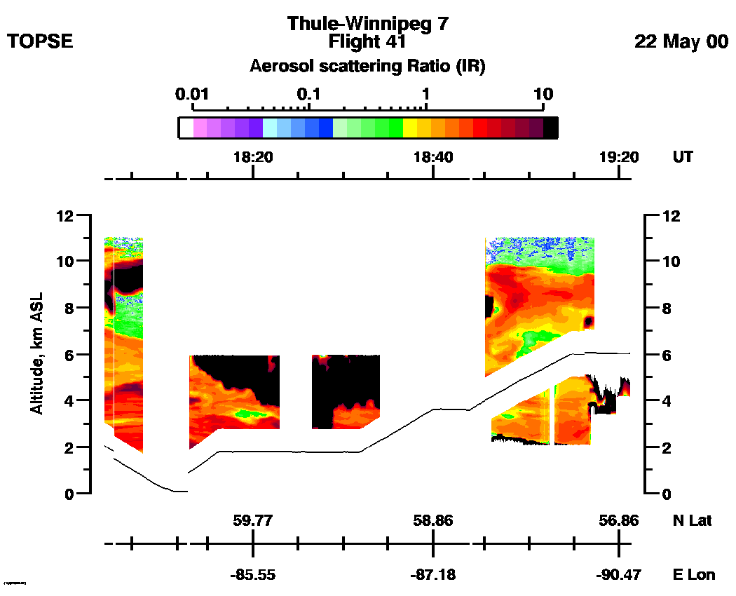
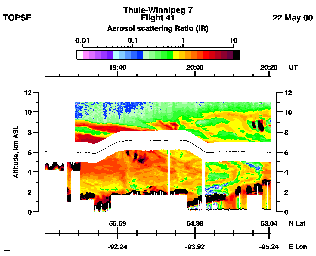
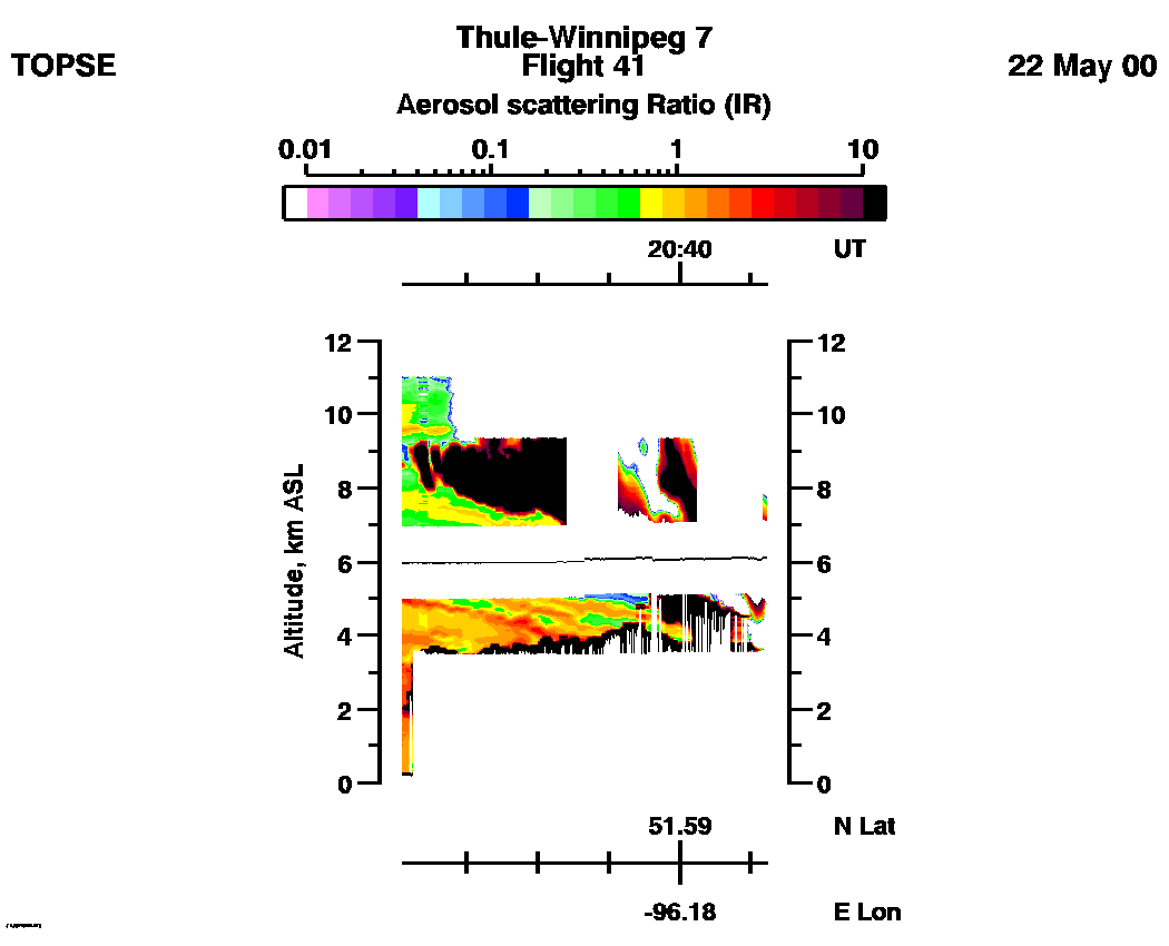
Aerosol Scattering Ratio images (IR): | 13:45 - 14:43 | 14:44 - 15:43 | 15:43 - 16:46 | 16:46 - 17:45 | 17:45 - 19:21 | 19:21 - 20:20 | 20:20 - 20:46 | movie_loop_all |
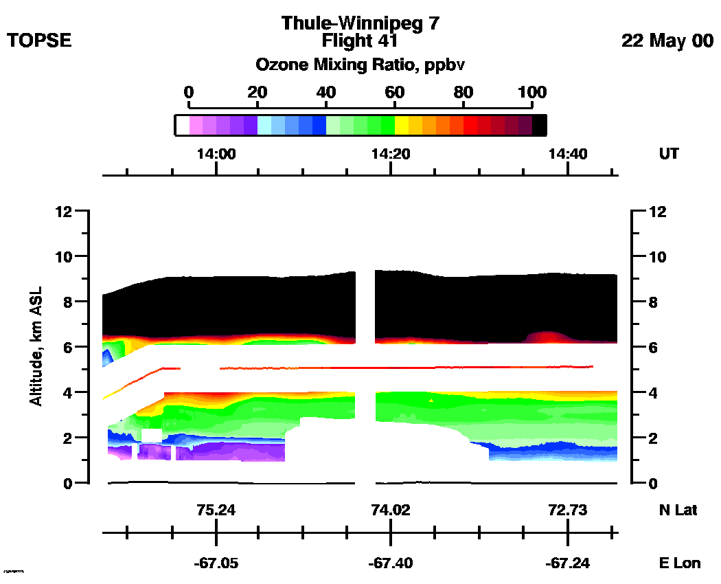
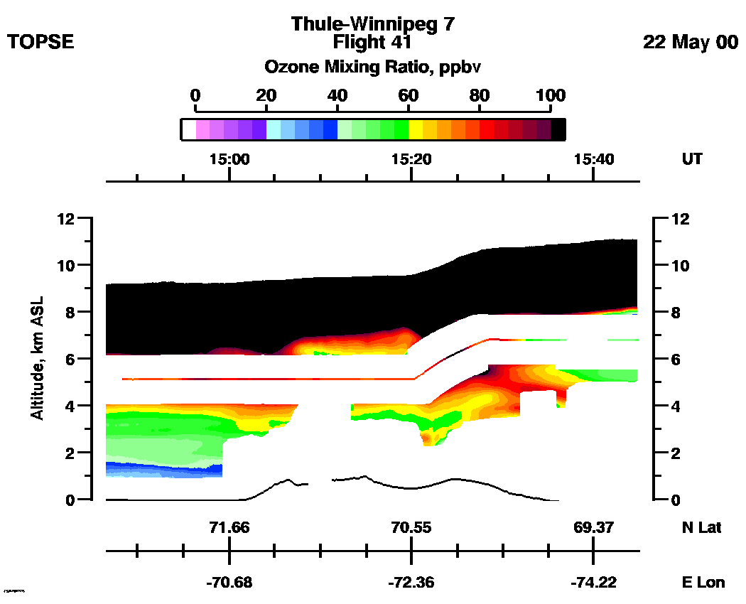
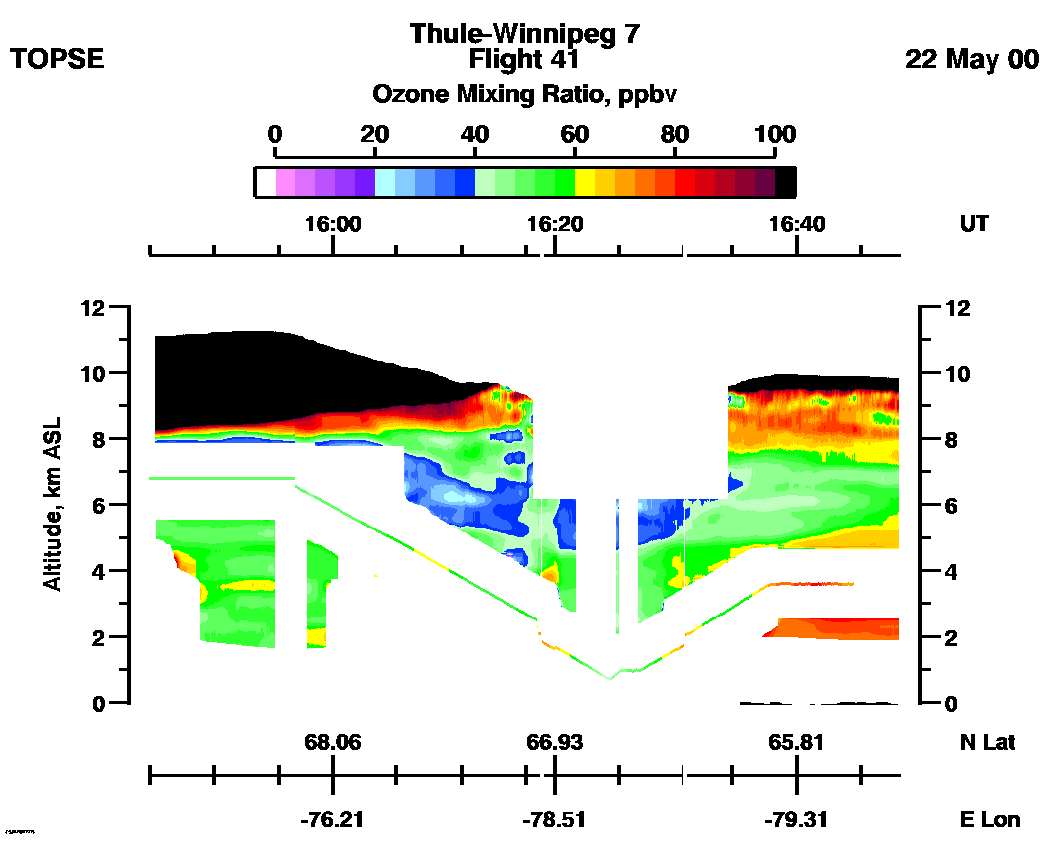
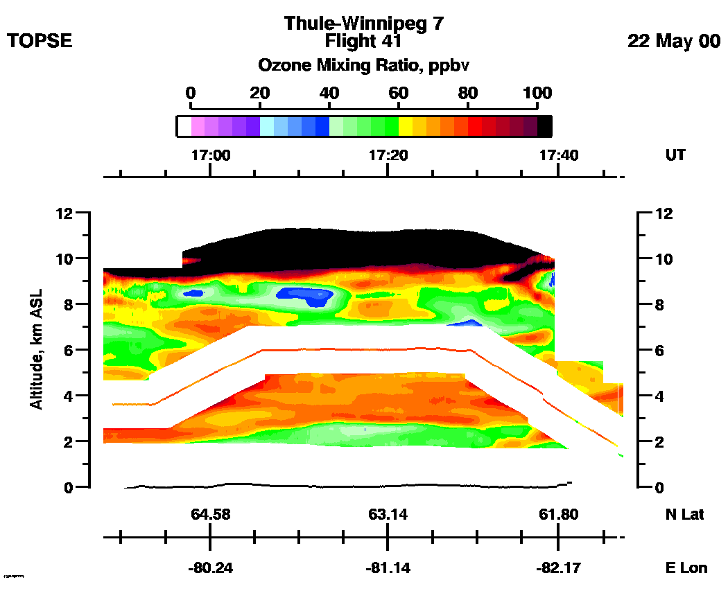
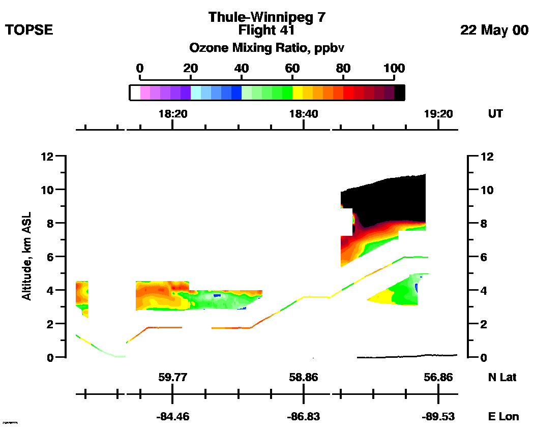
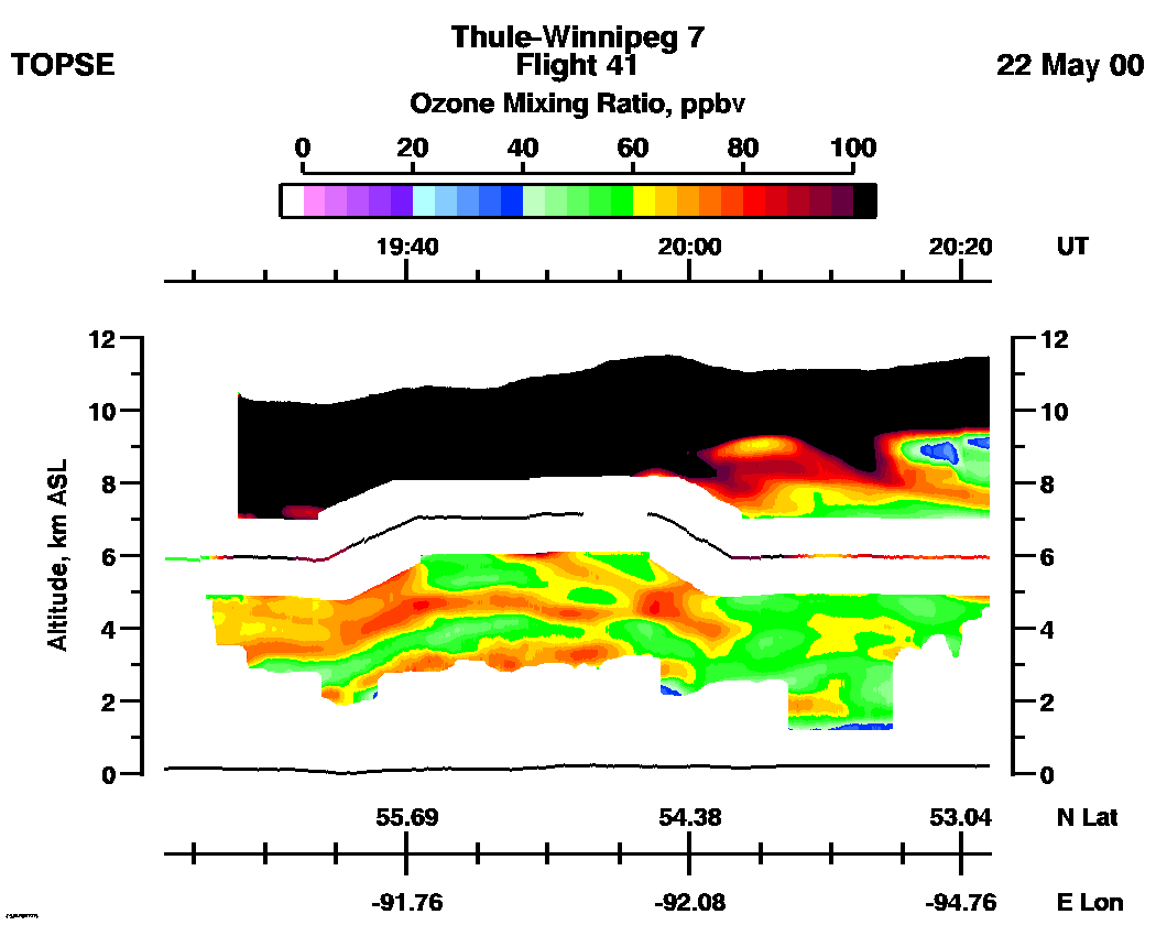
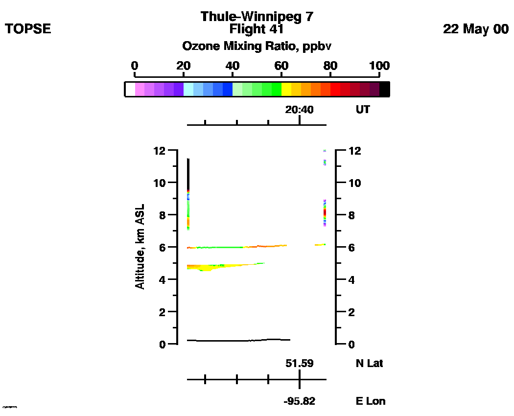
Ozone Mixing Ratio images (Scale: 100 ppbv, 300m range cell): | 13:47 - 14:45 | 14:45 - 15:44 | 15:44 - 16:48 | 16:48 - 17:48 | 17:48 - 19:22 | 19:22 - 20:22 | 20:22 - 20:44 | movie_loop_all |
