|
|
|
The Cloud-Aerosol Lidar and Infrared Pathfinder Satellite Observation
(CALIPSO) satellite, led by NASA Langley Research Center, provides new
insight into the role that clouds and atmospheric aerosols
(airborne particles) play in regulating Earth's weather, climate, and air
quality.
CALIPSO combines an active lidar instrument with passive infrared and visible
imagers to probe the vertical structure and properties of thin clouds
and aerosols over the globe. CALIPSO launched on April 28, 2006 with the
cloud profiling radar system on the CloudSat satellite.
CALIPSO's space-based lidar is very similar to the HSRL; therefore,
researchers from both teams have found it beneficial to compare simultaneous,
or coincident data from the two instruments. These comparisons are used to
calibrate and validate CALIPSO measurements.
CALIPSO and it's launch and orbit partner, CloudSat, underwent an intensive
calibration and validation campaign in September 2006 called
CCVEX (CALIPSO CloudSat Validation Experiment). During CCVEX, NASA flew
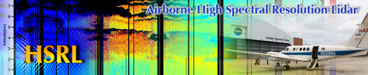
three aircraft: the NASA's Dryden Flight Research Center's ER-2, NASA's
Langley Research Center's B-200, and a Learjet leased from Weather
Modification, Inc. in support of the mission. With support crews and CALIPSO
and CloudSat research teams, the planes headed to Robins Air Force Base, GA,
for the validation experiment. All were outfitted with a suite of instruments
similar to those on the satellites.
Additionally, the HSRL team has flown shorter validation missions in the
southeastern Virginia region near NASA Langley Research Center.
Also, for more information about the CALIPSO Validation campaign, visit:
https://www.nasa.gov/mission_pages/calipso/main/index.html.
|
Funding for the deployment of the NASA King Air was provided by NASA and the Department of Energy (DOE) Atmospheric Science Program.
Logistical support was provided by NOAA ESRL. The information contained herein is provided as a public service, with the understanding
that NASA, DOE, NOAA, and the CALIPSO-VAL project collaborators make no warranties, either expressed or implied, concerning the
accuracy, completeness, reliability, or suitability of the information. Do not quote or cite without permission. Permission for use of
these data and additional information may be obtained from the investigating scientists: Chris Hostetler, Richard Ferrare, or John Hair.
The data are preliminary and subject to change.
|
|