| LITE Directory | |
| Home Page | |
| Mission Overview | |
| Data User's Guide | |
| Data FAQ's | |
| Science Steering Group | |
| Instrument | |
| Publications | |
| Images | |
| Photos | |
| Photos and Images | |
| Data Gallery | |
| Meta Data | |
| ISDB Data |
LITE Camera Photographs
This page provides access to the digitized versions of all the LITE camera photographs. The photographs may be displayed by time, orbit, and/or latitude/longitude range. Selections may be made by scrolling to the end of this page and following the directions to submit a request.
Upon submitting a request, a page with small LITE camera photographs will be displayed. Larger JPEG versions of the small LITE camera photographs may be obtained by clicking-on the small photographs.
A small LITE camera photograph is displayed below. Click-on the image to see the enlarged JPEG image.
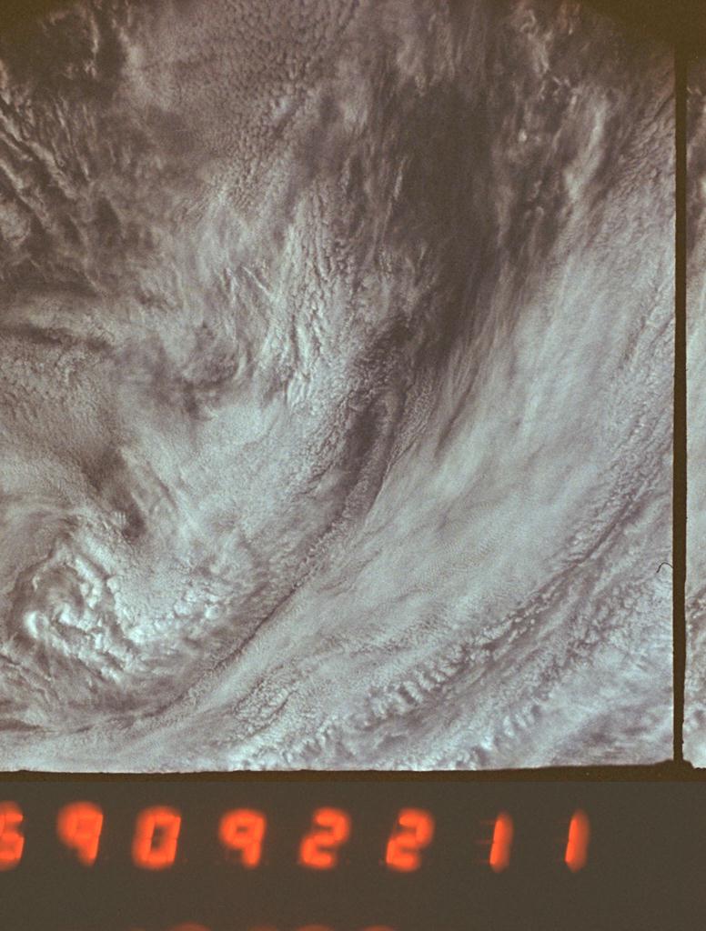 |
The annotation along the bottom of each small LITE camera photograph provides:
|
- The only annotation on the large JPEG images is the time in GMT. It is specified by DDHHMMSS, where DD is the last two digits for the day of year, HH is the hour, MM are minutes, and SS are seconds. The LITE camera photographs are available for days 252 through 262. The user must add 200 to DD to determine the day of the year.
- The Shuttle orientation varied with every orbit and the large JPEG images must be rotated before they can be aligned as a continuous photographic image along the LITE groundtrack. An explanation of how to orient the LITE camera photographs is presented below.
- The orbit, latitude, longitude, and rotation of the JPEG image must be obtained from the documentation provided with the small LITE camera photographs.
- The orientation information for the small LITE camera photographs for part of orbit 152 and all of orbits 153, 154, and 155 is unavailable.
How to Orient the JPEG Images to Produce a Continuous Photographic Image Along the LITE Groundtrack
- Obtain the rotation angle listed with the small LITE camera photographs.
- With JPEG image in vertical position (annotation along bottom), rotate around the JPEG image center, in a clockwise directon, the number of degrees specified by the rotation angle.
- Align consecutive JPEG images by matching cloud or surface patterns.
- Merge the JPEG images to eliminate the 20% overlap between successive frames.
LITE Camera Description
The LITE camera is a modified half-frame 35 mm camera originally used for aerial reconnaissance. It was used to photograph the Earth's surface and cloud cover during the daylight portions of orbits when lidar data were acquired. A 25 mm focal length lens was used, giving a coverage of 200 X 200 km2. The time interval between photographs is approximately 21 seconds, giving roughly 20% overlap between successive frames. A GMT time stamp recorded on each frame was used to determine the latitude and longitude on the surface of the Earth that corresponds to the center of each frame.
Requests made by selecting from more than one category will be ANDed together (i.e. made more exclusive). Requests for more than 200 photos will be truncated.
Longitude is from -180 to 180. To specify a longitude range that crosses 180 enter a start longitude that is greater that the stop longitude.