| LITE Directory | |
| Home Page | |
| Mission Overview | |
| Data User's Guide | |
| Data FAQ's | |
| Science Steering Group | |
| Instrument | |
| Publications | |
| Images | |
| Photos | |
| Photos and Images | |
| Data Gallery | |
| Meta Data | |
| ISDB Data |
LITE Data User's Guide
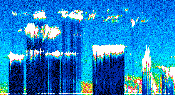
| LITE measured clouds,
tropospheric aerosols,
stratospheric aerosols,
the planetary boundary layer (PBL),
and the surface of earth during
during both the day and night conditions.
|
Commands were issued to optimize the LITE configuration for each of these studies. |
|
| TABLE 1 - LITE Data FAQ's | |
| Question | Answer |
| How do I access the LITE data? | Access LITE data from the NASA Langley Research Center (LaRC)
Distributed Active Archive Center (DAAC).
|
| How do I obtain a description of the LITE data? |
Descriptions of LITE data:
|
| How do I determine where LITE observations were made? | Locating LITE Measurements - Contains plots of the LITE measurement coverage. |
| Under what conditions were LITE measurements made? | LITE measurements were made during both daytime and nighttime conditions. LITE was
also selectively commanded to make surface and/or atmospheric measurements. The commanding was done real-time during the mission.
Modes of Operation - Describes what type of measurement was made and what the instrument settings were for each orbit. |
| What do I need to know about the instrument settings before using LITE data? | Instrument Settings Overview - Describes how to use the LITE instrument settings parameters. |
| TABLE 2 - LITE Operations, Data Acquisition, and Data Processing | |
| LITE Measurement Geometry | Page Topics: |
| How LITE Measurements Were Made | Page Topics: |
| How LITE Data Were Acquired During the Mission | Page Topics: |
| A Description of LITE Data Processing | Page Topics: |