| LITE Directory | |
| Home Page | |
| Mission Overview | |
| Data User's Guide | |
| Data FAQ's | |
| Science Steering Group | |
| Instrument | |
| Publications | |
| Images | |
| Photos | |
| Photos and Images | |
| Data Gallery | |
| Meta Data | |
| ISDB Data |
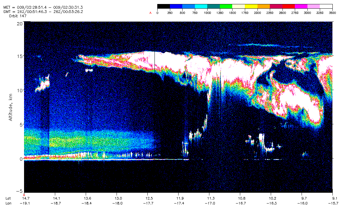
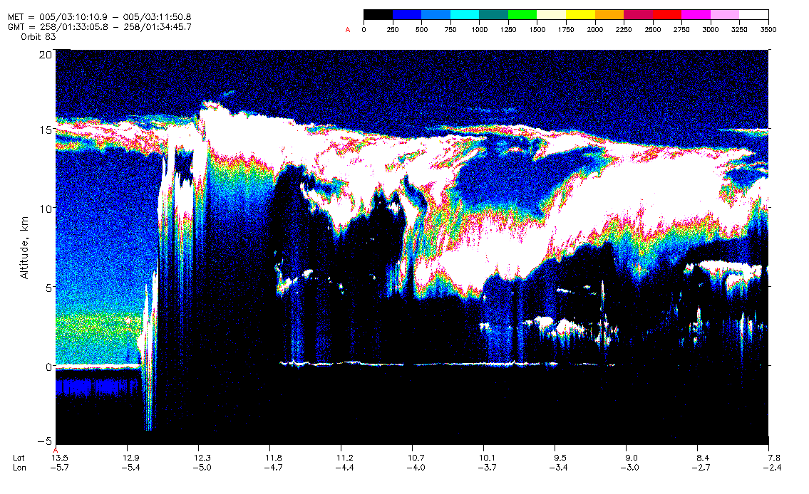
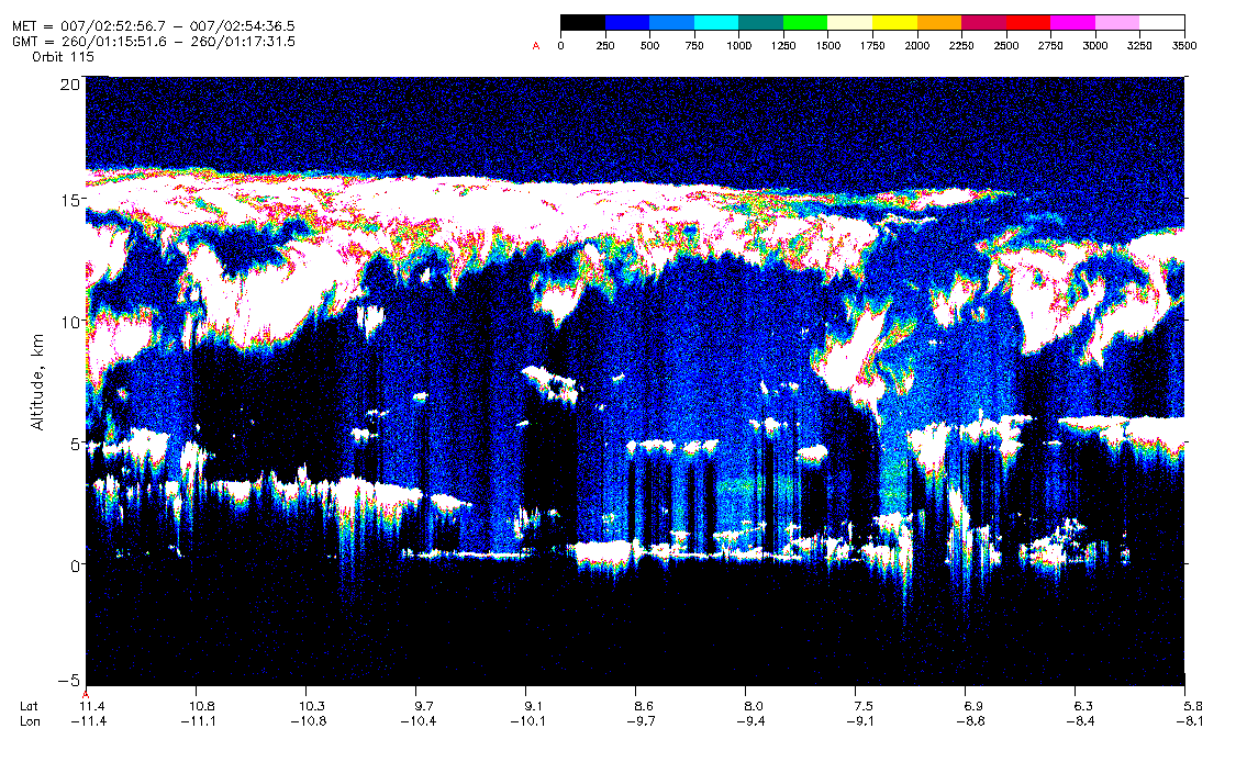
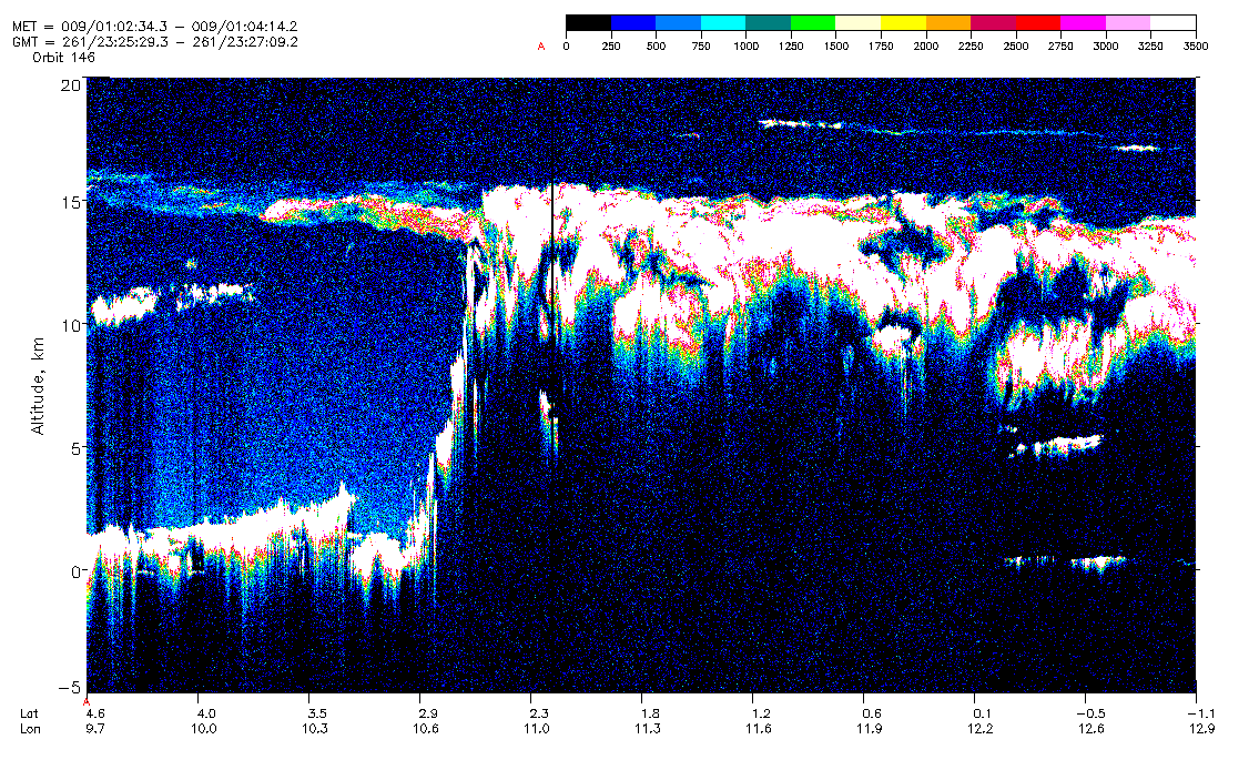
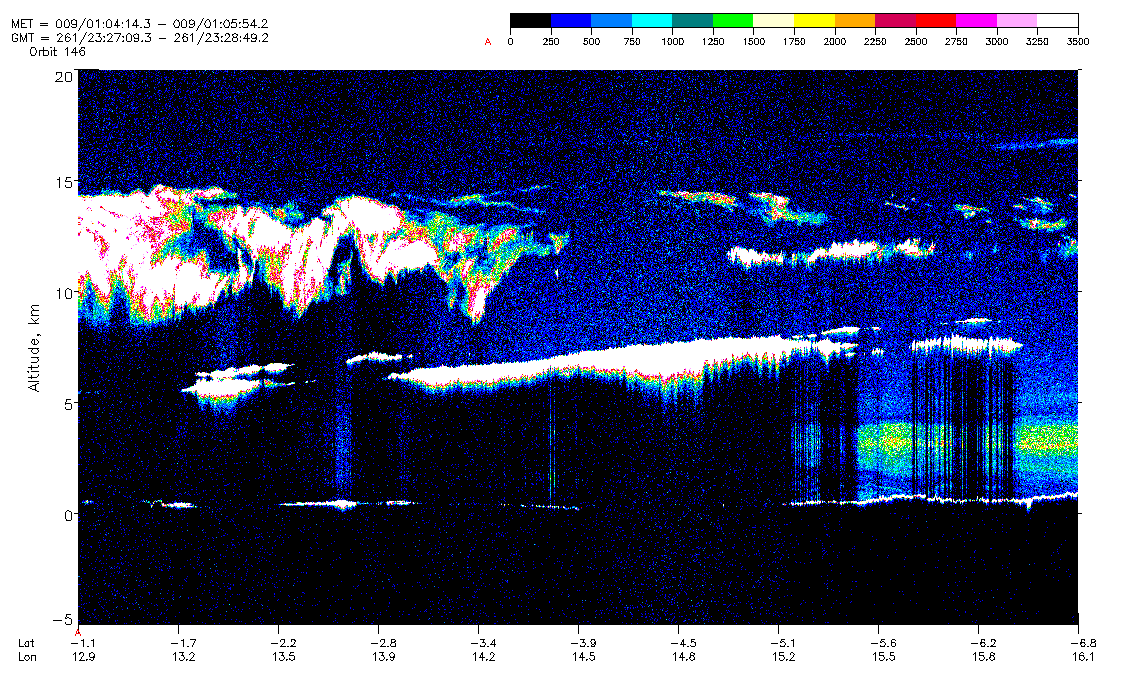
LITE Images of Tropical Convective Systems
This site shows several examples of tropical convective systems observed by LITE over the eastern Atlantic Ocean and western Africa in September 1994 (see map). These storms are located in the Intertropical Convergence Zone (ITCZ), which is characterized by a band of enhanced convective activity near the equator. The GIF images displayed on this page are color-modulated, altitude-time plots of LITE observations. Each GIF image shows LITE raw signal profiles (background-subtracted) from the 532 nm channel. The horizontal, vertical, and color scales are explained in LITE Data GIF Image Description .
The lidar is able to probe several kilometers into the tenuous cloud tops to delineate the structure of the convective cloud top, overlying cirrus, and the structure of surrounding cloud and aerosol layers. The disappearance of the return from the ocean surface (the white line at 0 km) is an indication that the lidar pulse has been completely attenuated within a cloud layer. Cirrus and cirrus anvils are penetrated in most cases, except near centers of convective activity.
The Lidar In-space Technology Experiment (LITE) is a three-wavelength backscatter lidar developed by NASA Langley Research Center to fly on the Space Shuttle. LITE flew on Discovery in September 1994 as part of the STS-64 mission. Descriptions of LITE on-orbit performance, measurement geometry, and instrument footprint are explained in LITE Background.

Orbit 83
September 15, 1994 01:33:05 GMT To 01:34:45 GMTLatitude From 13.5 To 7.8
Longitude From -5.7 To -2.4
Orbit 115
September 17, 1994 01:14:11 GMT To 01:19:11 GMTLatitude From 17.0 To 0.1
Longitude From -14.9 To -4.8


Orbit 131
September 18, 1994 01:03:26 GMT To 01:06:45 GMTLatitude From 14.5 To 3.2
Longitude From -16.1 To -9.4


Orbit 146
September 18, 1994 23:22:09 GMT To 23:28:49 GMTLatitude From 15.8 To -6.8
Longitude From 2.9 To 16.1


Orbit 147
September 19,1994 00:51:46 GMT To 262/00:55:06 GMTLatitude From 14.7 To 3.4
Longitude From -19.1 To -12.4