|
|
|
History - Tropospheric Signal in Total Ozone Measurements
In a series of papers that date back to the mid-1980s, our research group has pursued the idea that satellite data sets can be used to glean otherwise unattainable insight
into the distribution of ozone in the troposphere. Although the Total Ozone Mapping Spectrometer (TOMS) was built to monitor ozone in the stratosphere,
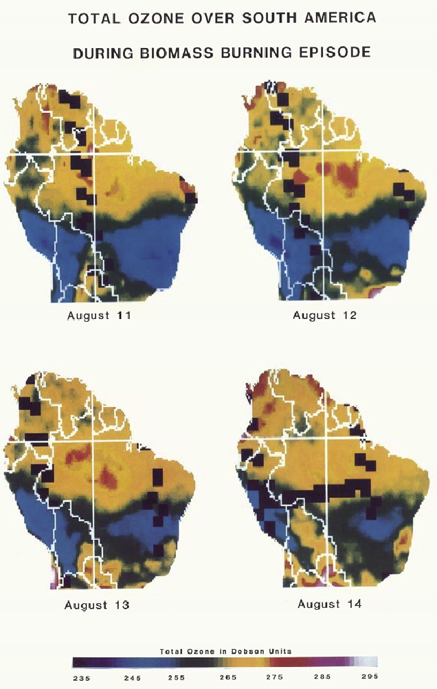
and perhaps provide insight into stratospheric ozone depletion, Fishman et al. [1986] showed that enhancements in the total ozone signal over Brazil occurred
when widespread biomass burning was present as shown in Figure 1.
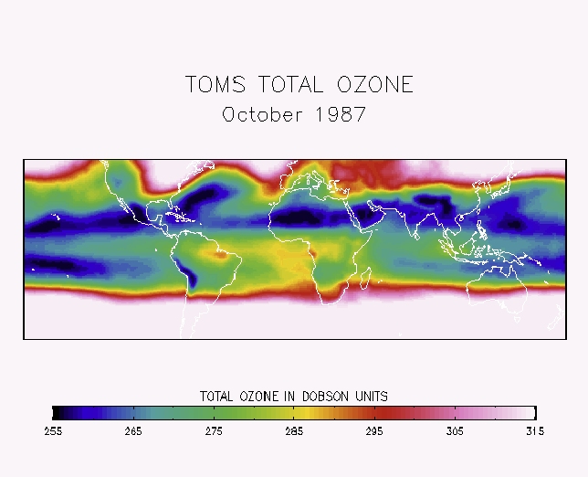
From the monthly average of the TOMS measurements shown in Figure 2,
enhanced values can be seen over South America and southern Africa and in a region over the South Atlantic Ocean, in what appears to be a plume coming off the African continent
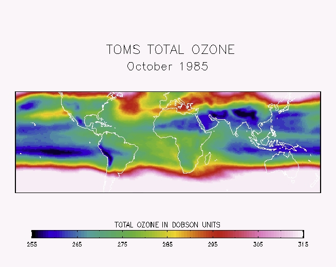
during October 1987. During other months, such as October 1985 (Figure 3), total ozone enhancements can be found off the west coast of North America.
During this particular month, a persistent area of anticyclonic circulation was situated off the northwest coast of the United States, resulting in the
plume-like structure emanating from the highly populated Los Angeles-San Diego region.
The data depicted in these figures, however, reflect total ozone measurements, of which only a relatively small percentage is found in the troposphere.
At higher latitudes, meteorological activity is generally more vigorous and persistent patterns over the period of a month are rare.
Therefore, identification of enhanced ozone of tropospheric origin is difficult and quasi-persistent plumes from Europe and northern Asia
would be lost beneath the variable stratospheric ozone amounts that would overwhelm any persistent tropospheric enhancements in these regions.
Thus, persistent ozone sources in the tropics offered the first indications that satellite information could be used to identify ozone pollution sources.
|
